登山路線圖
~~~~~~~~~~~~~~~~~~~~~~~~~~~~~~~~~~~~~~~~~~~~~~~~~~~~~~~~
~~~~~~~~~~~~~~~~~~~~~~~~~~~~~~~~~~~~~~~~~~~~~~~~~~~~~~~~
承前文: 2018美國跨州國家公園之旅D2 謝伊峽谷國家保護區(Canyon de Chelly National Monument) 、納瓦霍國家保護區(Navajo National Monument)
~~~~~~~~~~~~~~~~~~~~~~~~~~~~~~~~~~~~~~~~~~~~~~~~~~~~~~~~
第三天(2018.06.03、星期日)
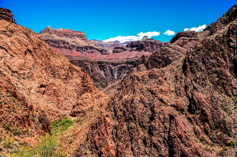
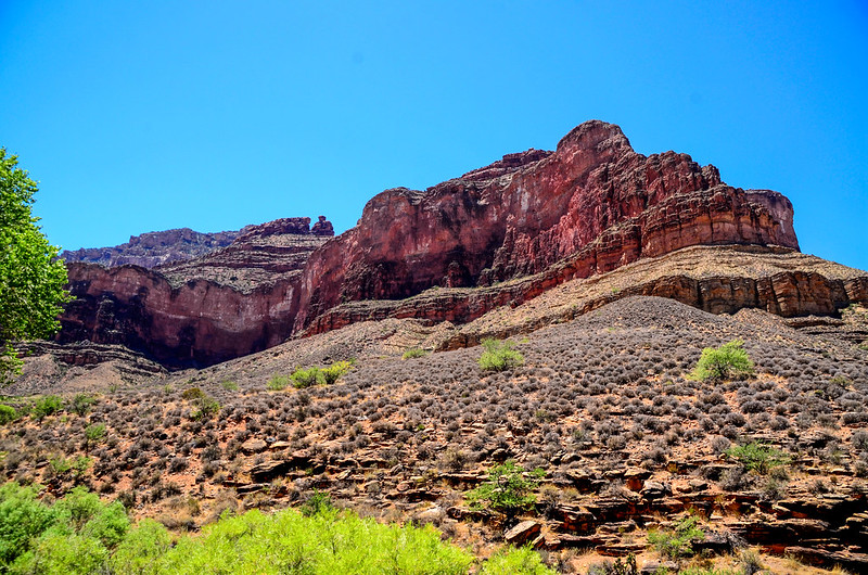
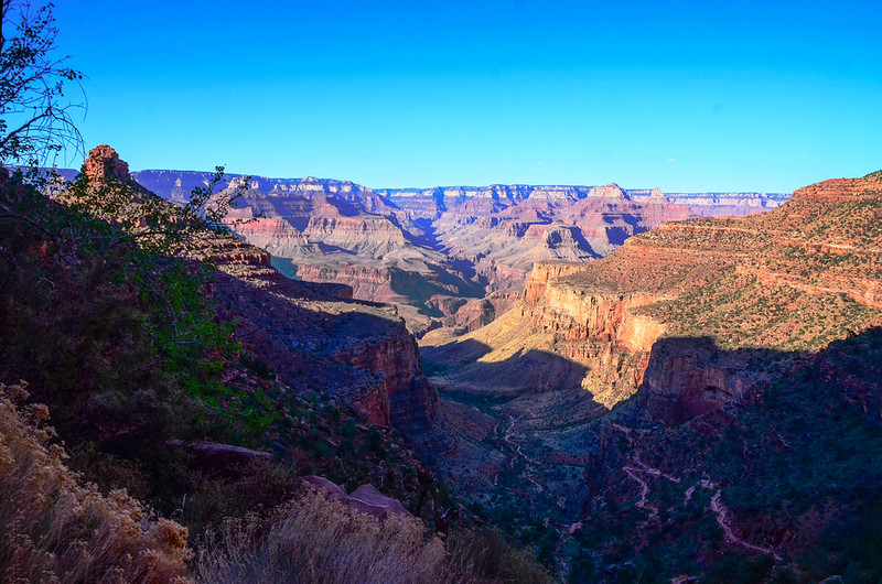
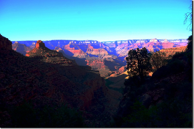
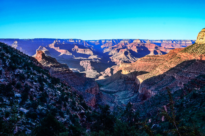
大峽谷國家公園(Grand Canyon National Park)2009年曾來遊過,但當年僅玩遍南緣(South Rim)各景點,此次女兒再次安排來此主要是讓我完成健行到谷底的心願,並到大峽谷北緣(North Rim) 走走。
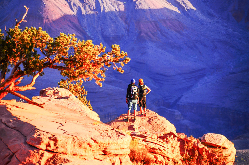
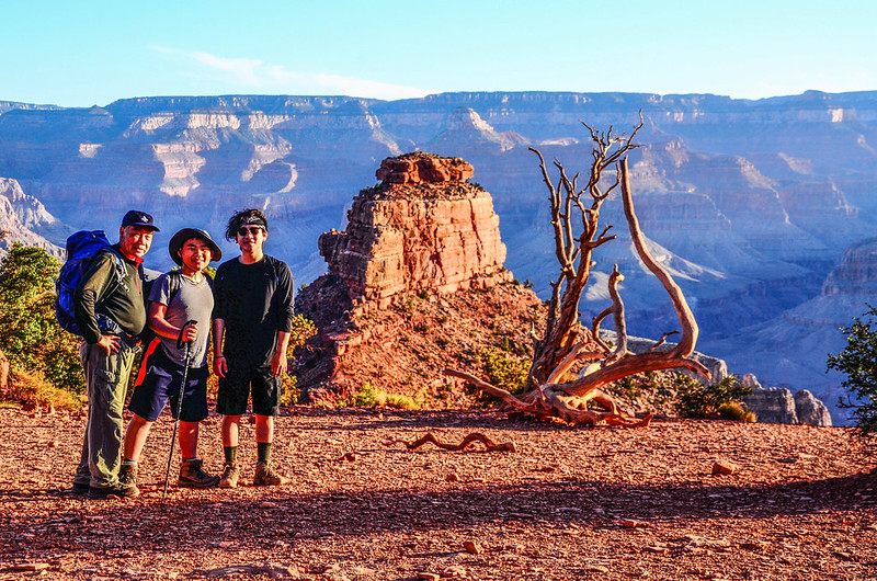
大峽谷南北緣越谷縱走是多少登山客的夢想,其走法是從北緣的North Kaibab Trail下到谷底在谷底的Phantom Ranch住宿或露營,第二天再由South Kaibab Trail或Bright Angel Trail上到南緣,或是採取反方向的行程,但此穿越大峽谷之行通常要在一年前開始排隊抽籤,其誇張程度遠比台灣任何高山行程的抽籤難上多了,即使抽籤上了你還得安排單程兩百多哩的接駁問題,這對一個不是住在當地或美國常住的登山客來說真是一件不容易的事;我為了一探大峽谷谷底風光就計畫了這趟瘋狂之旅~邀同兩個外孫(豆豆和貝貝)從南緣的South Kaibab Trail下谷底,然後沿著科羅拉多河河岸西行一哩多再由Bright Angel Trail上山回到南緣,這種一天來回的行程有點難度,連公園的Ranger都不太鼓勵的,但我們終於做到了,我以兩個外孫引以為傲!
~~~~~~~~~~~~~~~~~~~~~~~~~~~~~~~~~~~~~~~~~~~~~~~~~~~~~~~~~~~~~~
南緣下峽谷登山口:South Kaibab Trailhead,海拔7,200呎(2,195公尺)
谷底(Phantom Ranch):科羅拉多河,海拔2,400呎(732公尺)
回南緣登山口:Bright Angel Trailhead,海拔6,840呎(2,085公尺)
登山里程:16.1哩(25.76公里)
下山:6.8哩(10.88公里)
谷底沿河步道:1.5哩(2.4公里)
上山:7.8哩(12.48公里)
總爬升高度:約5,000呎(1,524公尺)
登山時間:14小時20分
難度一:先陡下1463公尺,再陡上1353公尺。
難度二:谷底高溫華氏110度(攝氏43.3度),高溫下陡上熱死人,我們每人飲水量都超過10公升。
~~~~~~~~~~~~~~~~~~~~~~~~~~~~~~~~~~~~~~~~~~~~~~~~~~~~~~~~~~~~~~
飲用水供給站:
(一) South Kaibab Trail全程無供應飲水設備,必須走到谷底Phantom Ranch才有加水站。
(二) Bright Angel Trail沿途每年四月底五月初供應到十月初者有:Bright Angel Campground、 Indian Garden Campground、 3.0哩Resthouse和 1.5哩Resthouse。
全年供應者僅有Bright Angel Campground 和 Indian Garden兩處
※Pipe Creek與科羅拉多河匯流口的River Resthouse是不供應飲用水的,上述供水站園方不敢保證不會有問題,所以登山客最好要有自行解決萬一缺水的備案措施。
廁所設備:
S0uth Kaibab Trail沿途有兩處,一處在距登山口1.5哩(2.4公里)的Cedar Ridge,一處在距離登山口4.5哩(7.2公里)的The Tipoff。
Bright Angel Trail沿途有四處,分別設在距Bright Angel Trail登山口1.5哩和3.0哩的休息站、距登山口4.5哩的Indian Garden和距登山口7.8哩Pipe Creek與科羅拉多河匯流口的River Resthouse附近。
~~~~~~~~~~~~~~~~~~~~~~~~~~~~~~~~~~~~~~~~~~~~~~~~~~~~~~~~~~~~~~
行程簡述:
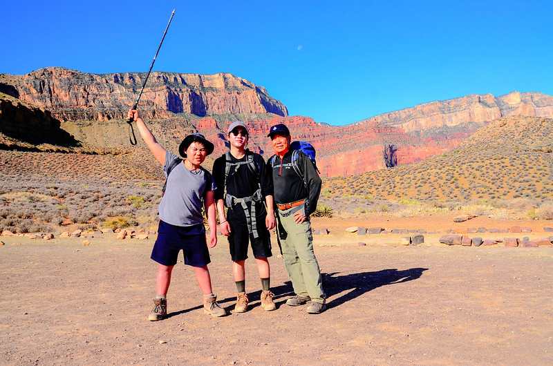
當天我們背了午餐、點心及飲用水出發,飲用水我背了四公升、豆豆也背了四公升,貝貝堅持背六公升上路,女兒打算陪我們走一段路後再單獨回旅館陪她老媽到南緣逛逛。
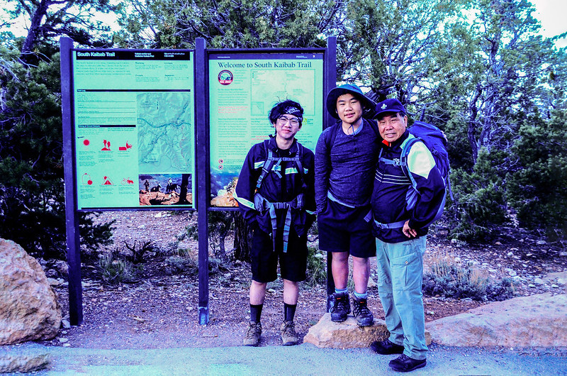
South Kaibab Trailhead
South Kaibab Trailhead
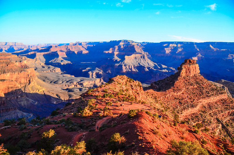
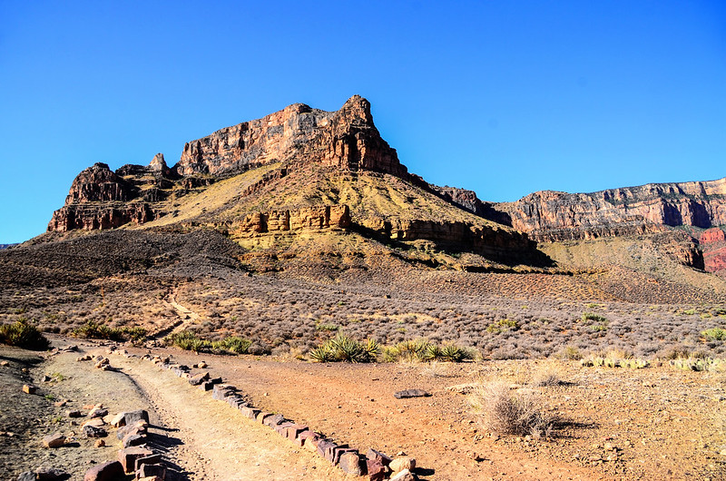
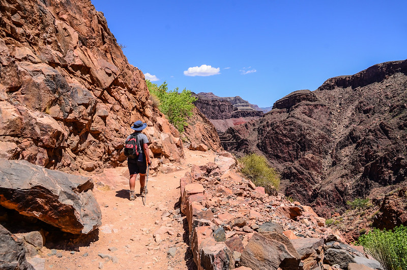
05:10 登山口(South Kaibab Trailhead)出發,天已亮,不用戴頭燈,沿著步道下行,South Kaibab Trail在陡峭的山壁間“之”字形迂迴下行,由上往下看極似一座螺旋樓梯。
The first part of the hike
Switch backs Begin Right Away
The first part of the hike
Switch backs Begin Right Away
05:35 抵達“Ooh Aah Point”,海拔6,440呎(1,963公尺) ,距登山口約0.9哩(1.44公里),這是一處不錯的展望點,女兒就陪我們走到此,祖孫三人繼續下行。
Ooh Aah Point With Trail In Background
Ooh Aah Point With Trail In Background
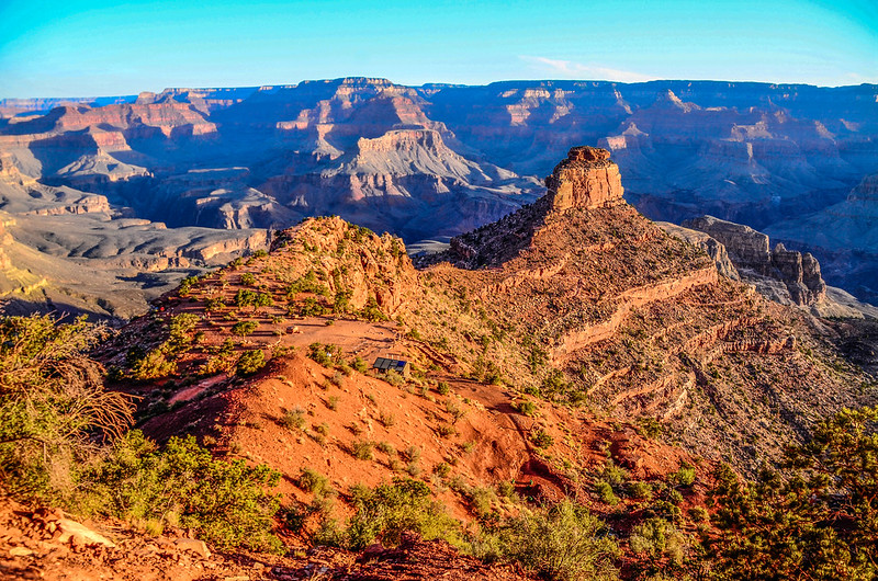
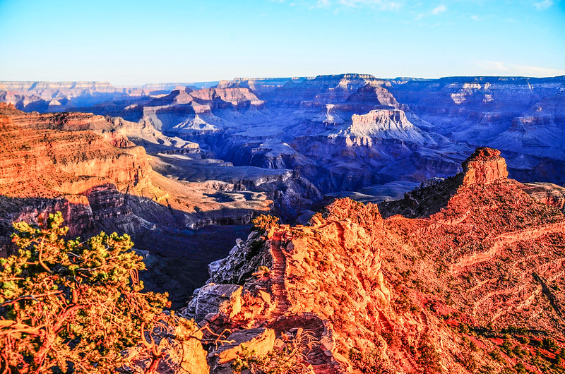
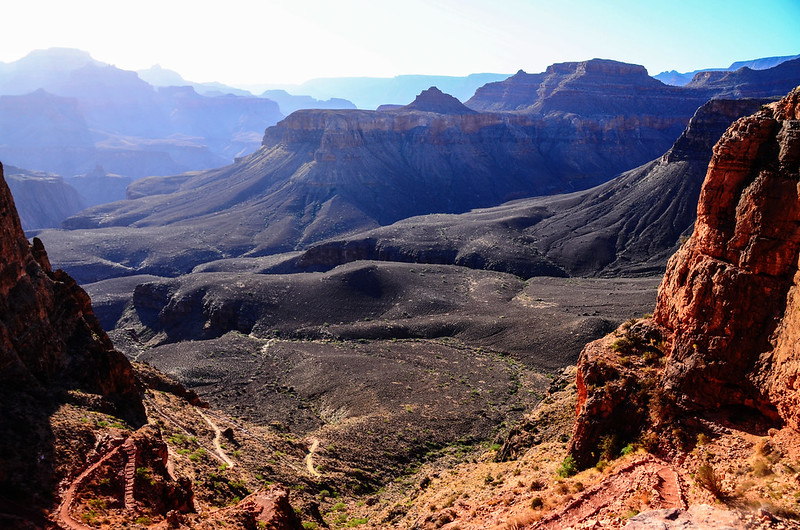
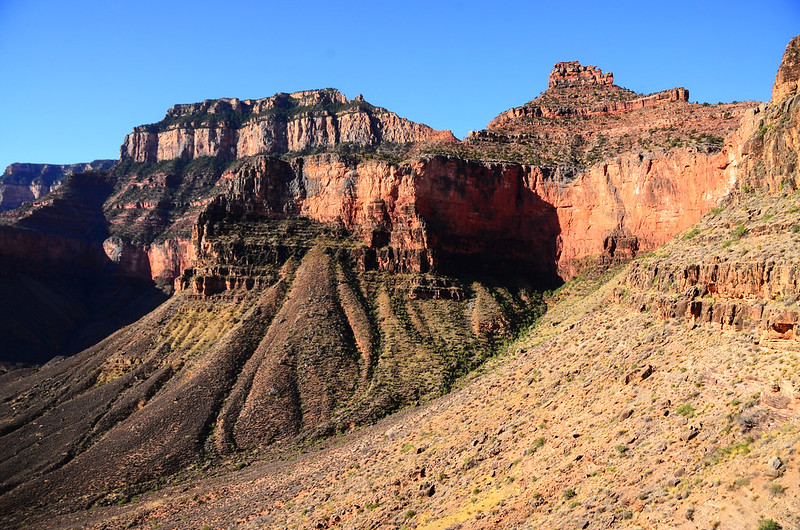
此後有一大部分時間走在Cedar Ridge山脊上,風景很美。
Hiking on Cedar Ridge
Hike on South Kaibab Trail
Looking down at Cedar Ridge & O’Neil Butte from the trail

Hike on South Kaibab Trail
Looking down at Cedar Ridge & O’Neil Butte from the trail
Hiking on Cedar Ridge
Hiking on Cedar Ridge
Hiking on Cedar Ridge
Hiking towards O’Neil Butte
06:00 抵達Cedar Ridge休息點,海拔6,080呎(1,853公尺),距離登山口1.5哩(2.4公里),此處是一處大平台,有一座廁所,大部分的登山客將此作為一處休息站;
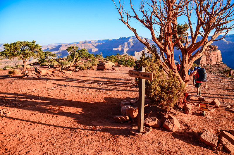
Cedar Ridge
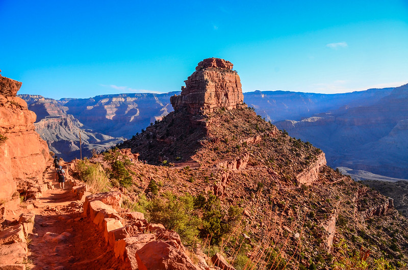
平台北邊那座形似大霸尖山的高峰就是O'Neill Butte,海拔6,071呎( 1,850 公尺),他是一座攀岩者喜愛的攀登山頭。
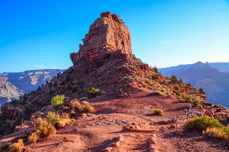
O’Neil Butte
Hikers on thier way up to South Rim
很多一般遊客也會健行到此處再折回登山口,我們小休後繼續下山;

Hike on South Kaibab Trail
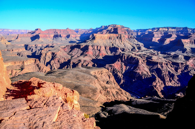
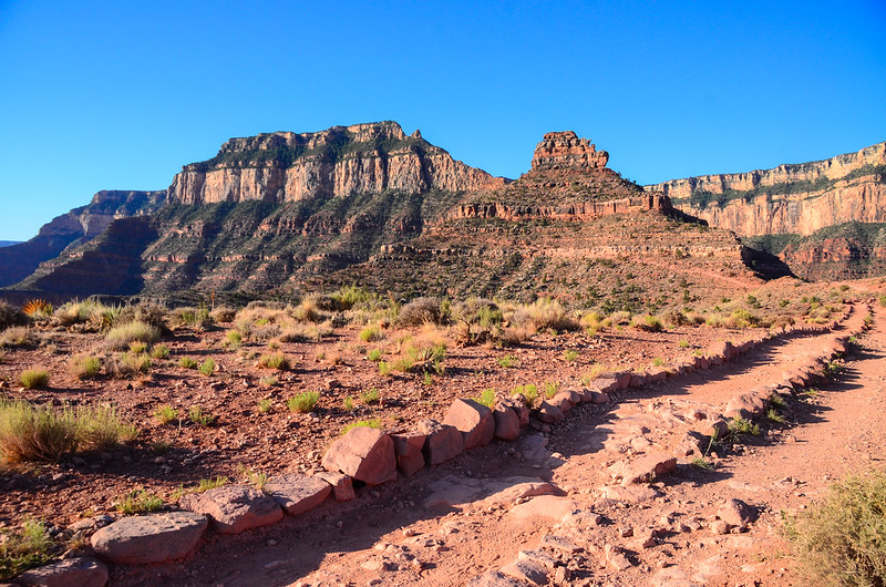
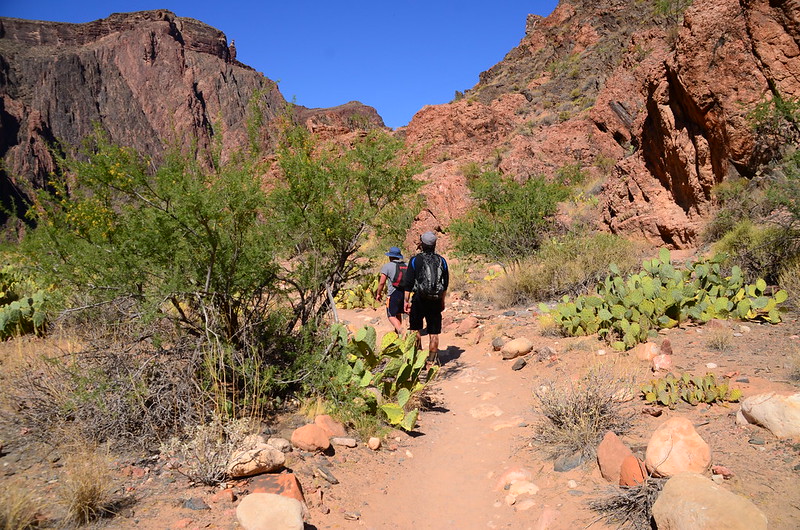
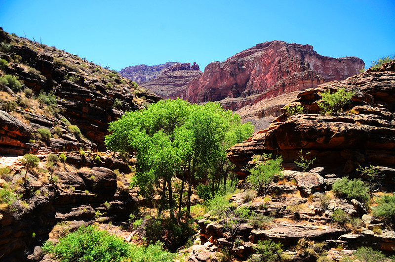
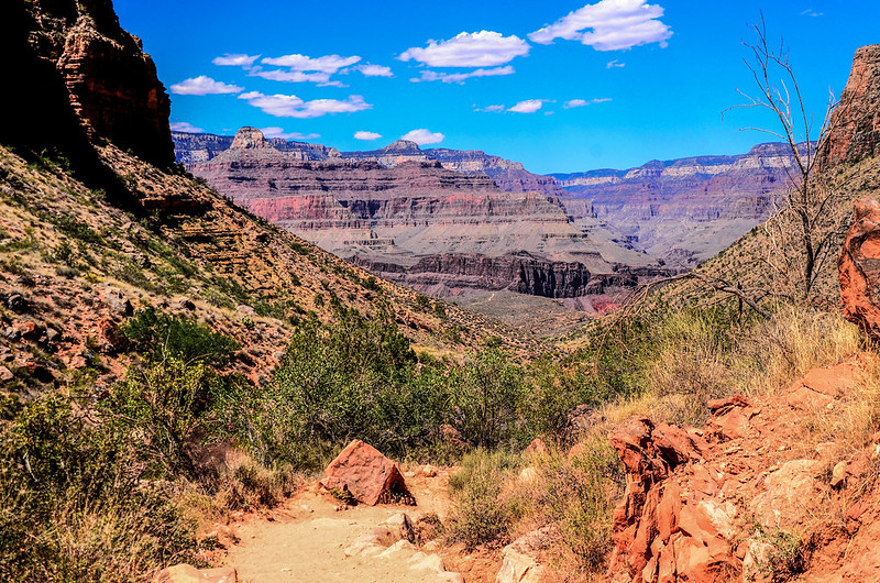
步道仍取“之”字形下降,不一會兒由形似大霸尖山的O'Neill Butte東側山腰繞過,繞過O'Neill Butte山腰後是一段平緩的筆直小徑,漫步在小徑上環視著顏色千變萬化的大峽谷岩壁、山谷,真是美極了!
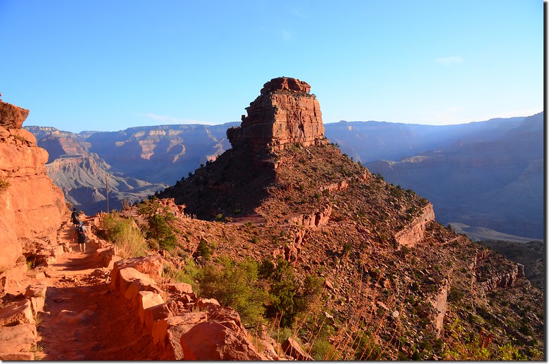
Hiking towards O’Neil Butte
View of Inner Canyon
Hiking below O’Neil Butte

Hiking below O’Neil Butte
步道仍取“之”字形下降,不一會兒由形似大霸尖山的O'Neill Butte東側山腰繞過,繞過O'Neill Butte山腰後是一段平緩的筆直小徑,漫步在小徑上環視著顏色千變萬化的大峽谷岩壁、山谷,真是美極了!
Hiking towards O’Neil Butte
View of Inner Canyon
Hiking below O’Neil Butte
Hiking below O’Neil Butte
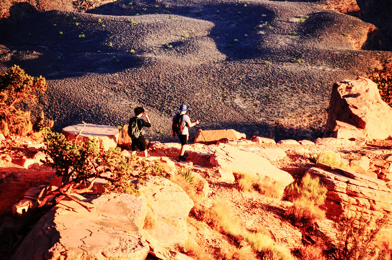
06:45 抵達Skeleton Point休息點,海拔5,160呎(1,573公尺),距離登山口3.0哩(4.8公里);大平台,兩兄弟加強防曬措施,小休後續行。
Jacob putting on sunscreen
View down in to canyon from below Skeleton Point
Jacob putting on sunscreen
View down in to canyon from below Skeleton Point
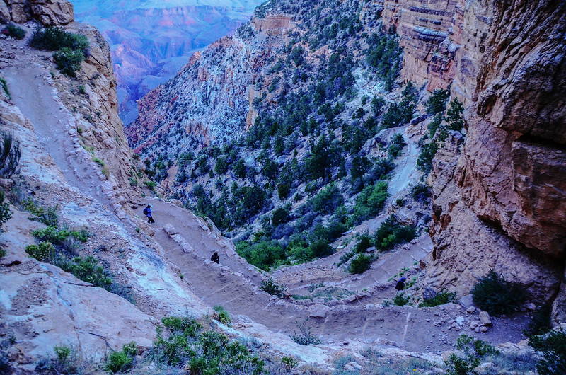
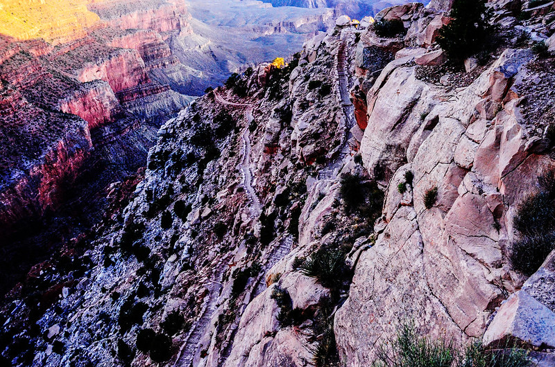
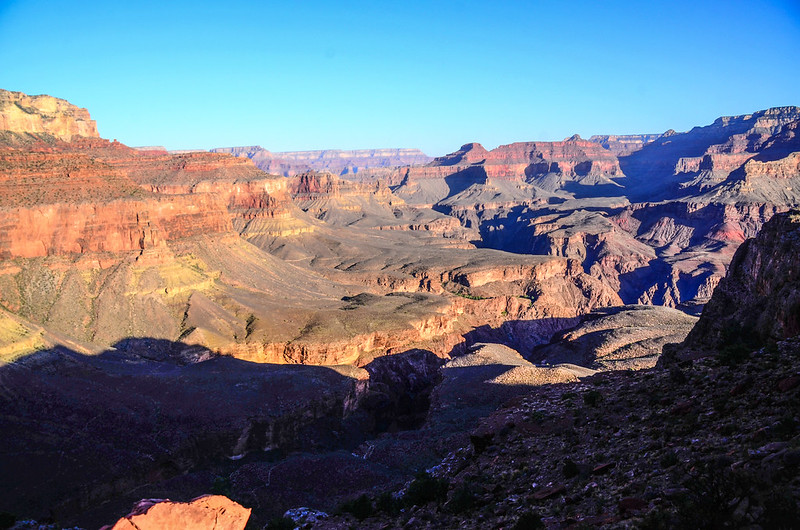
離開Skeleton Point後是一段蠻長的陡下坡,還好步道仍採取“之”字形迂迴而下,走來不算困難,倒是那“之”字形迂迴而下的步道由上往下看真是壯觀呀!
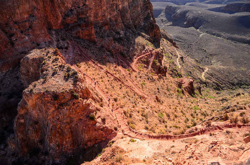
Looking down onto South Kaibab Trail from Skeleton Point
First View Of Calorado River
Looking down onto South Kaibab Trail from Skeleton Point
First View Of Calorado River
07:10 路右石壁上一標示牌標示“South Rim 3.5 ml、Phantom Ranch 3.8 ml”,此處海拔4,700呎(1,433公尺)。
Beautiful Rock Formations And Cliffs
Take a rest

Jacob on the South Kaibab Trail near The Tipoff

Me on the South Kaibab Trail near The Tipoff
Looking down onto The Tipoff from the trail
Beautiful Rock Formations And Cliffs
Take a rest
Jacob on the South Kaibab Trail near The Tipoff
Me on the South Kaibab Trail near The Tipoff
Looking down onto The Tipoff from the trail
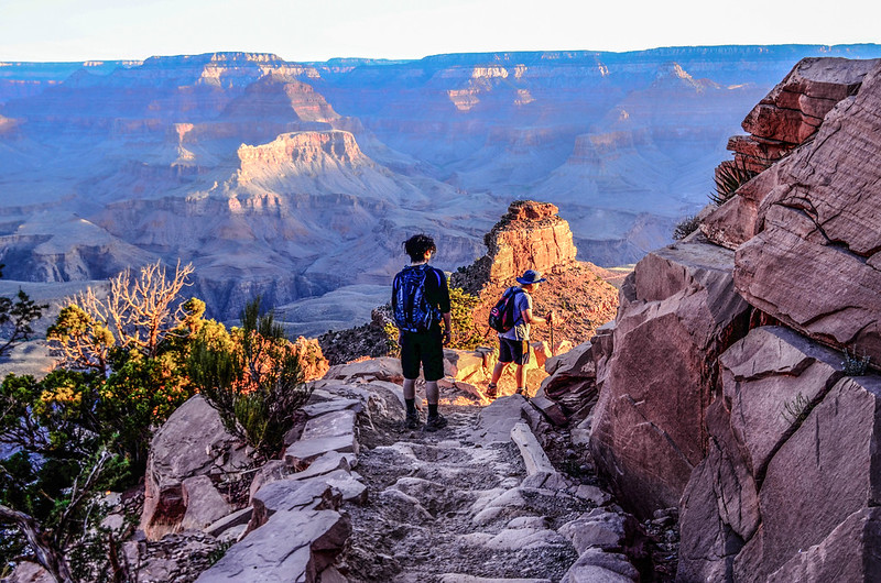
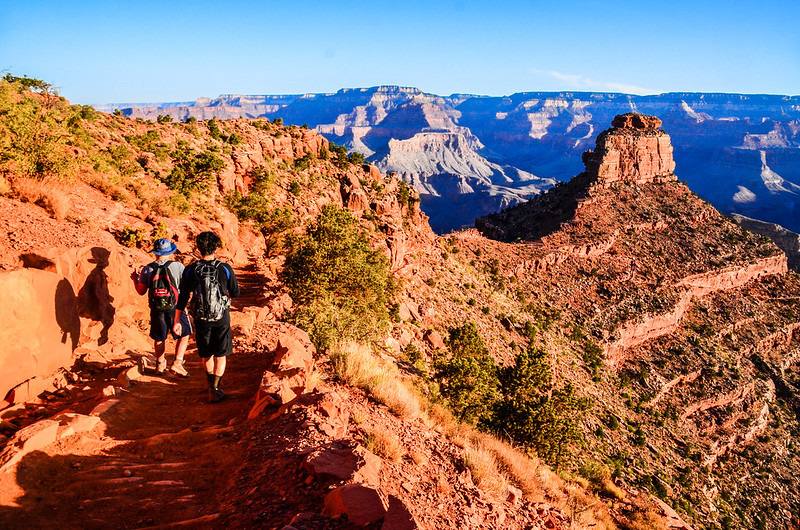
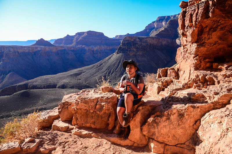
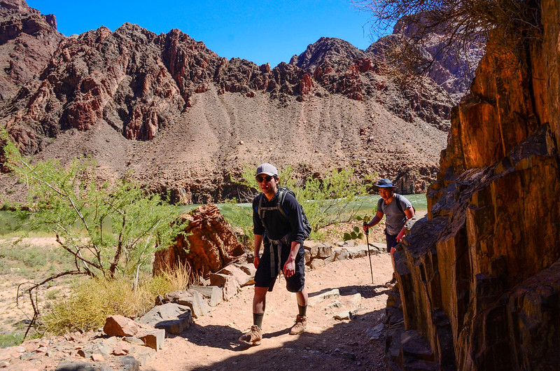
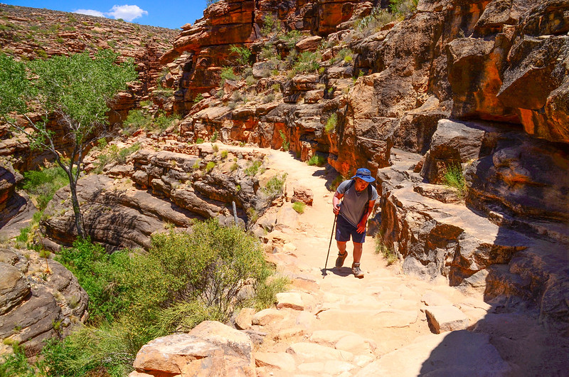
07:45 抵達The Tipoff,海拔3,920呎(1,195公尺),距離登山口4.5哩(7.2公里),此處亦是一處大平台,有一間廁所,距谷底高度還要下降約1,500呎(457公尺);豆豆和貝貝看起來精神都還不錯,豆豆督促貝貝再塗防曬油以免曬傷;在此休息約十分鐘再行,此後步道即是往谷底科羅拉多河陡下,落差有四百多公尺。
The Tipoff
Looking Back Most Of The Way Down
The Tipoff
Looking Back Most Of The Way Down
07:53 步道右上方一座緊急求救通訊設備。
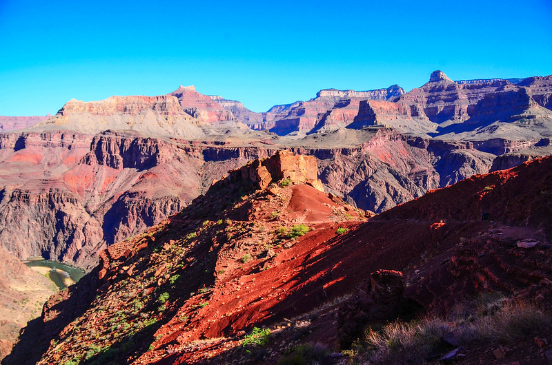
The trail across red slopes just below the Tipoff

Me on the South Kaibab Trail with Colorado River in the background

Matthew & Jacob on the South Kaibab Trail with Colorado River in the background
Near the end of the South Kaibab Trail, looking down onto the Black bridge over the Colorado
The trail across red slopes just below the Tipoff
Me on the South Kaibab Trail with Colorado River in the background
Matthew & Jacob on the South Kaibab Trail with Colorado River in the background
Near the end of the South Kaibab Trail, looking down onto the Black bridge over the Colorado
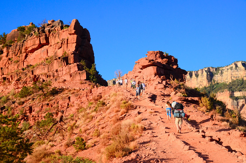
08:24 遇一隊十人的騾子隊上來,看情況前後兩人應是領隊及押隊,中間8人才是花錢的騎騾子登山客。
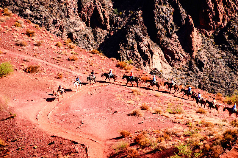
Mule train ascending the trail
Mule train ascending the trail
08:44 又遇一隊12匹騾子的騾子隊,不過這次騾子不是載人而是載貨,也許是載運農場的貨物吧!
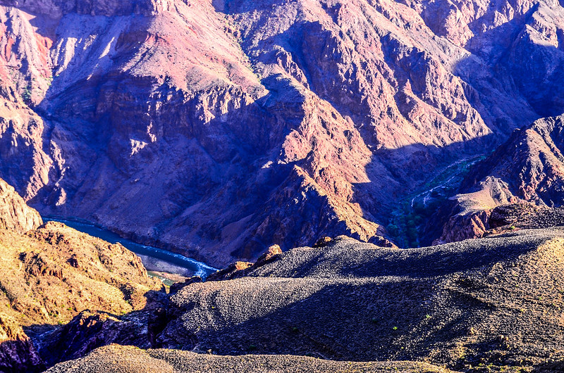
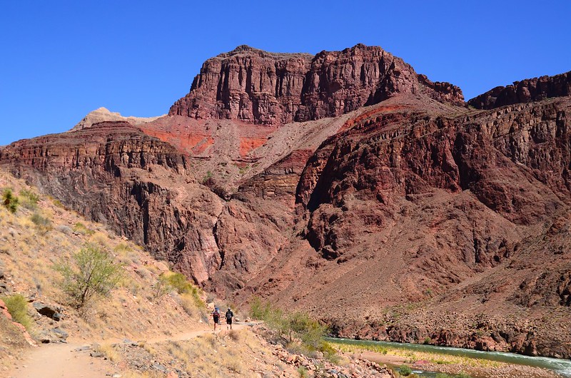
Looking down Colorado River & Black Bridge from the trail
Calorado River With Beach And Campground
Calorado River With Beach And Campground
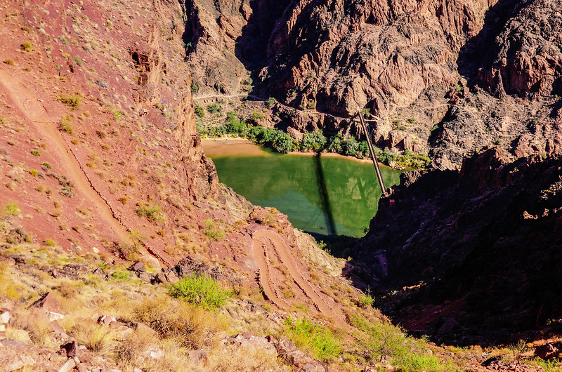
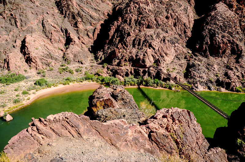
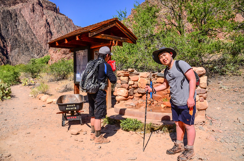
08:55 抵一岔路,左岔為River Trail,沿著科羅拉多河的南岸山壁間腰繞,不橫渡科羅拉多河最後在Silver Bridge橋頭和Bright Angel Trail會合,距離較短但沒經過谷底的加水站;右岔為South Kaibab Trail續往下行,下到谷底兩度橫渡科羅拉多河再回到Silver Bridge橋頭和River Trail會合後再沿科羅拉多河南岸西行,最後接Bright Angel Trail上山回到南緣(South Rim),此線距離較長但可到谷底加滿飲用水,我們取右行到谷底加水。
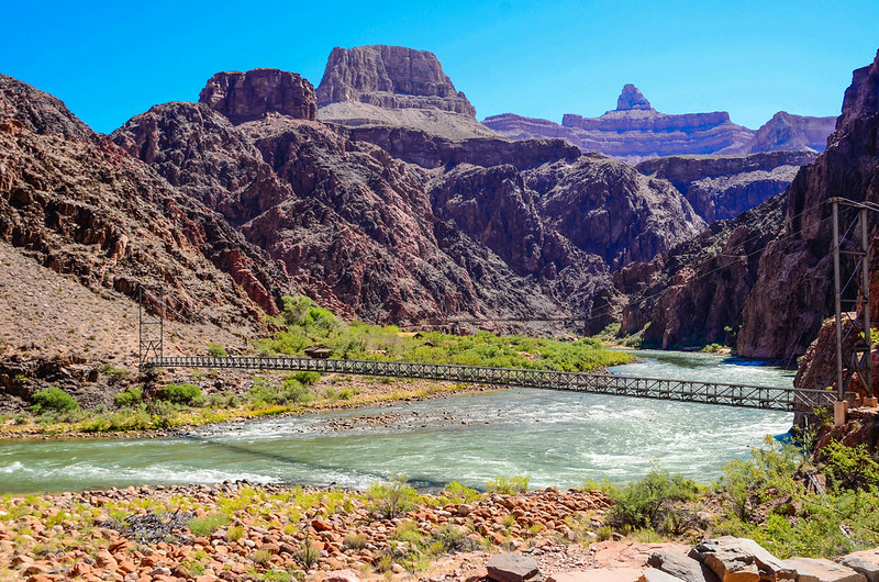
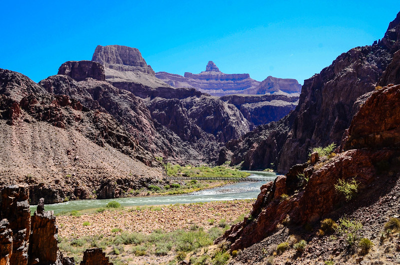
09:00 抵一隧道,出了隧道即是橫跨在科羅拉多河上的Black Bridge(Kaibab Suspension Bridge),此處距離登山口6.5哩(10.4公里),海拔約2,430呎(741公尺);該橋建於1928年,由於機動車輛無法進入施工現場,所以所有建材皆以人力和騾子將這122噸材料運輸到九英里的路上。

Black Bridge(Kaibab Suspension Bridge)
Black Bridge(Kaibab Suspension Bridge)
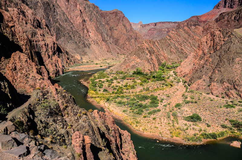
過了Black Bridge科羅拉多河北岸就是South Kaibab Trail的終點,緊接著沿著North Kaibab Trail在河的北岸西行。
Colorado River
Colorado River
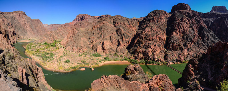
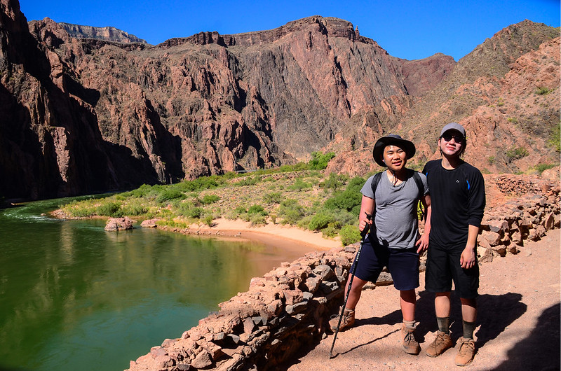
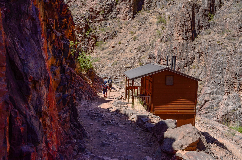
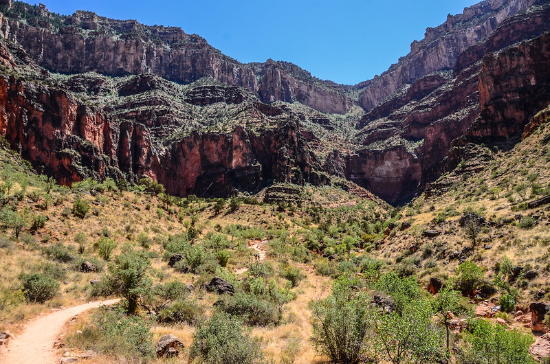
09:18 抵達谷底飲水加水站,距離登山口6.7哩(10.72公里),海拔約2,400呎(732公尺),這谷底一片莊園應該已屬Phantom Range範圍,旁有一座緊急求救通訊設備;

Water refilling station at the bottom on the South Kaibab Trail
登山客從登山口下來只要背下山足夠的飲用水就夠了,到此處加滿水,下一處加水站是距離4.8哩(9.68公里)之遙的Indian Garden,記著,此後的路程是上山,且挺熱的,需水量遠比下山時要多得多。
登山客從登山口下來只要背下山足夠的飲用水就夠了,到此處加滿水,下一處加水站是距離4.8哩(9.68公里)之遙的Indian Garden,記著,此後的路程是上山,且挺熱的,需水量遠比下山時要多得多。
Hiling to Phantom Ranch
才早上九點多,但谷底熱得很,聽其他山友說高溫華氏110度(攝氏43.3度);加好水後沿著步道在莊園間西行,不時見到莊園的建築。
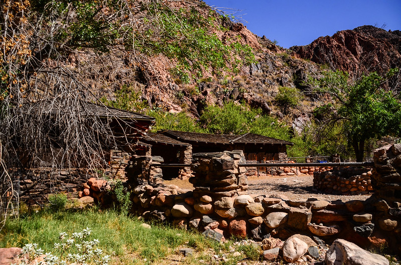
Phantom Ranch
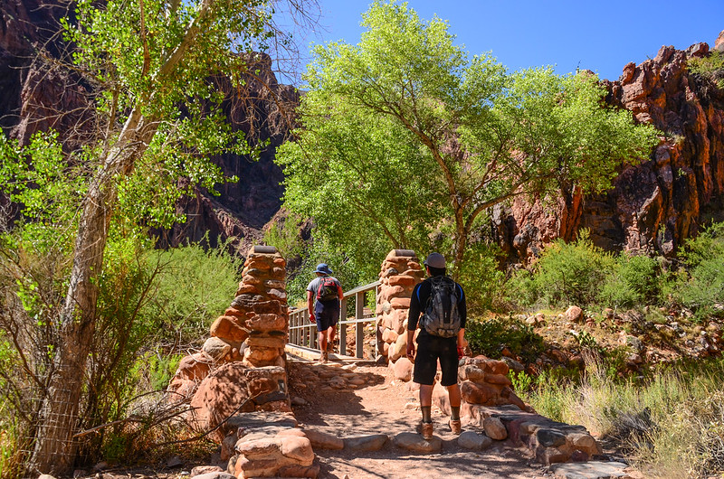
09:27 抵達North Kaibab Trail和Bright Angel Trail岔路,距離登山口6.8哩(10.88公里),海拔2,400呎(732公尺),右岔North Kaibab Trail通往Phantom Range住宿、露營區及上到北緣(North Rim),左岔Bright Angel Trail則是在橫渡科羅拉多河後上山回南緣(South Rim)的步道;取左行。

North Kaibab Trail & Bright Angel Trail junction
09:28 經過Bright Angel Creek上一座小橋。
Stone bridge
Stone bridge
09:34 抵達橫跨科羅拉多河上的第二座橋Silver Bridge,走過這座橋後又回到科羅拉多河南岸,左側一條山徑來接即是River Trail,取右側Bright Angel Trail沿著科羅拉多河南岸西行。

Silver bridge over the Colorado River
Hiking above the Colorado River
Hiking above the Colorado River
Hiking above the Colorado River
Hiking above the Colorado River
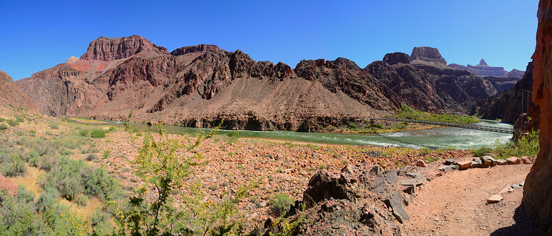

Enjoy beautiful views along this section of the Bright Angel Trail along the Colorado River
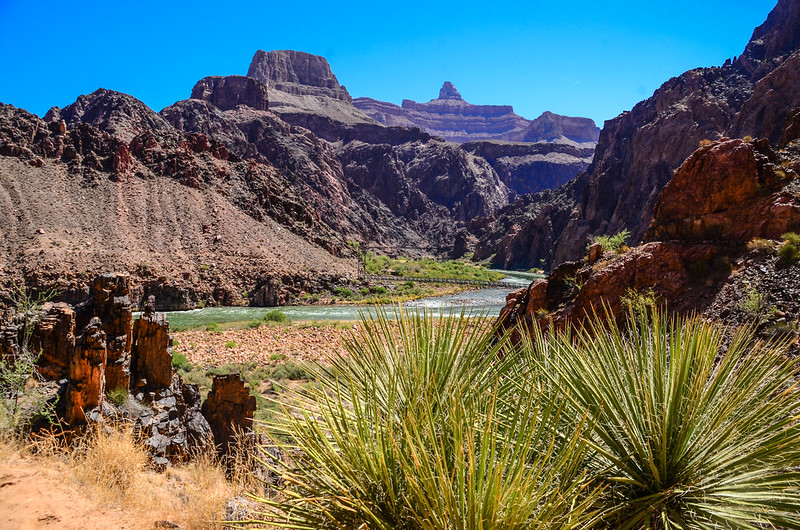
10:20 抵達Pipe Creek匯入科羅拉多河的匯流口,有一間廁所在步道右側,再行不遠跨過Pipe Creek山腳下有一座River Resthouse,有急難救助通訊設備,但無飲水供應,此處海拔2,480 呎( 756 公尺),距離南緣的South Kaibab Trail登山口約8.3哩(13.28公里),距南緣的Bright Angel Trail登山口約7.8哩;
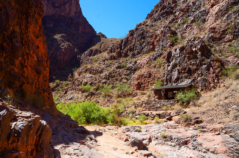
River Resthouse
此後登山步道一路沿著Pipe Creek兩岸穿梭緩坡上升;

Bright Angel Trail along Pipe Creek
沿途鮮少遮蔭處,炙熱的豔陽曬得頭昏腦脹,貝貝最怕熱了,好不容易看到一處小樹蔭或岩壁下內凹陰涼處就趁機休息一下,此段是緩坡都熱得受不了,等後半段的陡坡那還得了!
River Resthouse
此後登山步道一路沿著Pipe Creek兩岸穿梭緩坡上升;
Bright Angel Trail along Pipe Creek
沿途鮮少遮蔭處,炙熱的豔陽曬得頭昏腦脹,貝貝最怕熱了,好不容易看到一處小樹蔭或岩壁下內凹陰涼處就趁機休息一下,此段是緩坡都熱得受不了,等後半段的陡坡那還得了!
10:43 抵達Pipe Creek和Garden Creek分岔口,此處距River Resthouse約0.5哩,繼續沿著左岔的Pipe Creek上行。
11: 02 脫離Pipe Creek右切上山”之”字形盤升,此處距River Resthouse約1.0哩,途中又遇到一隊十人的騎騾子登山客從南緣下山。
Heading up the switchbacks
Heading up the switchbacks
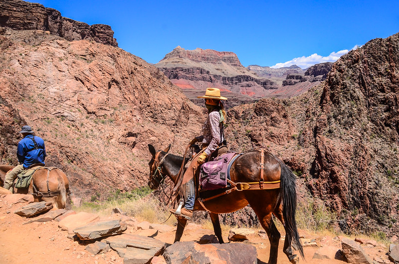
Rider
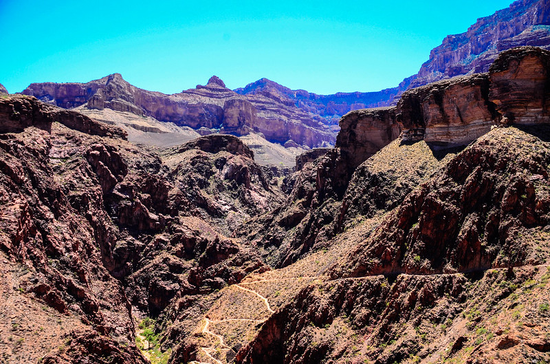
Looking at about 50 million years of layers into the canyon
Looking at about 50 million years of layers into the canyon
11:50 抵一處越稜點,越稜後西行不久即接到Garden Creek流域左岸朝西南爬升。
Jacob on his way up to Indian Gardens
Hot!Hot!Hot!
Jacob on his way up to Indian Gardens
Hot!Hot!Hot!

Hiking Up The Trail Approaching Indian Gardens
Jacob on his way up to Indian Gardens
12:58 左側一小徑來接,那條小徑是另一條登山步道”Tonta Trail”,繼續沿Bright Angel Trail直行。
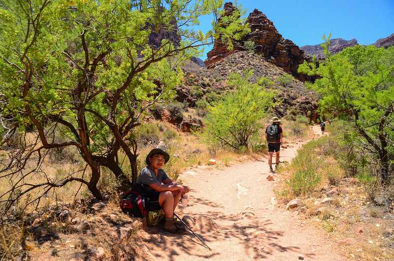
13:10 抵達Indian Garden,海拔3,800呎(1,158公尺),距離谷底River Resthouse約3.3哩(5.28公里),距離南緣的Bright Angel Trailhead約4.5哩(7.2公里);這是一處沙漠中的綠州,茂密的樹蔭、舒適的長椅、冰涼的飲用水及溪水(Garden Creek),此處是登山客一處長休的地方;園方貼心的在溫度計下貼張告示,上面寫著“Hot!Cool down in the creek! ← Get your clothes soaking wet, rest in the shade, and eat food before hiking。”
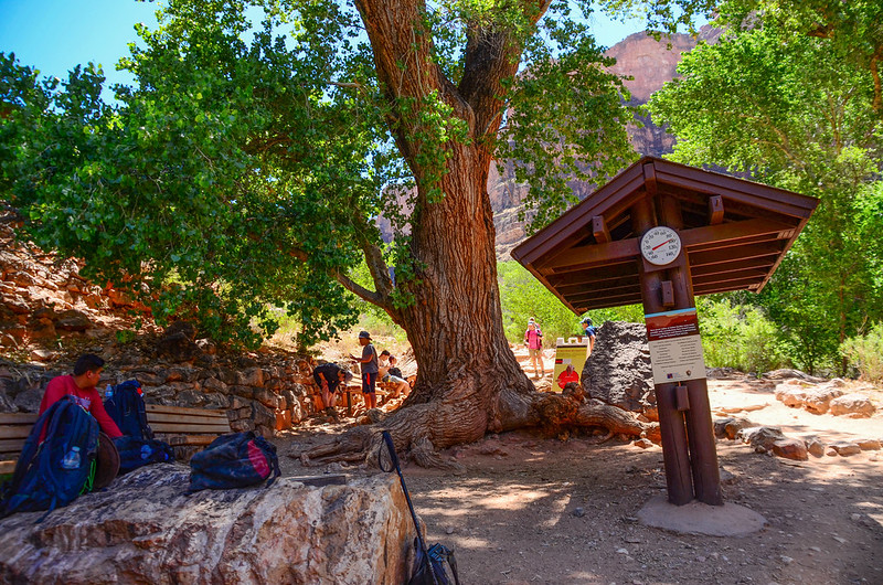
Indian Garden
Indian Garden
此處設有加水站及廁所,公園設置的氣溫計顯示陽光下氣溫華氏101度(攝氏38.3度),樹蔭下氣溫華氏92度(攝氏33.3度),谷底更熱了,有登山客上來說剛才谷底是華氏110度(攝氏43.3度),一位Ranger跟貝貝交談,她建議我們在此睡一覺,等四點以後陽光比較沒那麼熾熱再上山,感謝她的善意,但兩個孫子沒打算長休到四點,休息40分鐘後頂著強烈陽光繼續上行。
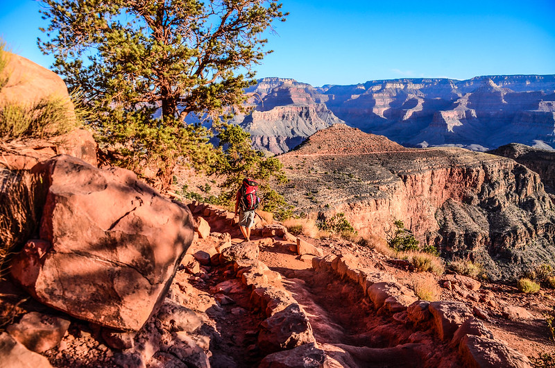
13:50 離開Indian Garden繼續上山;行約一個小時後貝貝右腳抽筋,休息好一陣子,後經一位老美山友給了一包運動飲料及一位來自江蘇的單姓山友給了一小包鹽巴加到飲用水飲用後再休息一陣子才漸漸舒緩疼痛,我怕女兒在登山口久等著急叫豆豆先行,我陪貝貝慢慢上山。
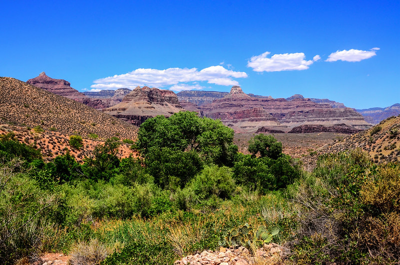
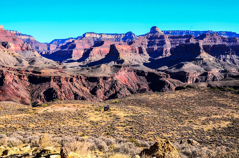
Looking north across the Canyon from Bright Angel Trail
Hiking above Indian Garden Campground
Hiking above Indian Garden Campground
16:35 左岔數十公尺是3.0哩休息站,貝貝腳已不疼痛不打算進去休息,飲用水也還足夠繼續沿步道上山,看來他腳抽筋之痛已紓解,體力來了!此休息站有加水設備及廁所。
Looking north across the Canyon from Bright Angel Trail
Looking north across the Canyon from Bright Angel Trail
17:55 抵達1.5哩休息站,在此再加點水,其實陽光已照不到我們,氣溫也降了許多,水量需求也少了,再1.5哩爬升350公尺左右即回到登山口,我已趕不上貝貝的腳步,看路況已無危險度就叫他先走不用等我。

Top of Bright Angel Trail
Grand Canyon
Top of Bright Angel Trail
Grand Canyon
18:40 抵達Lower Tunnel,這是一個不大的岩洞隧道,距登山口還有一哩左右,落差約170公尺。
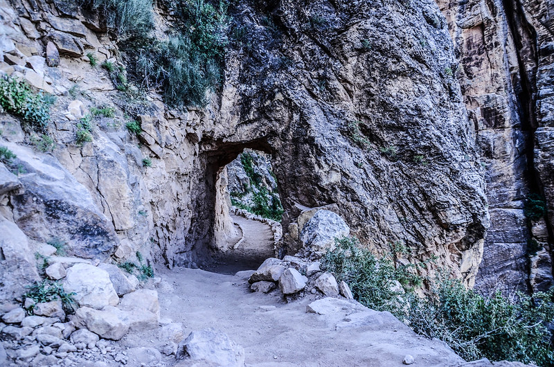
Lower Tunnel at the Bright Angel Trail
Grand Canyon
Grand Canyon
19:23 通過Upper Tunnel,快到登山口了!

Upper Tunnel at the Bright Angel Trail
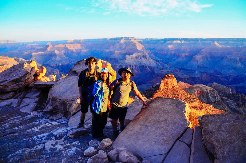
19:30 抵達南緣Bright Angel Trail登山口,貝貝說他在十幾分鐘前就到了,哥哥則早在一個多小時前就回到旅館了!
祖孫三人花了14個多小時完成了一趟艱難的大峽谷南緣下谷底O形環走行程,還蠻自以為傲的!
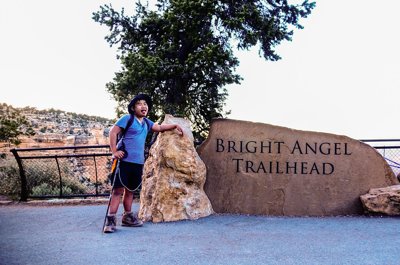
Bright Angel Trailhead
Bright Angel Trailhead
沒有留言:
張貼留言