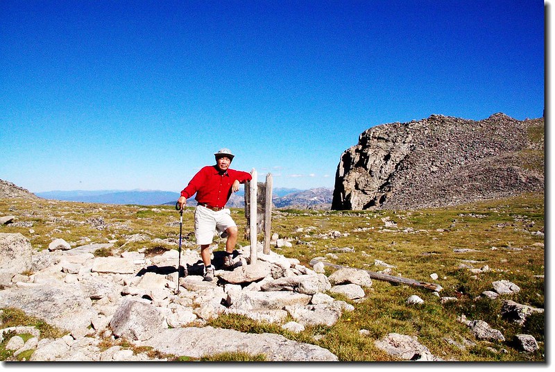
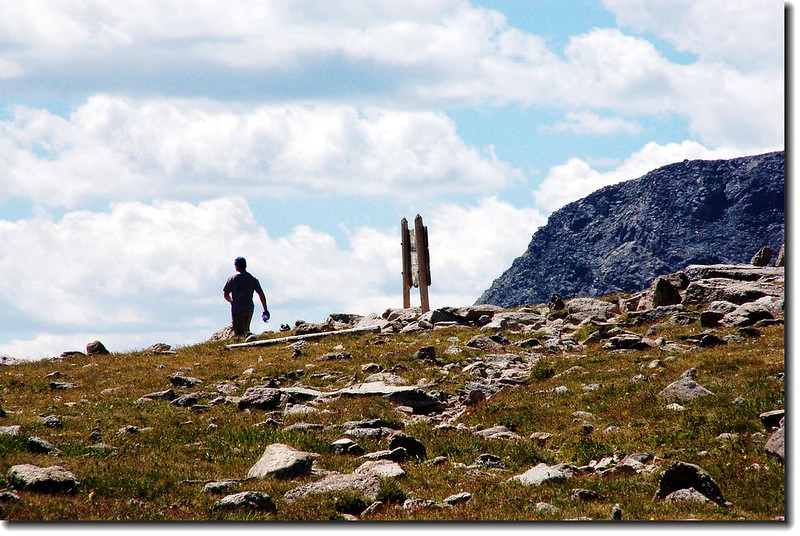
Pawnee Pass marked by sign on Continental Divide
Pawnee Pass是Indian Peaks Wilderness一條穿越洛磯山脈大陸分水嶺的高山步道,登山口在Brainard Lake Recreation Area。沿著步道沿途會經過Long Lake和Lake Isabelle兩個高山湖泊;上到最高點後是一大片的苔原,從此高點可攀爬Pawnee Peak和Shoshoni Peak。越過分水嶺後往西下可達Pawnee Lake ,在Brainard Lake Recreation Area地區是一條蠻受歡迎的登山健行路線。該路線我於兩年前走過一趟,主要是去攀爬Pawnee Peak和Shoshoni Peak。
------------------------------------------------------------------------------------------------
登山日期:2007.08.09
攀登山岳:Pawnee Peak( 12,943 ft . / 3,945 m )
Shoshoni Peak( 12,967 ft . / 3,952 m )
登 山 口:Long Lake Trailhead (10,480 ft. / 3,194 m )
登山里程:全程來回約12哩 ( 19.2公里 )
爬升高度:約2,900呎 ( 884公尺 )
花費時間:7 小時 42 分
登山口行車指南:
從Golden走72號公路(Peak To Peak)或由Boulder走119號公路到Nederland後續往北走12哩到達小鎮Ward,剛過小鎮路旁就可看到一面大指示牌指向西邊標明“Brainard Lake”,順著指示牌左轉沿Brainard Lake Road行約5哩即可到Brainard Lake ,中途2.6哩處會經過一收費站(夏季每一車輛9美元,持有國家公園年票-- America The Beautiful可適用;冬季大約10月初到次年6月中旬則免費。) The Long Lake Trailhead則續行約一哩,登山口有一停車場,但在夏季若不早到往往是客滿的。過了收費站後沿途會經過Red Rock Lake 和 Brainard Lake。
------------------------------------------------------------------------------------------------
行程紀要:
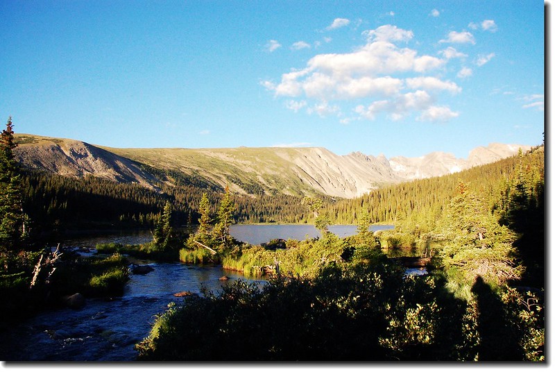
我於清晨六點左右到達Brainard Lake,清晨的湖光山色吸引我駐足好久,岸邊早就有釣客在此垂釣。六點半到達登山口停車場,因為來得早,車輛沒幾部。
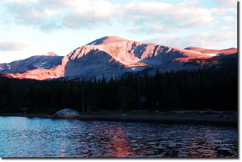
Morning light on Brainard Lake
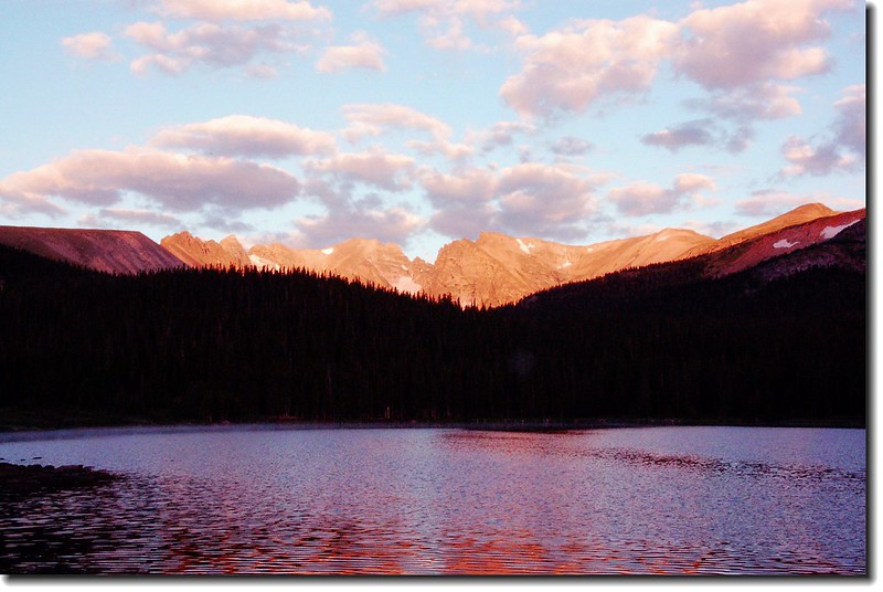
Morning light on Brainard Lake
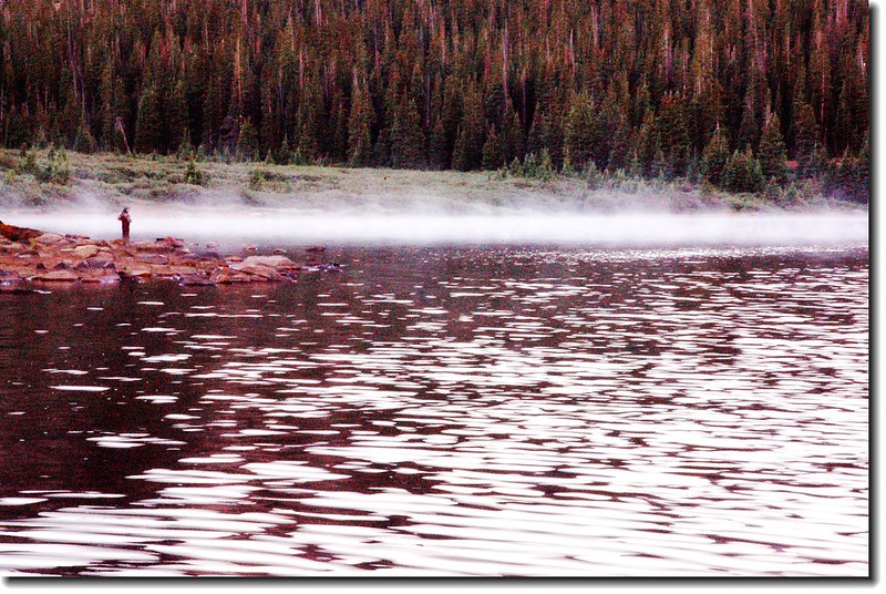
迷霧中的釣者
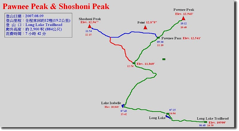
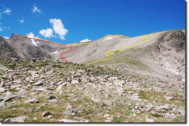
登山路線圖
06:48 登山口出發,沿著Long Lake Trail在松林間西行。
06:55 到達Long Lake東口,沿湖的北岸續往西行。
Long Lake
07:15 到達Long Lake的西端遇The Jean Lunnings Trail和Pawnee Pass Trail岔路(海拔10,674’),取右循Pawnee Pass Trail直行。
07:43 經過一段小陡坡後抵達Lake Isabelle。
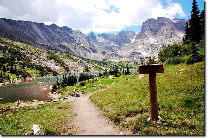
Lake Isabelle 岔路
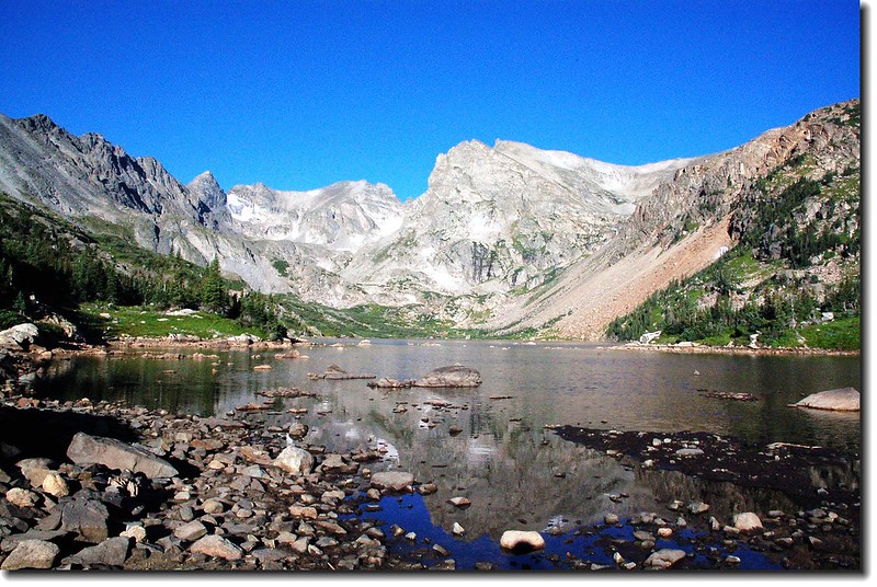
Lake Isabelle
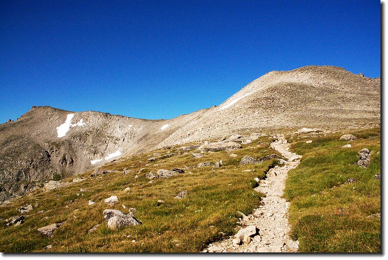
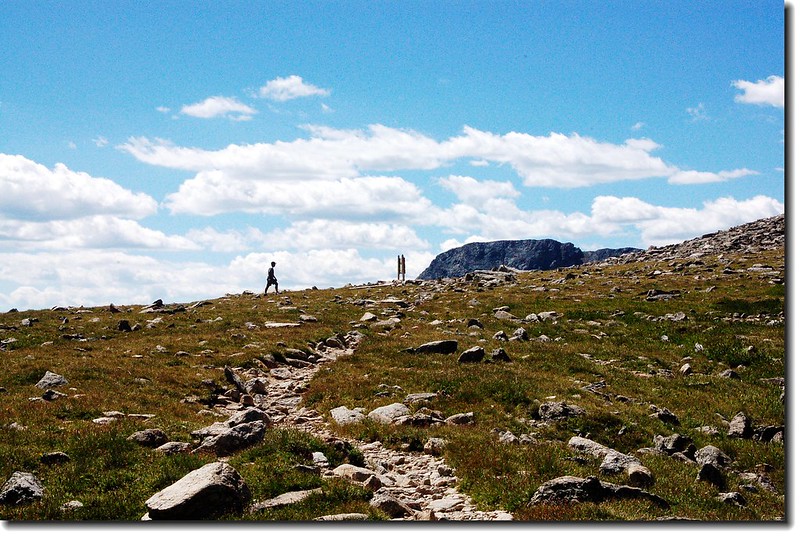
稍事停留續往右“之”字形攀升,步道轉為陡峭。約3/4哩後(距登山口約2.75 哩海拔約: 11,355呎)出了森林線,步道轉為較平緩,兩側是亂石堆的苔原地形,苔原上不時看到土撥鼠(Marmot)、短耳兔(Pika)和雷鳥(Ptarmigan) 在活動。
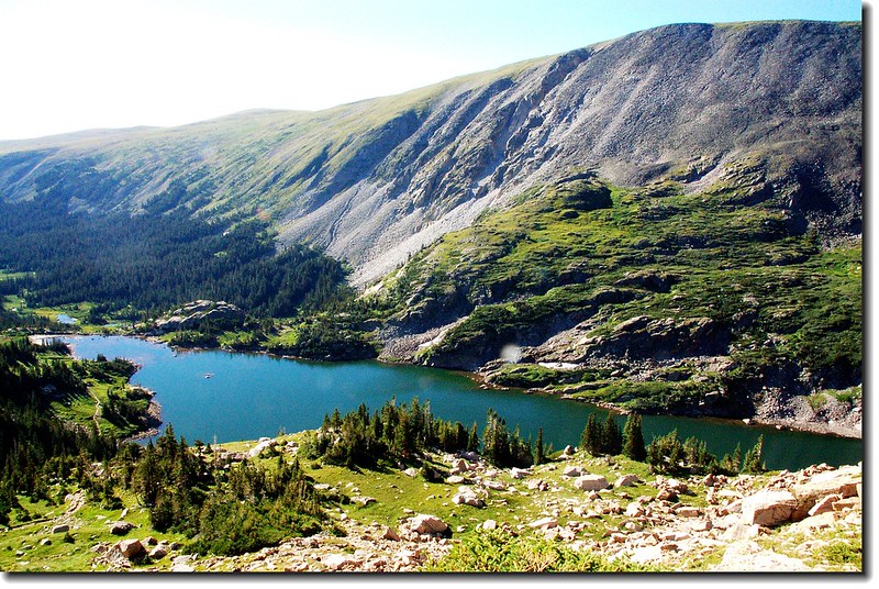
俯瞰Lake Isabelle
步道北眺Pawnee Peak東稜
步道南眺 Navajo Peak
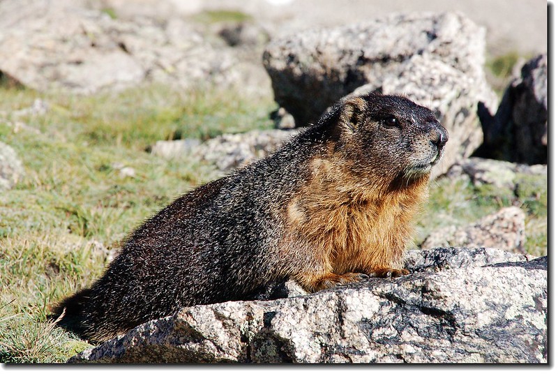
Marmot
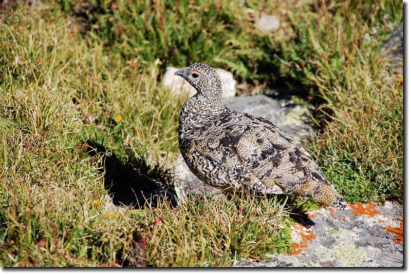
Ptermigan
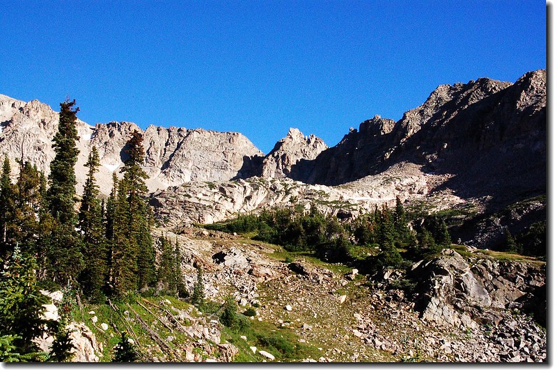
經過一斷平緩的亂石坡後再爬升一段陡坡便看到一片高原--Pawnee Pass最高點到了!
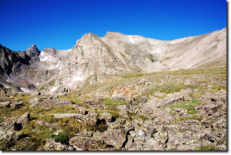
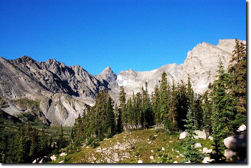
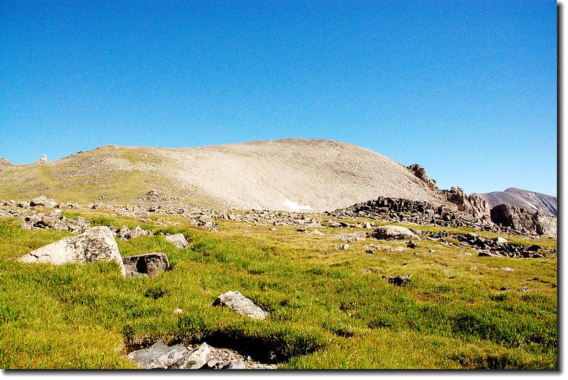
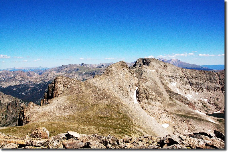
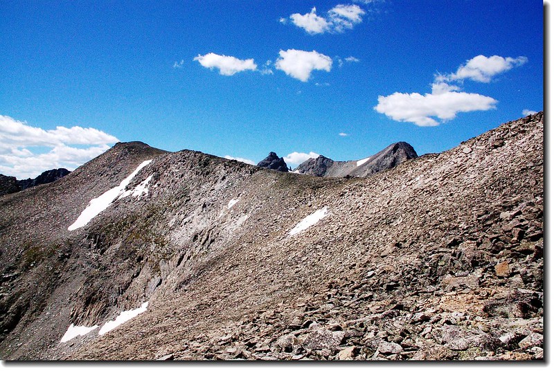
Shoshoni peak as seen from higher tundra plateau just below Pawnee Pass
Shoshoni peak(L) as seen from Pawnee Pass
09:30 抵達Pawnee Pass,海拔12,541呎,距登山口4.55哩,很寬廣的一片苔原,北側是Pawnee Peak ,南邊是一座海拔12,878呎的無名山頭,步道續往西行便是洛磯山脈的西邊,可達Pawnee Lake。
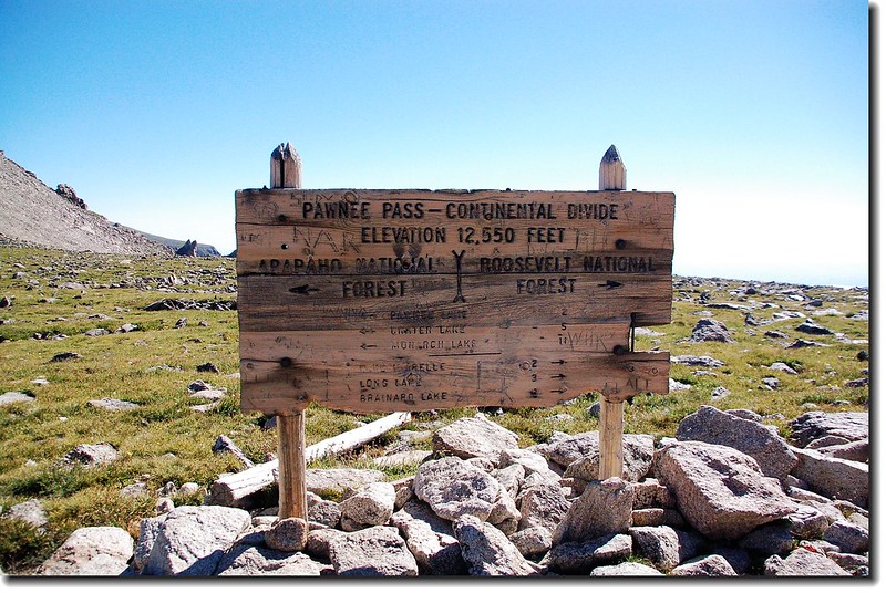
Pawnee Pass
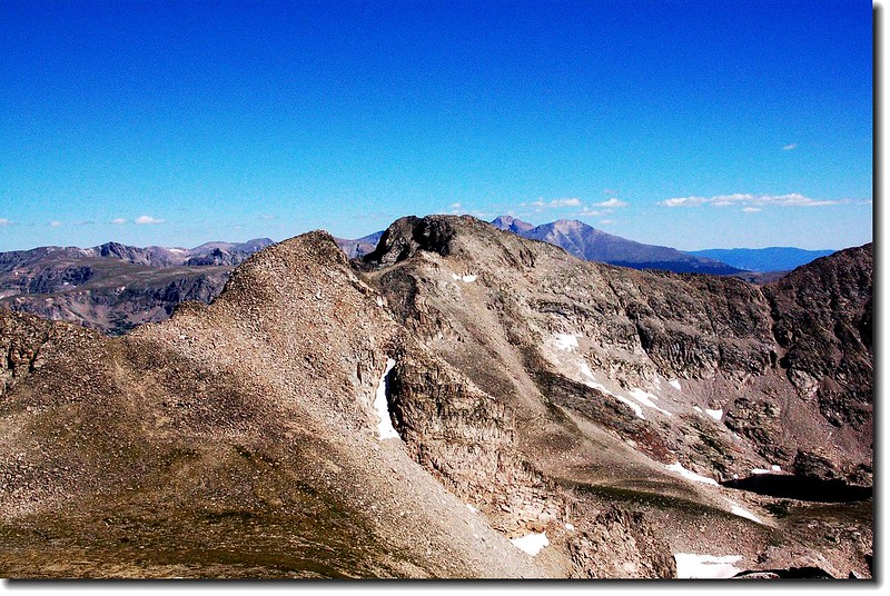
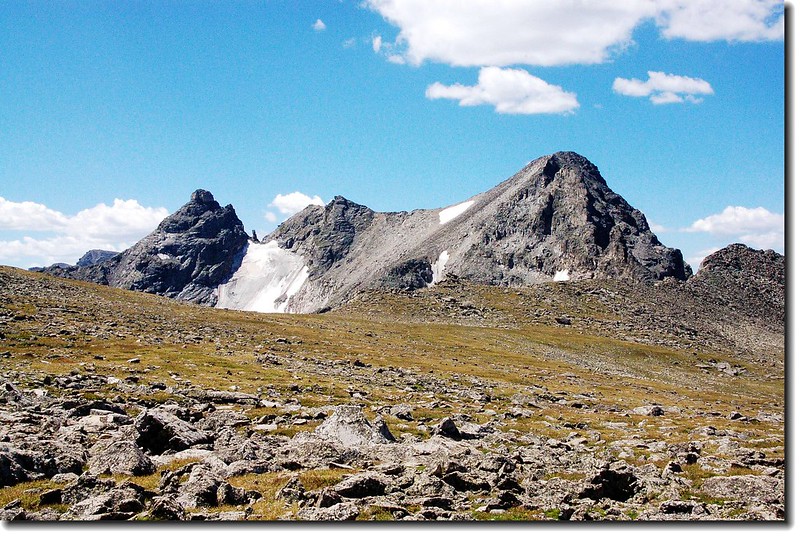
Pawnee Peak as seen from just below Pawnee Pass
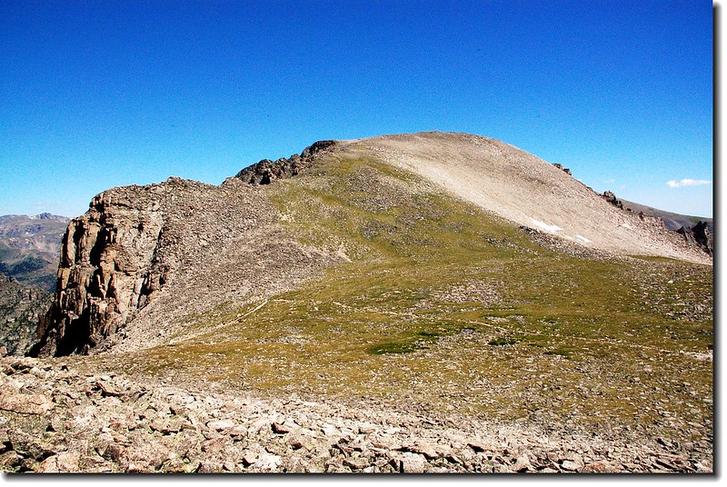
Pawnee Peak as seen from Pawnee Pass
在Pawnee Pass稍事休息並到處逛逛後開始朝Pawnee Peak山頂出發,一路在Pawnee Peak的南側坡上升,沒有明顯路跡但不難走,朝山頂自行尋路上山,爬升約400呎即可抵達山頂。
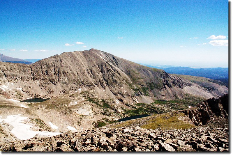
West face of Point 12,878' from Pawnee peak
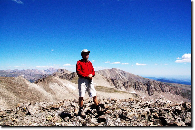
10:12 抵達Pawnee Peak山頂,海拔12,943呎.( 3,945 公尺)。
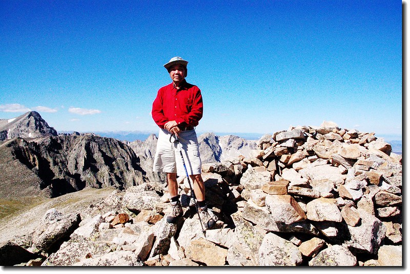
On the summit of Pawnee peak
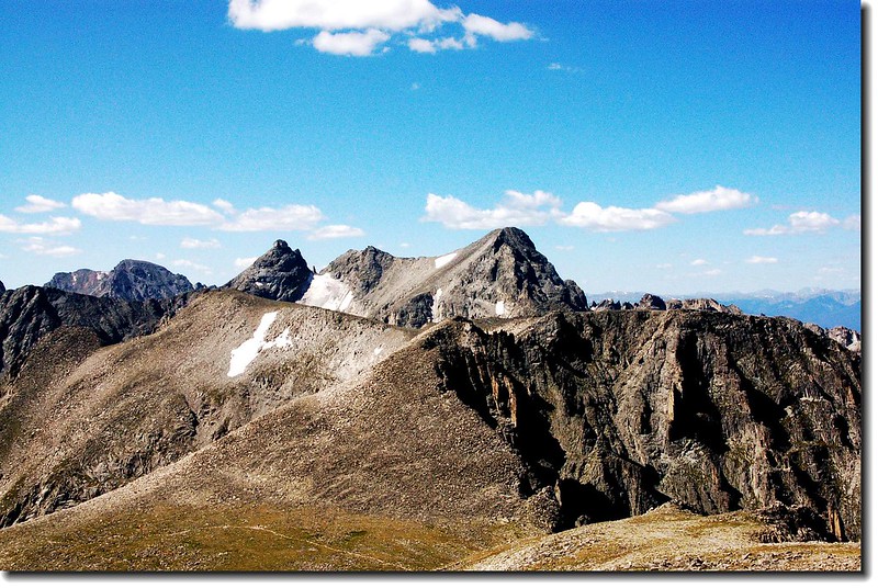
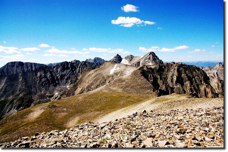
山頂有極佳的展望,環視整個Indian Peaks Area和北邊的洛磯山脈 ,北邊幾座山頭如Mt. Audubon ( 13,223’ )、Mt. Toll ( 12,979’ )和Paiute Peak (13,088')就在不遠處; Blue Lake and Little Blue Lake.也在山腳下,熟悉的Longs Peak也清晰可見。
View to south from Pawnee's summit
View to south from Pawnee's summit
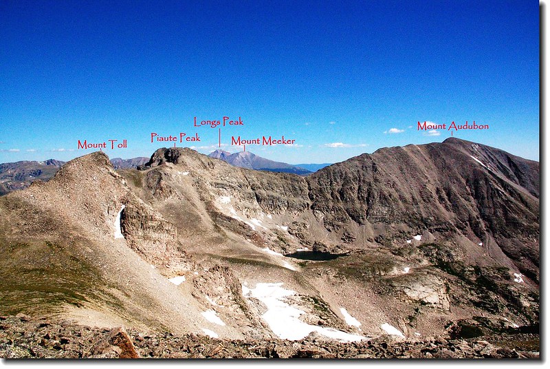
View to north from Pawnee's summit
View to north from Pawnee's summit
View to north from Pawnee's summit
Mount Audubon、Blue Lake(右下) and Little Blue Lake(左)
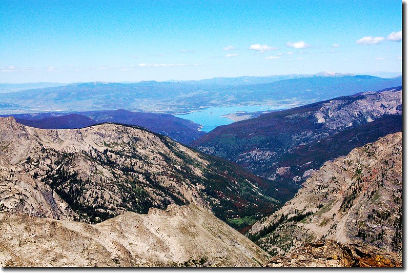
West view to Lake Granby from Pawnee Peak
10:40 下山
11:10 下抵Pawnee Pass,續往南邊的Shoshoni Peak前進。
Pawnee Passs
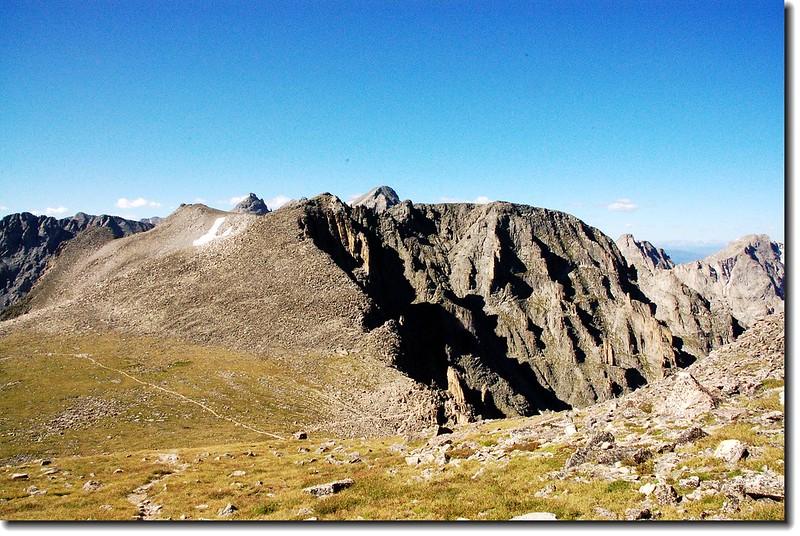
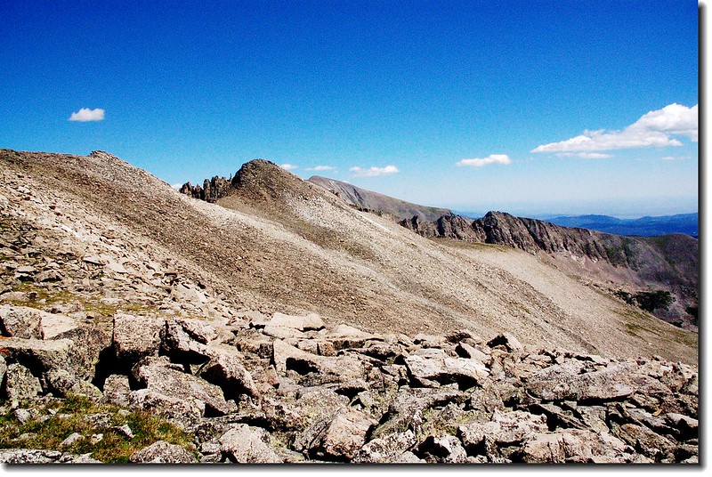
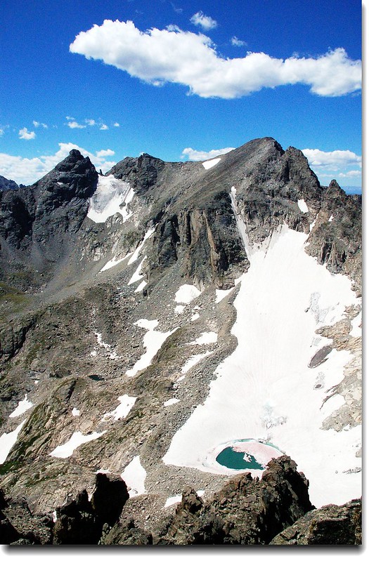
Shoshoni Peak位在Pawnee Pass的南方,要上此峰必須橫切Pawnee Pass南側12,878呎的無名山頭(Point 12’ 878’ )。Point 12’ 878’整座山頭都是亂石坡,走起來小心翼翼的,我在11:40切到Point 12,878’和Shoshoni Peak的鞍部,回望Point 12’ 878’和南眺Shoshoni Peak等群峰都有極佳的山景。
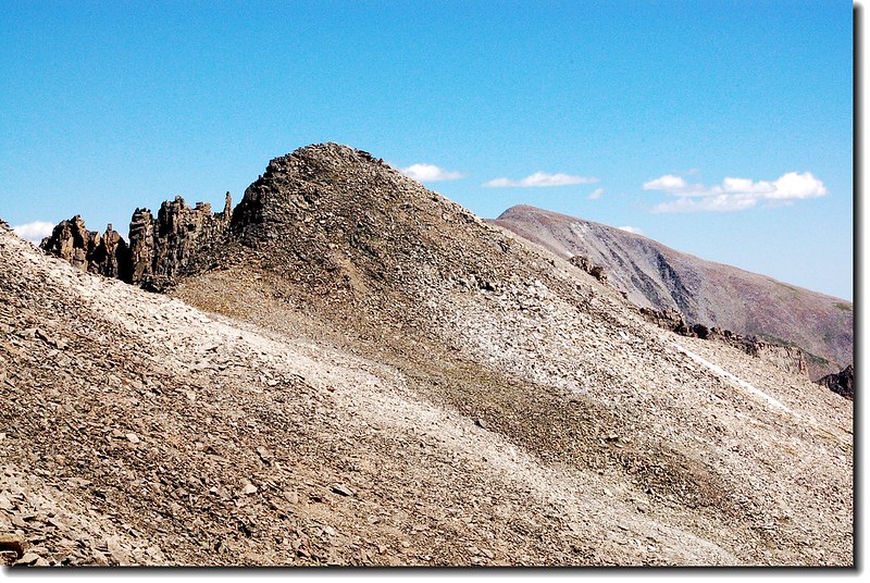
Point 12,878'
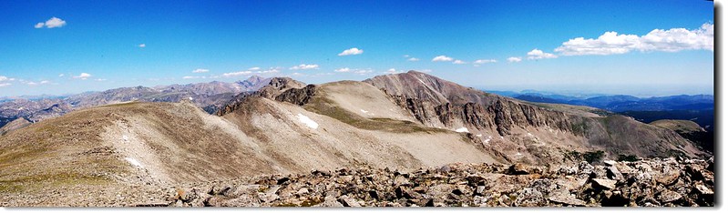
View to north from the gentle northern slopes of Shoshoni
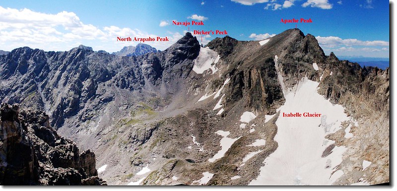
Navajo Peaks cone shaped summit peaking over Shoshoni-Point 12,878' saddle
Navajo Peak, Dickers Peck, and Apache Peak from the saddle
過了鞍部後便沿著Shoshoni Peak的西北坡直朝山頂爬升,這是一段緩坡好走的路段。
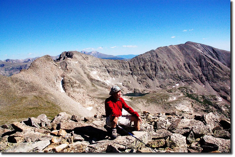
11:54 登頂Shoshoni Peak,海拔12,967 呎( 3,952公尺)。
On the summit of Shoshoni peak
站在峰頂上東眺Brainard Lake Recreation Area的Red Rock、Brainard、Long和Lake Isabelle等湖;南北則是洛磯山脈和印地安山群等諸名山,站在此有一種傲視山河的感覺。
Navajo Peak(L) and Apache Peak(R) from the summit of Shoshoni Peak
View to south from the summit of Shoshoni peak
 View to north from the summit of Shoshoni peak
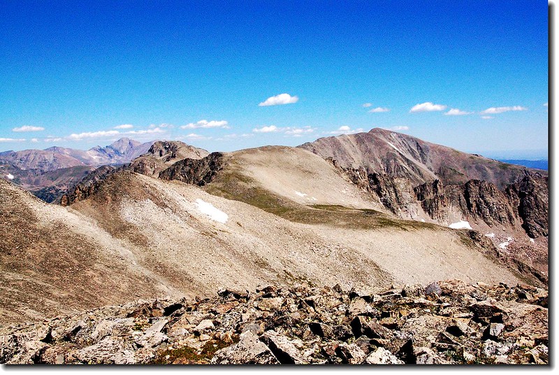
View to north from the summit of Shoshoni peak
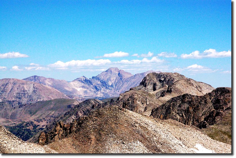
Longs Peak as seen from Shoshoni Peak
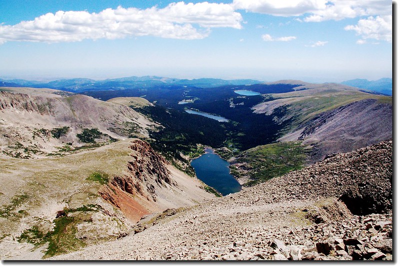
Lake Isabelle and Long Lake from Shoshoni Peak
12:15 下山,我循原路下切到Point 12,878’和Shoshoni Peak的鞍部後,轉向右下在Shoshoni Peak的北坡朝東下切。
12:54 接到Pawnee Pass Trail,此地海拔約11,860呎。
回望下切路
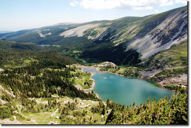
Lake Isabelle from the upper spot
13:42 返抵Lake Isabelle
14:04 抵達Long Lake
14:30 返抵登山口,結束一天愉快的行程。