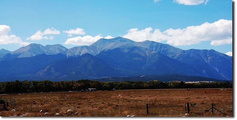
Mount Antero from US-285
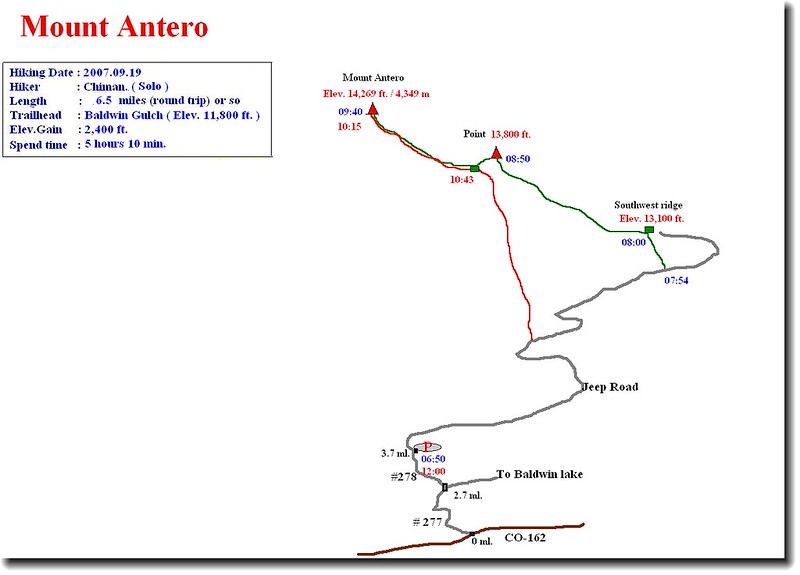
Hinking route
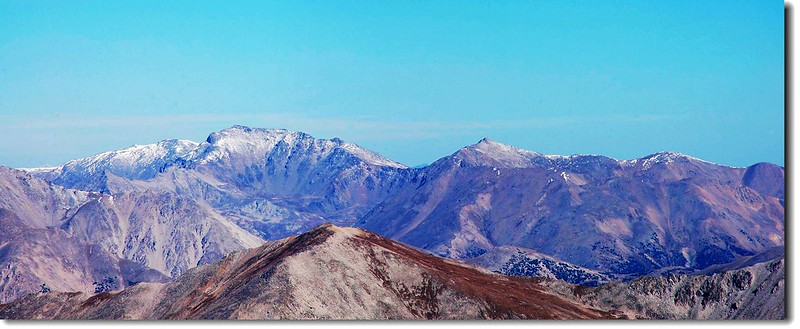
Mount Antero海拔14,269呎(4,349公尺),座落在Sawatch Range的中段,位在Buena Vista和Salida兩個小鎮之間,他與北邊的Mount Princeton隔著Chalk Creek Canyon南北對峙,氣勢雄偉,早期以蘊藏豐富的海藍寶石著名,Mount Antero及其附近的山頭現在也尚有幾處私人礦業還在開採中。
Mount Antero是在科羅拉多州以印地安人命名的山岳中最高的一座山,鄰近以印地安人名字命名的山峰還有Tabeguache、Shavano和Ouray。Antero是一位印地安猶特族(Ute)的酋長,在1960年代後期到70年代之間,當猶特族(Ute)和白人正處在一個緊張關係中時,他是一位主張和平主義者。他也是1880年華盛頓條約的簽字者之一,該經過修正的條約導致猶特族失去了他們大多數的土地。
Mount Antero 之所以吸引人有很多原因。他是科羅拉多第10高的高山;它有多條不是很難的登頂路線;在它的山坡開採出很多寶石,也因此使Antero成為奇石愛好者常去尋寶的一座山;在Antero的西邊有一條路況不錯的四傳車車道,可開抵距山頂不遠的地方,這使Antero成為熱愛越野車者趨之若鶩的一座山,基於以上原因,Mount Antero成為很熱門的一座山。
2007.09.19我趕在雪季回台前單獨去攀登此山,我採取的是較熱門的標準傳統登山路線,從Baldwin Gulch Trailhead 啟登的West Slopes Route,該登山口有一個好處,如果是車況良好的四傳車可開到離山頂不遠的山頭,因為這座山的山坡有一條很熱門的越野車車道。若從登山口起登來回約13.5哩(21.6公里) ,爬升高度約5,200呎(從登山口9,400呎到山頂14,269呎),攀登等級為Class 2。
當天凌晨兩點我從家中出發,取道I-70州際道路西行,到Golden後由Exit 260銜接CO-470 E南下,約6哩後轉US-285西行,約102哩後抵Johnson Village,續往南行,約6哩接Chaffee County Road CR-162,右轉朝Mt. Princeton Hot Springs西行,約12.5哩後接Baldwin Gulch Jeep Road(#277),此路位在CR-162的左側。左轉後開始是崎嶇狹小的石子路,行約2.7哩後抵一叉路,直行往Baldwin Lake,取左往Mt. Antero (#278)。
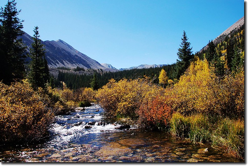
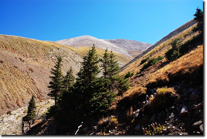
Baldwin Creek(taken from the Baldwin Gulch Road fork 10,800')
再行約1哩後於06:30抵森林線,在此停車。此地海拔11,800呎,車子還可開的更遠,但一來想多走一點路,二來怕山上的路況不熟,萬一有一點閃失可不好玩。停好車後整裝準備出發。

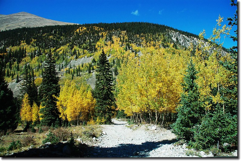
Aspen stood along Baldwin Gulch Jeep road
06:50 出發。
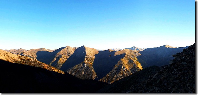
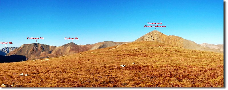
旭日東昇,紫紅色晨光灑落西南方的Cronin Peak(North Carbonate)山頭。
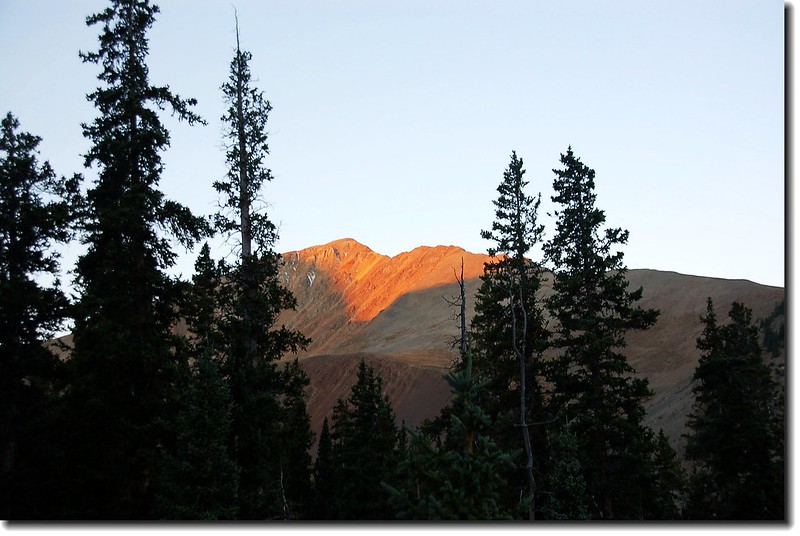
Sunrise on Cronin Peak(North Carbonate)
Parking here(tree line,11,800')
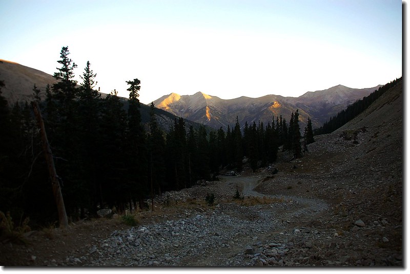
一路沿著Jeep車道在Mount Antero的西面山坡向南緩升。這是一條熱門的越野車道,也許時刻還早,整個路上就我一個人。行約數百呎後(海拔約12,000呎)車道便是一連串的「之」字形向南上升,我一路順著車道,偶而取兩彎道間的捷徑攀升。
Sunrise on Cronin Peak(North Carbonate)
Looking up southwest ridge
Sunrise on mountain(Mt. Antero view to north)
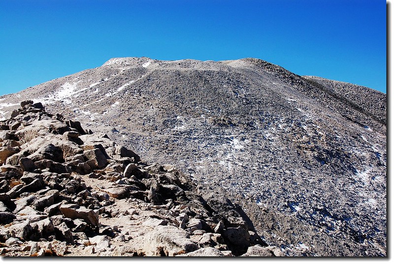
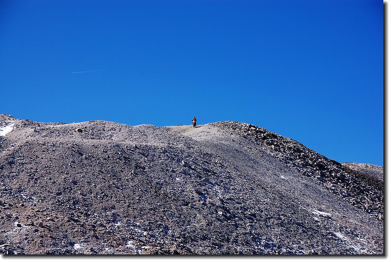
07:54 來到Mount Antero的西南稜下方,取左山坡捷徑上切。
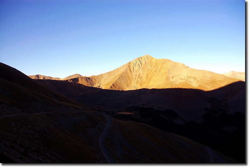
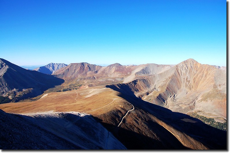
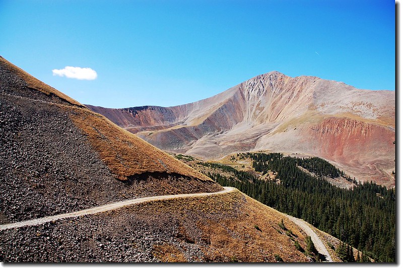
08:00 抵Mount Antero的西南稜稜線,海拔13,100呎(3,993公尺),一片大草原好美的視野。
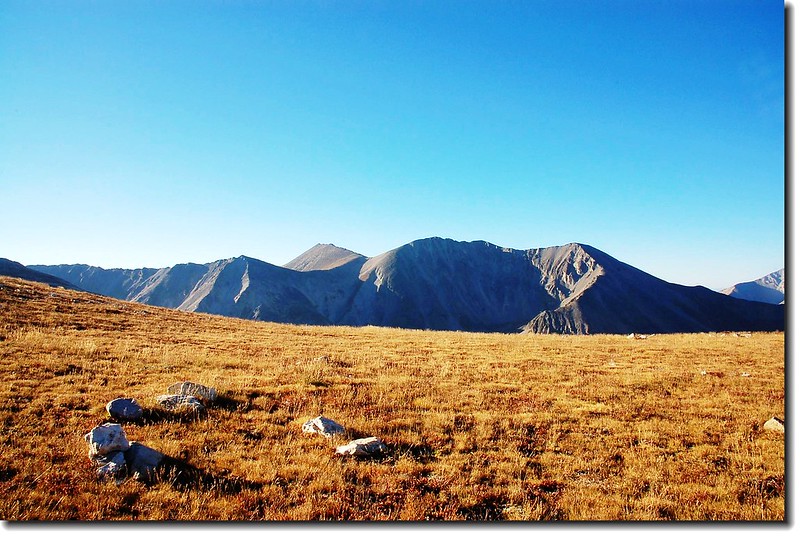
Shavano & Tabeguache from southwest ridge of Antero
View to north from southwest ridge of Antero
On the broad plateau on southwest ridge(background are Shavano & Tabeguache Peak
SW ridge(13,100') view to West
Jeep車道環繞西南稜續沿13,800呎高地的南坡往13,800呎高地爬升。我則順著稜線朝東北13,800呎高地攀升,路跡不明,只有抓準目標自尋路徑上攀。
Looking down SW ridge from near Point 13,800'
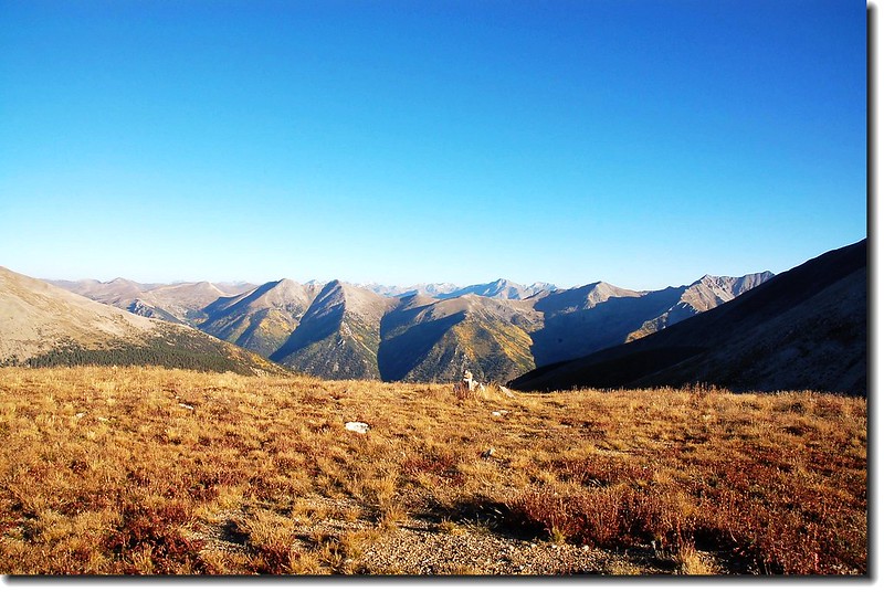
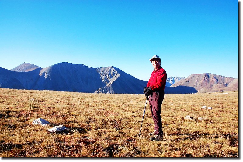
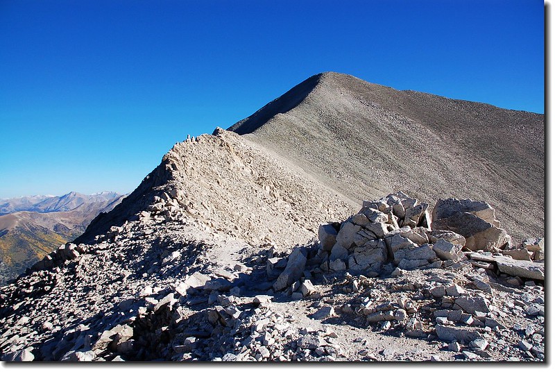
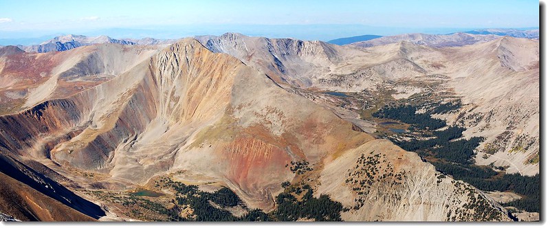
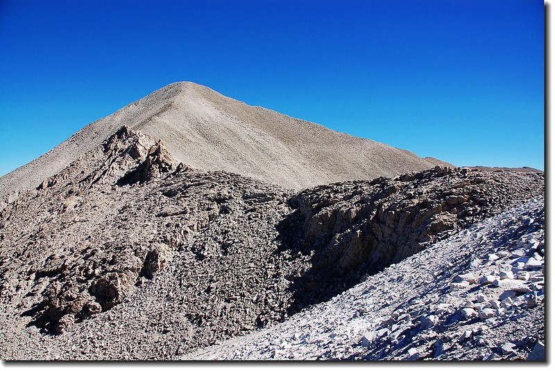
08:50 抵達Mount Antero南邊的13,800呎高地,Mount Antero就在北邊稜線頂端。另兩座Sawatch Range最南邊的14ers--Mount Shavano和 Tabeguache Peak看得非常清楚,那是明年的目標。
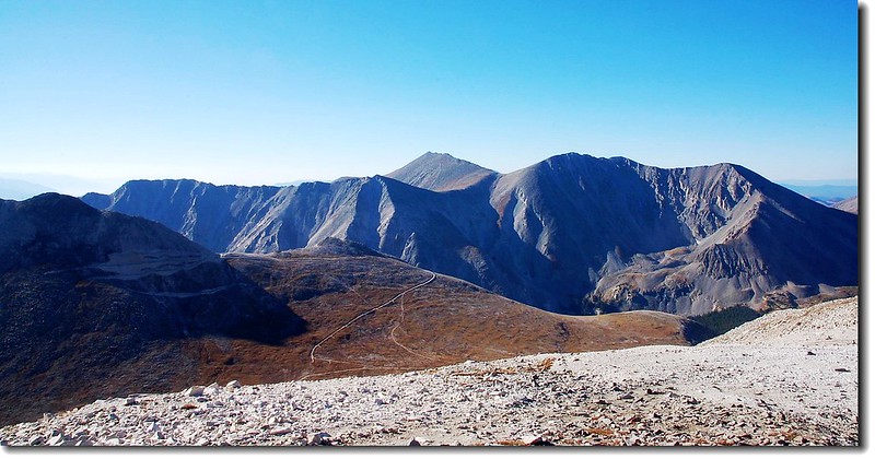
Shavano & Tabeguache from point 13,800 ft.
Mt. Antero from point 13,800 ft.
小休後續往Mount Antero山頂前進,先要下一個100呎左右的小坡。
09:05 下抵Mount Antero和13,800呎高地間的鞍部,開始往北朝Mount Antero山頂爬升。先經過一個巨石堆地形,腰繞而過。
Fresh snow on Point 13,800 ft.
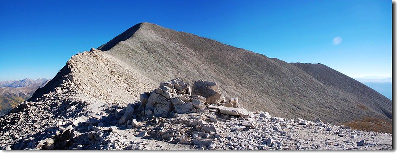
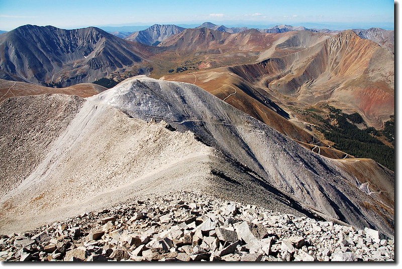
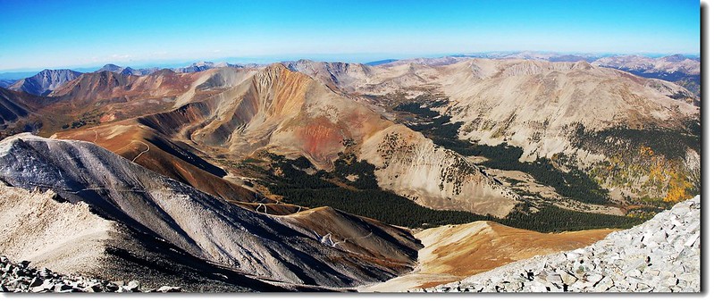
Antero's summit ridge (std route)
A part of ridge terrain up to summit
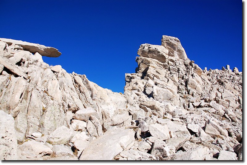
09:20 繞過巨石堆地形,抵達Mount Antero南稜稜線上。此後便一路沿Mount Antero南稜稜線攀升,亂石堆,不是很好走。

Antero from summit ridge
Looking down the ridge to the 13,800 ft. parking lot from below the summit
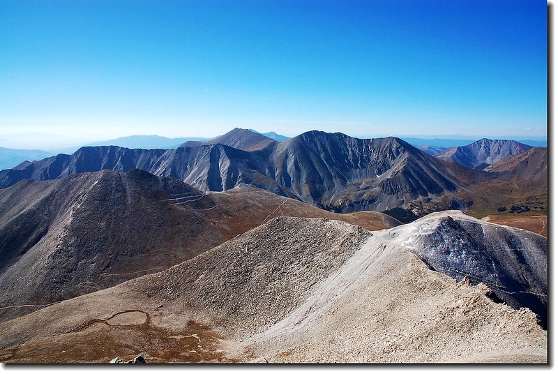
View to north from Antero's summit
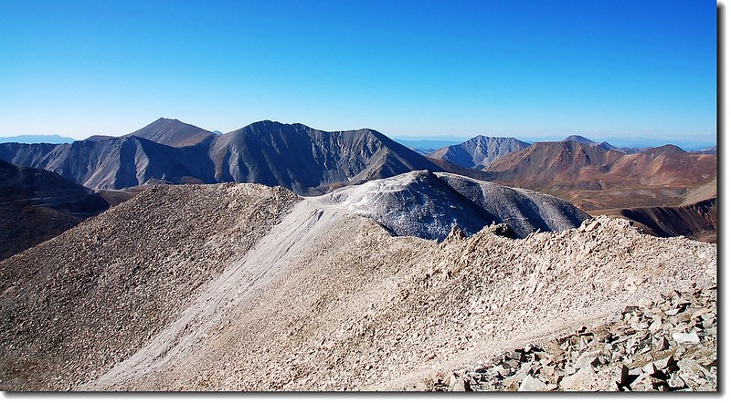
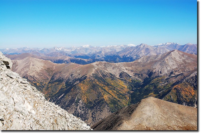
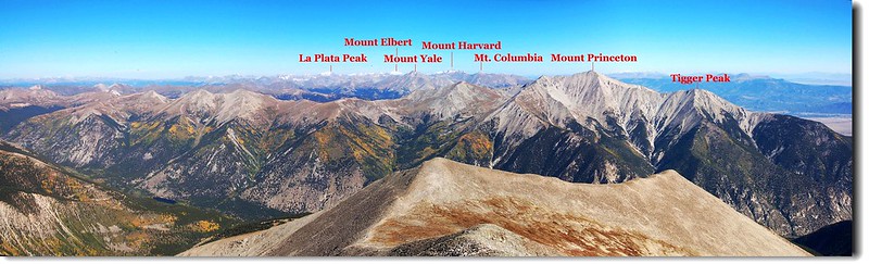
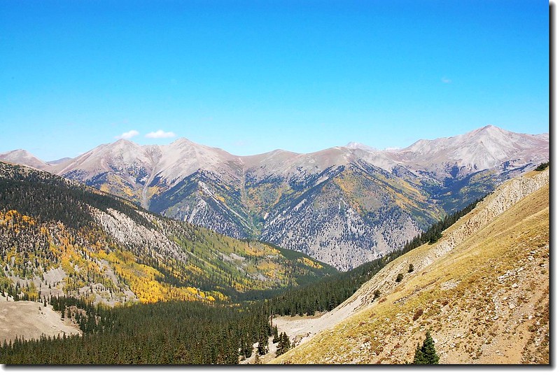
09:40 登頂科州第10高峰Mount Antero,海拔14,269呎(4,349公尺),這是我在科羅拉多州的第21座14ers。由於天氣晴朗,視野佳,整個Sawatch Range的14ers幾乎一覽無遺。
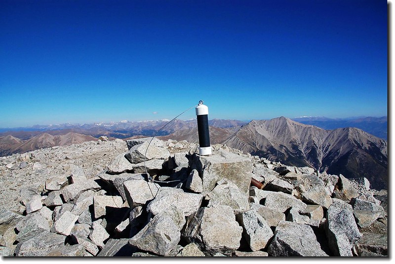
The summit of Mount Antero
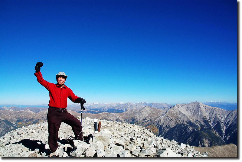
On the summit of Antero
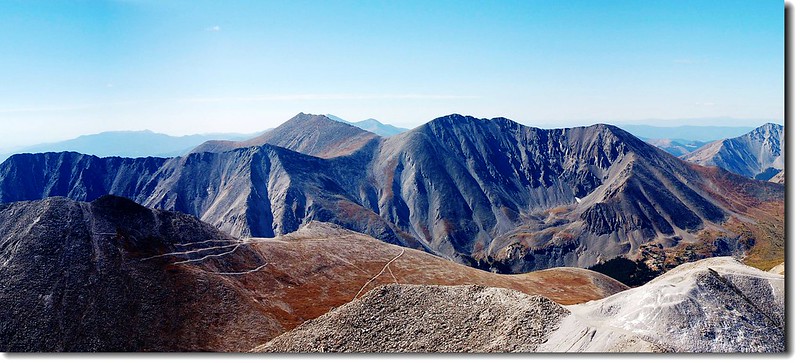
Looking down at the valley I came from
Look back down on the route from the summit of Antero
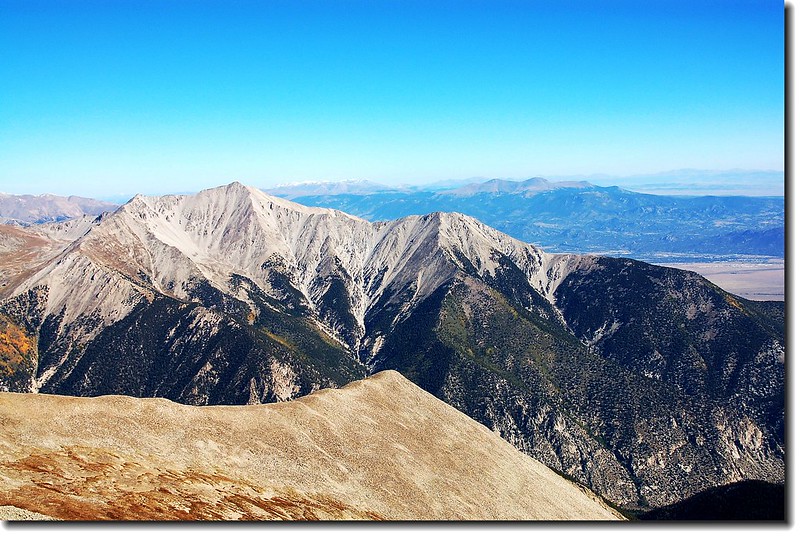
Mountains view from Antero's summit view to south
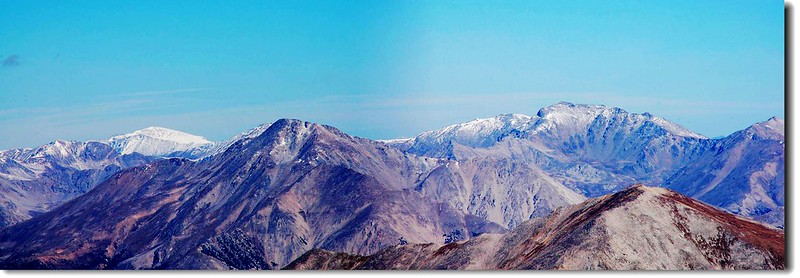
Yale, Harvart, Columbia from Antero's summit
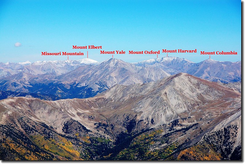
Sawatch Peaks from Antero's summit(標示之山頭為14ers)
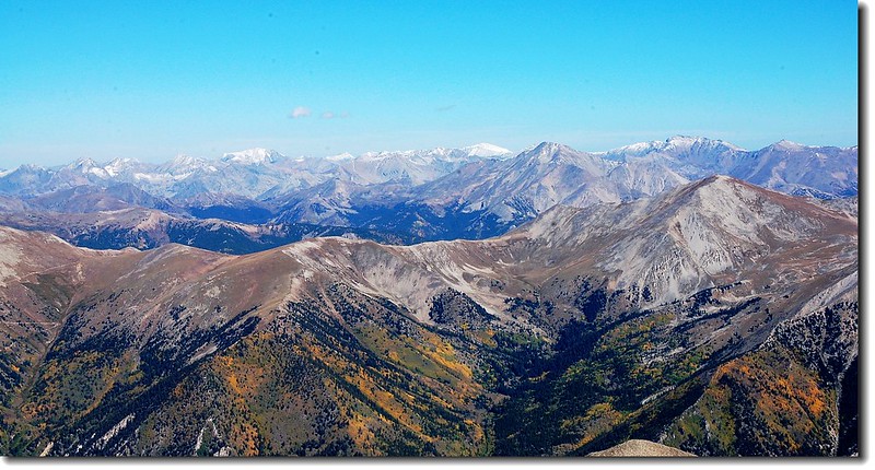
Sawatch Peaks from Antero's summit
Princeton,Yale, Harvart, Columbia from Antero's summit
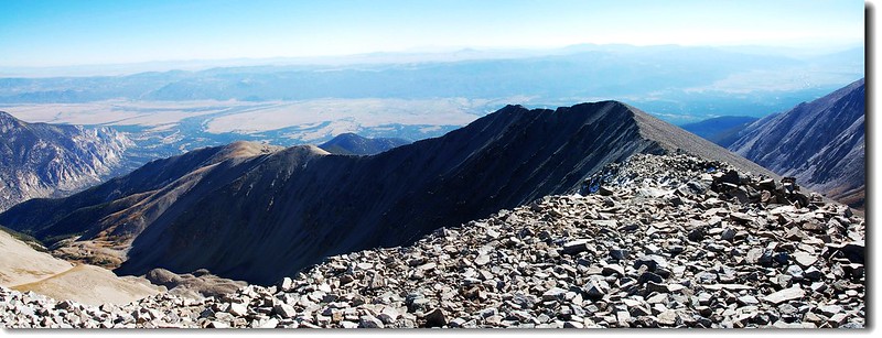
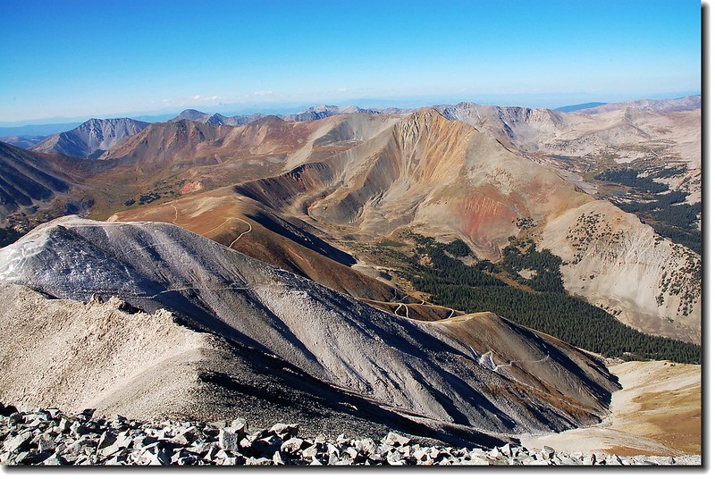
A view of antero's eastern summit ridge from the summit
Cronin Peak & Grizzly Mt. as seen from the summit to Mt. Antero
Mountains view from Antero's summit view to west
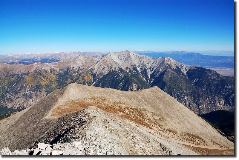
Shavano & Tabeguache from Antero's summit

Mountains view from Antero's summit view to south
Mountains view from Antero's summit view to north
Harvart, Columbia from Antero's summit
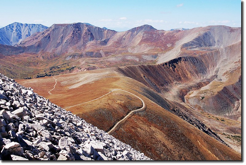
10:15 下山,仍循南稜稜線下切。
10:43 下抵Mount Antero和13,800呎高地間的鞍部,此時13,800呎高地上有好幾位機車騎士騎著越野機車奔馳在山頭。
Offroad motorcycle on Point 13,800 ft.

Offroad motorcycle on Point 13,800 ft.
Antero's summit ridge (std route)
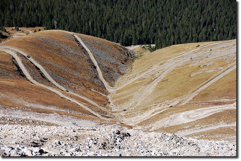
腰繞過13,800呎高地之後便朝山腳下的Jeep車道一路下切。山腰類似髮夾般的車道上此時有十幾二十部的越野車正在上下奔馳,由上往下看倒像是行走於沙漠中的大隊商賈。
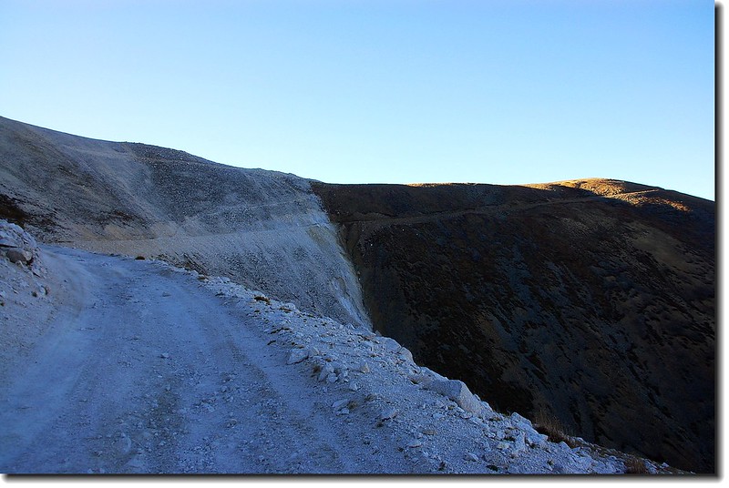
Looking down jeep road from west slopes
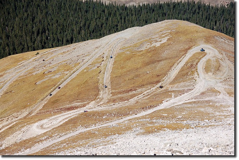
4-wheeler doing the Antero Road
11:20 切抵Jeep車道,沿車道下山。
Cronin Peak(North Carbonate) seen from the west slope of antero
Looking down Baldwin Gulch from tree line
Looking up point 13,800' from tree line
12:00 返抵停車處。今日攀登來回約6.5哩,爬升高度約2,400呎,共費5小時10分鐘。整裝後開車回家,也結束今年的14ers攀登計畫,預訂月底回台。
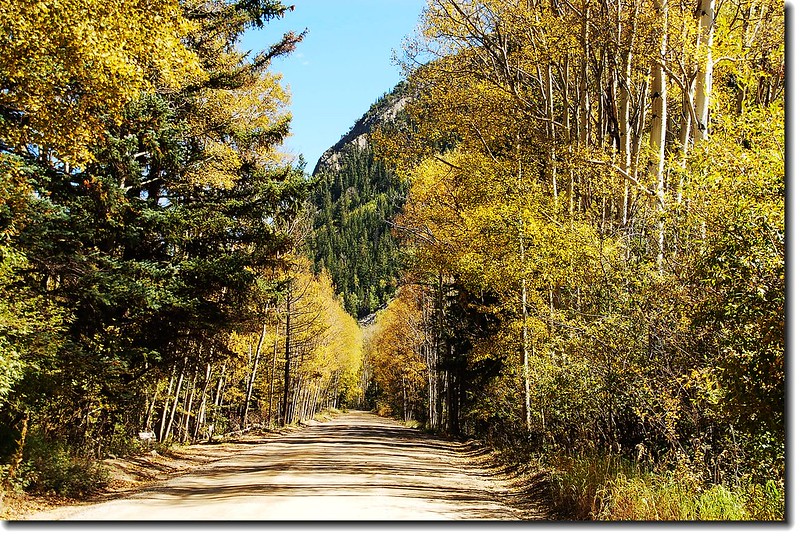
Aspen stood along CO-162 road