攀登山岳: Mount Evans (海拔 14,264 呎 / 4,348 公尺)
登山口:Guanella Pass Trailhead
登山口高度:海拔11,669呎/3,557公尺
距離(來回):約9哩(14.4公里)
爬升高度:約3,100呎/945公尺
攀登等級:Class 2
------------------------------------------------------------------------------------------------
山岳簡介:
Mount Evans位在丹佛西方約50哩的地方,隸屬於Front Range,海拔14,264呎/4,348公尺,在科羅拉多州高山14ers中排名第14,該座山有一條全美最高的鋪設柏油道路Mount Evans Scenic Byway 直通到距山頂130呎/40公尺高的地方。
Mount Evans最早的命名是Mount Rosa或 Mount Rosalie,她是由Albert Bierstadt為他後來的妻子Fitz Hugh Ludlow所命名,之所以名為Mount Evans是參考瑞士第一高峰Monte Rosa而來。Bierstadt是19世紀一位風景藝術家(Landscape artist)、落磯山脈勘測隊 (Rocky Mountains Survey Team) 成員,Mount Bierstadt即是以他之名而命名;他在1863年 和他的嚮導 William Newton Byers從Idaho Springs沿著Chicago Creek欲登此山,他們在要登上Summit Lake面對此山時花了幾天的時間在Chicago Lakes畫下此山的山容素描。
1895年科羅拉多州議會正式通過將此山改名為Mount Evans,用以表達對1862~1865年間的第二任科羅拉多州長John Evans的敬意。
到底誰是第一位登上此山者一直有所爭議,一說是Alber Bierstadt,另一說則是一位名為Judge Lunt的男子。
登Mount Evans有許多條路線,包括從Echo Lake路線、 Summit Lake路線、 West Chicago Creek路線、 Guanella Pass路線、 Bear Creek路線、 Deer Creek路線、 Cub Creek 和 Scott Gomer Creek路線,最簡單的路線是開車經由 Highway 5 (Mount Evans Scenic Byway)直上山頂,到距山頂僅剩130呎/40公尺高的停車場啟登,登頂不用10分鐘。
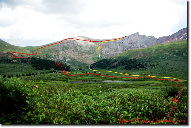
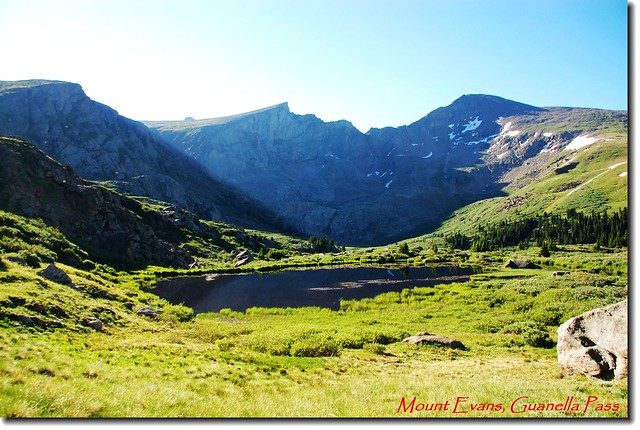
該座山我曾帶家人開車上過無數次,2006年夏天在美期間曾和山友Thomas和George 從另一登山口攻頂。該登山口位在Georgetown北方的Guanell Pass,海拔11,669呎/3,557公尺。我們由該登山口攀登Mount Bierstadt (海拔14,060 呎 /4,285公尺 在14ers中排名第38 )後,經由Sawtooth Ridge再攀登Mount Evans,然後由Sawtooth 和 Mt. Spalding之間的小峽谷下山,這是一條頗有難度的挑戰路線 (Mount Bierstadt to Mount Evans via Sawtooth ridge )。
前些日子陳聰胤(Tony)會計師邀集同登此山,他旅居美國多年,現在是CMC (Colorado Mountain Club)的領隊,此次活動是他主辦,攀登路線是由Guanella Pass 起登的West Ridge 路線,能和異地相遇的鄉親一起爬山是一件樂事,我乃欣然同意前往;當天我們相約六點在Golden集合,然後共乘前往登山口,同行山友尚有二男一女三位美國山友,我們由I-70西行經Georgetown轉Guanella Pass南下,於七點十分左右抵達Guanella Pass最高點,兩個停車場早已客滿,只好將車停在路邊;Guanella Pass從Georgetown到此處目前因拓寬工程施工,週一到週五的08:00~11:00及13:00~15:00是封閉不准通行的。
------------------------------------------------------------------------------------------------------
步程簡述:
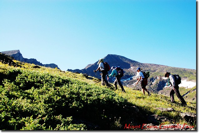
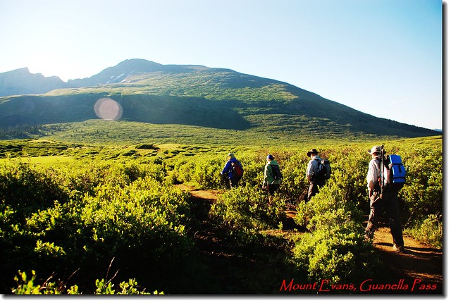
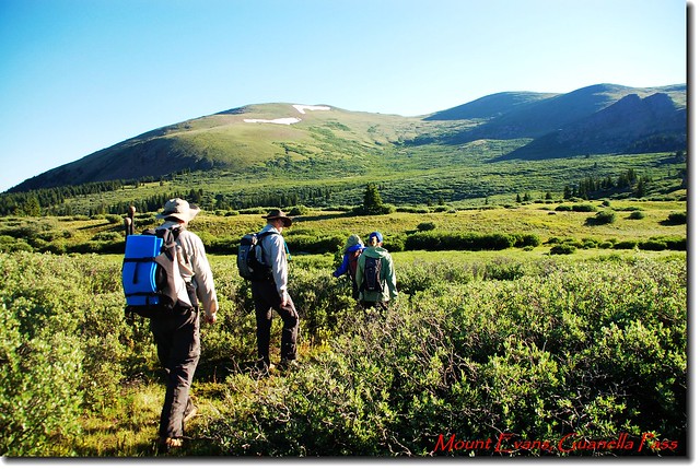
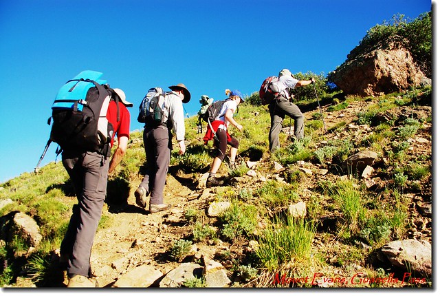
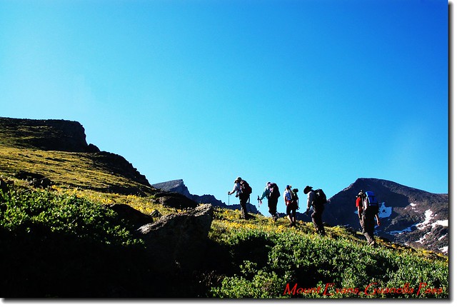
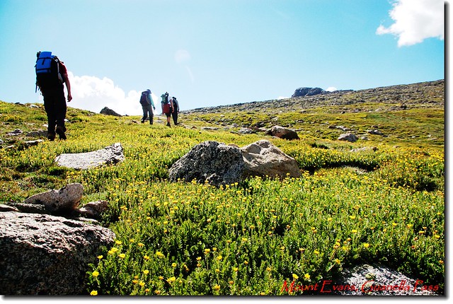
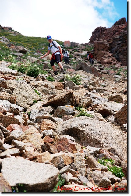
07:25 登山口出發,先下坡往沼澤地走,一開始便是長滿Willows的小樹叢,在較低窪的沼澤地方已鋪有木棧道,登山路徑在沼澤和Willows間穿梭而過,之後更穿越一大片大草原。
Weaving through the willows toward Scott Gomer Creek
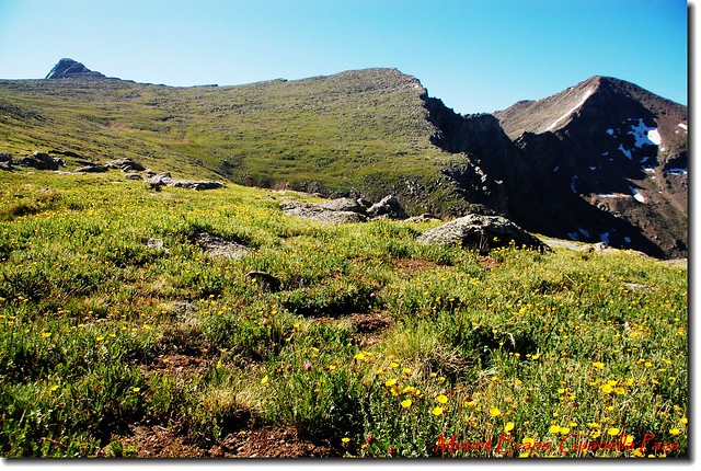
Some of the route seen from Guanella Pass
The marshy flats near Guanella Pass
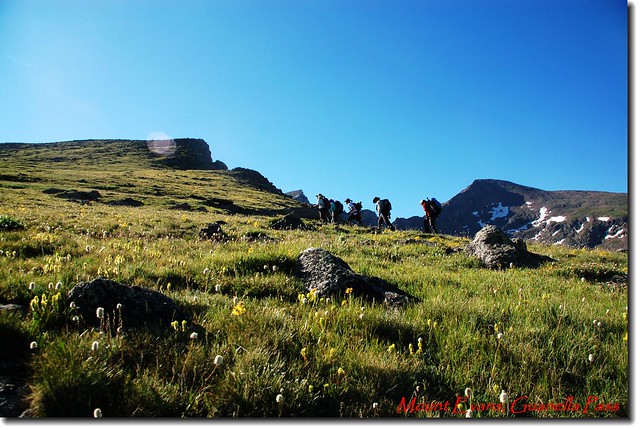
07:37 轉入往Mount Evans小徑,海拔約11,500呎/3,505公尺,Tony早已在此以石堆作一記號,真是用心。轉入小徑後路徑不明,這一路線五年前下山時走過,有點印象,沼澤地形依舊,Willows打在身上比台灣的箭竹來得疼痛。
Near 11,500' crossing the willows
Elephant Head
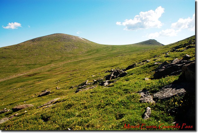
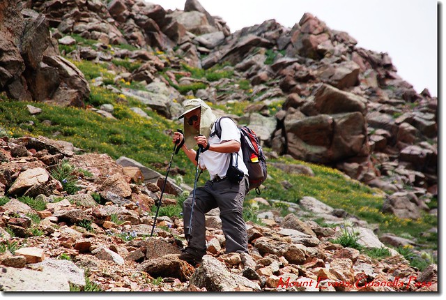
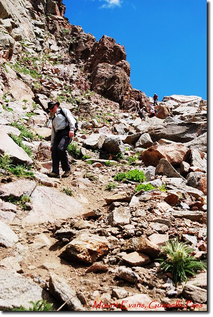
07:53 離開沼澤區開始往山坡爬升,在山坡上有比較清晰的路徑,記憶中此路徑必須穿越松林後上到一寬敞平台。
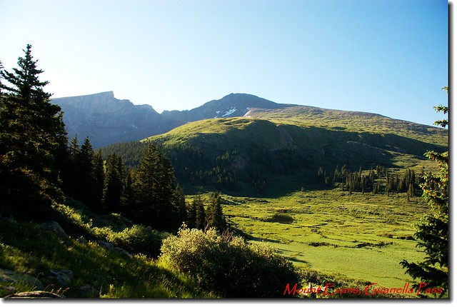
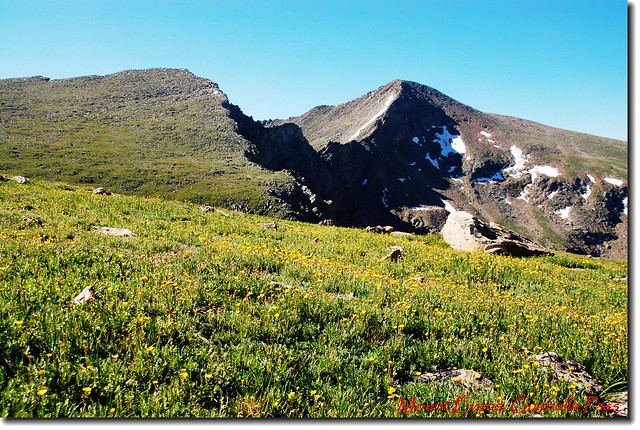
View to Sawtooth Ridge from above the marshy flats
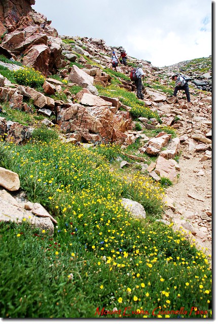
08:10 脫離森林,眼前是一寬敞的平台,路徑是穿越平台後由前方一大片巨大岩石左方緩坡處登上另一山坡,此山坡是Gray Wolf Mountain 向西南延伸的山坡。
Mount Bierstadt & The Sawtooth as seen from the trail

Partners making their way up to Mount Evans
Partners making their way up to Mount Evans
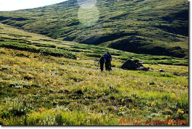
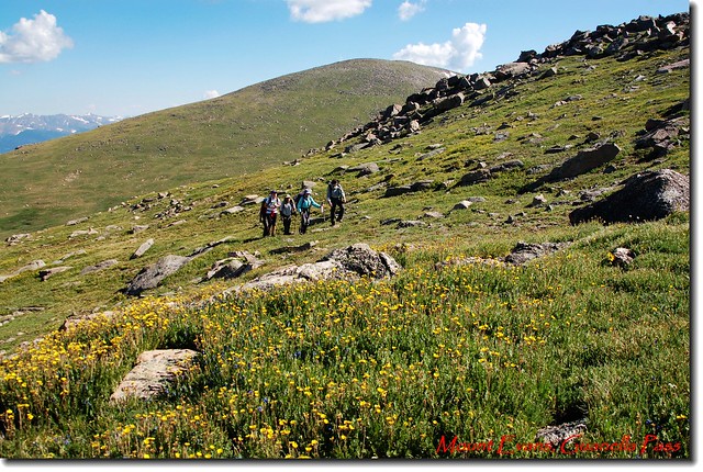
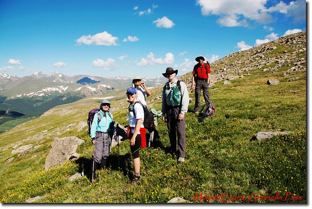
08:36 上到Gray Wolf Mountain 西南坡後正小休時一位女山友趕上我們,隨即加入我們的行列,她已完成科州的所有14ers,真了不起。小休後我們朝東微微下切過一條介於Gray Wolf Mountain和Mount Spalding之間的小溪澗(Scott Gomer Creek支流),過小溪澗後開始在Mount Spalding西面山坡爬升,高山野花為伴,坡雖陡但不覺得累!
Partners making their way up to Mount Evans
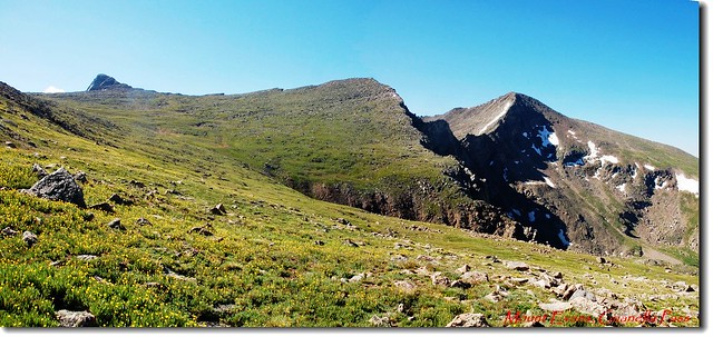
Sawtooth ridge as seen from the West slope of Spalding
Tony et al. making their way up the West slope of Spalding
Gray Wolf Mountain from Spalding's West slope

Hiker making her way up the West slope of Spalding
Tony et al. making their way up the West slope of Spalding
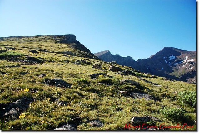
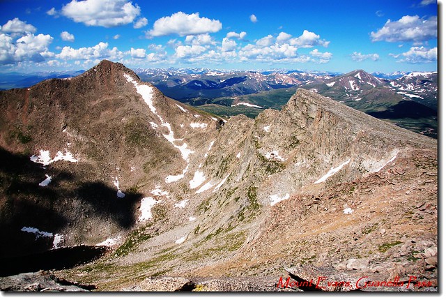
09:25 到達Mount Spalding西面山坡一高地,已可見到Mount Evans西稜的假山頭,向南更可見到Mount Bierstadt 和Sawtooth山頭;此地海拔約13,000呎/3,962公尺,小休後續往Mount Evans前進,此時我們是在Mount Spalding和Mount Evans間的坡面朝東南向Mount Evans的西稜假山頭爬升。

Mount Bierstadt & The Sawtooth as seen from Spalding's West slope
Evans-Bierstadt ridge from Spalding's West slope
Taken from the West slope of Spalding
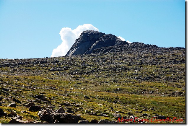
False summit of Evans on the West end of Evans' West ridge
Looking down Guanella Pass from Evans' West slope
Mount Spalding as seen from Evans' West slope
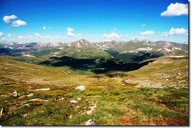
10:30 上到Mount Evans的西稜假山頭下一小鞍部(海拔約13,800呎/4,206公尺),隨即右下切到Mount Evans南坡腰繞。
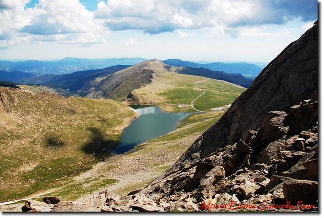
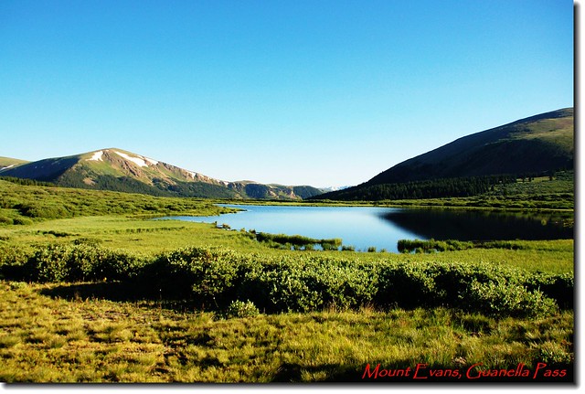
Summit Lake from Spalding-Evans ridge
Sawtooth Ridge from the west side of Mt Evans

Ptarmigan
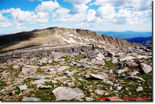
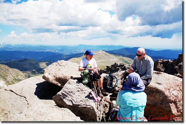
11:23 登頂Mount Evans,海拔14264呎/4348公尺,假日加上風和日麗,山頭都是人,好不熱鬧;在此用餐、休息!
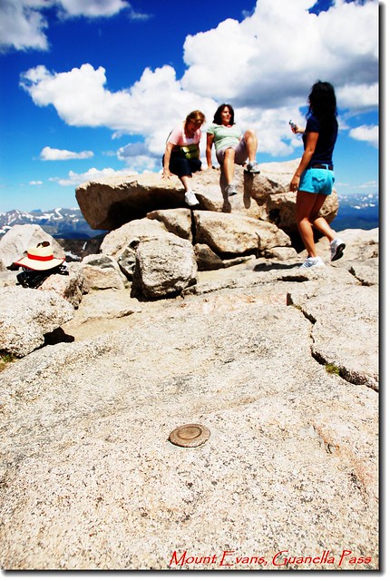
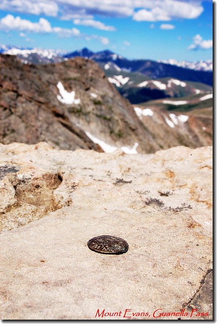
Benchmake on Mount Evans' top
The summit of Mount Evans
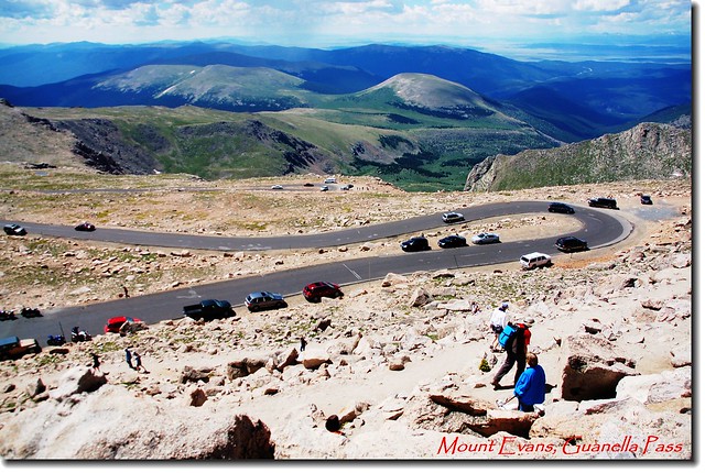
Looking down the Mount Evans Scenic Byway from Evans' summit
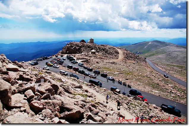
Looking down the parking lot from Evans' summit
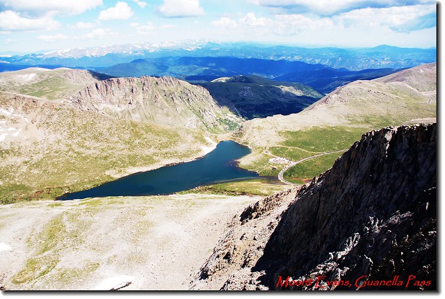
On the top of Evans, looking down the Summit Lake
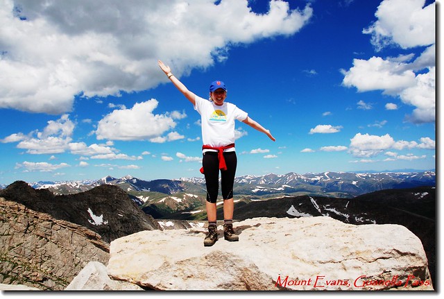
Me on the top of Mount Evans
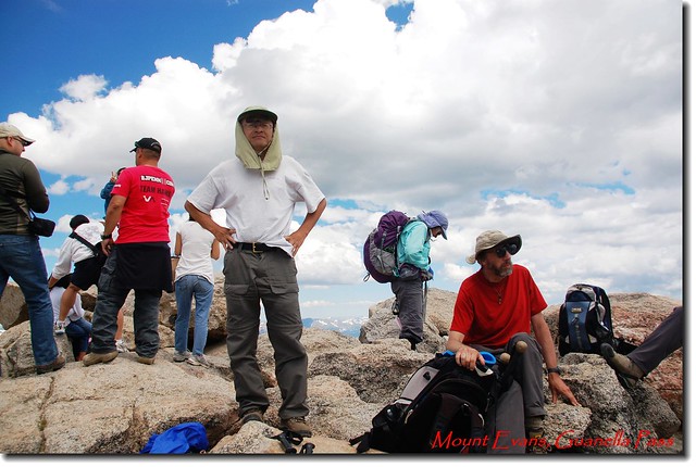
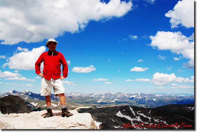
Tony on the top of Mount Evans

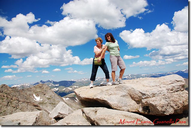
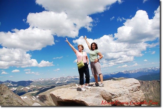
Partners on the top of Mount Evans
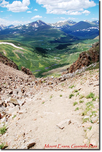
11:57 下山,循Mount Evans南面坡原路下山。
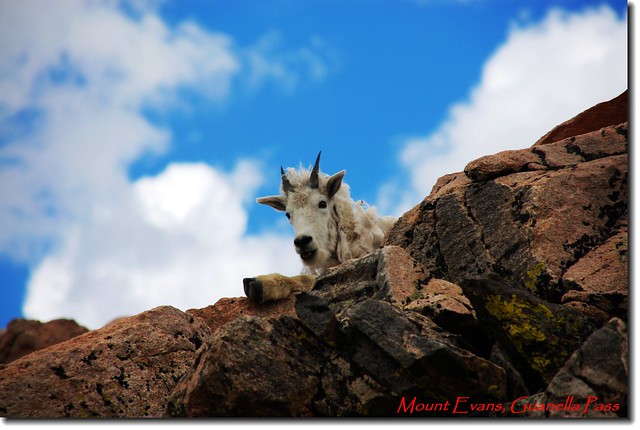
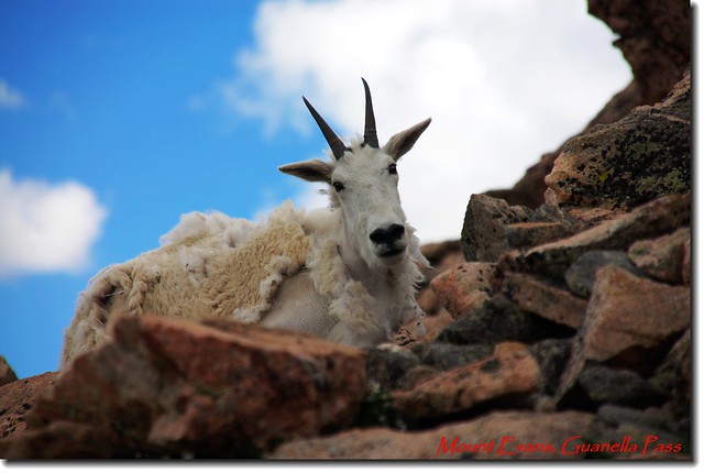
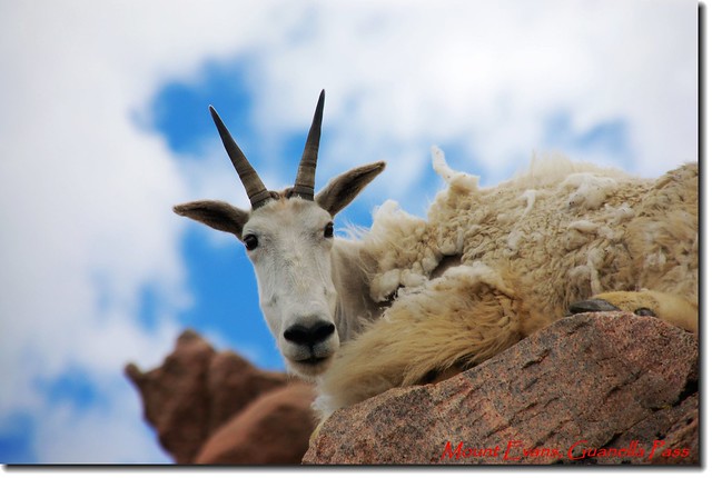
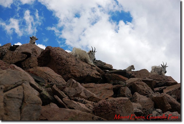
Mountain Goat
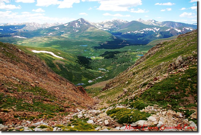
12:34回到Mount Evans西稜叉路處,取右下切,回程我們打算沿著Mount Spalding和The Sawtooth之間的峽谷直接下Scott Gomer Creek的沼澤區,而後來加入的女山友則打算續登Mount Spalding而分道揚鑣。
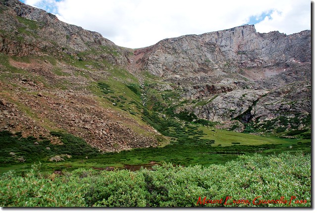
13:08 來到Mount Spalding和The Sawtooth 間的山溝狹谷頂端,此處海拔約13,300呎/4,054公尺;站在峽谷頂端往下看,峽谷又陡又深,資料記載有一段路是不太好走,但仔細一看仍隱約可看到路跡,想必不會太難走吧!
Near 13,300', approaching the top of the gully
看準路線由我領先下山,除了部分路段是“落屎石仔”腳易下滑外,有些路段要在岩石間跳躍、有些路段則在草坡上下行,基本上是不具太大危險性的。
Descending the gully
Near 12,600', descending the gully
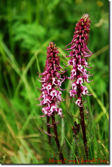
13:45 過了岩石坡,路程大約是峽谷的三分之二,接下來的三分之一路段雖然還是陡,但一路是草原坡,步道兩旁Blue Columbine盛開,首次見到這麼一大片的Blue Columbine花海!
Looking down Scott Gomer Creek, descending the gully
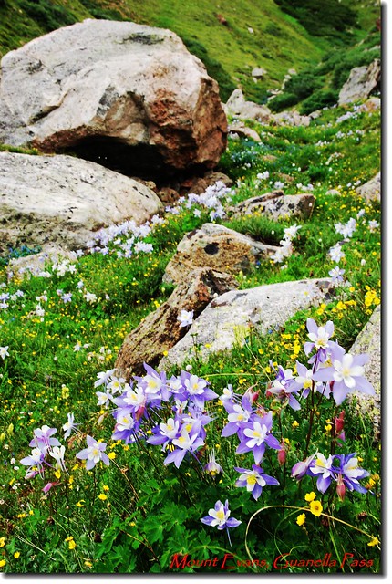
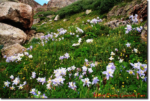
Blue Columbine
14:00 下抵Scott Gomer Creek的沼澤區,海拔約11,700呎/3,566公尺,越過Scott Gomer Creek後沿著Scott Gomer Creek的南岸的沼澤地穿行在Willows樹叢間,情況比早上的路線還難走,也許沒找到正途,有大部分時間是踩在沼澤地裡而過,弄得兩隻腳都是爛泥巴。
A look back at the gully from 11,700 ft.
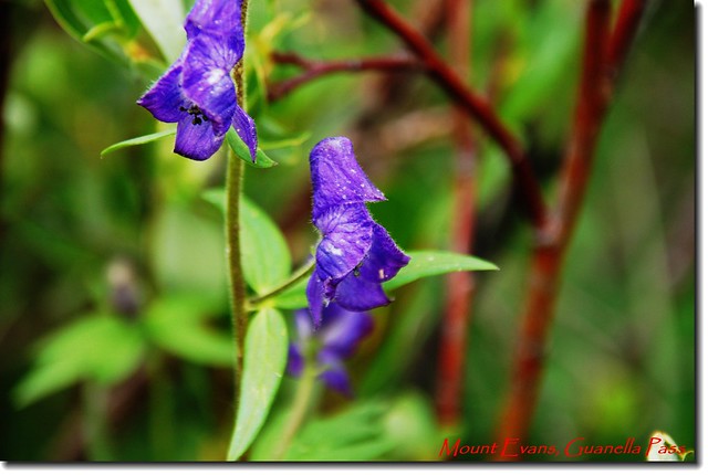
Monkshood

Crossing the marshy flats
14:48 終於接到Bierstadt Trail,過Scott Gomer Creek後往停車場前進。
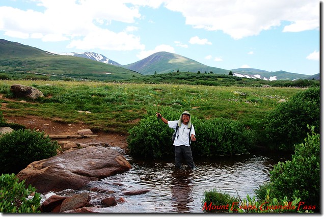
Tony crossing the Scott Gomer Creek
15:10 返抵停車場