~~~~~~~~~~~~~~~~~~~~~~~~~~~~~~~~~~~~~~~~~~~~~~~~~~~~~~~~
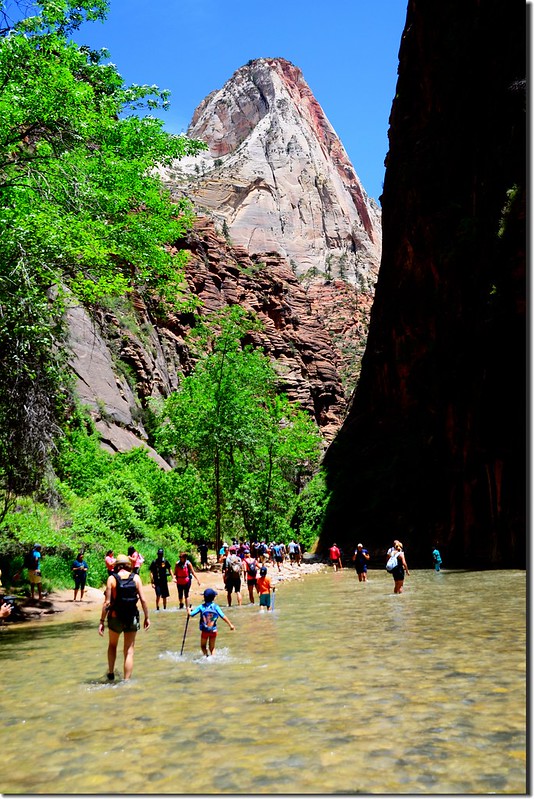
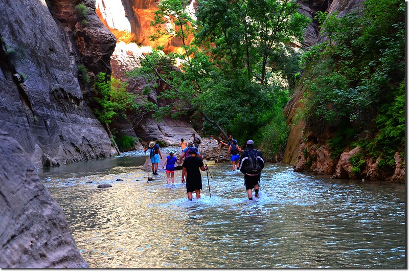
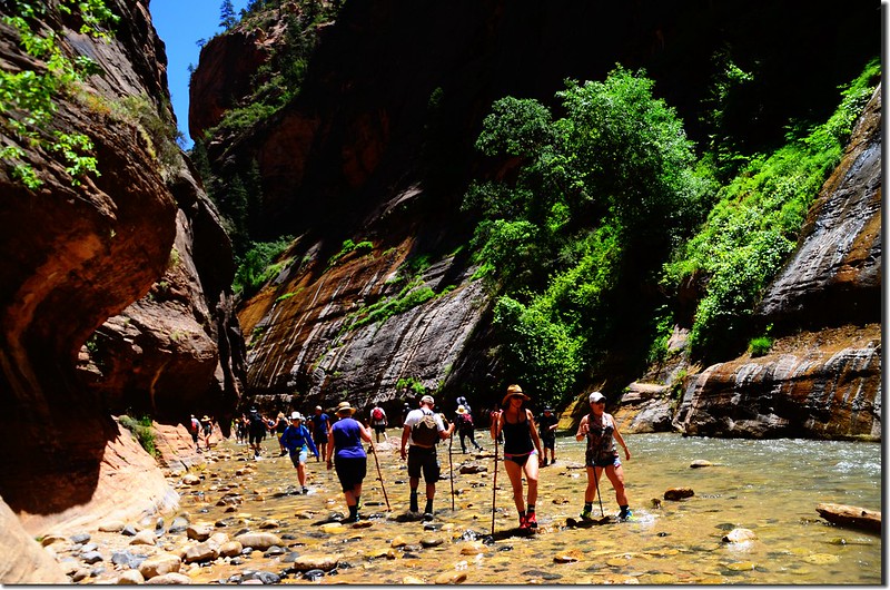
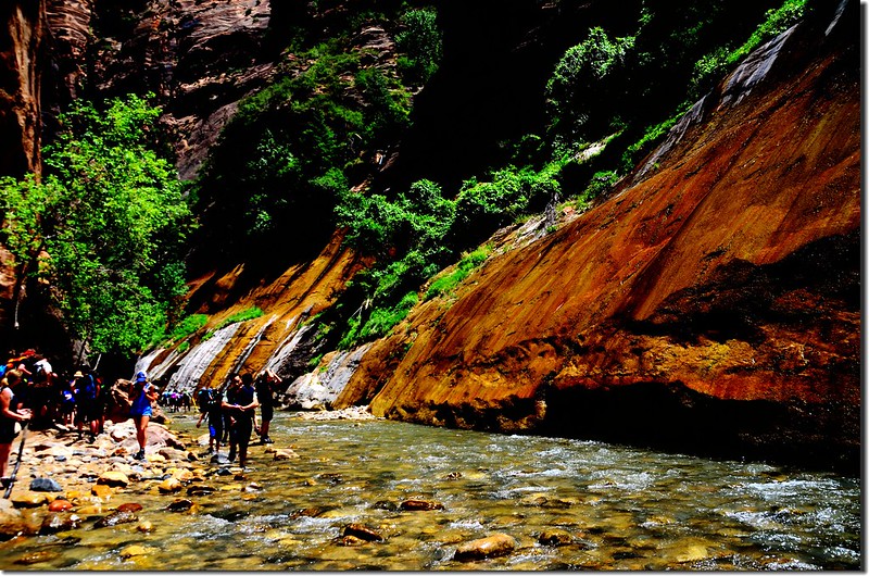
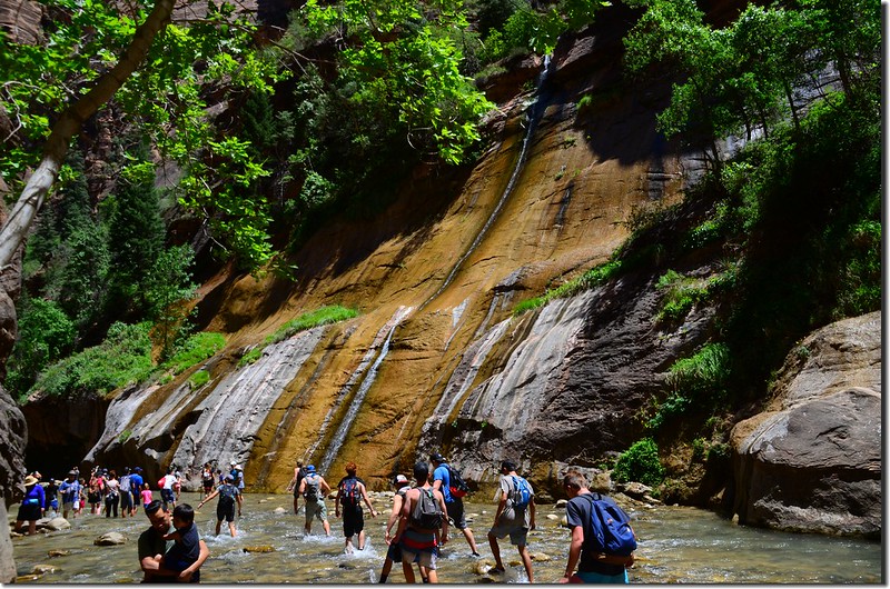
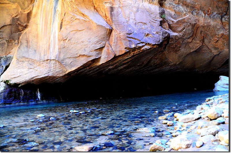
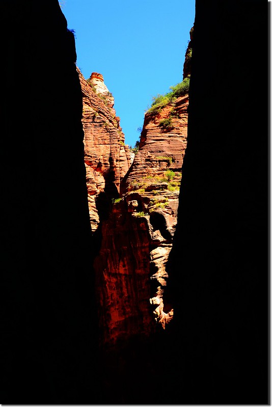
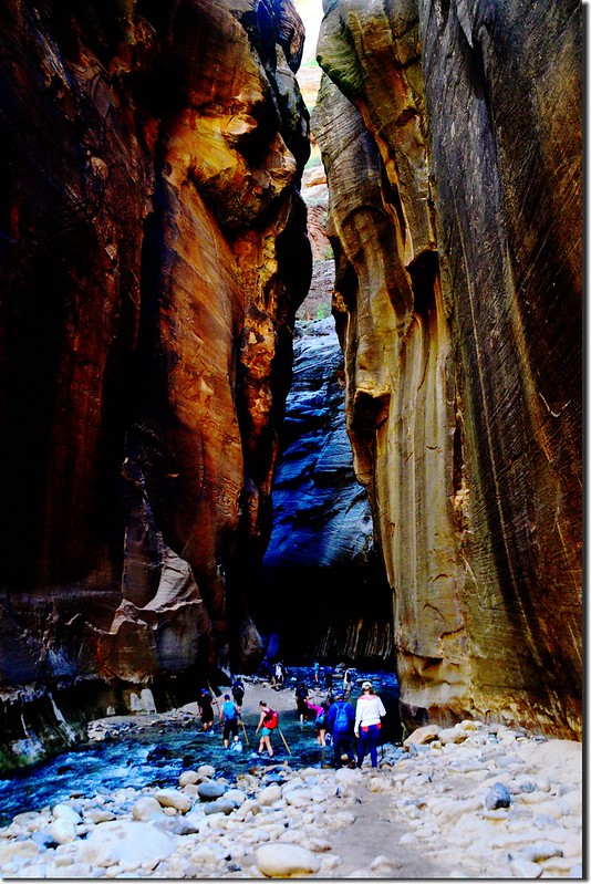
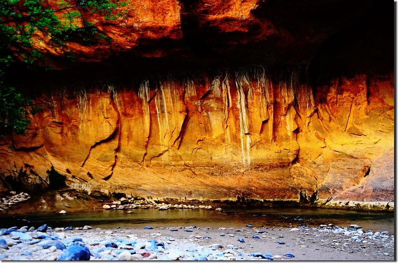
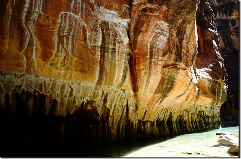
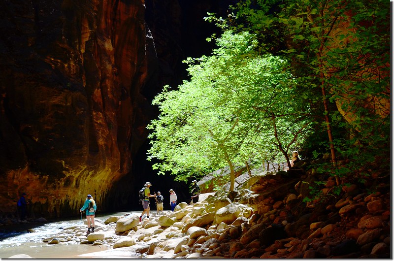
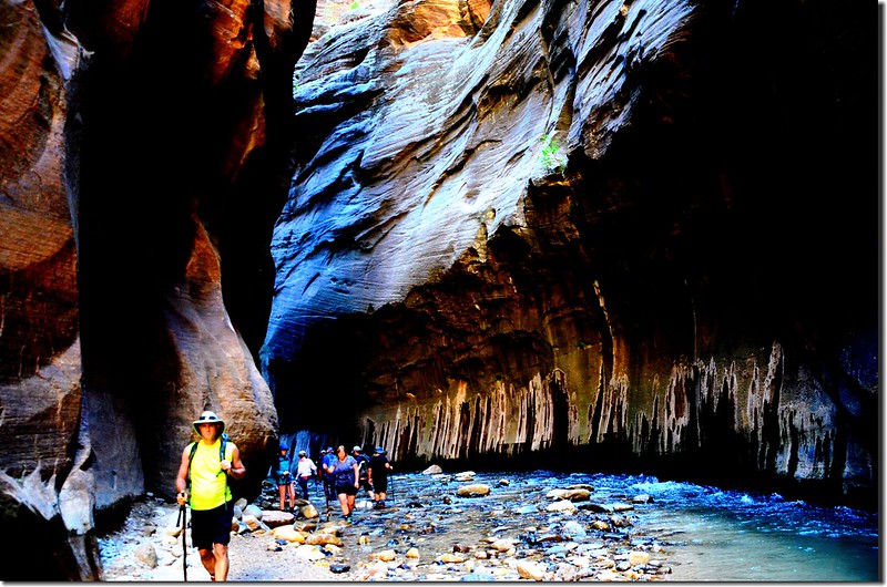
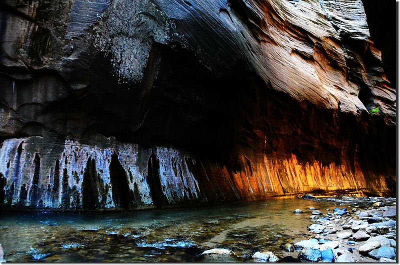
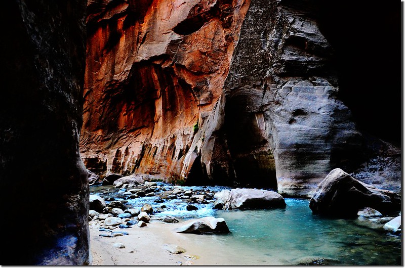
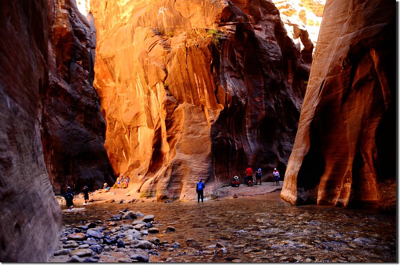
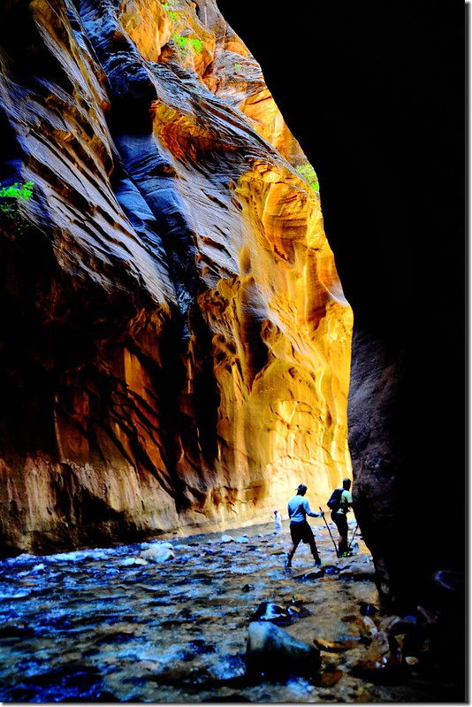
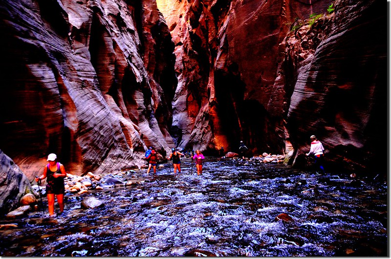
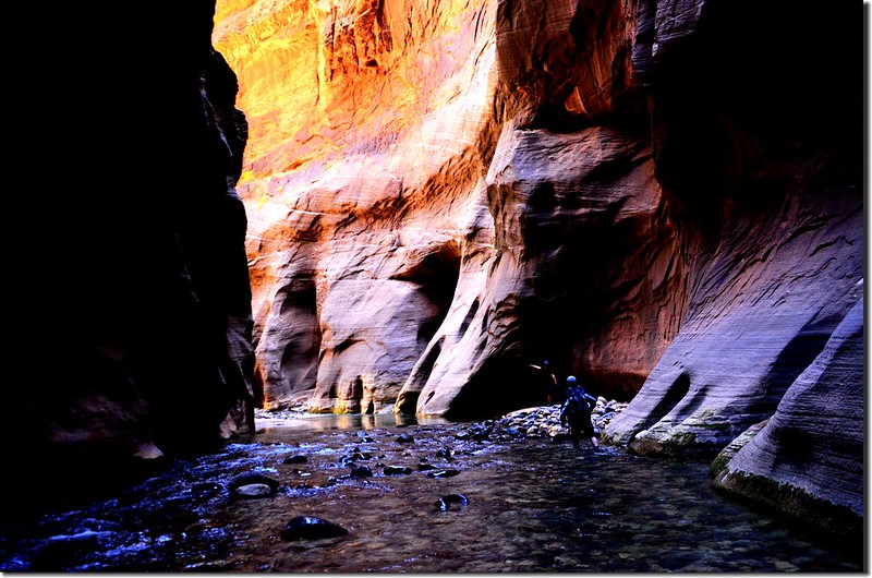
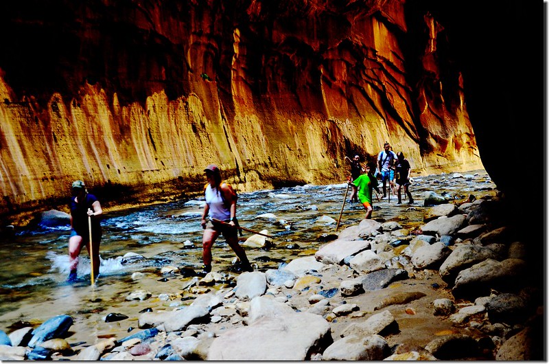
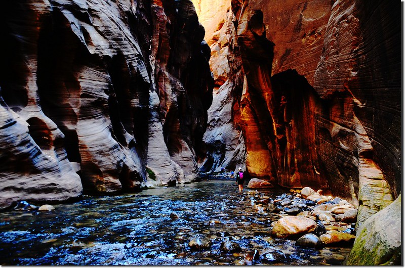
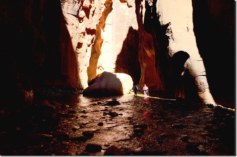
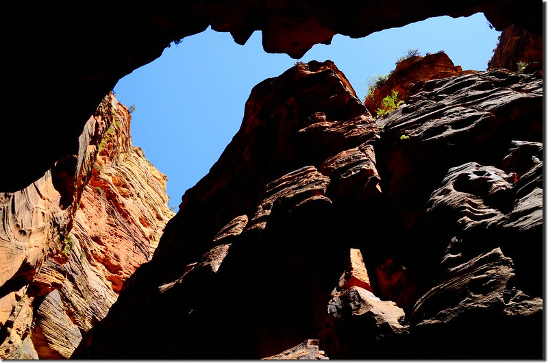
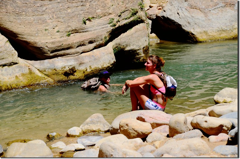
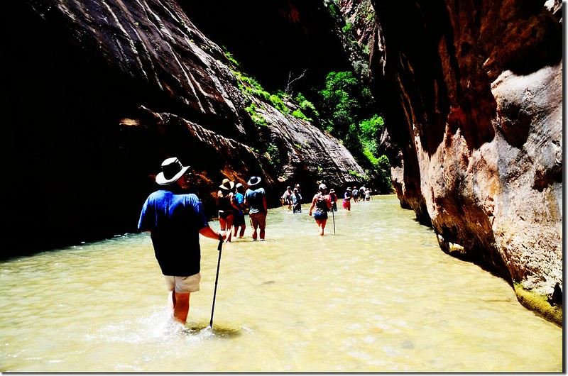
承前文: 2018美國跨州國家公園之旅D6錫安國家公園The Narrows溯溪行(2018.06.06) ~~~~~~~~~~~~~~~~~~~~~~~~~~~~~~~~~~~~~~~~~~~~~~~~~~~~~~~~
第七天(2018.06.07、星期四)
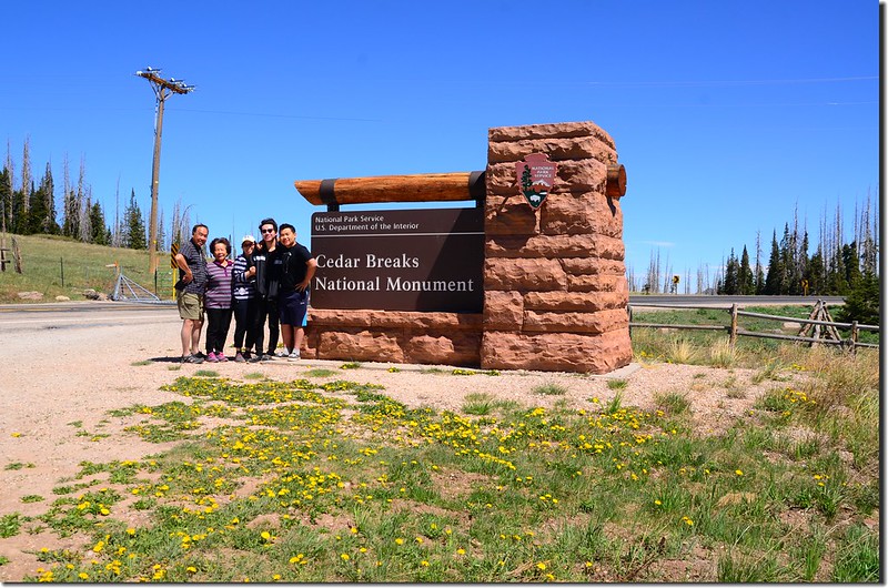
今天我們行程是由錫安國家公園開車前往Bryce Canyon National Park,途中特地繞道位在Cedar City附近的Cedar Breaks National Monument進去參觀。
早上離開Springdale後沿UT-9 W西行轉UT-17接I-15州際公路北行,I-15州際公路北行至里程40 mile(Exit 40)可下交流道往錫安國家公園的最西北角Kolob Canyon區,該地區前幾年去過,今天路過看路旁標示該區目前封閉中;車子續往北行至I-15里程57 mile (Exit 57)下交流道轉UT-130到Cedar City後轉UT-14東南行,最後轉UT-148北行抵達Cedar Breaks National Monument。
~~~~~~~~~~~~~~~~~~~~~~~~~~~~~~~~~~~~~~~~~~~~~~~~~~~~~~~~~~~~
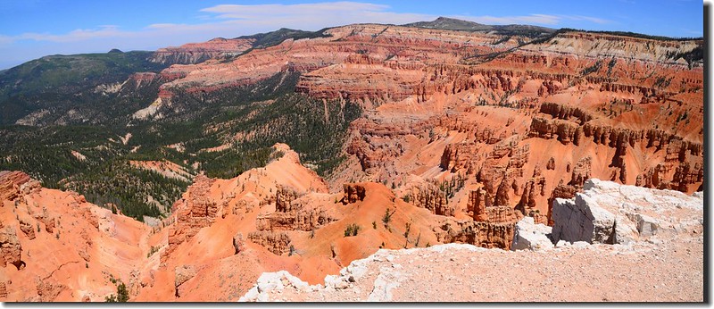
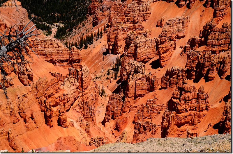
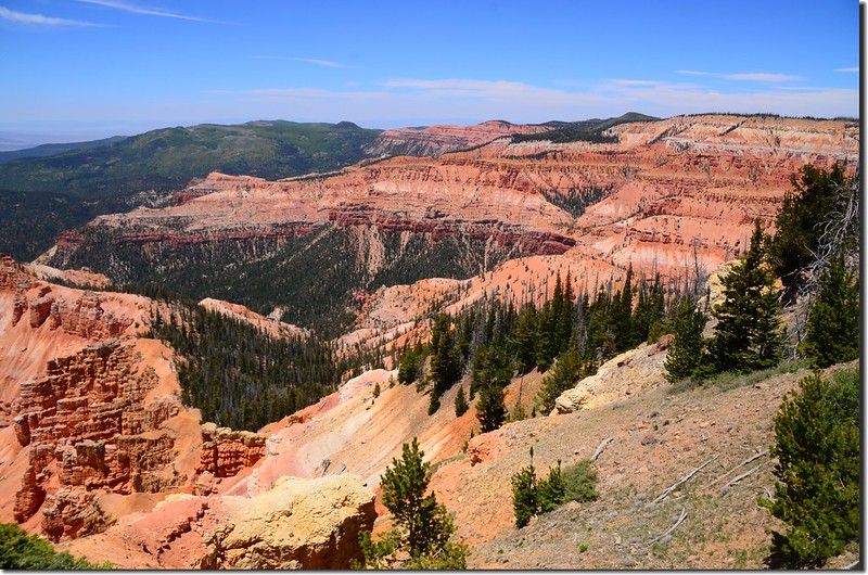
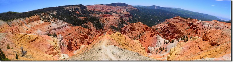
Cedar Breaks National Monument 位在美國猶他(Utah)州的Cedar市附近,1933年成立為國家保護區;該保護區地貌和Bryce Canyon National Park很相似,是屬於天然的圓形劇場式的峽谷,綿延3哩(4.8公里),深度超過2000呎(610公尺)。峽谷的邊緣處海拔超過10000呎(3048公尺)。
Cedar Breaks National Monument的侵蝕岩層類似Bryce Canyon國家公園,峽谷中最大特色是數以萬計的被稱為Hoodoos的岩石,只是規模小得多了,所以有“小Bryce”之稱,由於保護區海拔較高,每年的10月到次年的5月因下雪而關閉,僅在每年6月到10月開放,所以並不如附近的其他國家公園受遊客青睞,不過每年也有幾十萬遊客進入。
Cedar Breaks National Monument被侵蝕的峽谷中的岩石含有大量鐵和錳等的成分,呈現出鮮豔的色彩,印第安人稱之為“Circle of Painted Cliffs”(彩繪斷崖圈);氧化鐵呈現出供紅色,橙色和黃色,而氧化錳則呈現出紫色色調,這些被稱為Hoodoos的岩石比起布萊斯峽谷(Bryce Canyon)的Hoodoos顏色要柔和、細膩多了。
該地區地形是由峽谷、尖塔式岩石、石牆和峭壁組合的地形,如此陡峭和混雜的地形雖然具有很大的美學價值,但實用價值不大,早期移居者稱此地為惡地形或破碎地形,並將此種破碎地形(breaks)與生長在此地的一種松樹juniper (當時誤稱為Cedar,也許是當時錯誤的認知吧)結合成現在這個Cedar Breaks名稱。
~~~~~~~~~~~~~~~~~~~~~~~~~~~~~~~~~~~~~~~~~~~~~~~~~~~~~~~~~~~~
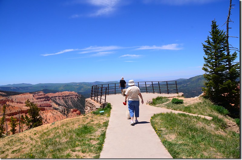
我們在11:20抵達Cedar Breaks National Monument(網路中譯為錫達布雷克斯國家保護區),先到遊客中心取得一些資訊後我們計畫先走走附近的Ramparts Overlook Trail,走完該步道後再開車到北邊幾個景點參觀。
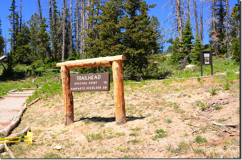
Ramparts Overlook Trailhead
Ramparts Overlook Trailhead
Ramparts Overlook Trailhead位於Cedar Breaks遊客中心停車場的西南端,海拔約10,370呎(3,161公尺);沿著小徑往上走沒多遠即抵達Cedar Breaks圓形劇場式峽谷的邊緣,海拔約10,404呎(3,171公尺);
Taken from Ramparts Overlook Trail, Cedar Breaks
Ramparts Overlook Trail, Cedar Breaks
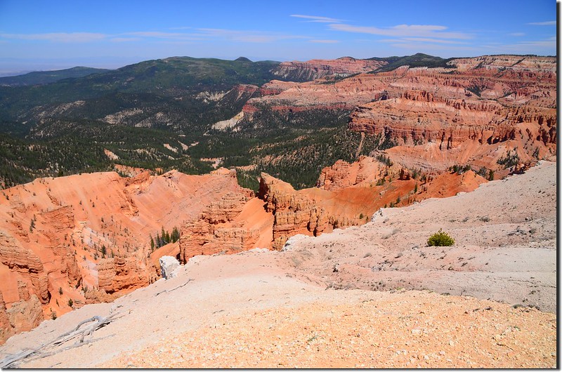
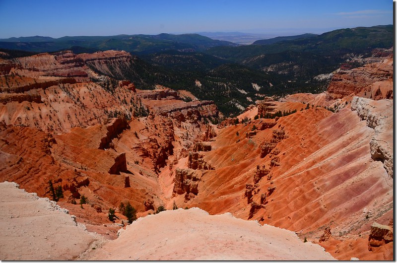
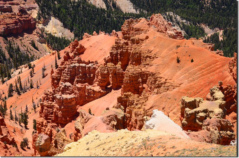
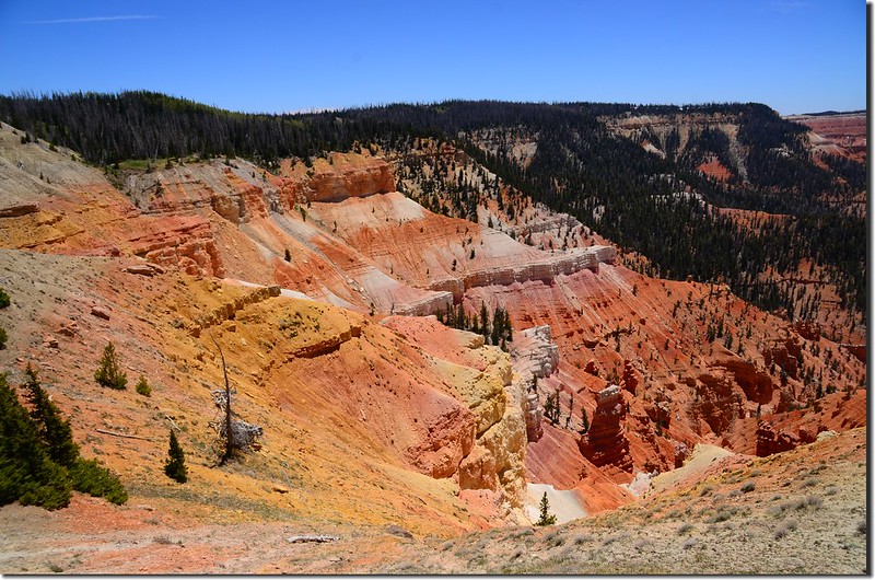
然後沿著峽谷的邊緣往西南爬升,行約0.5哩抵達步道的最高點,海拔約10,495呎(3,199公尺),步道旁有一座大型蓄水槽;
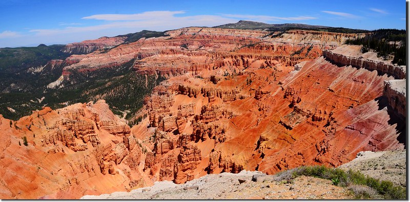
Ramparts Overlook Trail, Cedar Breaks
過了最高點步道開始下坡,沒多遠步道轉向北往下行,將抵達Spectra Point時步道旁有幾棵Bristlecone pines,這些生長在美國西南部的松樹其果有針刺,出現在這裡的Bristlecone pine有的樹齡已高達1600左右;而數年前到我到內華達州(Nevada)大盆地國家公園(Great Basin National Park)所見的Bristlecone pines樹齡更高達5000年以上。
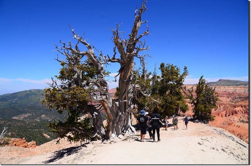
Bristlecone Pine Tree at Spectra Point of the Rampart Trail
Taken from Ramparts Overlook Trail, Cedar Breaks
Ramparts Overlook Trail, Cedar Breaks
然後沿著峽谷的邊緣往西南爬升,行約0.5哩抵達步道的最高點,海拔約10,495呎(3,199公尺),步道旁有一座大型蓄水槽;
Ramparts Overlook Trail, Cedar Breaks
過了最高點步道開始下坡,沒多遠步道轉向北往下行,將抵達Spectra Point時步道旁有幾棵Bristlecone pines,這些生長在美國西南部的松樹其果有針刺,出現在這裡的Bristlecone pine有的樹齡已高達1600左右;而數年前到我到內華達州(Nevada)大盆地國家公園(Great Basin National Park)所見的Bristlecone pines樹齡更高達5000年以上。
Bristlecone Pine Tree at Spectra Point of the Rampart Trail
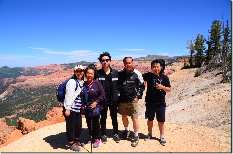
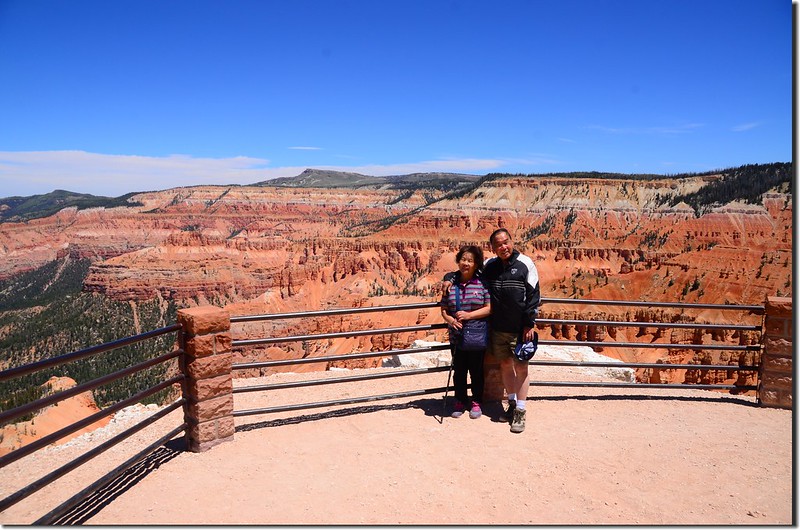
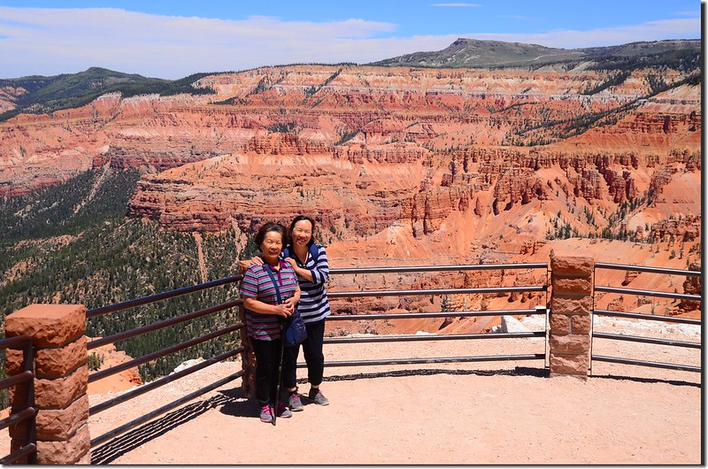
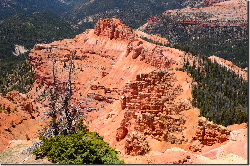
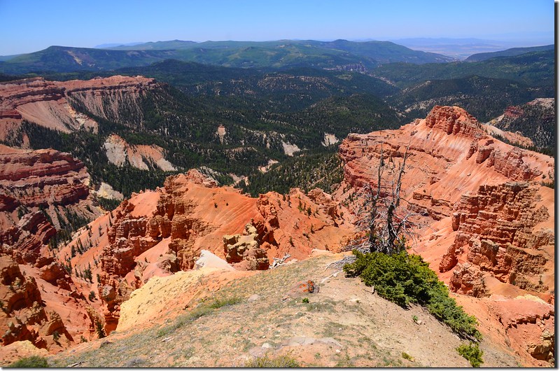
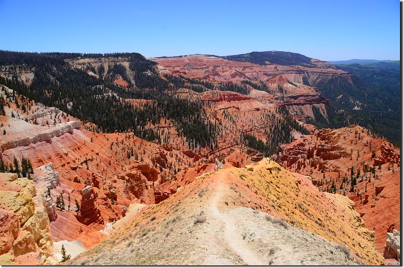
過了Bristlecone pines步道分岔,左岔續往下行約1.0哩可抵Ramparts Overlook,右岔直行往Spectra Point;我們今天計畫只走到Spectra Point就好,取右直行約0.1哩即抵達Spectra Point,此地海拔約10,245呎(3,123公尺),距登山口約1.0哩左右。
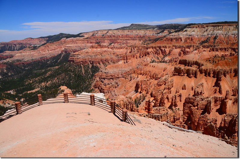
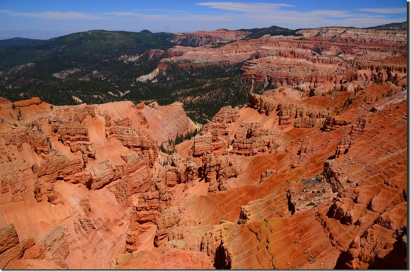
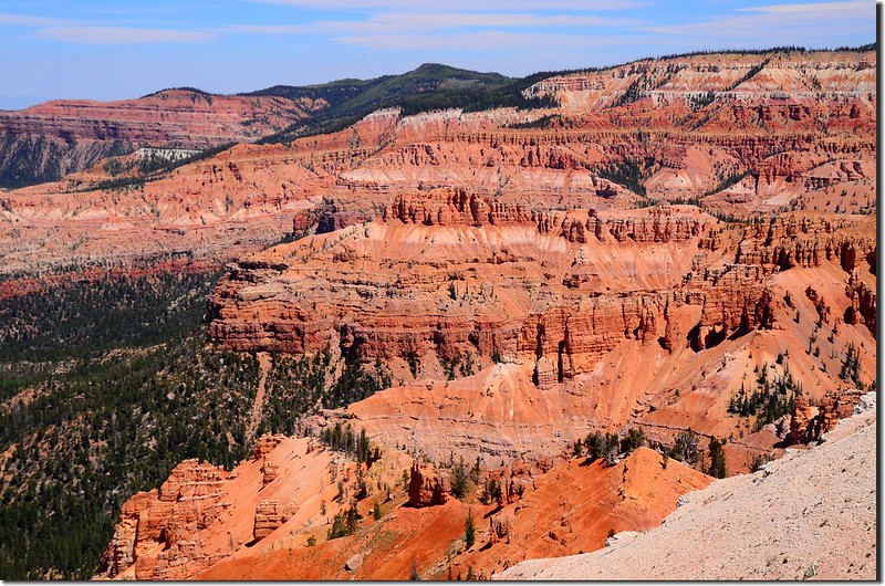
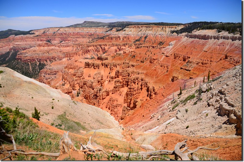
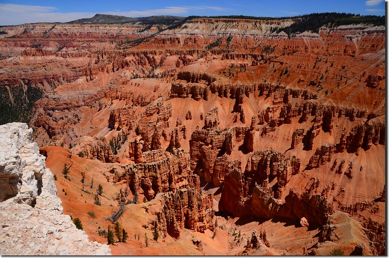
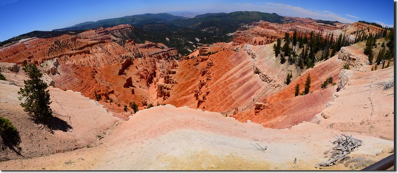
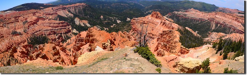
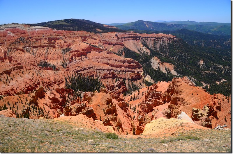
Spectra Point, Cedar Breaks
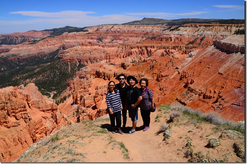
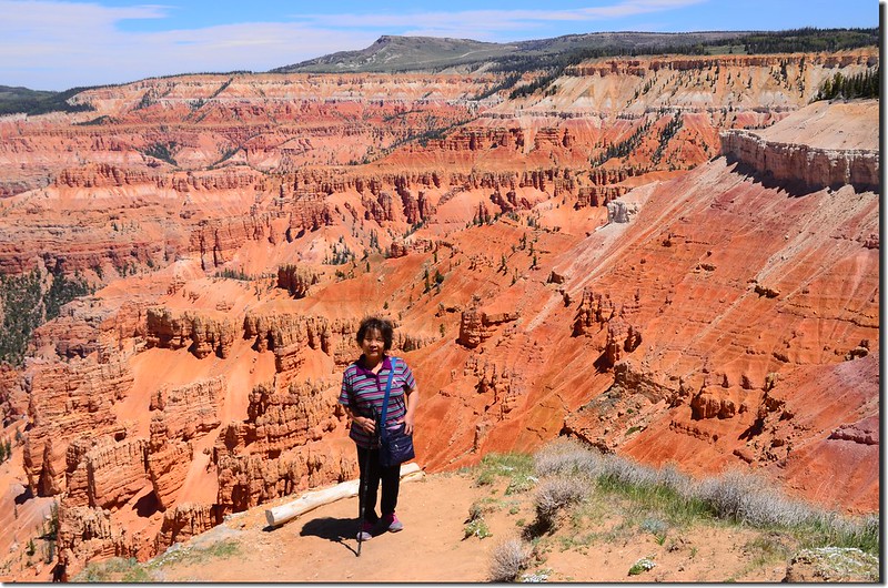
Taken from Spectra Point, Cedar Breaks
Spectra Point, Cedar Breaks
Taken from Spectra Point, Cedar Breaks
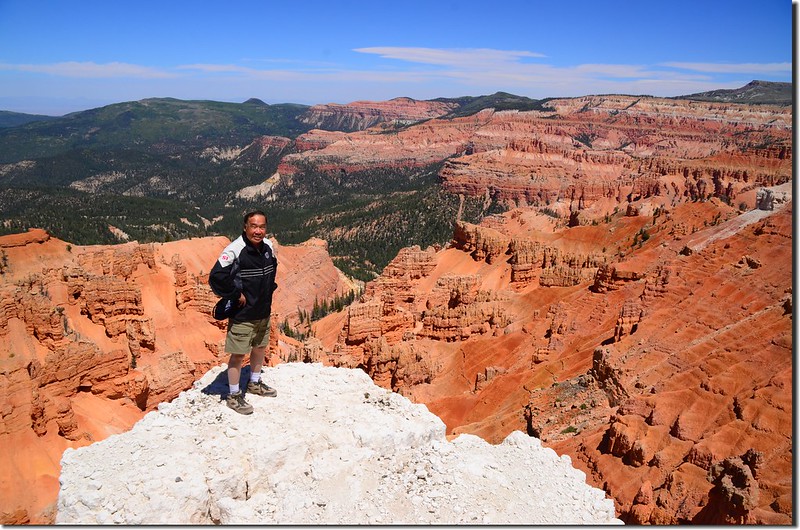
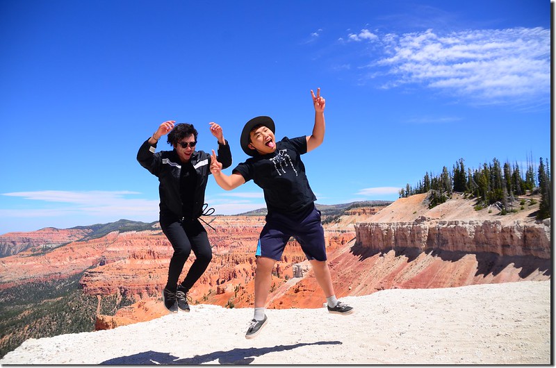
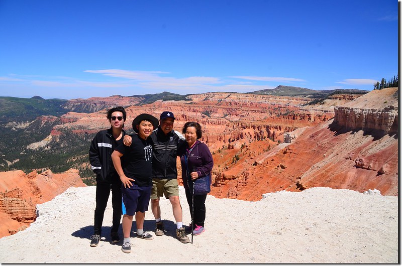
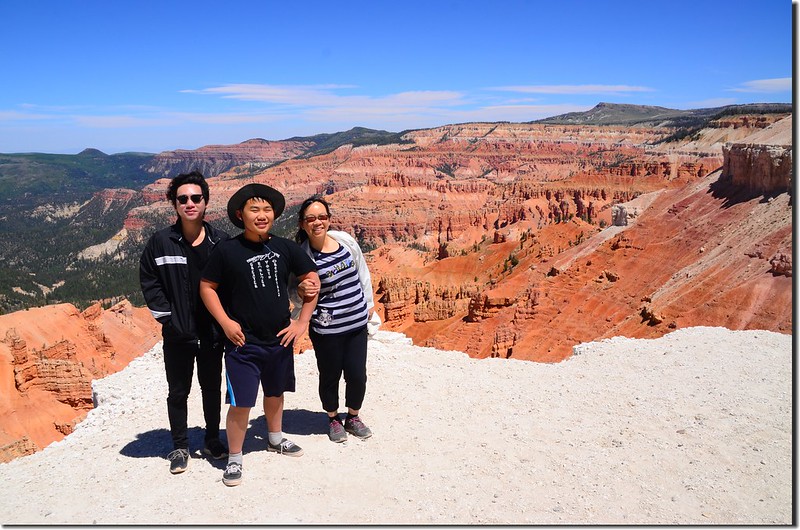
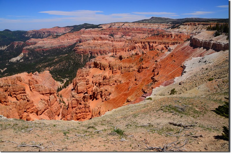
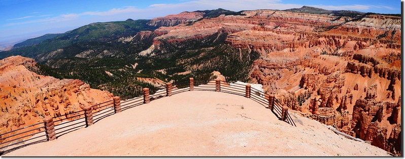
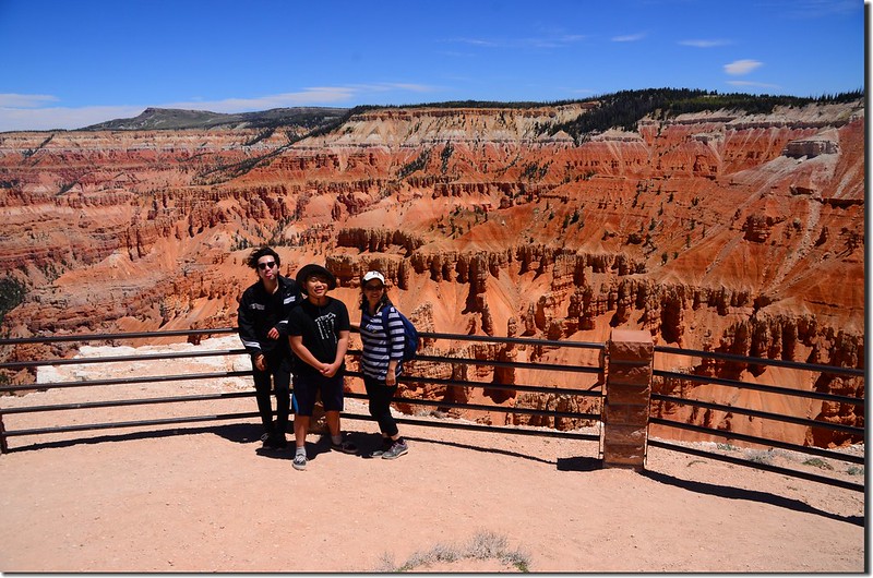
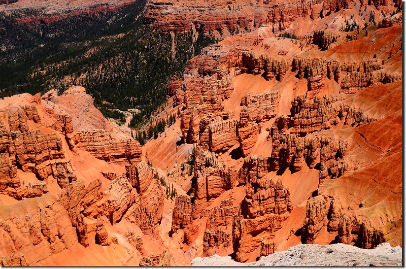
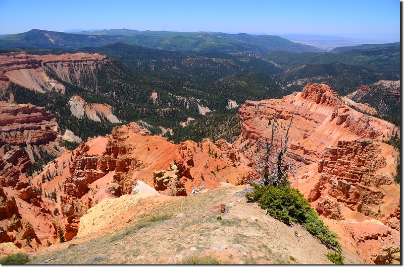
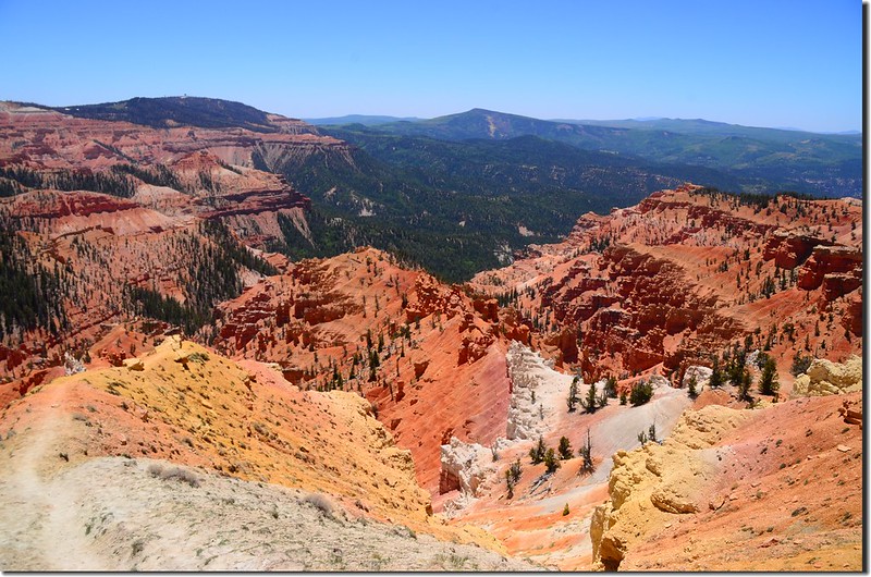
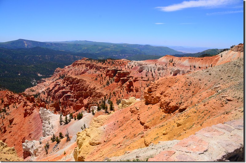
Spectra Point展望極佳,可以環視整個Cedar Breaks的全貌;
Ramparts Overlook Trail, Cedar Breaks
在Spectra Point停留一些時間後回頭循原路回到遊客中心停車場,此趟行程我們花了1小時40分鐘。回到停車場後我們於13:50上車沿UT-148 N北行,沿途參觀Cedar Breaks的幾個景點。
Ramparts Overlook Trail, Cedar Breaks
在Spectra Point停留一些時間後回頭循原路回到遊客中心停車場,此趟行程我們花了1小時40分鐘。回到停車場後我們於13:50上車沿UT-148 N北行,沿途參觀Cedar Breaks的幾個景點。
Sunset View Overlook
Sunset View Overlook
Sunset View Overlook
Chessmen Ridge Overlook
Chessmen Ridge Overlook
Chessmen Ridge Overlook
North View Overlook
North View Overlook
North View Overlook
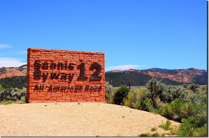
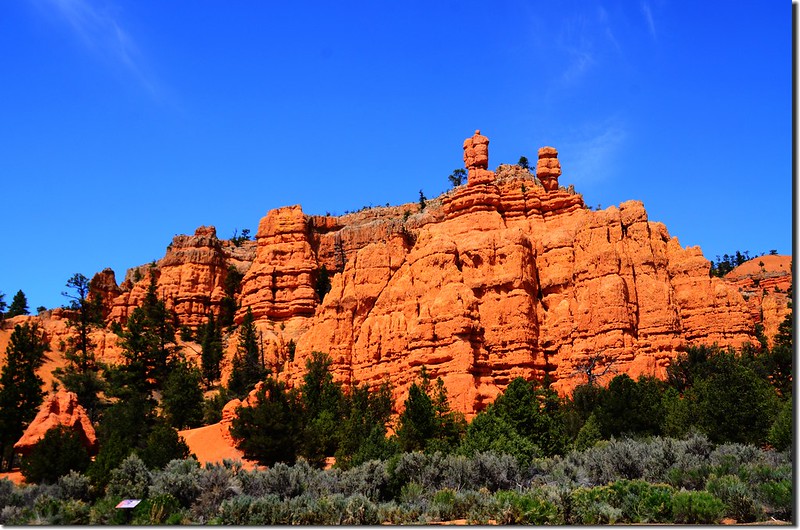
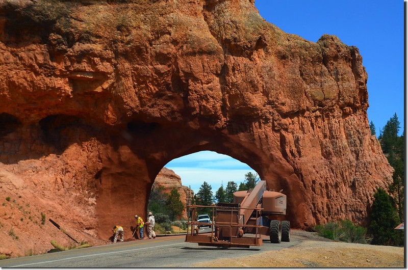
參觀完Cedar Breaks最後一個景點North View Overlook後我們準備開車前往Bryce Canyon National Park,由North View Overlook回頭改走UT-143公路離開Cedar Breaks 國家保護區,行車至Panguitch轉US-89公路南行後左轉有名的UT-12公路(Scenic Byway 12)~~Red Canyon。
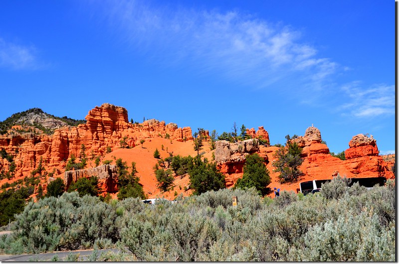
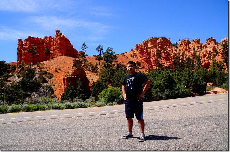
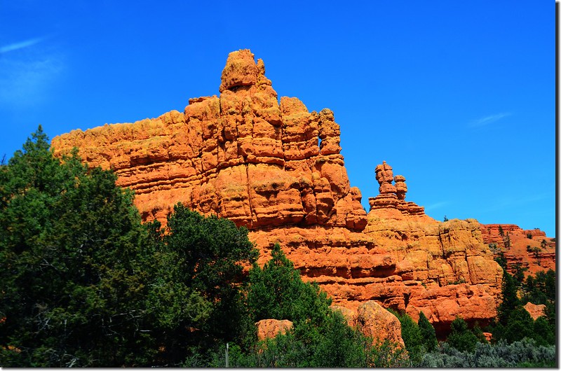
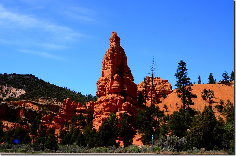
Red Canyon,Utah
Red Canyon,Utah
UT 12公路從西邊穿過Red Canyon抵達布萊斯峽谷國家公園(Bryce Canyon National Park),這是在Paunsaugunt高原一側環繞著暴露的橙紅色石灰岩相對較淺的山谷,公路邊的岩石就如同東邊的布萊斯峽谷國家公園(Bryce Canyon National Park)裡的岩石一樣被侵蝕成尖峰、圓柱和hoodoo狀,只是這裡的規模較小、顏色變化也較少,雖然該區主要公路交通流量也蠻大的,但大多數遊客都匆匆忙忙地趕往Bryce Canyon沒有停下來,而遠離主要公路的其他道路通常是很安靜、空無一人的。
Red Canyon,Utah
Red Canyon,Utah
穿過Red Canyon後於Bryce Canyon右轉UT-63朝Bryce Canyon National Park南行,我們於下午三點四十分抵達Bryce Canyon National Park。
今晚住宿Bryce View Lodge, Bryce Canyon, UT
本日行車約190哩(304公里)