
View from the top of Medicine Bow Peak
小外孫Jacob(貝貝)已上大學,他的哥哥Matthew(豆豆)將在下禮拜負笈加拿大多倫多,今後要再一家人同遊山林、攀登山岳的機會不多,趁Matthew啟程前夕特安排家人來趟跨州登山之旅,攀登山岳選擇難度不高的懷俄明州(Wyoming)的Medicine Bow Peak。
--------------------------------------------------------------------------------------------------
攀登山岳:Medicine Bow Peak,海拔12,018呎/3,663公尺
Medicine Bow Peak 是懷俄明州(Wyoming) Snowy Range最高峰,位於Laramie以西約 35 哩/56公里處,是懷俄明州南部的最高點。
登山口:West Lake Morie Trailhead,海拔10,442呎/3,183公尺
登山里程:O行環走全程計7.3哩/11.75公里
總爬升高度:2,022呎/616公尺
登山時間:5小時32分
--------------------------------------------------------------------------------------------------
行車資訊:
由丹佛沿I-25 州際公路北上,於269B出口下交流道左轉走CO-14朝Ft Collins前進,在Ft Collins轉US-287北行,US-287北行約63哩後改走I-80州際公路西行,行約1.5哩隨即在311出口下交流道左轉Snowy Range Rd西行,0.8哩後右轉WY-130 W/Snowy Range Rd西行,約42哩後抵達East Lake Marie parking lot,座標N41.33168° W106.32557°,海拔10,424呎/3,177公尺。

East Lake Marie parking lot
步程簡述:
09:10 登山口出發,座標N41.33160° W106.32563°,海拔10,442呎/3,183公尺;

West Lake Morie Trailhead
登山口位在停車場的西北角,沿著土石階步道上行,行至高處有幾張野餐桌及一座避難石屋處取左轉向西行;
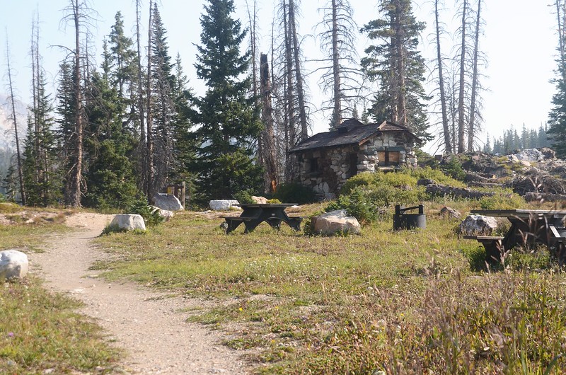
A bandoned stone cabin at Lake Marie

Medicine Bow Peak Hike
登山小徑沿著山坡迂迴上行,沿途北望Snowy Range及俯瞰Lake Marie幾座湖泊。

A lookout with views north towards Snowy Range and Lake Morie


Medicine Bow Peak Hike

A lookout with views north towards Snowy Range and Lake Morie


Medicine Bow Peak Hike
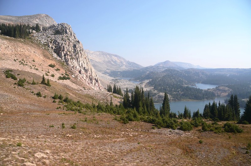
A lookout with views north towards Medicine Bow Peak and Lookout Lake、Lake Morie
09:44 登上Medicine Bow Peak南稜稜線,座標N41.33156° W106.33066°,海拔10,837呎/3,303公尺,距登山口約0.7哩/1.13公里;步道右轉朝北沿稜線上行。

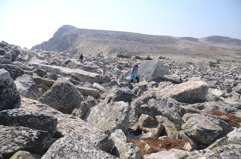
Rock piles with wooden posts mark the trail
09:52 步道進入岩石區向上爬升,座標N41.33355° W106.33012°,海拔10,936呎/3,333公尺,距登山口約0.8哩/1.29公里。

Medicine Bow Peak Hike

Looking down at lakes from Medicine Bow Peak Loop Trail near 11,011 ft.
09:59 步道開始在Medicine Bow Peak南稜稜線左側的岩石山坡“之”字形爬升,座標N41.33509° W106.33083°,海拔11,053呎/3,369公尺,距登山口約1.0哩/1.6公里。

 Medicine Bow Peak Hike

Looking down at Lake Morie from Medicine Bow Peak Loop Trail near 11,154 ft.

Medicine Bow Peak Hike

Looking back at the way we came
10:16 “之”字形岩石山坡頂端,進入苔原草原朝西北緩坡腰繞,座標N41.33713° W106.33089°,海拔11,337呎/3,456公尺,距登山口約1.2哩/1.93公里。


Medicine Bow Peak Hike
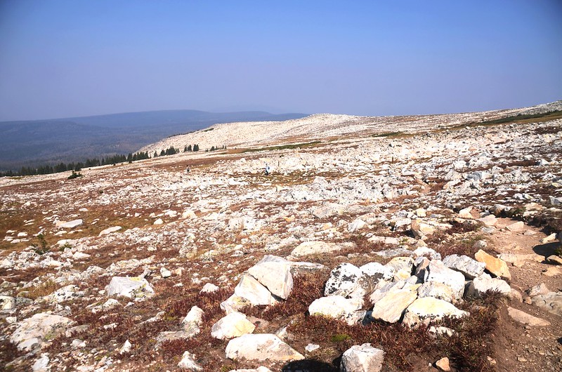
Gentle rocky slope on the Snowy Range

Medicine Bow Peak Hike
10:57 抵Old Lookout岔路,座標N41.35003° W106.32903°,海拔11,517呎/3,510公尺,距登山口約2.4哩/3.86公里;

“Old Lookout” split
東邊11,755 ft.山頭有一座早期石砌的瞭望台,我們沒上去參觀,沿步道續往北行。
Medicine Bow Peak Hike
11:14 抵Dipple Lake、Heart Lake 岔路,座標N41.35633° W106.32877°,海拔11,501呎/3,506公尺,距登山口約2.9哩/4.67公里;

Dipple Lake & Medicine Bow Peak junction
步道右轉朝東沿山坡岩石小徑爬升,坡度有點陡。

Medicine Bow Peak Hike
岩石小徑爬升約500公尺抵高點接近稜線時改取左朝東北沿稜線左側亂石中小徑緩升。


Medicine Bow Peak Hike
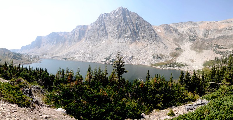
11:56 抵達Medicine Bow Peak西南邊稜線鞍部,座標N41.35954° W106.31871°,海拔11,923呎/3,634公尺,距登山口約3.7哩/5.95公里;此處東邊有極佳的展望俯瞰湖群,Medicine Bow Peak在左(東北)側不遠的亂石山頭。
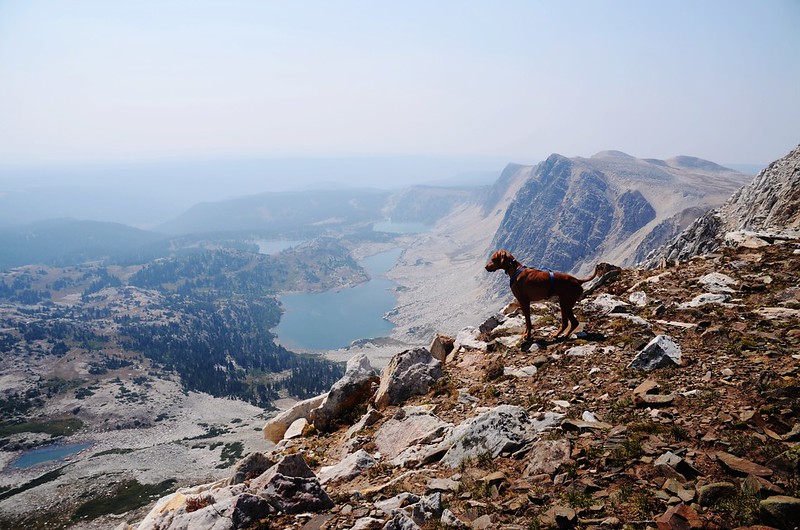

Looking down at lakes from the south saddle of Medicine Bow Peak


Taken from the south saddle of Medicine Bow Peak

View to Medicine Bow Peak from the saddle
在鞍部休息拍照後朝東北山頭岩石小徑爬升,接近山頂時開始在大塊岩石間攀越前進。

Up to Medicine Bow Peak
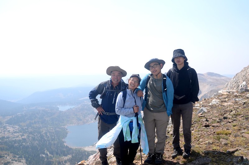
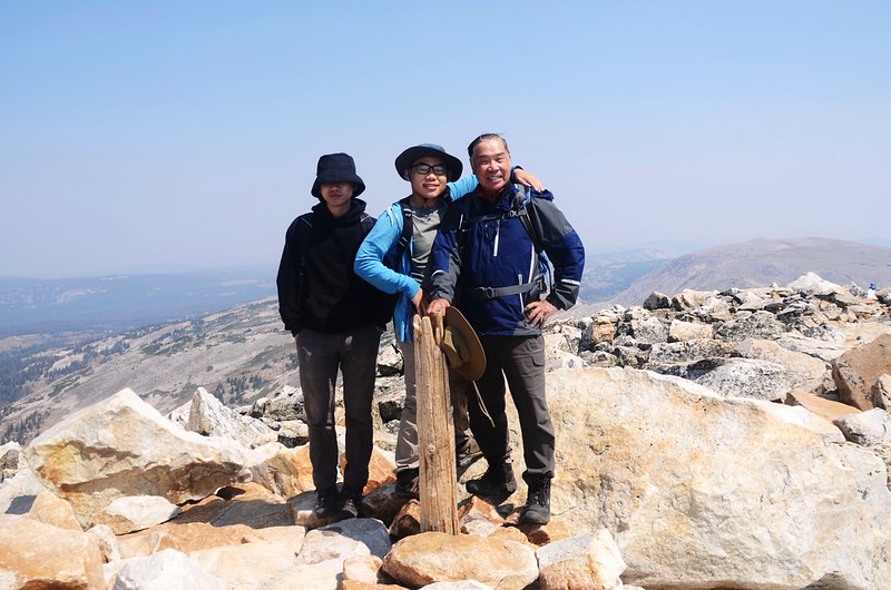
12:10 登頂Medicine Bow Peak,海拔12,018呎/3,663公尺(GPS顯示11,992呎/3,655公尺);
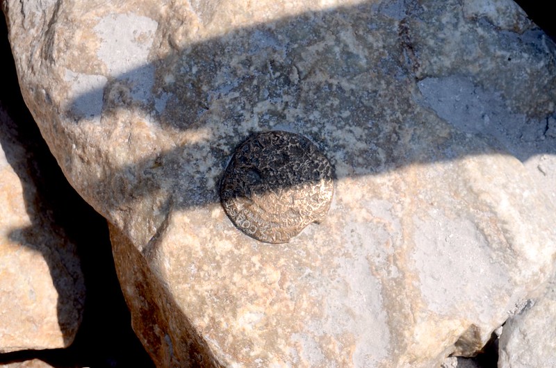

Benchmark on the top of Medicine Bow Peak
今天山頂人潮不少,大都是由Lewis Lake Trailhead 上來的登山客。


Taken from the top of Medicine Bow Peak
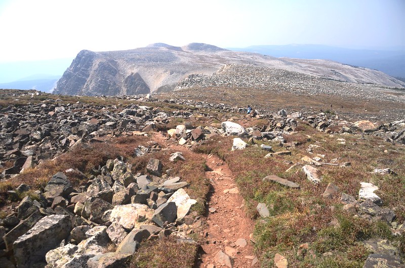
在山頂東南俯瞰下方星羅棋布的湖群,山頂西南一路延伸的幾個山頭成單面山姿態羅列,山頭右側(西)是緩斜岩石坡,左側(東)則是垂直陡峭的絕壁;


View from the top of Medicine Bow Peak
1955年10月6日一架美國聯合航空編號409的班機即在這山壁撞毀,機上63名乘客及3名機組員全數罹難,迄今在11,755 ft.山頭東邊峭壁下方仍殘留多處飛機的殘骸。
12:30 在山頂小休後開始朝東北方下山,開始時仍在山頂大岩塊間攀越下行;

Scrambling back down the boulder field after the summit
行約一百多公尺在稜線上朝右下切,開始在東面陡峭的山坡不斷的“之”字形迂迴下山,這條步道是從Lewis Lake Trailhead上來的步道。

Taking a short break from the switchbacks with beautiful lake views


View on the way down from Medicine Bow Peak

Taking a short break from the switchbacks with beautiful lake views


View on the way down from Medicine Bow Peak
13:21 下抵Lewis Lake Trailhead岔路,座標N41.35828° W106.30895°,海拔11,101呎/3,384公尺;

Lewis Lake Trailhead & Mirror Lake Trailhead junction
左岔往Lewis Lake Trailhead不取,取右往Mirror Lake Trailhead;


Looking west at Snowy Range & lakes from Medicine Bow Peak Trail
行不遠步道即在Lookout Lake東岸朝西南行。

Looking west at Snowy Range & lakes from Medicine Bow Peak Trail

Looking west at Snowy Range & Looking Lake from Medicine Bow Peak Trail

Medicine Bow Peak Hike

A lookout with views north towards Medicine Bow Peak and Lookout Lake

Medicine Bow Peak Hike
14:17 抵達Mirror Lake Picnic Area,座標N41.33836° W106.32348°,海拔10,609呎/3,234公尺;

Mirror Lake Picnic Area
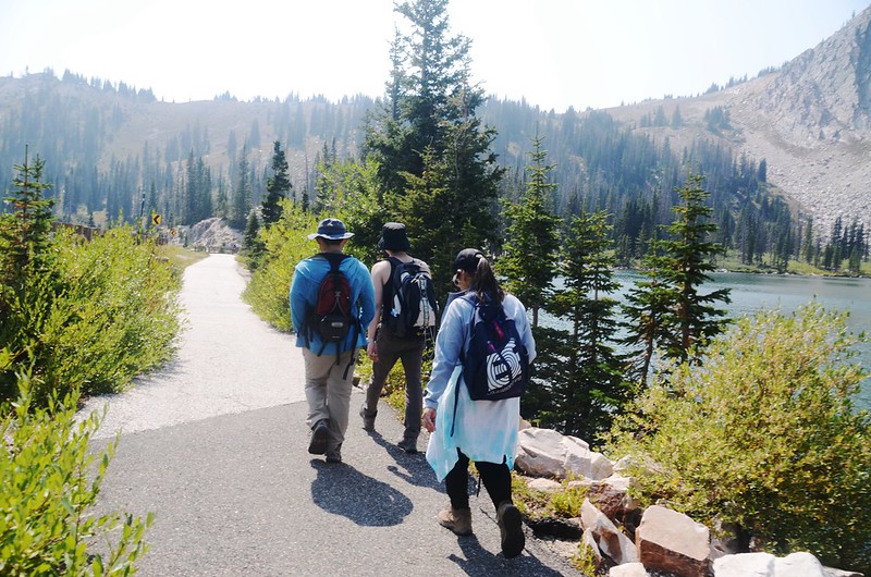
我們取右朝西南小徑下到Lake Marie湖岸再左上切接回寬大的舖設路面步道右轉回停車處;

The trail along Lake Morie

Lake Morie
正確走法沿野餐區的Forest Rd 228公路東南行約0.1哩於座標N41.33736° W106.32171°處右轉寬大的舖設路面步道回停車場快得多了!
14:29 抵103公路旁East Lake Marie parking lot,取右沿103公路邊寬敞步道在Lake Morie東岸往停車處南行。
The trail along Lake Morie
14:40 返抵登山口,整裝後開車返回科羅拉多,結束一天的跨州登山行。
Alltrails:Medicine Bow Peak Loop Trail (2021.08.28)