
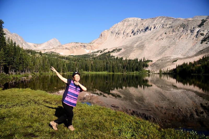
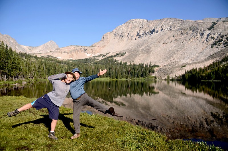
Blue Lake, Colorado
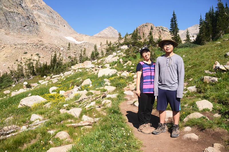
今天女兒請假陪我和小孫子貝貝前往Brainard Lake Recreation Area攀登Mitchell Lake和Blue Lake兩座高山湖泊;Brainard Lake Recreation Area往年只要有公園年票或現場買票即可進入,但今年起嚴格總量管制,在整個 2021 年運營季節(6月11日~10月16日)進入該區都須事先預約,預約許可證分九區申請(詳見Brainard Lake Recreation Area Timed Tickets官方網站);如沒早點預約還蠻難以預約得到的。
-----------------------------------------------------------------------------
攀登湖泊:
Mitchell Lake:海拔10,705呎/3,263公尺
Blue Lake:海拔11,355呎/3,461公尺
登山口:Mitchell Lake Trailhead,海拔10,472呎/3,192公尺
登山里程:上下山全程合計5.34哩/8.6公里
總爬升高度:968呎/295公尺
登山時間:3小時56分鐘
-----------------------------------------------------------------------------
行車資訊:
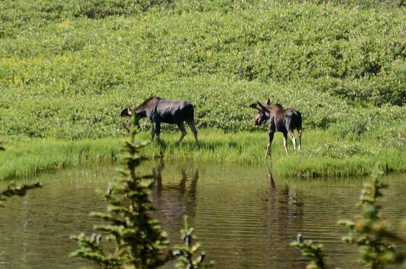
CO 72號公路(Peak To Peak)北行,經過小鎮Ward後路右就可看到一面大指示牌指向西邊標明“Brainard Lake”,座標N40.07594° W105.50296°;順著指示牌左轉沿Brainard Lake Road行約2.6哩/4.2公里抵達收費站,驗明預約許可證後進入Recreation Area續行(我們今天申請的是Mitchell Lake Trailhead),再行約2.0哩/3.2公里抵達Brainard Lake,此時在道路左側willows矮樹叢中發現有四隻moose(駝鹿),一公一母及兩隻小駝鹿,隨即停車拍照;


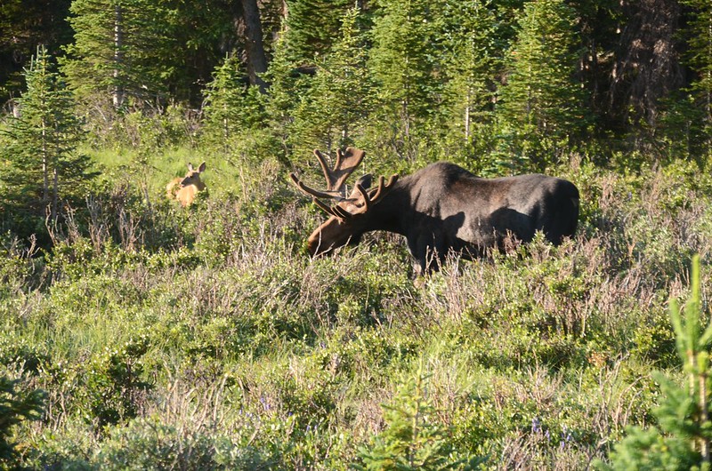

Moose at Brainard Lake area
拍完照再行1.12哩/1.8公里抵達Mitchell Lake Trailhead停車場,座標N40.08335° W105.58098°,海拔10,469呎/3,191公尺。
※ Moose和Elk都是世界上大型的鹿科動物,分布在北半球的溫帶地區,歐亞和北美大陸都可發現牠們的蹤跡。Moose和Elk的中文翻譯非常混淆,很多譯文都把這兩種鹿科動物翻成 “麋”,部分國家公園的中文譯本則將Moose翻為駝鹿,而將Elk翻為麋鹿,Moose是鹿科動物裡最龐大的一種,最大可達1,800磅,比起鹿科動物第二大種Elk的600~900磅大了許多。Moose的身軀是深褐色,看上去甚至有點像黑色,Elk則是淺褐色的。Elk比Moose較屬於群居動物,在夏天的季節裡最大族群甚至可達400頭。Moose喜歡在溼沼澤地覓食,而Elk則較常出現在草地及樹叢中。

Moose


Elk
步程簡述:
07:45 由Mitchell Lake Trail登山口起登,座標N40.08334° W105.58183°,海拔10,472呎/3,192公尺;

Mitchell Lake Trailhead
步道口標示:Mitchell Lake 1哩;Blue Lake 3哩;登山步道在雲杉、冷杉林間穿行,行來舒爽。
08:00 經過一座橫跨在Mitchell Creek上的木橋,座標N40.08569° W105.58852°,海拔10,591呎/3,228公尺,距登山口0.42哩/0.68公里;

Mitchell Creek crossing by log bridge
橋下流水潺潺,點綴河邊繽紛野花,頓覺暑氣全消。
過了Mitchell Creek 隨即進入Indian Peaks Wilderness 範圍,步道仍在山林間穿行。
08:16 來到Mitchell Lake岔路,座標N40.08658° W105.59443°,海拔10,696呎/3,260公尺,距登山口0.87哩/1.4公里;左岔直行往Blue Lake,右岔往Mitchell Lake湖邊;先取右到Mitchell Lake湖邊賞景拍照。

Mitchell Lake, Colorado


Mitchell Lake, Colorado
Mitchell Lake海拔10,705呎/3,263公尺, 湖的西北邊是科羅拉多的一座13ers--Mount Audubon,海拔13,221呎/4,030公尺,此山我曾三度登頂,在湖邊停留20分鐘拍完照後回到步道岔路續往Blue Lake前行。
08:40 抵達Mitchell Lake的進水口小溪,座標N40.08605° W105.59763°,海拔10,758呎/3,279公尺,距登山口1.12哩/1.8公里;

Mitchell Lake inlet crossing by log bridge
經過進水口小溪上的木橋後來到一處亂石區;

Blue Lake Trail (rocky area)
由亂石區底下穿過後步道開始朝西陡升。

Blue Lake Trail
08:48 陡升步道頂端地形轉為平緩地形,座標N40.08685° W105.59989°,海拔10,860呎/3,310公尺,距登山口1.3哩/2.1公里,在高點回頭俯瞰Mitchell Lake;

Looking back at Mitchell Lake from Blue Lake Trail

Looking northwest at Mount Audubon from Blue Lake Trail
在此小休後再行,步道緩平西行,兩旁陸續出現沼澤、小湖泊,沼澤野花盛開。


Beaver pond in the valley along Blue Lake Trail

Elephant Head flower
08:55 步道又開始陡升,座標N40.08697° W105.60240°,海拔10,876呎/3,315公尺,距登山口1.49哩/2.4公里。
09:01再度抵達地形轉為平緩山徑,此處已進入山谷上游,座標N40.08669° W105.60357°,海拔10,935呎/3,333公尺,距登山口1.55哩/2.5公里;
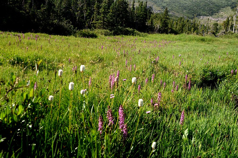
Wildflowers blooming along Blue Lake Trail
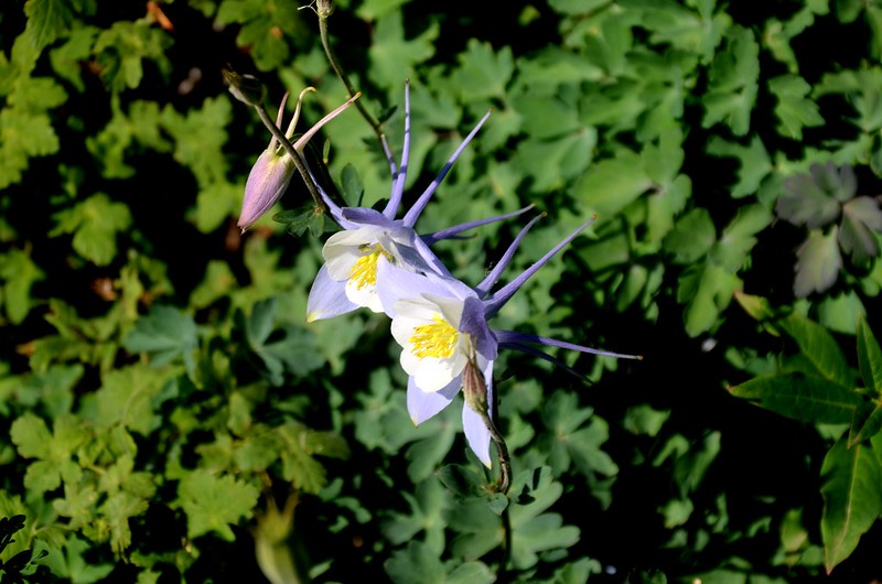

Blue Columbine

Beaver pond in the valley along Blue Lake Trail
路徑旁除了沼澤區、小湖邊野花盛開外,山徑慢慢轉為多岩石地形,步道就在岩石間小徑緩坡爬升。

Blue Lake Trail (rocky area)

Beaver pond in the valley along Blue Lake Trail
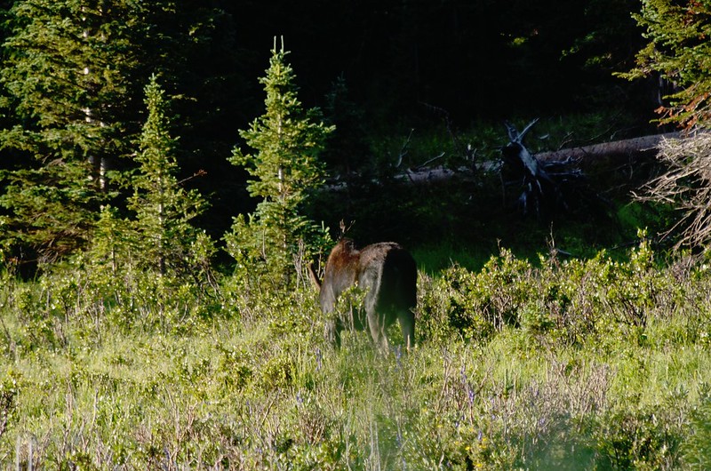
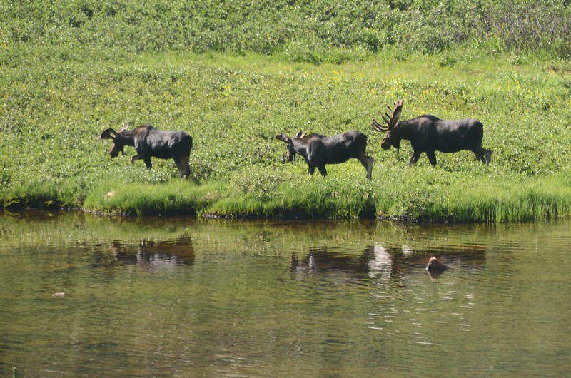
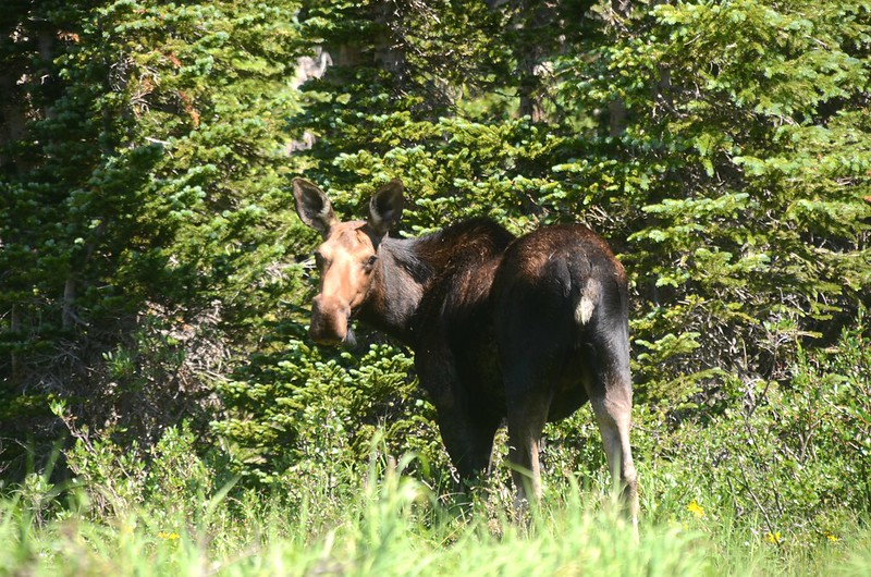
09:23 左側下山谷小湖邊又見到四隻moose(駝鹿),距離有點遠,但還是看得蠻清楚的;


Moose at Blue Lake Trail
今天運氣真好,這種稀少的體型最大鹿科動物見到的機率不高,就是幸運看到也僅是一兩隻,而今天卻連續遇到兩群共八隻,是我20年來見到最多的一天。


Beaver pond in the valley along Blue Lake Trail
09:31 出森林線,座標N40.08462° W105.61190°,海拔11,138呎/3,395公尺,距登山口2.24哩/3.6公里;


Taken from just above the treeline (11,138')
山徑又轉為有點陡的陡坡朝Blue Lake爬升。

Wildflowers blooming along Blue Lake Trail

Blue Lake Trail below Blue Lake
09:55 步道左側不遠處是Blue Lake出水口,形成一座小流瀑。

Blue Lake outlet

Blue Lake outlet

Wildflowers blooming along Blue Lake Trail
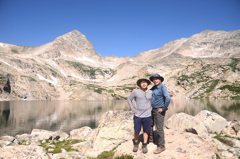
10:00 抵達Blue Lake,座標N40.08855° W105.61731°,海拔11,355呎/3,461公尺,距登山口2.73哩/4.4公里;

Blue Lake, Colorado


Blue Lake, Colorado
尖塔狀的Mount Toll(海拔12,979呎/3,956公尺)矗立在湖的西岸,北岸是海拔13,221呎(4,030公尺)的Mount Audubon,南岸則是海拔12,943 呎(3,945公尺)的Pawnee Peak ,這美麗的高山湖泊就寧靜的躺在這群山的懷抱裡,我們拍完照小休後隨即下山。
10:13 循原路下山。
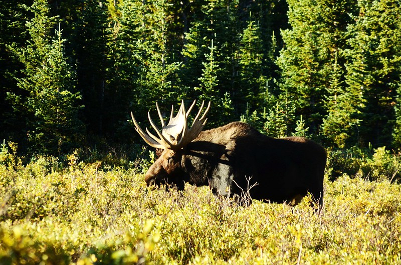
11:00 路左沼澤邊小樹叢又見到一大一小兩隻moose(駝鹿),應是母子關係,今天總計遇見三群10隻moose(駝鹿),真是幸運的一天!

Moose at Blue Lake Trail
11:45 返抵登山口,整裝後開車返家。
Alltrails:Mitchell Lake、Blue Lake Trail Hiking Tract (2021.07.27)