Thunder Lake
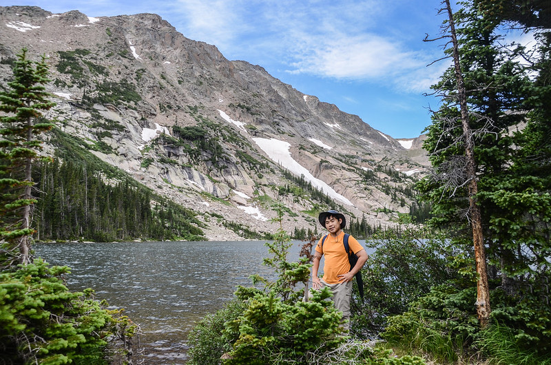
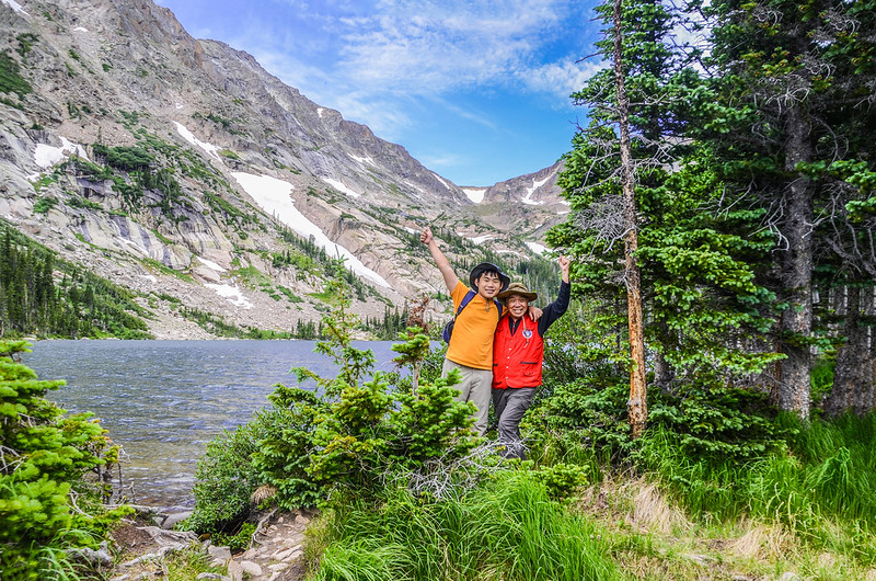
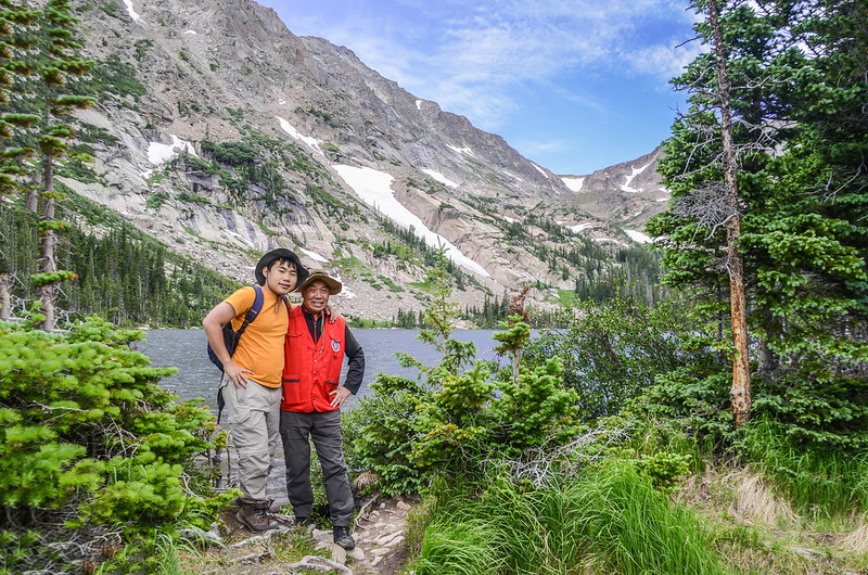
昨天去攀登的Thunder Lake早在2006年就去攀登過,近日有山友貼出在該步道拍到罕見的野生蘭~Clustered Lady’s Slipper orchid(簇狀少女拖鞋蘭)誘發我再度前往的衝動,小外孫貝貝也敲邊鼓的說要陪我去就此成行了!
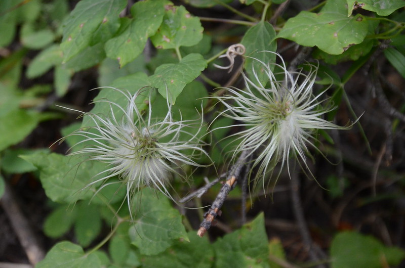
昨天是找到了Clustered Lady’s Slipper orchid,但已花謝甚至結實,期待來年了;照片後四張是山友在七月中上旬所拍的花開照片!
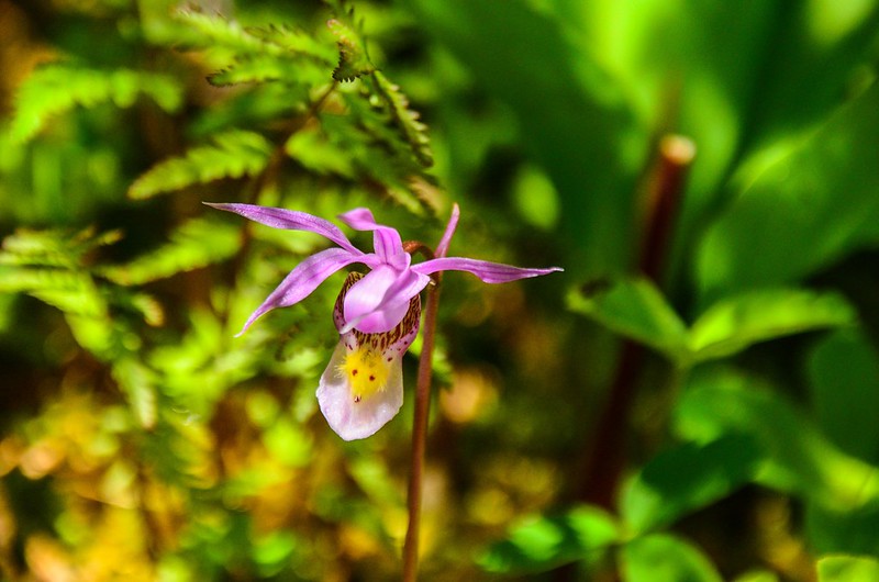
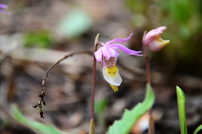
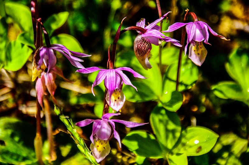
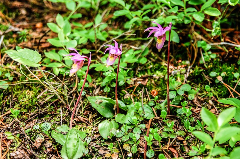
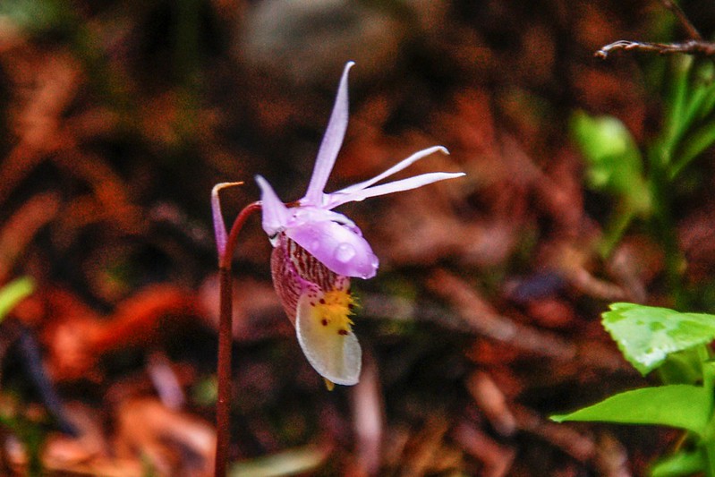
Thunder Lake Trail的前半段Bluebird Lake Trail另有一種罕見的野生蘭Calypso蘭(仙女拖鞋蘭, Fairy Slipper Orchid),植株、花朵特小(全株高約20公分,花朵長約2.5 -3.5公分),且藏身在森林陰暗處的腐植土上不容易發現,但她的花期是5~6月,昨天當然沒找到她的芳蹤;特貼出幾張前幾年拍的照片回味一下!
----------------------------------------------------------------------------------------
攀登湖泊:Thunder Lake,海拔10,574呎/3,223公尺
登山口:Wild Basin Trailhead,海拔8,510呎/2,594公尺
登山里程:往返共計約12.5哩/20.17公里
總爬升高度:2,318呎/707公尺
登山時間:上山3小時43分,上下山費時8小時
----------------------------------------------------------------------------------------
步程簡述:
07:50 由Wild Basin Trailhead出發,座標N40° 12.466' W105° 33.990',海拔8,510呎/2,594公尺;
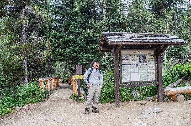
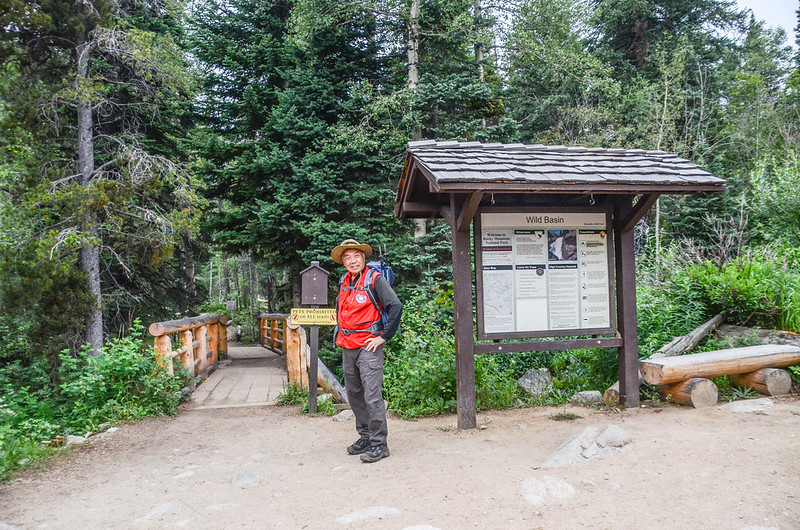
Wild Basin Trailhead
沿著寬敞維護良好的步道朝西南行。
08:00 抵Lower Copeland Falls岔路,取左前往Lower Copeland Falls,然後沿河邊小徑西南行;
Lower Copeland Falls
經過Upper Copeland Falls後接回正規步道朝西南行,步道旁野花盛開。

Upper Copeland Falls

Pink Wintergreen

Whipple's Penstemon
virgin's bower
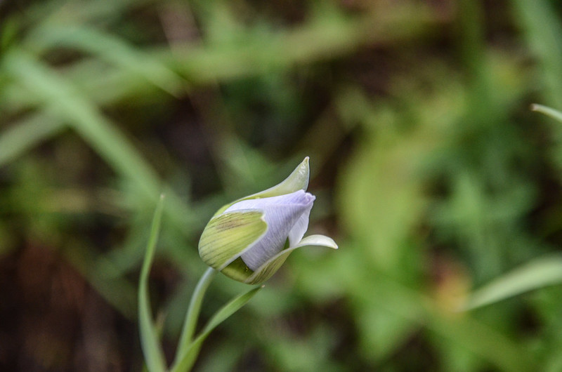
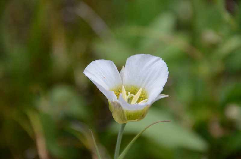
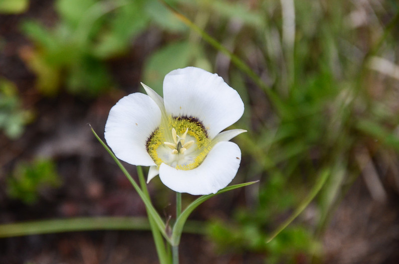
Sego Lily (mariposa lily)

North St. Vrain Creek next to the trail
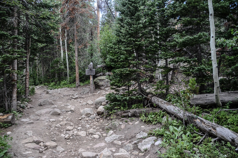
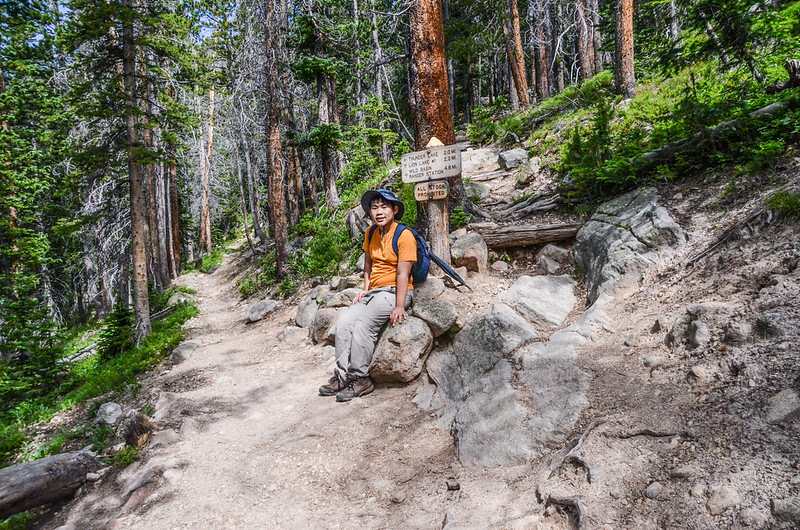
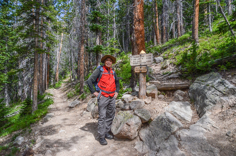
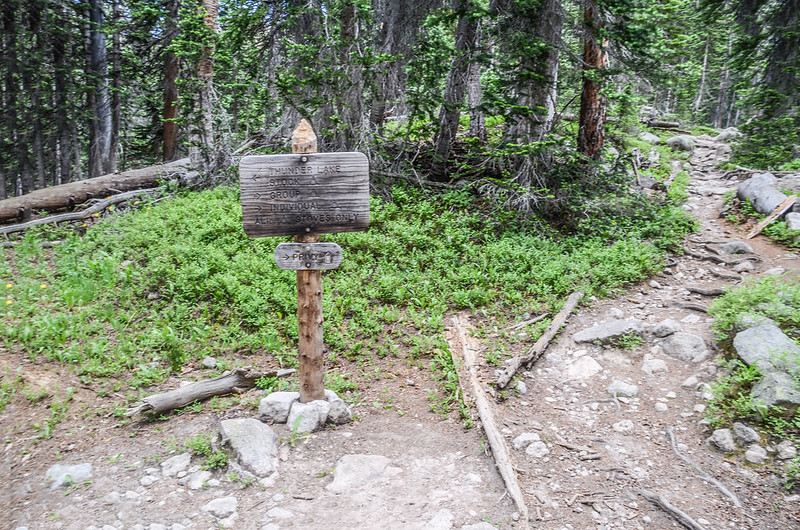
08:33 抵Thunder Lake Trail和Ouzel Falls、Bluebird Lake Trail岔路,座標N40° 12.014' W105° 35.285',海拔8,884呎/2,708公尺,距登山口約1.4哩/2.25公里;
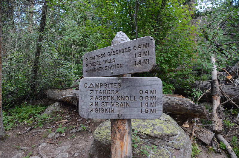
The Campsites spur trail, take a right here
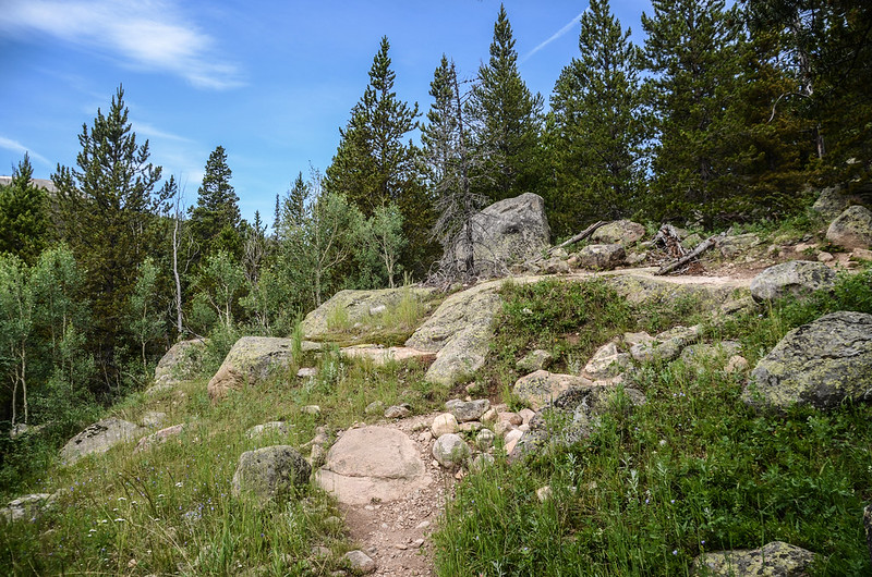
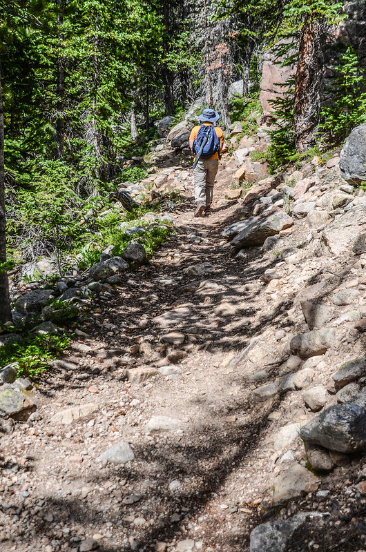
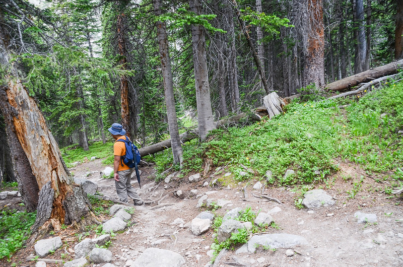
左岔正規步道會經過Calypso Cascade、Ouzel Falls後在下一岔路分別左往Bluebird Lake和右往Thunder Lake,右邊岔路Backcountry campsite access trail 則是經幾個露營區後直接通往Thunder Lake,此經露營區的捷徑步道比經瀑布的正規步道距離短了0.7哩/1.13公里,我們決定先取右上行往Thunder Lake,下山時視有否時間再決定是否繞道Ouzel Falls,此段經幾處露營區的步道有點陡,路面粗糙多亂石,但路徑還算清楚不難走。
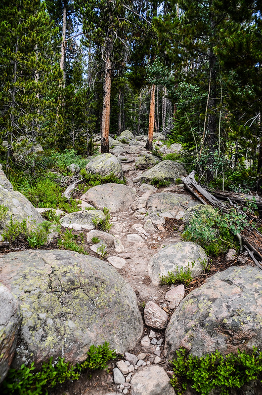
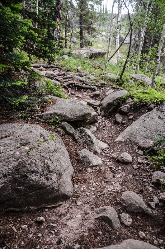
Typical terrain along the Campsites spur
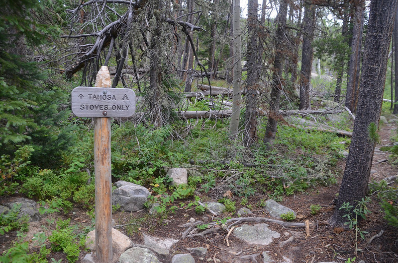
08:47 抵一處右岔路通往Tahosa Campsite,取左續直上行。
Tahosa Campsite spur
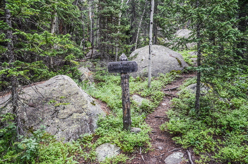
09:00 再經一右側岔路通往Aspen Knoll Campsite,仍取左岔續直上行。
Aspen Knoll Campsite spur
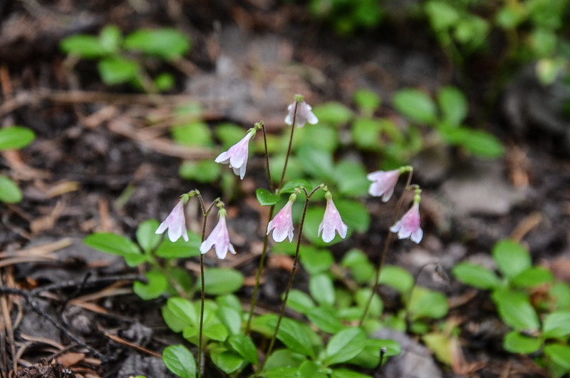
Linnaea Borealis
Backcountry campsite access trail
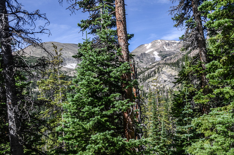
Looking southwest at Copeland Mountain from Thunder Lake Trail near 9,394'
09:25 抵由Ouzel Falls上來的正規步道岔路,座標N40° 12.303' W105° 36.403',海拔9,480呎/2,890公尺,距登山口約2.7哩/4.35公里;
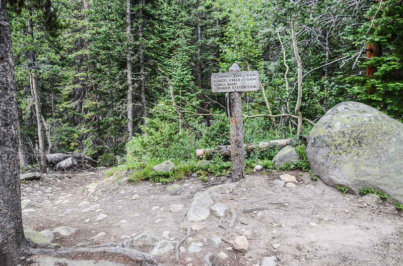
Thunder Lake & Ouzel Falls junction
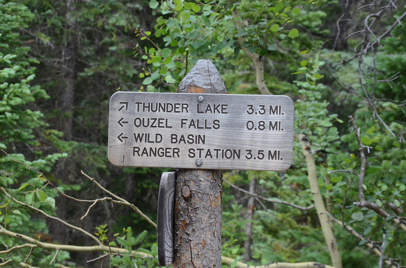
Trail sign at the trail merger
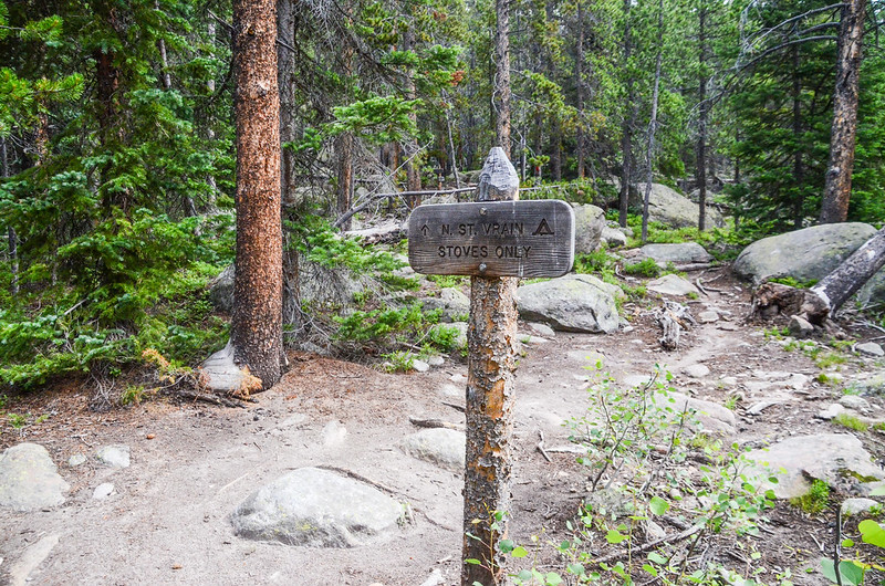
路牌標示左下往Ouzel Falls約0.8 哩,右直行往Thunder Lake約3.3哩,取右朝Thunder Lake上行,隨即右側有一岔路通往N. St. Vrain Campsite,取左沿主線上行。
N. St. Vrain Campsite spur
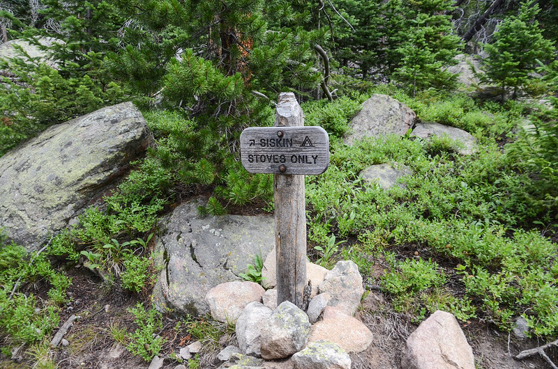
09:28 路右Siskin Campsite岔路,取左主線上行;
Siskin Campsite spur
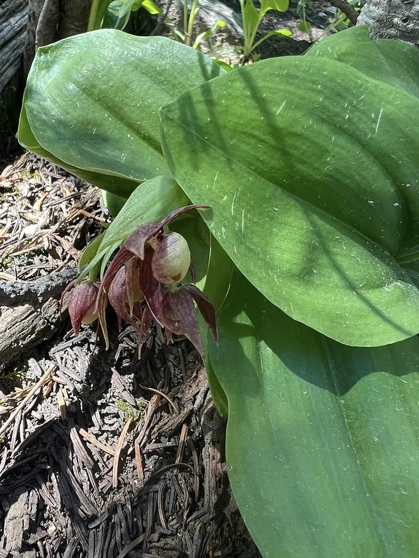
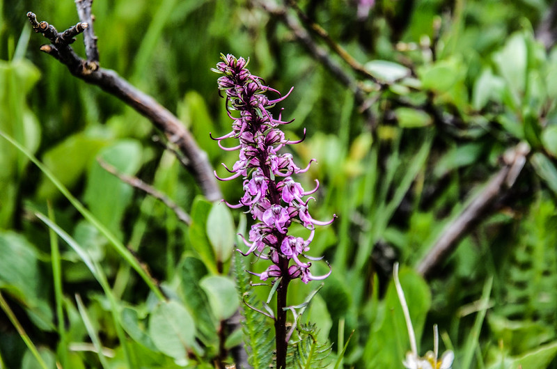
此後沿途陸續出現較罕見的野生蘭~Clustered Lady’s Slipper (簇狀少女拖鞋蘭),這是今天主要尋找的野生蘭,可惜已過了花期,僅殘留幾朵已凋謝的花朵;
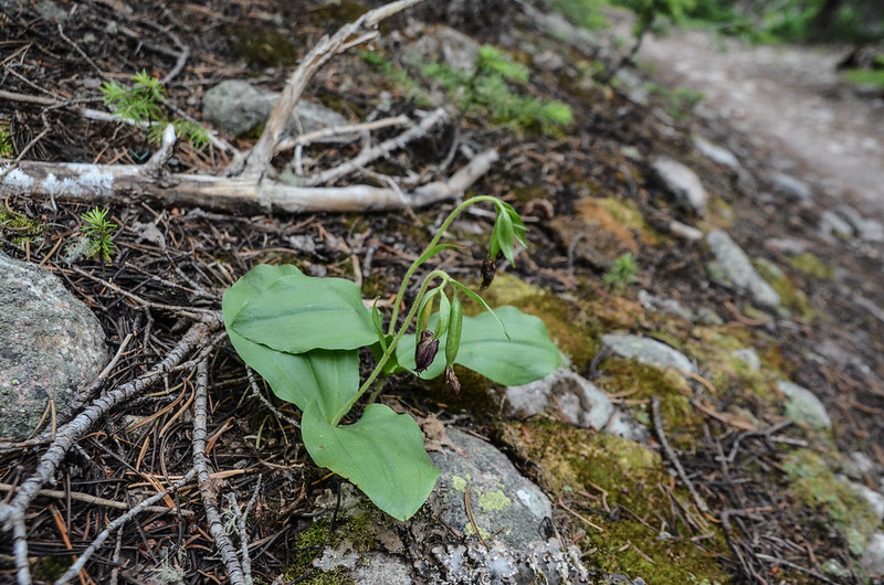
Clustered Lady's Slipper
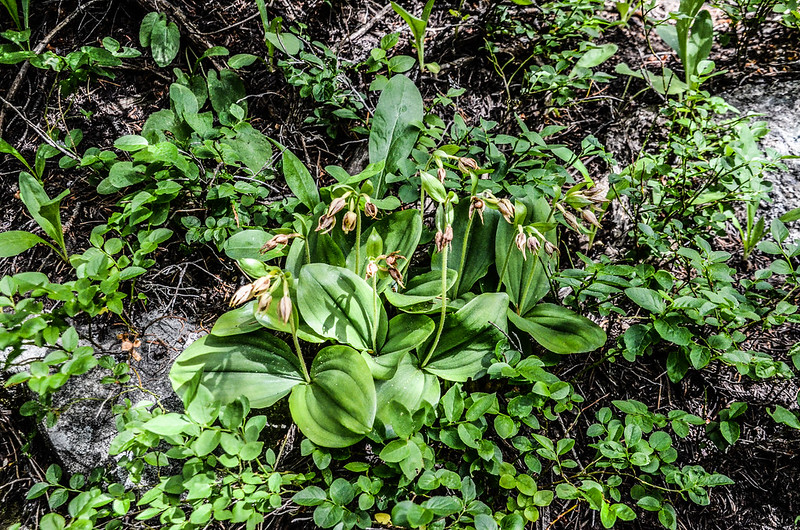
以下幾張照片是採自山友七月初發表在臉書花開的照片:

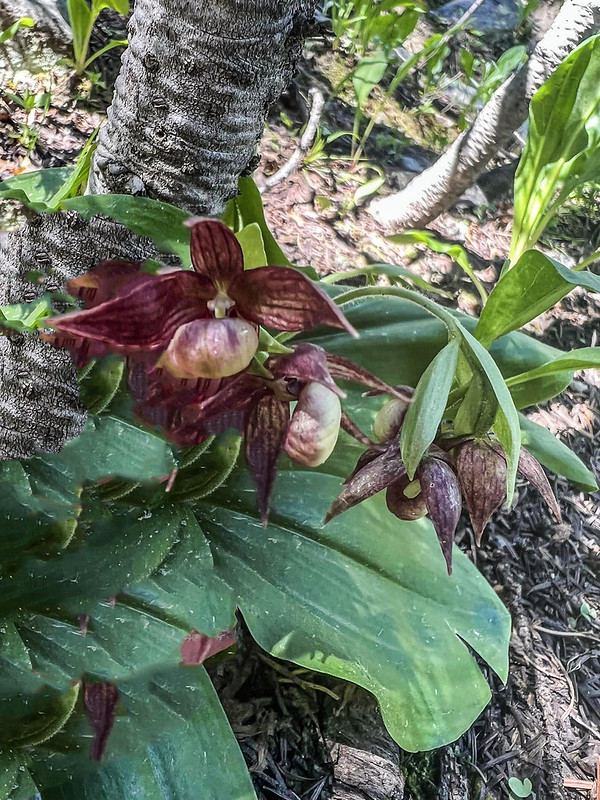
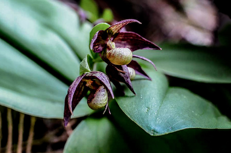
Clustered Lady’s Slipper at blooming
一路沿著綠樹成蔭的小徑上升,偶爾瞥一眼周圍的群山,海拔不斷上升。
Looking southeast at Meadow Mountain & Saint Vrain Mountain from Thunder Lake Trail near 9,900'
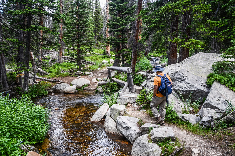
10:11 通過橫跨支流小溪澗的簡易原木續行。

Cross bridge over tributary
10:14 抵Thunder Lake Trail和Lion Lake Trail岔路,座標N40° 12.766' W105° 37.495',海拔10,054呎/3,064公尺,距登山口約3.9哩/6.28公里;
Thunder Lake & Lion Lake Trail split
路牌標示距Thunder Lake還有2.0哩,取左朝Thunder Lake西行;
On the way up to Thunder Lake
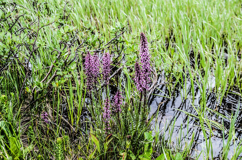
此後的步道是一段長陡坡,步道旁仍不時見到花已謝的Clustered Lady’s Slipper;
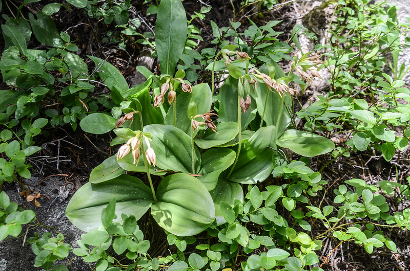
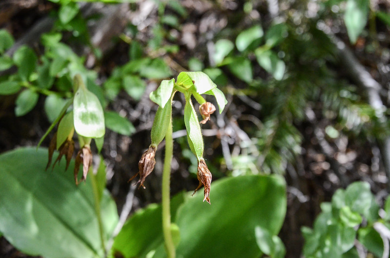
Clustered Lady’s Slipper
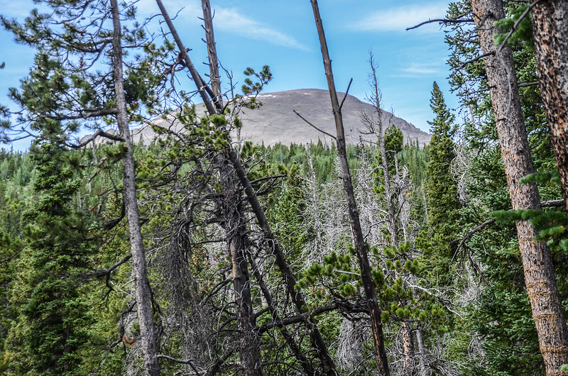
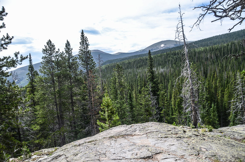
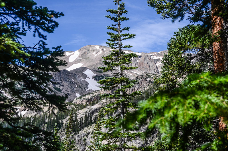
透過樹林空隙可清楚看見西方的高山Copeland Mountain。
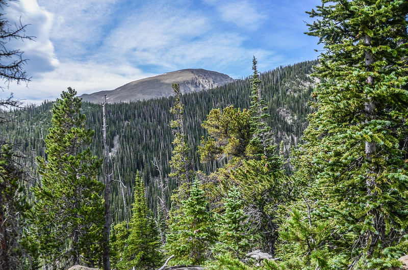
Looking southwest at Copeland Mountain from Thunder Lake Trail near 10,200'
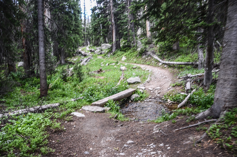
10:38 上抵一處開闊地,步道坡度轉為緩坡並進入亞高山森林(subalpine forest)緩坡穿行,座標N40° 12.731' W105° 37.785',海拔10,245呎/3,123公尺,距登山口約4.3哩/6.92公里;
On the way up to Thunder Lake

On the way up to Thunder Lake
行進間偶爾可以透過稀疏的松樹林瞥見西邊大陸分水嶺的高山。
Looking to higher ground
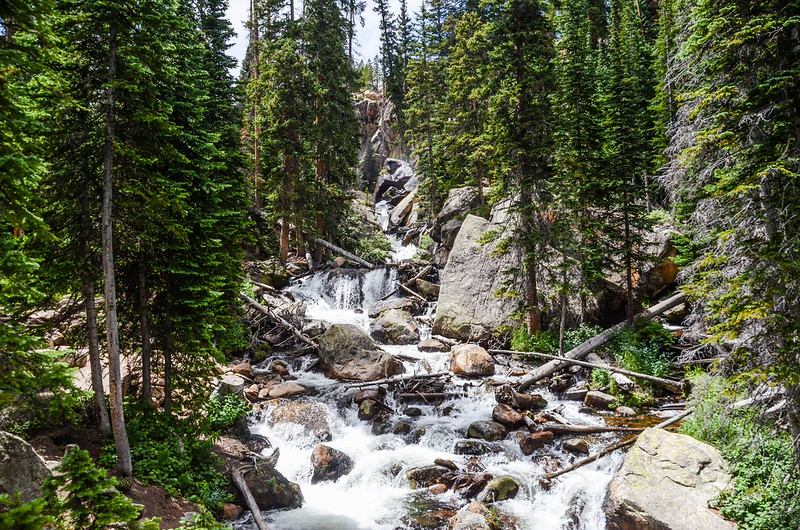
11:11 經過一座有單邊扶手的獨木橋跨越支流。
Cross bridge over tributary
Cross bridge over tributary
11:28 抵Thunder Lake Trail最高點,座標N40° 13.424' W105° 38.651',海拔10,687呎/3,257公尺,距登山口約5.7哩/9.17公里;
The deceptive highest point of the trail
此處有兩岔路,右岔往露營區,取左岔下行往Thunder Lake。
On the way up to Thunder Lake
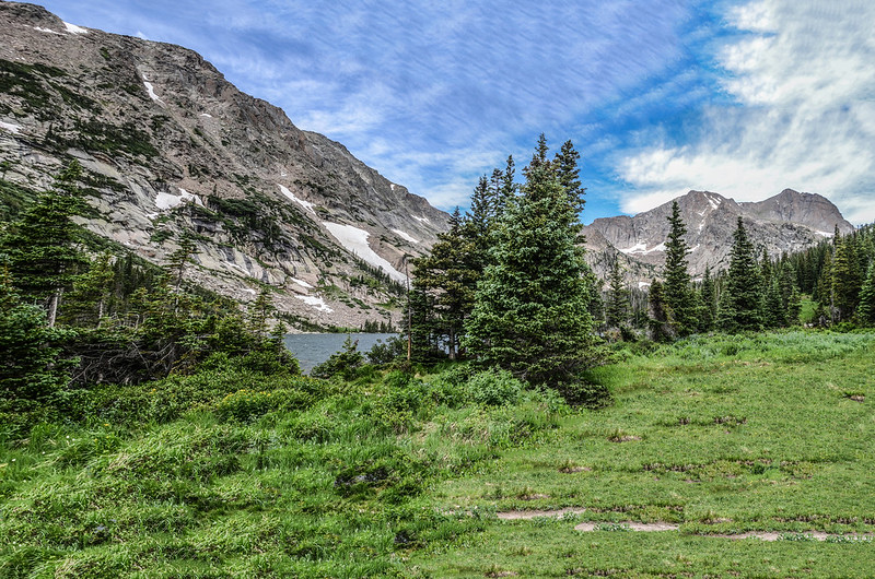
11:35 抵達Thunder Lake,座標N40° 13.329' W105° 38.706',海拔10,574呎/3,223公尺,距登山口約5.8哩/9.33公里;
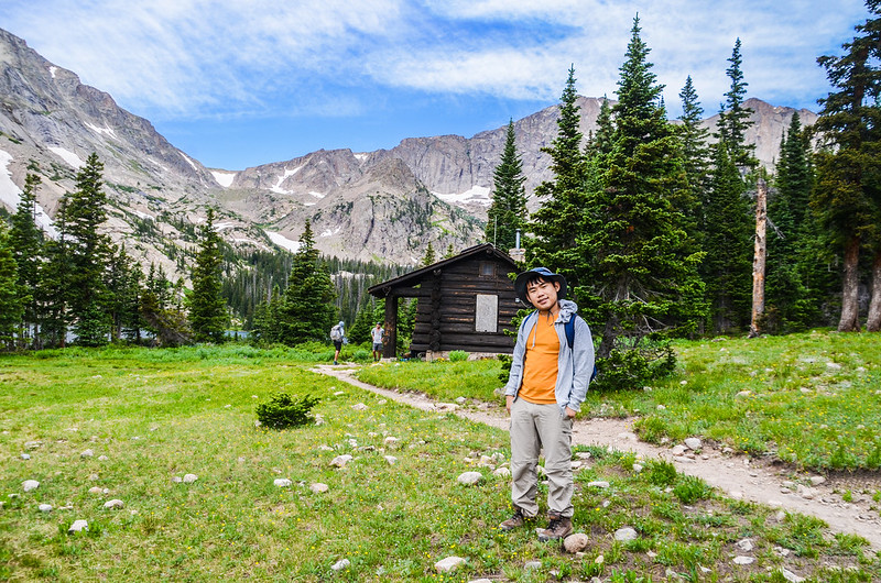
Thunder Lake with the USFS cabin in background
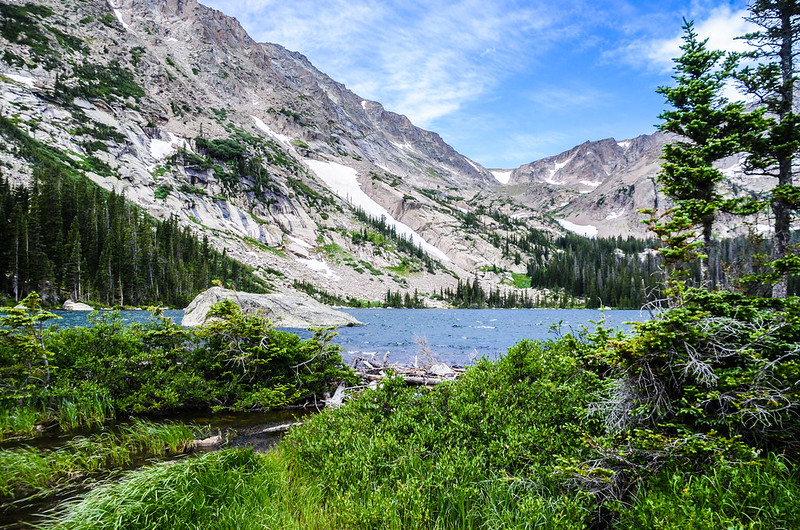
Thunder Lake
在湖的東北角有一座Thunder Lake Patrol Cabin(巡邏小屋),這座屬於USFS (US Forest Service)只有一間房間的小木屋建於1930年,並於1988年被列入國家史蹟名錄。
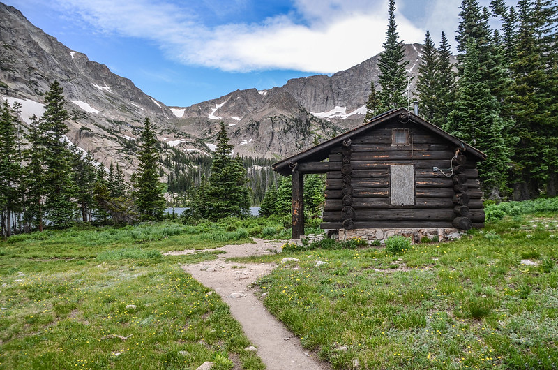
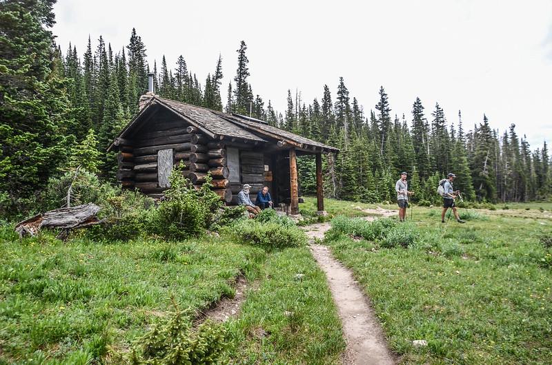
The USFS (Forest Service) cabin
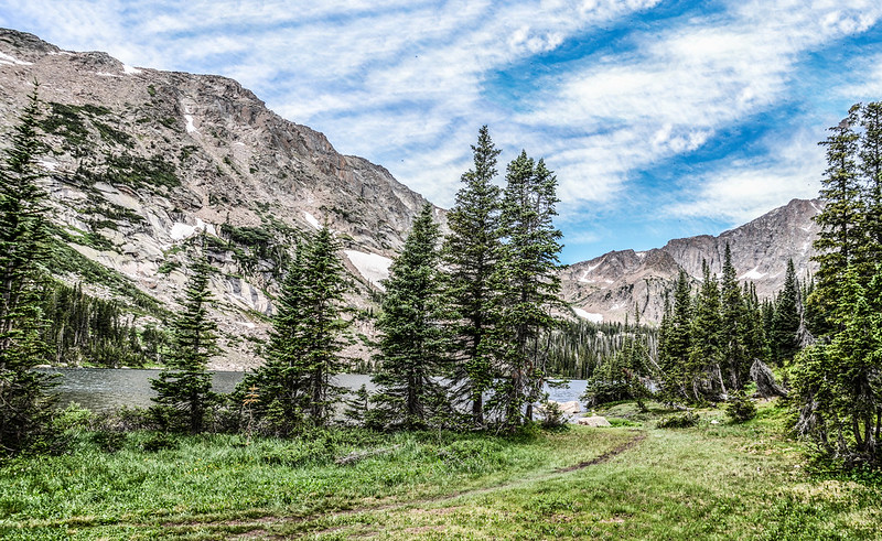
此湖我在2006年5月底曾上來過,當時整座湖還處於冰凍狀態,白茫茫一片,今天才能一窺此湖的全貌;

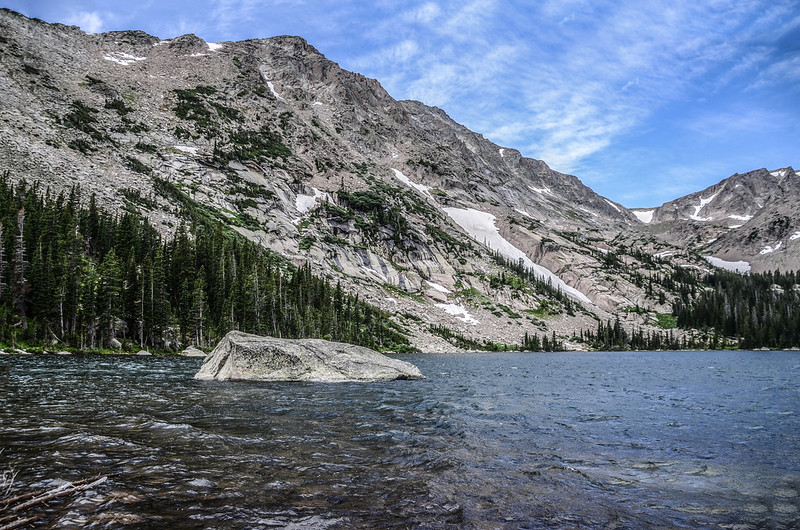
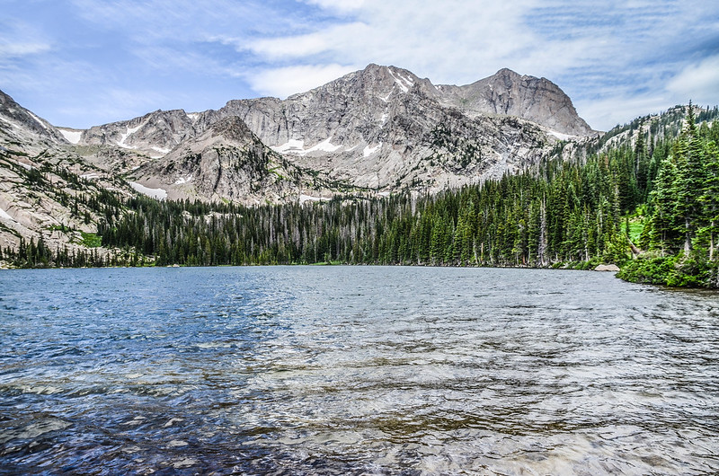
Thunder Lake
Thunder Lake 位在海拔3,790公尺的Tanima Peak南面山腳下,西北邊是海拔3,692公尺的Pilot Mountain和4,058公尺的Mount Alice,湖的出水口蠻多盛開的野花,我們在湖邊休息用午餐。

Thunder Lake
Elephant Head flower
12:00 循原路下山。
13:38 回到Ouzel Falls的岔路,貝貝提議繞道Ouzel Falls去走走,取右岔往Ouzel Falls下行。
13:52 接到Bluebird Lake Trail,右岔上行通往Ouzel Lake和Bluebird Lake,左岔下行往Ouzel Falls和Wild Basin Trailhead,座標N40° 12.094' W105° 36.197',海拔9,400呎/2,865公尺,取左下行。
14:09 下抵Ouzel Falls下方橫跨Ouzel Creek的木橋;
A full Ouzel Creek, fueled by mid-summer snowmelt and rain
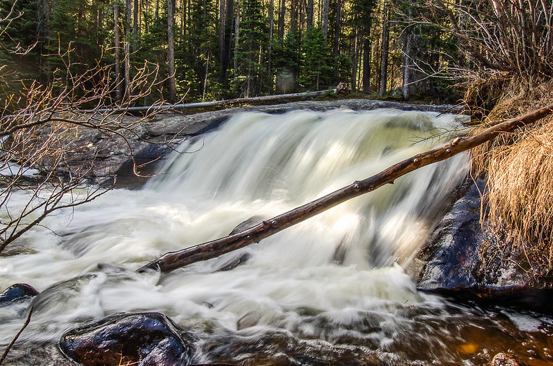
過了木橋後取右沿著小徑上到Ouzel Falls處欣賞瀑布及小休;

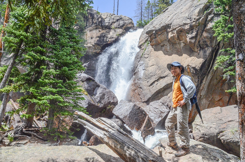
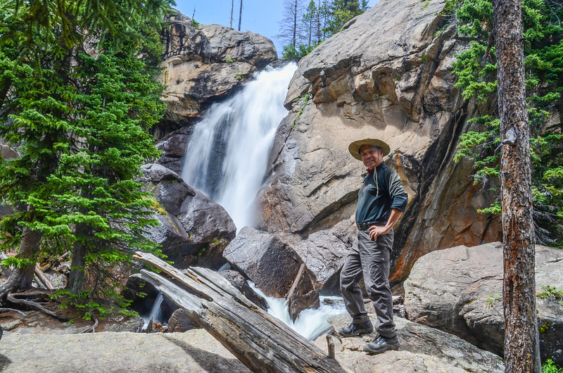
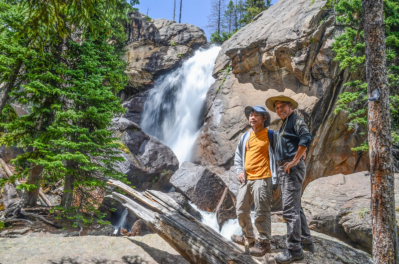
Ouzel Falls
休息約20分鐘後下山。
14:56 經過Calypso Cascade後續行下山。
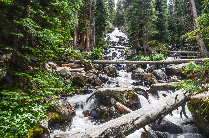
Calypso Cascade
15:50 返抵登山口,開車返家。
Alltrails:Thunder Lake Loop Trail (2023.07.25)