Upper Mohawk Lake (by Jeanie)
今天參加丹佛華人登山隊前往Breckenridge附近攀登Mayflower Lake、Mohawk Lakes,Mohawk Lakes早在2011年即去攀登過 ,今天算是舊地重遊。
攀登湖泊:
Mayflower lake:海拔11,306呎/3,446公尺
Upper Mohawk Lake:海拔12,057呎/3,675公尺
Lower Mohawk Lake:海拔11,811呎/3,600公尺
登山口:Spruce Creek Trailhead,海拔10,351呎/3,155公尺
登山里程:來回約7.95 哩/12.8公里
總爬升高度:約2,093呎/638公尺
登山時間:上山4小時,上下山費時6小時32分
行車資訊:
由丹佛沿I-70州際公路西行,過了Dillon不久由Exit 203出口下交流道,經過Frisco後沿US-9號公路南下,路過 Breckenridge後於最後一個交通號誌(US-9與Boreas Pass Road交叉口)算起,約2.4哩經過公路左側的小湖 Goose Pasture Tarn後右轉Spruce Creek Road (CR 800),再沿Spruce Creek Road 行約1.2哩抵Spruce Creek Trailhead第一停車場,一般小房車可到;性能佳的高底盤四傳車可續行到2哩後的第二停車場。

Spruce Creek Trailhead parking lot
步程簡述:
08:32 由登山口(Spruce Creek Trailhead)出發,此地海拔10,351呎/3,155公尺;


Spruce Creek Trailhead
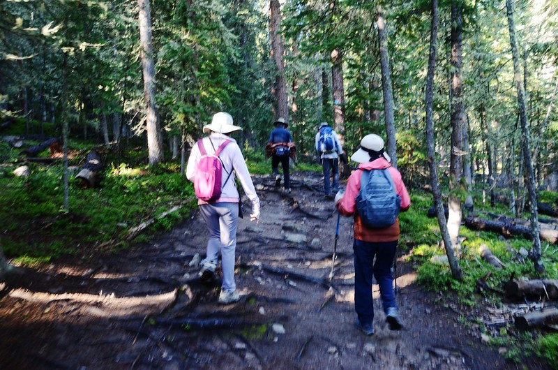
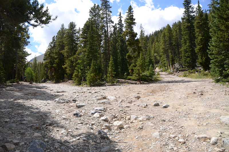
登山口有一標示牌,上頭標示“Wheeler Trail Junction 1.8, Continental Falls 3.0, Mohawk Lakes 3.4.”;另有一面步道前方封閉的公告,經請問剛下山的兩位越野單車車友後得知登山步道行約近兩哩在沼澤草原處封閉但可繞道,我們仍沿Spruce Creek trail朝西南在森林中緩坡前行,誠如他人登山記錄描述的,由登山口至第二停車場的2哩路是穿行在茂密的白楊木及松林間的緩坡道,登頂前的最佳熱身運動,兩哩路僅爬升761呎(232公尺)。
Spruce Creek Trail
08:50 行約0.45哩/720公尺由一座木橋跨過Spruce Creek後續在森林中穿行。
09:27 抵一小空曠處,透空處窺見Mount Helen(13,164 ft.)矗立西邊,座標N39° 25' 33.6" W106° 03' 49.2",海拔 10,732呎/3,271公尺,距登山口1.3 哩/2.1公里。

Mount Helen from Spruce Creek Trail
09:39 遇Wheeler Trail junction,座標N39° 25' 25.4" W106° 04' 03.5",海拔 10,879呎/3,316公尺,距登山口1.62 哩/2.6公里;

Spruce Creek trail & Wheeler Trail intersects
此處告示接下來的Spruce Creek Trail封閉,欲前往Mohawk Lakes必須改道,在此取右轉沿Wheeler Trail北行。
在Spruce Creek Trail和Wheeler Trail岔路西側是一大片長滿willows矮樹叢和短草的開闊沼澤地,沼澤地分布幾處無名水塘,水塘西邊高山是Mount Helen(海拔13,164 呎/4,012公尺),在此拍照後繞道沿Wheeler Trail北行。


No name pond along the trail
10:00 接到Spruce Creek Road上的Francie's Hut - High Parking Lot,座標N39° 25' 42.9" W106° 04' 11.0",海拔 10,925呎/3,330公尺,停車場不大,約可停十幾部車;

Francie's Hut - High Parking Lot
此停車場北邊有一條較小的車道上行不遠有一柵門的是Wheeler Trail可通往Crystal Creek Road、Francie's Hut,沿Spruce Creek Road往東北行約1.24哩/2.0公里可回到我們停車的Spruce Creek Trailhead第一停車場,其實高底盤四輪傳動車可開到此處;

Francie's Hut - High Parking Lot
我們由停車場西南角沿Spruce Creek Road朝西南上行。
10:06 停車場西南行約0.1哩/160公尺遇岔路;

Spruce Creek Road、Mayflower Lakes Trail junction
左岔Spruce Creek Road可抵Mohawk Lake登山口四傳車停車場,取右岔Mayflower Lakes Trail上行;

Mayflower Lakes Trail

View from Mayflower Trail looking east
Mayflower Lakes Trail蠻寬敞的,行不遠經過一片空曠地區,兩旁是低矮的Aspen(白楊木)和Spruce(雲杉)的初生林,推測此區應經過雪崩(avalanche)的摧殘。


Mayflower Lakes Trail

View from Mayflower Trail looking east
10:41 經過一段有點坡度的長坡後抵一處Boulder field,座標N39° 25' 29.2" W106° 04' 38.5",海拔11,276呎/3,437公尺,寬敞的步道到此終止;

Mayflower Lakes Trail
穿過boulderfield後遇一片長滿willows矮樹叢的沼澤區,該沼澤區即是Spruce Creek的上游,矮樹叢沼澤區西邊有一無名小潭;

Willows swamp area
盡量靠右從willows叢中穿過沼澤區後續沿小徑西南行。


Snow gentian
10:56 抵達Mayflower Lakes,座標N39° 25' 19.8" W106° 04' 49.9",海拔11,306呎/3,446公尺,在湖邊拍照後取左朝東南續行。


Mayflower lake
11:09 接到Spruce Creek Trail,座標N39° 25' 16.0" W106° 04' 45.4",海拔11,280呎/3,438公尺;

Spruce Creek Trail & Mayflower Lakes junction
左岔可回第一、第二登山口但封閉整修中,取右岔上山。
登山步道平緩朝西南行,經一座類似Horse hitching rack(拴馬架);

Horse hitching rack
及一座橫跨Mayflower Lake出水口木橋後步道開始朝西攀越幾處岩塊往上陡升。
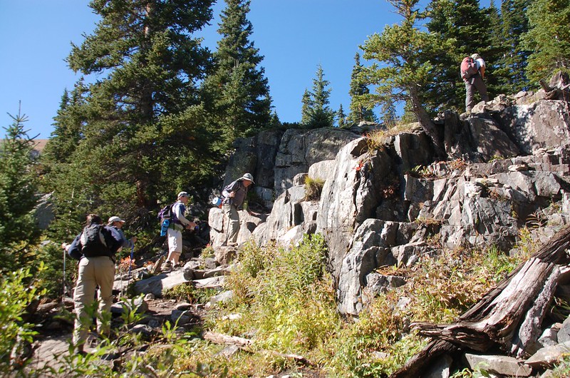
A steep rocks terrain
11:15 抵一座木屋遺址,座標N39° 25' 14.5" W106° 04' 51.8",海拔11,375呎/3,467公尺;此木屋本是1880年代採礦者Continental Cabin木屋遺址,此廢墟已在1989年10月整修為避難木屋。


Ruins of the 1880 mining settlement

View from Mohawk Lakes Trail looking east
Continental Cabin右後方標示牌標示“左往Lower Mohawk Lake 1/2, Upper Continental Falls;右往Lower Falls Vista”;由避難木屋朝西北行約70公尺可抵Continental Falls 底部就近觀賞Continental Falls。


Continental Falls
觀賞完瀑布後回到避難木屋右轉續往Mohawk Lakes爬升。


Mountain gentian(Parry gentian)
11:30 上到Upper Continental Falls觀景點,座標N39° 25' 15.5" W106° 04' 56.7",海拔11,473呎/3,497公尺;

Upper Continental Falls

Upper Continental Falls (by Jeanie)
觀賞完上瀑布後回到步道續往上爬,此段路徑較為混亂,直攻上山亦可,正確路徑應在左側腰繞緩上。
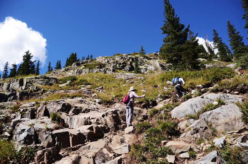
It’s a steep terrain and at times a mystery trying to find the trail through the rocks

View from Mohawk Lakes Trail looking east


Fringed Gentian
11:57 抵達一座類似流籠頭的木座廢墟,座標N39° 25' 15.5" W106° 04' 56.7",海拔11,473呎/3,497公尺;

The gear shaft of the trolley mechanism
此機具是採礦時期作為牽引礦石車斗之用。


The gear shaft
過了木座廢墟已接近Lower Mohawk Lake,步道轉為平緩地在Lower Mohawk Lake出水口左岸willows叢旁前進。

Lower Mohawk Lake
12:07 抵達Lower Mohawk Lake,座標N39° 25' 17.3" W106° 05' 10.7",海拔11,811呎/3,600公尺;


Lower Mohawk Lake
Lower Mohawk Lake湖水很淺,有點小巧玲瓏,湖邊出水口附近棄置一個早期裝運礦石車斗;

Rusty Ore Cart
湖的西北端流瀑下方有一礦場木屋廢墟,往Upper Mohawk Lake的步道沿著Lower Mohawk Lake南岸西進,然後往南繞過一陡坡上山。

On the way near Upper Mohawk Lake

View from below Upper Mohawk Lake looking down at Lower Mohawk Lake and the mountains across the valley
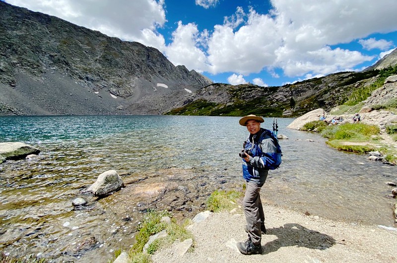
12:32 登抵Mohawk Lake,座標N39° 25' 08.6" W106° 05' 22.7",海拔12,057呎/3,675公尺,距登山口含繞道約4.47哩/7.2公里,上山含繞道花了4小時;


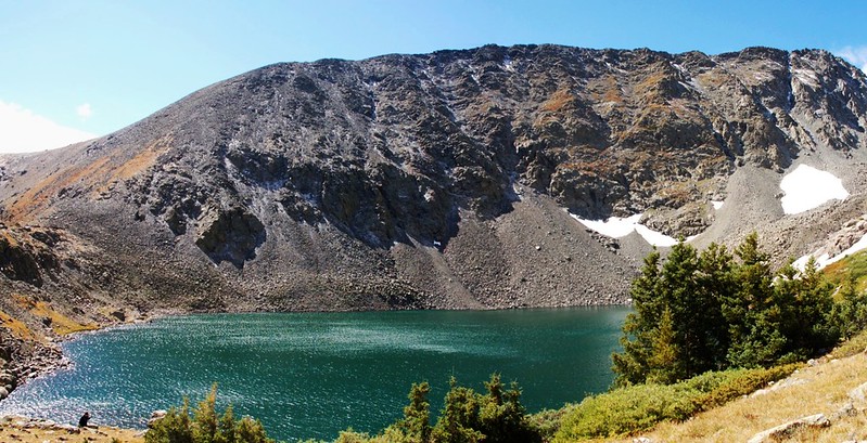
Upper Mohawk Lake
我們在湖的東北角一處制高點避風處休息用餐。


Upper Mohawk Lake (by Jeanie)

View from above Upper Mohawk Lake looking down at Lower Mohawk Lake and the mountains across the valley

Taken from above Upper Mohawk Lake looking down at Lower Mohawk Lake and the mountains across the valley
13:05 循原路下山
14:34 回到Francie's Hut - High Parking Lot取直沿Spruce Creek Road往東北行回第一停車場。
14:58 接到Crystal Creek Road,取右下行回第一停車場。
Crystal Creek Road、Spruce Creek Road junction
15:05 返抵停車場,下山里程約3.23哩/5.2公里,費時2小時;回到車上稍作整裝後開車返家。
Alltrails:Mohawk Lakes via Mayflower Lake Hike (2022.08.27)