搜尋此網誌

2015/10/31

西洋萬聖節 (Halloween)-2015.10.31

Pumpkin field 2


萬聖節由來

萬聖節 (Halloween) 是在每年的 十月三十一日 ,當天晚上打扮得「鬼」模「鬼」樣,愈嚇人愈好。小孩子則忙著挨家挨戶要糖果,而且不忘說句「 Trick or treat, 」 (給糖吃,不然就搗蛋 )

萬聖節究竟怎麼來的?其實在天主教會裡面, 十 一月一日 是諸聖節 (All Saints Day),隔天 十 一月二日 則為萬靈節(All Souls Day,或譯為追思亡者節 ),可以說是萬聖節的起源。

天主教會將一些生前具有超高德性的信徒封為聖人,以表彰那些信徒,並立為其他信徒所遵循的模範。但因為具有非凡德性的信徒其實不少,只是不為人知而已,對於那些沒沒無聞的人來說,教會未將其立為聖人,好像有點不公平,所以在諸聖節那天,紀念所有被教會冊封的聖人及應該被封為聖人卻未被封聖的信徒。

其實,早在西元前數世紀,凱爾特人(Celts,居住在蘇格蘭、威爾斯及愛爾蘭等地)便在 十月三十一日 的時候,慶祝一個名為「 Samhain 」的節日。因為在十月底,活人世界跟死人世界之間的界線會變得模糊,因此死人的靈魂很容易進入活人的世界,跟我們農曆七月開鬼門的傳說很像。在那一天,大家會穿著奇裝異服,在外面遊行,希望能把外面的孤魂野鬼給嚇跑。

Halloween 4

Halloween 2
Halloween 12982353324_cf19259c2b_o2982353632_40168b5f0f_o


南瓜燈的由來

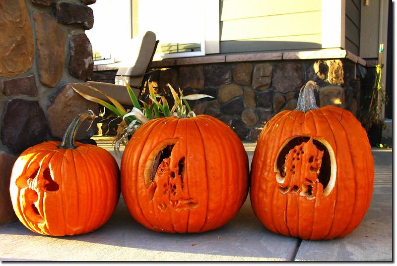
南瓜燈的由來,與愛爾蘭的一個傳說有關。相傳古時候有個人名叫 Jack,一天到晚喝醉酒。有一天大概又喝醉了,竟然將撒旦哄到樹上,又叫撒旦在樹上刻了一個十字架,結果撒旦被困在樹上下不來。後來Jack 就跟撒旦談條件,如果撒旦能保證他死後不會進地獄,就會把撒旦弄下來,撒旦果真答應。然而他不入地獄,卻也進不了天堂,只好在黑暗世界中不停地遊蕩。撒旦給他一個大頭菜挖空做成的燈籠,裡面放著炭火,讓他在黑暗的世界中能夠找到路。

這種燈籠稱為 Jack-o-Lantern,愛爾蘭人在慶祝萬聖節時,都會提這種燈籠。本來是用大頭菜 (turnip )做的,後來愛爾蘭人移民到美國之後,發現用南瓜來雕刻更加容易,所以大頭菜燈就變成了南瓜燈。

Pumpkin field 1

pumpkin 5

Halloween in U.S.A.9

Jack-O'-Lantern 2

Jack-O'-Lantern 9

Halloween 5


至於 Halloween 這個字的意思,是從 All Hallows Eve (Hallows 指聖人 )而來,即指 十 一月一日 諸聖節的前一天晚上。(聯合報,2002/10/2838版)

現在一般講的(Halloween)其實是萬聖節的前一天1031日晚上,較貼切的說法應是萬聖夜。

萬聖夜英文稱之「Halloween」,為「All Hallow Eve」的縮寫,是指萬聖節All Hallow's Day)的前夜,類似於聖誕夜被稱為「Christmas Eve」。「Hallow」來源於中古英語halwen,與holy詞源很接近,在蘇格蘭和加拿大的某些區域,萬聖節仍然被稱為「All Hallow Mas」,意思是在紀念所有的聖人(Hallow)那一天,要舉行的彌撒儀式(Mass)。


西方國家在萬聖節常見的活動有:

()、房屋、庭園佈置

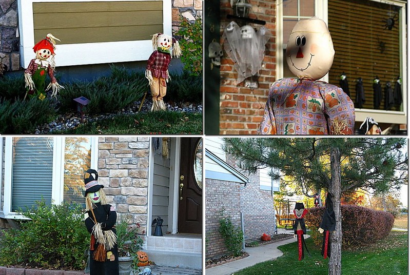
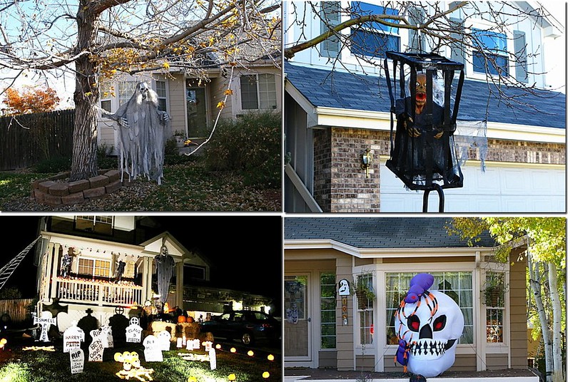
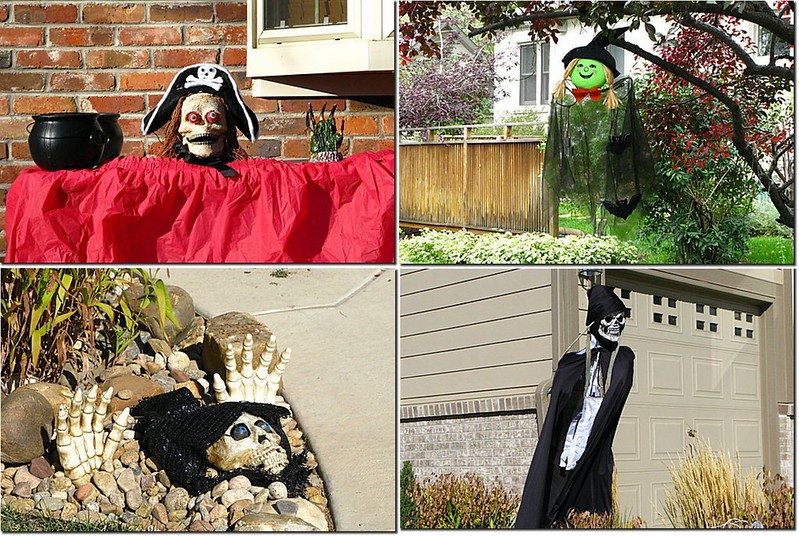
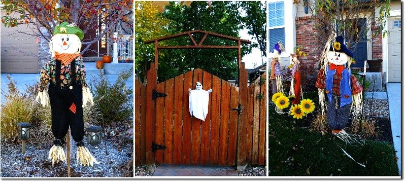
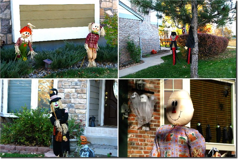
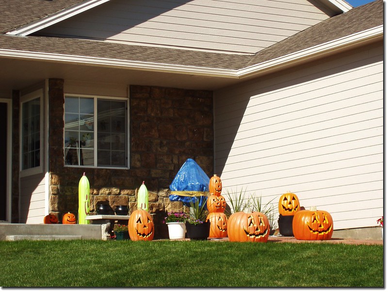
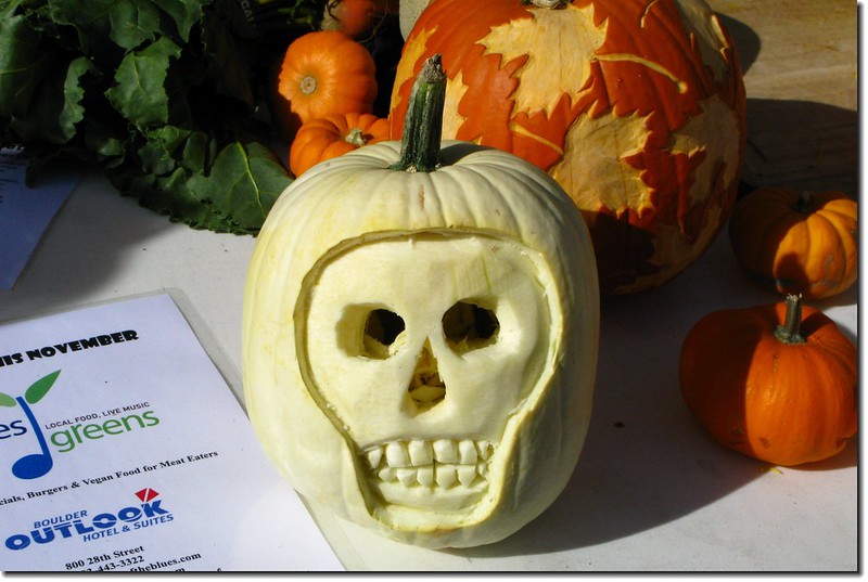
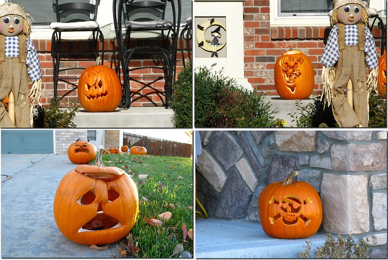
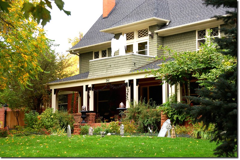
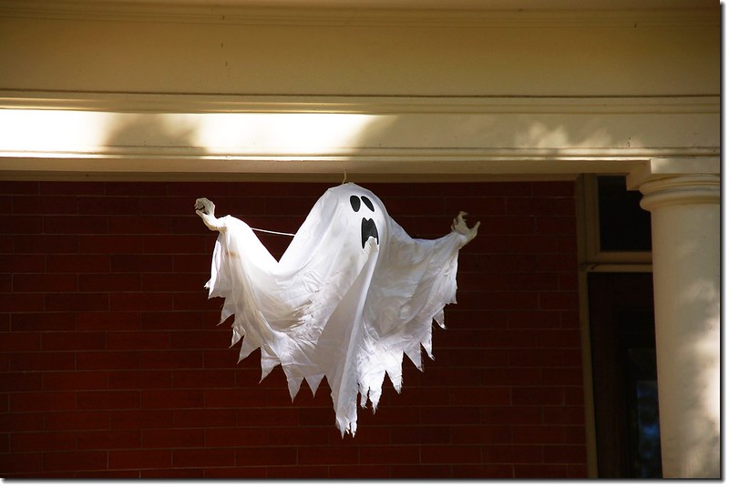
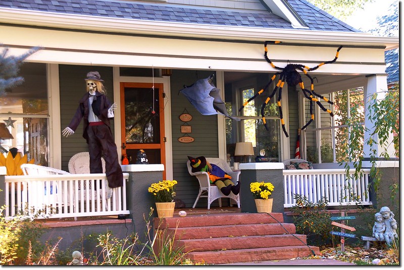
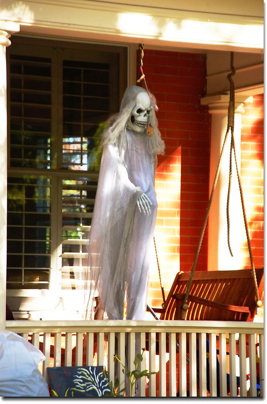
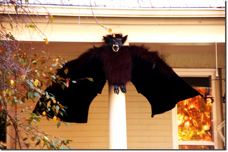
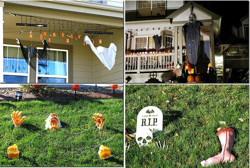
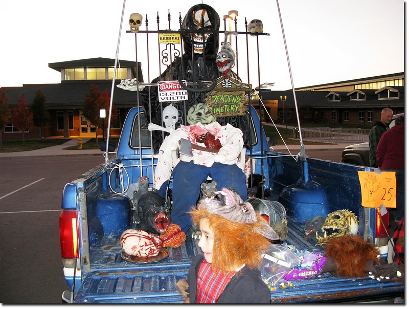
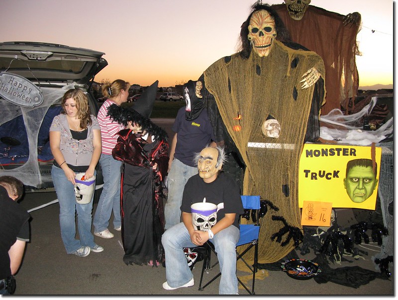
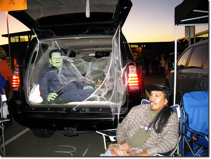
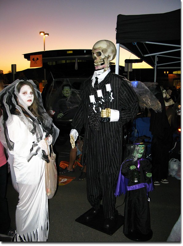
大部份的家庭會在院子裡擺上幾棵南瓜或是和真人一般高的稻草人,並且在窗戶上裝飾小小的南瓜燈或是掛上一副骷髏;有些人也會在前門上方掛些蜘蛛網。更誇張的是將庭院裝置成一座墓園,棺木、墓碑、骷髏一應俱全,這在東方國家看來是不可思議的,但在早期他們的想法是唯有如此才能嚇走鬼魂。愛熱鬧或是有年輕人在家的家庭則會舉辦化妝舞會,或是將家裏裝飾成鬼屋!
Halloween 家庭布置 2

Halloween 家庭布置 4

Halloween in U.S.A.1

Halloween 家庭布置 1

Halloween 家庭布置 3


Halloween 家庭布置 5

Halloween 家庭布置 6

Halloween 3


()、化妝舞會、萬聖節遊行

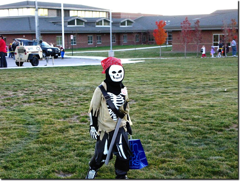
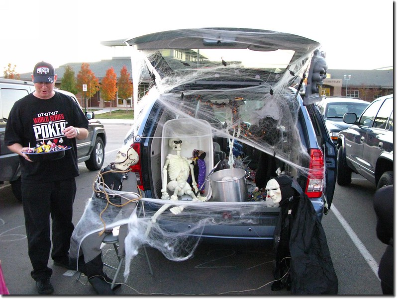
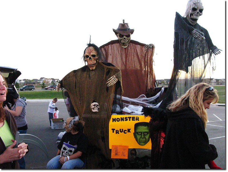
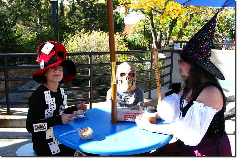
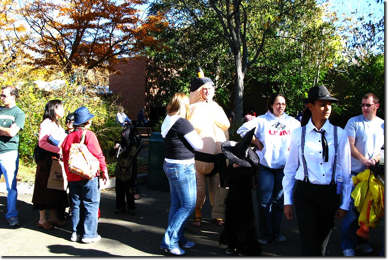
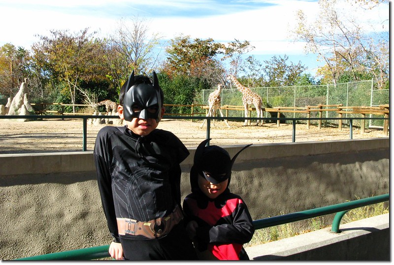
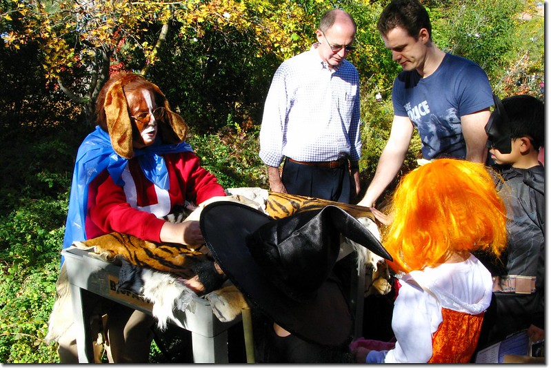
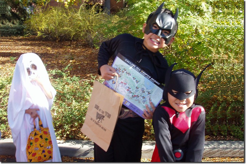
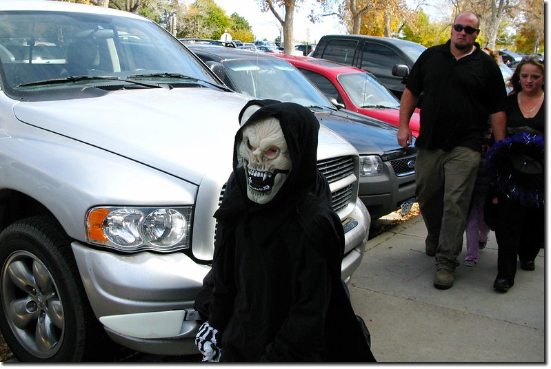
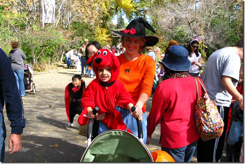
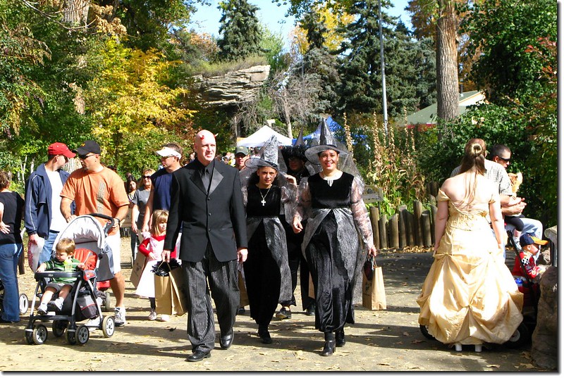
一些主題樂園或機關團體會在萬聖節之前一個星期左右舉辦聚會、遊園會等,大人小孩都化妝參與,小孩則拿著手提袋、南瓜袋等到各攤位大玩「Trick or Treat」領糖果,通常一天下來小孩都是滿載而歸。
2008 trunk or treat halloween 4
2008 trunk or treat halloween 12
2008 trunk or treat halloween 19
2008 trunk or treat halloween 23
2008 trunk or treat halloween 25
2008 trunk or treat halloween 11
2008 trunk or treat halloween 34


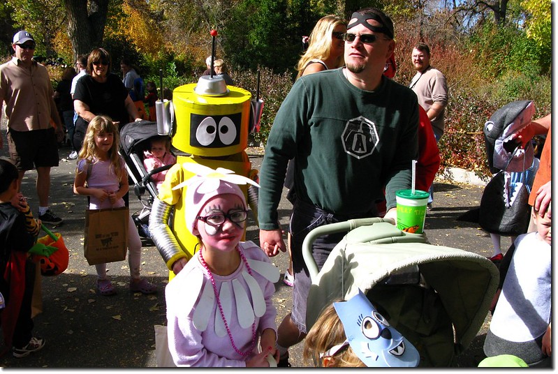
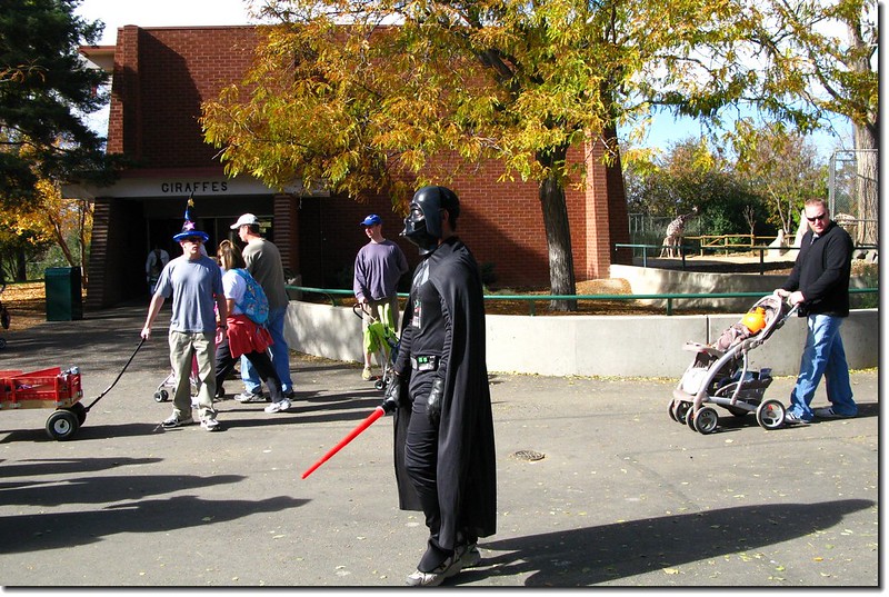
今年(2008)帶著兩個小外孫到丹佛動物園(Denver Zoo)參加由動物園舉辦的“Boo at the Zoo”活動,結果我發覺當天雖然大家都還得買門票進場,但多數是人看人而非看動物。

Halloween party(Denver Zoo) 9

Halloween party(Denver Zoo) 6

Halloween party(Denver Zoo) 5

Halloween party(Denver Zoo) 4

Halloween party(Denver Zoo) 24

Halloween party(Denver Zoo) 23

Halloween party(Denver Zoo) 20Halloween party(Denver Zoo) 21

Halloween party(Denver Zoo) 18

Halloween party(Denver Zoo) 12


()、萬聖夜大玩「Trick or Treat」遊戲


10月31晚上當夜幕降臨,孩子們便迫不及待地穿上化裝服裝,戴上千奇百怪的面具,手中提著南瓜形狀的傑克燈(Jack-O'-Lantern),來到鄰居家門前,威嚇般地喊著"Trick or Treat"(給糖吃,不然就搗蛋 ),當然,大多數人都非常樂於款待這些小客人,最簡單的方式就是給糖果。但近幾年這種習俗變得是孩童的純好玩,而不在乎那些糖果。(因曾發生過有心人以有毒之糖果送給小孩之情事,所以通常很多小孩將糖果帶回家後,謹慎的家長還是把糖果丟掉。人心不古,中外皆然!)

2015/10/28

Mount Sniktau雪地行(2015.10.24)

Me on the summit of Mount Sniktau 1
 Me on the summit of Mount Sniktau 
爬完這座,高山已難爬,積雪太厚了~~
從登山口開始一路在雪地裡攀爬,雪深一度達腰際,大部份達腳踝、小腿,很累~~還好這裡的雪是乾雪,天氣又超好!
攀登山岳Mount Sniktau(海拔13,234 呎/4,034 公尺)
登山口Loveland Pass(海拔11,990呎/3,655公尺)
總爬升高度1,800呎/549公尺
登山里程3.7 哩/5.92公里
登山時間4小時

-----------------------------------------------------------------------------------------------------
Mount Sniktau from I-70 HWY

一週來的連日陰雨綿綿,難得今天的大好晴天,本來計畫到Loveland Pass攀登海拔4,093公尺Grizzly Peak,但因繞道Boulder去拍一些艷日下的楓葉耽誤了不少時間,抵達登山口已經十二點多,決定改爬路程較短的Mount SniktauMount Sniktau是位在Loveland Pass山頂東側北邊的一座山頭,海拔13,234 /4,034 公尺,在科羅拉多眾多高山中排名第448名,因為此山沒有困難的地形,路程短,爬升也不高,所以在融雪之後的季節算是一座適合郊遊健行的大眾化路線,蠻受一般遊客的喜愛。
該山在八年前曾帶豆豆去爬過,當年他年僅八歲,爬到13,152峰時距山頂僅剩0.45哩,但因積雪未化而撤退,今天打算攻頂,只要積雪不要太深!
行車資訊:
由丹佛沿I-70州際公路西行,在Exit 216出口下交流道,然後行駛US-6 W上山,行約4.4哩抵達Loveland Pass山頂停車場,此為登山口,海拔11,990(3,655公尺)

Loveland Pass' summit
Loveland Pass' summitHiking route of Mount Sniktau

 登山路線

步程簡述:
12:20 由公路東側登山口(Loveland Pass)出發上山,積雪蠻多蠻厚的,小心行走。

Up the mountain through the footsteps
Looking up onto Sniktau-Grizzly ridge from Loveland Pass above 1
Looking up onto Sniktau-Grizzly ridge from Loveland Pass above

從登山口到山頂陵線約一哩路,爬升約930(283公尺),也算有點坡度,加上沿路積雪蠻厚的,爬起來有點吃力,四週白茫茫的,若不帶墨鏡眼睛很容易受傷害。
A part of the Continental Divide from above Loveland Pass
Overlooking south onto Arapahoe Basin Ski Area from Loveland Pass above
Overlooking southwest from Loveland Pass above, Quandary, Lincoln et al. 14ers are in the distance
Looking down onto Loveland Pass from Point 12,915' below
Overlooking down the Loveland Pass from Mount Sniktau ridge


13:20 抵稜線Point 12,915’,海拔12,915(3,937公尺),距登山口約一哩(1.6公里)
The 12,915' Point
The 12,915' Point
Me on the 12,915' Point, in the background is the 13,152' Point

往右()循稜線走前往攀登Grizzly Peak,路程較遠,本來今天規畫攀登該山,但因先去Boulder拍楓葉耽誤不少時間,決定爬備案的路程較短的Mount Sniktau
Looking southeast onto Grays, Torreys, Grizzly & Cupit from the 12,915' Point 3-1
Looking southeast onto Grays, Torreys, Grizzly & Cupit from the 12,915' Point

取左稜線北上。

Looking north onto 13,152' Point & Sniktau from the 12,915' Point 1
Looking north onto 13,152' Point & Sniktau from the 12,915' Point

12,915呎高地先下坡到12,800(3,901公尺)左右開始緩坡往13,152呎高地爬升,積雪越來越厚,深達小腿肚,一路踩著之前登山客留下的足跡前進。
The snow is so deep that it reaches up to my leg
Looking back at the 12,915' Point on the way to 13,152' Point


13:50 登抵13,152呎高地(Point 13,152),海拔13,152(4,009公尺)距登山口約1.4(2.24公里)循之前登山客的足跡由西側腰繞而過。
Point 13,152'
Point 13,152'

腰繞過13,152呎高地後便可見到Mount Sniktau的山頭矗立在北方偏東的不遠處,但中間隔著一處落差約150呎的低鞍,必須先下到低鞍處再爬升約240呎左右才能登頂。
Overlooking northeast onto Sniktau's summit from the 13,152 Point
Mount Sniktau's summit as seen from point 13,152'

積雪越來越厚,根據經驗美國的高山山頂幾乎是亂石堆,沒積雪還好,有明顯的路跡可依循,積雪後完全看不出路跡,所以雪下的地形可能暗藏危機,增加不少危險性,還好一路留有之前登山客的足跡,一路依循足跡前進還不至太困難。
14:00 下抵13,152呎高地與Mount Sniktau山頂之間的最低鞍,海拔約13,000(3,962公尺),距登山口約1.6(2.56公里)

Looking back at the 13,152' Point from the saddle between Sniktau & 13,152' Point 1
Looking back at the 13,152' Point from the saddle between Sniktau & 13,152' Point (鞍部回望13,152高地)
Snow dimples with Point 13,152' behind it
Snow dimples with Torreys Peak behind it
Snow dimples with Torreys Peak behind it(凸出山頭是距此三哩多、海拔4,349公尺的Torreys Peak)
The final push to the summit of Sniktau from the saddle at 13,002' on the Southwest Ridge 2
The final push to the summit of Sniktau from the saddle at 13,002' on the Southwest Ridge (鞍部北望Sniktau山頂)


接下來要爬升約近三百呎(91公尺)
Mount Sniktau東面坡是從稜線即垂直下切的懸崖峭壁,西面坡雖然也很陡,但陡坡面與稜線之間尚有一段蠻安全的斜坡,由於積雪很厚,無法判斷積雪底下的地形,所以登山客都將行進路線盡量往下移,遠離稜線以策安全,我很想上到稜線看看稜線下的風光,但最終還是不敢越雷池一步,深怕一步踩空掉到懸崖下去,還是乖乖的跟著足跡前進。

Looking southeast onto Torreys, Grizzly, Cupit & 13,152 Point from Sniktau's summit down below 3
Looking southeast onto Torreys, Grizzly, Cupit & 13,152 Point from Sniktau's summit down below
Looking southwest from the summit of Mount Sniktau down below 1
Looking southwest from the summit of Mount Sniktau down below


14:20 終於登上Mount Sniktau山頂,積雪已將山頂上兩座石頭堆砌的避風角覆蓋住,可想而知積雪有多厚,剛才一度下陷到腰際,所以在雪地裡走路還真需步步小心呢!
Me on the summit of Mount Sniktau 2
Me on the summit of Mount Sniktau

Mount Sniktau標高13,234 (4,034 公尺),登山口到此約1.85(2.96公里);今天是一個禮拜以來難得的好天氣,萬里無雲,陽光普照,山頂風勢也不大,溫度應有四十幾度(華氏)以上,遠眺四週的白茫茫的山景甚為壯觀!
A 180° Panorama from the summit of Mount Sniktau(southwest to northeast) 1
A 180° Panorama from the summit of Mount Sniktau(southwest to northeast)

東邊俯瞰I-70州際公路;每每從I-70州際公路經過總是仰望這座山型不錯的高山,今天總算能站在這山頂上俯瞰那常走的I-70州際公路了。
After seeing Mt. Sniktau countless times from Interstate 70, I could finally look down at the upper Clear Creek valley and Interstate 70 from the summit.

東南邊遠眺Mount Evans, Grays & Torreys Peaks等三座14ers,南邊則是另一座本來今天要攀登的13ers~Grizzly Peak以及整個稜線。
Looking northeast to south from the summit of Mount Sniktau
Looking southeast from the summit of Mount Sniktau 1-1
Looking southeast from the summit of Mount Sniktau
Grays, Torreys, & Grizzly Peaks as seen from the summit of Mount Sniktau 3
Grays, Torreys, & Grizzly Peaks as seen from the summit of Mount Sniktau
The ridge that connects Sniktau & Grizzly from the summit of Mount Sniktau
Point 13,152' as seen from the summit of Mount Sniktau


西南邊一直到西邊近處可俯瞰Loveland Pass, I-70州際公路及艾森豪隧道(Eisenhower Tunnels),遠處則可遠眺Quandary PeakMount Lincoln等好幾座14ers
Overlooking down onto Eisenhower Tunnels from the summit of Mount Sniktau 1
Overlooking down onto Eisenhower Tunnels from the summit of Mount Sniktau
Looking southwest from the summit of Mount Sniktau 1-1
Looking southwest from the summit of Mount Sniktau

北邊則是綿延千里的落磯山脈大陸分水嶺數不清的高山,尤其是這兩個禮拜攀登的四座山頭Pettingell, Woods, ParnassusBard就在眼前,還好早一步攀登,現在去就難了,沒雪地登山配備~~
Looking northeast onto Woods, Parnassus & Bard Peak from the summit of Mount Sniktau 1-1
Looking northeast onto Woods, Parnassus & Bard Peak from the summit of Mount Sniktau
Looking north from the summit of Mount Sniktau 4-1
Looking north from the summit of Mount Sniktau
Mount Parnassus & Bard Peak as seen from the summit of Mount Sniktau
Mount Parnassus(L) & Bard Peak(R) as seen from the summit of Mount Sniktau

14:43 賞完景後循原路下山。
15:03 下底最低鞍,往13,152’高地上攀。
15:15 登上13,152呎高地,此次不腰繞直攻山頂賞景。

Me on the Point 13,152'
Overlooking southwest from the 13,152' Point, Quandary, Lincoln et al. 14ers are in the distance
Looking southeast onto Grays, Torreys & Grizzly Peak from the 13,152' Point


15:25 13,152高地下撤,先下一小段蠻陡又有點難走的亂石坡後續沿雪地往12,915高地移動。
15:45 返抵12,915呎高地,取右沿原路下山。

Hikers on their way down the mountain

16:20 返抵登山口,來回共四個小時,若沒積雪此山應可在三個半小時內完成。