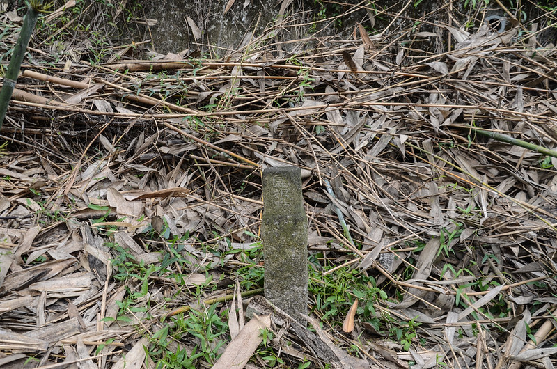
三疊溪冠字倉(07)土地調查局圖根點(Elev. 30 m)
造訪基石:
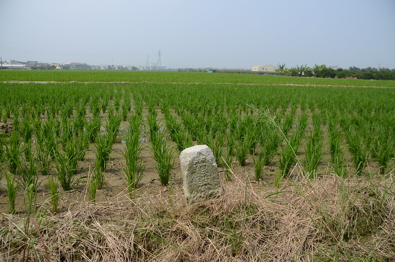
三疊溪:位在嘉義縣大林鎮,標高30公尺,立有一顆冠字倉(07)的土地調查局圖根點,座標192021 2609793。
大林陸橋:位於嘉義縣大林鎮,標高26尺,立有一顆編號陸檢第1666號的陸檢一等水準點,座標192234 2609566。
內林:位在嘉義縣大林鎮,標高40公尺,立有一顆冠字本(14)的土地調查局圖根點,座標195777 2613320。
下林頭:位在嘉義縣大林鎮,標高52公尺,立有一顆編號276號的三等三角點,座標198314 2613220。
過溪:位在嘉義縣大林鎮,標高51公尺,立有一顆冠字本(09)的土地調查局圖根點,座標197609 2611963。
崎頭:位在嘉義縣大林鎮,標高73公尺,立有一顆冠字本(07)的土地調查局圖根點,座標199540 2611064。
員埔洋:位在嘉義縣大林鎮,標高43公尺,立有一顆冠字本(11)的土地調查局圖根點,座標196559 2609916。
--------------------------------------------------------------------------------------------------------
三疊溪:位在嘉義縣大林鎮,標高30公尺,立有一顆冠字倉(07)的土地調查局圖根點,座標192021 2609793。
行車資訊:
國道1號北上,在250大林下交流道後右轉行150公尺隨即再右轉繼續走162縣道東南行,1.2公里後右轉台1線,台1線南行1.6公里後於大林陸橋前右轉嘉92鄉道,岔路口有一座”集元宮”;
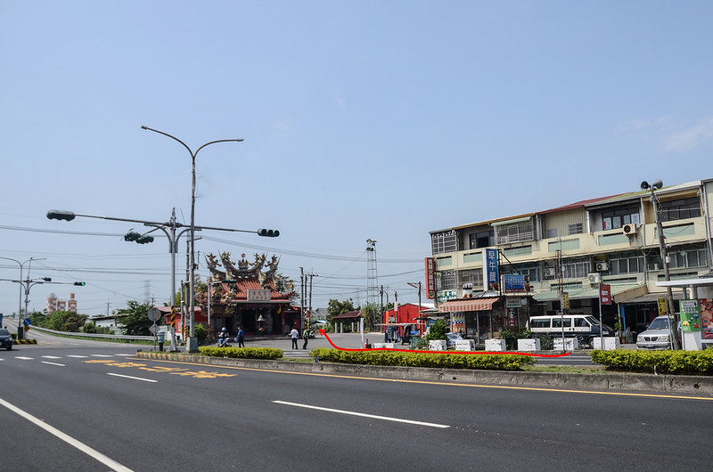
台1線三疊溪岔
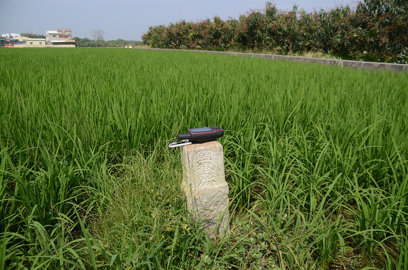
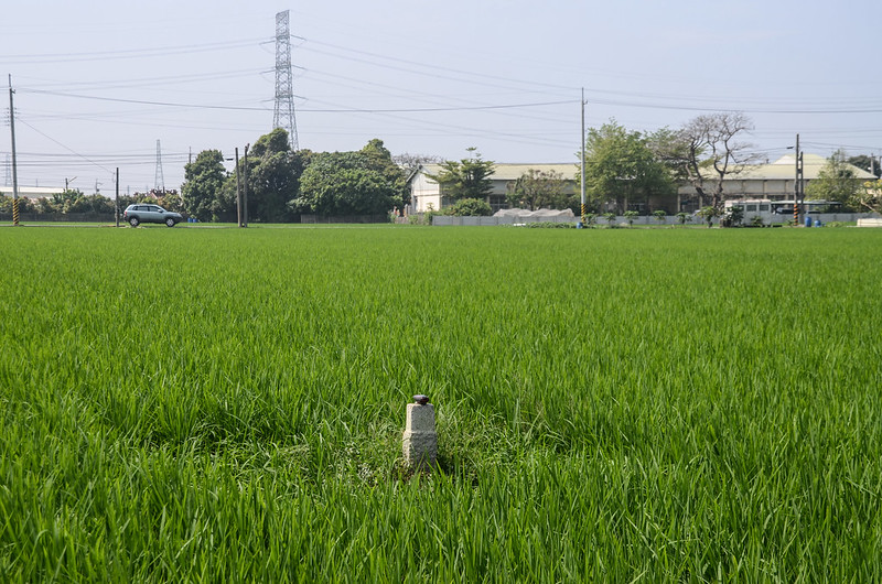
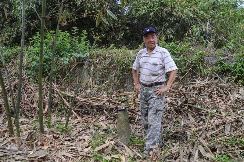
嘉92鄉道行約450公尺後再右轉田間水泥路,行約250公尺停車於”大林15分6"電線桿旁,座標192006 2609690,海拔29公尺;三疊溪圖根點在路右(北)水稻田中。

三疊溪圖根點點位
台1線三疊溪岔
嘉92鄉道行約450公尺後再右轉田間水泥路,行約250公尺停車於”大林15分6"電線桿旁,座標192006 2609690,海拔29公尺;三疊溪圖根點在路右(北)水稻田中。
三疊溪圖根點點位
步程簡述:
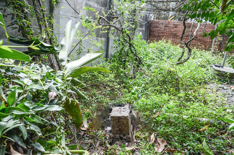
由”大林15分6"電線桿東邊田埂北行110公尺後左轉小水排再行5公尺,然後左入稻田約7公尺處即見到三疊溪圖根點立於水田中。
三疊溪冠字倉(07)土地調查局圖根點(Elev. 30 m)

三疊溪冠字倉(07)土地調查局圖根點(Elev. 30 m)
三疊溪冠字倉(07)土地調查局圖根點(Elev. 30 m)
三疊溪冠字倉(07)土地調查局圖根點(Elev. 30 m)
--------------------------------------------------------------------------------------------------------
大林陸橋:位於嘉義縣大林鎮,標高26尺,立有一顆編號陸檢第1666號的陸檢一等水準點,座標192234 2609566。
行車資訊:
由三疊溪回頭東行250公尺後右轉再行100公尺後左轉,60公尺停車,再前行為三疊溪平交道,僅機車及行人能通行。
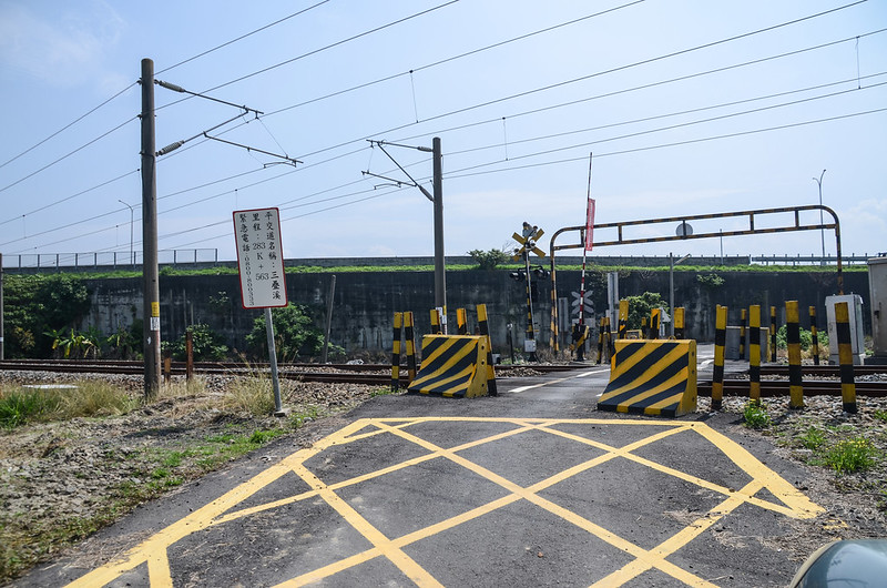
三疊溪平交道
三疊溪平交道
步程簡述:
過鐵路平交道走10公尺路左即見到大林陸橋陸檢第1666號一等水準點,明顯好找。
大林陸橋陸檢一等水準點(# 陸檢1666 Elev. 26 m)

大林陸橋陸檢一等水準點(# 陸檢1666 Elev. 26 m)
大林陸橋陸檢一等水準點(# 陸檢1666 Elev. 26 m)
大林陸橋陸檢一等水準點(# 陸檢1666 Elev. 26 m)
--------------------------------------------------------------------------------------------------------
內林:位在嘉義縣大林鎮,標高40公尺,立有一顆冠字本(14)的土地調查局圖根點,座標195777 2613320。
行車資訊:
由大林陸橋循原路往西行61公尺後於嘉92鄉道向右轉,北行550公尺後於台1線向左轉北行,台1線北行4.5公里後於台1線里程約249.45K處右轉嘉98鄉道東行,東行900公尺後向左轉,北行260公尺停車,電線桿為“三村20分6”。
停車處內林冠字本(14)土地調查局圖根點點位
停車處內林冠字本(14)土地調查局圖根點點位
步程簡述:
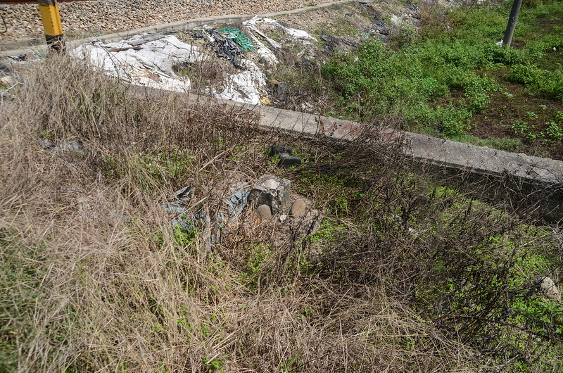
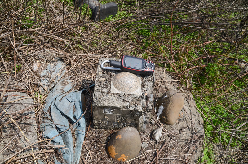
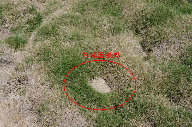
由路左岔路北向入田埂走25公尺抵一門大墳,整個墳墓是又厚又密的韓國草草坪,根本看不到基石,找了好一陣子才幸運的踢到內林圖根點,基石露土不高,整個基石幾乎被韓國草覆蓋住;其相關位置為面對墓碑於墳墓的右後方(東南),距磚砌香爐旁小石獅子約20公尺,距南邊的稻田約5公尺。

內林冠字本(14)土地調查局圖根點點位
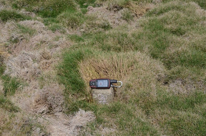
內林冠字本(14)土地調查局圖根點(Elev. 40 m)
內林冠字本(14)土地調查局圖根點點位
內林冠字本(14)土地調查局圖根點(Elev. 40 m)
--------------------------------------------------------------------------------------------------------
下林頭:位在嘉義縣大林鎮,標高52公尺,立有一顆編號276號的三等三角點,座標198314 2613220。
行車資訊:
由內林停車處續往東北行約330公尺”T”字路取右行,560公尺後岔路取左北行,北行110公尺後向右轉東行,250公尺後於嘉100鄉道向右轉,60公尺後隨即左轉繼續沿嘉100鄉道東行,行約1.1公里後於嘉97鄉道向右轉東南行,再行500公尺後停車於“石寮11A”電線桿旁,座標198318 2613210,海拔56公尺。
步程簡述:
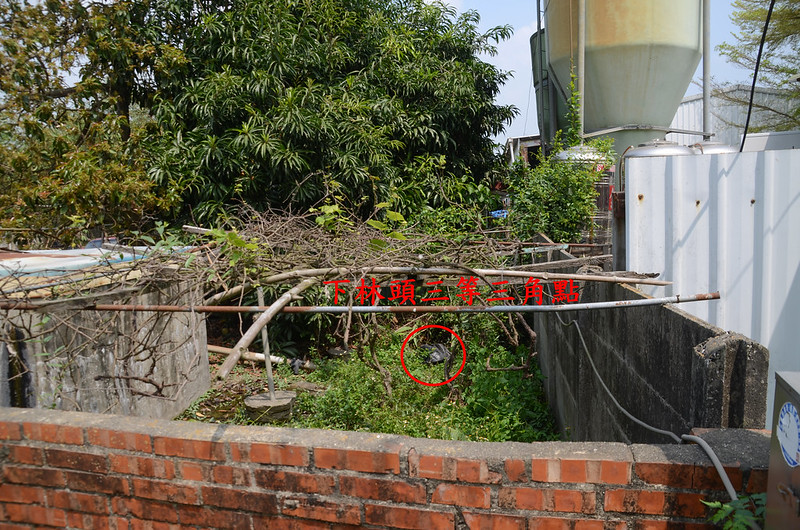
停車處北邊東側是一間蠻大的鐵皮廠房(早期可能是養雞場),西側是一間紅磚圍牆民宅,紅磚牆上有三角點噴漆,下林頭三等三角點位在圍牆內民宅與廠房水泥圍牆邊,東側廠房有兩座大型養雞場料塔,基石西南邊兩三公尺處是一座方形水泥蓄水槽,基石用一黑色塑膠布罩住。
下林頭三等三角點點位
下林頭三等三角點點位
繞道由民宅西邊大門進入;

下林頭三等三角點點位民宅
家犬狂吠,跟屋主(看似四十多歲男子,個子不大)說明來意,屋主說沒見過,要我自己去找,雖顯得不耐還好沒刁難我,我繞到民宅東南角掀開塑膠布,拍照後向屋主道謝後離開。

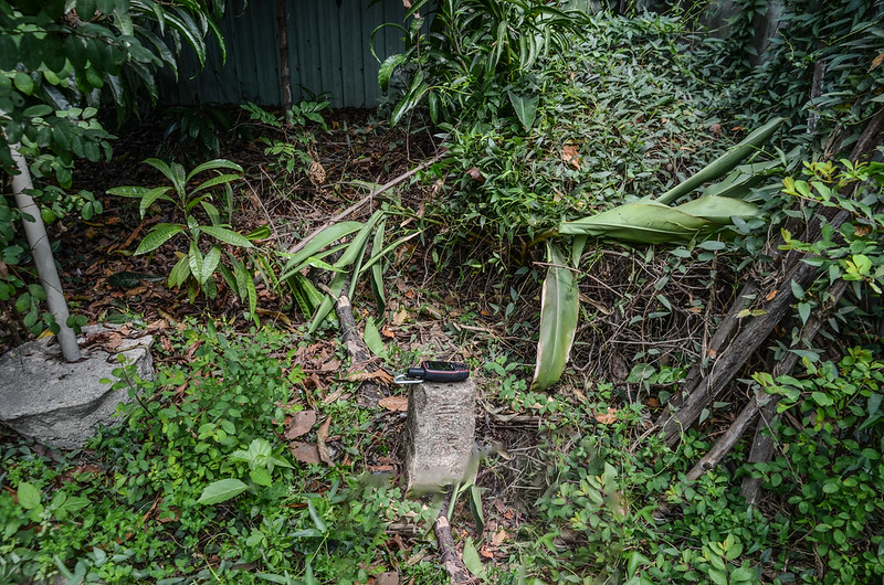
下林頭三等三角點(# 276 Elev. 52 m)

下林頭三等三角點(# 276 Elev. 52 m)
下林頭三等三角點點位民宅
家犬狂吠,跟屋主(看似四十多歲男子,個子不大)說明來意,屋主說沒見過,要我自己去找,雖顯得不耐還好沒刁難我,我繞到民宅東南角掀開塑膠布,拍照後向屋主道謝後離開。
下林頭三等三角點(# 276 Elev. 52 m)
下林頭三等三角點(# 276 Elev. 52 m)
--------------------------------------------------------------------------------------------------------
過溪:位在嘉義縣大林鎮,標高51公尺,立有一顆冠字本(09)的土地調查局圖根點,座標197609 2611963。
行車資訊:
由下林頭停車處往東南行150公尺後向右轉,繼續沿嘉97鄉道前進,沿主線道行約1.8公里後於內林活動中心前”T”字路左轉嘉98鄉道,40公尺隨即再左轉東南行,行約630公尺後右轉田間小路,100公尺後停車,座標197594 2612006,海拔52公尺。
步程簡述:
由停車處南邊稻田與香蕉園間田埂南行約45公尺即見到過溪圖根點立在田埂上,明顯好找。
過溪圖根點點位

過溪冠字本(09)土地調查局圖根點(Elev. 51 m)
過溪圖根點點位
過溪冠字本(09)土地調查局圖根點(Elev. 51 m)
--------------------------------------------------------------------------------------------------------
崎頭:位在嘉義縣大林鎮,標高73公尺,立有一顆冠字本(07)的土地調查局圖根點,座標199540 2611064。
行車資訊:
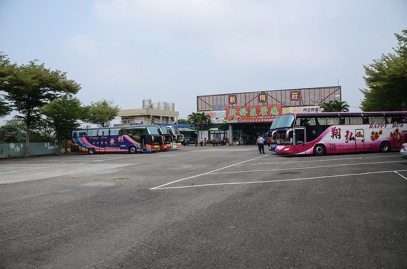
由過溪回行100公尺右轉嘉98鄉道東南行,行約750公尺後於中興路二段/162縣道向左轉,東行約1.5公里停車於路左新梅莊餐廳停車場內(車子亦可經由餐廳、廚房前朝西開到基點旁)。

崎頭圖根點點位所在新梅莊餐廳
崎頭圖根點點位所在新梅莊餐廳
步程簡述:
由新梅莊餐廳停車場朝西北前行,直線距離約150公尺處水泥地西北角一根電線桿下即是崎頭圖根點點位,此點應有位移過。
崎頭圖根點點位所在新梅莊餐廳

崎頭圖根點點位
崎頭冠字本(07)土地調查局圖根點(Elev. 73 m)
崎頭冠字本(07)土地調查局圖根點(Elev. 73 m)
崎頭圖根點點位所在新梅莊餐廳
崎頭圖根點點位
崎頭冠字本(07)土地調查局圖根點(Elev. 73 m)
崎頭冠字本(07)土地調查局圖根點(Elev. 73 m)
--------------------------------------------------------------------------------------------------------
員埔洋:位在嘉義縣大林鎮,標高43公尺,立有一顆冠字本(11)的土地調查局圖根點,座標196559 2609916。
行車資訊:
由新梅莊餐廳停車場崎頭停車處回頭沿162縣道西行1.8公里後左轉嘉102鄉道西南行,再行約1.8公里後遇T字路向左轉,220公尺後於竹林前右轉沿竹林邊南行,行約70公尺遇岔路靠右行駛,150公尺後岔路取左南行170公尺後停車。
步程簡述:
員埔洋圖根點剛好就在二條夾角的竹林內,點位正在“麻園48分22”電線桿下方,基石露土頗高明顯好找,竹林地面比馬路低約1公尺。

員埔圖根點點位

員埔洋冠字本(11)土地調查局圖根點(Elev. 43 m)
員埔圖根點點位
員埔洋冠字本(11)土地調查局圖根點(Elev. 43 m)