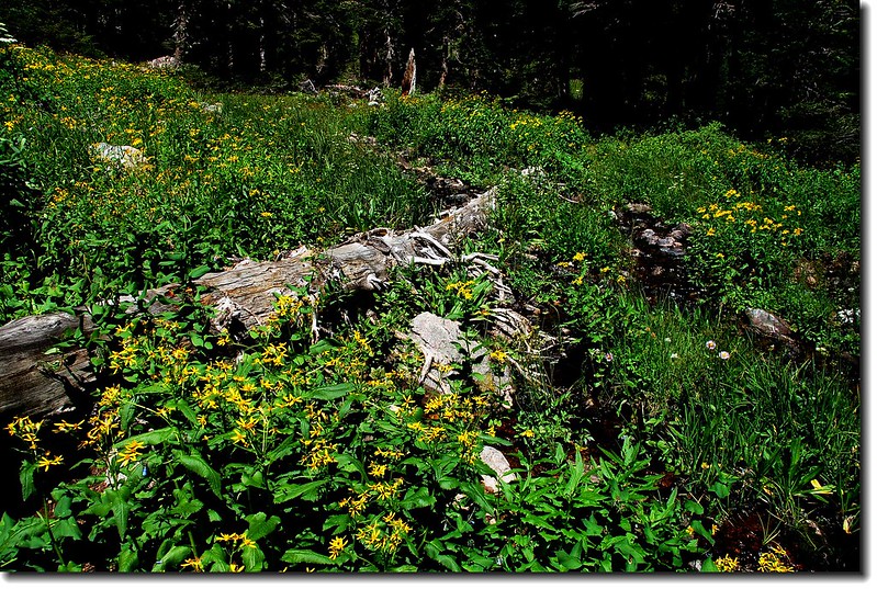
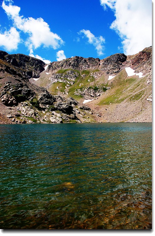
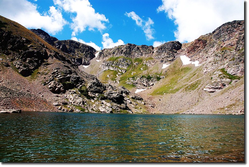
South Crater Lake
Crater Lakes位在James Peak Wilderness範圍內,是一處五個高山湖構成的登山景點,登山口在Rollinsville西邊約7.5哩處屬於Union Pacific Railroad火車隧道東入口(Moffat Tunnel)的East Portal Trailhead。Crater Lakes五個湖的分佈可分為上、中、下三層,最下層一個湖位在中層南、北兩湖出水口下方,因為較偏遠,且路徑陡峭較少人前往;中層有兩個湖,因分處南、北兩方位,故稱為南湖(South Crater Lake)跟北湖(North Crater Lake),這兩湖是一般遊客必到的地方,而一般所稱的Crater Lakes大概就是指這兒,北湖四周的森林空地是非常理想的露營營地;最上層距中層雖只約0.5哩,但因爬昇甚高、路徑陡峭,所以也較少人攀登,最上層也有兩個湖略呈東西向排列,登上此地不但居高臨下,而且沿途有盛開野花依偎小瀑流水,攀登Crater Lakes而不到此兩湖一遊實為可惜。
Crater Lakes Trail來回約6.1哩(若登上Upper Crater Lakes則需約7.1哩),由登山口的海拔9,220呎爬升到North Crater Lake的10,600呎,爬升約1,400呎(若到Upper Crater Lakes則約爬昇1,700呎),由於步道有三分之二都在森林間穿行的寬敞步道,所以是一老少咸宜的登山步道。
----------------------------------------------------------------------------------------------------------------------------
登山口: 從 Boulder走Boulder Canyon Road(CO 119)西行,16哩後抵Nederland小鎮,接Peak To Peak景觀公路(CO 119, CO 72)南下,行4.8哩抵Rollinsville,右轉E. Portal road (Rollins Pass)西行,約7.5哩後行車終點(Moffat Tunnel)即為登山口,此處是Union Pacific Railroad火車隧道的東入口。
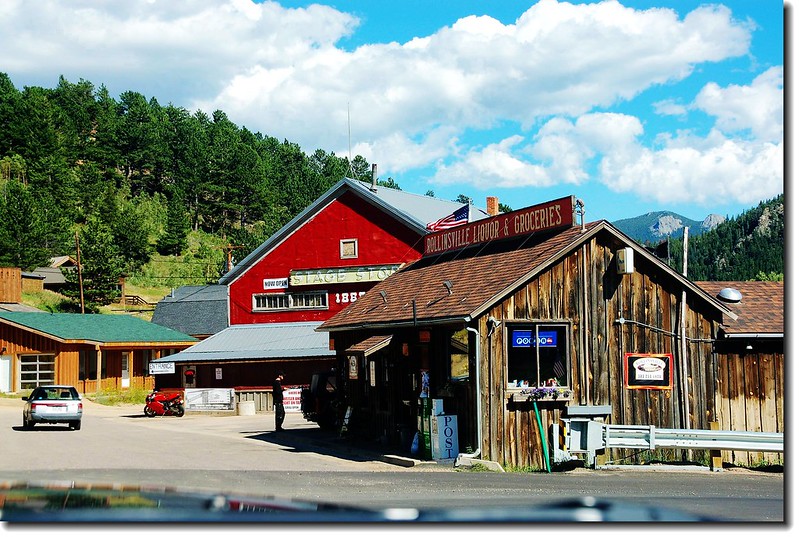
Town of Rollinsville
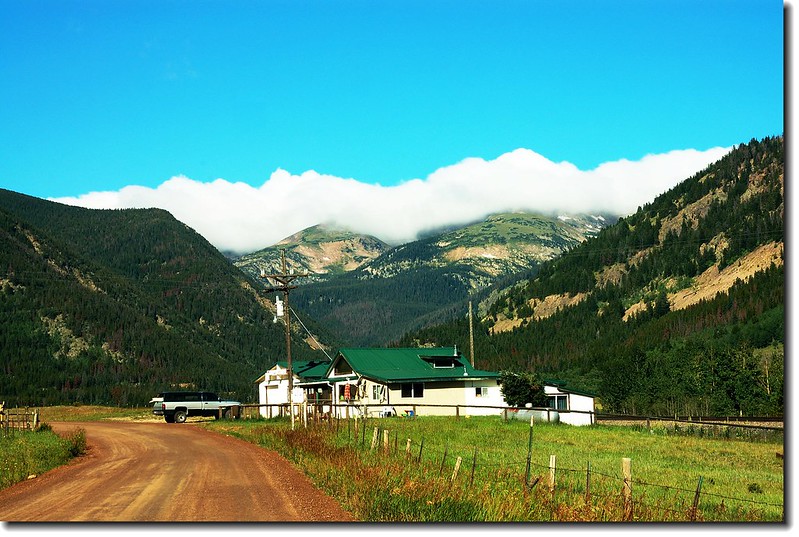
E. Portal road (Rollins Pass)
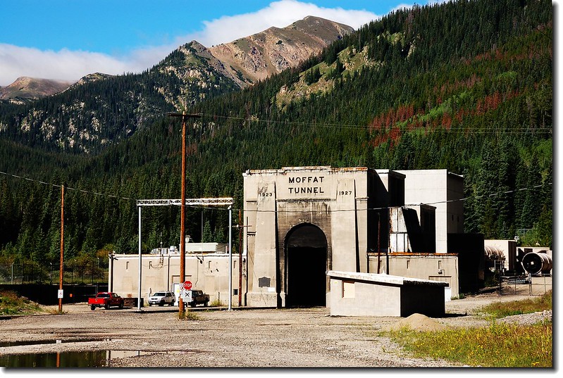
Moffat Tunnel(Union Pacific Railroad)
----------------------------------------------------------------------------------------------------------------------------
我的登山行程:
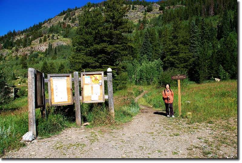
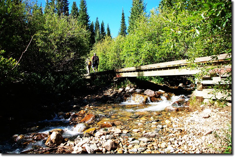
09:45 從East Portal Trailhead(海拔約9,220呎)停車場由隧道(Moffat Tunnel)右側循South Boulder Creek Trail的指示牌沿步道前進;
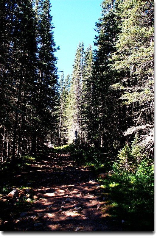
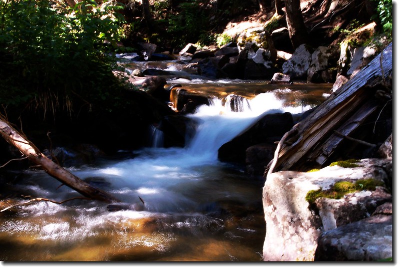
注意勿侵入旁邊的私人土地,步道朝西北越過隧道上方後略朝西前進,除一小段狹小步道外即進入寬敞的舊車道。步道沿著South Boulder Creek西進,沿途夾雜著雲杉、冷杉、白楊木和草原,流水聲伴著野花香,加上走在林間的寬敞步道上,難得太座輕鬆的說--So easy!
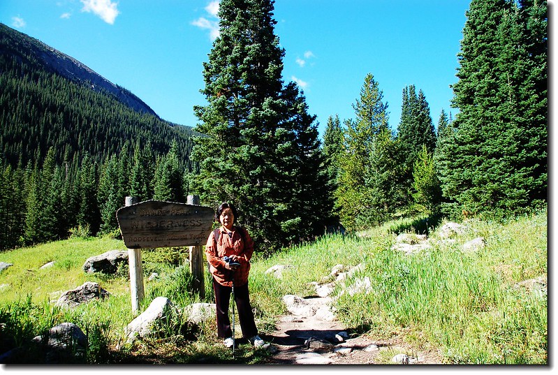
09:55 經過James Peak Wilderness 界碑(木牌告示)(距登山口約0.25 哩 )。
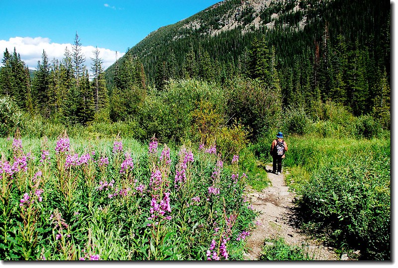
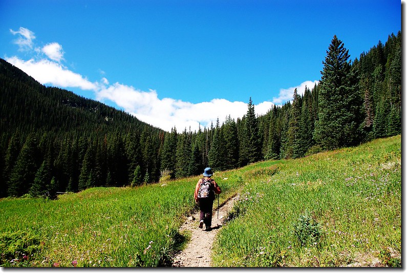
10:25 來到一寬敞的開闊草原地。
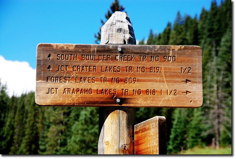
10:27 抵達Arapaho Lakes 、Forest Lakes Trail 岔路(距登山口約1.25 哩,海拔約9,555呎),右往Arapaho Lakes 、Forest Lakes,左往South Boulder Creek TR、Crater Lakes TR,取左直行。
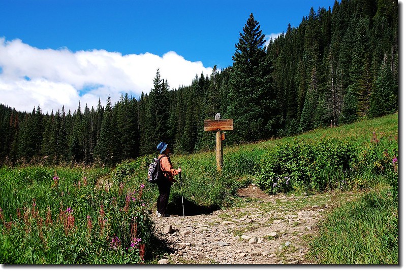
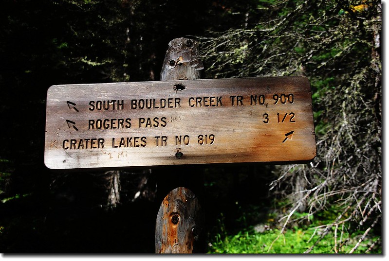
11:00 抵達Crater Lakes Trail 岔路(距登山口約1.95 哩,海拔約9,930呎),左往South Boulder Creek TR、Rogers Pass,右往Crater Lakes,取右在森林中盤昇;
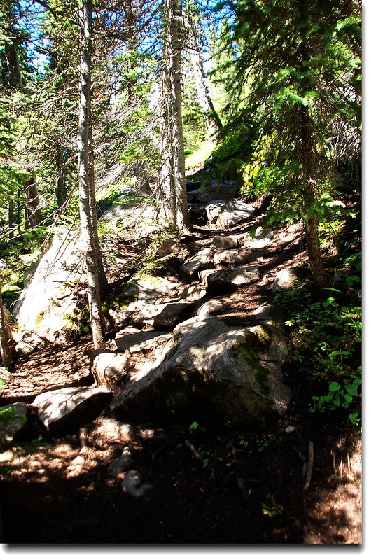
此後步道轉為較陡峭,偶有大岩石、難走地形,如此路段大約有0.7哩,直到稜線平緩地形。
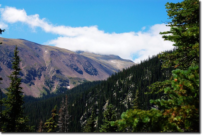
Mountain view from the trail
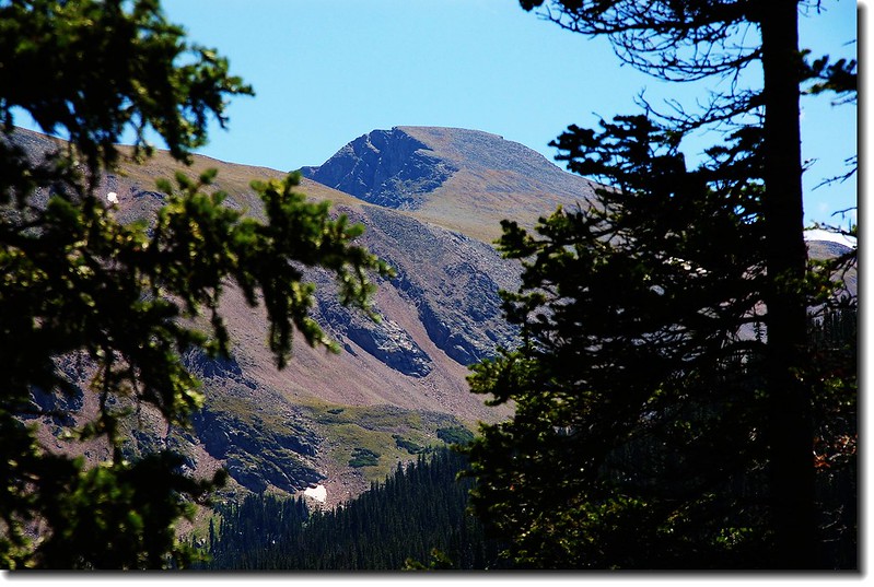
James Peak from the trail
11:45 越過稜線緩下坡。
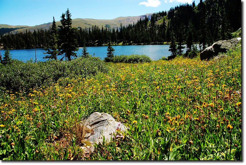
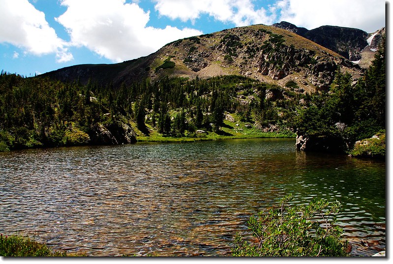
11:50 抵達Crater Lakes南湖出水口(距登山口約2.85 哩,海拔約10,543呎) 。
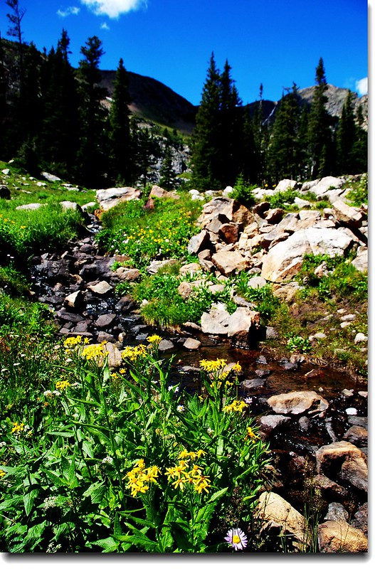
South Crater Lake outlet
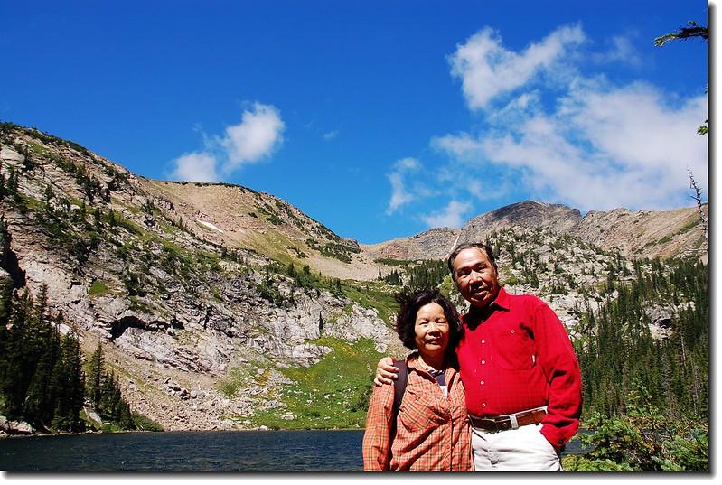
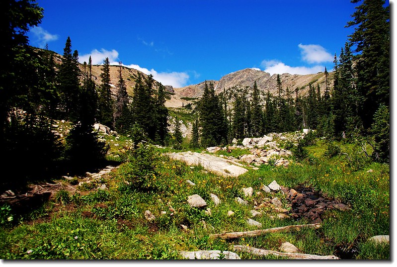
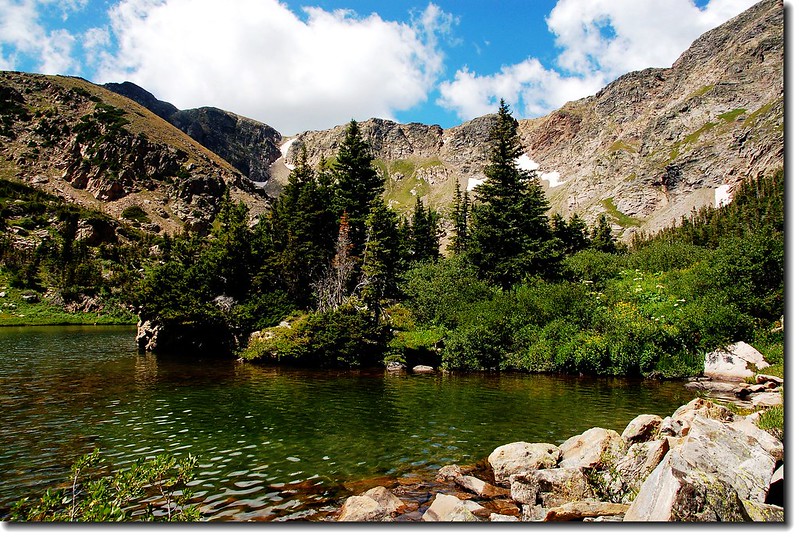
11:57 抵達South Crater Lake (距登山口約3.00 哩,海拔約10,575呎)。
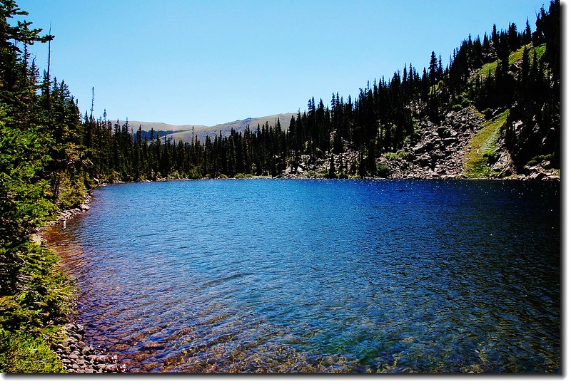
South Crater Lakes
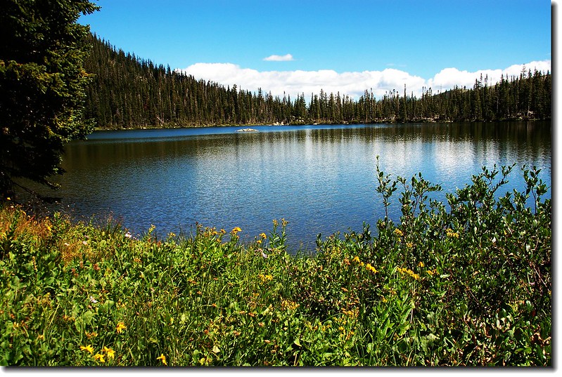
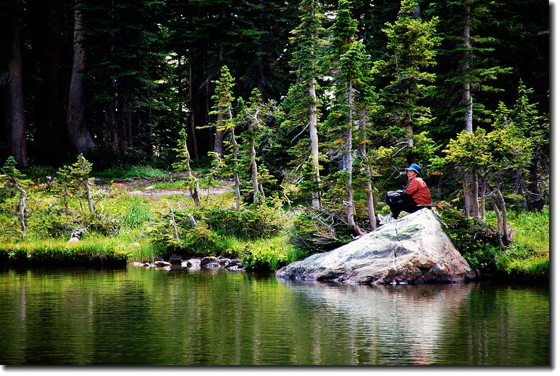
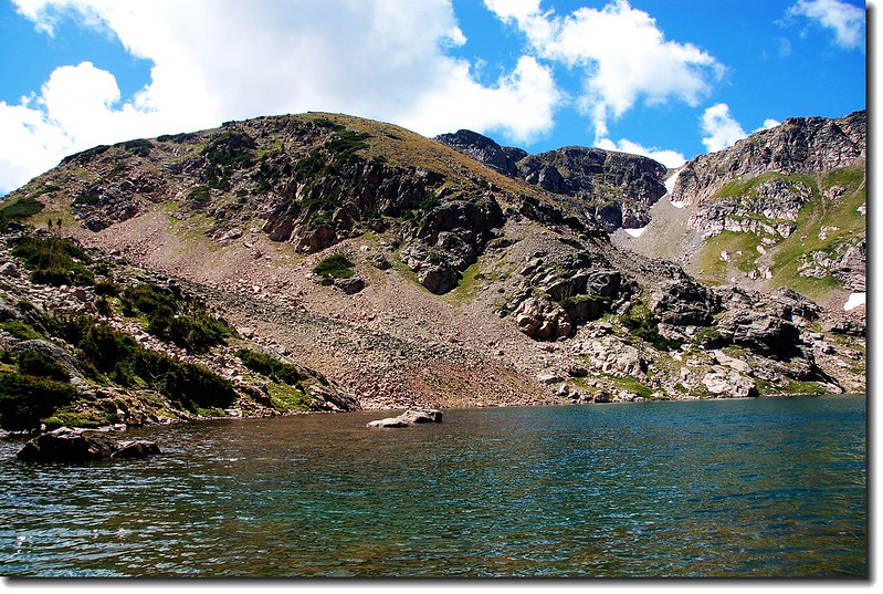
12:09 由South Crater Lake 北岸越過一小段步道即抵達North Crater Lake (距登山口約3.05 哩,海拔約10,600呎),North Crater Lake是此處最大的一座湖,四周有多處營地,湖邊多人在垂釣。
12:30 前往Upper Crater Lake,太座不願前往,在North Crater Lake等候。
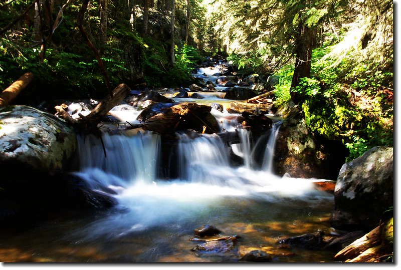
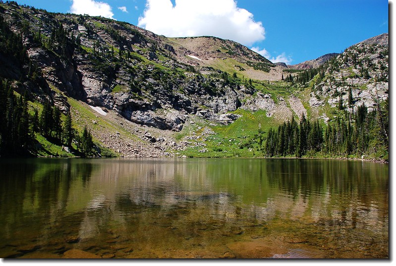
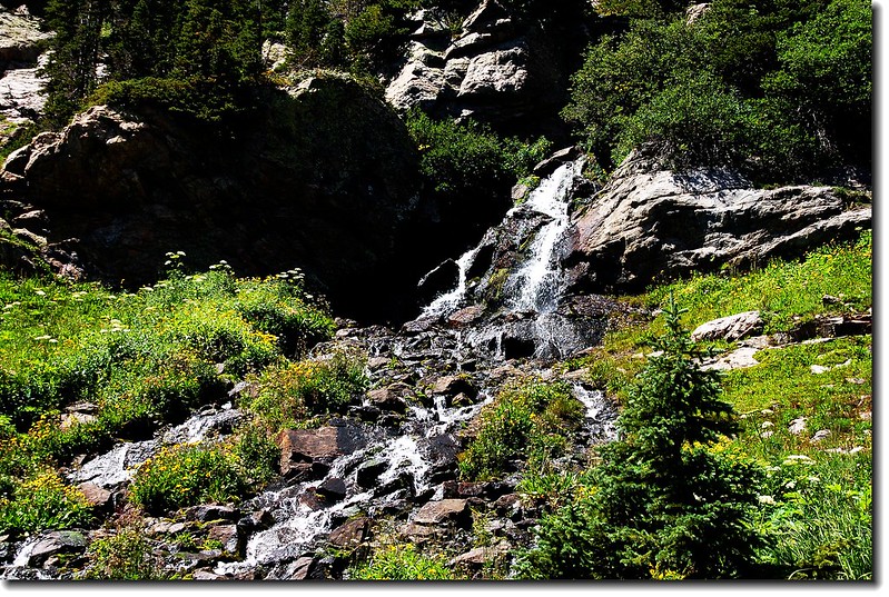
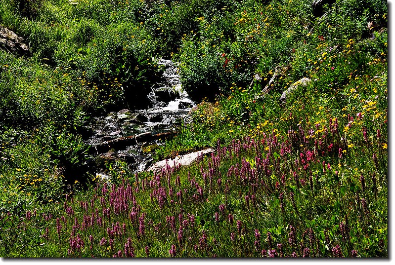
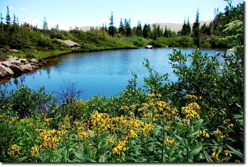
Upper Crater Lake登山步道沿著North Crater Lake西北岸行不久即上切,陡峭難行,幸有沿途野花伴著潺潺流水,偶見白絹似流瀑,分散不少對疲勞的感覺。
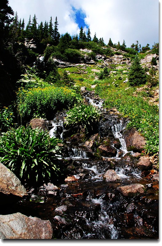
步道越往上升視野越好,俯瞰North Crater Lake和South Crater Lake平躺在森林環抱中。
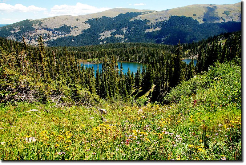
Overlook Crater Lakes from upper Crater Lakes
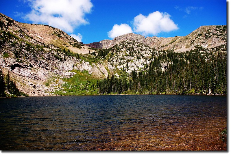
12:55 抵達Upper Crater Lake的第一個湖;
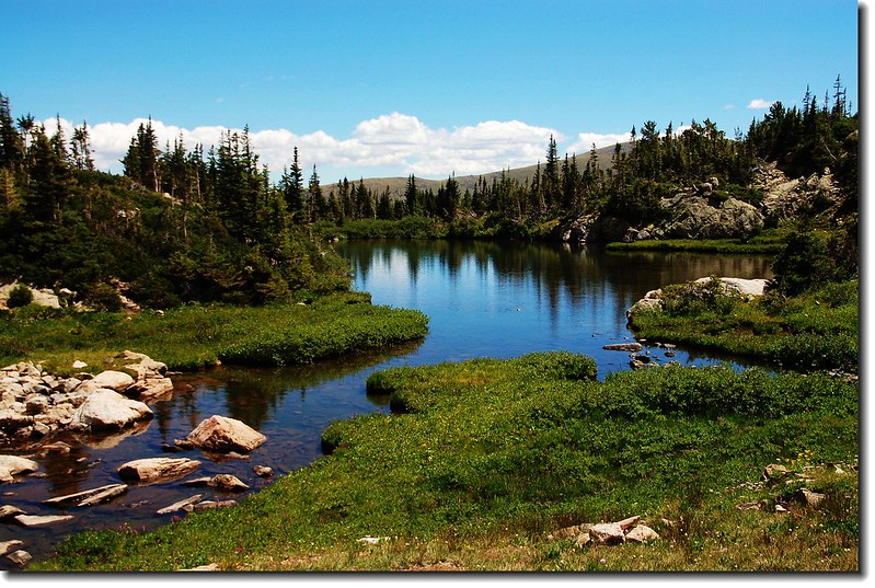
First upper Crater Lake
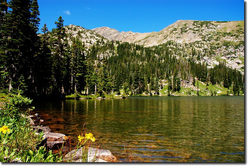
越過第一個湖後於13:00抵達第二個湖,此湖比前者來得大也來得美。
13:10 下山
13:30 回到North Crater Lake偕太座下山,沿途遇到好多登山客,或單人、或成群結伴、或闔家出動上山露營,今天是周末。
15:40回到登山口,開車回家。
沒有留言:
張貼留言