攀登山頭:
三重溪山:位在台南市白河區,標高151公尺,山頂立有一顆冠字福(10)的土地調查局圖根點,座標192457 2579060。
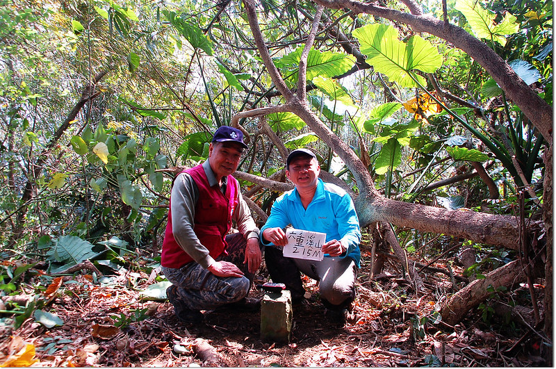
六重溪山:位在台南市白河區、東山區交界處,標高215公尺,山頂立有一顆冠字補黃(05)的台灣省政府圖根補點,座標193957 2578114;原冠字福(09)的圖根點已遺失。
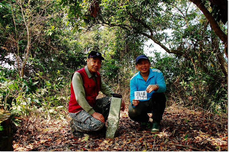
頂埔:位在台南市白河區,標高179公尺,山頂立有一顆編號鑛993號的鑛務課基點,座標194639 2578772。
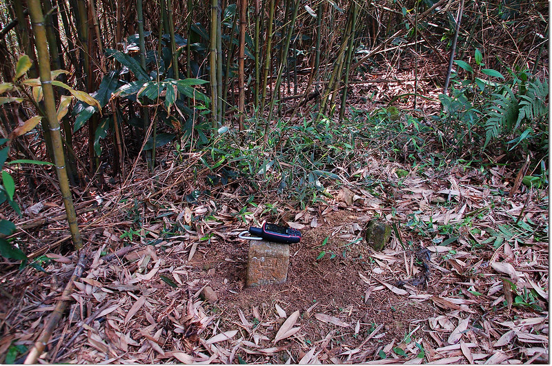
硫黃崎頭山(火坑山):位在台南市白河區,標高396公尺,山頂立有一顆冠字澤(28)的土地調查局圖根點,座標196293 2579678。
黃牛山(大檳榔山):位在台南市白河區,標高657公尺,山頂立有一顆冠字澤(26)的土地調查局圖根點,座標198780 2579963。
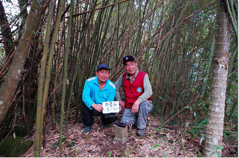
白鷺山:位在台南市白河區,標高513公尺,山頂立有一顆冠字補中(19)的山字森林三角點,座標199256 2581725。
鏡壁山:位在台南市白河區,標高496公尺,山頂立有一顆台灣省政府圖根補點,座標197526 2581876,點位西南方約160公尺山頭原立有一顆編號430號的三等三角點,已遺失不見。
--------------------------------------------------------------------------------------------------------
三重溪山:位在台南市白河區,標高151公尺,山頂立有一顆冠字福(10)的土地調查局圖根點,座標192454 2579059。
行車資訊:
國道3號北上到311白河交流道(172縣道 出口) 下交流道,然後右轉往關仔嶺,500公尺後向右急轉,行約1.0公里後於南97鄉道向左轉,南97鄉道行約1.0公里右岔不取,取左續沿南97鄉道東南行,再行1.7公里後於過嘉宏橋後約50公尺遇右岔下坡路(電線桿“大溪高幹67”,約南97鄉道里程2.7K),右轉過溪後走約250公尺遇右岔路不取,取左續直行;一路沿小水泥路再行750公尺果園水泥路底岔路口停車。
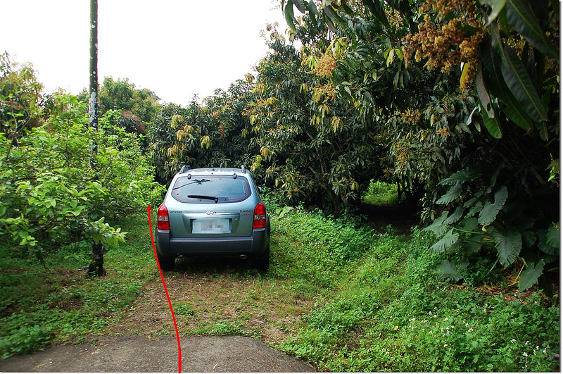
三重溪山停車處
三重溪山停車處
步程簡述:
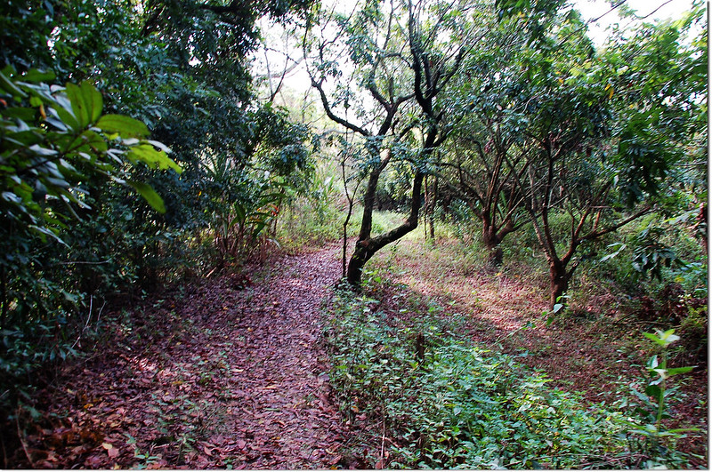
停車處沿左側果園邊岔路東行;
三重溪山果園產道
三重溪山大芒果樹
一路沿果園邊土路行約250公尺路終,早期大鵬醫師車子開到此停車;
三重溪山果園上切稜線
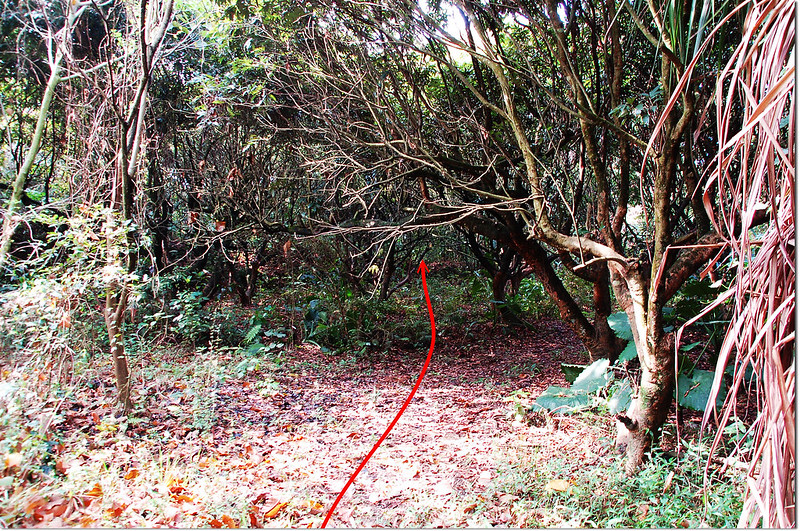
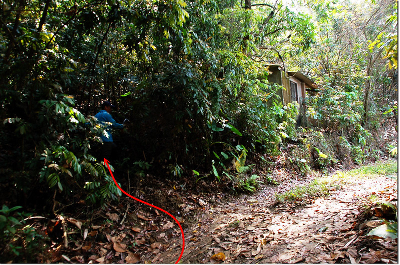
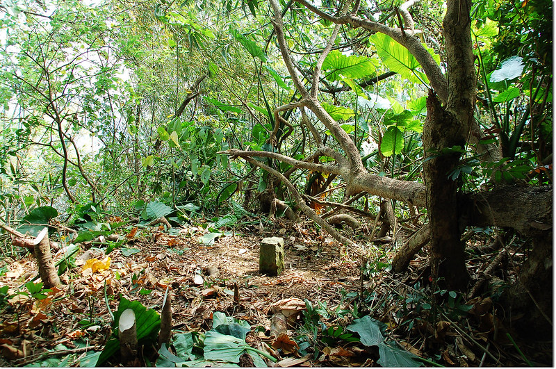
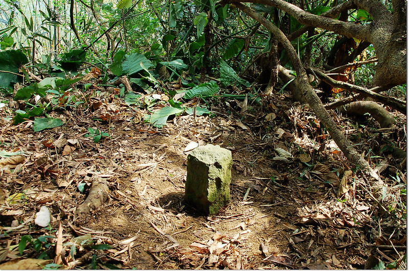
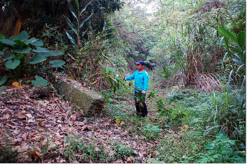
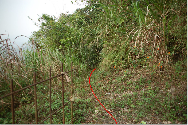
由果園邊切上稜一路沿稜線偶而右側腰繞東南行約550公尺抵達最高點即可見到三重溪山土地調查局圖根點,途中幾處危稜盡可能靠右側行走;
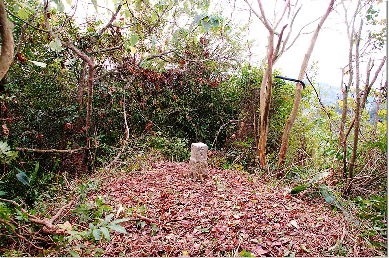
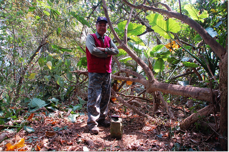
三重溪山土地調查局圖根點(Elev. 151 m)
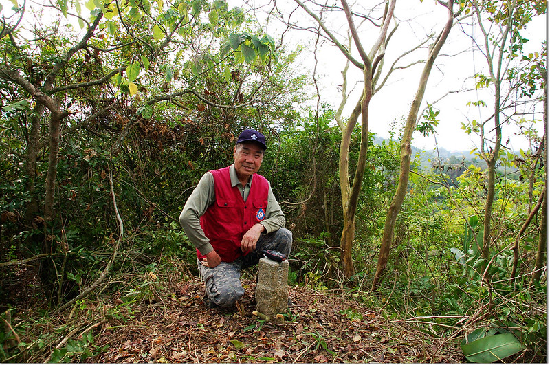
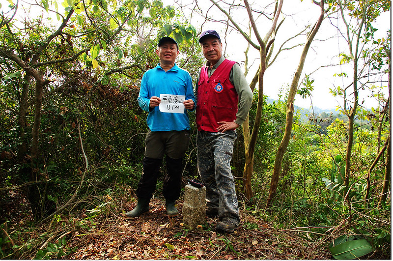
三重溪山山頂
山頂稍有展望,透過樹縫可以遙望東邊的大棟山和枕頭山。
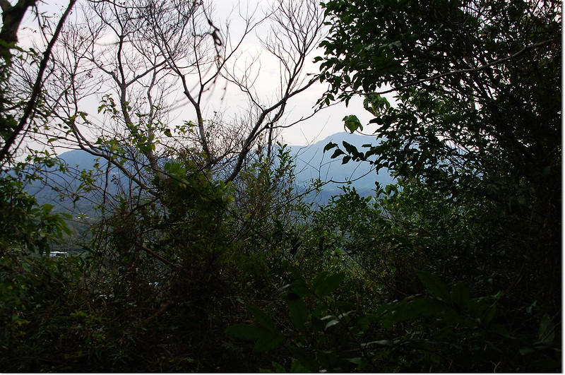
三重溪山東眺大棟山、枕頭山
三重溪山南眺滴水山(右)
三重溪山果園產道
三重溪山大芒果樹
一路沿果園邊土路行約250公尺路終,早期大鵬醫師車子開到此停車;
三重溪山果園上切稜線
由果園邊切上稜一路沿稜線偶而右側腰繞東南行約550公尺抵達最高點即可見到三重溪山土地調查局圖根點,途中幾處危稜盡可能靠右側行走;
三重溪山土地調查局圖根點(Elev. 151 m)
三重溪山山頂
山頂稍有展望,透過樹縫可以遙望東邊的大棟山和枕頭山。
三重溪山東眺大棟山、枕頭山
三重溪山南眺滴水山(右)
此山上山砍路花了50分鐘,下山僅花25分鐘。
--------------------------------------------------------------------------------------------------------
六重溪山:位在台南市白河區、東山區交界處,標高215公尺,山頂立有一顆冠字補黃(05)的台灣省政府圖根補點,座標193960 2578112;原冠字福(09)的圖根點已遺失。
行車資訊:
由三重溪山回到南97鄉道右轉續行約3.0公里後在過了六溪一號橋東端橋頭(約南97鄉道里程5.7K)隨即右(南)轉,沿主線行約2.3公里遇岔路(“六原高分54”電線桿),右往垃圾場不取,取左陡坡水泥農路行300公尺遇岔路取左(我誤走右岔停在前50公尺處工寮,多走一段產道);
六重溪山產道東眺大棟山系
左岔路再行約300公尺抵路左果園路右一座廢棄工寮時小車可停此(也可勉強續行);
六重溪山小車停車處
土產道再行100公尺岔路取左上,再行120公尺後停車於產道左側一間廢工寮附近(193894 2578058,海拔198公尺)。
六重溪山登山口
六重溪山產道東眺大棟山系
左岔路再行約300公尺抵路左果園路右一座廢棄工寮時小車可停此(也可勉強續行);
六重溪山小車停車處
土產道再行100公尺岔路取左上,再行120公尺後停車於產道左側一間廢工寮附近(193894 2578058,海拔198公尺)。
六重溪山登山口
步程簡述:
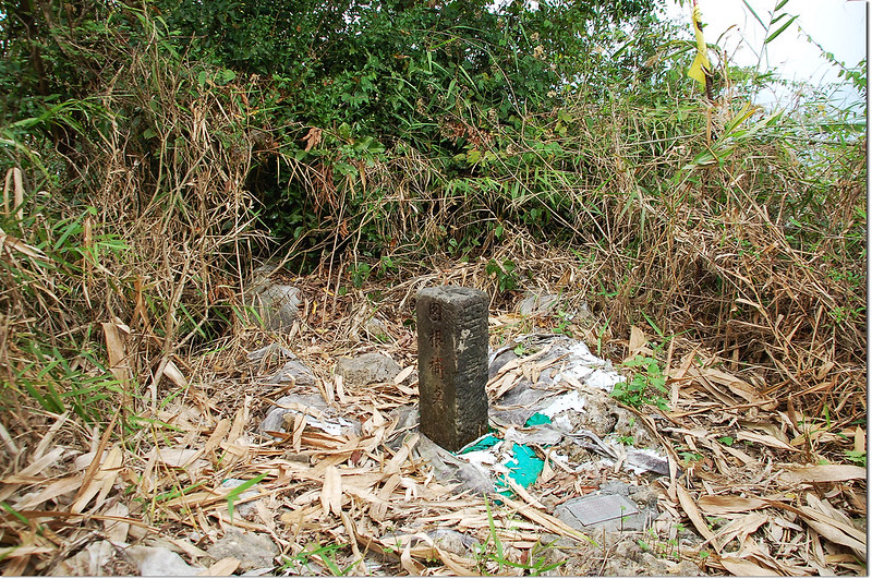
由廢工寮之前乾溪溝切入朝東北高處上行約100公尺5分鐘登頂六重溪山基點處;六重溪山省政府圖根補點已經斷頭,只剩下段沒有文字部份,原冠字福(09)的圖根點已遺失不見,山頂無展望。
六重溪山山頂
六重溪山省政府圖根補點(Elev. 215 m)
六重溪山山頂
六重溪山山頂
六重溪山省政府圖根補點(Elev. 215 m)
六重溪山山頂
--------------------------------------------------------------------------------------------------------
頂埔:位在台南市白河區,標高179公尺,山頂立有一顆編號鑛993號的鑛務課基點,座標194638 2578770。
行車資訊:
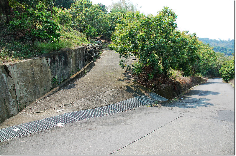
由六重溪回到南97鄉道右轉續行約650公尺後停車於道路右彎處路左空地(194591 2578901,海拔134公尺)。
步程簡述:
由停車處回頭十幾公尺取左岔水泥路上行;
頂埔山登山口
約70公尺水泥路崩塌,取左上切到自來水公司大型蓄水槽;

頂埔山自來水儲水槽
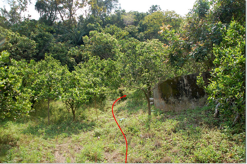
頂埔登山路徑
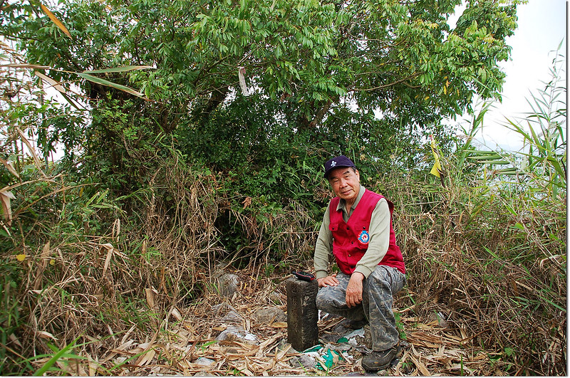
由蓄水槽左後方直接陡上到高點即見頂埔編號993號的鑛務課基點立在龍眼樹下,基點旁有一座圓形磚砌蓄水槽及一根小水泥柱。
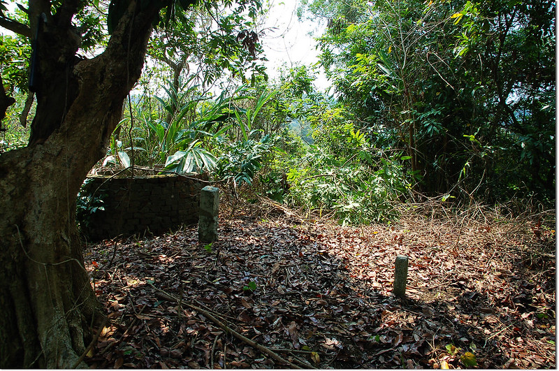
頂埔山頂
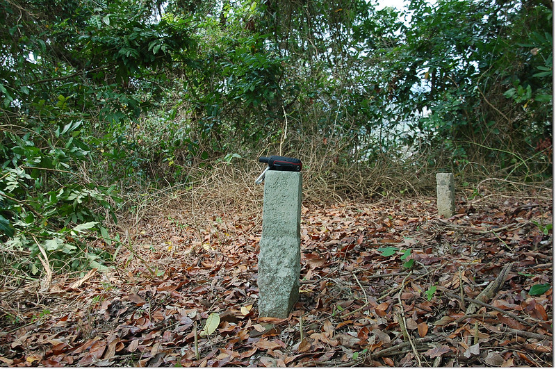
頂埔鑛務課基點(# 993 Elev. 179 m)
頂埔山頂
頂埔山登山口
約70公尺水泥路崩塌,取左上切到自來水公司大型蓄水槽;
頂埔山自來水儲水槽
頂埔登山路徑
由蓄水槽左後方直接陡上到高點即見頂埔編號993號的鑛務課基點立在龍眼樹下,基點旁有一座圓形磚砌蓄水槽及一根小水泥柱。
頂埔山頂
頂埔鑛務課基點(# 993 Elev. 179 m)
頂埔山頂
此點如從南97鄉道里程6.8K處(194869 2578737)進入到民宅路底停車,再從果園上登可能比較好走。
--------------------------------------------------------------------------------------------------------
--------------------------------------------------------------------------------------------------------
硫黃崎頭山(火坑山):位在台南市白河區,標高396公尺,山頂立有一顆冠字澤(28)的土地調查局圖根點,座標196292 2579678。
行車資訊:
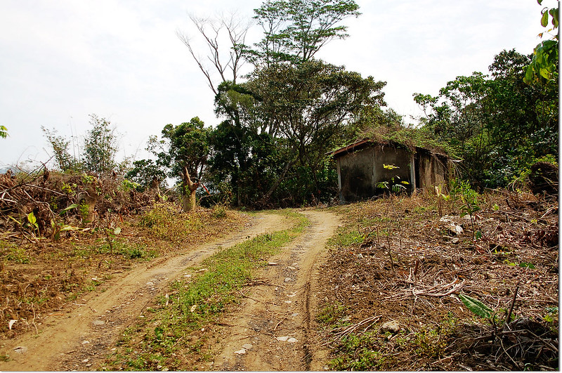
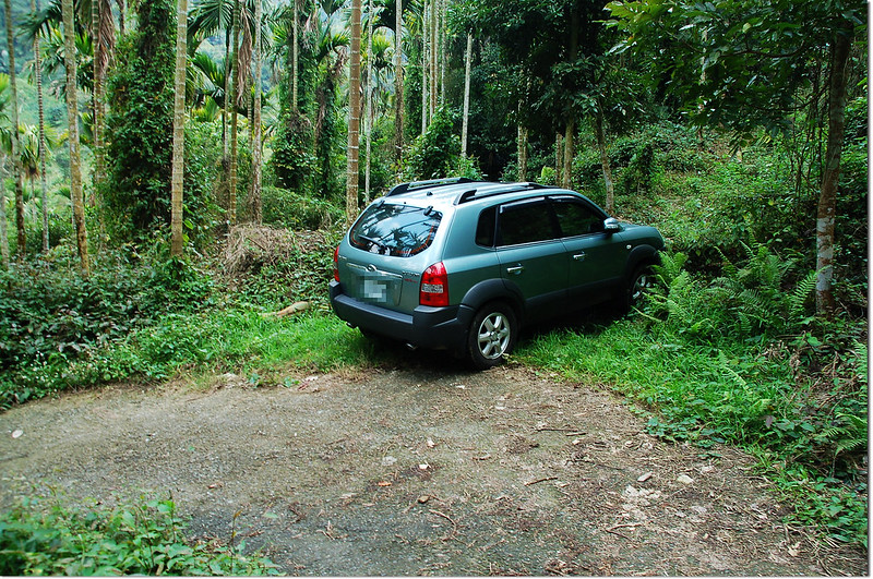
由頂埔回到南97鄉道向右轉行約1.1公里後於南97鄉道里程7.45K處向左轉往慈竹寺北行,1.1公里後十字路取右往千霞園上行,沿著山中水泥產道上行1.9公里後於一處道路左彎處停車(196259 2579844,海拔338公尺),右岔有一條已荒廢的土路。
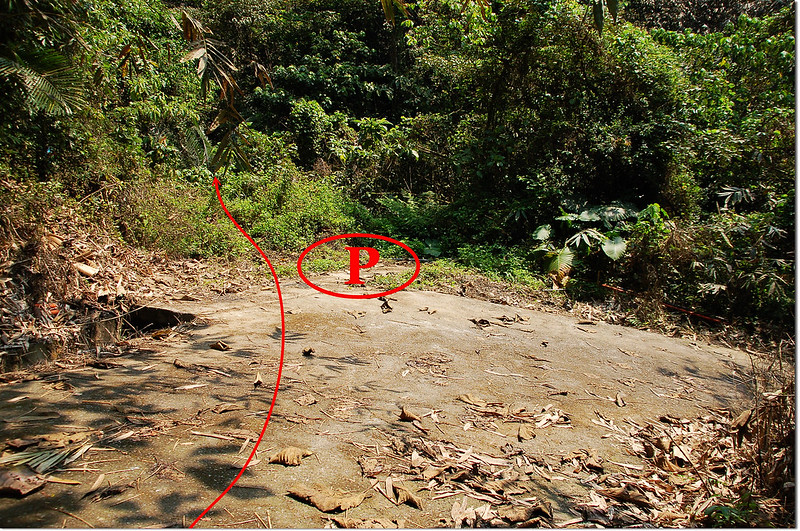
硫黃崎頭山停車處登山口
硫黃崎頭山停車處登山口
步程簡述:
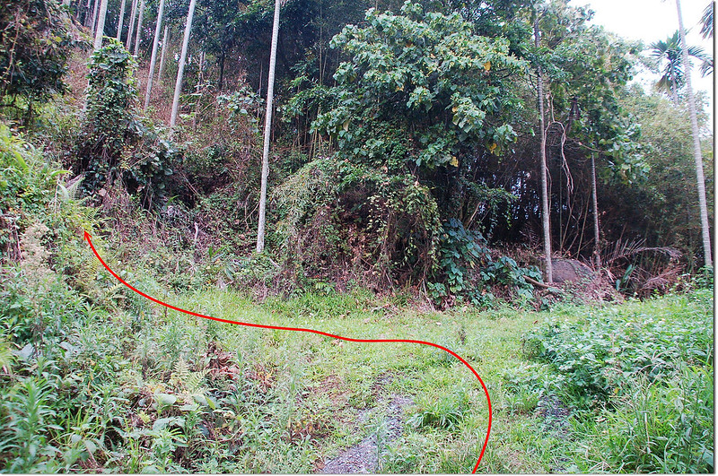
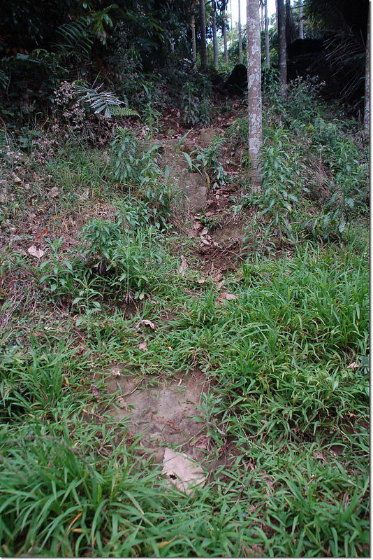
沿著荒廢土路走約50公尺遇乾溪溝,由看似水泥橋過乾溪溝後右轉沿不明顯的廢產道上行,行約100公尺後廢產道終止取左朝山頂陡攀,再行約150公尺抵達硫黃崎頭山,在最高點處一叢山棕樹旁找到硫黃崎頭山圖根點,上山約20分鐘。
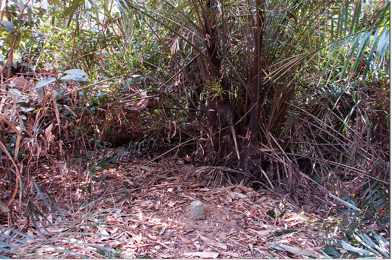
硫黃崎頭山土地調查局圖根點(Elev. 396 m)
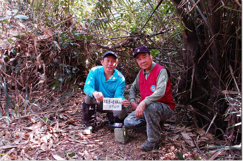
硫黃崎頭山山頂
硫黃崎頭山土地調查局圖根點(Elev. 396 m)
硫黃崎頭山山頂
--------------------------------------------------------------------------------------------------------
黃牛山(大檳榔山):位在台南市白河區,標高657公尺,山頂立有一顆冠字澤(26)的土地調查局圖根點,座標198780 2579962。
行車資訊:
由硫黃崎頭山停車處繼續上行約500公尺遇岔路右轉上行,再行約300公尺遇岔路仍取右行,再行2.2公里後接到175縣道取右轉往六甲東南行,行約600公尺在175縣道里程約4.1K處左轉岔路往檳榔山;行約1.3公里遇左岔路下往溫泉區不取,取右直行上山,再行約600公尺抵達大棟山土地公廟的停車場(198876 2579932,海拔637公尺)。
步程簡述:
從停車場走廟後水泥路進入走約150公尺到三叉路口,取中間岔路直上,然後直接上稜沿竹林邊上到高點或是沿土產道右行再左繞到最高點在土產道終點處右側竹林邊找到黃牛山(大檳榔山)圖根點。
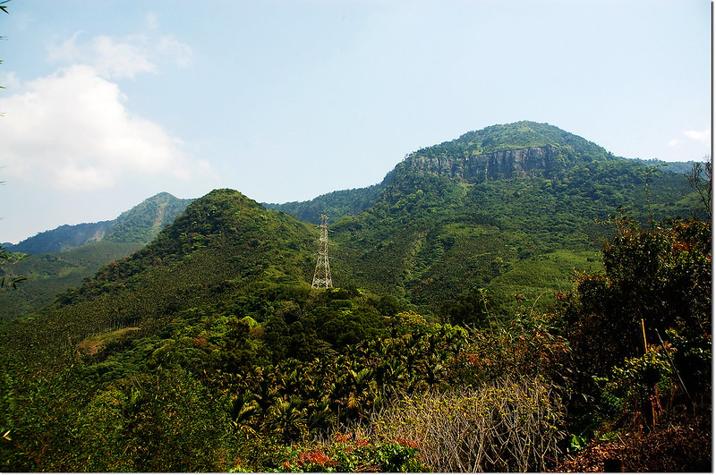
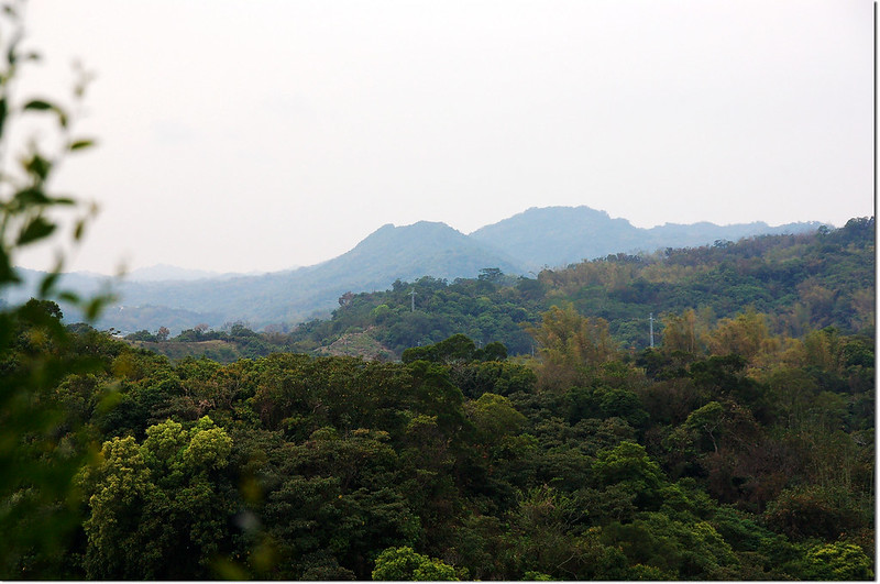
黃牛山東眺大棟山
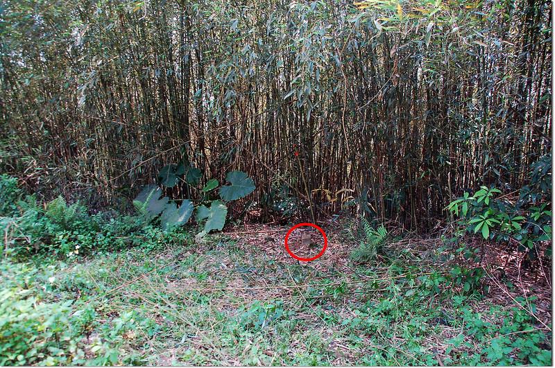
黃牛山土地調查局圖根點點位
黃牛山土地調查局圖根點(Elev. 657 m)
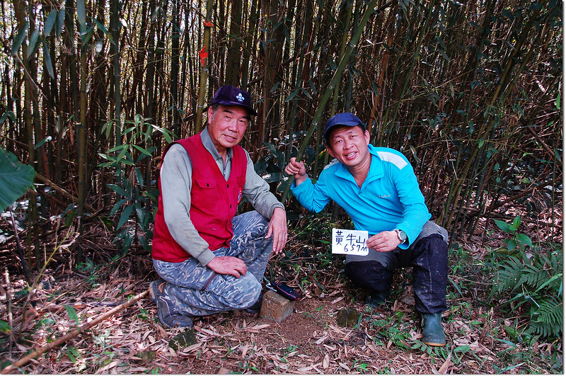
黃牛山山頂
黃牛山東眺大棟山
黃牛山土地調查局圖根點點位
黃牛山土地調查局圖根點(Elev. 657 m)
黃牛山山頂
--------------------------------------------------------------------------------------------------------
白鷺山:位在台南市白河區,標高513公尺,山頂立有一顆冠字補中(19)的山字森林三角點,座標199258 2581722。
行車資訊:
由大棟山土地公廟的停車場往西北循原路回行600公尺後岔路右轉下行往關子嶺溫泉區,行約2.2公里後於崩山農路向右轉往紅葉公園,行約800公尺遇岔路取右岔水泥上山(198964 2581677);上山水泥路行約530公尺右岔往民宅不取,取左行微下坡再行約370公尺遇岔路取右岔上行,再行約80公尺又遇岔路仍取右岔續行,再行約50公尺路陡在一處產道右彎處左側廢土產道岔路口停車(199400 2581688,海拔440公尺)。
白鷺山停車處
白鷺山停車處
步程簡述:
停車處沿水泥產道續行約150公尺水泥路終止遇岔路,取右轉土路再上行100公尺產道終止,取左小徑上切西行;
白鷺山產道終點登山口
白鷺山登山小徑
陡上約80公尺抵最高點在竹林邊找到白鷺山森林三角點,上山約10分鐘。
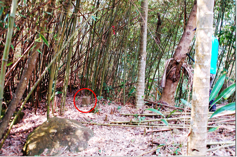
白鷺山山頂
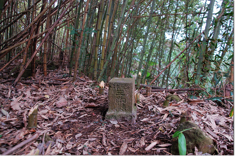
白鷺山山字森林三角點(Elev. 513 m)
白鷺山山頂
白鷺山產道終點登山口
白鷺山登山小徑
陡上約80公尺抵最高點在竹林邊找到白鷺山森林三角點,上山約10分鐘。
白鷺山山頂
白鷺山山字森林三角點(Elev. 513 m)
白鷺山山頂
--------------------------------------------------------------------------------------------------------
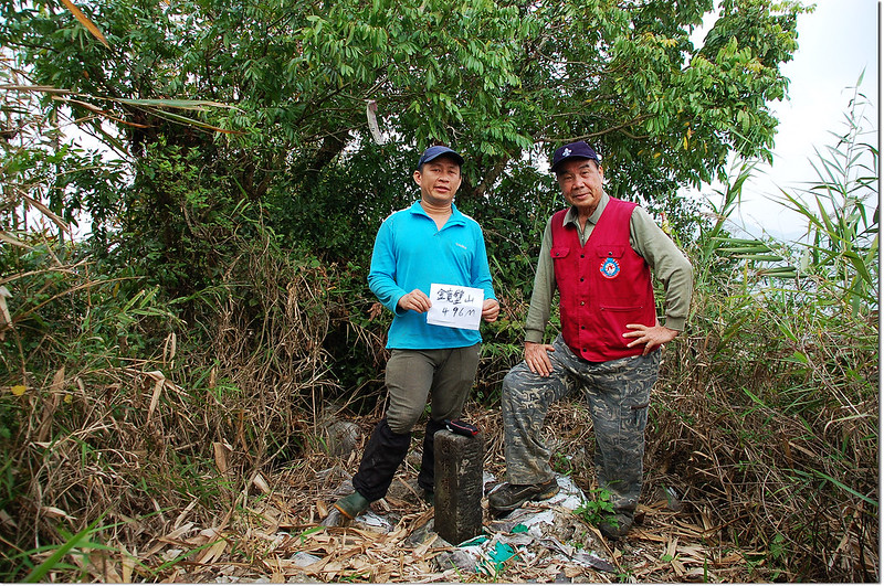
鏡壁山:位在台南市白河區,標高496公尺,山頂立有一顆台灣省政府圖根補點,座標197527 2581871,點位西南方約160公尺山頭原立有一顆編號430號的三等三角點,已遺失不見。
行車資訊:
由白鷺山回到175縣道“竹香園甕缸雞”處左轉南行,110公尺後遇右岔下坡路取右岔下行(懷香食堂),950公尺後向左急後轉上山,550公尺後坡太陡爬不上去停車(197704 2581935,海拔375公尺)。

鏡壁山停車處
鏡壁山停車處
步程簡述:
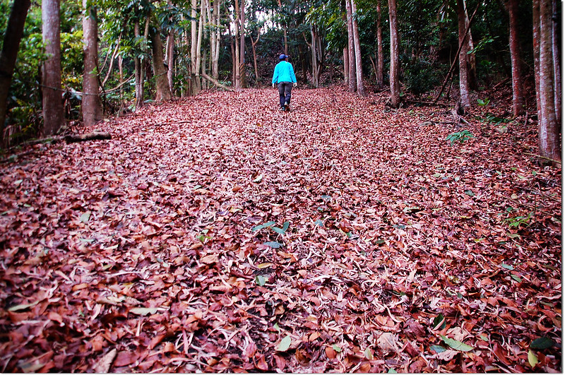
停車處沿寬大的水泥道路上行,兩旁是高大的桃花心木,地面上厚厚的一層落葉走來蠻詩情畫意的,但是坡度真有夠陡,不知一般的四傳車能否上得來;
鏡壁山水泥產道
行約500公尺大水泥路前方似已坍方中斷取右岔廢土產道進入續行;
鏡壁山廢產道岔路
廢土產道行約130公尺抵達早期“古月農場”的廢工寮及圓形大蓄水槽;
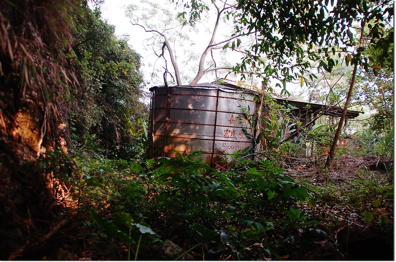
古月農場遺址
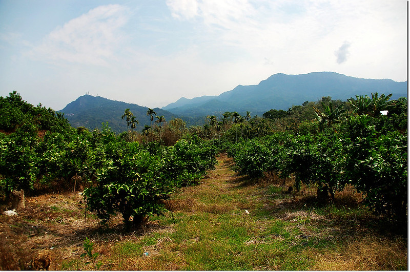
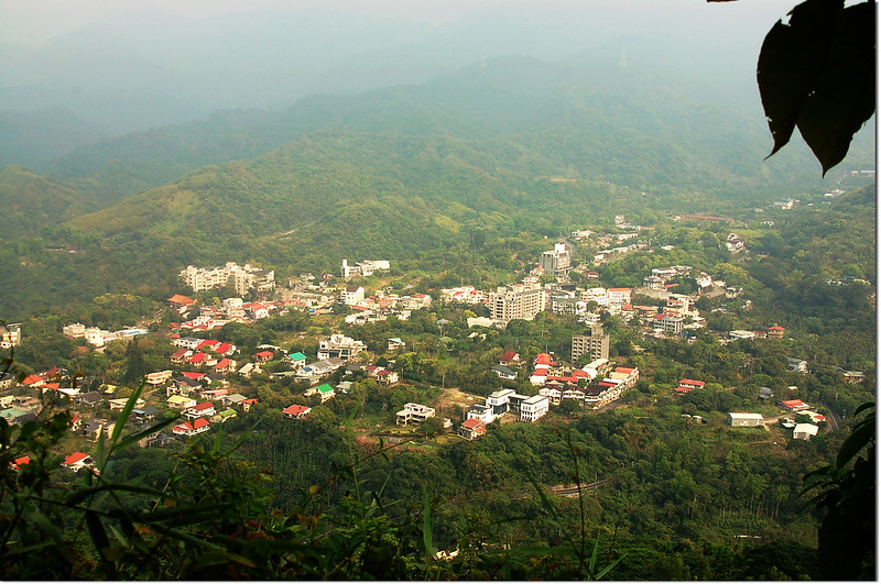
繞過廢工寮及圓形大蓄水槽上到稜上接到坍方的水泥產道右轉即是一處早期的觀景平台(有休閒椅),在此可眺望枕頭山,俯瞰崩塌地、白河水庫溪源等;
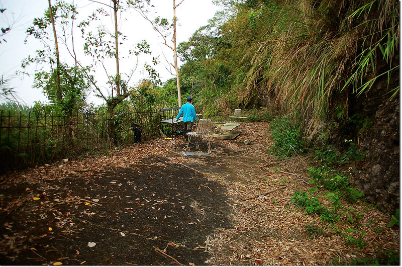
鏡壁山山頂觀景平台
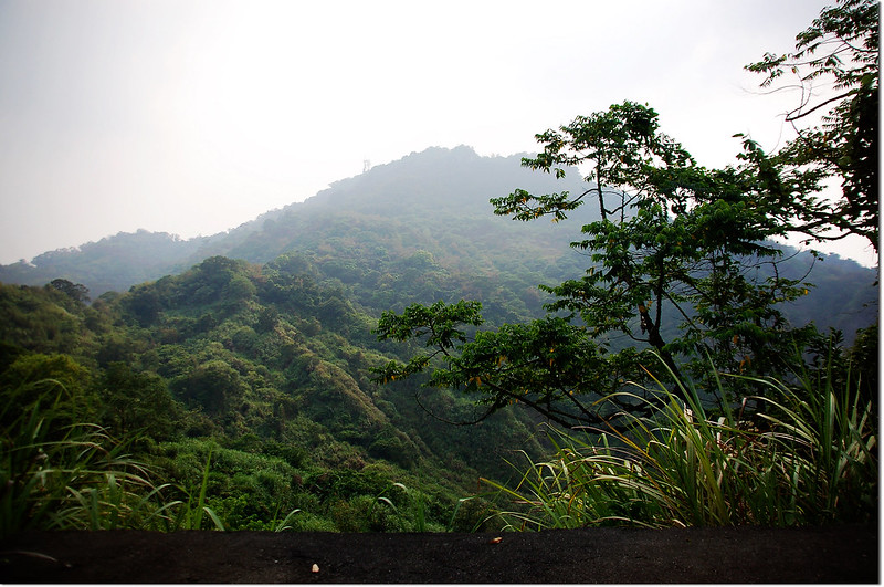
鏡壁山西南眺枕頭山

鏡壁山山頂俯瞰白河水庫
從觀景平台的北端沿峭壁下小徑東北行;
鏡壁山山頂小徑
100公尺後右上切沿山徑直上稜線再左轉北行,經過一座鐵架休息平台後即見鏡壁山省政府圖根補點,基石有一面被刻上四二O号,此山在圖根補點點位西南方約160公尺山頭原立有一顆編號430號的三等三角點,已遺失不見。
鏡壁山山頂俯瞰關子嶺溫泉區
鏡壁山省政府圖根補點(Elev. 496 m)
鏡壁山山頂
鏡壁山水泥產道
行約500公尺大水泥路前方似已坍方中斷取右岔廢土產道進入續行;
鏡壁山廢產道岔路
廢土產道行約130公尺抵達早期“古月農場”的廢工寮及圓形大蓄水槽;
古月農場遺址
繞過廢工寮及圓形大蓄水槽上到稜上接到坍方的水泥產道右轉即是一處早期的觀景平台(有休閒椅),在此可眺望枕頭山,俯瞰崩塌地、白河水庫溪源等;
鏡壁山山頂觀景平台
鏡壁山西南眺枕頭山
鏡壁山山頂俯瞰白河水庫
從觀景平台的北端沿峭壁下小徑東北行;
鏡壁山山頂小徑
100公尺後右上切沿山徑直上稜線再左轉北行,經過一座鐵架休息平台後即見鏡壁山省政府圖根補點,基石有一面被刻上四二O号,此山在圖根補點點位西南方約160公尺山頭原立有一顆編號430號的三等三角點,已遺失不見。
鏡壁山山頂俯瞰關子嶺溫泉區
鏡壁山省政府圖根補點(Elev. 496 m)
鏡壁山山頂
鏡壁山為台南縣百名山之一,山頂視野佳,遠眺大棟山系,俯瞰關子嶺溫泉區等,由停車處至山頂基石上山走25分。
沒有留言:
張貼留言