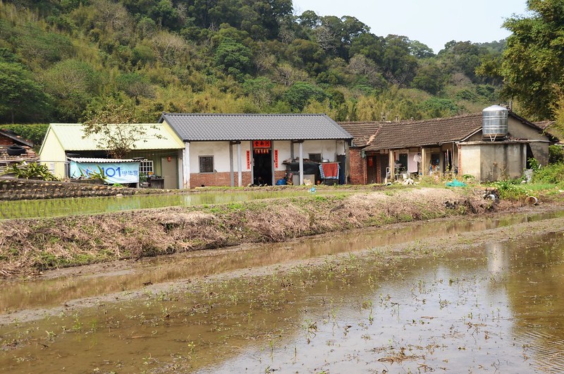
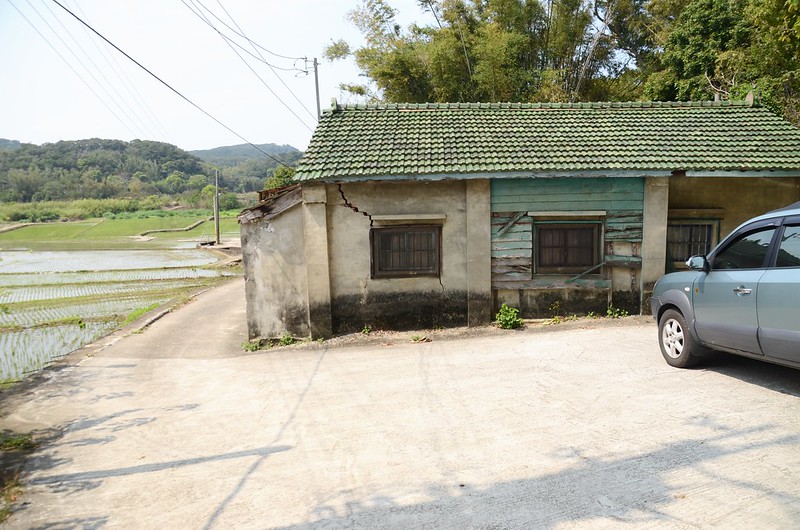
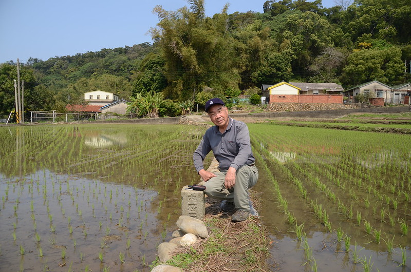
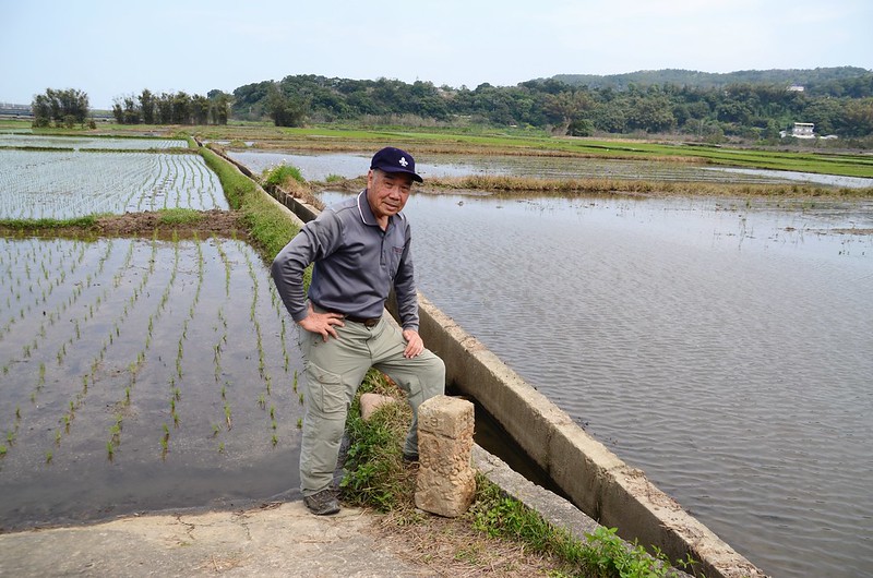
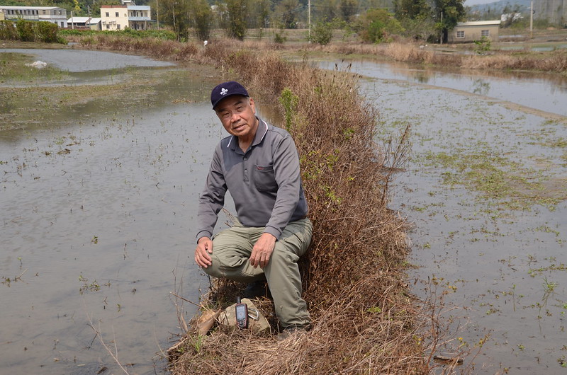
上四湖水準點附近農家
造訪基點:
南坑山(龍洞山):位於苗栗縣西湖鄉,標高140公尺,山頂立有一顆冠字渡(14)的土地調查局圖根點,座標226436 2715601。
茅仔埔:位於苗栗縣西湖鄉,標高70公尺,立有一顆編號町杭10/0的總督府內務局水準點,座標224757 2714021。
羊寮崎:位於苗栗縣西湖鄉,標高43公尺,立有一顆編號町杭8/0的總督府內務局水準點,座標223609 2715257。
老屋下:位於苗栗縣西湖鄉,標高52公尺,立有一顆編號町杭9/0的總督府內務局水準點,座標223610 2713909。
青子窩山(下四湖山):位於苗栗縣西湖鄉,標高166公尺,山頂立有一顆冠字渡(17)的土地調查局圖根點,座標223388 2713266。
上四湖:位於苗栗縣西湖鄉,標高17公尺,立有一顆編號町杭8/0的總督府內務局水準點,座標222927 2715276。
-------------------------------------------------------------------------------------------------------
南坑山(龍洞山):位於苗栗縣西湖鄉,標高140公尺,山頂立有一顆冠字渡(14)的土地調查局圖根點,座標226436 2715601。
行車資訊:
由竹南開車沿國道3號南下,行至後龍出口下交流道後右轉沿台6線西北行,750公尺後左轉沿台1線西南行,台1線南行約5.4公里後於里程118.4K處左轉119縣道朝東南行,119縣道行約1.0公里於119縣道里程7.05K處左轉苗34-2鄉道(龍安產道)東南行,行約1.4公里於“龍洞幹16B”電線桿處左轉過龍洞橋續沿苗34-2鄉道(龍洞產業道路)東南行,再行1.7公里於路左廢棄水泥產道口停車,岔路口電線桿為“龍洞枝74”。
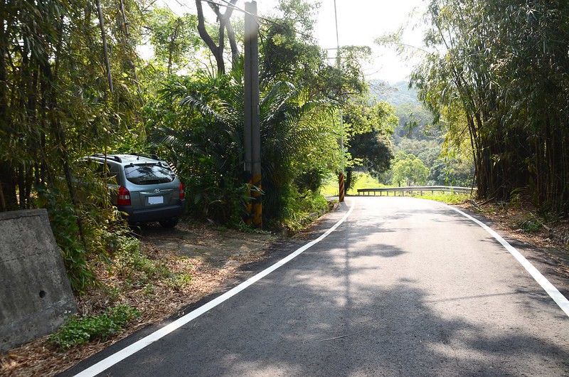
南坑山停車處
南坑山停車處
步程簡述:
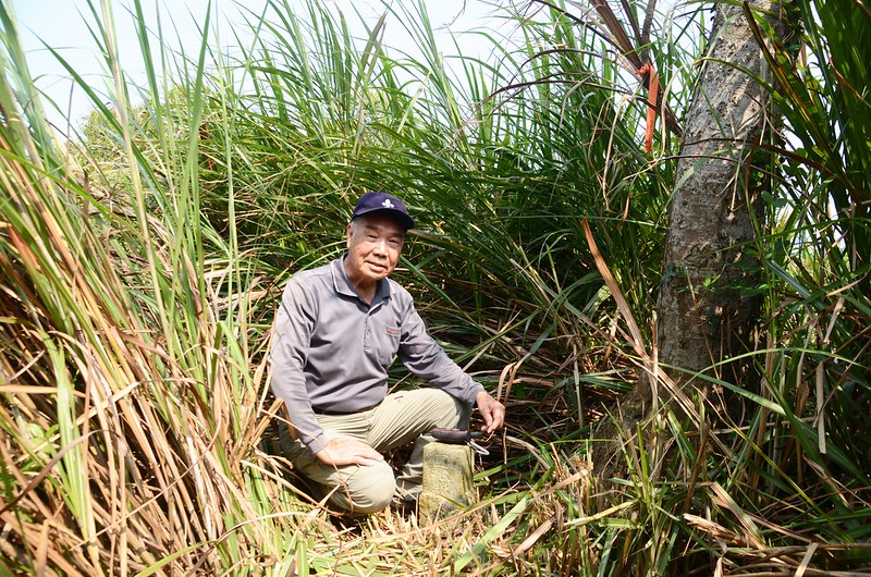
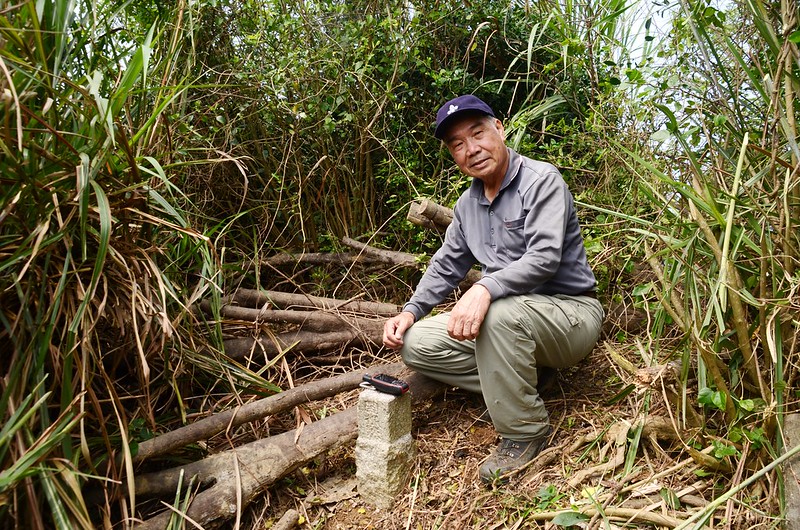
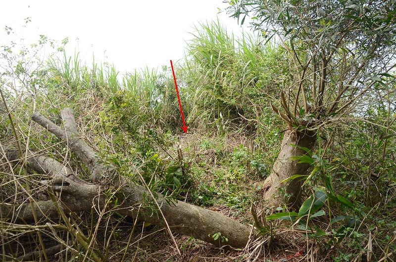
沿荒廢的水泥路東北行約160公尺到路底,取左進入綠竹筍園朝西行,行約50公尺到竹筍園末端取右入雜林朝稜線上攀,上到稜線後取左沿稜線西北行,行約40公尺抵山頂,山頂有一座水泥製蓄水槽,南坑山(龍洞山)冠字渡(14)的土地調查局圖根點位在蓄水槽後面的一棵真山馬茶(南洋山馬茶、台灣狗牙花)樹頭邊,整個蓄水槽和基點周遭全被茂密的高大菅芒草包覆著,花了近半小時才砍開,短期內前往能輕易抵達;
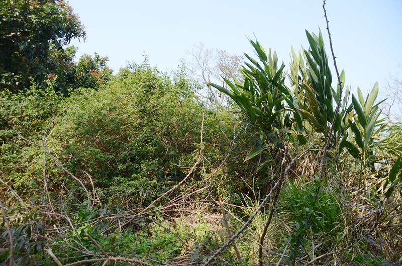
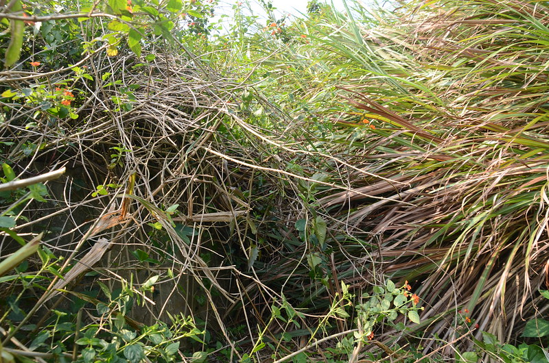
南坑山圖根點未清理前現場
山頂毫無展望,拍照後下山。
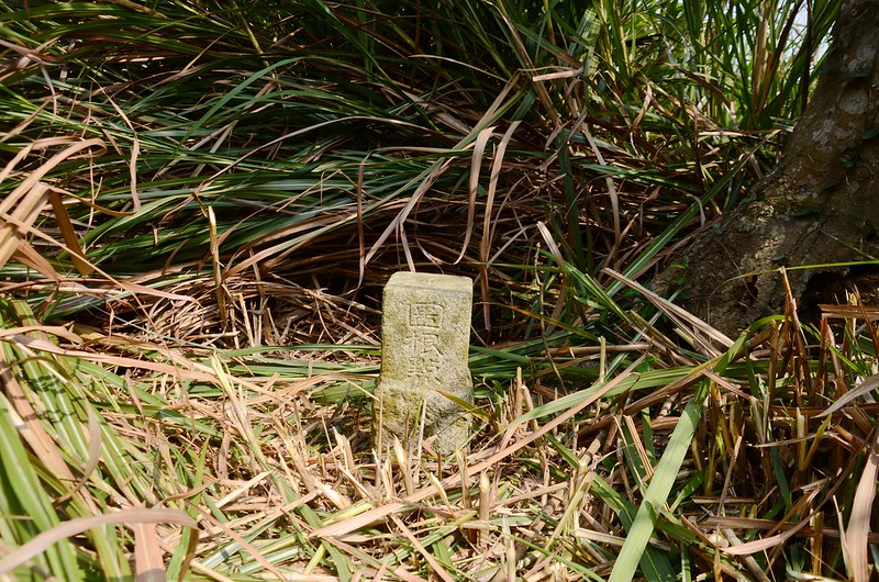
南坑山冠字渡(14)土地調查局圖根點(Elev. 140 m)
南坑山山頂

南坑山圖根點點位
南坑山圖根點旁山馬茶花和葉
山馬茶花
南坑山圖根點未清理前現場
山頂毫無展望,拍照後下山。
南坑山冠字渡(14)土地調查局圖根點(Elev. 140 m)
南坑山山頂
南坑山圖根點點位
南坑山圖根點旁山馬茶花和葉
山馬茶花
此山上山20分,清理菅芒草花了二十幾分,上下山共計用去55分鐘。
-------------------------------------------------------------------------------------------------------
茅仔埔:位於苗栗縣西湖鄉,標高70公尺,立有一顆編號町杭10/0的總督府內務局水準點,座標224757 2714021。
行車資訊:
由南坑山停車處循原路回行1.7公里過龍洞橋左轉苗34-3鄉道南行,苗34-3鄉道南行2.5公里遇119縣道取右轉西北行,行約530公尺在119縣道里程約10.9K“茅仔埔”公車站牌處取左下坡岔路下行,行約40公尺停車於民房旁空地。
茅仔埔停車處
茅仔埔停車處
步程簡述:
停車處續沿水泥路下行,行約45公尺取左通過第一座橫跨大水溝的水泥橋,接著直接沿田埂東南行;
茅仔埔總督府內務局水準點點位
行約50公尺在田埂上發現立於昭和八年的茅仔埔總督府內務局町杭10/0號水準點。
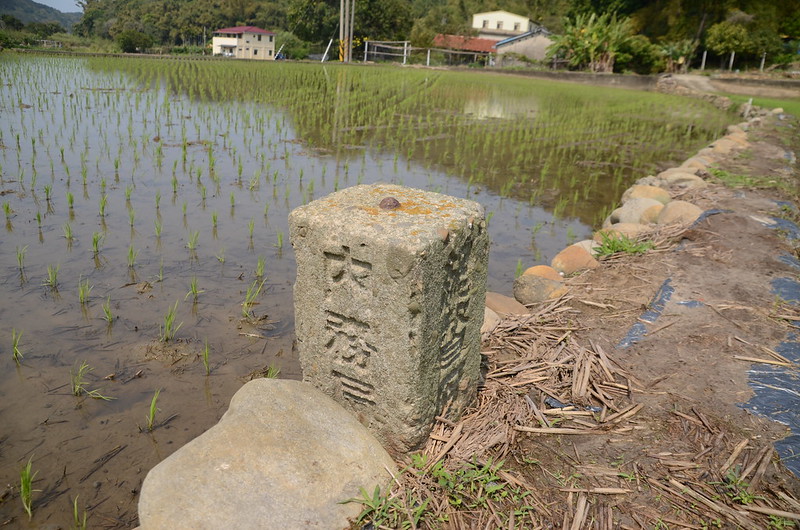
茅仔埔總督府內務局水準點(# 町杭10-0 Elev. 70 m)
茅仔埔總督府內務局水準點
茅仔埔總督府內務局水準點點位
行約50公尺在田埂上發現立於昭和八年的茅仔埔總督府內務局町杭10/0號水準點。
茅仔埔總督府內務局水準點(# 町杭10-0 Elev. 70 m)
茅仔埔總督府內務局水準點
-------------------------------------------------------------------------------------------------------
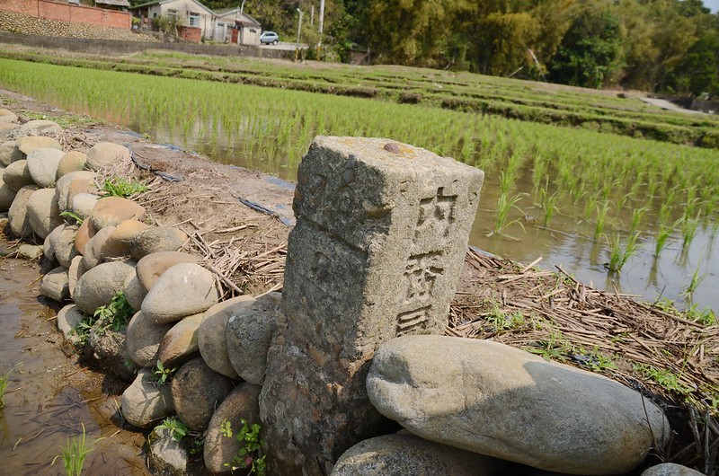
羊寮崎:位於苗栗縣西湖鄉,標高43公尺,立有一顆編號町杭8/0的總督府內務局水準點,座標223609 2715257。
行車資訊:
由茅仔埔停車處回到119縣道左轉西北行,119縣道行約1.2公里於里程8.8K處遇左岔路,路口電線桿為“西湖幹97”,因正值工程進行車輛阻路乃將車子停放馬路邊,否則車子可直開到基點附近。
步程簡述:
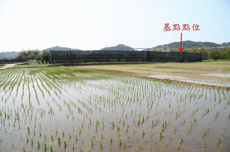
取左下坡路約70公尺遇岔路,左轉續沿水泥路南行,南行不久看到稻田中有一大面黑色圍網,羊寮崎編號町杭8/0的總督府內務局水準點就在為網後的柚子園中;
羊寮崎總督府內務局水準點點位
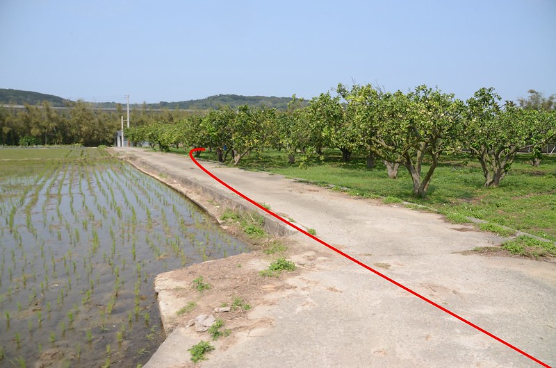
水泥路行約240公尺到柚子園邊切入柚子園北行30公尺即在柚子園中找到羊寮崎編號町杭8/0的總督府內務局水準點;
羊寮崎總督府內務局水準點點位
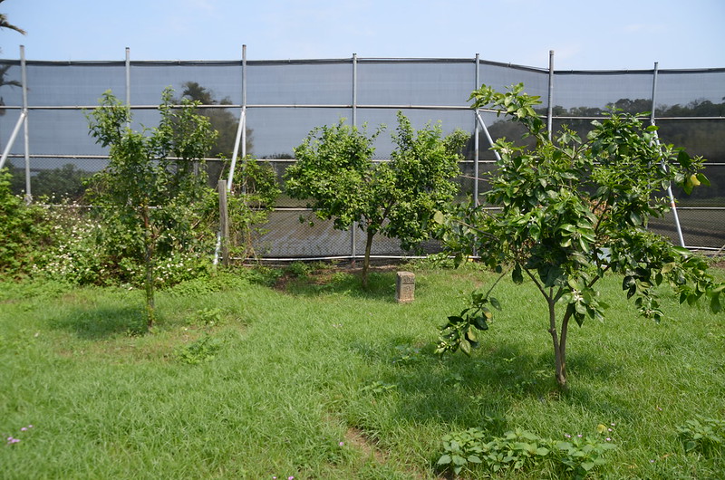
該點立於昭和八年,原已埋入土哩,地主用怪手挖出重埋,基石很完整。
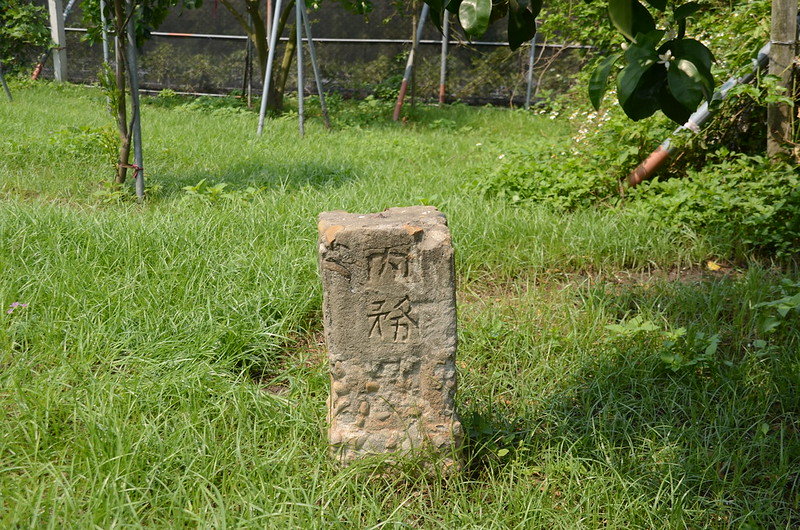
羊寮崎總督府內務局水準點(# 町杭8-0 Elev. 43 m)
羊寮崎總督府內務局水準點
羊寮崎總督府內務局水準點點位
水泥路行約240公尺到柚子園邊切入柚子園北行30公尺即在柚子園中找到羊寮崎編號町杭8/0的總督府內務局水準點;
羊寮崎總督府內務局水準點點位
該點立於昭和八年,原已埋入土哩,地主用怪手挖出重埋,基石很完整。
羊寮崎總督府內務局水準點(# 町杭8-0 Elev. 43 m)
羊寮崎總督府內務局水準點
-------------------------------------------------------------------------------------------------------
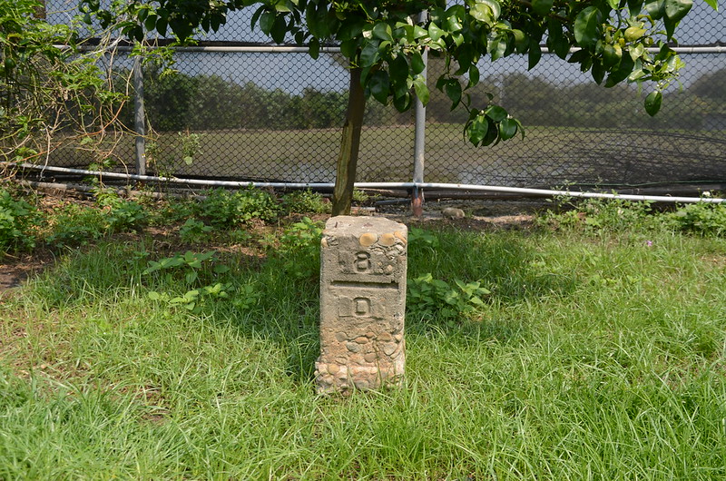
老屋下:位於苗栗縣西湖鄉,標高52公尺,立有一顆編號町杭9/0的總督府內務局水準點,座標223610 2713909。
行車資訊:
由羊寮崎停車處回頭沿119縣道南行,行約850公尺岔路取右岔苗35鄉道西南行,行約750公尺於四湖活動中心前十字路左轉苗33鄉道南行,350公尺後停車於“中廣幹14支7”電線桿附近。
步程簡述:
從道路北邊“中廣幹14支7”電線桿與“西湖鄉1058號”路燈中間水泥斜坡下行,隨即發現老屋下編號町杭9/0的總督府內務局水準點被棄置於斜坡邊,此點立於昭和八年;將基點扶正拍照後再放回原處。
老屋下總督府內務局水準點(# 町杭9-0 Elev. 52 m)


老屋下總督府內務局水準點(# 町杭9-0 Elev. 52 m)
老屋下總督府內務局水準點
老屋下總督府內務局水準點(# 町杭9-0 Elev. 52 m)
老屋下總督府內務局水準點(# 町杭9-0 Elev. 52 m)
老屋下總督府內務局水準點
-------------------------------------------------------------------------------------------------------
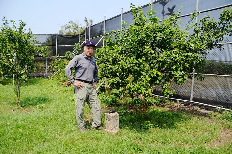
青子窩山(下四湖山):位於苗栗縣西湖鄉,標高166公尺,山頂立有一顆冠字渡(17)的土地調查局圖根點,座標223388 2713266。
行車資訊:
由老屋下沿苗33鄉道續往西轉南行,行約260公尺遇岔路;
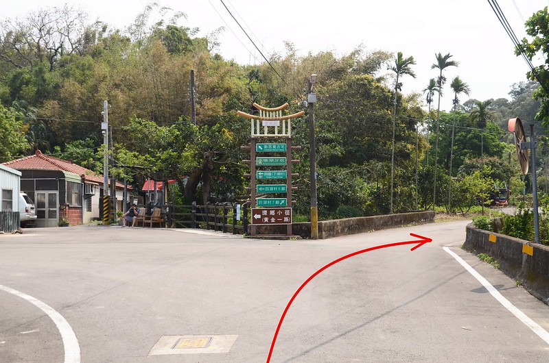
青子窩山行車岔
左岔往“環鄉小徑(黃金一路)”不取,取右岔往瑞湖國小,行約80公尺又遇岔路,左岔往瑞湖國小不取,取右岔往四湖村7鄰方向水泥路南行,行約850公尺經過“范陽堂”民宅後下到右側荒廢土岔路口停車,右上方有一座墳墓,停車處座標223637 2713091,海拔105公尺。
青子窩山行車岔
左岔往“環鄉小徑(黃金一路)”不取,取右岔往瑞湖國小,行約80公尺又遇岔路,左岔往瑞湖國小不取,取右岔往四湖村7鄰方向水泥路南行,行約850公尺經過“范陽堂”民宅後下到右側荒廢土岔路口停車,右上方有一座墳墓,停車處座標223637 2713091,海拔105公尺。
步程簡述:
由荒廢的土岔路切入朝西北上行;

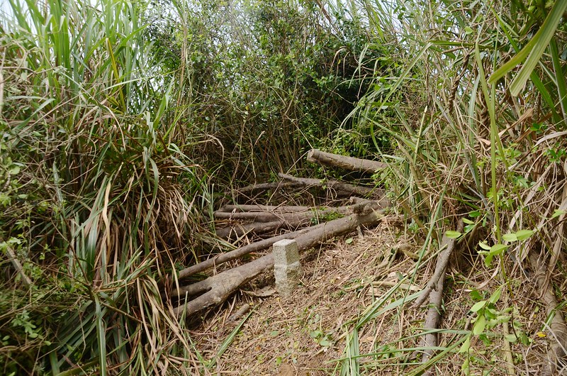
青子窩山登山口
基本上都是沿著廢產道上行,遇岔路則取右岔往高處走,廢產道沒惱人的植被還算好走,行約360公尺抵達山頂,只見山頂是茂密的菅芒草叢,花了不少時間才將菅芒草砍開,在幾根倒木間找到青子窩山的圖根點,短期間內很容易抵達。
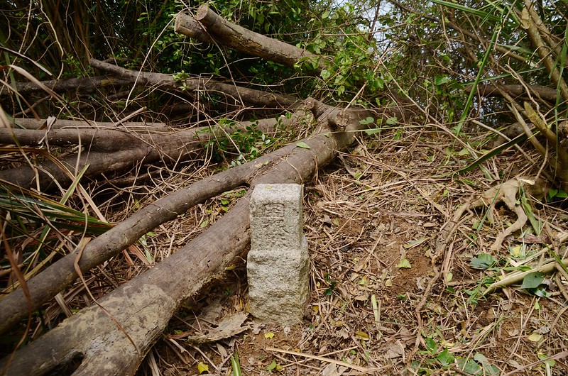
青子窩山冠字渡(17)土地調查局圖根點(Elev. 166 m)
青子窩山山頂
青子窩山基點清理後現場
青子窩山登山口
基本上都是沿著廢產道上行,遇岔路則取右岔往高處走,廢產道沒惱人的植被還算好走,行約360公尺抵達山頂,只見山頂是茂密的菅芒草叢,花了不少時間才將菅芒草砍開,在幾根倒木間找到青子窩山的圖根點,短期間內很容易抵達。
青子窩山冠字渡(17)土地調查局圖根點(Elev. 166 m)
青子窩山山頂
青子窩山基點清理後現場
此山上山走12分鐘,清理菅芒草花了不少時間,上下山共花了44分鐘。
-------------------------------------------------------------------------------------------------------
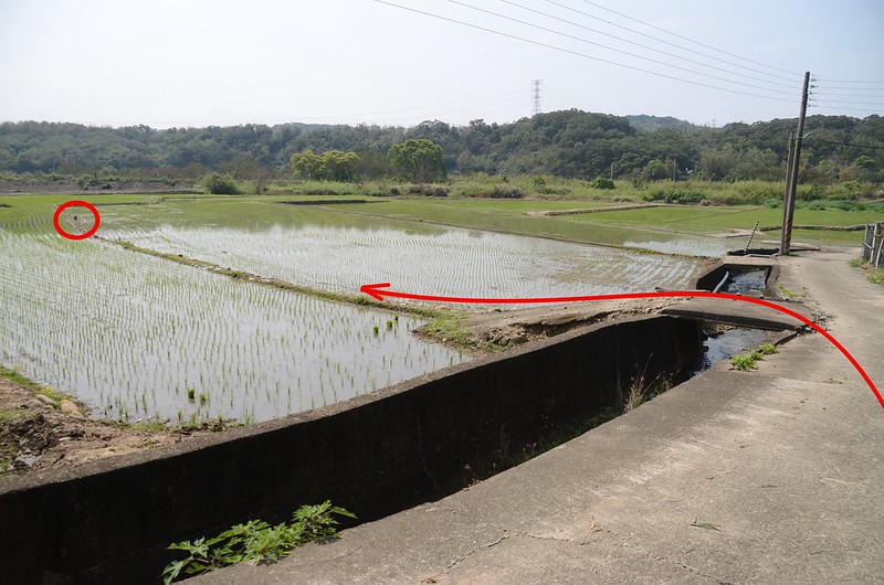
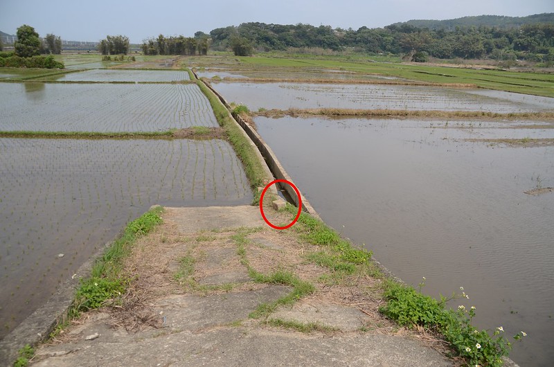
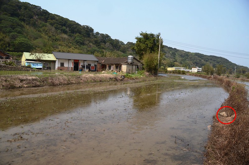
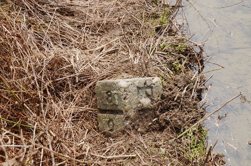
上四湖:位於苗栗縣西湖鄉,標高17公尺,立有一顆編號町杭8/0的總督府內務局水準點,座標222927 2715276。
行車資訊:
由青子窩山循原路行約930公尺回到苗33鄉道環鄉小徑(黃金一路)”岔路取左朝西北行,苗33鄉道西北行約2.1公里連續穿過高鐵及國3高架橋後停車於1103、0193電燈號誌桿(同一根)旁岔路口,座標222854 2715219,海拔62公尺。
步程簡述:
停車處取右下坡左轉道路往民家,隨即右轉沿水泥田埂東行,行約45公尺左轉沿第四與第五畦(由上往下算)稻田間田埂北行,行約50公尺發現半埋在田埂上的上四湖總督府內務局水準點,僅露出一小角一不小心很容易錯過,因為田埂鬆軟且狹窄,不敢挖掘,僅清出號碼拍照。
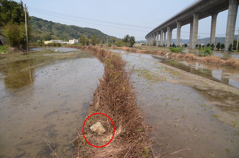
上四湖總督府內務局水準點點位
上四湖總督府內務局水準點(# 町杭8-0 Elev. 17 m)
上四湖總督府內務局水準點

上四湖總督府內務局水準點附近國3高架橋
上四湖總督府內務局水準點點位
上四湖總督府內務局水準點(# 町杭8-0 Elev. 17 m)
上四湖總督府內務局水準點
上四湖總督府內務局水準點附近國3高架橋
沒有留言:
張貼留言