
Upper Arapaho Lake
在James Peak Wilderness區內Forest Lakes南邊有一處被Forest Service放棄的湖區~ Arapaho Lakes,所謂被放棄並不是政策性的封山禁止攀登,而是主管單位不再維修此步道而不鼓勵山友攀登,但是還是有蠻多山友活動的。
Arapaho Lakes 從地圖上看是三個湖群,最東邊的兩個小湖海拔約10,778呎/3,285公尺,稱之為Lower Arapaho Lakes,最西邊的小湖海拔約11,470呎/3,496公尺,稱之為Upper Arapaho Lake,但這兩個湖群少人提及,一般登山客僅到中間的兩個湖,這兩個湖是連在一起的,中間只隔一寬約10公尺的陸地,第一個湖(東)比第二個湖(西)大很多,這兩座湖我在2010年即攀登過,今天除再度攀登此兩湖外,打算順便攀登Upper和Lower兩湖區三小湖。
---------------------------------------------------------------------------------------------------
攀登湖泊:
North Lower Arapaho Lake,海拔10,778呎/3,285公尺
South Lower Arapaho Lake,海拔10,791呎/3,289公尺
Upper Arapaho Lake,海拔11,470呎/3,496公尺
East Arapaho Lake,海拔11,175呎/3,406公尺
West Arapaho Lake,海拔11,171呎/3,405公尺
登山口:East Portal Trailhead,海拔9,186呎/2,800公尺
登山里程:全程往返共計9.69哩/15.6公里
總爬升高度:2,464呎/751公尺
登山時間:7小時57分
-------------------------------------------------------------------------------------------------
行車資訊:
從 Boulder走Boulder Canyon Road(CO 119)西行,16哩後抵Nederland小鎮,接Peak To Peak景觀公路(CO 119, CO 72)南下,行4.8哩抵Rollinsville,右轉E. Portal road (Rollins Pass)西行,約7.5哩後行車終點(Moffat Tunnel)即為登山口,此處是Union Pacific Railroad火車隧道的東入口。
如從Golden開車可沿CO 119或CO 72北上,抵Rollinsville再左轉E. Portal road (Rollins Pass)西行抵登山口。
步程簡述:
08:17 登山口出發,座標N39.90319° W105.64442°,海拔9,186呎/2,800公尺。
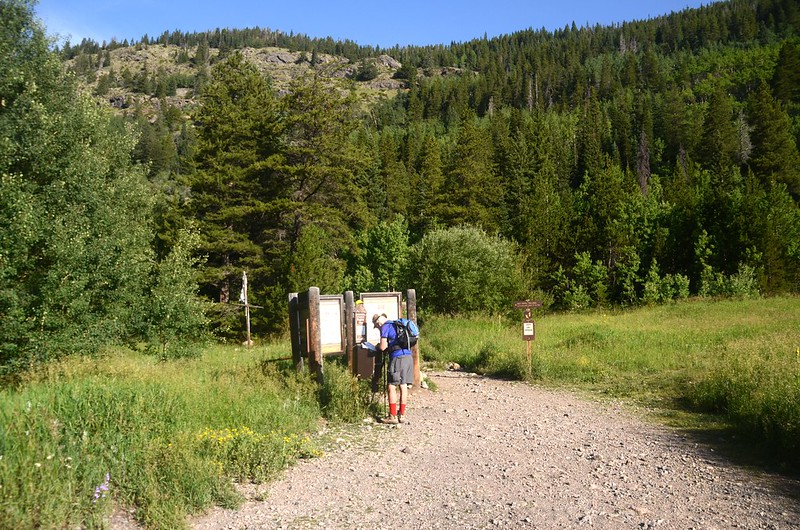
East Portal Trailhead
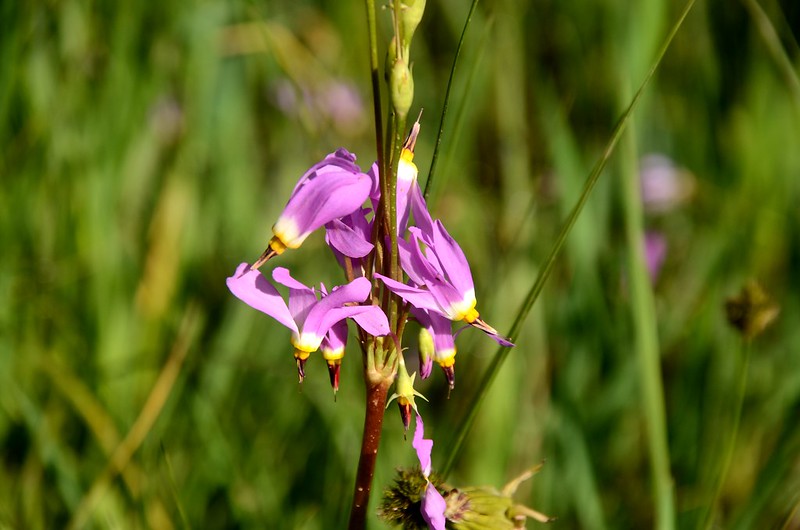
Shooting Star flower
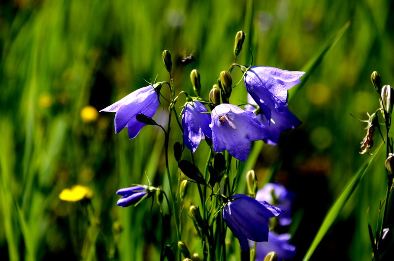
Mountain Harebell
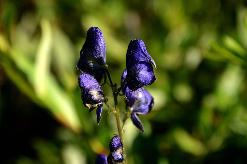
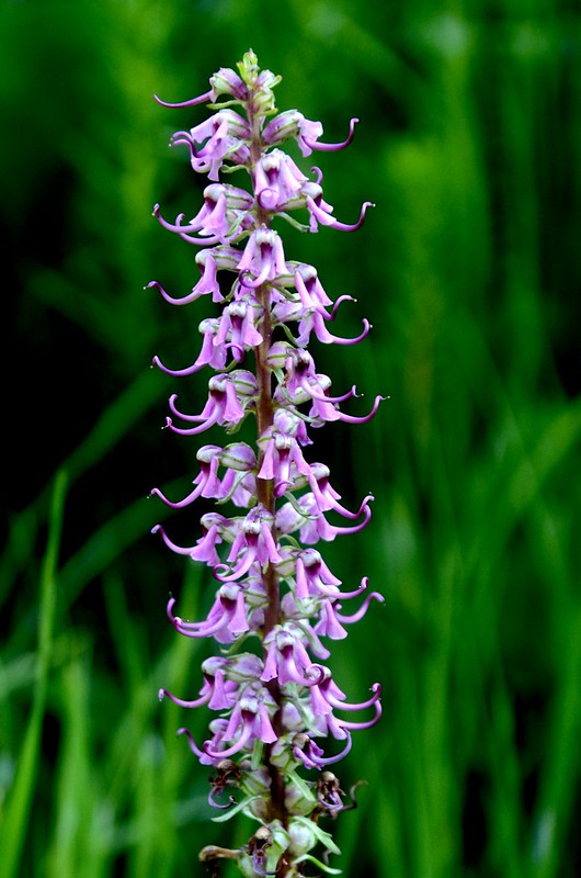
Monkshood
09:00 抵達Forest Lakes & South Boulder Creek Trail 岔路,座標N39.89336° W105.66048°,海拔9,521呎/2,902公尺,距登山口1.3哩/2.1公里;
Forest Lakes & South Boulder Creek Trail junction
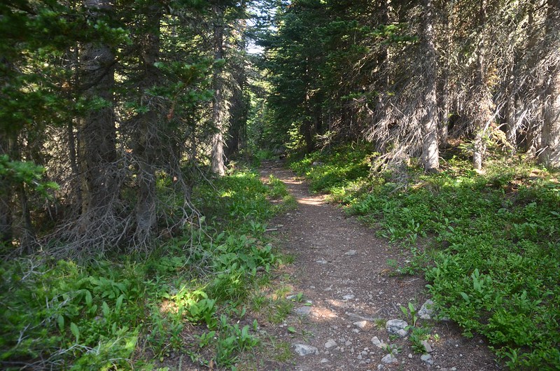
取右岔往Forest Lakes Trail上行,步道寬敞筆直,兩旁是杉木林。
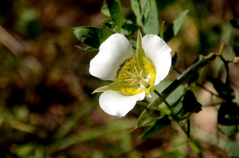
Sego Lily
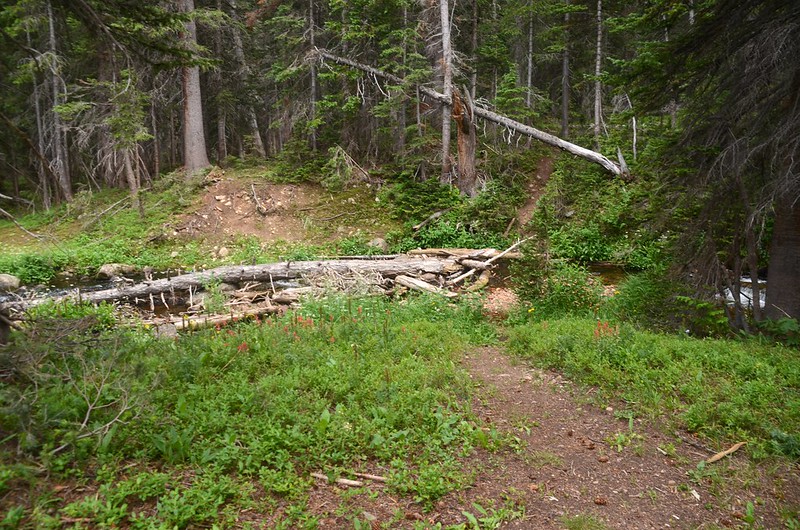
09:21 來到 Arapaho Creek,有一木橋橫跨而過,座標N39.90126° W105.65662°,海拔約9,813呎/2,991公尺,距登山口1.93 哩/3.1公里;過了木橋後步道沿著Arapaho Creek右岸陡升,一路在杉林中穿行。
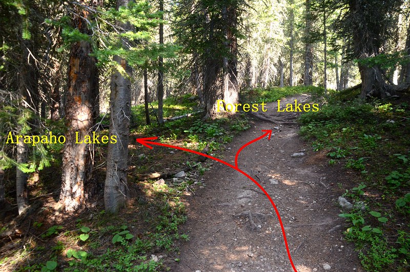
09:38 抵達第一處Forest Lakes 和 Arapaho Lakes 岔路,座標N39.90609° W105.65943°,海拔約10,059呎/3,066公尺,距登山口2.3 哩/3.7公里;
Forest Lakes & Arapaho Lakes junction #1
岔路不明顯且以數根倒木橫擋岔路口,岔路再前行十餘公尺有一座原木橋,我捨此岔路續沿Forest Lakes Trail往上行。
09:43 抵達第二處Forest Lakes 和 Arapaho Lakes 岔路,座標N39.90724° W105.66100°,海拔約10,118呎/3,084公尺,距登山口2.42 哩/3.9公里;
Forest Lakes & Arapaho Lakes junction #2
取左不明顯岔路下行。
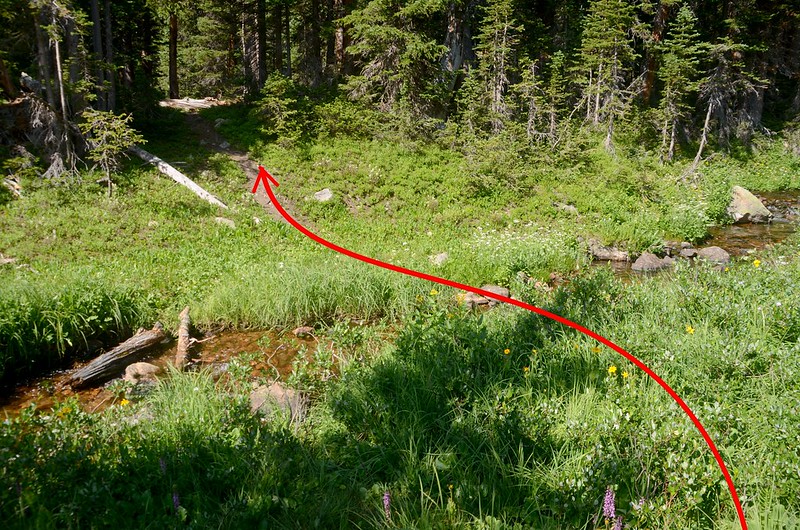
岔路下行30公尺遇左岔路,該岔路即是第一處岔路上來的路徑,還蠻清楚的;取右上行,小徑左側是Arapaho Creek,登山小徑蠻清楚的,應蠻多登山客在利用。
Arapaho Lakes Trail
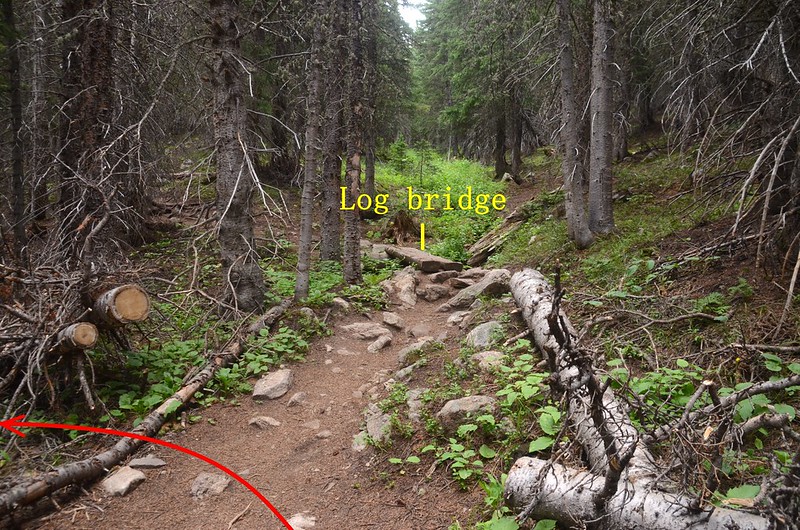
09:59 遇一岔路,座標N39.91007° W105.66552°,海拔約10,289呎/3,136公尺;
Arapaho Creek crossing by log bridge.
左岔有一原木橋橫跨Arapaho Creek到西岸,左右岔路行不久會會合,我先取右岔仍沿Arapaho Creek東岸上行。
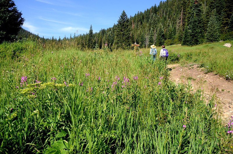
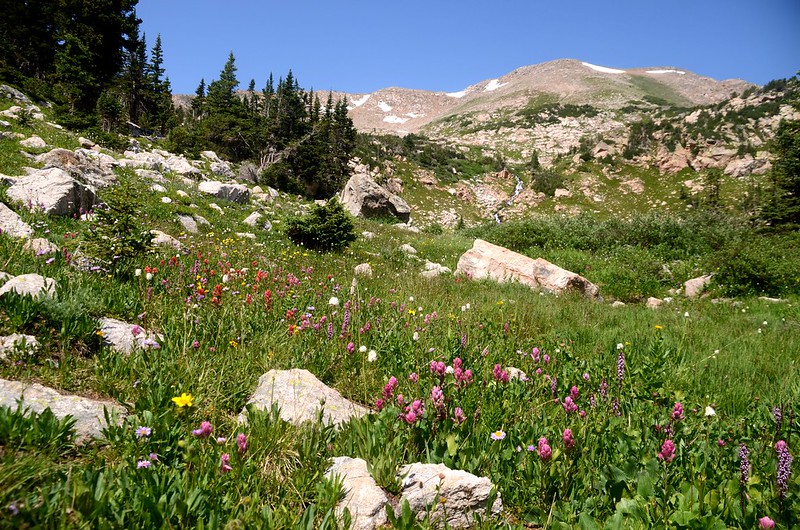
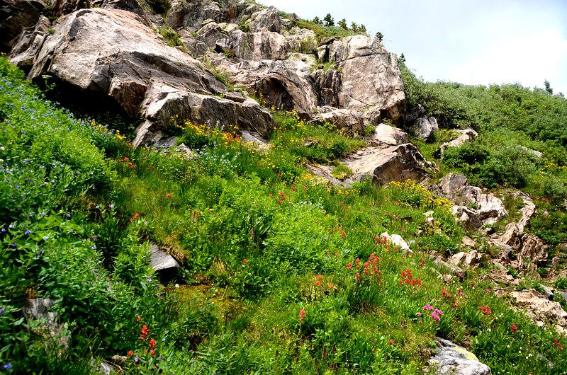
10:06 抵達一片大草原,草原上野花盛開;
Elephant Head
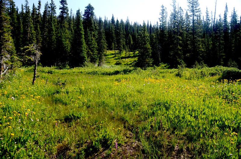
Wildflowers blooming along Arapaho Lakes Trail
草原左側河邊一處狹窄處有兩塊石頭可渡河,踩著Arapaho Creek溪中兩顆墊腳石越過Arapaho Creek到西岸,座標N39.91059° W105.66604°,海拔10,240呎/3,121公尺,距登山口2.92哩/4.7公里;
Arapaho Creek crossing over stones
過河後隨即遇第一處渡河處來接的岔路右轉在林中朝西緩坡上行。
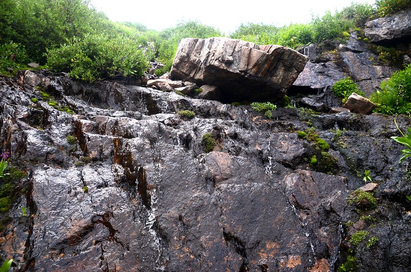
10:15 抵達路右接近Arapaho Creek一處不小的流瀑,座標N39.91048° W105.66884°,海拔10,358呎/3,157公尺,距登山口3.11哩/5.0公里;

Waterfalls along Arapaho Lakes Trail
沿著Arapaho Creek左(西)岸上攀,山徑轉為極陡爬升。
10:35 路過一棵大枯木後已達Lower Arapaho Lakes等高線,看左側林中植被還蠻乾淨的,決定由此左切往Lower Arapaho Lakes,座標N39.90963° W105.67230°,海拔10,715呎/3,266公尺,距登山口3.36哩/5.4公里;
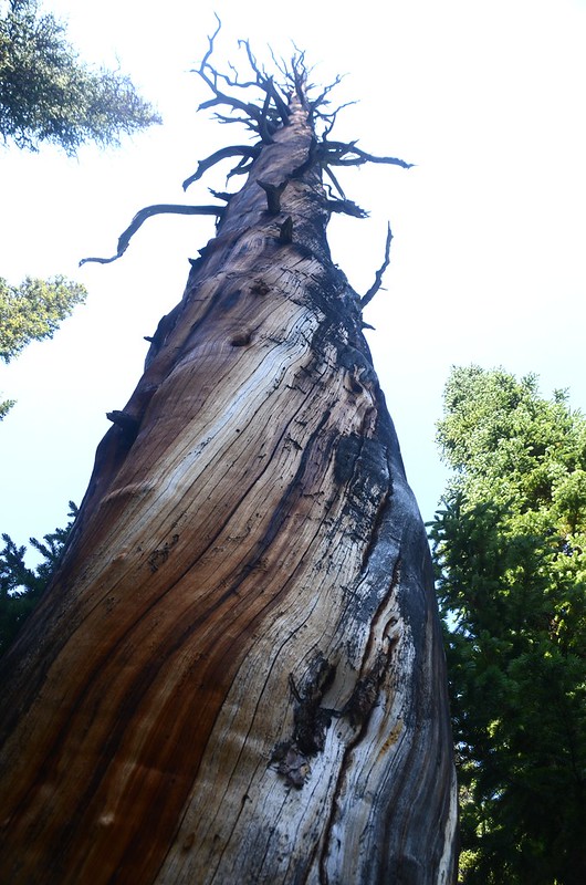
Dead tree
切入林後大致沿著等高線西南行,全無路徑抓準湖的方向西南行。
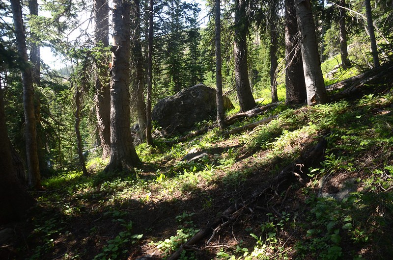
Lower Arapaho Lakes Trail
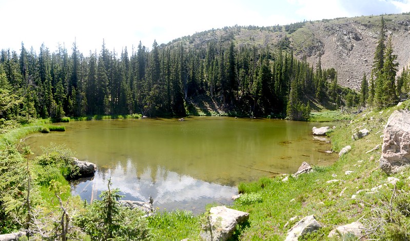
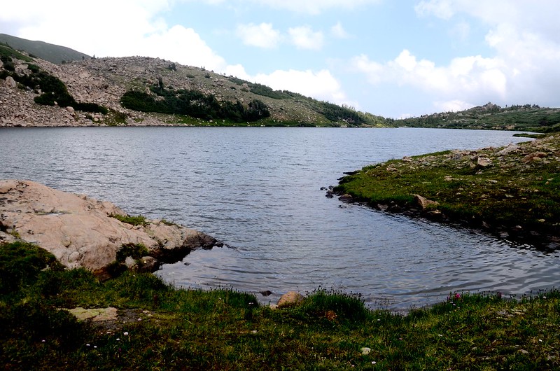
10:40 抵達North Lower Arapaho Lake,座標N39.90816° W105.67320°,海拔10,778呎/3,285公尺,距登山口3.54哩/5.7公里;

North Lower Arapaho Lake
North Lower Arapaho Lake
沿著南北兩座Lower Arapaho Lakes繞一圈後找一條更清晰的路線切回Arapaho Lakes Trail。
North Lower Arapaho Lake
South Lower Arapaho Lake
11:15 回到Arapaho Lakes Trail主線,座標N39.90934° W105.67350°,海拔10,823呎/3,299公尺;

Lower Arapaho Lake fork #2
取左續往Arapaho Lakes 上行。
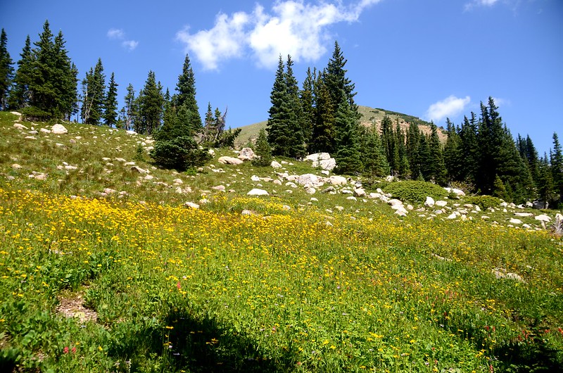

Wildflowers blooming along Arapaho Lakes Trail
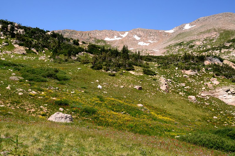
11:21 上抵一片平坦山谷,山谷長滿矮灌木Willow,此處海拔10,951呎/3,338公尺,距登山口 4.1哩/6.6公里;
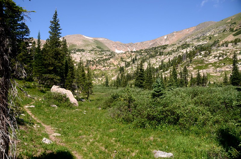
Upper valley below Arapaho lakes
向東俯眺隱約可見來時路Rollins Pass;
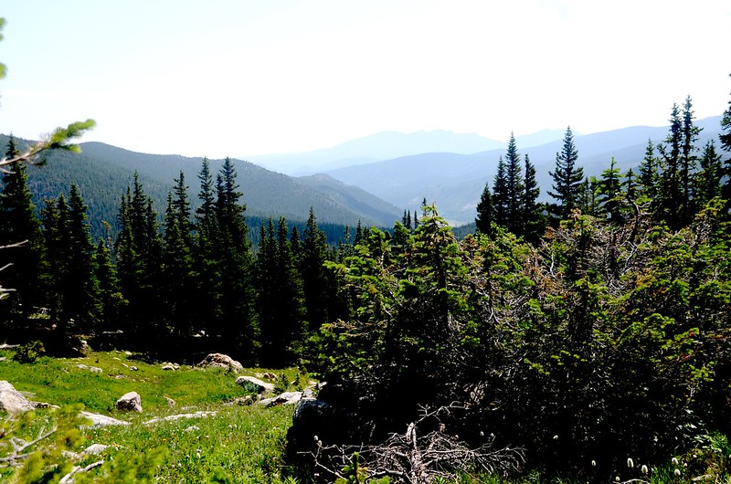
Looking back down trailhead from upper valley
步道沿著山谷平緩前進;
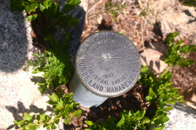
Benchmark at upper valley
近目的地前約數百公尺再上一小坡即抵達第一個Arapaho Lake。
Wildflowers blooming along Arapaho Lakes Trail
11:50 抵達East Arapaho Lake出水口,座標N39.90789° W105.67894°,海拔11,138呎/3,395公尺,距登山口4.47哩/7.2公里(含Lower Arapaho Lake 0.53哩/0.85公里)。
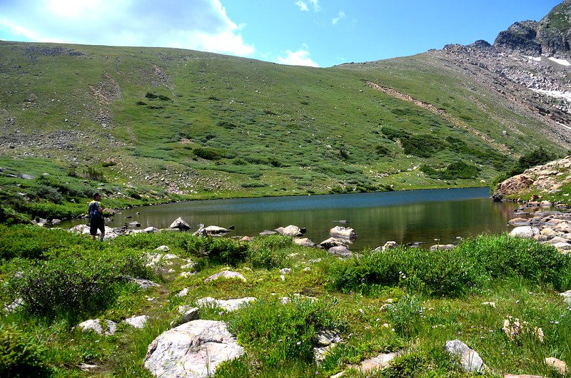
East Arapaho Lake outlet
在出水口小休和一位德裔美國山友寒暄後他要翻越南稜下Crater Lakes,我則沿Arapaho Lake的北稜攀登Upper Arapaho Lake。
Arapaho Lake的北稜基本上還算好走,但有一段路是穿梭在針葉林的矮樹叢間是較困擾的,注意腳下別踩空了。
12:28 登上Arapaho Lake 北稜一處大亂石堆高點,俯瞰Arapaho Lake,Upper Arapaho Lake則隱藏在西邊不遠處山腳下,中間要下到一小鞍部再攀上一岩坡;小心在大岩塊間朝Upper Arapaho Lake續行。
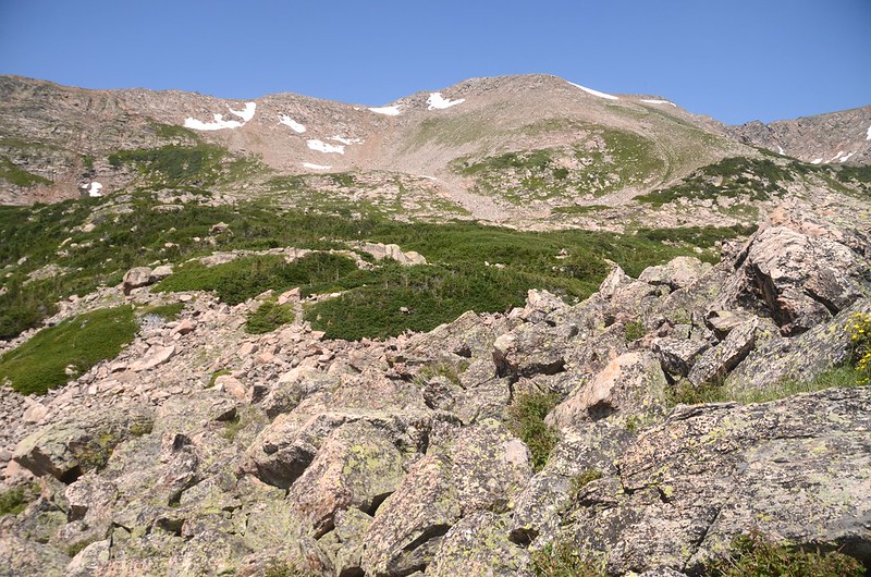
North ridge of Arapaho Lakes
Looking down at Arapaho Lakes from it's north ridge
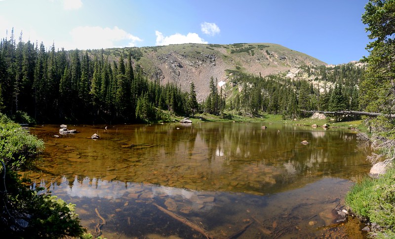
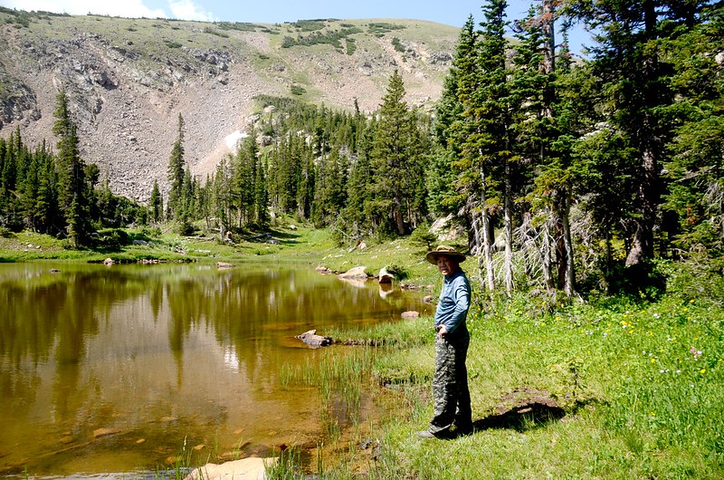
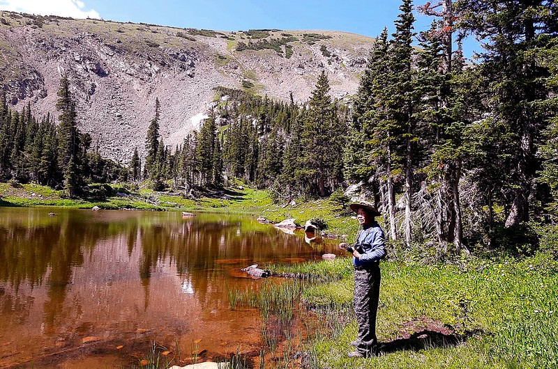
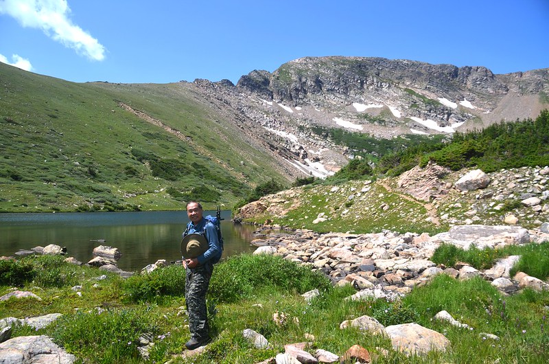
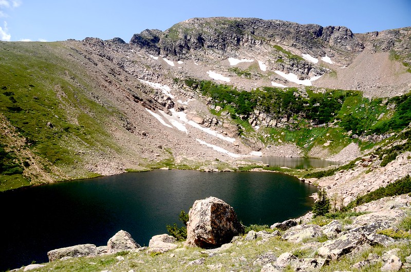
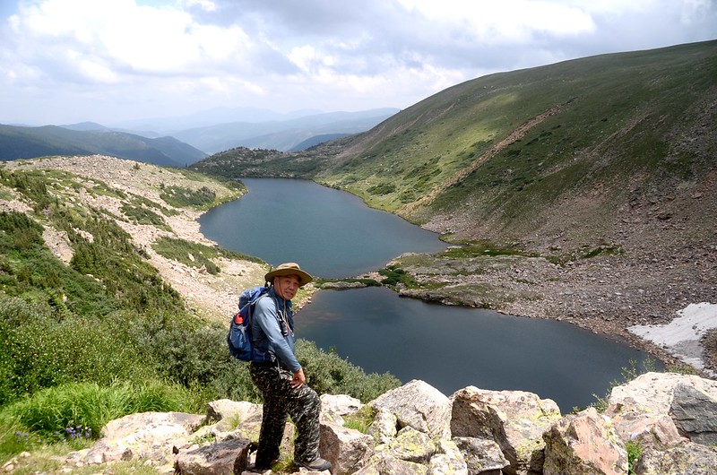
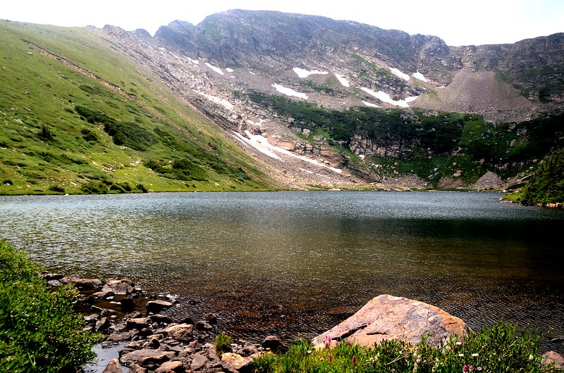
12:39 抵達Upper Arapaho Lake東北角制高點,座標N39.90925° W105.68555°,海拔11,486呎/3,501公尺,距登山口5.1哩/8.2公里;在此休息俯瞰Upper Arapaho Lake。

Upper Arapaho Lake
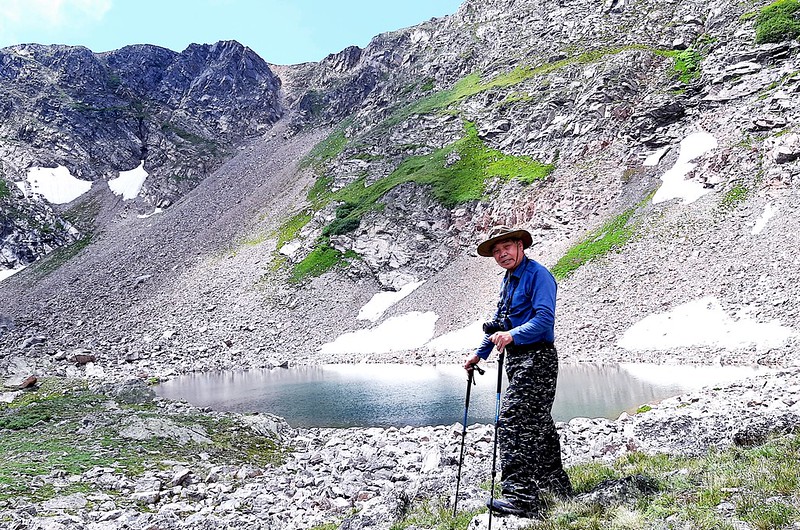
Upper Arapaho Lake
13:05 啟程下山,先下到Upper Arapaho Lake東岸走一趟後觀察下切West Arapaho Lake的路線,發現沿著Upper Arapaho Lake出水口下切應為可行,路徑雖然陡峭但依稀可看到不明顯路跡,顯示有山友由此線上下。
Looking down at East & West Arapaho Lake from Upper Arapaho Lake
13:13 由Upper Arapaho Lake出水口下切,座標N39.90823° W105.68603°,海拔11,457呎/3,492公尺,循著舊足跡小心下行,除一處大岩壁峭壁外,其他地形雖陡峭但小心踏點則無危險性;
Cliff under Upper Arapaho Lake
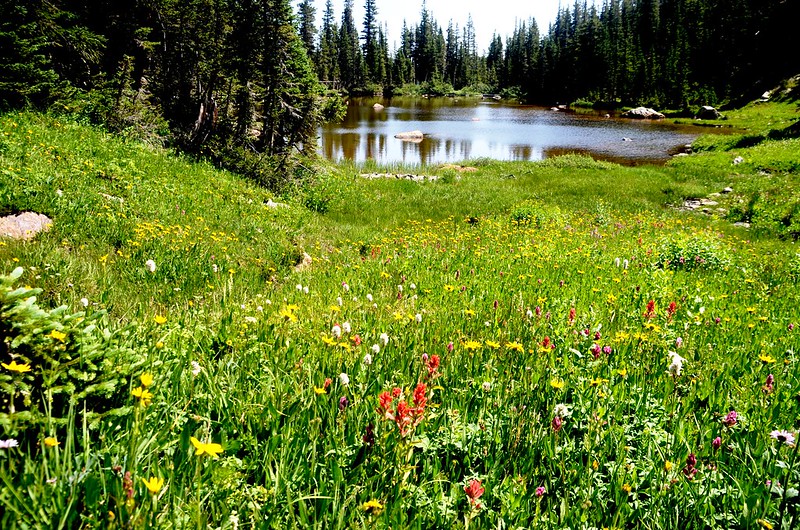
大岩壁峭壁段手腳並用、踏穩腳步再行亦不太困難,沿途沼澤型態百花齊放。
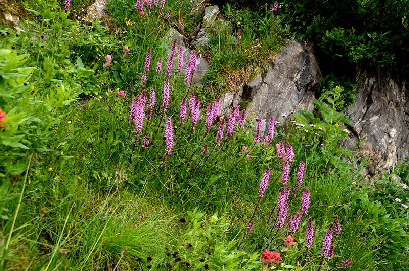
Wildflowers blooming along Arapaho Lakes Trail
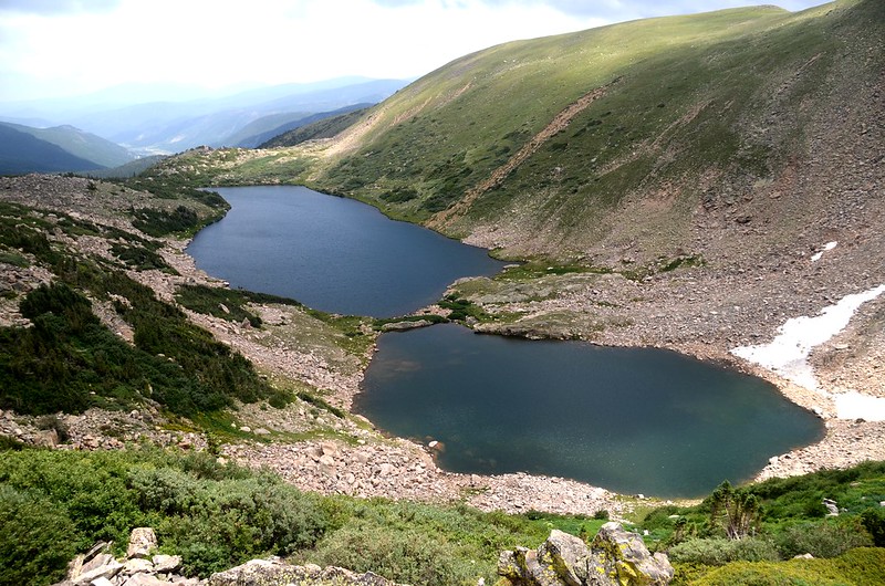
13:36 下抵West Arapaho Lake西岸,座標N39.90750° W105.68469°,海拔11,171呎/3,405公尺,距登山口5.4哩/8.7公里;沿著West Arapaho Lake北岸繞到East Arapaho Lake和West Arapaho Lake之間分隔島;

A thin band of talus and sedge separates the Arapaho Lakes
沿著分隔島走到East Arapaho Lake南岸,再沿南岸東行到East Arapaho Lake出水口。
East Arapaho Lake
East Arapaho Lake outlet
14:10 下山,循上山原路下山。
14:38 下抵Lower Arapaho Lake 第二岔路取左下山。
15:11 回到Forest Lakes & Arapaho Lakes 岔路前約30公尺的岔路,座標N39.90726° W105.66126°;早上是從左岔下來,但右岔路跡很明顯,取右岔沿Arapaho Creek左岸下行。
15:17 接回Forest Lakes Trail,座標N39.90609° W105.65943°,海拔10,125呎/3,086公尺;岔路口上行幾公尺即是一座原木橋,岔路口以倒木橫置極不明顯,取右循Forest Lakes Trail下山。
15:46 返抵Forest Lakes & South Boulder Creek Trail 岔路,取左岔下山。
16:14 返抵登山口,完成Arapaho Lakes 探索之行。
Alltrails:Arapaho Lakes hiking track (2021.07.29)
沒有留言:
張貼留言