
Looking east at mountions from Second Creek Trail near 11,867 ft.
-------------------------------------------------------------------------------------
攀登山頭:Twin Cones,海拔12,057呎/3,675公尺
登山口:Second Creek Trailhead,海拔10,591呎/3,228公尺
登山里程:全程往返5.1哩/8.2公里
總爬升高度:1,512呎/461公尺
登山時間:上下山費時5小時10分鐘
-------------------------------------------------------------------------------------
行車資訊:
由Golden開車沿I-70西行,行至I-70里程232哩時由Exit-232下交流道,然後右轉沿U.S. 40 西行,行約14.5哩抵達道路最高點大陸分水嶺 Berthoud Pass (US 40哩程243 mile);過Berthoud Pass後道路開始下坡,行約3哩在道路左側有一土石地面停車空間 (US 40哩程240 mile),此為Second Creek Trailhead登山口停車場,座標N39° 49' 22.4" W105° 46' 10.4",海拔10,554呎/3,217公尺。

Second Creek Trailhead parking lot
步程簡述:
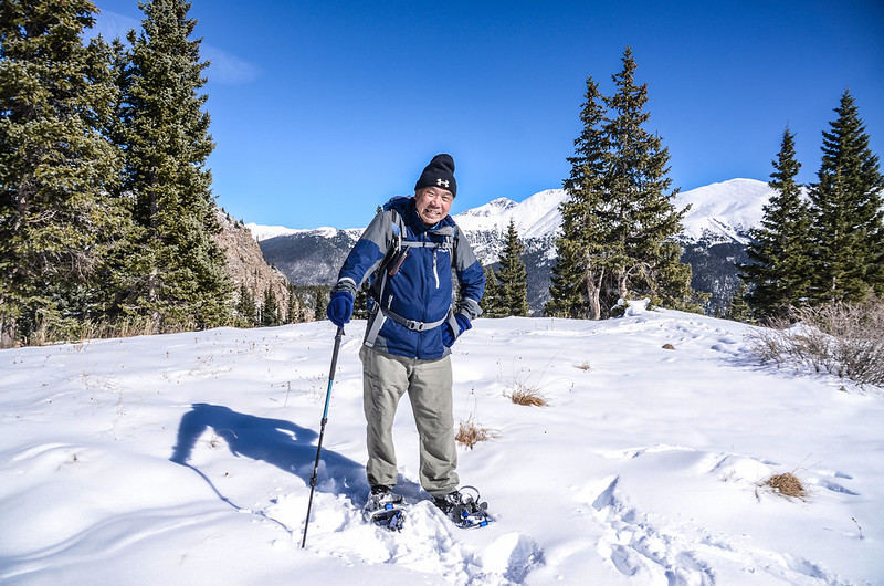
09:00 由Second Creek Trailhead登山口出發,座標N39° 49' 21.9" W105° 46' 11.2",海拔10,591呎/3,228公尺;
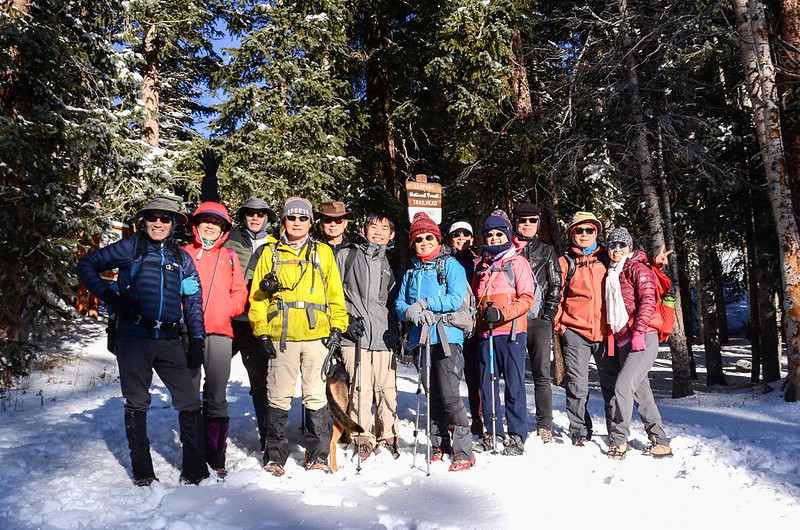

Second Creek Trailhead
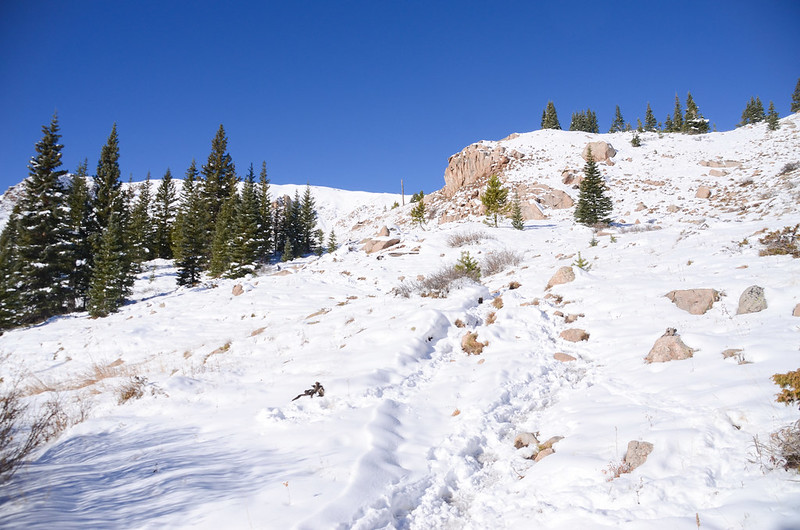
沿著Second Creek Trail朝西北爬升,步道前段在松林中穿行,整個步道覆蓋著約一尺厚的積雪,今天我們算是早來所以僅看到一兩個登山客走過的足跡,我們僅能依循航跡自行摸索爬升,雪厚走來不輕鬆。


On our way up to Broome Hut
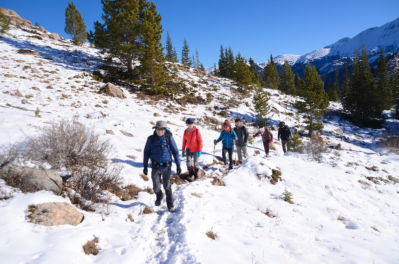
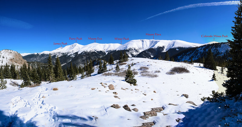
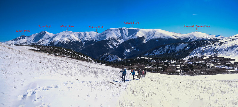
一路在松林中往上爬升,不時回首由樹梢空隙東望Mount Eva稜線幾座山頭;

Looking east at mountions from Second Creek Trail near 11,161 ft.

Looking east at mountions from Second Creek Trail near 11,142 ft.
行約45分鐘後於海拔11,155呎/3,400公尺左右出了森林線,視野更加寬闊。
On our way up to Broome Hut

Looking east at mountions from Second Creek Trail near 11,181 ft.

Looking east at mountions from Second Creek Trail near 11,188 ft.

Looking east at mountions from Second Creek Trail near 11,214 ft.

Looking east at mountions from Second Creek Trail near 11,243 ft.
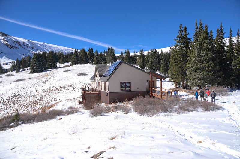
10:00 抵達Broome Hut,座標N39° 49' 35.1" W105° 46' 58.9",海拔11,350呎/3,459公尺;

Broome Hut

Broome Hut
Broome Hut則是位於Berthoud Pass以西一英里半處的11,350英尺的陡峭山頂上,屬於Grand Huts Association所擁有和經營,原名為Second Creek Hut,是科羅拉多州最好的高海拔滑雪和徒步旅行地點之一,一年四季提供戶外活動者住宿之用,由於輕鬆的登山步道和極佳的滑雪設施為遊客提供絕佳的野外休閒娛樂機會;我們在小屋東側一展望台休息觀景。


Broome Hut Viewpoint
Looking east at mountions from Broome Hut Viewpoint
10:22 續往Twin Cones出發,由Broome Hut屋後小徑續朝西北行,此後的步道被厚厚白雪覆蓋,又沒登山客走過完全看不到路徑,此時領隊宇靈兄穿上他的Snowshoe在前開道,跟循航跡緩慢上行,我們在後亦步亦趨地在雪地上列隊上行;

Snowshoe

Snowshoeing
步道先穿過小段松林後即在矮willow叢中朝凹谷盆地西北行。


On the way up to Twin Cones
10:47 跨過First Creek後繼續上行;

Crossing First Creek


On the way up to Twin Cones
再行約350公尺步道改沿稜線南坡朝西北爬升。
Looking east at mountions from Second Creek Trail near 11,847 ft.

Looking east at mountions from Second Creek Trail near 11,922 ft.


On the way up to Twin Cones
11:33 抵達稜線上第一處石堆(Cairn),座標N39° 49' 58.5" W105° 47' 32.6",海拔11,946呎/3,641公尺;

Cairn #1


Cairn #1
此處可望見右側遠處的Twin Cones。

Twin Cones from #1 cairn

Twin Cones
在大片雪白的雪地上你才會體會此石堆的重要性,它猶如一座沒有燈光的燈塔,給了登山客一座明確的指標不致分不清方向。
11:40 抵第二處石堆(Cairn),步道在此石堆處右轉朝遠方的Twin Cones東北行,座標N39° 50' 01.4" W105° 47' 34.9",海拔11,942呎/3,640公尺。

Cairn #2
12:00 抵達第一座石坵,我們由石坵的南面岩石坡往上爬,這是一段危險的路程,由於岩石坡覆蓋厚厚白雪,根本看不出岩石堆的狀況,萬一一腳踩空,輕則擦傷重責骨折,爬來真是戰戰兢兢,幾乎是狗爬式爬上山頂。

On the way up to Twin Cones
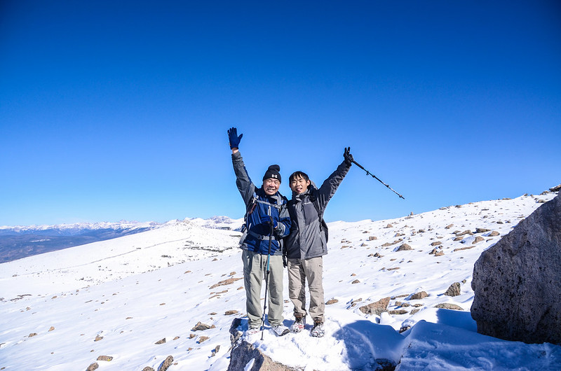
12:10 登上第一座石坵(Cone),座標N39° 50' 13.2" W105° 47' 14.7",海拔12,057呎/3,675公尺;


On the Twin Cones' Top

Looking north at North Cone & mountains from Twin Cones' top
在山頂休息後觀察地形覺得北面坡坡度較緩遂改由北面坡下山;


Going down from #1 Twin Cone

Looking north at North Cone & mountains from Twin Cones
下抵石坵下覺得積雪太厚危險乃放棄再登第二個石坵轉頭循原路下山。

Looking north at North Cone & mountains from Twin Cones' top

Looking southwest at mountains from Twin Cones


Going down the mountain

Looking east at mountions from Second Creek Trail near 11,906 ft.

Looking east at mountions from Second Creek Trail near 11,860 ft.
13:28 返抵Broome Hut,小休後續沿原路下山。
14:10 返抵登山口,因為明天就要返台,依依不捨地和山友們道別後貝貝體貼的自告奮勇開車返家,結束今年第一趟也是最後一趟雪地登山行程。
Alltrails:Twin Cones Trail Hike (2022.10.29)
沒有留言:
張貼留言