
Overlooking Pikes Peak from I-25 Hwy
Pikes Peak是科羅拉多州排名第32高的一座14er,海拔14,115呎/4,302公尺,車子可直接開到山頂,我和女兒家人曾在2005.05.28開車上去;小外孫貝貝近日欲和其同學家人去攀登此山,一直慫恿我一起去爬,還用激將法說我如沒去爬就不算真正爬完丹佛近郊28座14ers,最終在他的半激半求下還是拚著老命跟他和他同學家人去爬了!
這次我們決定走Northwest Slopes路線,由Crags Campground附近的Crags trailhead起登;登山口Crags trailhead海拔10,000呎/3,048公尺,往返里程約14哩/22.53公里,總爬升約4,300呎/1,311公尺,如在台灣勉可撐上去,問題是在這高海拔的國度,空氣稀薄,加上年紀稍長體力大不如前,對我來說不啻是另一挑戰。
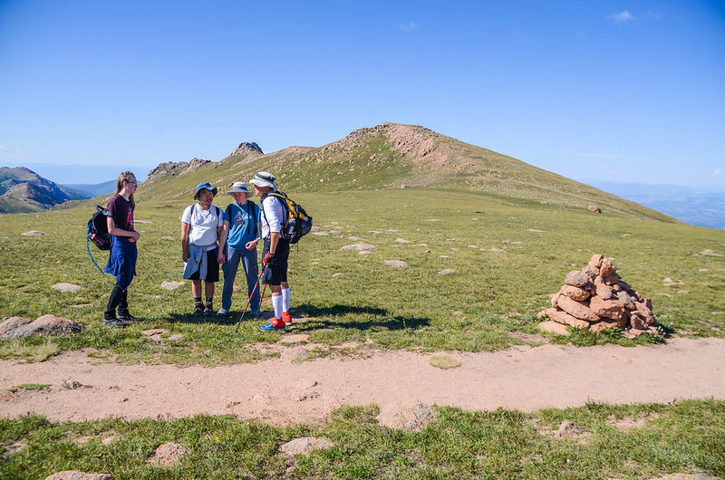
此次登山除了我和小外孫貝貝(Jacob)外,還有他大學同學及家人,他同學的外公Scott今年也74歲了,也許常運動,體力顯然比我好很多,他的孫子都叫他Blue Truck (他早年開著一部藍色小卡),登山途中我也很自然地叫他Blue Truck。

Pikes Peak view from Garden of the Gods visitor center

Pikes Peak view from Siamese Twins Arch , Garden of the Gods
----------------------------------------------------------------------------------
攀登山岳:Pikes Peak,海拔14,115呎/4,302公尺
登山日期:2023.08.16
登山口:Crags trailhead,海拔9,989呎/3,045公尺
登山里程:上下山合計約14哩/22.53公里
總爬升高度:約4,300呎/1,311公尺
登山時間:上山6小時,下山4小時,山頂休息1小時,往返費時11小時
登山人員:Scott、Regina、Peter、Jacob、陳基滿
----------------------------------------------------------------------------------
行車資訊:
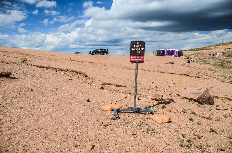
由Colorado Springs開車沿U.S. 24公路往Woodland Park西北行,行約25哩到Divide左轉入CO-67公路南行,行約4.3哩後在牧場附近左轉進入Teller Co Rd 62土石路朝東北行,土石路行約3.0哩抵達Crags Devils Playground trailhead Parking Lot,座標N38° 52.424' W105° 07.435',海拔10,000呎/3,048公尺。

Crags Devils Playground trailhead Parking Lot

Mountain view from the trailhead
步程簡述:
06:50 由Crags trailhead登山口出發,海拔9,989呎/3,045公尺;


Crags Trailhead
先經過登山口南側一座橫跨在Fourmile Creek 溪上的木橋後步道開始在杉林中迂迴盤升。

Cross Fourmile Creek by log bridge

Crags Trail
07:04 抵一岔路,座標N38° 52.299' W105° 07.013',海拔10,167呎/3,099公尺,距登山口約0.5哩/0.8公里;

Crags Trail
岔路口右側有三根凸出地面不高的水管,右側往後岔路是由舊登山口Crags Campground上來的路,過岔路後十來公尺又遇Crags trail和Devil's Playground Trail岔路,左岔Crags Trail直行往Crags不取,取右岔Devil's Playground Trail下行。

Crags trail & Devil's Playground Trail junction
07:05 由兩根大原木度過Fourmile Creek,座標N38° 52.297' W105° 07.003',海拔10,165呎/3,098公尺,距登山口約0.51哩/0.82公里;

Cross Fourmile Creek by log bridge
跨過小溪後即可看到右側的路標確認您正在通往Devil's Playground的小路上。
07:14 再度過一條小溪,上有兩根原木,此處海拔約10,400呎/3,170公尺;

Cross Fourmile Creek by log bridge
此後步道在森林中緩坡上攀,隨著高度的增加從樹縫及樹梢空隙可看見路左朝陽照射下艷紅的Crags。

Devils Playground Trail

The Crags stand prominently in the distance
07:50 抵一片空曠小草地,座標N38° 52.084' W105° 05.855',海拔11,022呎/3,360公尺,距登山口約1.8哩/2.9公里;

Above 10,900’, viewing the route to tree line
在小空地邊緣行約50公尺後左轉朝東北方爬上一條長而直的路段直至11,300呎/3,444公尺左右。

Devils Playground Trail

Looking back toward the Crags from Devil's Playground Trail
08:28 開始“之”字形在山坡間盤升,此處海拔約11,342呎/3,457公尺,距登山口約2.1哩/3.38公里;此路段坡度比前面路段來得要陡。

Devils Playground Trail

The view from Devil's Playground Trail near the saddle
08:52 最後一次髮夾彎右轉後朝東南爬升,座標N38° 52.009' W105° 05.401',海拔11,857呎/3,614公尺;

Devils Playground Trail
過此髮夾彎已接近森林線。
08:53 出森林線,座標N38° 51.964' W105° 05.335',海拔11,900呎/3,627公尺,距登山口約2.7哩/4.35公里;

Leaving the trees and approaching the steepest section of the trail

Devils Playground Trail
此後步道即在山坡中朝東南往稜線鞍部直線爬升,坡度很陡。

Devils Playground Trail

The view from Devil's Playground Trail near the saddle
09:15 登山步道微左轉朝東繼續在坡面上陡峭爬升,座標N38° 51.882' W105° 05.155',海拔12,140呎/3,700公尺。

Devils Playground Trail
09:46 終於登上陡坡頂端抵達一鞍部,座標N38° 51.868' W105° 04.736',海拔12,756呎/3,888公尺,距登山口約3.2哩/5.15公里;


The 12,750' saddle at northwest slopes
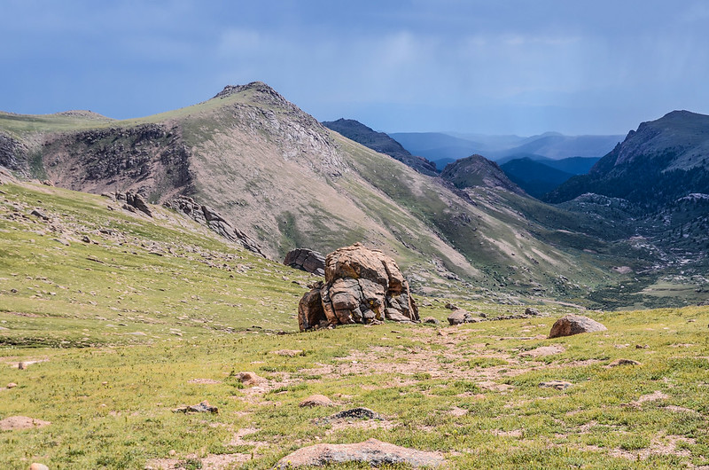
路旁一座大石堆(cairn),此鞍部朝東南方向可以看到Pikes Peak的山頂,也隱約可看到剩餘路線的大部分景色,從這裡到山頂還有3哩多的路程;

Near the 12,750-foot saddle, viewing much of the remaining route. From this point, it’s 3 more miles of hiking to reach the summit.
我們在此小休十來分鐘再朝山頂續行,此後步道轉為較為平坦的路面朝東往Devils Playground緩坡東行。
10:00 左側稜線上有一處觀景點,座標N38° 51.927' W105° 04.540',取左脫離步道上到稜線朝北俯瞰如無數髮夾彎的Pikes Peak Toll Road及路邊的Glen Cove – PPIHC、Ski Area – PPIHC;PPIHC (The Pikes Peak International Hill Climb)是Pikes Peak國際爬山賽,也稱為“雲端競賽”,是一年一度的美國科羅拉多州Pikes Peak頂峰汽車爬山賽。

Devils Playground Trail


Overlooking Pikes Peak Toll Road from the viewpoint facing north
在北邊遠方湖泊是North Catamount Reservoir。

Overlooking Pikes Peak Toll Road from the viewpoint facing north
10:15 抵一堵大岩層中間一缺口,座標N38° 51.781' W105° 04.298',海拔12,860呎/3,920公尺,距登山口3.8哩/6.12公里;
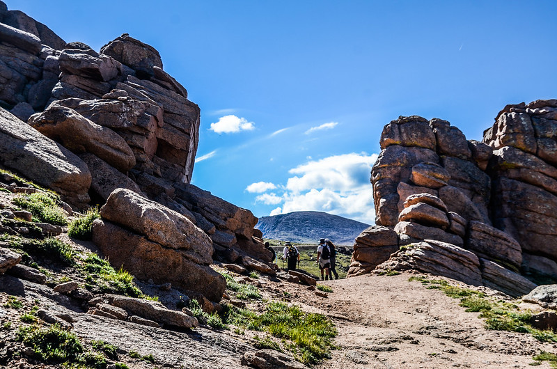
Portal to the Devils Playground
大岩層堆疊的一片片岩塊Blue Truck稱他為“Pancake”,倒也有幾分像,路過這裡肚子也有點餓了,要是來幾片“Pancake”最好,如沒有望望那石塊就當望梅止渴也好!


Looking back through the 'gateway' in the rocks~Pancake
穿過岩層缺口就快到Devils Playground了;由缺口東南望今天的目的地Pikes Peak矗立在約2.5哩/4.02公里外的遠方。

Devils Playground Trail

Up through the rocks
10:22 抵達Devils Playground大停車場,座標N38° 51.800' W105° 04.131',海拔12,945哩/3,946公尺,距登山口約3.9哩/6.28公里;
Devils Playground
停車場蠻大的,設置有行動廁所,停車場有一條Devils Playground Trail可登上西北邊的Devils Playground Peak。
10:24 由停車場東北角穿越Pikes Peak Toll Road到道路北側沿著Pikes Peak Toll Road東側登山步道往山頂東南行,穿越點座標N38° 51.832' W105° 04.087',海拔12,936呎/3,943公尺,距登山口約4.0哩/6.44公里;穿越過Pikes Peak Toll Road後步道旁立了一面告示牌,看了之後才知道命名的由來,告示牌上寫道“Devil’s Playground so named because of the way lightning jumps from rock to rock during a thunderstorm”。

Devils Playground
步道緊挨著左側山頭山腳下寬敞的步道南行。

Looking back at the route leading to Devils Playground, The Pikes Peak Road is in the foreground

Near 12,950’ along the road, Follow the trail on the left side of the road as you approach point 13,363’
10:43 抵Bottomless pit viewpoint,座標N38° 51.440' W105° 03.823',海拔12,940呎/3,944公尺;


Bottomless pit viewpoint

Bottomless pit viewpoint
過了Bottomless pit viewpoint後步道繼續向南繞過左邊的一個山頭續往東南行;

Bottomless pit viewpoint

Devils Playground Trail

At 13,150’ on the left (northeast) side of Point 13,363’. Follow the trail back to the road and past two more road corners
不久下到13,363’山頭(有人稱該山頭為Little Pikes)左側山腳下沿步道東南行。

Devils Playground Trail
11:00 登山步道由13,363’山頭左側山腳下經過朝東南緩升,此時剩下的登山步道盡收眼底。

Devils Playground Trail
11:13 繞過13,363’山頭後抵達13,363’山頭與Pikes Peak間的鞍部,座標N38° 50.984' W105° 03.426',海拔123130呎/4002公尺;

The saddle between Pikes Peak & Point 13,363'
此鞍部右側緊鄰著Pikes Peak Toll Road,鞍部有少許早期礦場遺留的機具。
11:44 離開鞍部由Pikes Peak Toll Road大轉角旁沿著路跡還很清楚的小徑切上Pikes Peak岩石坡下方大平台,座標N38° 50.706' W105° 02.959',海拔13,500呎/4,115公尺;

Pikes Peak Toll Road

Devils Playground Trail

The platform at the bottom of the final stretch


Bighorn sheep
在平台上仰望接下來剩下約0.5哩的陡峭亂石坡,此亂石坡要爬升約600呎/183公尺左右。

The final stretch below the summit
離開平台進入大亂石坡沿著登山客堆疊的石堆(cairn)往山頂爬升,部分路段石堆有點分岐必須仔細尋找路徑。

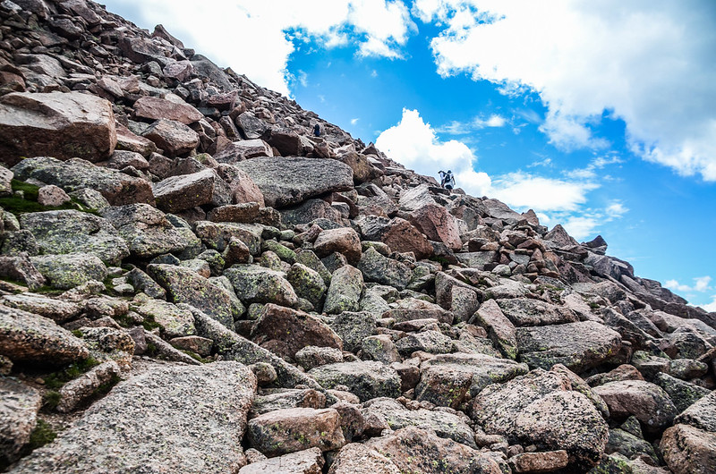
Crossing the upper scree field

View southwest at Bighorn Reservoir from the rock slopes below the summit

Rocky terrain throughout hike on Devils Playground route
12:47 抵達一處道路大彎道轉角處,此處已快到山頂了,座標N38° 50.492' W105° 02.773',海拔14,034呎/4,278公尺;

Just below the summit on a corner of the road
由道路轉角處左上切較為緩坡的碎石坡續往山頂爬升。

Crossing the upper scree field
12:50 花了六小時終於登上Pikes Peak山頂,距登山口約6.6哩/10.62公里;

The view from Pikes Peak summit
Blue Truck趁和我拍照時高興地拉著我向遊客說“Our combined ages are 152"(我們的總年齡是 152);

2005.05.28拍攝於山頂標誌碑,當年我懷中的小孩即是今天陪我登頂的貝貝


Me & Blue Truck on the summit


New summit sign at Pikes Peak

The benchmark on the summit of Pikes Peak
一望無際的山頂大平台已煥然一新,景物和十幾年前已完全不同,原來石砌的遊客中心已拆除改建為現代化的時尚建築;

Summit house (Taken in 2005.05.28)

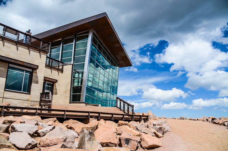

Pikes Peak summit visitor center
在山頂官方所立的山頂標誌拍照後我們進入遊客中心休息用餐,當然嚐嚐這裡有名的甜甜圈是一定要的啦!

The high altitude donuts at Pikes Peak Summit House

View north from the summit of Pikes Peak

Looking down to Lake Moraine from the summit(To the southeast)

View north from the Pikes Peak summit

The view from Pikes Peak summit

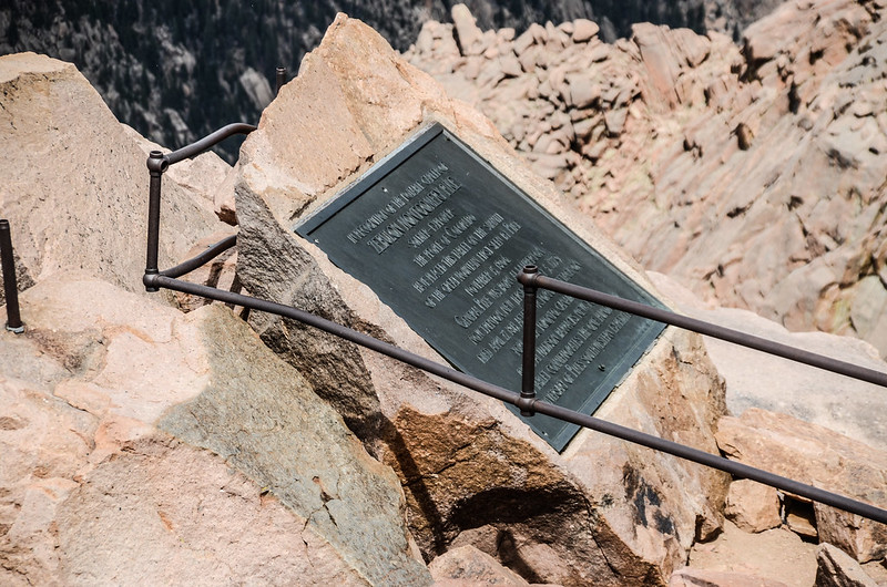
“America the Beautiful ” plaque on thesummit of Pikes Peak (by Katharine Lee Bates)
Zebulon Montgomery Pike Marker on the summit of Pikes Peak

Looking over the cog rail line at the summit of Pikes Peak, Colorado
13:50 休息後在山頂繞一圈後循原路下山。

Crossing the upper scree field
15:33 回到Devils Playground續沿原路下山。

Devils Playground Trail
17:50 返抵登山口停車場,稍微整裝後搭Blue Truck的車下山返家。
沒有留言:
張貼留言