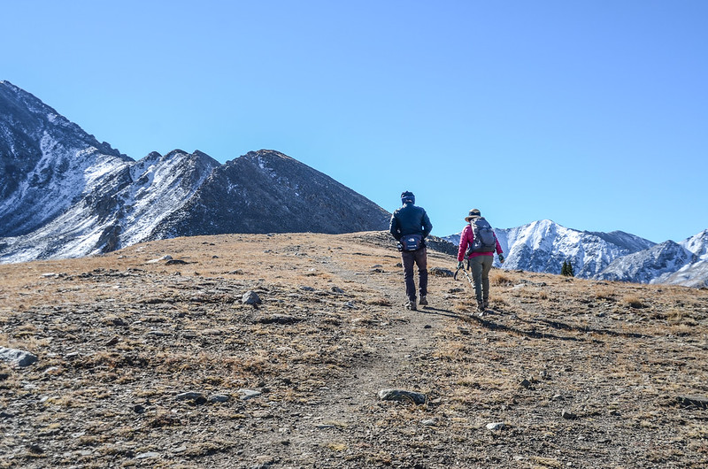
Looking east at the jagged ridgeline above the Boston mine from Drift's northwest ridge
採礦遺址Boston mine位於Summit County的Mayflower Gulch頂端,坐落在一個天然的圈谷中,三面被長期白雪覆蓋的尖頂岩石峭壁包圍;Boston Mine是一個1890年代的採礦營地,大約有六間處於不同腐爛狀態的小木屋、傾頹的礦工住宿廢墟以及散佈在現場周圍的生鏽的採礦工具,Mayflower Gulch Trail是一條很優質的健行步道,除了登山健行外,又可探索礦坑遺址,適合家庭老少、親子同行。
-----------------------------------------------------------------------------
登山步道:Mayflower Gulch Trail
登山口:Mayflower Gulch Trailhead,海拔10,980呎/3,347公尺
登山里程:往返全程約6.31哩/10.15公尺
總爬升高度:1,634呎/498公尺
登山時間:全程費時4小時44分
-----------------------------------------------------------------------------
行車資訊:
由丹佛開車沿I-70往Copper Mountain ski resort西行,行至I-70里程195 Mile下交流道朝CO-91 S前進並往Copper Mountain/Leadville的方向走,0.4哩後接著走CO-91 S南行,CO-91 S行約5.9哩左轉進入道路東側Mayflower Gulch Trailhead停車場停車,座標N39° 25.832' W106° 09.928',海拔10,980呎/3,347公尺。
Looking southeast at the jagged ridgeline above the Boston mine from Mayflower Gulch Trailhead
步程簡述:
08:40 由Mayflower Gulch Trail登山口出發,座標N39° 25.819' W106° 09.916',海拔約10,980呎/3,347公尺;
Mayflower Gulch Trailhead
行約數十公尺遇一鐵柵門,此鐵柵門係採季節性封閉,冬季封閉禁止車輛進入。
The gate near trailhead
Mayflower Gulch Trail是一條早期礦區使用的道路,所以步道很寬,步道朝向東南前行,眼前遙望正前方鋸齒狀稜線是海拔四千多公尺的Atlantic Peak~Fletcher Mountain連稜,今天要去的Boston mine採礦遺址及位在該稜線下方;
Looking southeast to the jagged ridgeline above the Boston mine from Mayflower Gulch Trailhead
Looking southeast at the jagged ridgeline above the Boston mine from Mayflower Gulch Trail
步道經過鐵柵門後行不遠即進入森林穿行在高聳的杉林中,沿途尚留下一些採礦遺跡;
Mayflower Gulch Trail
此步道前1.5哩尚可行駛高底盤四輪傳動車。
09:06 路左一棟已傾倒的木屋,座標N39° 25.334' W106° 09.456',距登山口約0.7哩/1.13公里。
A collapsed cabin along Mayflower Gulch Trail
09:07 路右略高點有一座廢棄的建築~礦石溜槽( ore chute),是早期採礦過程的一部分設備,用途是將沉重的岩石移入貨車;此處座標N39° 25.270' W106° 09.397',距登山口約0.8哩/1.26公里。
An old ore chute along Mayflower Gulch Trail
Looking east at mountains from Mayflower Gulch Trail
09:38 抵達Jeep road的終點,座標N39° 24.858' W106° 08.912',海拔約11,530呎/3,514公尺,距登山口約1.5哩/2.41公里;高底盤四傳車可開到此,終點處道路兩旁多處空間可停車,但空處不多,粗估不超過停十輛車的空間。
Looking east at mountains from Mayflower Gulch Trail
道路終點左右各有一管制柵門禁止車輛進入,左岔有一鐵柵門通往Mayflower Gulch頂端的Boston Mine遺址,右岔一道原木柵門的步道是Mayflower Gulch Trail另一支線,該支線行約0.7哩、爬升約520呎可通往右側一高處展望點,該展望點是屬於海拔4,237公尺的Drift Peak西北稜線;我們決定先取右岔上展望點賞景,然後再到Boston Mine遺址參觀。
Mayflower Gulch Trail fork
Drift Peak from Mayflower Gulch Trail
After exiting the trees, the Drift Peak summit and northwest ridge come into view
On the road up to the ridge crest
10:14 登上Drift Peak西北稜線,座標N39° 24.702' W106° 09.134',海拔12,000呎/3,658公尺,此處是Alltrails航跡的終點,右下緩平稜線通往11,936呎/3,638公尺的Gold Hill,並有步道下到左側山谷的Clinton Gulch Dam Reservoir;
The northwest ridge crest of Drift Peak
取左沿稜線上行。
Hike south up the ridge to a flat spot, near 12,050'
10:22 抵達稜線上一處Rock shelter處,座標N39° 24.702' W106° 09.134',海拔12,050呎/3,673公尺,距登山口約2.2哩/3.54公里。
Taken from Drift's NW Ridge near 12,050’
此處有極佳的展望,東邊近看Tenmile Range由北至南Crystal Peak、Pacific Peak、Atlantic Peak、Fletcher Mountain、Drift Peak等幾座13ers連稜;
Looking east at the jagged ridgeline above the Boston mine from Drift's northwest ridge
Looking southeast toward Fletcher Mountain & Drift Peak from Drift's NW Ridge near 12,050’
西南邊遙望Sawatch Range的La Plata Peak、Mount Elbert、Mount Massive及Mount of the Holy Cross等幾座14ers;
Looking southwest at Sawatch Range from Grift Peak's northwest ridge
Looking south toward Mountains from Drift's NW Ridge near 12,050’
Looking southwest at Mount Elbert from Grift Peak's northwest ridge
北望Gore Range及Tenmile Range部分山頭。
Looking north to Gore Range & Tenmile Range from Drift's NW Ridge
Looking north at mountains from Grift Peak's northwest ridge
在此賞景拍照後下切循原路回到Mayflower Gulch Trail。
10:48 返抵Mayflower Gulch Trail Jeep road的終點處取右岔經一鐵柵門朝東南往Boston Mine遺址上行,在鐵柵門處東南望峽谷盡頭的圈谷三面被四千多公尺的高山環抱,山與山之間是尖聳岩石峭壁的稜線;群山環抱下的圈谷即是Boston Mine礦場遺址。
Soaring mountains surround the end of Mayflower Gulch
10:51 抵Boston Mine遺址廢墟處,座標N39° 24.793' W106° 08.816',海拔11,560呎/3,523公尺,距Jeep road終點約0.1哩;
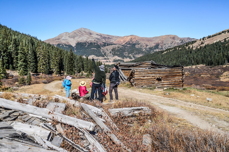
Boarding house and cabin Ruins Of Boston Mine, Mayflower Gulch
A view of the Boston Mine ghost town
Boarding house and cabin Ruins Of Boston Mine, Mayflower Gulch
Ghost town cabin window view
此處看到一棟還算完整的木屋遺址及三棟已傾倒的木屋遺址,在木屋遺址的西南角較低處有一處採礦遺址,散置著部分已鏽蝕的採礦機具。
Mining ruins and rusty mining machinery
我們在遺址附近休息用餐。
1880s mining camp still clinging to life in Mayflower Gulch. Jacque Peak (13,205′) rises in the distance
11:15 續沿Boston Mine遺址廢墟旁小徑(Mayflower Gulch Trail)往峽谷頂端朝東南上行。
Old Boston Mine Trail
11:40 又經過一道鐵柵門,海拔約11,910呎/3,630公尺。
Old Boston Mine gate #3
11:51 路左一座不像木屋倒像是拴馬架的原木建築遺址;
Boarding house and cabin Ruins Of Boston Mine, Mayflower Gulch
過此遺址後小徑續往前行可上到半山腰的礦坑廢墟,由下往上望陡峭的山壁分布幾處礦坑出口,看狀況大部分很難再接近了;我們今天沒計畫參觀礦坑廢墟,改右下切往右邊山腳下的流籠頭遺址參觀。
Cable Tower Ruin At Boston Mine, Mayflower Gulch
Looking west at Mount of the Holy Cross from old Boston Mine
12:00 抵達流籠頭遺址,座標N39° 24.622' W106° 08.115',海拔12,100呎/3,688公尺,此處距Jeep road終點約1.1哩/1.77公里;
Cable Tower Ruin At Boston Mine, Mayflower Gulch
此流籠頭即是架設纜繩到半山腰的礦坑出口,用纜車將採出的礦石運下山,現在還留下纜繩在上頭;
A cable connects the cable tower to a mine adit far above on the hillside
Mine ruins on the cliff
流籠頭附近還有一棟傾倒的木屋遺址及一些採礦機具。
Boarding house and cabin Ruins Of Boston Mine, Mayflower Gulch
12:13 參觀完遺址後循原路下山。
Looking west at mountains from old Boston Mine
13:24 返抵登山口整裝後開車返家,結束今天的登山健行及探訪採礦遺址之旅。
Alltrails:Mayflower Gulch Trail (2023.10.07)


沒有留言:
張貼留言