機上隨意拍,無聊時比對衛星地圖,竟然發現自己飛了一條經典航線--沿著科羅拉多河飛越爬過的每一座山,飛越大峽谷。這種事後的驚喜我也沒辦法形容。
日期:2006.09.28上午十一時至下午一時(美國山區時間)
地點:丹佛至洛杉磯
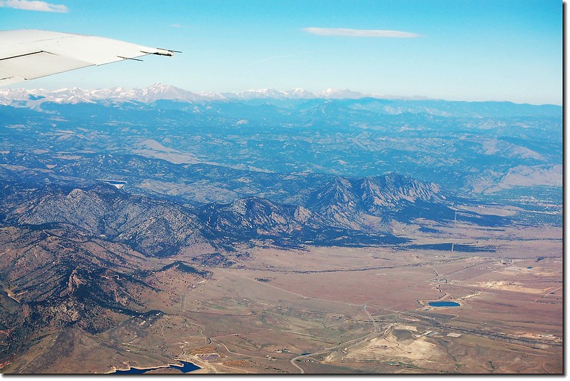
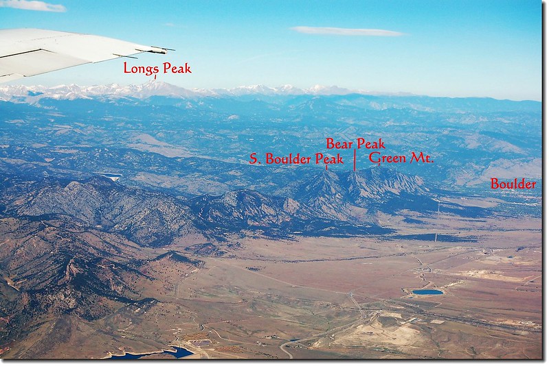
上圖機翼下山區為落磯山國家公園,右邊Boulder city是一個很美的小鎮,位在丹佛北方約30哩處,科羅拉多大學Boulder校區在此。
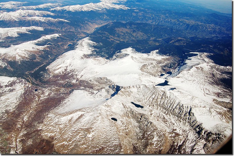
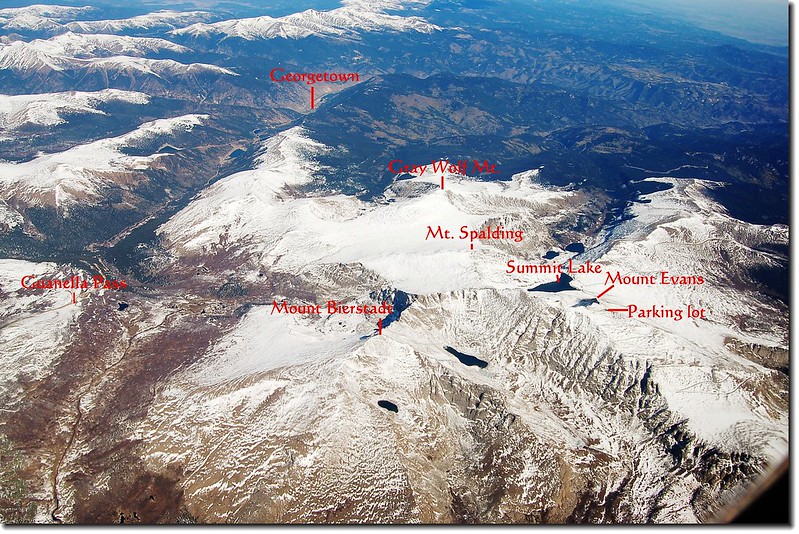
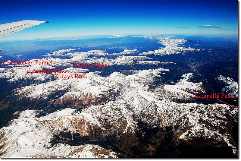
上圖是Mount Evans Scenic Byway與Guanella Pass間的區域,是我經常活動山區;其中兩座14ers--Mount Evans和Mount Bierstadt已攀爬多次。
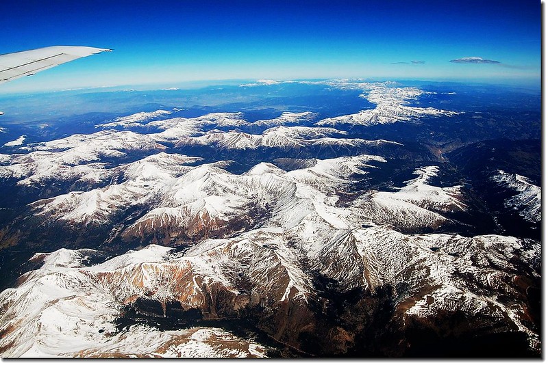
落磯山脈
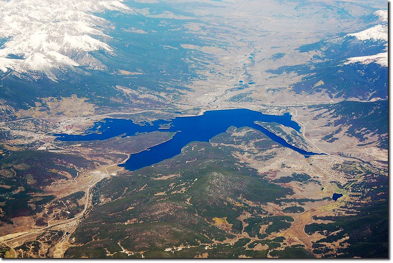
70號州際公路旁的小鎮Dillon、Silverthorne、Frisco和Dillon Reservoir
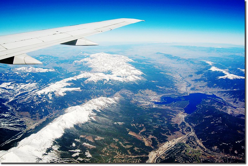
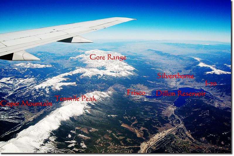
上圖是I-70州際公路行經的Dillon附近,左下角Copper Mountain是一滑雪勝地

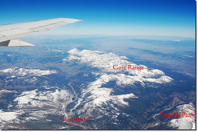
Dillon北方的山脈Gore Range
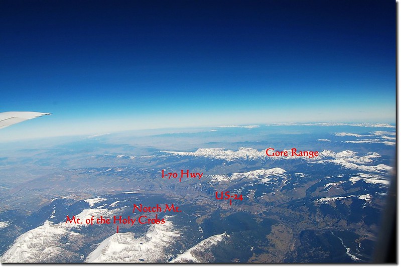
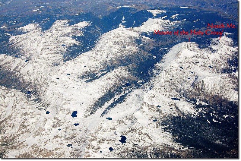
Mt. of the Holy Cross是另一座14ers
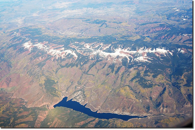
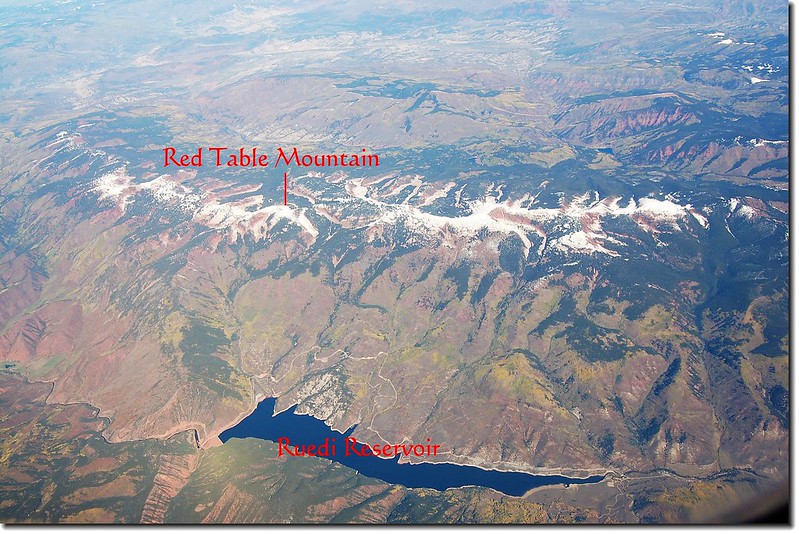
位在Aspen北方Basalt的Ruedi Reservoir
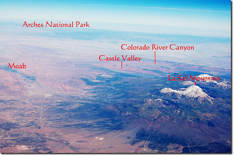
飛機進入猶他州即見拱門(Arches)國家公園
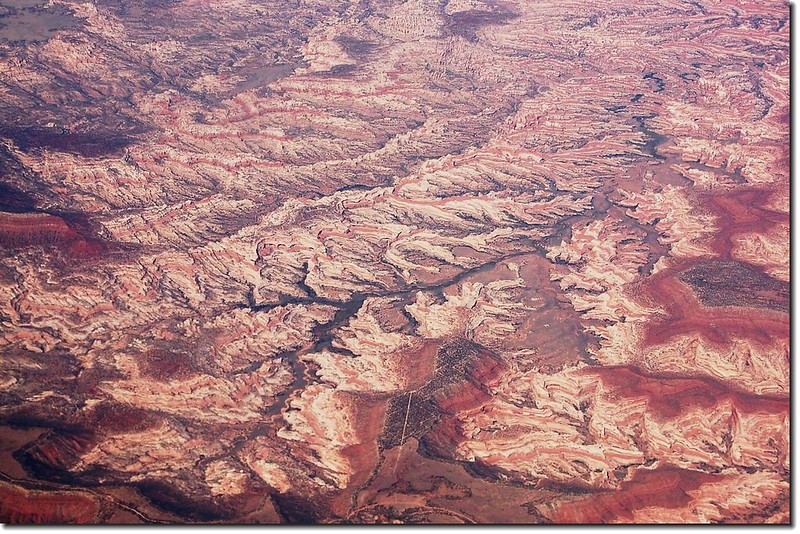
猶他州的紅色砂岩地質
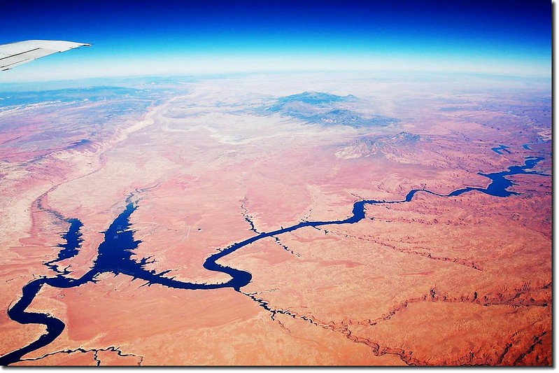
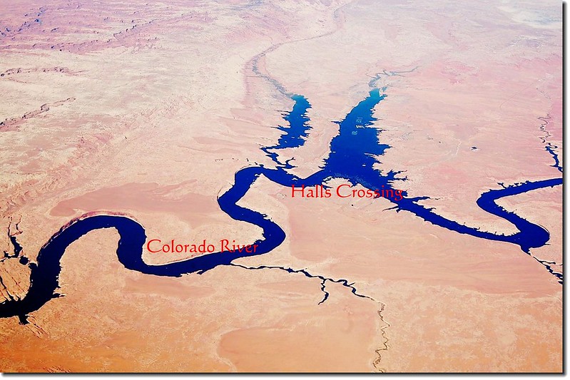
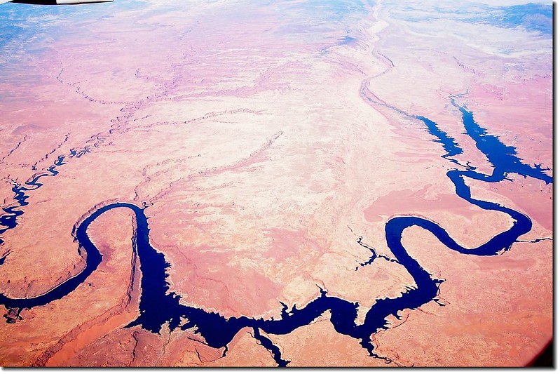
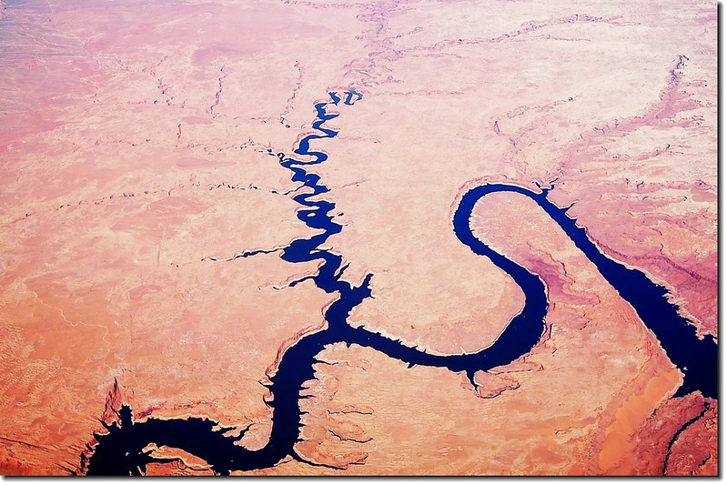
大江“西”去--科羅拉多河
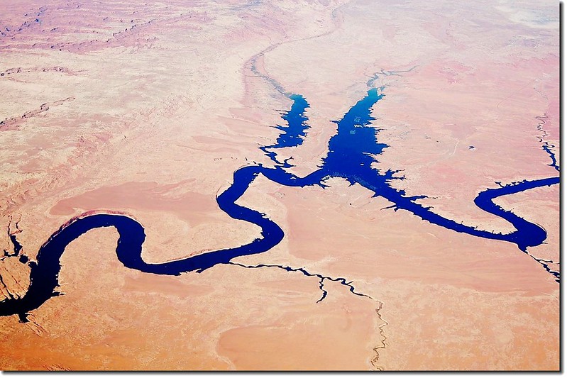
科羅拉多河兩大水壩-- Glen Canyon Dam和Hoover Dam一次看個夠。
1956年,美國政府決定在大峽谷(Grand Canyon)和Glen Canyon間興建一座具爭議性的水庫(Glen Canyon Dam)和水力發電廠,來提供人口不斷增加的美國西南地區水電來源。這個水庫破壞了科羅拉多河正常的水流,也淹沒了景觀壯麗的Glen Canyon,更在峽谷中形成了一個原本不存在的大湖Lake Powell。
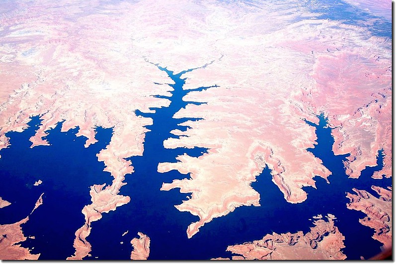
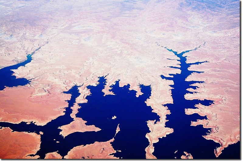

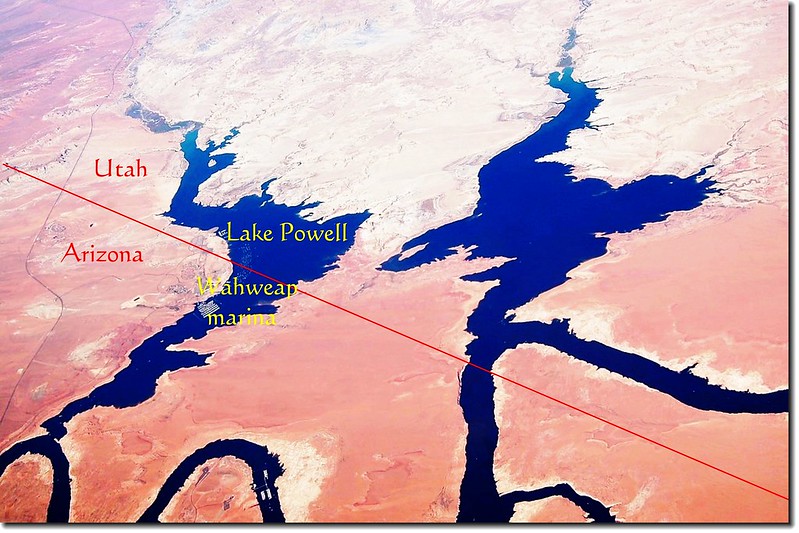
包威爾湖(Lake Powell)--介於猶他州和亞利桑那州之間
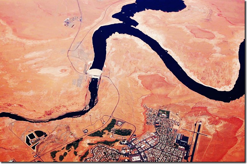

上圖是頗受爭議的 Glen Canyon Dam,一座沙漠中的水壩。原本位於水庫邊、建造水庫工人的營地,也從1957年開始逐漸演變成小城Page(下),Page附近有一處極負盛名的羚羊峽谷(Antelope Canyon)和馬蹄灣(Horseshoe Bend)。
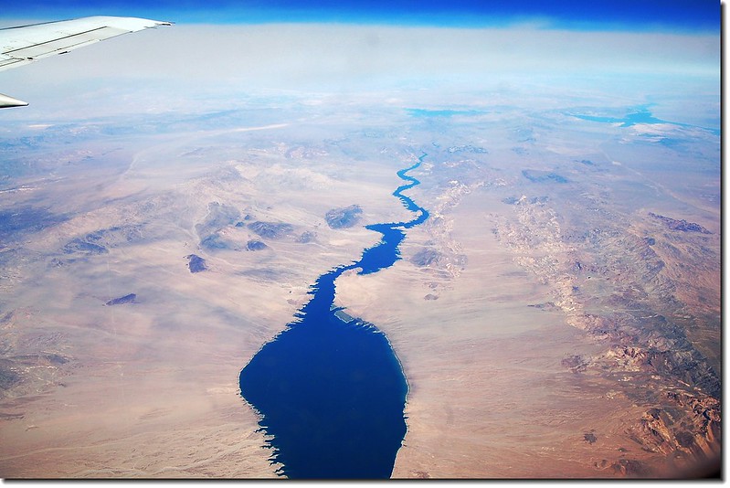

胡佛水壩和Lake Mead。這個連接內華達州和亞立桑那州的水壩,築於科羅拉多河上。公路,就由大壩上穿過。這裡大概是來賭城遊客必遊之處。胡佛水壩建於1931年,壩高221.4公尺 ,寬379.2公尺 ,是全美第二高的水壩。賭城拉斯維加斯在左上角。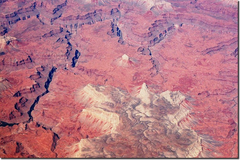
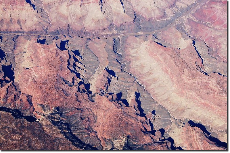
俯瞰大峽谷
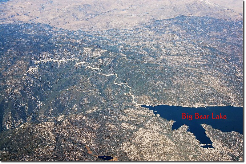
Big Bear Lake 位在洛杉磯東邊約100哩山區
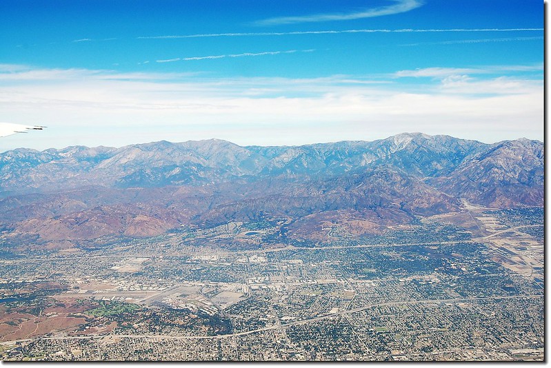
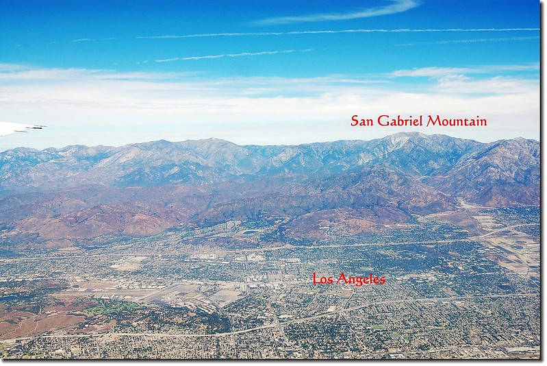
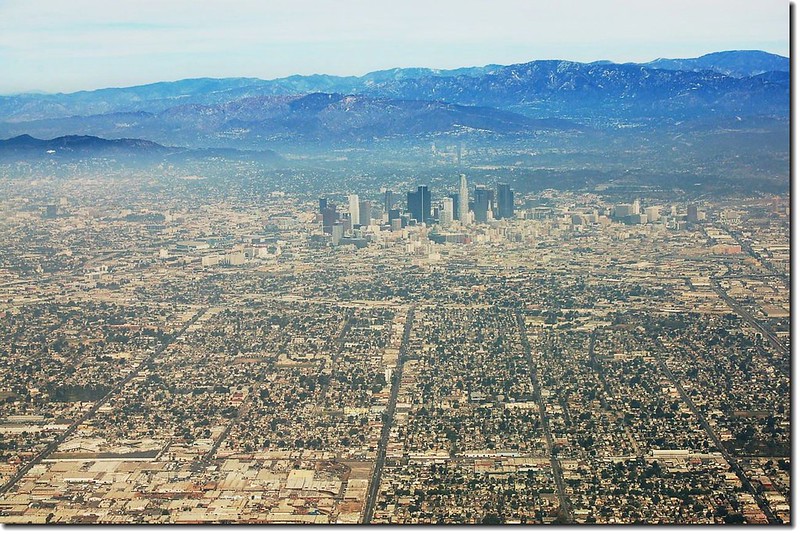
俯瞰洛杉磯市區
沒有留言:
張貼留言