~~~~~~~~~~~~~~~~~~~~~~~~~~~~~~~~~~~~~~~~~~~~~~~~~~~~~~~~
~~~~~~~~~~~~~~~~~~~~~~~~~~~~~~~~~~~~~~~~~~~~~~~~~~~~~~~~
第二天(2018.06.02、星期六)
今天行程是從昨晚住宿的Cortez開車前往大峽谷國家公園(Grand Canyon National Park),途中順路遊覽謝伊峽谷國家保護區(Canyon de Chelly National Monument )(de Chelly發音為“de-SHAY”)和納瓦霍國家保護區(Navajo National Monument),今晚住宿大峽谷國家公園(Grand Canyon National Park)內的旅館。
行程簡述:
07:40 由昨晚住宿的旅館出發,出了Cortez後沿US-491 S公路南下。
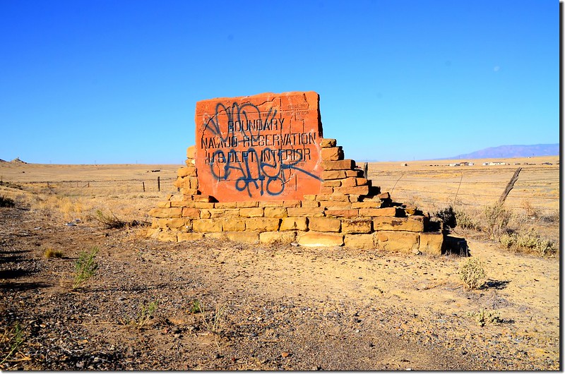
08:22 離開科羅拉多州進入納瓦霍印第安人保留區,公路旁有一面美國聯邦內政部(US Dept. Interior)立的“Boundary Navajo Reservation” 石碑。
Navajo reservation boundary sign
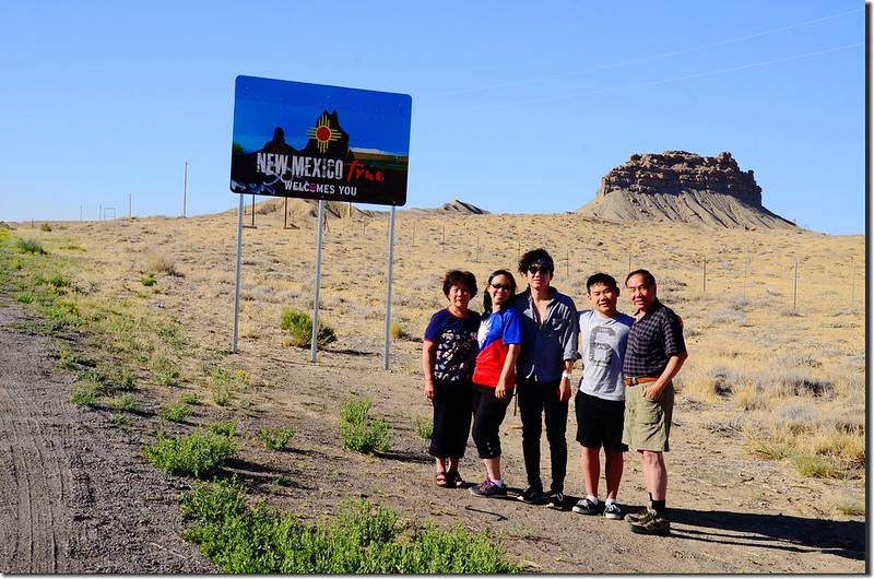
隔不久道路右側立有一面新墨西哥州的歡迎牌。
New Mexico state line sign
Navajo reservation boundary sign
隔不久道路右側立有一面新墨西哥州的歡迎牌。
New Mexico state line sign
進入新墨西哥州後沿US-491 S續往南行,行約22.4哩後右轉Indian Service Rte 13道路西南行,20.7後離開新墨西哥州進入亞利桑那州。
09:17 車子進入亞利桑那州續沿Indian Service Rte 13道路西行1.0哩後進入路右“Red Rock Trading Post”小休後續行,自此處道路轉向南行,一路跟著衛星導航行約43哩抵達謝伊峽谷國家保護區(Canyon de Chelly National Monument)。
~~~~~~~~~~~~~~~~~~~~~~~~~~~~~~~~~~~~~~~~~~~~~~~~~~~~~~~~~~~~~
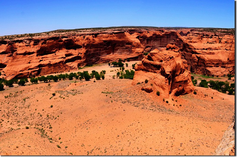
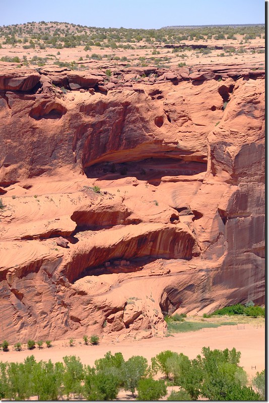
謝伊峽谷 (Canyon de Chelly)(發音為“de-SHAY”)國家保護區位於亞利桑那州 (Arizona) 東部邊緣地區附近,富有冒險精神的遊客不但可以在這裏欣賞到壯麗的景色,還能了解美國土著的傳統生活。
納瓦霍印第安人保留區 (Navajo Indian Reservation)位於新墨西哥州 (New Mexico) 阿爾伯克基 (Albuquerque) 西北部 379 公里處,這個壯觀的砂巖峽谷保存了幾個世紀之前的遠祖普韋布洛人的住宅和巖石藝術,以及遠古人的營地遺址及風蝕的畫像。幾千年前,這些遠古人成為居住在大峽谷的第一群人,納瓦霍人一直居住在這片土地上,迄今已 300 餘年。
在峽谷 305 公尺高的巖石壁之間,有許多淺水灣,水岸旁棉白楊樹林立,淺水灣蜿蜒穿過翠綠色的草地,簡陋的農場,巨大的砂巖石,偶爾還流經傳統的納瓦霍人草屋 (hogan)。在懸崖峭壁上,你會發現小小的土坯房以及成片的巖石雕刻圖案,這些圖案被稱作巖畫,描繪了動物圖像、螺旋圖形、蛇及其他激發人們想象的圖形。
~~~~~~~~~~~~~~~~~~~~~~~~~~~~~~~~~~~~~~~~~~~~~~~~~~~~~~~~~~~~~
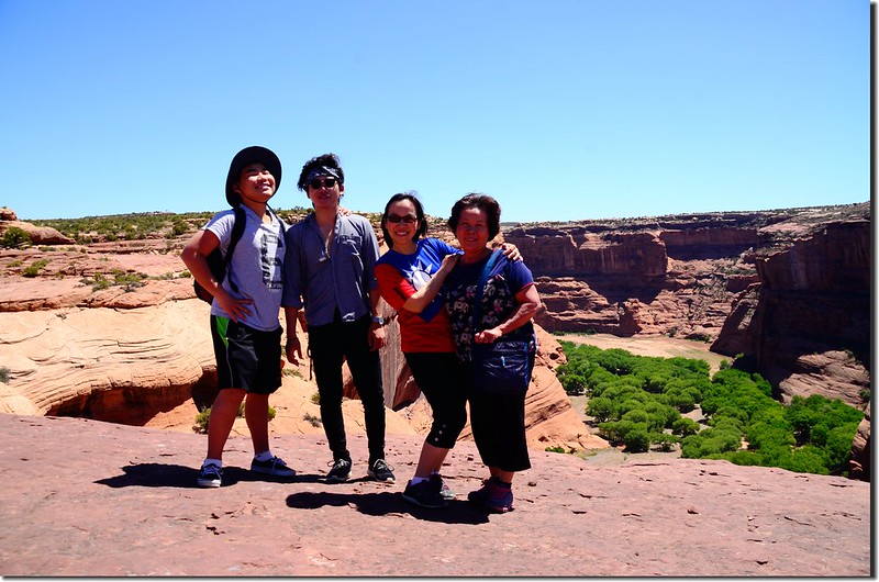
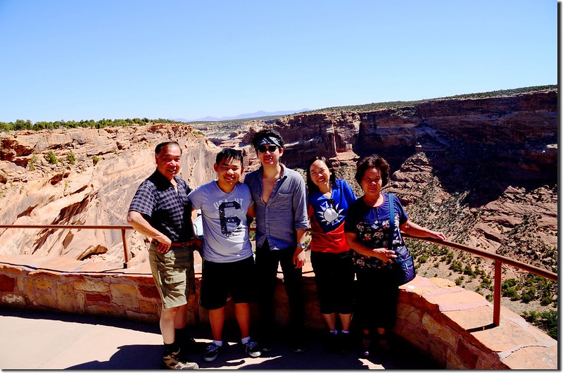
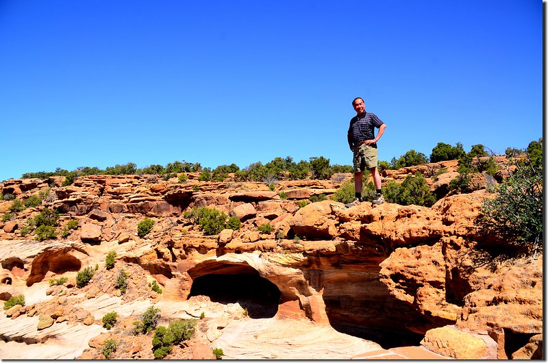
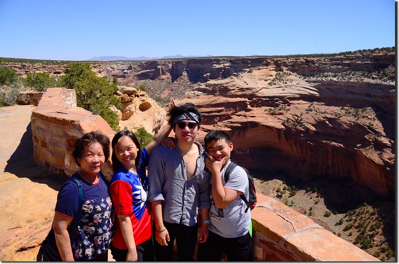
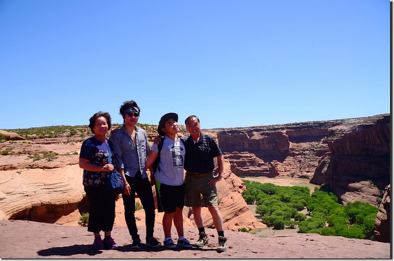
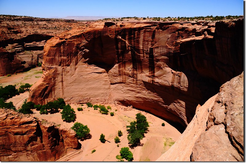
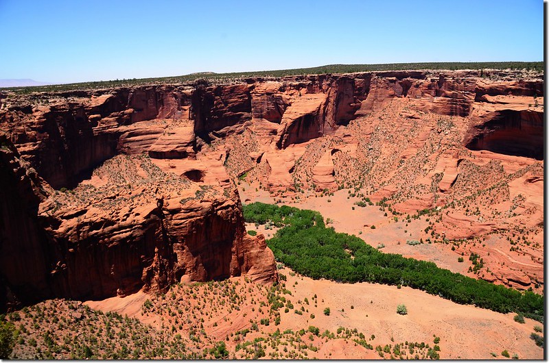
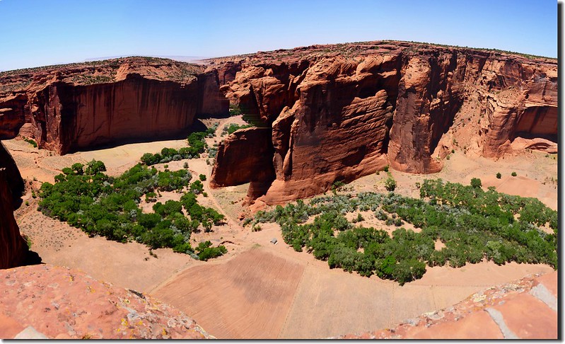
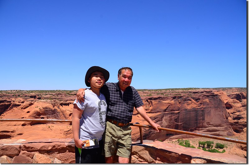
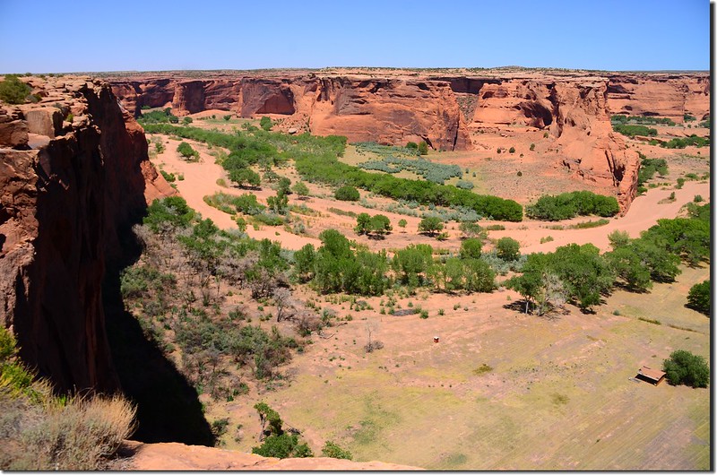
謝伊峽谷國家保護區(Canyon de Chelly National Monument)有北緣路線(North Rim Drive)和南緣路線(South Rim Drive)兩條景觀道路,每條景觀道路均以遊客中心為起點,沿途會經過幾個全景觀景台,保護區的Ranger建議上午參觀北緣路線,下午參觀南緣路線,如此拍照效果較佳;我們因是由北南下先抵達北緣路線,所以沒先到遊客中心就直接參觀北緣路線距遊客中心最遠的Massacre Cave Overlook(屠殺洞穴觀景台)。
謝伊峽谷國家保護區(Canyon de Chelly National Monument)有北緣路線(North Rim Drive)和南緣路線(South Rim Drive)兩條景觀道路,每條景觀道路均以遊客中心為起點,沿途會經過幾個全景觀景台,保護區的Ranger建議上午參觀北緣路線,下午參觀南緣路線,如此拍照效果較佳;我們因是由北南下先抵達北緣路線,所以沒先到遊客中心就直接參觀北緣路線距遊客中心最遠的Massacre Cave Overlook(屠殺洞穴觀景台)。
北緣路線(North Rim Drive)
Massacre Cave Overlook(屠殺洞穴觀景台)
距離遊客中心大約13.2哩;此洞穴之取名乃因當年西班牙人在這兒的一次"大屠殺"而命名;1805年的一個冬天,一支西班牙武裝探險隊來到謝伊峽谷,結果在死人谷與納瓦霍人交火一整天,當時探險隊的首領、後來西班牙新墨西哥殖民地的長官安東尼奧·納博納在一份報告中寫道:我們殺死了90名印第安勇士和25名婦女兒童。事實上,當天由於許多納瓦霍男子外出捕獵,西班牙殖民者殺死的絕大多數都是婦女兒童。
一名勇敢的納瓦霍婦女就在這兒與西班牙士兵奮勇搏鬥並揪住他一起跌落懸崖,納瓦霍人把這個屠殺洞穴稱為"兩人跌落的地方"。
Massacre Cave Overlook
Massacre Cave in Canyon del Muerto; view from the overlook
Looking down at Canyon del Muerto from Mummy Cave Overlook
Massacre Cave Overlook
Massacre Cave in Canyon del Muerto; view from the overlook
Looking down at Canyon del Muerto from Mummy Cave Overlook
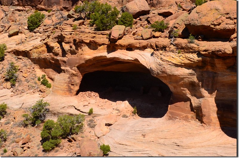
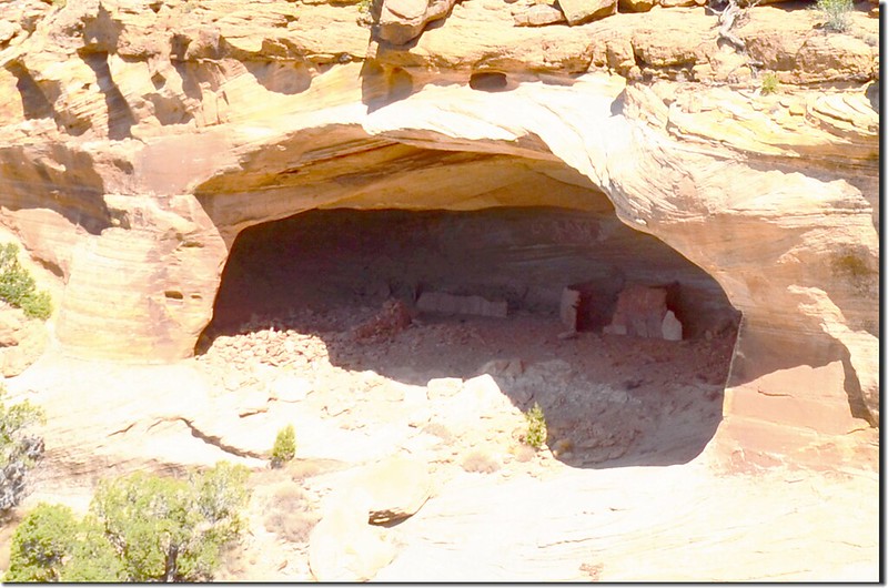
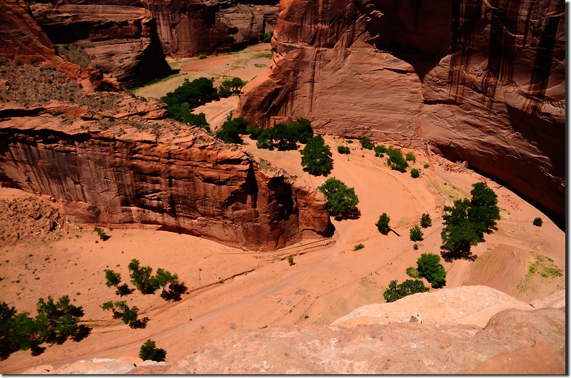
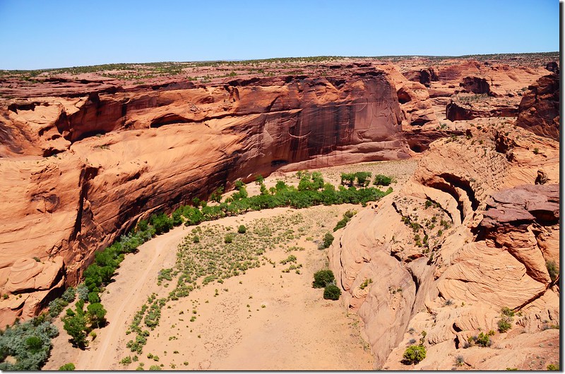
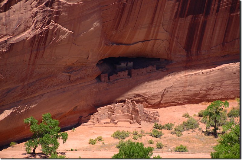
Mummy Cave Overlook(木乃伊洞穴觀景台)
距離遊客中心大約13.2哩;這個遺址得名於在此發現的兩具保存完好的印第安人木乃伊。
木乃伊洞穴高90多公尺,是謝伊峽谷中最大的印第安遺址之一,阿納薩齊人在此居住了近千年,可能是整個峽谷中最為悠久的一個洞穴。這些房屋完全建於早期的圓形坑洞之上,最顯眼的當屬一棟三層的塔樓,整組建築有著濃郁的梅薩維德風格,考古學家認為公元13世紀可能有部分印第安人從梅薩維德(Mesa Verde)搬遷至謝伊峽谷中。
Mummy Cave Overlook
Looking down at Canyon del Muerto from Mummy Cave Overlook
Mummy Cave from Mummy Cave Overlook
Mummy Cave Overlook
Looking down at Canyon del Muerto from Mummy Cave Overlook
Mummy Cave from Mummy Cave Overlook
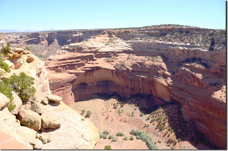
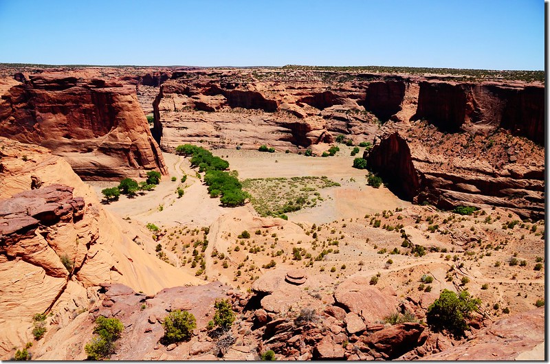
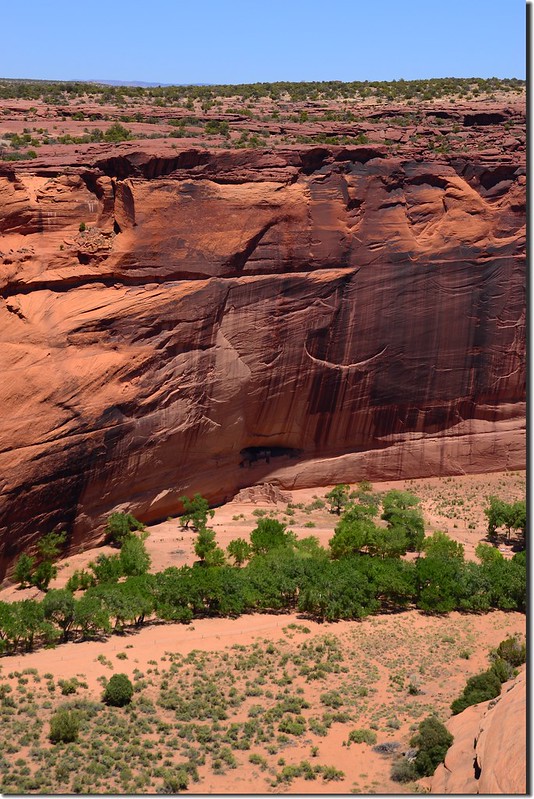
Antelope House Overlook(羚羊屋觀景台)
距離遊客中心大約8.5哩;羚羊屋觀景台(Antelope House Overlook)可俯瞰整個死人谷中的印第安村落遺址;
Antelope House Overlook
Looking down at Canyon del Muerto from Antelope House Overlook
Antelope House 之所以命名為Antelope House (羚羊屋)乃得名於建築左上方由19世紀上半葉一位住在谷中的納瓦霍藝術家所創作的羚羊岩畫。
Antelope House Overlook
Looking down at Canyon del Muerto from Antelope House Overlook
Antelope House 之所以命名為Antelope House (羚羊屋)乃得名於建築左上方由19世紀上半葉一位住在谷中的納瓦霍藝術家所創作的羚羊岩畫。
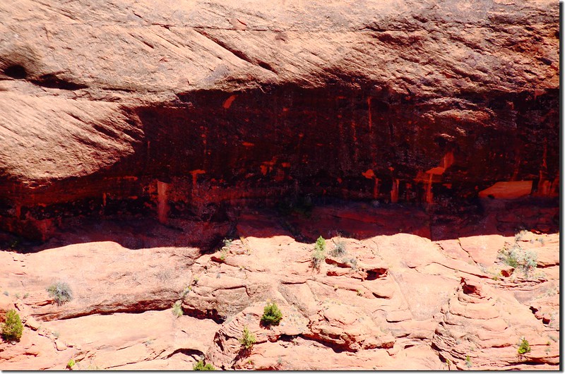
謝伊峽谷中幾百座印第安村落遺址絕大部分建於公元350-1300年間,其中大型崖居多建在12-14世紀的普韋布洛時期,在羚羊屋上方還可以看到阿納薩齊人創作的岩畫。
阿納薩齊人從公元700年前後在此居住了約6個世紀,如今所看到的羚羊屋大部分建築則是建於公元1050年之後。
Antelope House Ruin, Canyon del Muerto
Antelope House Ruin, Canyon del Muerto
參觀完Antelope House Overlook(羚羊屋觀景台)後開車到遊客中心休息,並簡單吃個點心後繼續參觀南緣路線的景點;
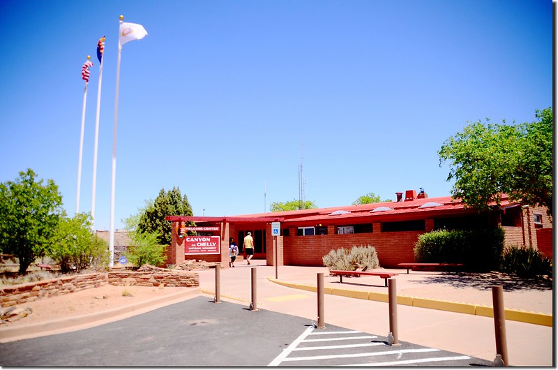
Canyon de Chelly National Monument Visitor center
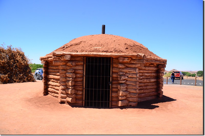
Hogan House at visitor center
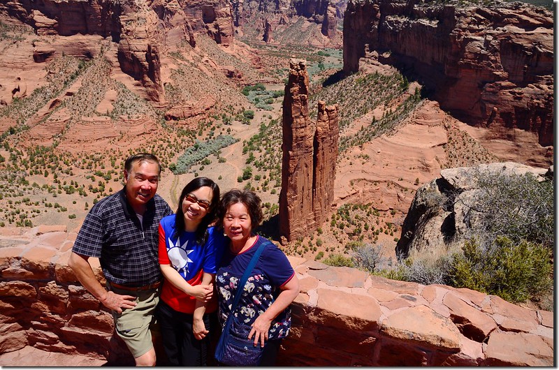
由於南緣路線的幾個觀景台都在道路左側,所以女兒決定先直接開到最遠的Spider Rock Overlook(蜘蛛岩觀景台),然後一路參觀回來,如此是順暢多了!
Canyon de Chelly National Monument Visitor center
Hogan House at visitor center
由於南緣路線的幾個觀景台都在道路左側,所以女兒決定先直接開到最遠的Spider Rock Overlook(蜘蛛岩觀景台),然後一路參觀回來,如此是順暢多了!
南緣路線(South Rim Drive)
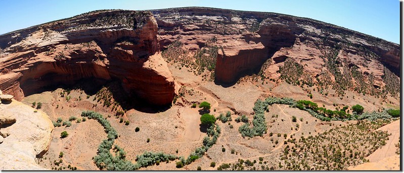
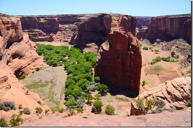
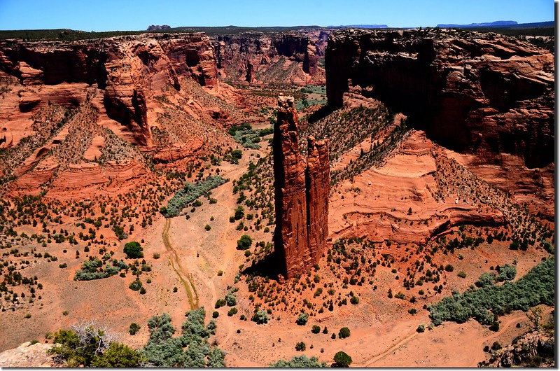
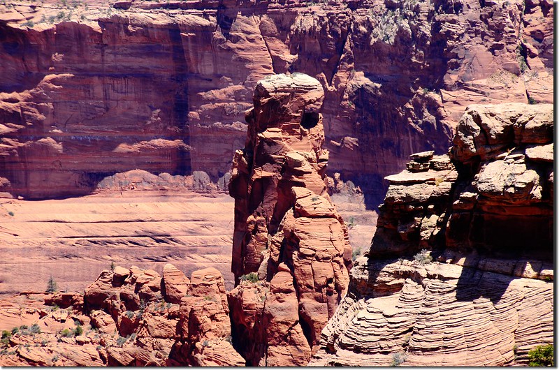
Spider Rock Overlook(蜘蛛岩觀景台)
距離遊客中心大約15.6哩;南緣路線的終點是谷中兩座巨大的蜘蛛岩 (Spider Rock),其聳立的砂岩雙峰高達 244 公尺,十分壯觀,從觀景臺的停車場,經過一條短途徒步道,你便可以欣賞到這一標誌性的岩石景觀;
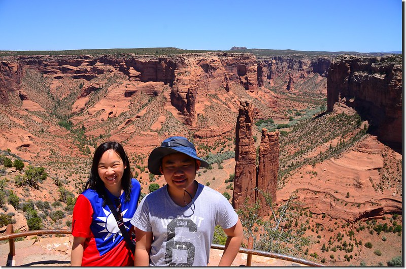
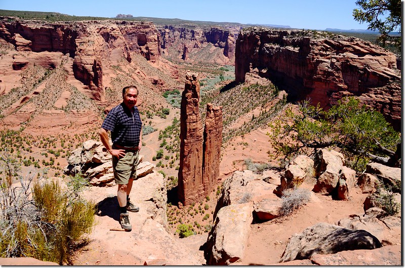
Spider Rock Overlook
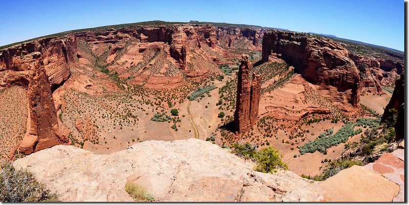
Looking down at Canyon del Muerto from Spider Rock Overlook(照片左側為Face Rock)
再仔細看你可發現右邊巨岩底端一平台上存留著建築遺址。
Spider Rock from Spider Rock Overlook
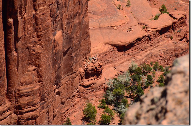
Spider Rock Ruin from Spider Rock Overlook
Spider Rock Overlook
Looking down at Canyon del Muerto from Spider Rock Overlook(照片左側為Face Rock)
再仔細看你可發現右邊巨岩底端一平台上存留著建築遺址。
Spider Rock from Spider Rock Overlook
Spider Rock Ruin from Spider Rock Overlook
Face Rock Overlook(臉岩觀景台)
距離遊客中心大約14.8哩;臉岩觀景台(Face Rock Overlook)可俯瞰一座像鰭狀的巨岩矗立在峽谷中,巨岩頂端酷似一個人臉因而得名。
Face Rock Overlook
Face Rock from Face Rock Overlook
Looking down at Canyon del Muerto from Face Rock Overlook
Face Rock Overlook
Face Rock from Face Rock Overlook
Looking down at Canyon del Muerto from Face Rock Overlook
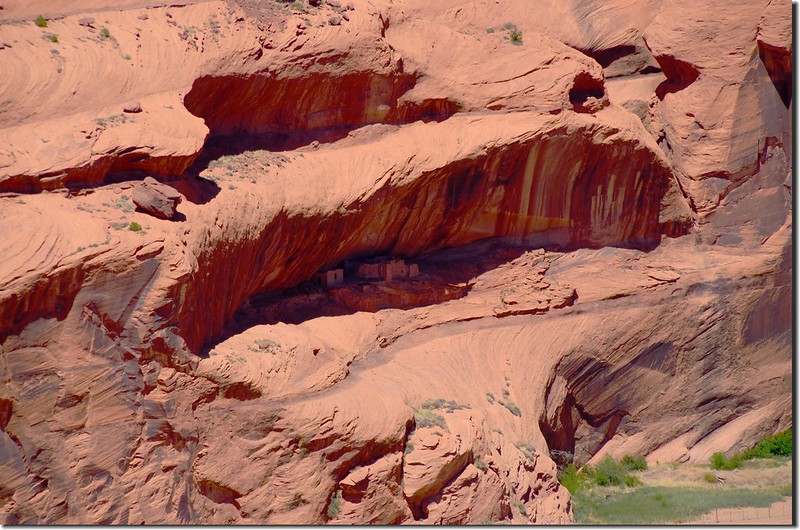
Sliding House Overlook(滑屋觀景台)
距離遊客中心大約10.3哩;滑坡屋觀景台(Sliding House Overlook)對面懸崖上的村落建於公元900年前後,雖然這兒的懸崖坡度很陡經常發生滑坡,但阿納薩齊人卻在此居住了長達3個世紀,最多的時候這兒大概有50棟房屋。
Looking down at Canyon del Muerto from Sliding House Overlook
Sliding House Ruin from Sliding House Overlook
Looking down at Canyon del Muerto from Sliding House Overlook
Sliding House Ruin from Sliding House Overlook
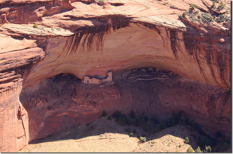
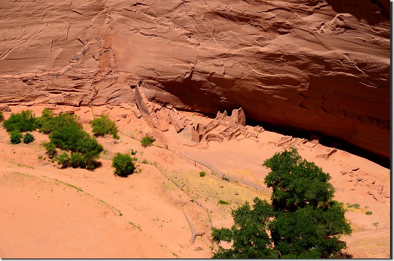
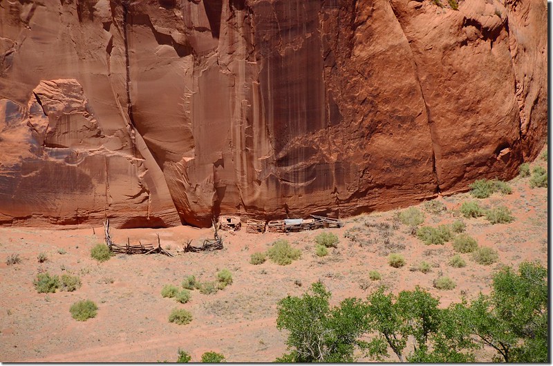
White House Overlook(白屋觀景台)
距離遊客中心大約5.6哩;從白屋觀景台(White House Overlook)憑欄遠眺,可以清晰看到峽谷對岸岩壁上的白屋遺址,這是一座建於公元1060-1275年間的古普韋布洛村落遺址,因其建築上方長的白牆而得名。阿納薩齊人在此生活了差不多2個世紀,整個村子由近70棟房屋組成。
White House Overlook
Looking down at Canyon del Muerto from White House Overlook
White House Ruin from White House Overlook
White House Overlook
Looking down at Canyon del Muerto from White House Overlook
White House Ruin from White House Overlook
從觀景台右側有一條往返2.5英里的步道可以通往白屋遺址,這也是整個保護區內唯一條遊客可以無需許可證或納瓦霍嚮導自行前往的路線。
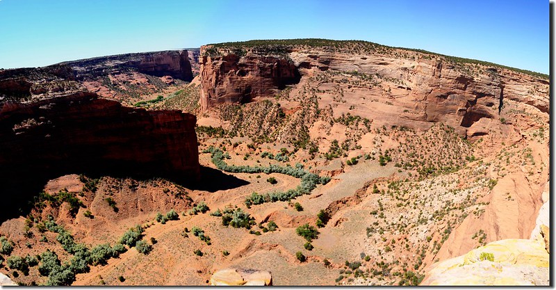
Juction Overlook(交匯觀景台)
距離遊客中心大約3.5哩;俯瞰死人谷與謝伊峽谷在此交匯,一南一北往東綿延而去;抬頭遠眺,古印第安村落交匯遺址(Junction Ruin)等鑲嵌於紅色峭壁之中。
Dog Rock, an isolated block of sandstone near Junction Overlook
Junction Ruin from Junction Overlook
Dog Rock, an isolated block of sandstone near Junction Overlook
Junction Ruin from Junction Overlook
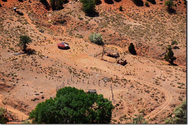
Tsegi Overlook(謝伊觀景台)
距離遊客中心大約2.2哩;謝伊觀景台(Tseyi Overlook)是一處視野開闊的觀景台,河曲蜿蜒在谷間,納瓦霍人在此生活了三個世紀,他們放羊耕地,自給自足,這兒就是他們的家園。
Chinle Wash flowing through Canyon de Chelly, from Tsegi Overlook
Chinle Wash flowing through Canyon de Chelly, from Tsegi Overlook
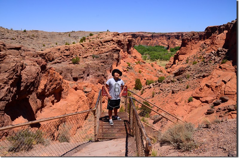
Tunnel Overlook(隧道觀景台)
距離遊客中心最近,僅約1.8哩;此點看不到任何遺址,僅可以俯瞰到主峽谷的局部景觀,這裡的峽谷很淺,大約250呎深。
在觀景台邊上有一座鐵扶梯可以通往谷地,然後沿著“隧道”一直往前走就到了謝伊峽谷山谷中,不過由於地處納瓦霍印第安人保護區,除了白屋遺址(White House Ruin)路線可以不帶導遊外,去園中其他遺址一律得跟隨納瓦霍嚮導。
Tunnel Overlook
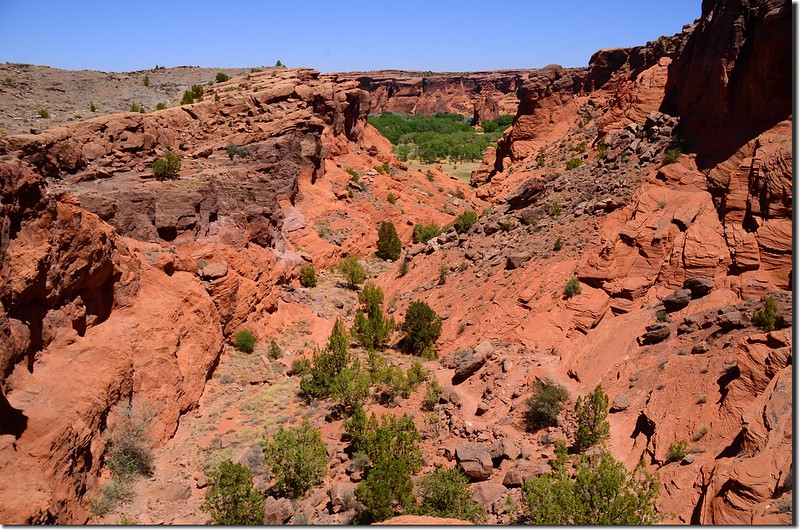
Tunnel Overlook; westernmost viewpoint on the South Rim, site of a trail down to the canyon floor
Tunnel Overlook
Tunnel Overlook; westernmost viewpoint on the South Rim, site of a trail down to the canyon floor
參觀完謝伊峽谷國家保護區(Canyon de Chelly National Monument)後驅車前往大峽谷國家公園(Grand Canyon National Park),今晚住宿在公園內的Maswik Lodge South, Grand Canyon, AZ;途中路過納瓦霍國家保護區(Navajo National Monument)再進去參觀。
~~~~~~~~~~~~~~~~~~~~~~~~~~~~~~~~~~~~~~~~~~~~~~~~~~~~~~~~~~~~~
納瓦霍國家保護區是位於亞利桑那州北部納瓦霍民族地區西北部的國家保護區,其建立的目的是為了保存三座保存完好的祖先普埃布洛人的廢墟~ Broken Pottery (Kitsʼiil)、 Ledge House (Bitátʼahkin)和Inscription House (Tsʼah Biiʼ Kin)。這座保護區位於亞利桑那州Kayenta以西,俯瞰著Tsegi峽谷系統。它設有一個遊客中心,一個博物館,兩個短的自導式(self-guided)步道,兩個小露營地和一個野餐區。
~~~~~~~~~~~~~~~~~~~~~~~~~~~~~~~~~~~~~~~~~~~~~~~~~~~~~~~~~~~~~
當車行至US-160 W與AZ-564 N岔路時右轉沿AZ-564 N北行,行約9.5哩抵達納瓦霍國家保護區(Navajo National Monument)遊客中心發現遊客中心竟已關門,時間是下午五點半,由於該保護區景點都要花些時間走路,考量要趕到大峽谷怕時間太晚,稍作停留後即離開;
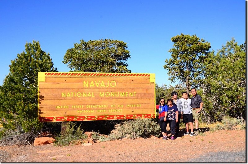
Navajo National Monument sign
Navajo National Monument Visitor Center
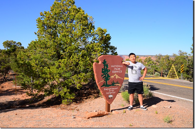
一路驅車趕往大峽谷國家公園今晚住宿旅館。
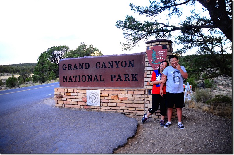
Grand Canyon National Park sign
Navajo National Monument sign
Navajo National Monument Visitor Center
一路驅車趕往大峽谷國家公園今晚住宿旅館。
Grand Canyon National Park sign
沒有留言:
張貼留言