
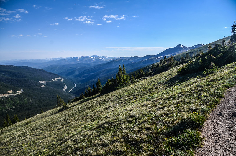
Looking west across Berthoud Pass at the ridge leading to Stanley Mountain from the trail near 11,630 ft.
今年首度隨同丹佛華人登山隊攀登第一座13er(海拔介於13,000呎/3,962公尺~13,999呎/4,267公尺間之高山)Mount Flora,該山我已爬過兩次,今天是第三度攀登。
Mount Flora是位在洛磯山脈James Peak Wilderness區內一座大陸分水嶺上的高山,也是科羅拉多州637座13ers中排名第528的一座高山;科羅拉多州另有58座14ers (海拔超過14,000 ft./4,267 m的高山),所以依順序排列Mount Flora是科羅拉多州排名第586高的高山。
攀登山頭:Mount Flora,海拔13,146呎/4,007公尺
登山口:Berthoud Pass Trailhead,海拔11,307呎/3,446公尺
登山里程:來回約6.6哩/10.62公里
總爬升高度:1,973呎/601公尺
登山時間:上山2小時33分,上下山費時4小時40分
行車資訊:
由Thornton開車經I-25轉I-76、I-70西行,行至I-70里程232哩時由Exit-232下交流道,然後右轉沿U.S. 40 西行,行約14.5哩抵達道路最高點大陸分水嶺Berthoud Pass,道路右側有一大型停車場和一座避難和休息用的warming hut,此處為洛磯山脈大陸分水嶺,北邊屬於太平洋水系,南邊屬於大西洋水系,此處也是Berthoud Pass登山口,海拔11,307呎(3,446公尺),將車子停在停車場。

Contilental Divied Berthoud Pass sign


Contilental Divied Berthoud Pass sign
步程簡述:
07:40 從warming hut旁邊Berthoud Pass大陸分水嶺石牌邊的小路朝西南行;

Contilental Divied Trail sign

Contilental Divied Berthoud Pass sign

Mount Flora Trail
行約400呎接到一條寬大的土石車道,此土石車道可行車通往Colorado Mines Peak的山頂,左轉沿可行車的土石車道往上爬,土石車道”之”字形爬升。

The unpaved road up to Colorado Mines Peak

Looking west across Berthoud Pass at the ridge leading to Stanley Mountain from the trail near 11,430 ft.
08:09 抵達道路左側一小徑岔路,座標N39.79657° W105.77204°,海拔11,639呎/3,548公尺,距登山口約0.9哩/1.45公里;

Colorado Mines Peak road & Mount Flora Trail junction
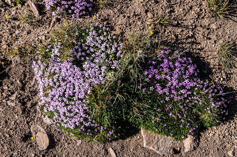
路牌標示通往Mount Flora,右側土石車道續行通往Colorado Mines Peak山頂,取左小徑往Mount Flora;此後小徑在Colorado Mines Peak西面坡山腰朝東北緩升,整面山坡是苔原地貌,長滿苔原短草及花卉,野花尚未盛開,五年前和小外孫貝貝來登此山時野花盛開,異常壯觀。

Alpine Avens

Western Wallflower

Sky pilot

Alpine primrose
當海拔爬升至約11,800呎/3,597公尺後小徑轉到Colorado Mines Peak北面坡朝東緩升。

Looking up to the top of Colorado Mines Peak from the trail

Looking north to the Rocky Mountains from Mount Flora Trail near 11,740 ft
Looking north to the Rocky Mountains from Mount Flora Trail near 11,740 ft


Mount Flora Trail


Wildflowers blooming along the Mount Flora Trail
08:53 抵達Colorado Mines Peak和Mount Flora間的鞍部,此處座標N39.79756° W105.75993°,海拔12,151呎/3,704公尺,距登山口約1.7哩/2.74公里。

Taken from the saddle between Colorado Mines Peak & Mount Flora
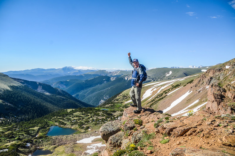
在鞍部上右邊(南)是Colorado Mines Peak,山頂上雷達設施是美國聯邦航空局空中交通管制設施;左邊(北)是通往Mount Flora的路線;正前方(東南)向下俯瞰Blue Creek流域,Blue Creek最上游湛藍的小湖是Blue Lake;

Looking down at Blue Lake & Blue Creek drainaga from the saddle below Colorado Mines Peak
鞍部往南極目遠眺則可將Mount Evans、Mount Bierstadt、Grays Peak和Torreys Peak四座14ers盡收眼底。
在鞍部小休後取左朝Mount Flora往東北爬升,這一段路有點陡,一路在稜線上爬升。
Moss Campion

Looking south to mountains from Mountain Flora Trail near 12,376 ft

Looking southeast to Mount Evans (L) & Bierstadt (R) from Mount Flora Trail near 12,460 ft

Looking southwest to Grays Peak (L) & Torreys Peak (R) from Mount Flora Trail near 12,460 ft
09:26 由Mount Flora前假山頭腰繞而過,海拔約12,576呎/3,833公尺,距登山口約2.2哩/3.52公里。

Near cross the ridge point

Looking north to the Rocky Mountains from Mount Flora Trail near 12,675 ft
09:38 過了假山頭後步道坡度趨緩,海拔約12,709哩/3,874公尺;Mount Flora山頂在望。

The west slopes meadow of CDT are gently

Looking at Mount Flora (L) & Breckenridge Peak (R) from the trail near 12,785 ft.

Dwarf clover

Forget Me Not
09:49 登頂前一處亂石小高點,座標N39.80381° W105.74363°,海拔12,843呎/3,915公尺,距登山口約2.8哩/4.5公里;

Looking south to mountains from the Rough rocky hill near Mount Flora's summit

Looking at Mount Flora's summit from the Rough rocky hill

Looking north to Longs Peak and the Rocky Mountains


Wildflowers blooming along the Mount Flora Trail
10:13 登頂Mount Flora,Mount Flora海拔13,146呎/4,007公尺,距登山口約3.3哩/5.31公里;


Taken from the summit of Mount Flora

Mount Flora USGS Benchmark

Taken from the summit of Mount Flora
山頂是一片寬平的岩石平台,從山頂往北極眺是一望無際的洛磯山脈;

Mount Flora's summit

Looking north at mountains from Mount Flora's summit
東北方較近的幾個山頭是James Peak Wilderness區內的Mount Eva、Parry Peak、James Peak三座13ers和海拔13,250呎的Mount Bancroft;

Looking north at mountains from Mount Flora's summit
俯瞰東邊的山谷是Mill Creek流域,其源頭的湖泊Ethel Lake大部分的湖面還處於冰凍狀態;

Looking east at Ethel Lake & mountains from Mount Flora's summit
東邊往下延伸的稜線可到Breckenridge Peak,那是一座海拔12,889呎/3,929公尺的山頭;
南邊遠方則是Mount Evans等四座14ers。

Looking southwest to mountains from Mount Flora's summit
Mount Flora的山頂有一座石頭圍成的避風處(rock shelter),在美國幾乎每座高山山頂都有此種登山客自行堆砌的避風處,山友們窩在山頂用餐休息!

Stone Summit Shelter on Mount Flora


Taken from the summit of Mount Flora
10:42 循原路下山。


Mount Flora Trail
11:35 下抵Colorado Mines Peak和Mount Flora間的鞍部,取右循原路下山。

Wildflowers blooming along the Mount Flora Trail

Mount Flora Trail
11:57 回到Colorado Mines Peak和Mount Flora岔路,取右沿土石車道下山。
12:20 返抵登山口,整裝後開車返家結束今天的登山活動。
Alltrail:Mount Flora Trail Hiking Route(2023.07.08)
沒有留言:
張貼留言