
Gold Hill Trail
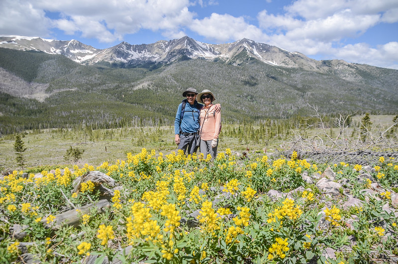
睽違八個月後今天再度參加丹佛華人登山隊前往Frisco附近攀登Gold Hill to Peaks Trail,女兒和小外孫貝貝同行:Gold Hill Trail 位於科羅拉多州連接Frisco和Breckenridge兩城鎮之間的南北主幹道 9 號高速公路旁,它向西延伸 3.9哩,到西端接到Peaks Trail終止。該步道亦屬於Colorado Trail的一小段,Colorado Trail從丹佛(Denver)到杜蘭戈(Durango),全長近 500哩,Gold Hill Trail這段短途路段始於Ten Mile Range山麓,坡度適中,非常適合跑步、騎自行車、家庭和冬季休閒。
在登山步道我們遇到一位年輕人,閒聊中得知他從5月份就從墨西哥邊境出發,計畫縱走Continental Divide Trail (大陸分水嶺步道),預計9月份走到加拿大,全程約2,700哩/4,345公里,這是一般常人無法做到,也無法理解的行動,令我們不由得由衷的佩服!
登山步道:Gold Hill to Peaks Trail,Frisco, Colorado
登山口:Gold Hill Trailhead,海拔9,123呎/2,781公尺
折返點海拔:10,033呎/3,058公尺
登山里程:往返全程8.1哩/13.04公里
總爬升高度:1,692呎/516公尺
登山時間:上下山費時6小時25分
行車資訊:
由丹佛沿I-70州際公路西行,過了Dillon不久由Exit 203出口下交流道,經過Frisco後沿US-9號公路往Breckenridge南行,計行約6哩後於CR 950處向右轉進入Gateway Drive再行約150呎停車於路左土石大停車場,座標N39.54141° W106.04220°,海拔9,122呎/2,780公尺。

Gold Hill Trailhead parking lot
步程簡述:
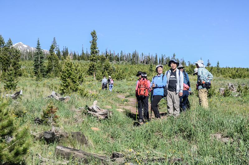
08:45 登山隊全員到齊後由Gold Hill Trailhead登山口出發:


Gold Hill Trailhead
沿山坡的Gold Hill Trail朝西緩坡上行;

Gold Hill Trail
登山口標示此Gold Hill Trail是屬於Colorado Trail的一小段,距Peaks Trail交叉口3.5哩;Gold Hill Trail兩旁沒有茂密的森林,而是低矮的杉林,兩旁野花盛開。


Prairie Smoke

Lupinus (Lupine)


Gold Hill Trail
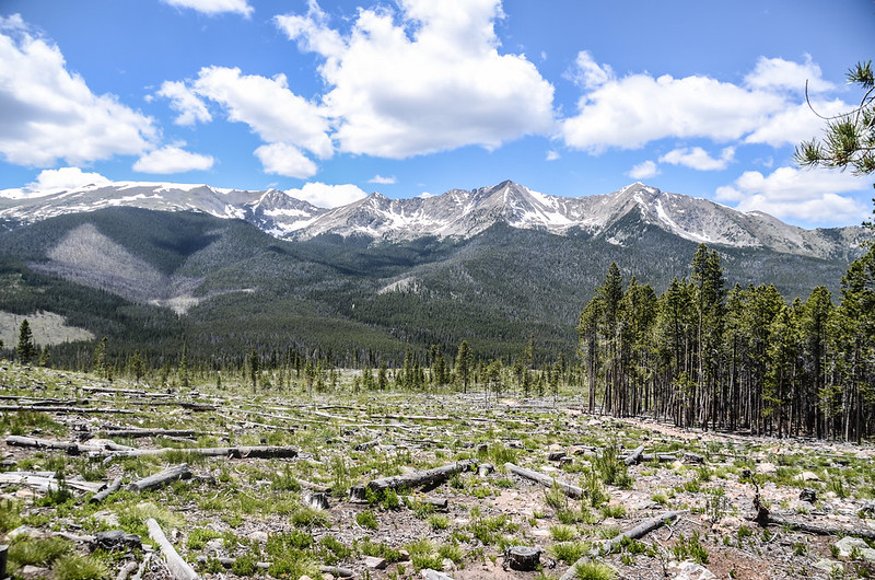
09:05 進入大片開闊砍伐區;


Gold Hill Trail
此山區杉木的樹齡平均為70至100年,這些樹木由於其密度和樹齡,特別容易受到Pine beetles病蟲害和火災的摧殘肆虐,所以在1988及2008曾作一系列的疏林砍伐,此計畫性的小型砍伐區域旨在通過創造樹齡差異和開放的空地來減少整個森林遭受病蟲害及森林火災的危險。
在開闊的砍伐區西望Ten Mile Range部分積雪山頭,東邊俯瞰Upper Blue River Valley的風景,而砍伐區則正是野花盛開。

Wildflowers fill open space along the Gold Hill Trail

View to the southeast from Gold Hill Trail near 9,396'
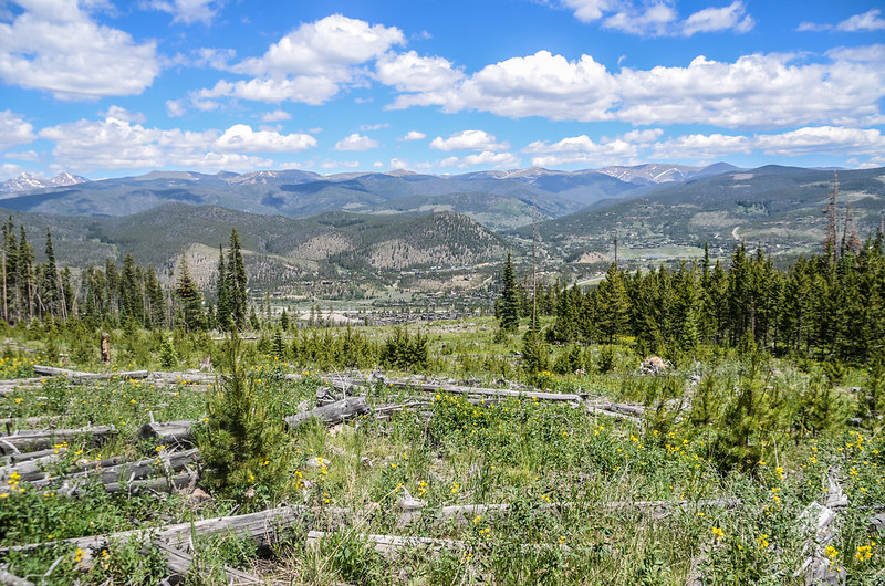
Gold Hill Trail

Looking down at Dillon Reservoir from Gold Hill Trail near 9,530 ft
09:39 步道接到一條森林維護道路,隨即左轉登山步道朝西南行,座標N39.54257° W106.05798°,海拔9,643呎/2,939公尺,距登山口約1.4哩/2.25公里。

1.4 miles Merge with road and immediately depart left
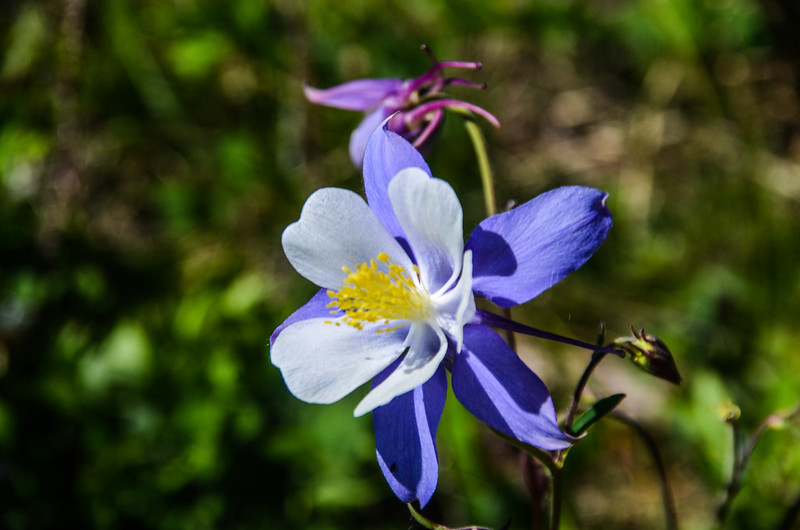
Columbine flower


Gold Hill Trail
10:02 進入存留未砍伐的茂密杉林,座標N39.53598° W106.06070°,海拔9,904呎/3,019公尺;登山小徑在筆直的杉林間朝西南上行。

1.9 miles Into the thick fir forest

Thick fir forest
10:07 登山步道再度穿過森林維護道路後取左續沿登山步道西行。

2.1 miles Trail crosses forest service road


Gold Hill Trail

View to the northeast from Gold Hill Trail near 10,129'


Gold Hill Trail
10:52 登上Gold Hill Trail最高點,座標N39.53815° W106.07021°,海拔10,315呎/3,144公尺,距登山口約2.9哩/4.67公里;

The top of Gold Hill
這是Gold Hill Trail一處不很明顯的最高山頭,山頭上西眺Tenmile Range積雪山頭連稜:

View to the east from the top of Gold Hill Trail


Taken from the top of Gold Hill Trail, background are Ten Mile Range
在此小休後續朝西行。

Gold Hill Trail
離開Gold Hill Trail最高點後步道開始在原生林與砍伐區間步道往西下行:


Gold Hill Trail
路右是大片原生林,路左則是2008年新砍伐區的大片開闊山坡,山坡上甚多盛開的野花。

View to west at Ten Mile Range from Gold Hill Trail near 10,290 ft.


Purple Fringe (phacelia sericea)


Monkshood Flower
11:27 步道穿過一條森林維護道路(forest service road)朝西北下行,座標N39.53947° W106.07592°,海拔10,153呎/3,095公尺,距登山口約3.4 哩。

3.4 miles Trail crosses forest service road
11:41 下抵Gold Hill Trail終點接到Peaks Trail,座標N39.53759° W106.08167°,海拔9,944呎/3,031公尺,距登山口約3.9哩/6.28公里;

Gold Hill Trail & Peaks Trail junction
取左沿Peaks Trail朝東南上行,領隊計畫走到制高點休息午餐。


Peaks Trail
11:51 抵步道制高點,座標N39.53523° W106.07989°,海拔10,033呎/3,058公尺,距登山口約4.1哩/6.6公里,此制高點位在Tenmile Range山鹿,朝西仰望Tenmile Range幾座積雪高山;

Return point
領隊決定今天登山到此處折返,山友們在此各自找位置休息午餐。

Return point
12:20 循原路下山。
12:27 下抵Gold Hill Trail、Peaks Trail岔路口,取右沿Gold Hill Trail朝北上行下山。
13:08 再度登上Gold Hill Trail最高點,不做停留續朝東下山。
15:10 返抵登山口,整裝後開車返家,結束今年來美和登山隊的第一次登山活動。
Alltrails:Gold Hill to Peaks Trail Hiking Route (2023.07.01)
沒有留言:
張貼留言