------------------------------------------------------------------------------------------------------
承前文:美西國家公園之旅(三)—優勝美地國家公園(Yosemite National Park)~2014.06.10
---------------------------------------------------------------------------------------------------------------------------
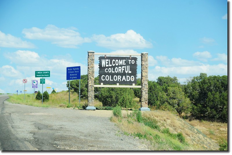
原先旅行計畫今天是到優勝美地國家公園南邊的Mariposa Grove參觀美州杉(Sequoia Tree)後再開車到Las Vegas 的,但在旅行途中遇到一些遊客,閒談中總是建議我們要走一趟美洲杉國家公園(Sequoia National Park);其實出發前女兒也曾有此計畫,但因受限於她的假期所以沒排進去,僅計畫參觀優勝美地的Mariposa Grove區,雖然早知道這裏的美洲杉不管是數量或是高度體積 都遠遠比不上Sequoia National Park裏頭那些巨木。後來禁不起遊客(還有昨天在Glacier Point遇到的交大學長)的遊說 ,臨時改變計畫取消優勝美地Mariposa Grove區的參觀改到南邊150哩(240公里)外的Sequoia National Park,如此一來多出兩個多小時的車程,加上耗在Sequoia National Park的參觀時間預計要在凌晨一、兩點才能抵達Las Vegas,又將是瘋狂的一天!
------------------------------------------------------------------------------------------------------
美洲杉國家公園(Sequoia National Park,或譯紅杉國家公園),是位於美國西部California(加利福尼亞州)內華達山脈內的一座國家公園,成立於1890年,是繼黃石國家公園(Yellowstone National Park)和已經關閉的麥基諾國家公園(Mackinac National Park)之後,美國創立的第三個國家公園,面積1,635平方公里,美國本土的最高山峰 Mount Whitney(惠特尼峰,海拔14,505 呎/(4,421 公尺)就位於美洲杉國家公園內;美洲杉國家公園位於國王峽谷國家公園(Kings Canyon National Park)以南,與其相鄰,兩座國家公園由美國國家公園管理局統一管理。
美洲杉國家公園因公園內的珍稀樹種巨杉Sequoia而聞名,其中General Sherman Tree更是現今世界上材積最大的樹木,該公園在1980年被聯合國教科文組織視為自然遺產,列入世界遺產名錄“The World Heritage List”。美洲杉國家公園雖然擁有獨特而又多變的自然景觀,但是遊客相對而言卻不算多,也許是該公園距其北邊的優勝美地國家公園(Yosemite National Park)不遠,被優勝美地的盛名搶去了他的風采的緣故吧!
------------------------------------------------------------------------------------------------------
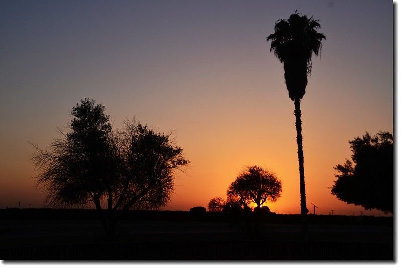
我們在近八點離開營地,08:20抵達優勝美地谷地的Bridalveil Fall,參觀完Bridalveil Fall後一刻也沒停留,沿著昨天到Glacier Point的Wawona Road (CA- 41)南下。
08:50 離開Bridalveil Fall,取道Wawona Road (CA 41)南下。
09:40 優勝美地南出口(South Entrance),抵出口前左岔路即是通往Mariposa Grove區的Mariposa Grove Road。出了南出口後續沿CA- 41南下趕往美洲杉(紅杉)國家公園(Sequoia National Park)。10:50 車行到Fresno City 轉走CA-99繼續南行。
11:10 下Fowler City加油順便用中餐後續上CA-99南行。
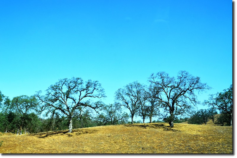
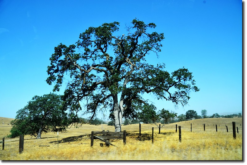
高速公路沿途所見樹木,Park Ranger說那是Black Oak Tree
12:00 在Goshen左轉CA-198東行。
12:50 抵達Sequoia and Kings Canyon National Parks的南入口Ash Mountain Entrance,驗票後進入園區;
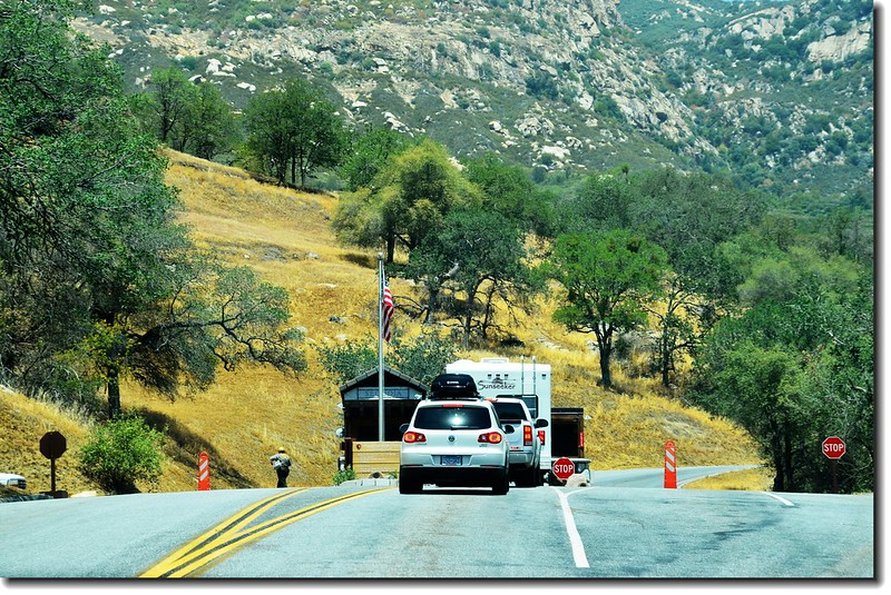
Ash Mountain Entrance
園區道路稱之為“Generals Highway”,縱貫公園南北,並連通Kings Canyon National Park;Generals Highway彎彎曲曲,禁止遊覽車、拖車等大型車輛進入,所以得要自己開車才能前往。不要受到美國道路路名的誤導,有許多小道路它也稱為“Highway”。
13:05 進入Foothills Visitor Center索取一些資料,並將我們預定停留時間告知,請Ranger建議我們一些參觀景點;由於晚上還將趕往Las Vegas,所以我們預定停留五個小時,Park Ranger建議我們走訪Giant Forest Museum、Big Trees Trail、General Sherman Tree、Mono Rock、Tunnel Log及Crescent Meadow Loop等幾個景點就差不多了,她說,這些僅是公園南邊的極小一部分,但是你們僅有五小時的時間!後來我們連Crescent Meadow Loop都沒時間走,時間真的不夠。
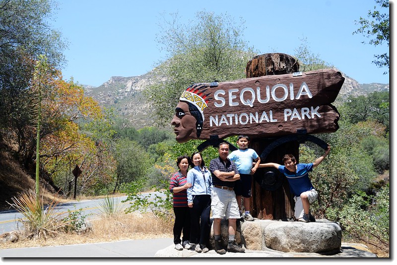
Photo of Ash Mountain Entrance Sign in Sequoia
13:20 路左Tunnel Rock,以往車子是從隧道石通過,後來另闢園區道路後才不再使用。
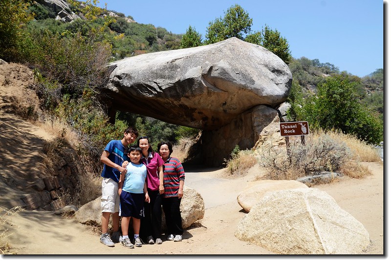
Tunnel Rock
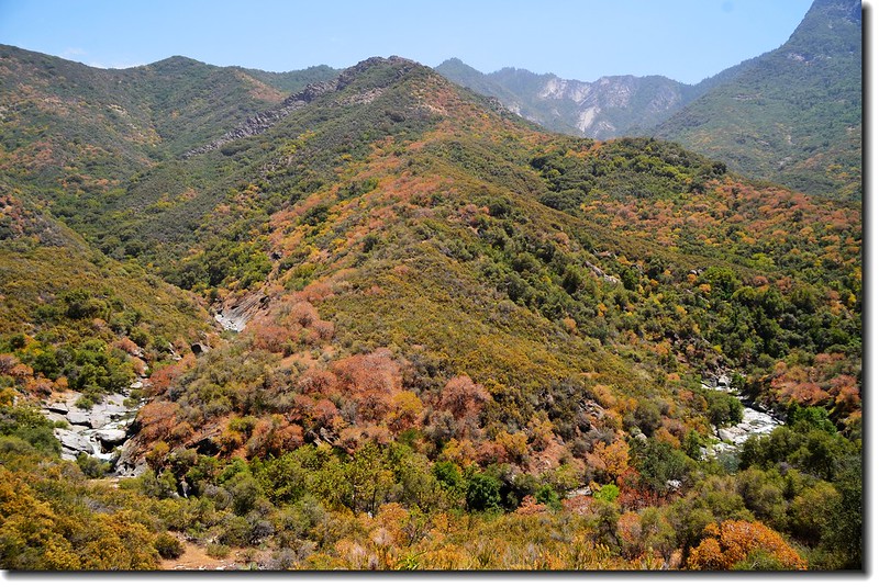
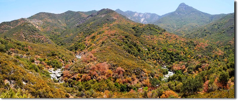
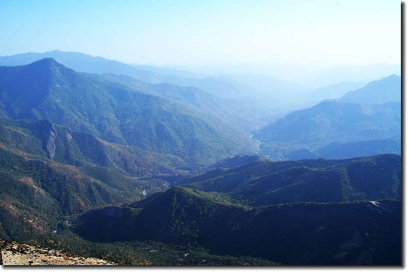
Mountain view & Kaweah River from Generals Highway
13:50 抵一展望點Amphitheater Point ,展望良好。
Amphitheater Point
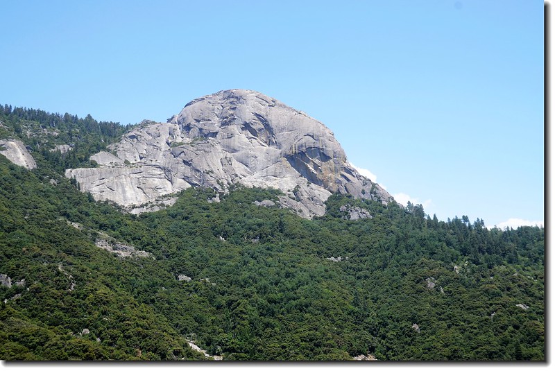
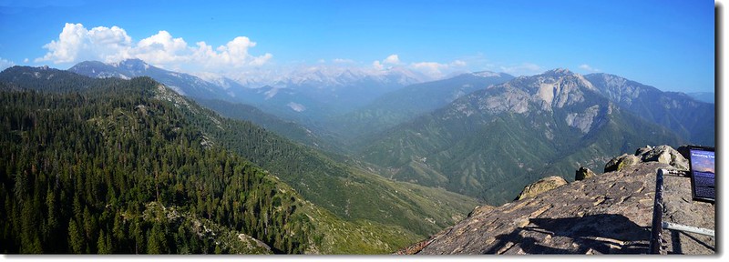
Mono Rock from Amphitheater Point
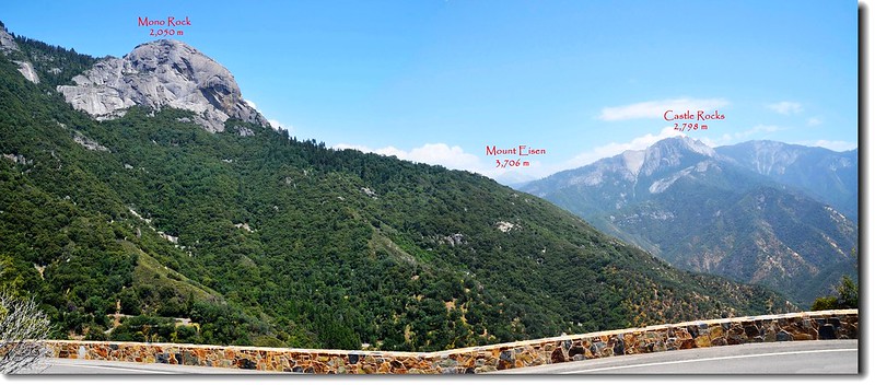
Mono Rock(L) & Castle Rocks(R) from Amphitheater Point
14:03 道路整修管制通車,耽擱了二十幾分鐘。
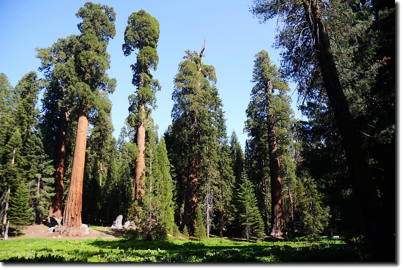
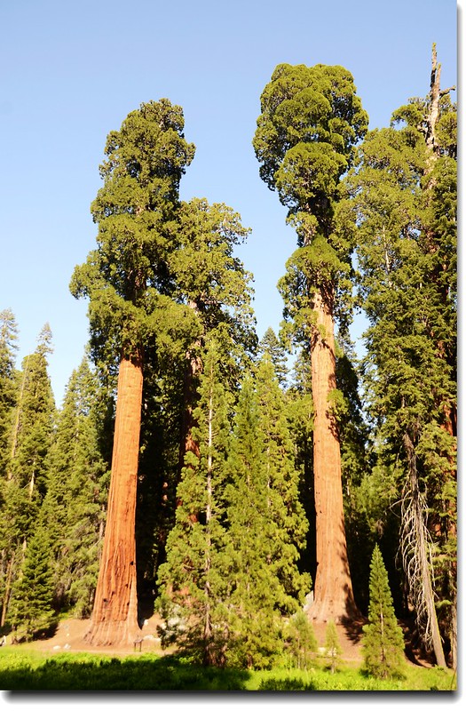
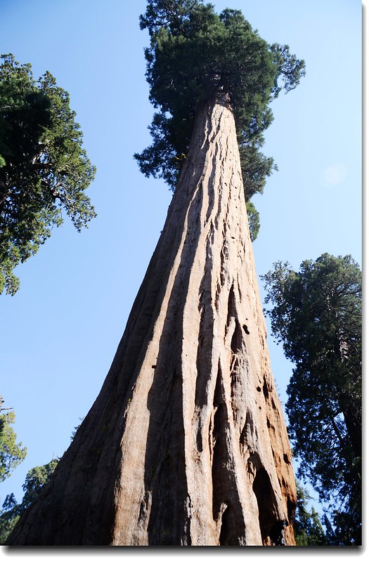
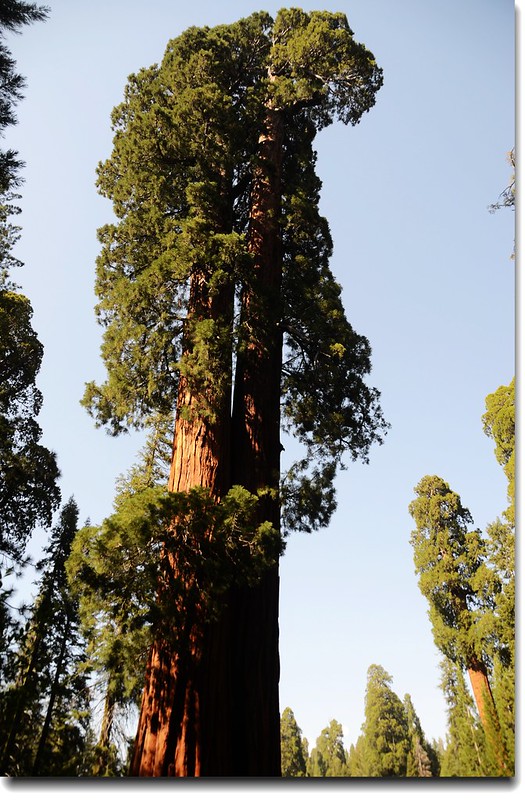
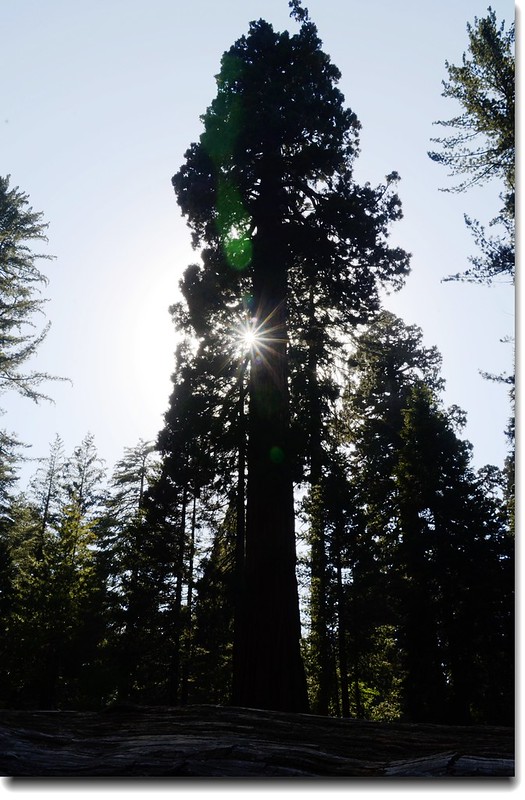
14:50 車子直開到General Sherman Tree上方停車場停車,然後沿Sherman Tree Trail下行,沿途都是高聳入雲的巨杉。
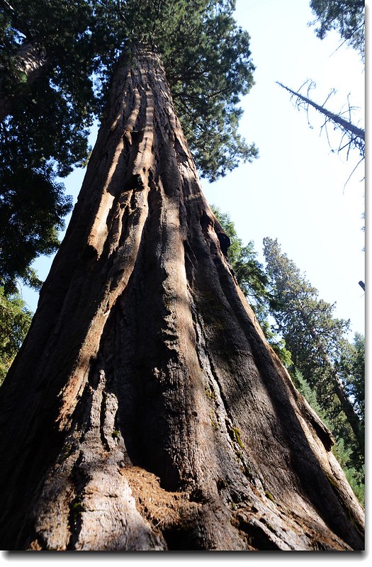
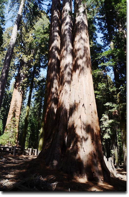
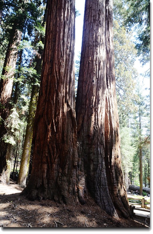
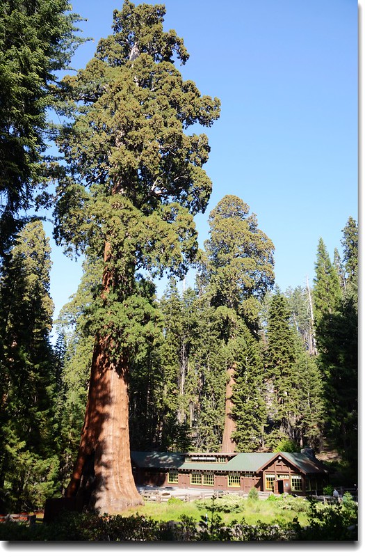
Giant Forest, Sequoia National Park
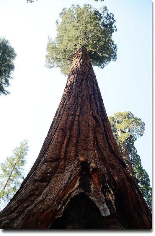
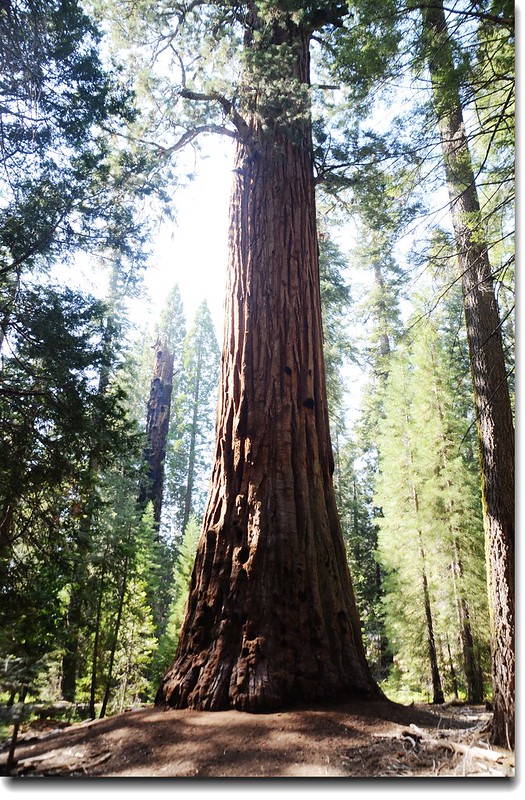
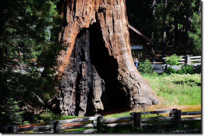
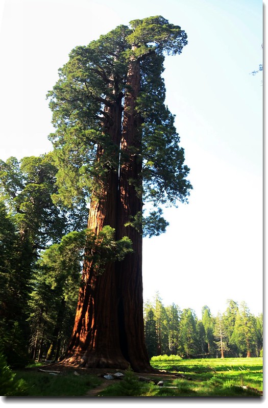
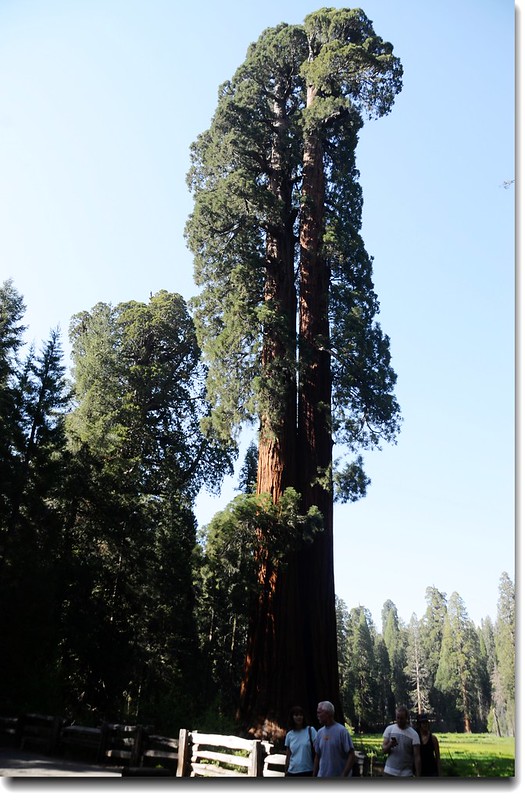
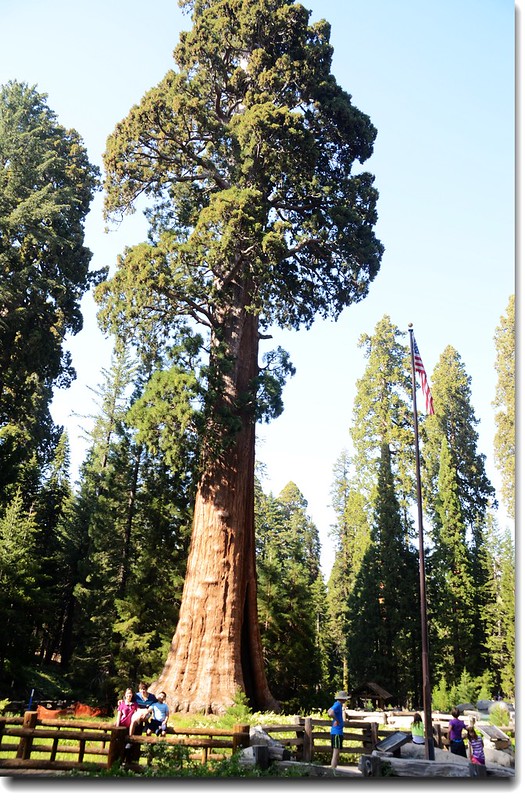
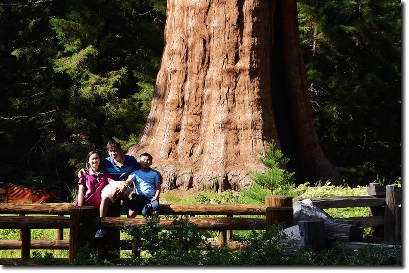
15:17 抵達世界最大的樹—The General Sherman Tree。
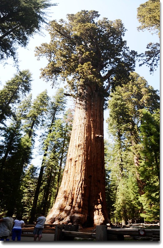
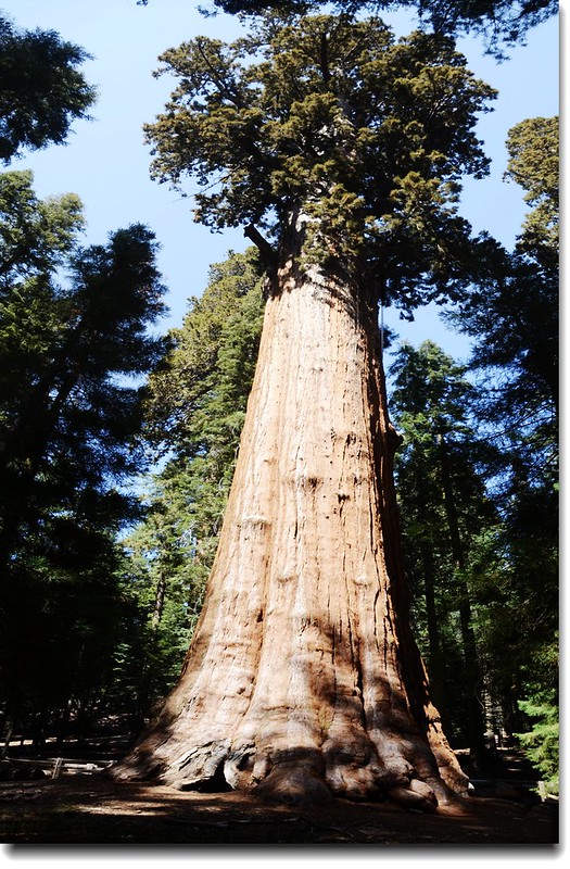
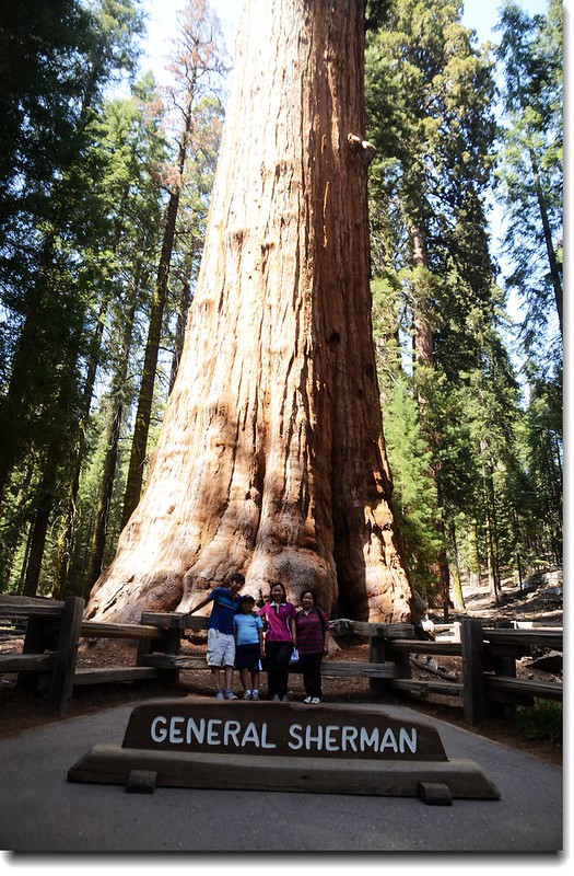
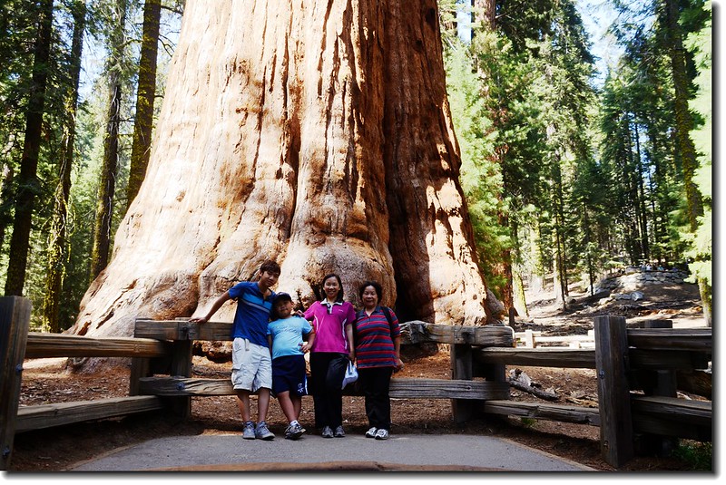
The General Sherman Tree, the largest tree in the world
The General Sherman tree是一棵巨型美國杉(紅杉)樹,樹高約83公尺,基部樹圍31公尺,樹齡約2300到2700年。The General Sherman tree被稱為世界上最大的樹,這裡所稱的第一不是指最高的樹,也不是指樹圍最粗的樹,更不是指年代最久的樹,他的所謂第一是指體積(材積)是現今地球上已知的最大樹木,根據1985年科學工作者測算,認為“General Sherman”樹重約2800噸,它的體積大約是1487立方公尺,被認為是世界上體積最大的樹。
此樹之命名是為了紀念南北戰爭時的名將William Tecumseh Sherman而以之為名,在其西北方約30哩的Kings Canyon National Park另有一棵也是以南北戰爭時的另一名將Ulysses S. Grant命名的號稱世界第二的The General Grant Tree。
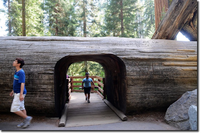
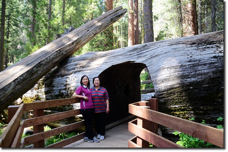
The General Sherman 旁不遠的tunnel log
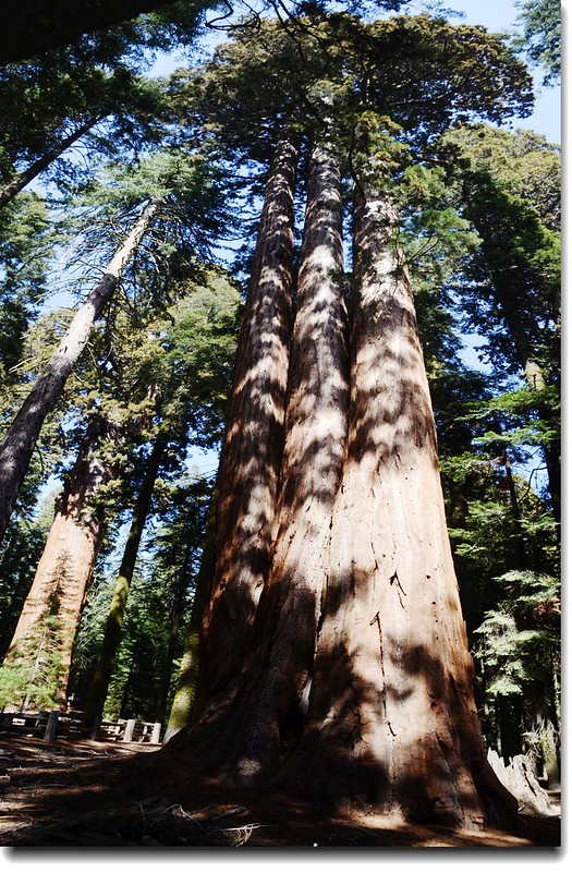
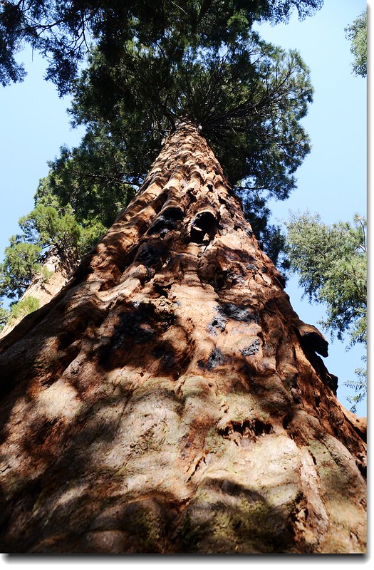
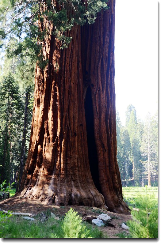
16:10 返抵Giant Forest Museum,車停停車場後走一趟Big Trees Trail,全長1.2哩(1.9公里),我們花了40分鐘繞一圈,途中遇到了一隻黑熊覓食,我們近距離接觸(20公尺左右),看樣子是隻未成年的小熊。
16:19 路左一棵“Clara Barton Tree”,此樹以美國紅十字會創始人Clara Barton女士名字命名。
Clara Barton Tree
Round Meadow
繞一圈約0.8哩(近一公里),近乎是平路的兩旁立有十幾座生態解說牌,我們就是在這草原上與小黑熊近距離接觸的。
Giant sequoias along Round Meadow
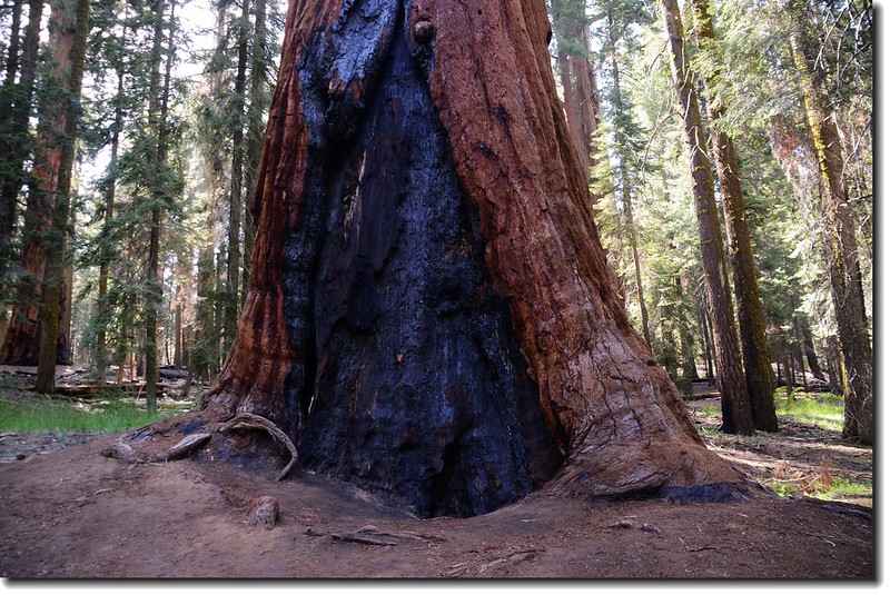
The base of a fire scarred sequoia
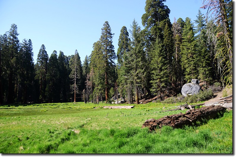
Looking across Round Meadow
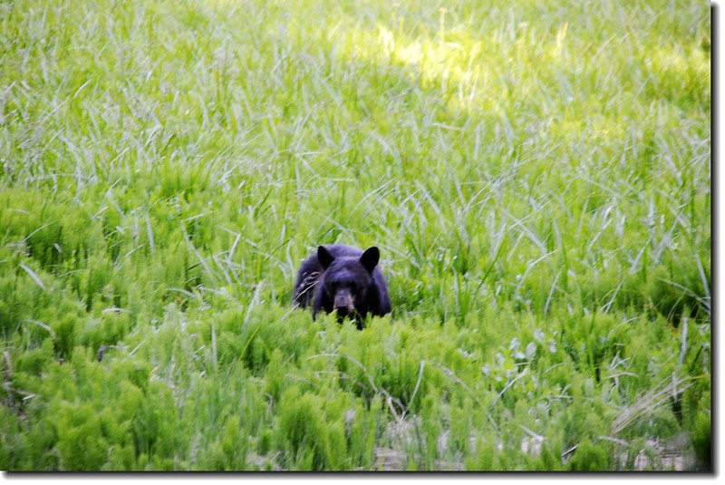
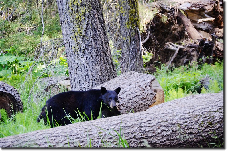
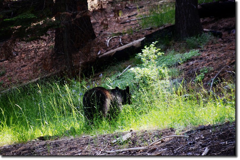
Black Bear un Round Meadow
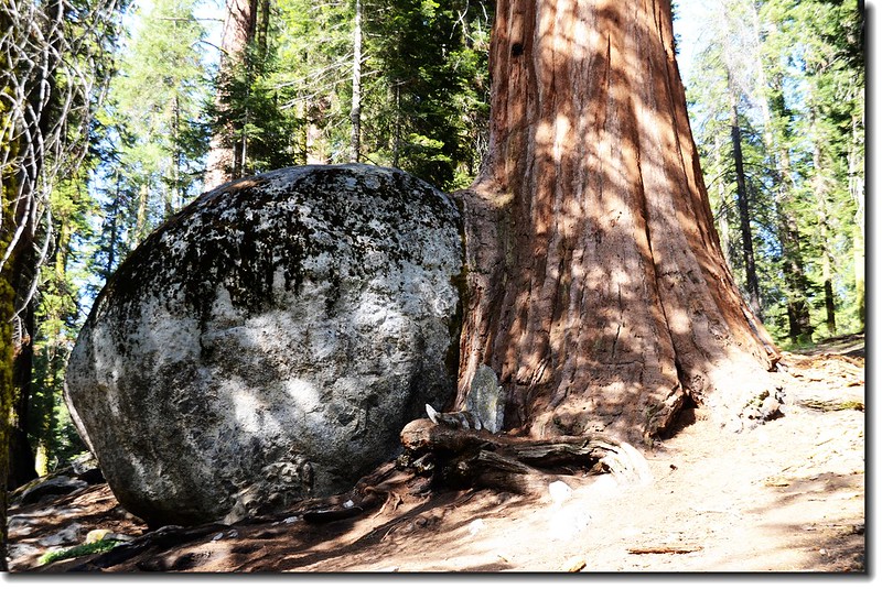
A boulder-hugging sequoia along Big Trees Trail
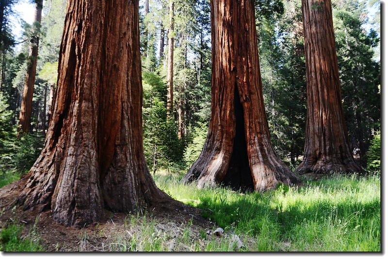
The Ed by Ned Trees
The Ed by Ned Trees
這棵看起來是分岔的一棵樹,其實他們是兩棵長得很接近的樹,長大以後樹頭部分便糾結成為一棵樹,該樹基部長10.4公尺,寬7.6公尺。
16:55 回到Giant Forest Museum,Giant Forest Museum是1900年代後期在Giant Forest區內超過300棟建物被拆除後僅存建物之一,裡面展示重點是美洲杉的生長史及一小書店;我們進去稍為參觀一下後便開車續往Mono Rock景點。
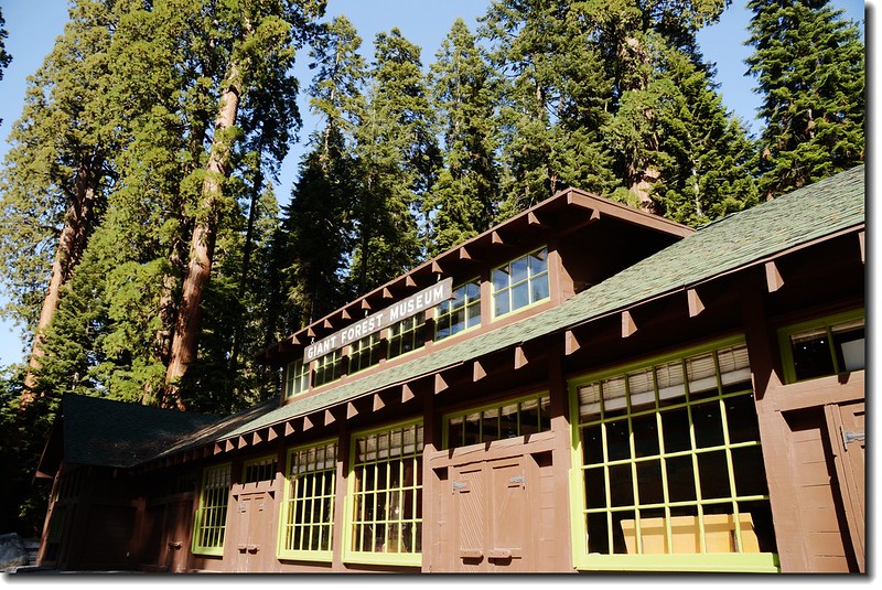
Sentinel Tree & Giant Forest Museum
Giant Forest Museum前面的Sentinel Tree
從Giant Forest Museum往Mono Rock車程約七、八分鐘,車道狹小彎曲,開車宜小心。
17:12 抵達Mono Rock停車場,沿Mono Rock Trail攀登Mono Rock。
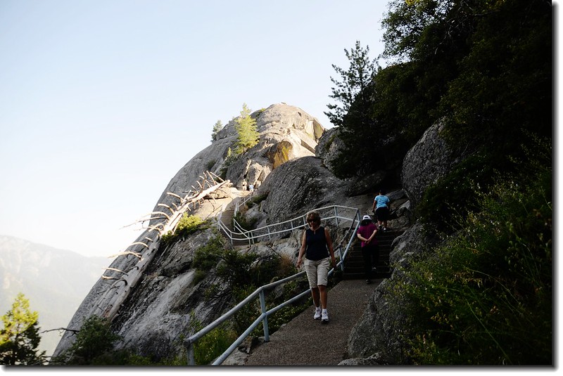
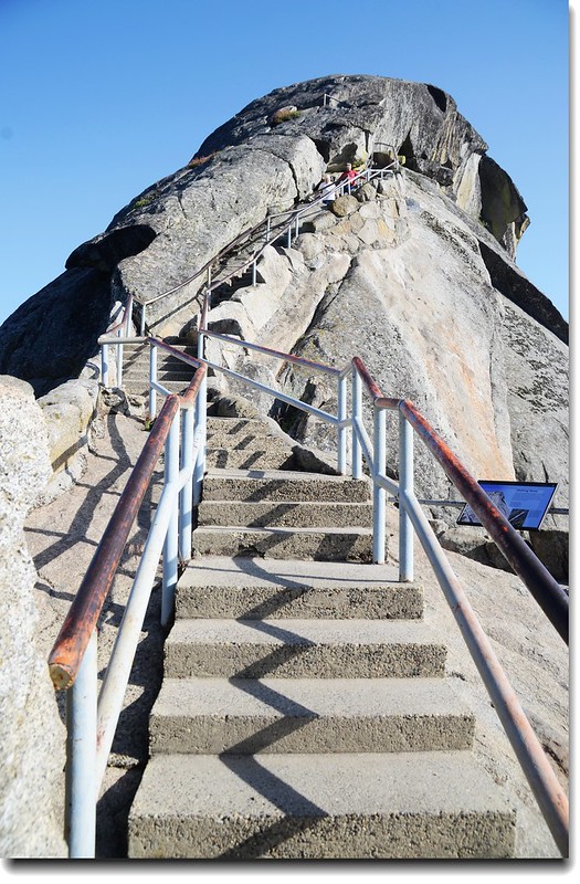
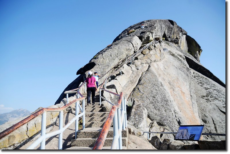
Mono Rock Trail
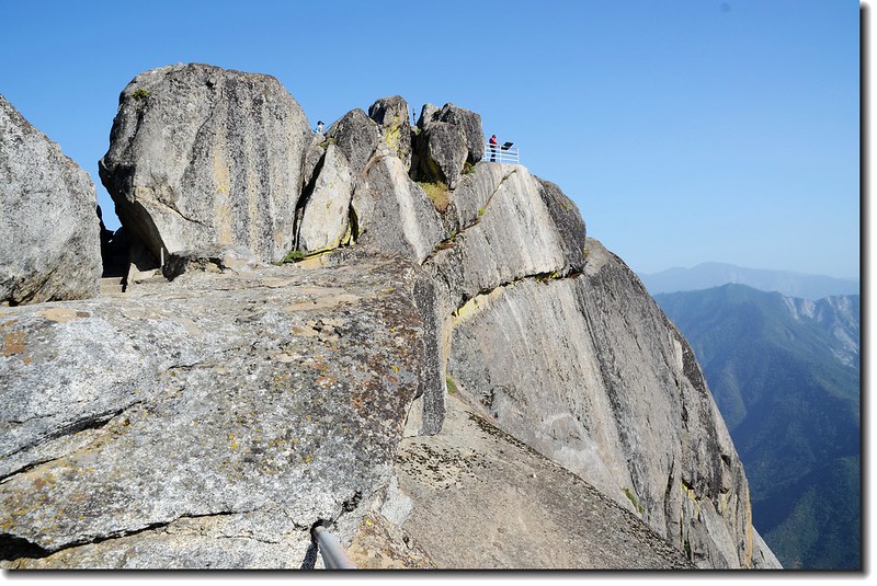
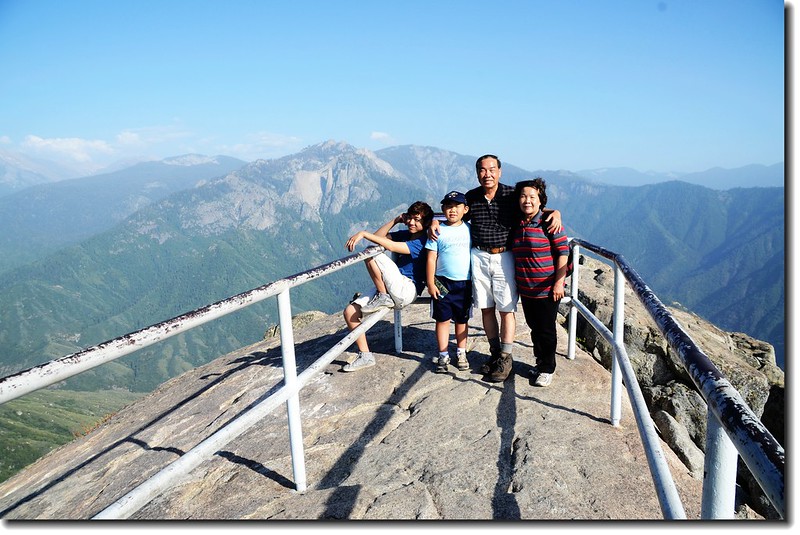
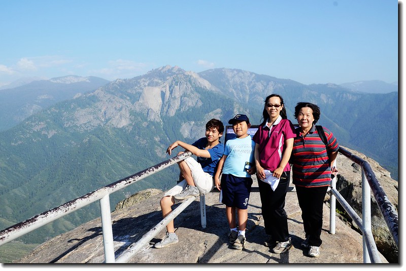
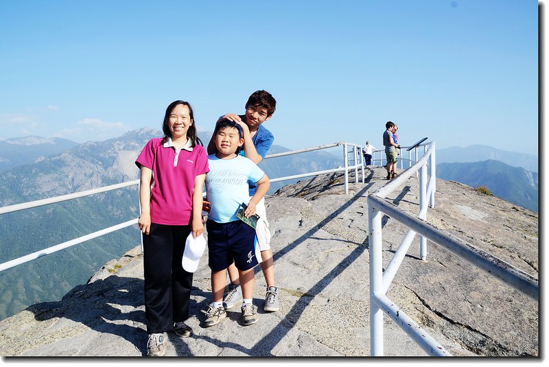
Mono Rock海拔6,725呎 (2,050公尺),山頭是一座巨大的花崗岩,公園管理單位設有步道可登上頂端;Mono Rock登頂步道是沿著岩石邊往上攀登,安全措施做得蠻好的,步道全長約400公尺,爬升高度約91公尺,登頂後俯瞰山谷、環視群山、盡攬周遭景色。
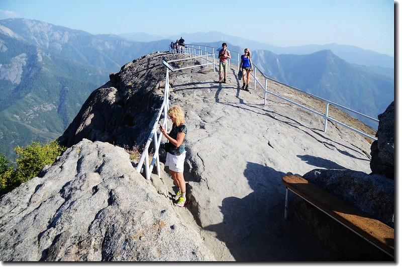
On the top of Mono Rock
Overlook the valley from the top of Mono Rock
Overlook from the top of Mono Rock
17:45 續往Tunnel Log,三、四分鐘便抵達Tunnel Log。
Tunnel Log是園區內從一棵1937年4月倒下的美洲杉鑿出一個可以開車通過的通道,該棵美洲山底部直徑6.4公尺,長度83.8公尺,樹洞(隧道)高2.44公尺,寬5.2公尺,一般休旅車通過無礙。
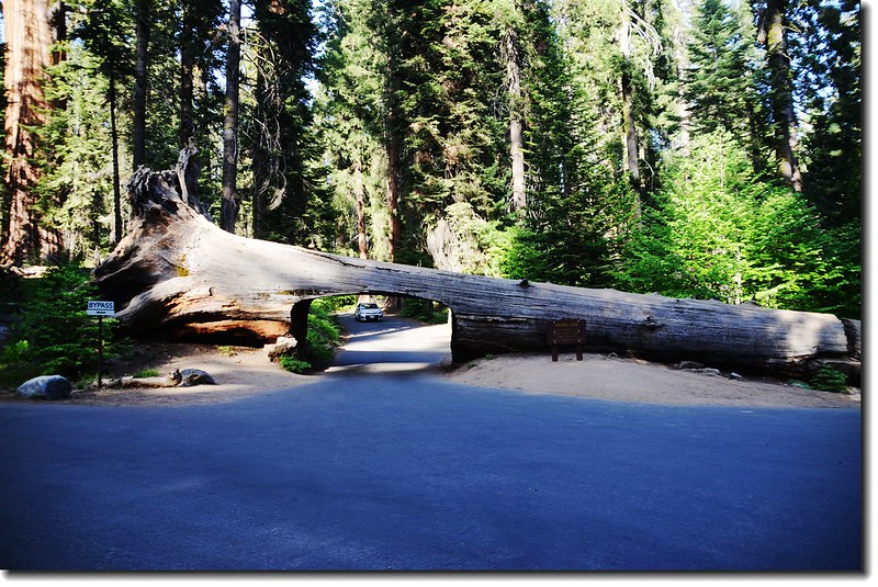
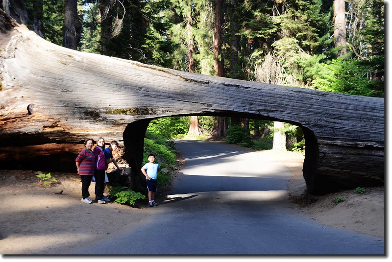
Tunnel log
參觀完Tunnel Log之後已是下午六點,Ranger建議的Crescent Meadow Loop只好捨棄,開車循原路下山,從公園到Las Vegas估計要七個多小時,順利的話預計凌晨兩點以前抵達Las Vegas。
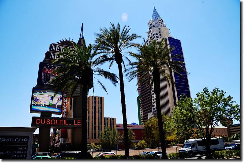
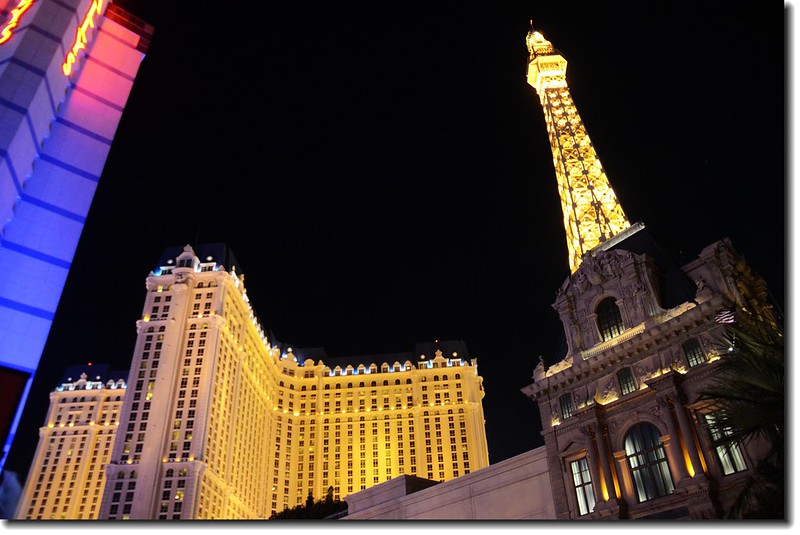
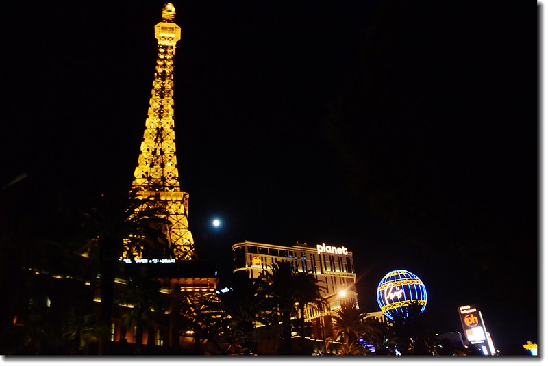
出了Sequoia National Park後一路沿CA-198、CA-65 、CA-99、CA-58、I-15HWY開往Las Vegas,抵達住宿飯店Boulder Station時正好凌晨兩點,漫長的一天!
▲今日行程詳細路線圖
▲點此看放大圖
---------------------------------------------------------------------------------------
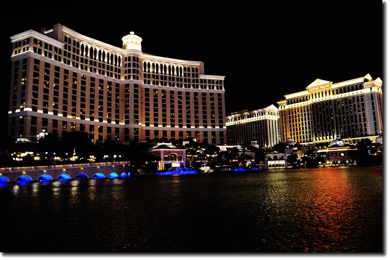
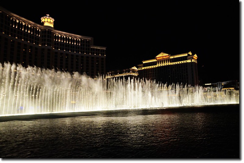
繼續瀏覽:美西國家公園之旅(五)— 拉斯維加斯(Las Vegas)、回程(2014.06.12~13)
---------------------------------------------------------------------------------------