----------------------------------------------------------------------------------------------------------
第一天 (06/08) Denver → Baker(Nevada) →Great Basin National Park
05:40 由女兒家中(Thornton, Co)出發,沿I-25南下接I-76轉I-70州際公路西行。
07:00 在Dillion湖畔小憩,該湖水位極低,不知怎地,該湖感覺上一年比一年難看,水位急降、松樹乾枯、遊艇驟減,而且情況是每況愈下!
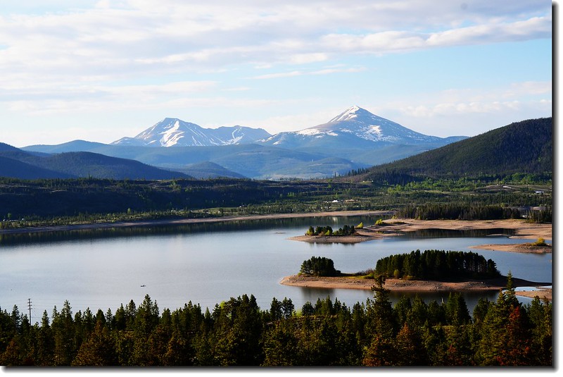
Dillon Reservoir
09:50 在抵達Grand Junction之前繞道小鎮Palisade加油,順便小休。
10:30 車抵科羅拉多州、猶他州州界,進入Utah州。
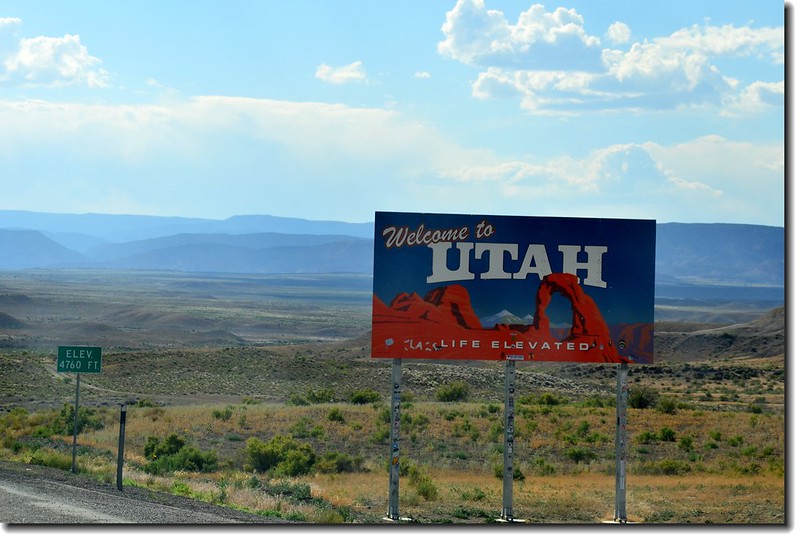
Colorado & Utah State Line (I-70)
I-70 WHY
11:40 在Green River用中餐。
12:50 抵達Ghost Rock Viewpoint,小休。
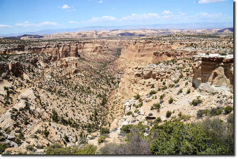

Ghost Rock Viewpoint
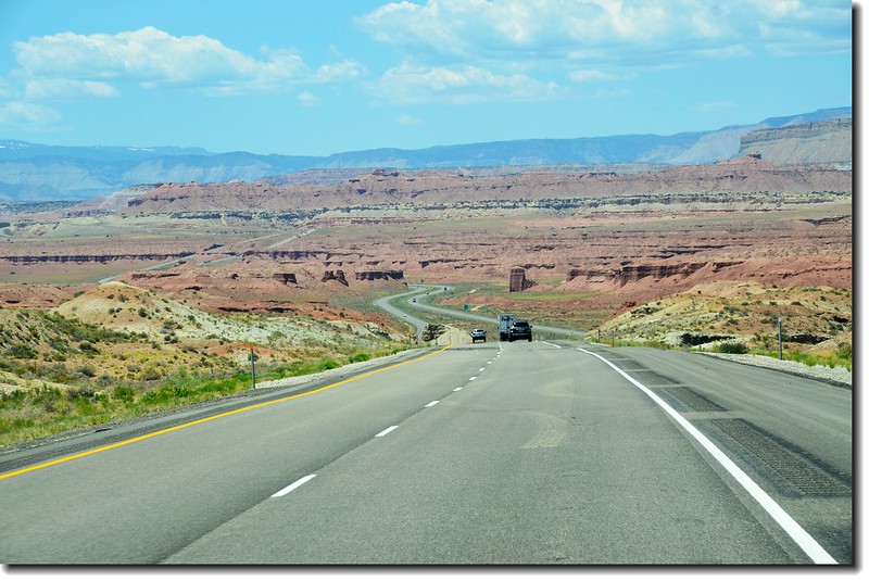
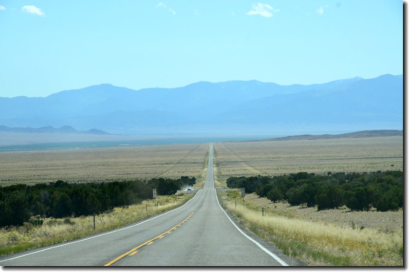
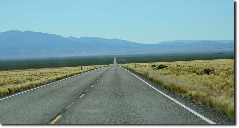
13:30 由I-70州際公路Exit 56下交流道改走US-50經Salina往西行;US-50公路素有“美國最寂寞的公路”(The Loneliest Road in America)之稱,但也許有家人的陪伴感覺還好!
US-50 HWY
16:40 抵達今晚住宿地~~Border Inn, Baker, Nevada,此旅館正位在US 50公路Utah和Nevada的州界,設備較為簡陋,沒辦法,Baker較為理想旅館已被訂光!Check in後時間還早,掌握時間趕往Great Basin National Park遊覽Wheeler Peak Scenic Drive,明天再參觀Lehman Cave。
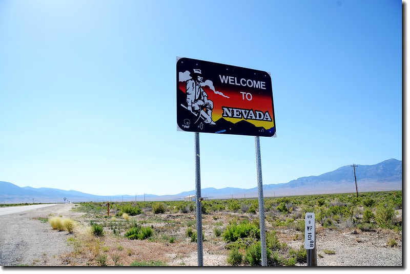
Utah-Nevada State Line
17:10 抵達Great Basin Visitor Center,索取一些資料後開車前往公園,一路沿Wheeler Peak Scenic Drive上山;該國家公園竟然不用門票,只有參觀Lehman Cave時須購票進入,可能是此公園遊客太少的緣故吧!
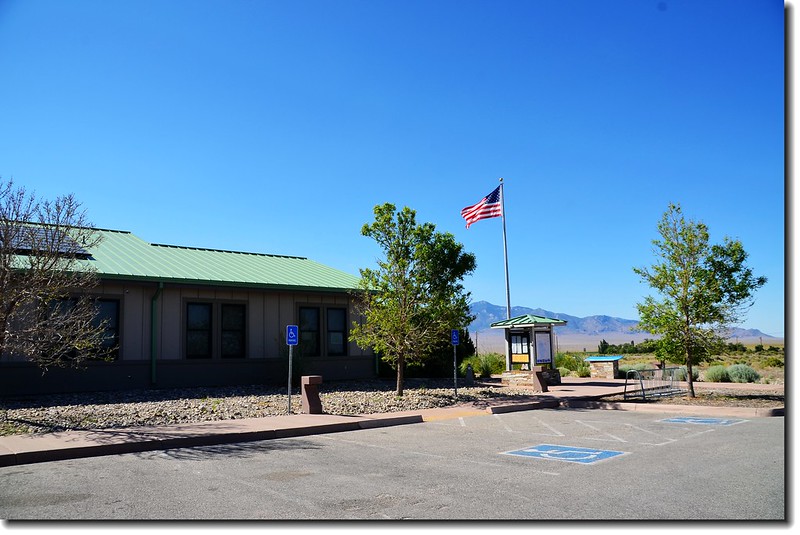
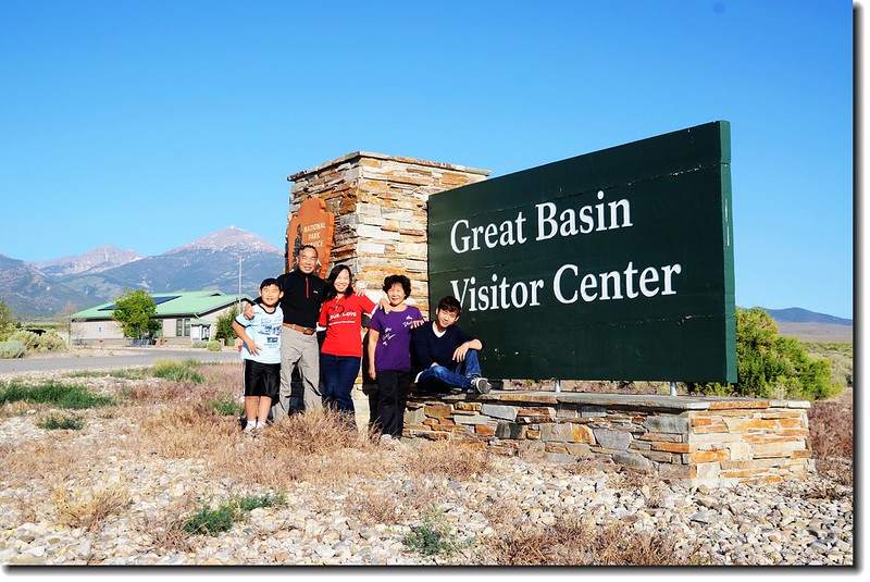
Great Basin Visitor Center
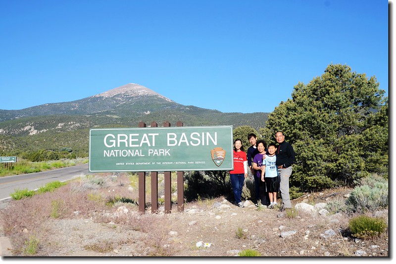
Great Basin NP Entrance
----------------------------------------------------------------------------------------------------------
大盆地國家公園(Great Basin National Park)位於內華達州和猶他州的交界處不遠的Baker往西大約有五英里 的路程,景區面積約312平方公里,它是美國內華達州唯一的國家公園,成立於1986年。公園裡有高山、冰河、Bristlecone pine(美國西南部一種毬果有針刺的松樹)、岩洞等特色景觀。
該公園因為地處偏僻,而且附近沒有其他容易抵達的風景名勝,因此大盆地國家公園在美國國家公園裡是遊客造訪最少的其中之一。
----------------------------------------------------------------------------------------------------------
惠勒峰景觀道路(Wheeler Peak Scenic Drive)
惠勒峰景觀道路(Wheeler Peak Scenic Drive)是到大盆地國家公園(Great Basin National Park)必走的景點,事實上如果你在該公園的時間不多,也只有此景點和李曼洞穴(Lehman Caves)好走。
惠勒峰景觀道路(Wheeler Peak Scenic Drive)在經過國家公園入口意象牌後隨即右轉上山,全長是12哩(19.2公里 )鋪設良好路面的山區道路,沿著South Snake Range的東面山坡蜿蜒而上,全程爬升約4,000呎(1,219公尺 )抵達近10,200呎(3,109公尺 )的公路頂端;此景觀道路經過多種不同的動植物棲息地,道路的底端是一處Wheeler Peak Campground,此公路前段3哩全年開放,後段9哩路通常僅在6~10月開放。
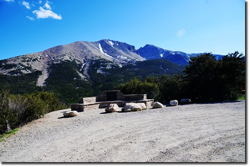
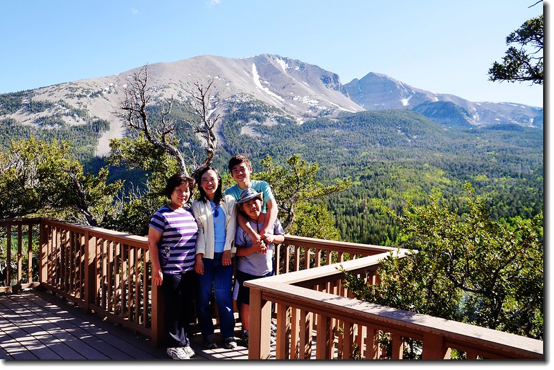
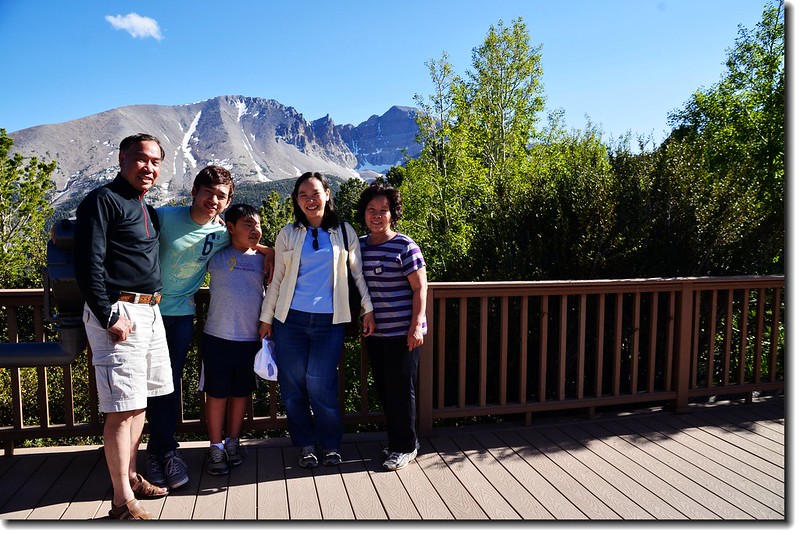
Overlook from Wheeler Peak Scenic Drive
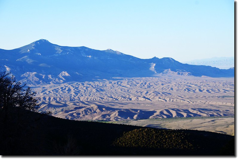
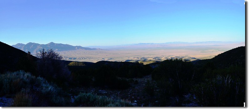
道路沿途時時可俯瞰東邊的Snake Valley,園方也設置了兩個觀景點:
Mather Overlook
距景觀道路起點約8哩,Mather Overlook是為了紀念美國國家公園管理處(National Park Service)的第一個行政主管(director)-- Stephen Tyng Mather而命名,在他任內(1917~1929)共成立了八座國家公園,除了此公園外,其他在Grand Canyon、Yosemite、Kings Canyon等國家公園也都有以他名字命名的景點、設施。
Mather Overlook
在此景點可俯瞰Snake Valley及遠眺Snake Range,內華達州的第二高峰Wheeler Peak在此也看得一清二楚。
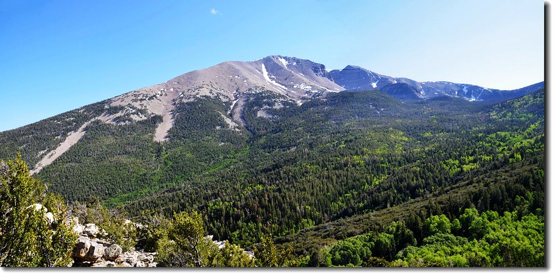
Wheeler Peak from Mother Overlook
Taken from Mother Overlook
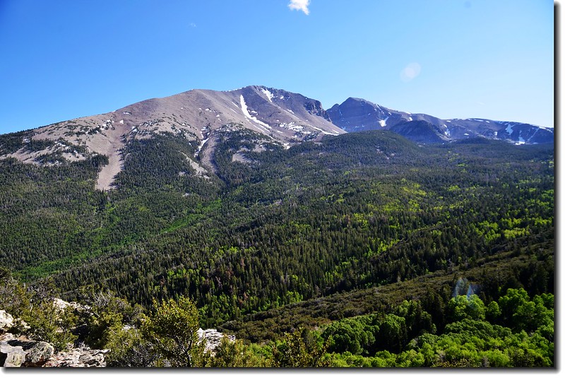
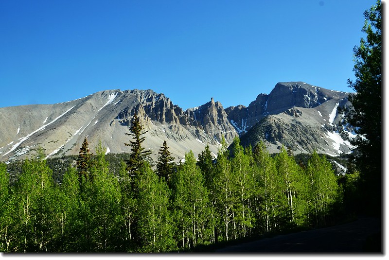
Wheeler Peak Overlook
此觀景點可遠眺Wheeler Peak,Wheeler Peak是公園裡一重要的景點,該峰海拔13,063呎(3,982公尺 ),是內華達州第二高峰,頂峰附近座落著內華達州僅有的一座冰川。 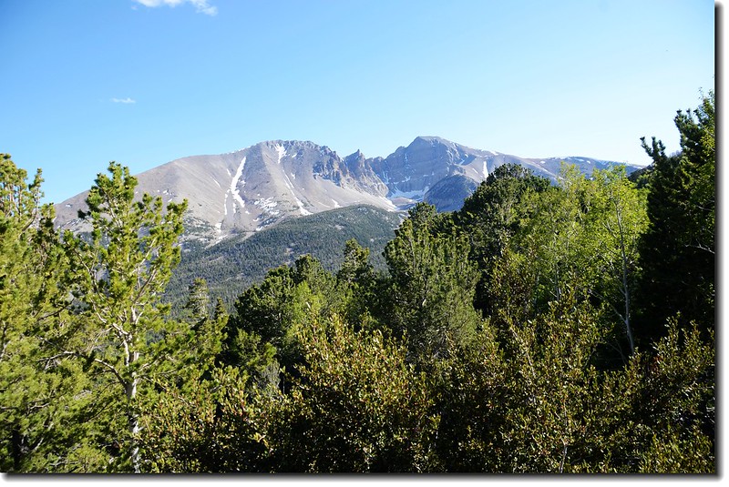
Wheeler Peak from Wheeler Peak Overlook
Taken from Wheeler Peak Overlook
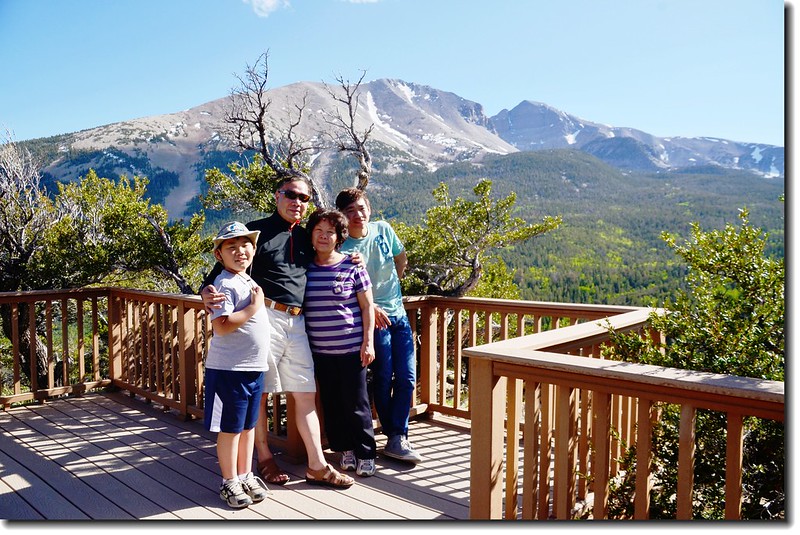
一路上行到Wheeler Peak Summit Trail登山口,此處海拔約10,160呎(3,097公尺 ),應是該公路的最高點了,繼續前行則是有點下坡;此登山口是登Wheeler Peak的登山口,Wheeler Peak海拔13,063呎(3,982公尺 ),它是內華達州的第二高峰,全程來回約8.2哩(13公里 ),爬升高度約2,900呎(884公尺 ),根據我的經驗至少要5~6小時的時程,而且必須很早就出發,高海拔山區的午後Thunderstorms(雷雨)已領教過一次,它是極具危險性的。
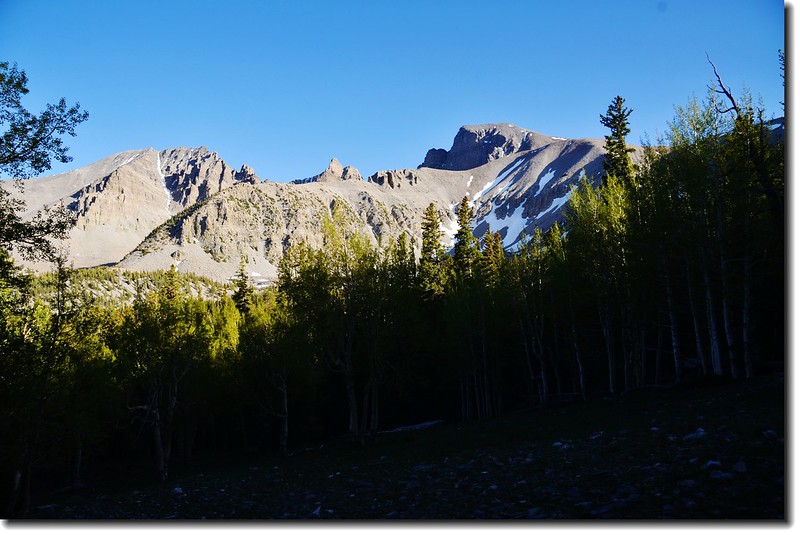
Wheeler Peak from Wheeler Peak Scenic Drive
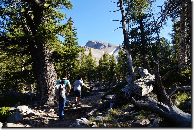
我們抵達Wheeler Peak Campground後已是下午五點多,只好選擇一條最熱門的Alpine Lakes Loop Trail走走,該步道是一環形步道,登山口高度9,800呎(2,987公尺 ),全程約2.7哩(4.32公里 ),總爬升高度約600呎(183公尺 ),途中會經過兩個有名的高山湖泊~~Stella Lake和Teresa Lake。
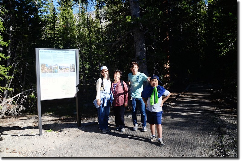
Bristlecone-Alpine Lakes Trailhead(2,990 m)
Alpine Lakes Trail
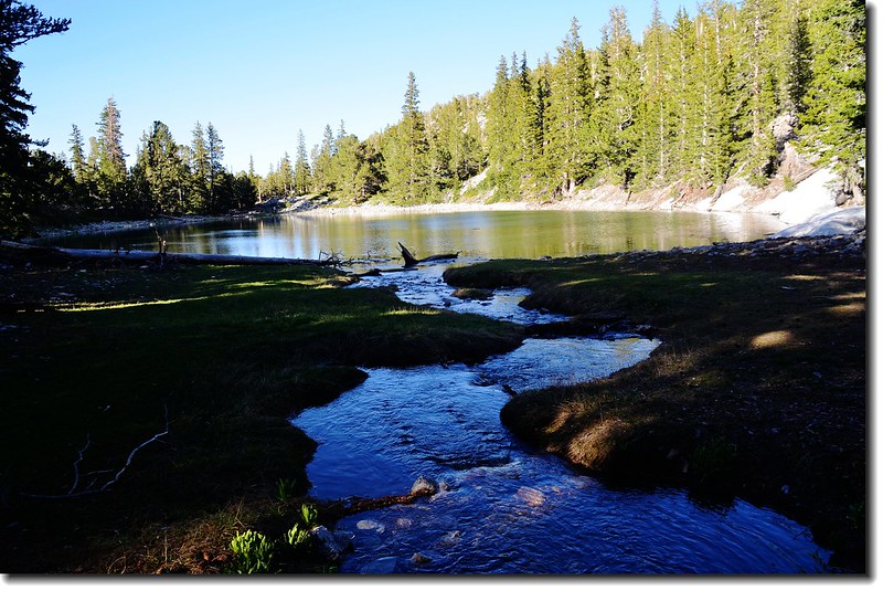
Teresa Lake
Teresa Lake
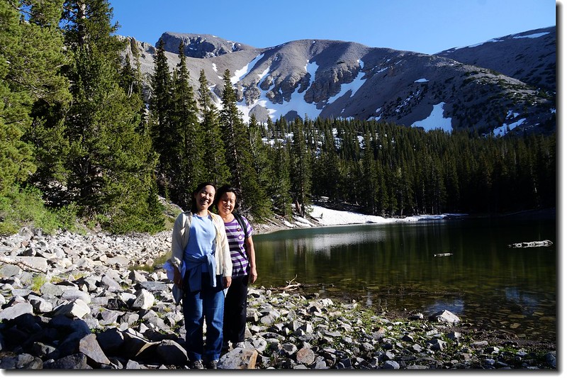
Teresa Lake
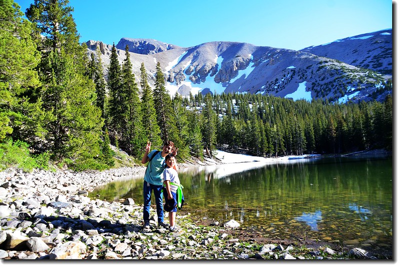
Teresa Lake
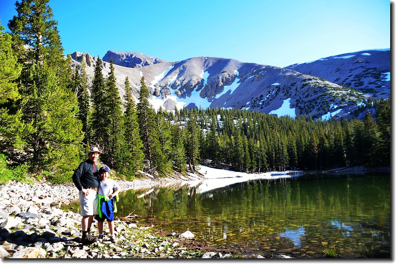
Teresa Lake
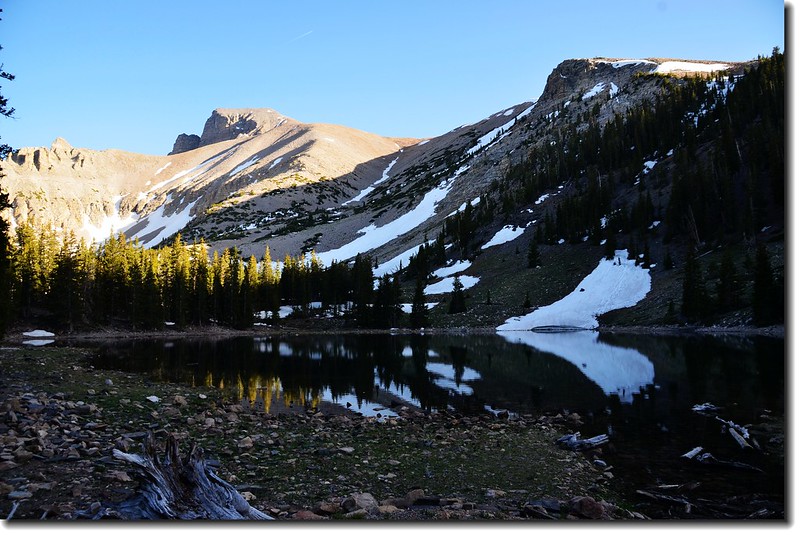
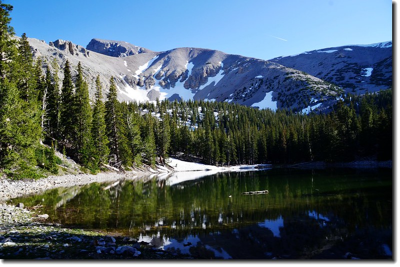
Stella Lake
Wheeler Peak from Alpine Lakes Trail
此登山口另有幾條步道是值得一走的,可惜我們來得太晚,只好忍痛割愛了!
Bristlecone Grove Trail:全長來回4.5公里,可觀賞Bristlecone pine群聚(美國西南部一種毬果有針刺的松樹)。
Bristlecone and Glacier Trail:全長來回7.4公里,此步道是Bristlecone Grove Trail的沿伸,通過Bristlecone Grove後直抵躺臥在Wheeler Peak下方的內華達州唯一的冰川。
----------------------------------------------------------------------------------------------------------
李曼洞穴(Lehman Caves)
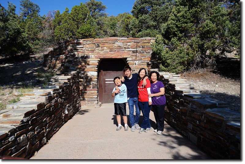
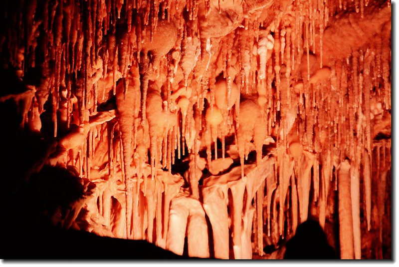
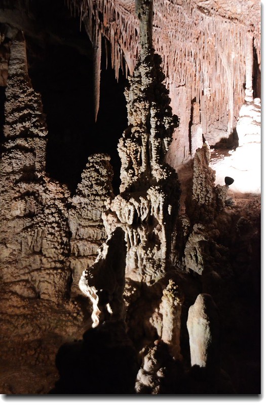
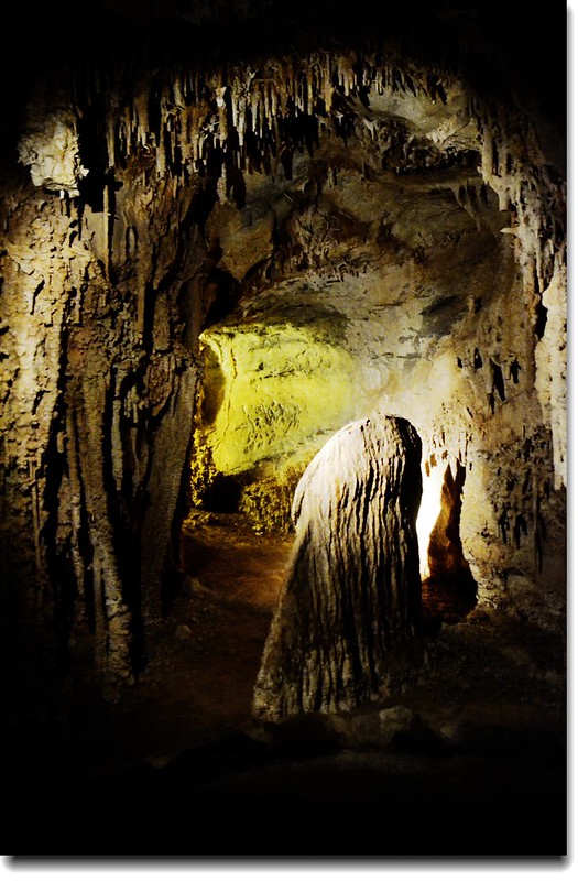
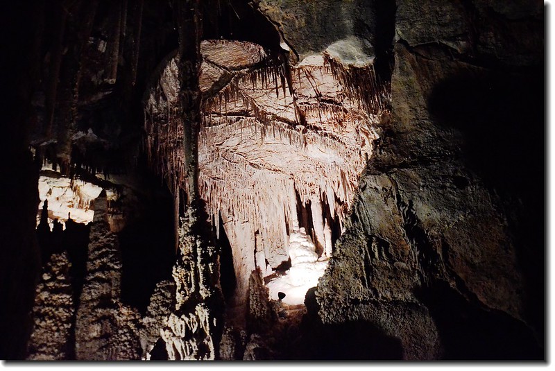
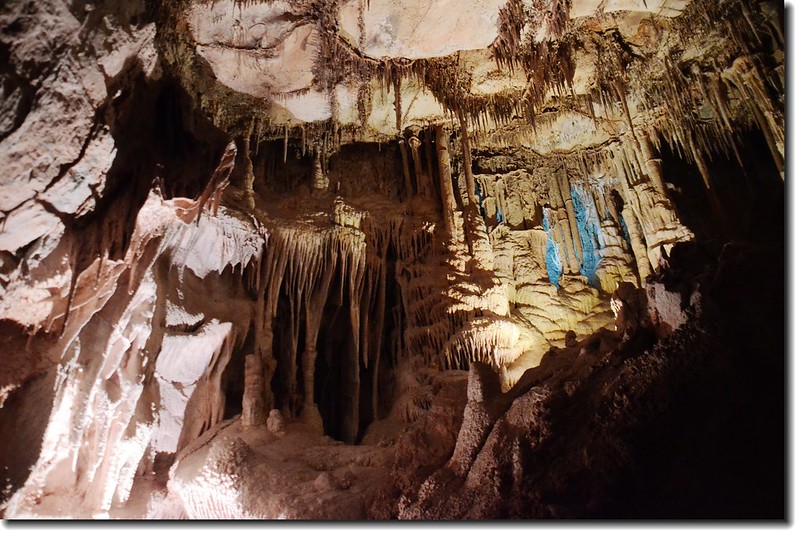
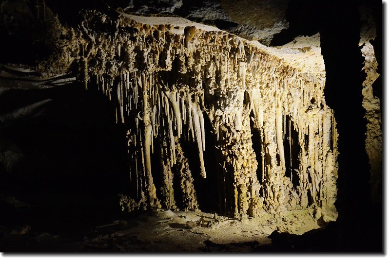
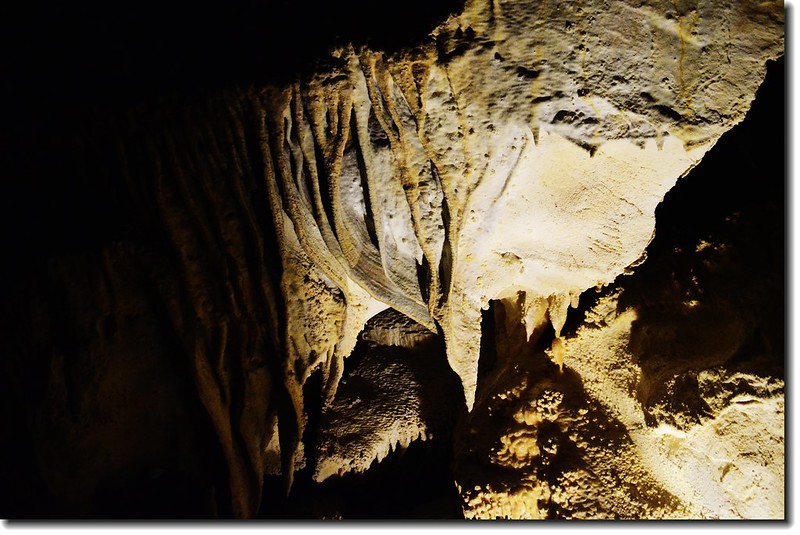
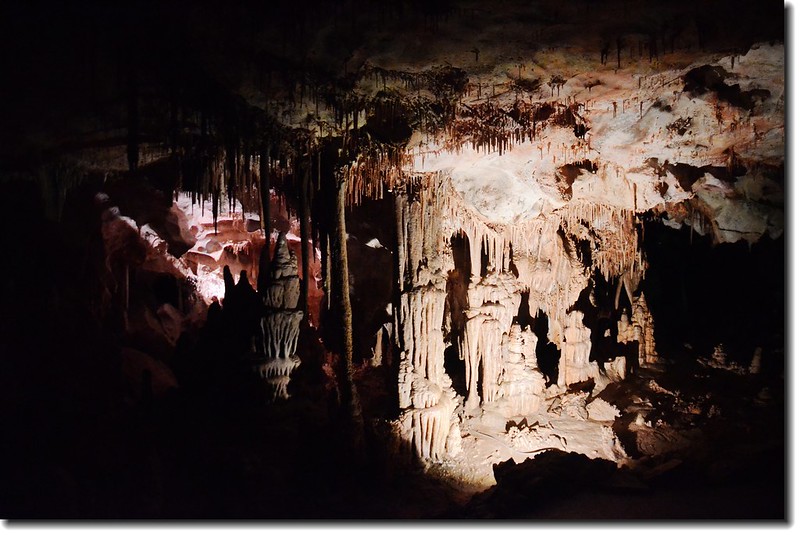
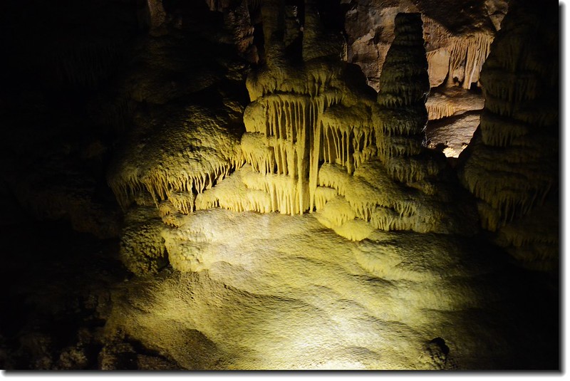
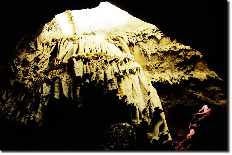
李曼洞穴(Lehman Caves)位於惠勒峰(Wheeler Peak)低坡上,海拔約6,825呎(2,080公尺 ),該洞穴是由一位Absalom Lehman的牧場工人、礦工在1885年所發現,李曼洞穴裡的鐘乳石不只是石灰岩所形成,還有一部分是大理石所形成,這些洞穴猶如一個地下仙境,裡面佈滿了壯觀瑰麗而又錯綜複雜的鐘乳石、格狀石柱、波狀的石帳幔和捲曲石,洞穴規模雖比不上世界幾個有名洞穴,但仍有其獨特性與可看性。
我們於第二天(9)早上七點多抵達Lehman Caves Visitor Center等待09:00第一批的洞穴參觀,等待期間到Visitor Center後面的Mountain View Nature Trail走走,該步道長僅0.4公里 ,僅爬升25公尺,步道旁立有植物、地質、景觀解說牌,不錯的自導式步道。 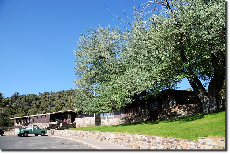
Lehman Caves Visitor Center
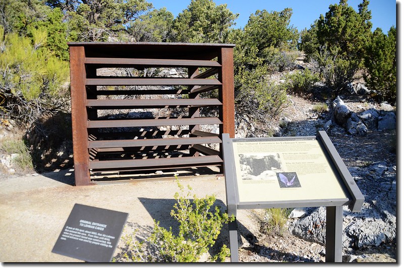
The natural entrance to Lehman Caves
Lehman Caves
Lehman Caves的石筍、鐘乳石
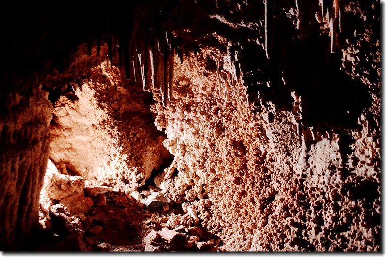
Cave popcorn(爆米花), Lehman Caves

Shields in Lehman Cave ~盾型鐘乳石
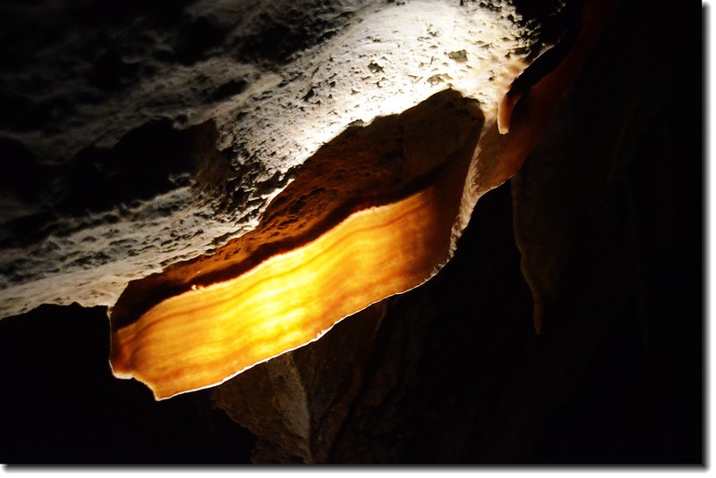
Transluscent cave bacon in Lehman Caves~半透明的培根
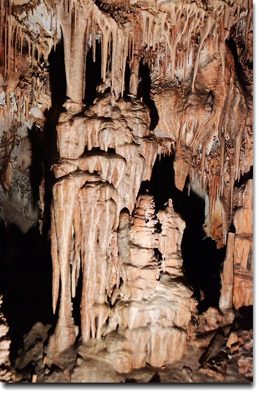
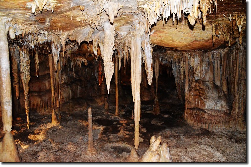
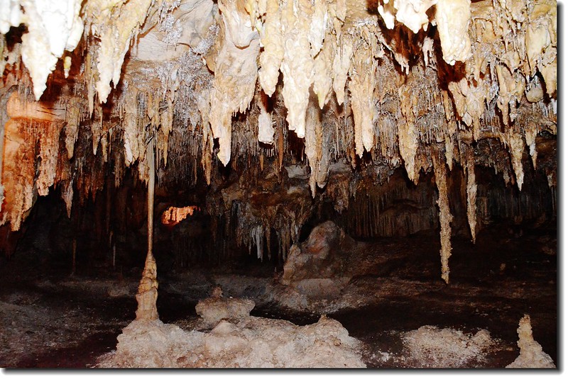
Stalagmites in Lehman Caves
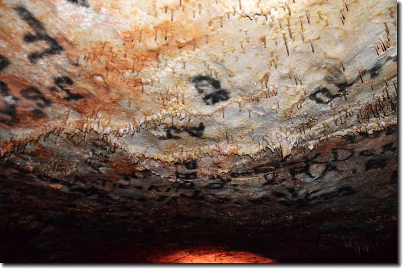
洞穴內這些黑色塗鴉是五十年前人類活動的遺跡,據說是以火焰燻黑的,之所以保存下來而未以清除是為了尊重當時人類活動的價值觀,這種塗鴉不希望以現代的觀點來評論當時的行為之對與錯。
----------------------------------------------------------------------------------------
繼續瀏覽:美西國家公園之旅(二)-- Great Basin to Yosemite~2014.06.09
----------------------------------------------------------------------------------------
▲(點此)→行程路線圖
沒有留言:
張貼留言