----------------------------------------------------------------------------------------
----------------------------------------------------------------------------------------
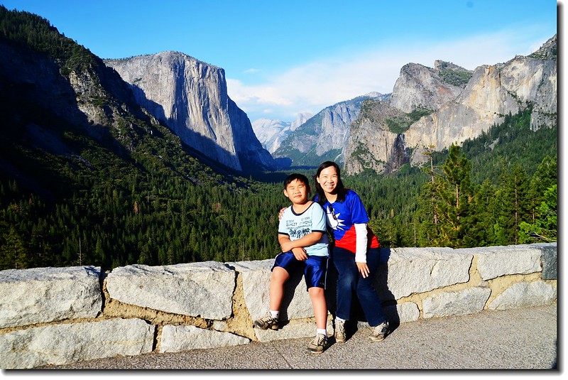
Tunnel View, Yosemite, CA
優勝美地國家公園(Yosemite National Park)是一座位在美國加州橫跨 Tuolumne、Mariposa和Mader三個County的國家公園,成立於1890年10月1日,公園面積有747,956英畝(3,027平方公里),公園範圍包括內華達山脈西側山坡,該國家公園在1984年被聯合國教科文組織指定為世界遺產。
早期白人抵達此地時,誤認“優勝美地(Yosemite)”是從前住在這裡的一個印地安部落的名字,故以其命名,實際上當地原住民自稱“阿瓦尼奇(Ahwahneechee)”,稱優勝美地谷地(Yosemite Valley)為“阿瓦尼(Ahwahnee)”,而“優勝美地(Yosemite)”則為該族語言中“殺手”的意思。
優勝美地國家公園以其拔地而起壯觀的花崗岩懸崖、瀑布、巨杉和豐富的生物多樣性聞名於世,每年有超過三百七十萬名遊客造訪優勝美地國家公園,大多數是為了優勝美地谷地(Yosemite Valley)而來。
------------------------------------------------------------------------------------------------------
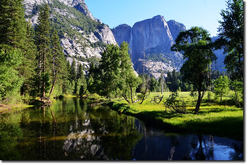
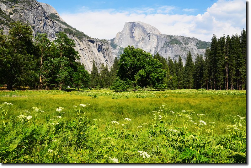
優勝美地谷地在上一次冰河時期被冰川覆蓋,谷地呈U字型,兩旁峭壁上到處可見由冰川切削過的痕跡,美麗清澈的Merced River由谷地中流過,最有名的地理景觀就是半圓丘(Half Dome)。
有人說來到優勝美地印象最深刻的是矗立在Yosemite Valley兩側拔地而起的大理石岩壁、以及懸掛在岩壁上的瀑布群,優勝美地絕大部分有名的瀑布都集中在優勝美地谷地(Yosemite Valley),最有名的是優勝美地瀑布(Yosemite Falls),但也許是參觀季節的關係,我印象最深的則是Nevada Fall和Vernal Fall ;觀賞瀑布最佳時段是春天融雪期間,這些瀑布通常在夏末和冬天水量極少甚至完全沒有水流下。
------------------------------------------------------------------------------------------------------
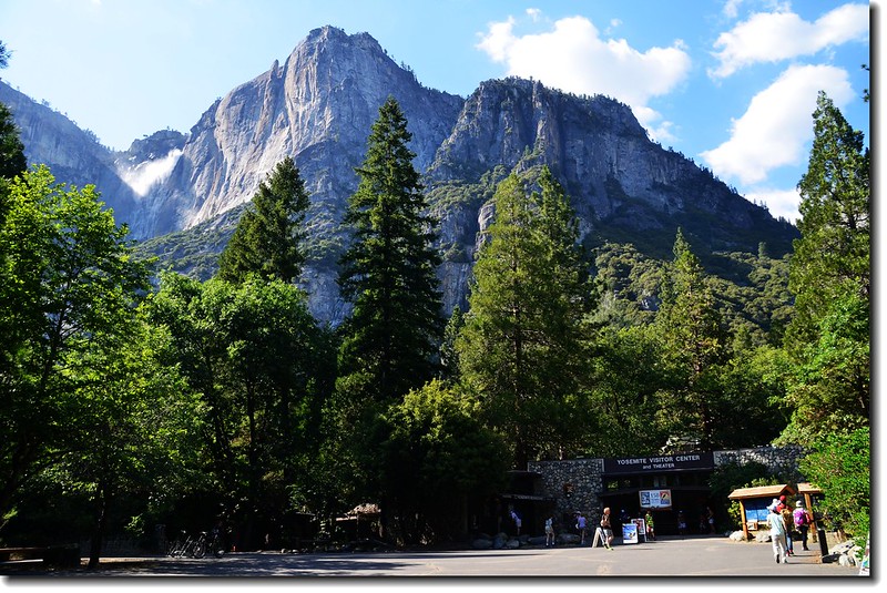
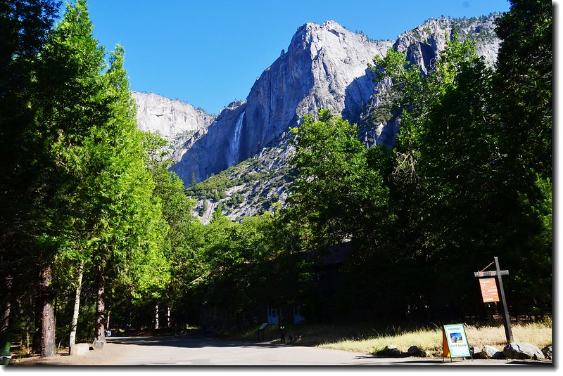
美西國家公園之旅第三天旅遊重點是優勝美地國家公園的谷地(Yosemite Valley),我們在近七點由Crane Flat營地沿著Big Oak Flat Road東南行,走走停停看看,抵達離Valley Village和Valley Visitor Center最近的停車場已八點鐘(正常行車時間約半小時);旅遊優勝美地谷地(Yosemite Valley)大部分的遊客是搭園區的免費遊園車,此遊園車班次蠻密的,而且可達每一景點,當然也有部分遊客喜歡自己開車,但自己開車時有些景點是受到限制車子不能進去的。
Yosemite Valley from Big Oak Flat Road
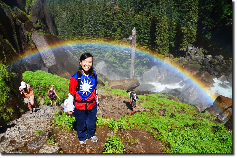
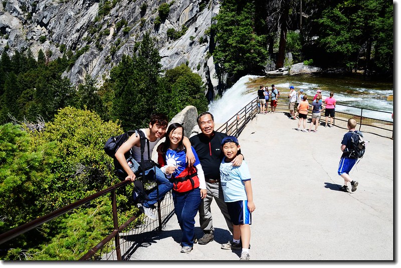
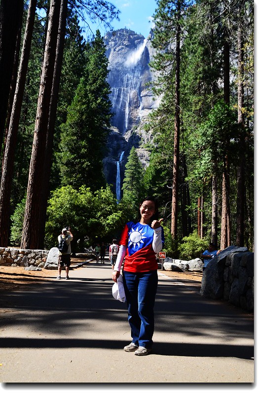
出國前大女兒特別向台北的妹妹(我的小女兒)要了一件國旗裝,她今天就穿這件國旗裝遊園,一位Park Ranger看到後主動搭訕,這位Ranger說他待過台灣,很喜歡台灣,並熱心的強烈建議我們先遊貫通Vernal Fall和Nevada Fall的Mist Trail,然後再遊其他景點,因為Mist Trail稍晚一點人潮會很多,擁擠得很;也多虧他的建議,下山時果然人潮如織,而且蠻熱的。
此趟我們搭遊園車共參觀了下列幾個瀑布及景點:
瀑布
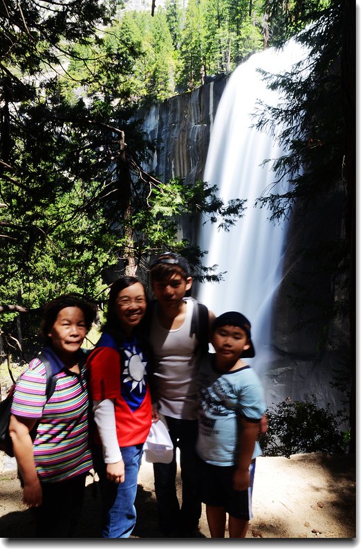
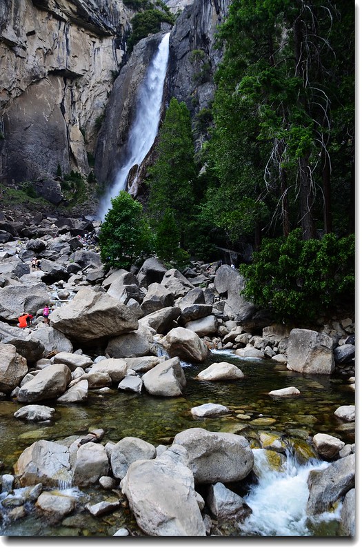
(一)Vernal Fall和Nevada Fall
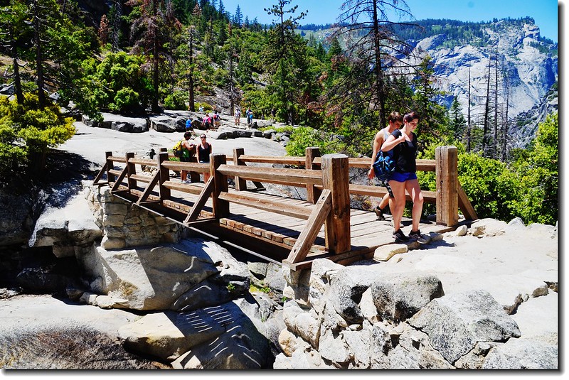
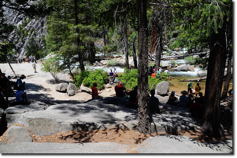
登山口在Happy Isles Trailhead,搭遊園車在第16站下車,此登山口是多條登山步道的登山口,有名的Half Dome Trail也是由此登山口出發。
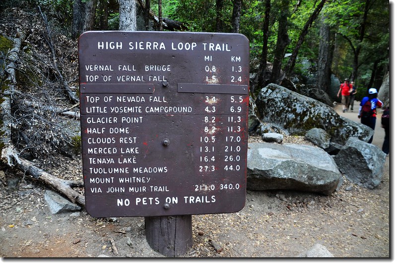
Happy Isles Trailhead
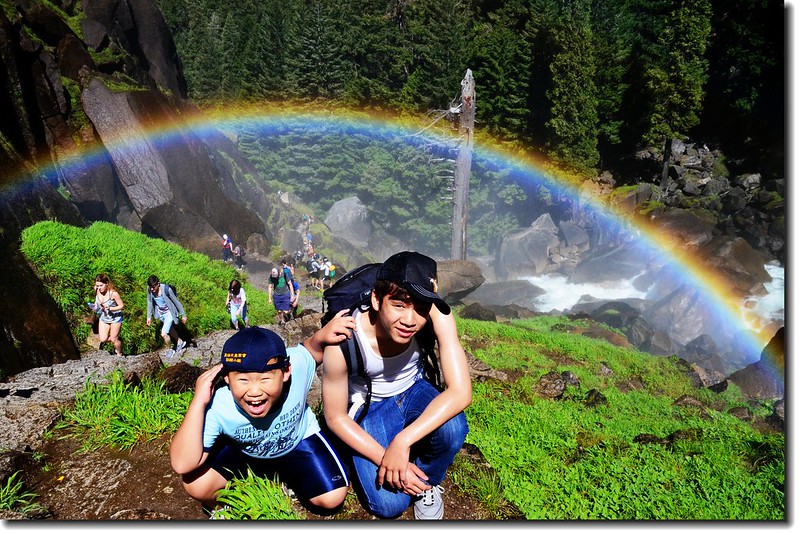
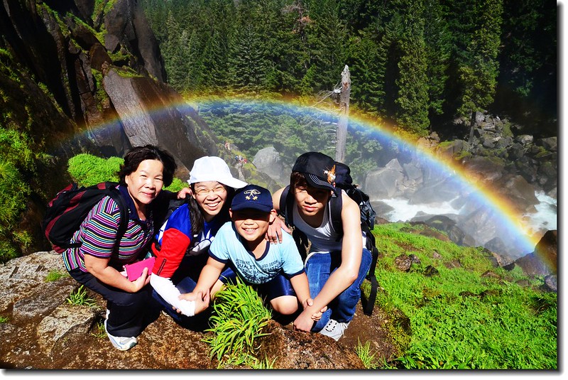
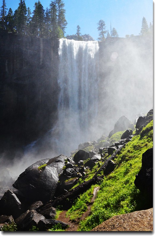
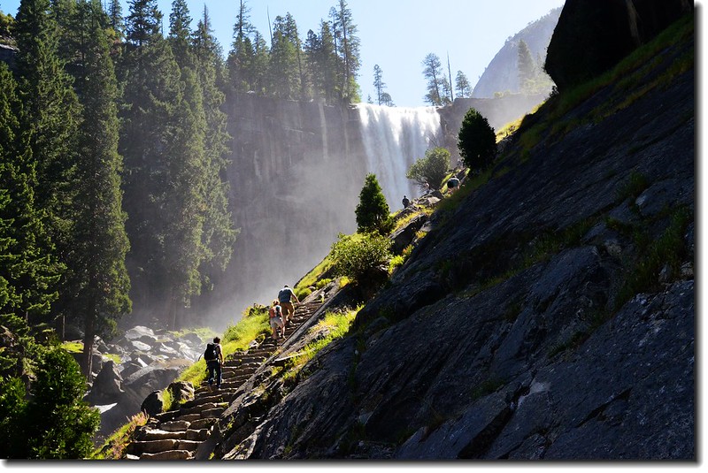
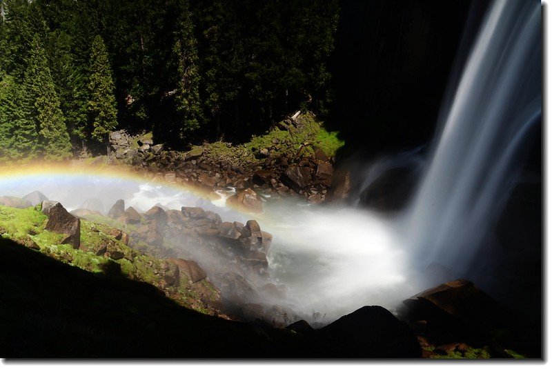
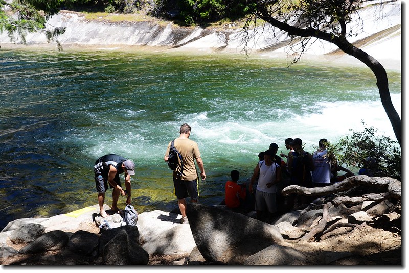
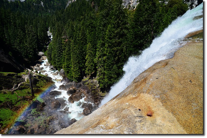
Mist Trail是通達Vernal Fall和Nevada Fall兩個瀑布的小環形步道,全長往返約7哩(11.2公里),爬升高度約1,900呎(579公尺),費時約需5~6小時;該步道約1哩處在Vernal Fall下方若在水量豐沛期,整條步道被瀑布飛濺出的水珠瀰漫,猶如行在細雨中,所以稱之為Mist Trail,一般遊客絕不會錯過此步道,如果體力不繼可以走到Vernal Fall即下撤,如此行程約2哩,一小時左右即可完成。
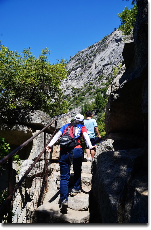
Mist Trail
==================================================================
彩虹瀑布?
==================================================================
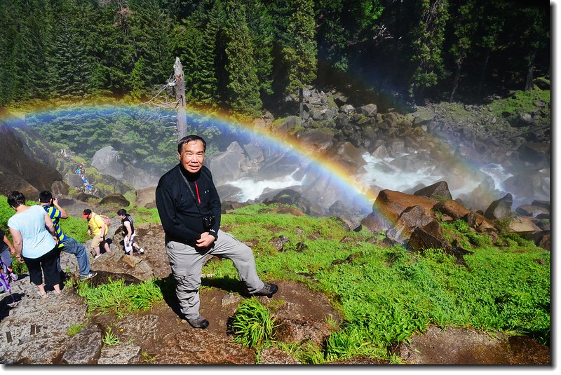

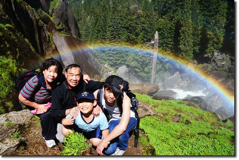
Taken under rainbow, Vernal Fall
Vernal Falls & Mist Trail

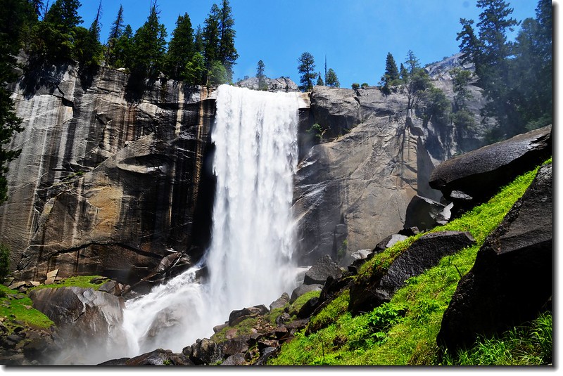
Vernal Falls, Yosemite National Park
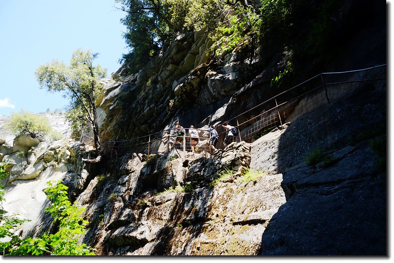
Mist Trail
Mist Trail
Vernal Fall 頂端的 Emerald Pool
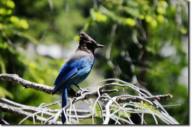
Steller's Jay bird
Vernal Fall 頂端俯瞰Merced River and Mist Trail
The top of Vernal Fall
The top of Vernal Fall
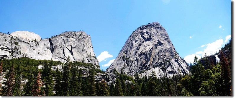
Half Dome, Mt. Broderick Clouds Rest and Liberty Cap from Mist Trail
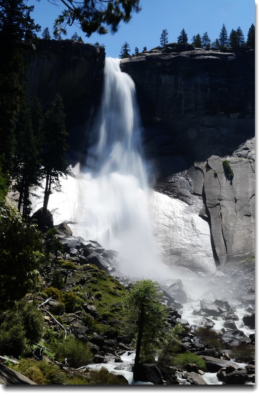
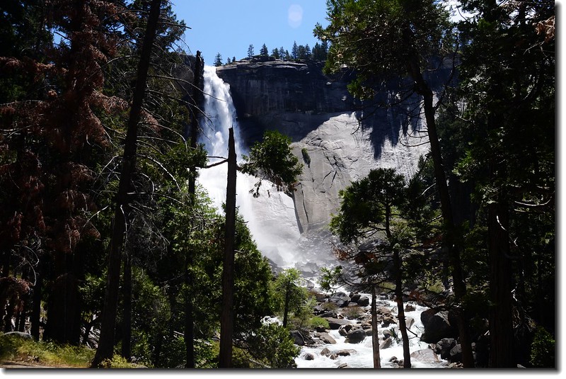
Nevada Fall
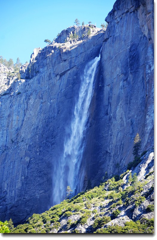
(二)Yosemite Falls
優勝美地瀑布(Yosemite Falls),是北美洲落差最大的瀑布,全高為2,425呎(739公尺),一共可分為三段,雖然在外觀看來僅有Upper Yosemite Fall與Lower Yosemite Fall兩段,但事實上包括了中間的落差地帶。
上瀑布的登山步道全長來回約7.2哩,費時約需6~8小時,一般的遊客可能不太容意撥出時間來;下瀑布有相當容易的步道可達,全長來回約1哩路,半個小時左右即可走完,因此往往是遊客最多的地方。
Yosemite Falls from Yosemite Village
Lower Yosemite Fall
Yosemite Falls and Lower Yosemite Fall Trail
Yosemite Falls from Yosemite Visitor Center
Yosemite Falls from Yosemite Village
Yosemite Falls from Swinging Bridge
(三)Bridalveil Fall
新娘面紗瀑布(Bridalveil Fall)是第四天要去Sequoia National Park時順路進去的,從Bridalveil Fall停車場走約1,000呎的步道即可到達瀑布觀景點,瀑布的水不大,朦朦朧朧的像一塊新娘面紗般優雅的從將近200公尺 的山崖向下傾瀉,猶如懸掛在空中的一縷面紗 。
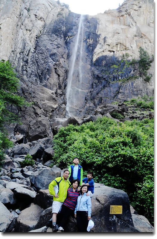
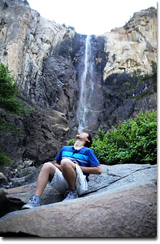
Is Matthew really so thirsty ?(at Bridalveil Fall, Yosemite)
岩壁
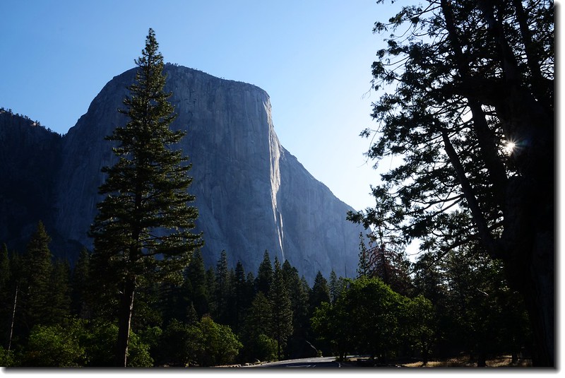
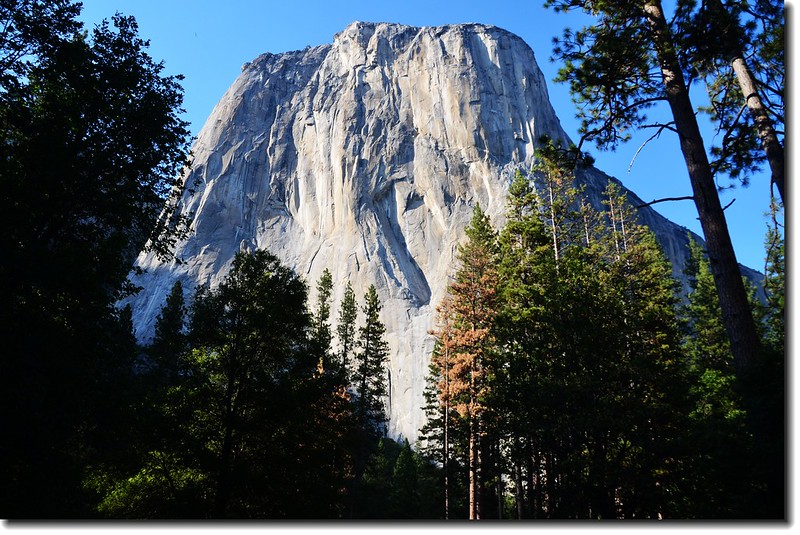
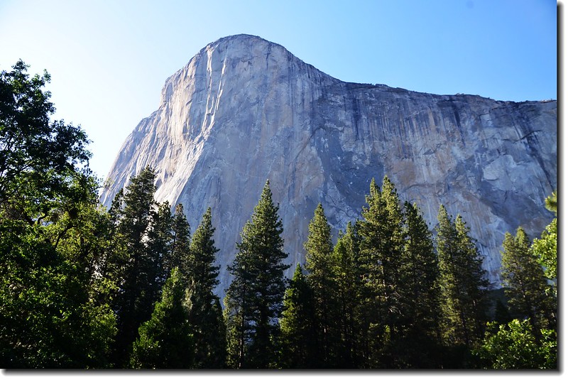
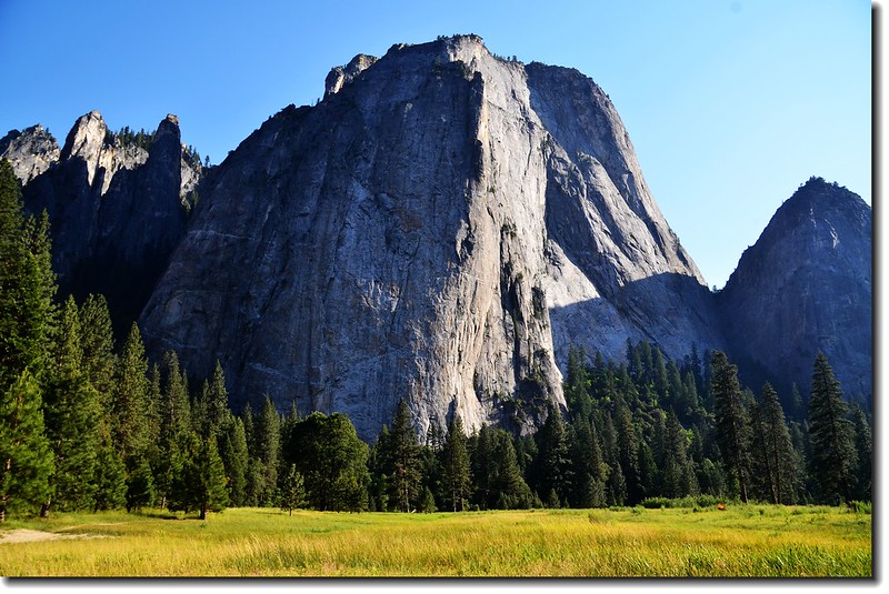
(一)El Capitán
“El Capitán”位在Yosemite Valley西端的北側, “El Capitán”是西班牙文,就是英文“The Captain”, "the chief"之意。
“El Capitán” 海拔7,569 呎(2,307公尺),是優勝美地國家公園(Yosemite National Park)內非常具有代表性的一處垂直岩壁,岩壁高約910公尺,是世界著名攀岩聖地之一;該岩峭壁上的花崗岩據說已有一億年的歷史,岩石間幾乎沒有便於攀爬的縫隙,因而在世界各地的攀岩者眼裡攀登“El Capitán”算是極大的挑戰。
在“El Capitán“數條頗具難度的攀岩路線中,“The Nose”路線無疑是世界上最艱具的攀岩路線之一,通常情況下,這條路線需要四天才能完成,無論是從體力、技術還是心理承受力來講都是對攀岩者的巨大挑戰,因此每年吸引著眾多攀岩好手在此奮戰,卻少有成功者。
El Capitan
El Capitan
El Capitan from El Capitan Meadow
(二)Half Dome
半圓頂巨岩 (Half Dome)是矗立在優勝美地山谷的花崗岩巨石,海拔8,842呎(2,695公尺), 是全世界最著名的花崗岩山。這塊巨岩陡峭的西北壁和曲線流暢的石肩,被舉世公認是優勝美地國家公園的象徵, 登上山頂的遊客,可以360度瞭望全部優勝美地國家公園,因此前往半圓頂巨岩的步道已成公園內最熱門的步道之一。 雖然攀登這塊巨岩是一大挑戰,在登頂的最後一段最為險峻,不但是45度的斜坡,而且整塊花崗岩上空無一物,沒有外力協助根本無法攀爬, 園方因此架設不鏽鋼鐵鍊,讓勇於攀登走壁的人如願登頂,但每年仍然有數以萬計的遊客登頂,而且都會在上面停留個把小時, 儘情欣賞西邊猶如世外桃源的優勝美地山谷,以及東邊內華達山脈動人的美景。
Half Dome登山步道的登山口和登Vernal Fall、Nevada Fall的Mist Trail是同一登山口(Happy Isles Trailhead),全程往返約16.4哩(約26.4公里),總爬升高度約4,800 呎(1,463公尺),通常往返需要大約10~12個小時,其中最具挑戰性的最後的登頂段,攀登者腳踏光滑的岩壁,全憑雙手緊拉鐵鍊一步步往上爬,看登頂照片的人潮就有如台灣的天梯剛啟用時一般,黑鴉鴉的一條線,要快也快不得。也就是太有名氣,早年登此山不用申請,鼎盛時一天曾湧上上千人登頂,因此發生不少山難,更危險的是遇到北美高地特有的Thunderstorm(雷雨)時下撤根本來不及,2011年公園管理局為安全起見規定,採取登頂總量管制,每天300人(當日單攻225人,過夜75人)為限,通常登山季節入山證都在幾個月前便開放申請,跟登玉山一樣,申請人數超過管制人數則採抽籤方式發給登頂許可證。
Half Dome overlook from Cook's meadow Trail, nearby shuttle stop #6
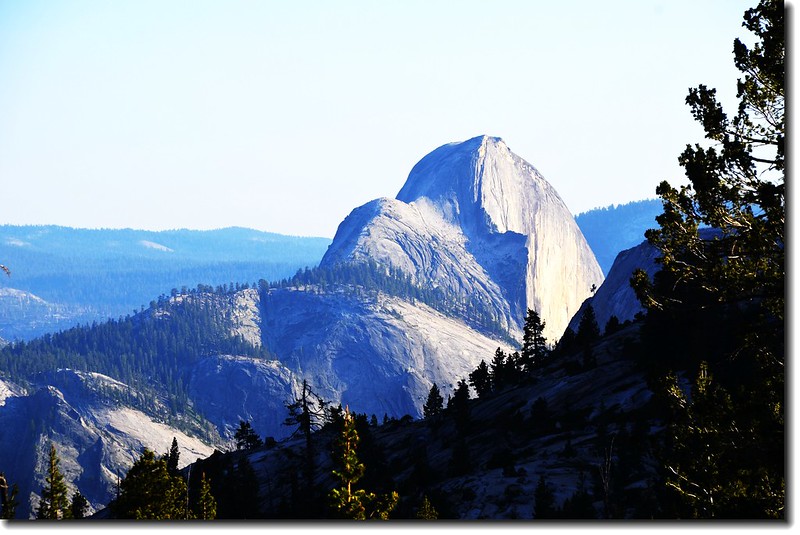
從Tioga Road眺望Half Dome的背面
(三)Cathedral Rocks
Cathedral Rocks位在El Capitán的正對面,海拔6,644 呎(2,025 公尺),在其西邊就是Bridalveil Fall,有人認為此岩壁之壯觀並不亞於El Capitán,也是攀岩者喜愛的挑戰路線。
Cathedral Rocks and Cathedral Spires (on the far left), from El Capitan Meadow

Sentinel Rock from Yosemite Visitor Center
The Ahwahnee Hotel
The Ahwahnee Hotel 是優勝美地谷地內一家有點歷史的豪華酒店,整棟建物由石材、混泥土、木頭及玻璃等建材建造,此棟建築是由本次旅遊第一篇題到的美國National Park Service第一任Director名叫Stephen T. Mather者提出的構想,在優勝美地谷地建造這棟全國首棟國家公園內的高檔酒店;此家酒店於1927年開始營運,並於1987年列入“National Historic Landmark ”。
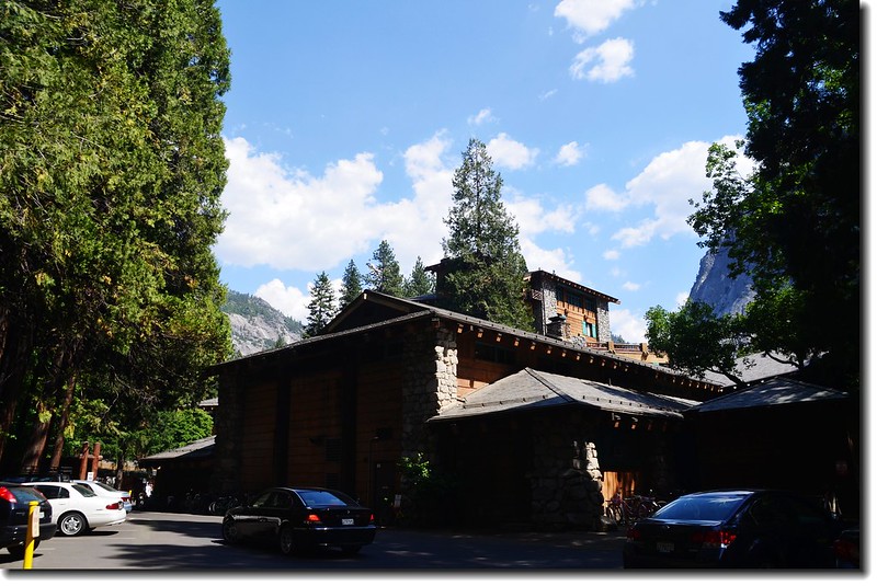
The Ahwahnee Hotel 價位不低,每個房間起跳價都在四、五百元以上,但你沒進去住沒關係,除了一些私密場所外,該棟建物開放一般遊客參觀,一般遊客都會進去庭院、一樓客廳感受一下奢豪的感覺。


The Ahwahnee Hotel
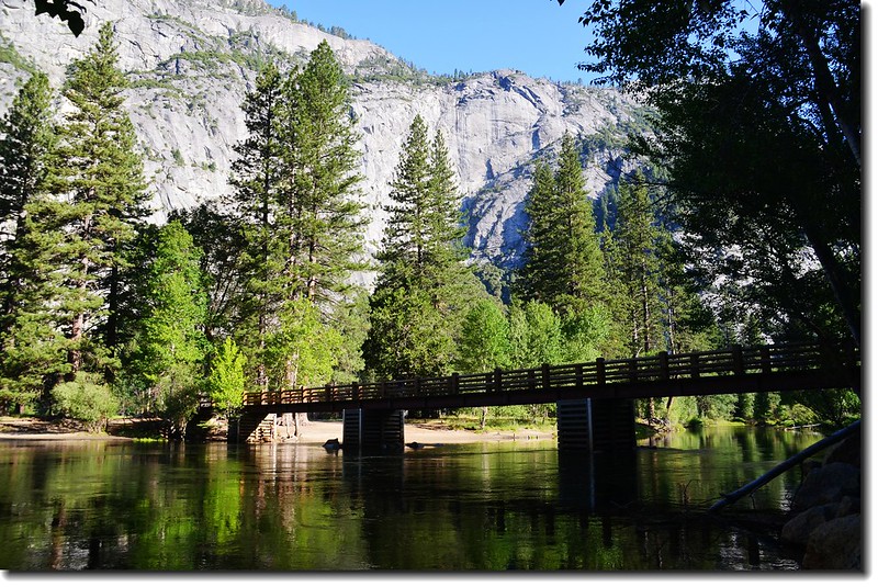
Swinging Bridge
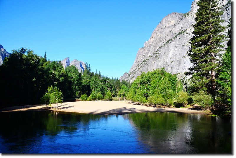
Swinging Bridge Beach
觀景點(Viewpoint)--自行開車
(一)Tunnel View:
隧道口觀景點(Tunnel View)是俯瞰整個優勝美地谷地(Yosemite Valley)的最佳地點,從這裡可以看到El Capitan 和 Bridalveil Fall由谷地竄起,而山谷遠處則是Half Dome的正面雄姿;這個觀景點位在 Wawona Road (Highway 41)上Wawona Tunnel 東端出口處。
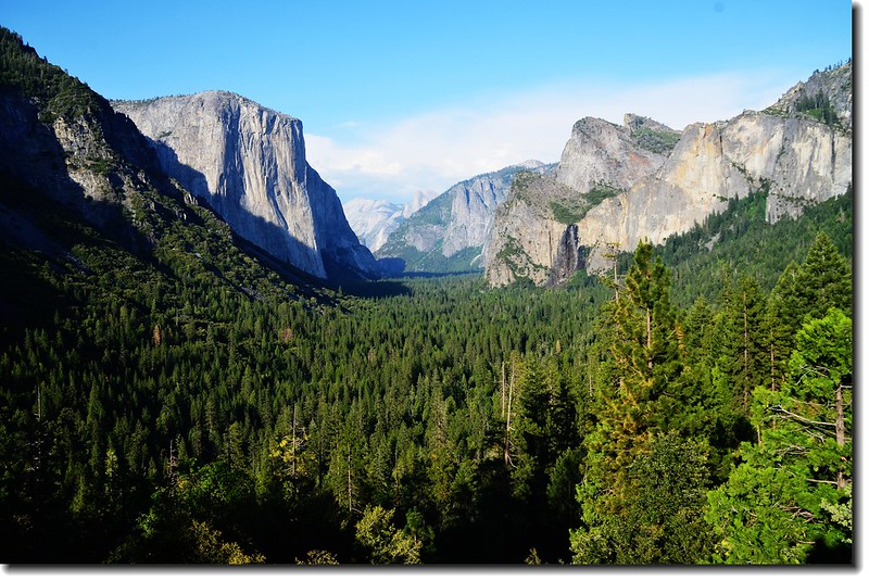
At the Tunnel View, looking east toward El Capitan, Cathedral Rocks, Bridalveil Fall, Sentinel Rock, Half Dome。
(二)Glacier Point
Glacier Point是位在Curry Village南側的山頭,但開車卻須經25哩的山路、50分鐘的車程,當你抵達此景點時會有不虛此行的感覺;在此不但可俯瞰優勝美地谷地,更可遠眺Half Dome、Vernal Fall和Nevada Fall等景觀,此處也是攝影愛好者掠取夕陽餘暉的好地方;當我們在此賞景時遇到一位男士來和女兒搭訕,他也是被女兒的國旗裝吸引來的,相談之下巧的是竟然他是女兒交大高幾屆的同系學長,目前在矽谷工作,女兒說,今天這件國旗裝真給她帶來不少幸運!
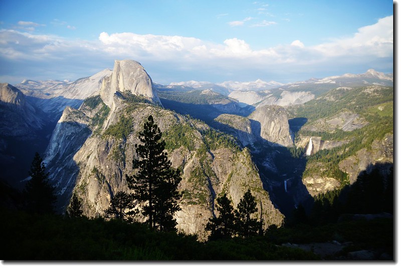
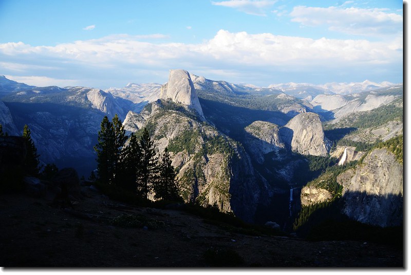
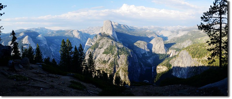
Half Dome from Glacier Point
Overlook from Glacier Point
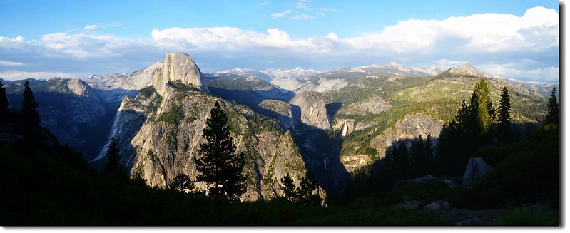
(三)Washburn Point
此景點在Glacier Point之前不遠的路邊,規模比Glacier Point小得多,但所看景觀有點類似Glacier Point的景觀。
View to Northeast from Washburn Point
Panoramic Photo from Washburn Point
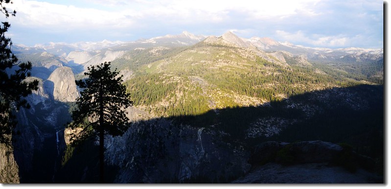
Panoramic Photo from Washburn Point
本來在優勝美地我們還計畫參觀Yosemite Valley南邊的Mariposa Grove,位在公園南入口附近的Mariposa Grove以高大的Sequoia(美州杉、紅杉)為名,後來計畫更改參觀另一處以Sequoia較多、較大許多的Sequoia National Park而放棄Yosemite 的Mariposa Grove景點。
晚上八點多回到營地,鄰居都已吃飽飯在聊天,太座忙著炊事,吃飽後早早入眠,明天是臨時更改的行程~~Sequoia National Park,然後趕往Las Vegas,一定是累斃了的一天!
▲今日行程詳細路線圖
沒有留言:
張貼留言