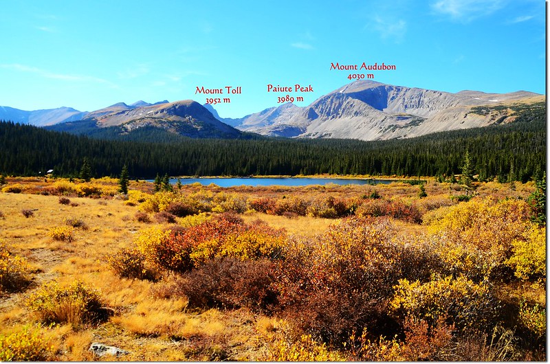
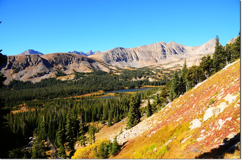
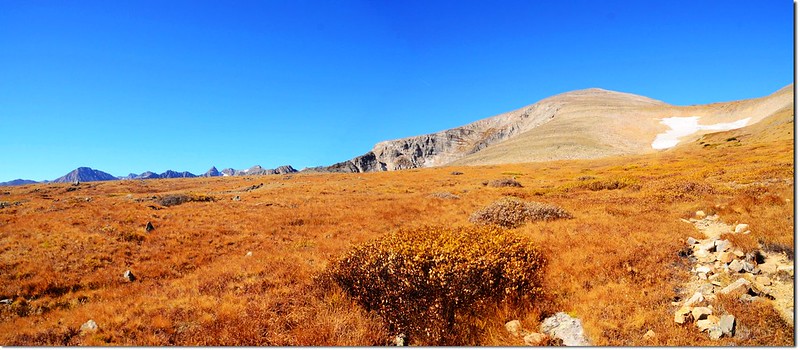
今天攀登山岳(右)~Brainard Lake under Mount Audubon with Mount Toll and Paiute Peak visible
上週六進入Brainard Lake Recreation Area攀爬一座13ers(海拔介於13,000~13,999呎的高山簡稱)Mount Audubon,該座山之前已登過兩次,四年前的一次攀登差點迷失在森林的雪地中(攀登Mount Audubon(2011.07.02));本來今天是想看登頂狀況,可能的話打算續走Mount Audubon西稜攀登Paiute Peak,然後下切Blue Lake循Blue Lake Trail回登山口作一“O”型縱走,登頂後看時間可能有點緊迫,放棄原計畫在山頂糜爛一小時後循原路下山,由於天氣好、展望佳,在九月底的科羅拉多算是難得的登山好日子!
---------------------------------------------------------------------------------------------------------
攀登山岳:Mount Audubon(海拔13,223呎/4,030公尺)
登山口:Brainard Lake (海拔10,360呎/3,158公尺)
步道全長:來回約9.2哩(14.72公里)
爬升高度:約2,870呎(875公尺)
花費時間:6小時20分(含山頂休息一小時)
---------------------------------------------------------------------------------------------------------
Mount Audubon的山名是為紀念一位美國著名鳥類學家、博物學家兼畫家John James Audubon (April 26, 1785 ~ January 27, 1851)而命名,John James Audubon以記錄美國所有類型的鳥類,並詳細描繪鳥類自然棲息地的插圖著名,他被認為是有史以來最優秀的鳥類學家。Mount Audubon位於在科羅拉多州Front Range的印第安自然保護區內,它正在大陸分水嶺東邊約一哩處,該地區的地形特點就是山峰崢嶸嶙峋;Mount Audubon則有別於其鄰近的山峰,寬廣的山脊和浩瀚的苔原呈現出該山是一座柔美的山。同樣地,它也是一座喜歡攀爬過艱困碎石地形後徜徉於大片高山野花的登山者讚譽為最佳的一座山,在此山山頂有極佳的視野,整個Indian Peaks和落磯山脈一覽無遺,經由此山也有多種“O”形或多座山岳縱走的行程安排,總之,它是一座許多登山者來了還想再來的高山。
行車資訊:(同Mount Toll行車資訊)
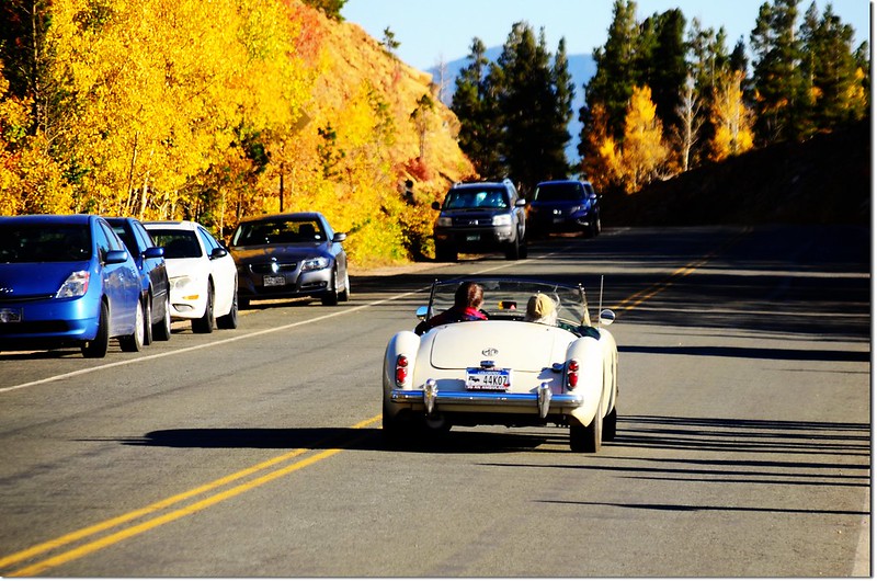
從Golden走72號公路(Peak To Peak)或由Boulder走119號公路到Nederland後續往北走12哩到達小鎮Ward,剛過小鎮路旁就可看到一面大指示牌指向西邊標明“Brainard Lake”,順著指示牌左轉沿Brainard Lake Road行約5哩即可到Brainard Lake,中途2.6哩處會經過一收費站(夏季每一車輛10美元,持有國家公園年票-- America The Beautiful可適用;冬季大約10月中旬到次年6月中旬則免費)。Mitchell Lake Trailhead則續行約一哩,登山口有一大停車場,此停車場在夏季若不早到往往是客滿的。
此趟進去到Mitchell Lake Trailhead停車場時跟上次一樣已無車位,只好再開回Brainard Lake停車,然後再步行至登山口。
下面照片是開車沿途所見的白楊(Aspen)秋色~~
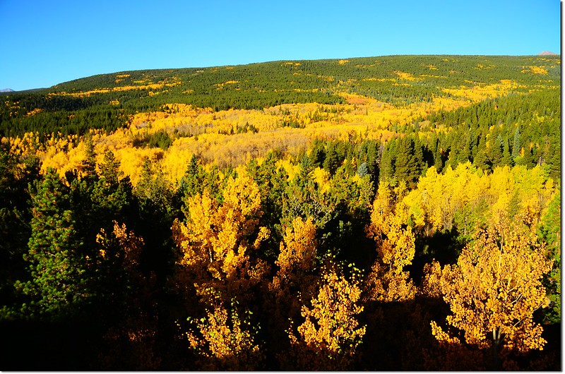
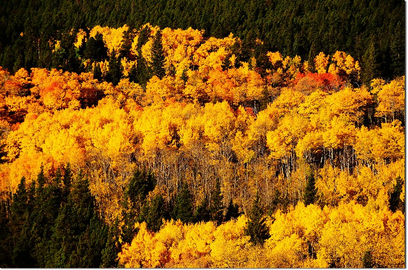
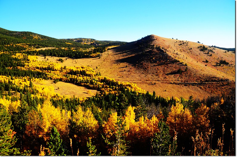
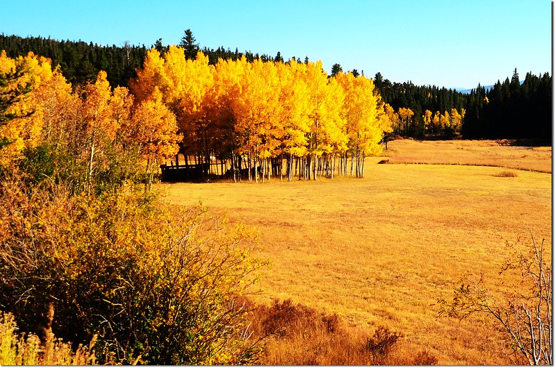
Fall colors by Peak to Peak HWY
步程簡述:
09:10 從停車處(Brainard Lake)出發,海拔10,360呎(3,158公尺)。
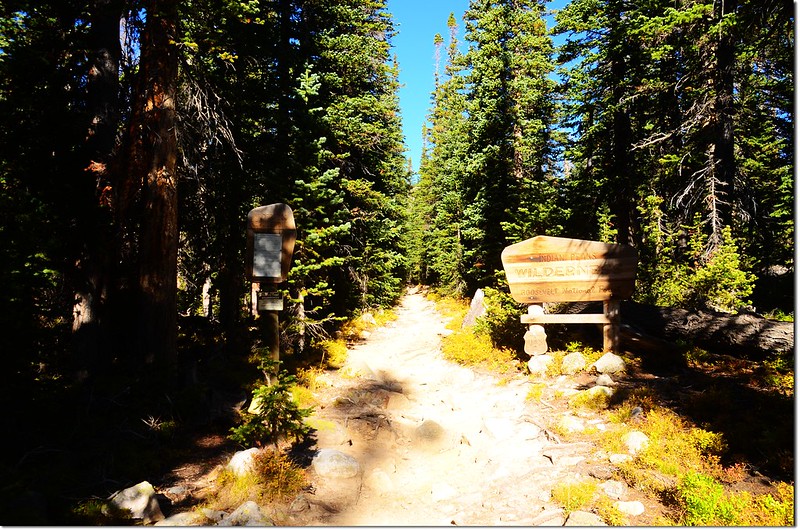
09:26 抵達Beaver Creek Trailhead(海拔10,525呎/3,208公尺),此登山口和Mitchell Lake Trailhead位在同一停車場內,Beaver Creek Trailhead在停車場北端;停車處到此約0.6哩,往後里程由此歸零累計,進入登山口後沿松林間步道往西北前進。
09:28 正式進入Indian Peaks Wilderness範圍。
Beaver Creek Trail
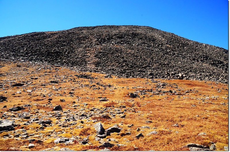
09:50 出森林抵開闊地,海拔10,900呎(3,322公尺),距登山口約0.75哩,北邊面對的是Mount Audubon陡峭的南坡,上次登此山因積雪未退即是由此直接陡攀南坡走非正式步道登頂;
Early morning view of the south face of Mount Audubon
正規步道由此右轉朝東北腰繞上山,接下來是幾處的“之”字彎道。
Beaver Creek Trail
09:59 在一處右彎道處清楚俯瞰Mitchell Lake。
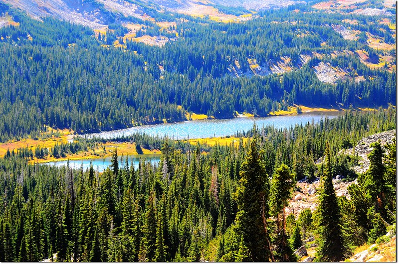
Mitchell Lake from the Mount Audubon Trail
10:17 出森林線,海拔約11,300呎(3,444公尺),距登山口約1.5哩。
The trail out of treeline
10:25 抵達Mount Audubon與Beaver Creek Trail的岔路,海拔11,400呎(3,475公尺),距登山口約1.7哩;右往Beaver Creek Trail,取左往Mount Audubon。
Mount Audubon, Beaver Creek Trail junction
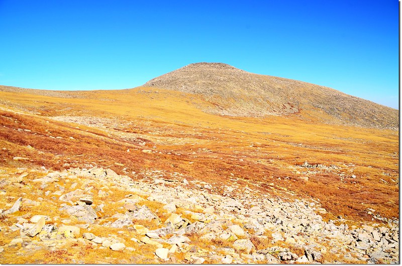
過了岔路不久即見到Mount Audubon的山頭突出於正前方的苔原中,夾在Mount Audubon與其右方12,706峰(Mount Notabon)之間是一大片未融化的大雪原,活像天使般迎接著登山客;
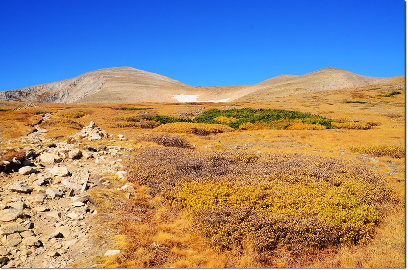
This is Mt. Audubon as viewed just after turning off of the Beaver Creek Trail
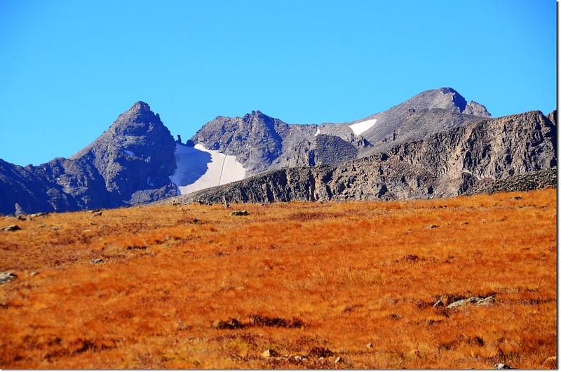
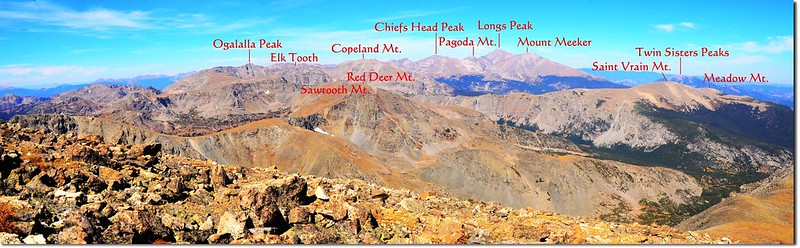
而右前方(北)則清楚見到Chiefs Head Peak, Pagoda Mt., Longs Peak 和 Mount Meeker 等山頭;
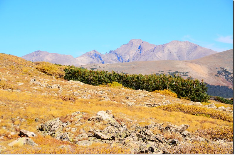
View of Chiefs Head Peak, Pagoda Mt., Longs Peak and Mount Meeker from near the Beaver Creek Trail junction
Overlooking down on Stapp Lakes & Beaver Reservoir from the trail
Overlooking down on Stapp Lakes from the trail
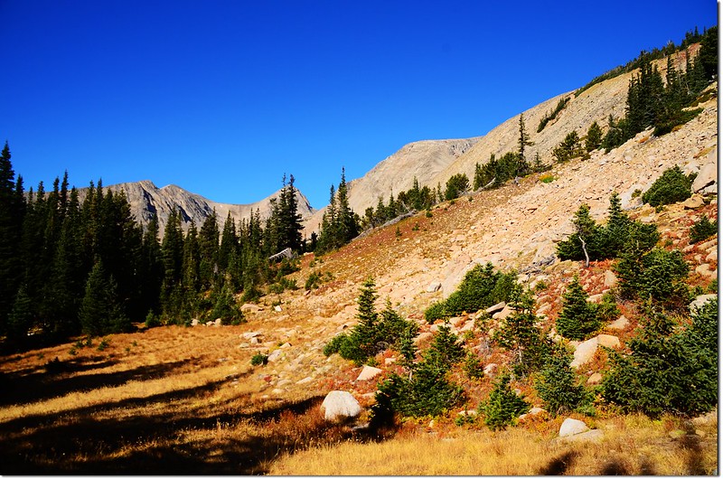
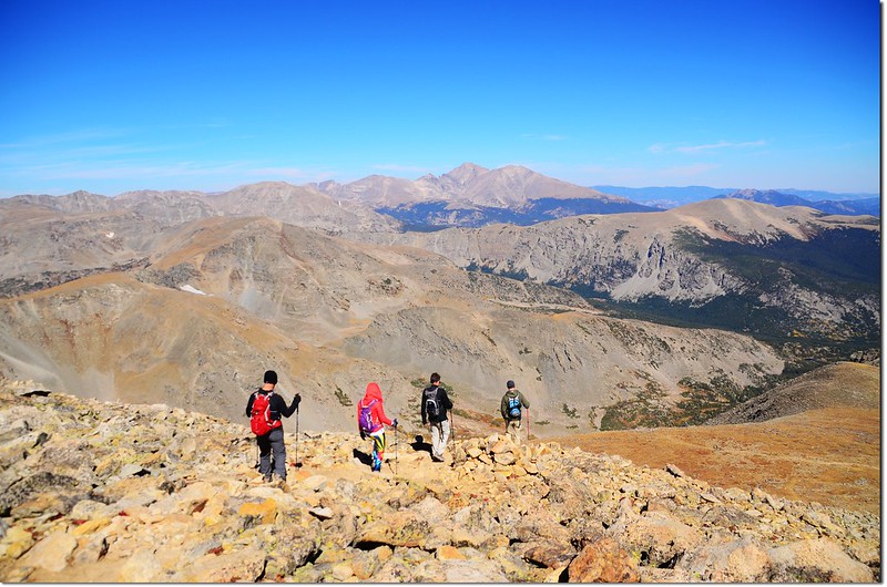
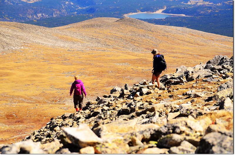
由森林線開始步道大部分在開闊的苔原中依循明確的步道上升,約有兩哩路直抵Mount Audubon的北鞍,這時在南方的Little Pawnee Peak、Navajo Peak、Apache Peak、Shoshoni Peak等Indian Peaks幾座山頭都一一呈現在視線內。
Overlooking up on Indian Peaks from the trail
View of Navajo Peak from the Beaver Creek trail
Hiking up Audubon
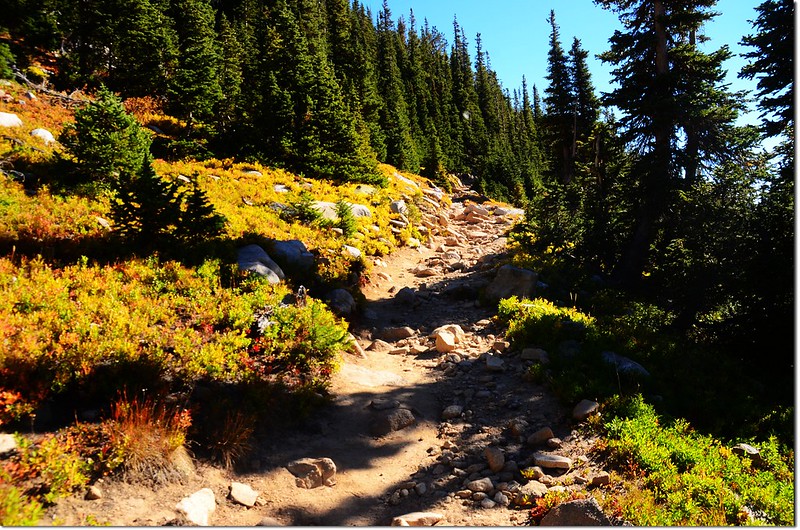
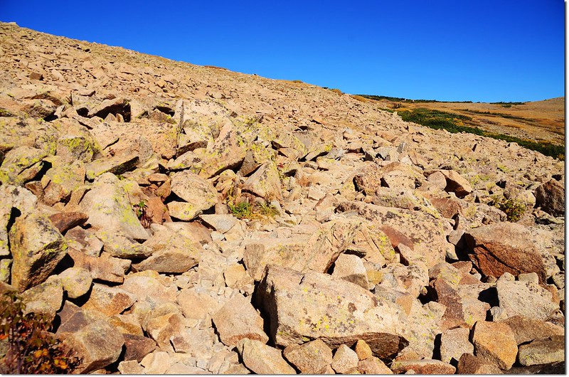
10:55 步道抵達一大片亂石坡,步道在亂石坡中“之”字上升;海拔約12,000呎(3,658公尺),距登山口約2.5哩,左下方即是那一大片雪原。
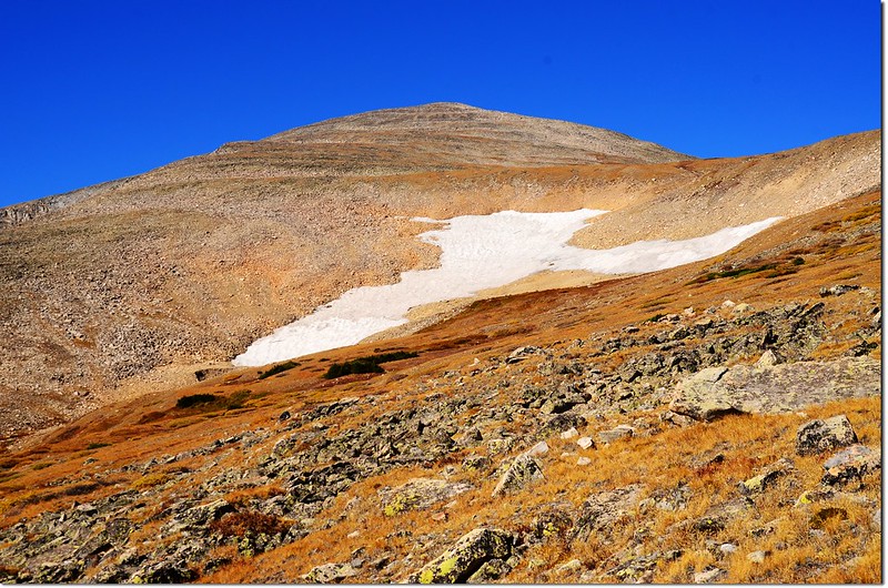
The snowfield beside the trail
11:14 脫離大片亂石坡又進入苔原地形,海拔約12,200呎(3,719公尺),距登山口約2.75哩。
Cairns by the trail
Mount Notabon from the trail
11:45 抵達Mount Audubon的北鞍,海拔約12,700呎(3,871公尺),距登山口約3.5哩,在此朝右(北)極眺落磯山脈,右下方即是海拔12,706呎的Mount Notabon;
View north into Rocky Mountains from Audubon's north saddle
Mount Notabon from Audubon's north saddle
左邊(南)則是Mount Audubon山頭,此處距山頂還要爬升五百多呎的陡峭亂石坡。
Mount Audubon summit from it's north saddle
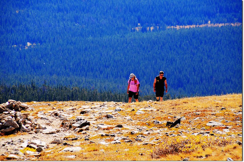
從Mount Audubon的北鞍到山頂的亂石坡沒有一定的路線可遵循,但仔細看仍可看出兩三條較多人走出的清晰路線,沿途也都有堆砌小石堆(cairs)為記,還不至於迷路;我選擇最右側(東)的路線上登。
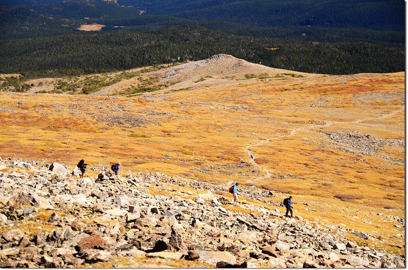
Hikers on their way down the mountain
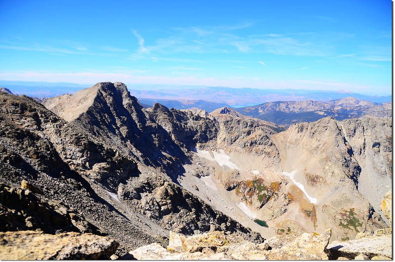
12:15 快接近山頂一處稜線曝露點西眺Paiute Peak及俯瞰腳底下的Upper Coney Lake。
Looking to the Northwest from near the summit of Mount Audubon
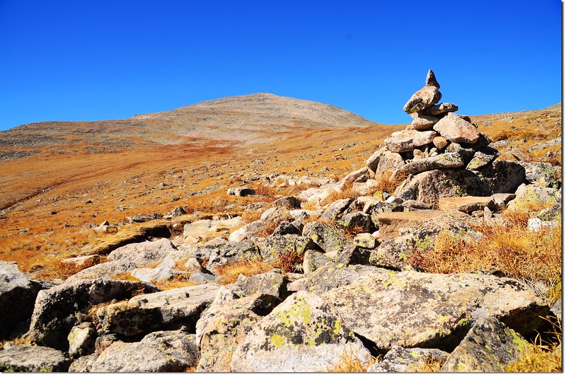
12:19 登上Mount Audubon山頂稜線北端,有一座大型石塊堆砌的避風角。
12:22 登頂Mount Audubon山頂,海拔13,223呎(4,030公尺),距登山口約4哩(6.4公里),山頂有三、四處石砌避風角,此種登山客長年慢慢合力完成的避風建物在此地幾乎每座山頭都有;今天登山客不少。
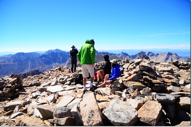
Mount Audubon summit
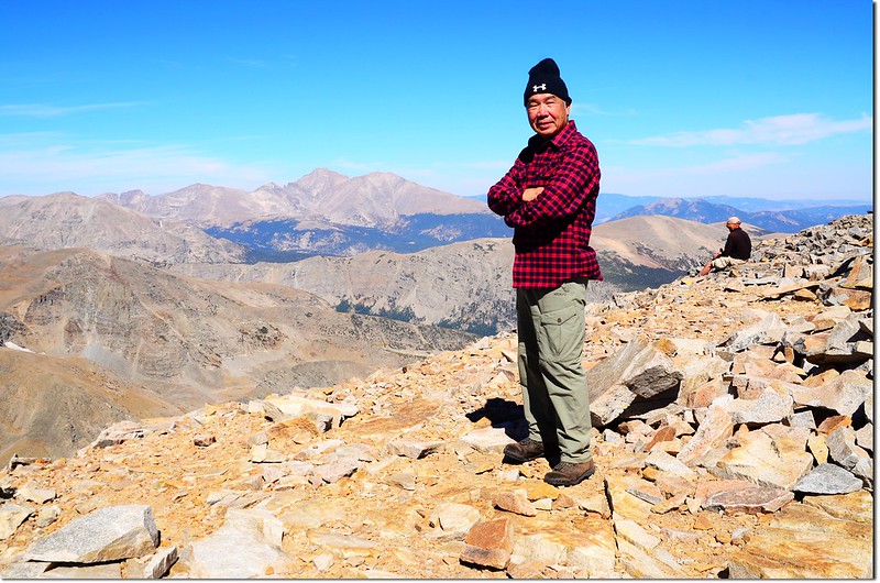
Me on the summit of Mount Audubon, background are Longs Peak & Mount Meeker
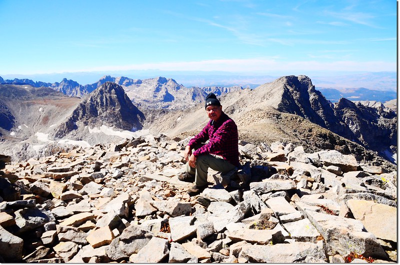
Me on the summit of Mount Audubon, background are Mount Toll & Paiute Peak
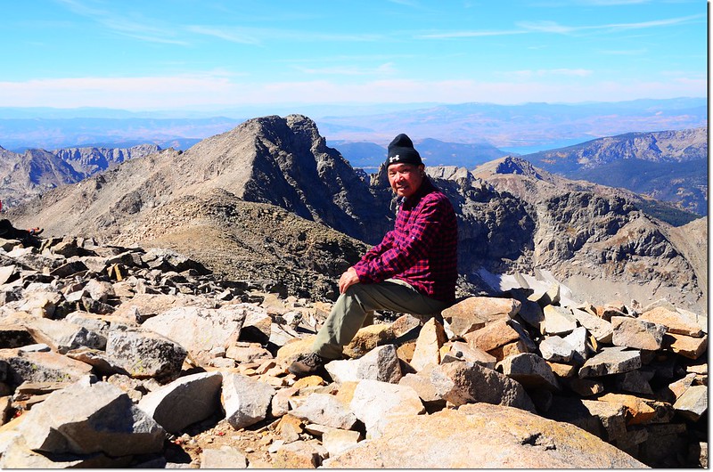
Me on the summit of Mount Audubon, with Paiute Peak in background
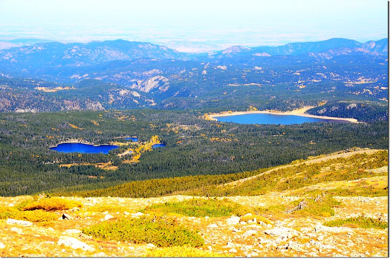
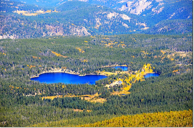
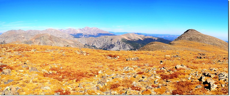
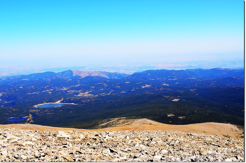
今天天氣非常好,山頂展望特佳;北望落磯山脈,南眺Indian Peaks,東邊俯瞰Brainard Lake Recreation Area,西邊則遠眺Winter Park、Lake Granby等地。
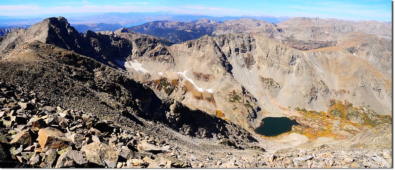
Paiute Peak & Upper Coney Lake from Mt Audubon
View north into Rocky Mountains from the summit of Mount Audubon
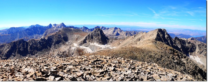
View south into Indian Peaks from the summit of Mount Audubon
View south into Indian Peaks from the summit of Mount Audubon
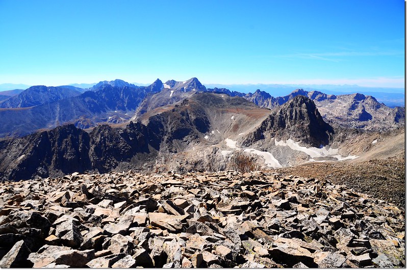
Close up of Navajo Peak, Dickers Peck, and Apache Peak from the summit of Mount Audubon
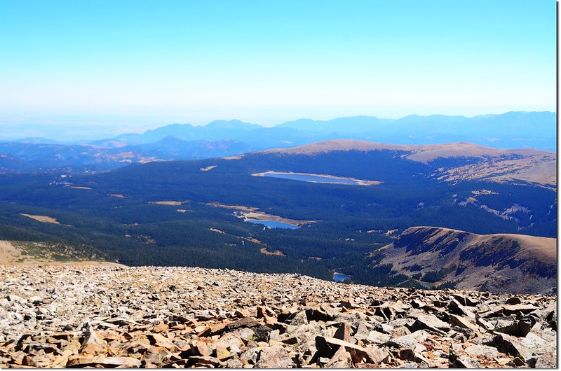
Overlooking down on Brainard Lake Recreation Area from the summit of Mount Audubon
Overlooking down on Beaver Creek Area from the summit of Mount Audubon
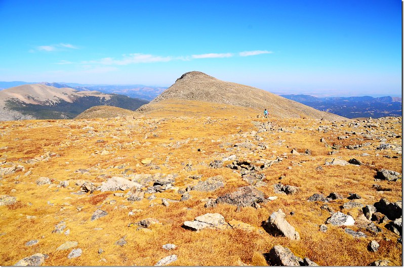
從Mount Audubon山頂順著西稜可續爬直線距離0.84哩的Paiute Peak,今天時間不夠放棄了;
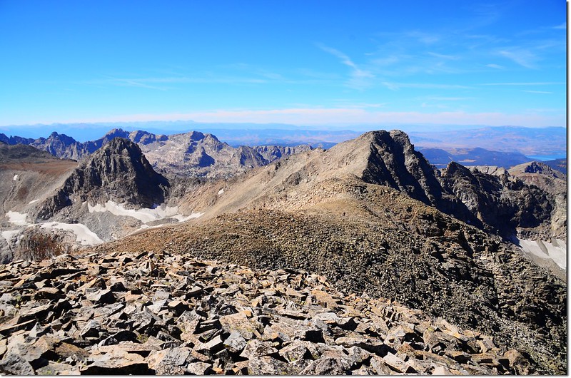
View from the summit of Mount Audubon, looking west along the ridge to Paiute Peak
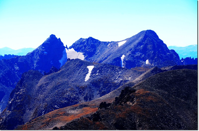
在Paiute Peak南邊的山頭即是兩個禮拜前攀登的Mount Toll,這邊看過去不覺得有多難爬,但當天可是把我搞得差點精疲力盡!
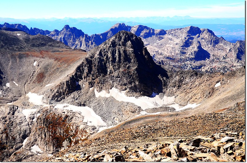
Mount Toll from Mount Audubon
此山山頂沒有Benchmark(水準點)的銅標,卻在一塊岩石上發現此一人頭標誌,原來此標誌人頭像是一位鄉村音樂作曲家Larry W. Jones,他出生在德州,現居住在科羅拉多的Longmont,聽說作品有六千多首,絕大部分是鄉村音樂,還有牛仔、西部等膾炙人口的歌曲,此標誌也許是他登此山時所留下的吧!
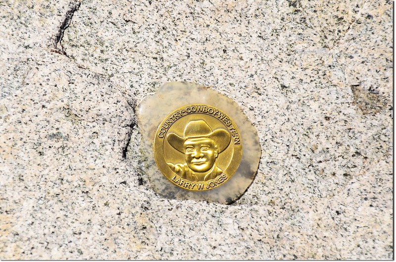
Larry W. Jones, The Kingwood Kowboy
13:20 在山頭休息一個小時後下山;
The slopes of Mount Audubon
View of Green Mt.、 Bear Peak and South Boulder Peak from the Mt. Audubon trail
15:30 回到停車處,此次上山費了3小時12分鐘,下山僅用去2小時10分鐘。