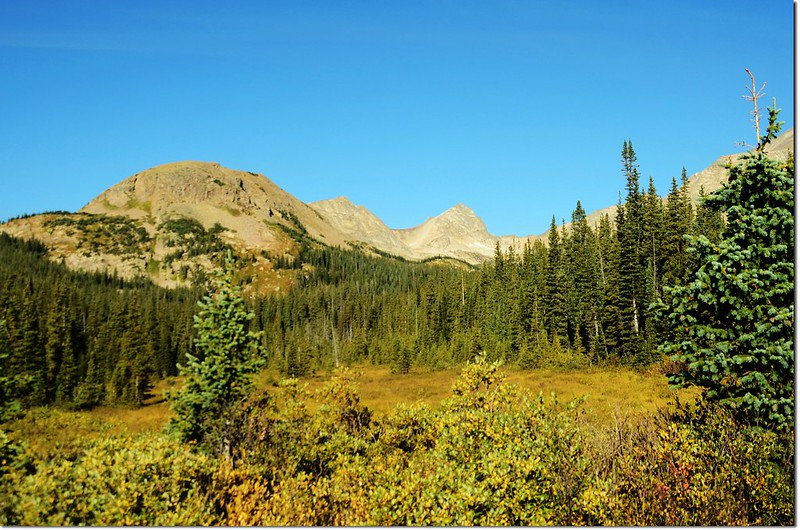
Blue Lake, 尖凸山頭 是今天計畫攀登山頭 Mount Toll
週六進去Brainard Lake Recreation Area攀爬Blue Lake,狀況許可的話計畫攀登Blue Lake西側的高山Mount Toll;Mount Toll海拔12,979呎(3,956公尺),雖然比起其北邊緊鄰的Paiute Peak (13,088呎/3,989公尺)和Mt. Audubon (13,223呎/4,030公尺) 矮了一些,但由於其山形突出,鋒芒反而蓋過Paiute Peak和Mt. Audubon。
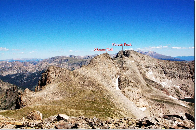
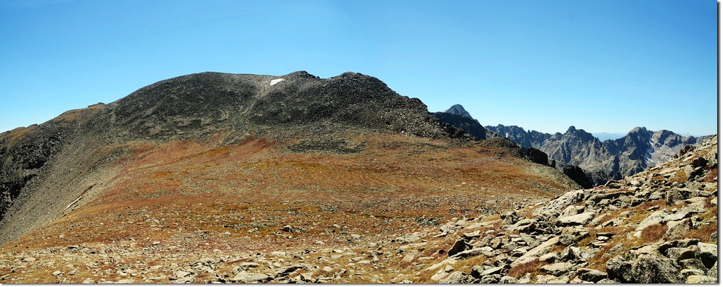
由Mt. Toll南邊的Pawnee Peak 北望 Mt. Toll 和Paiute Peak
當天行車到Red Rock Lake附近時很幸運的遇見了一對moose,這是十多年來每年來美渡假第一次遇到如此漂亮的公moose,而且是一對恩愛相隨,因此耗了不少時間拍攝,導致車行到Mitchell Lake Trailhead停車場時已無車位,只好再開回Brainard Lake停車,巧的是在登山口遇到Tony陳聰胤會計師也來登山,他參加CMC登山隊的行程,目的地也是Blue Lake。
陳聰胤會計師部落格:http://blog.yam.com/ink11
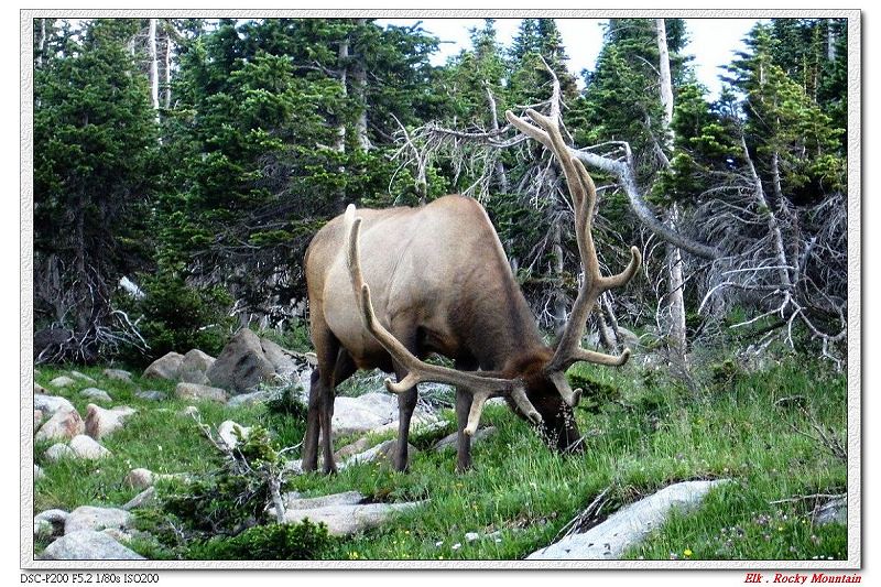
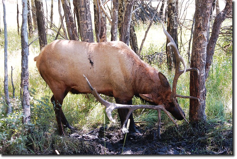
Moose和Elk都是世界上大型的鹿科動物,分布在北半球的溫帶地區,歐亞和北美大陸都可發現牠們的蹤跡。Moose和Elk的中文翻譯非常混淆,很多譯文都把這兩種鹿科動物翻成 “麋”,部分國家公園的中文譯本則將Moose翻為駝鹿,而將Elk翻為麋鹿,Moose是鹿科動物裡最龐大的一種,最大可達1,800磅,比起鹿科動物第二大種Elk的600~900磅大了許多。Moose的身軀是深褐色,看上去甚至有點像黑色,Elk則是淺褐色的。Elk比Moose較屬於群居動物,在夏天的季節裡最大族群甚至可達400頭。Moose喜歡在溼沼澤地覓食,而Elk則較常出現在草地及樹叢中。
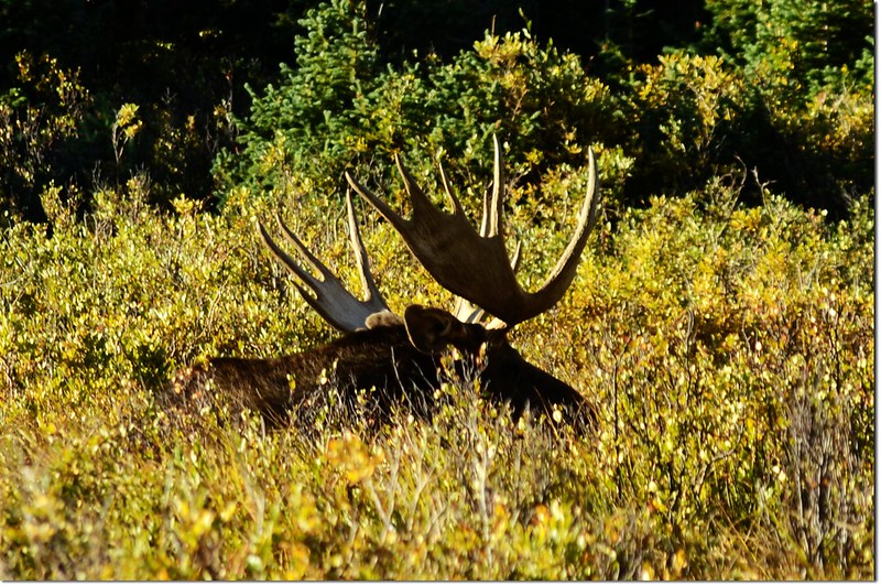
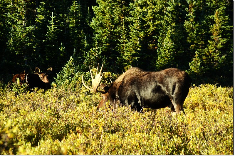
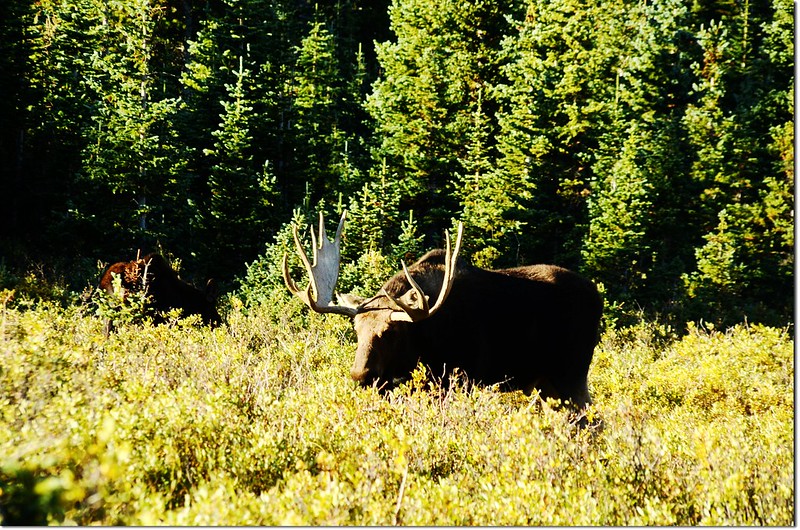
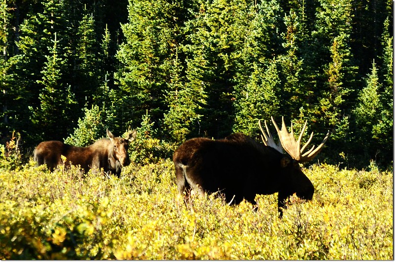
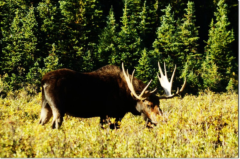
Moose at Brainard Lake
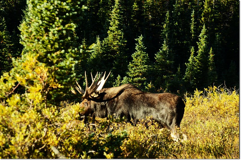
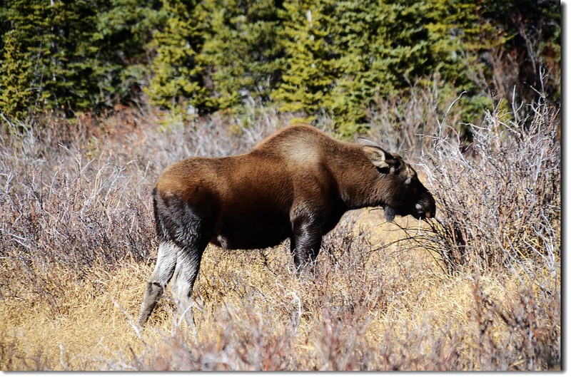
以下照片為Elk(麋鹿)照片
--------------------------------------------------------------------------------------------------------------
攀登山岳:Mount Toll(海拔12,979呎/3,956公尺)
登山口:Mitchell Lake Trailhead(海拔10,525呎/3,208公尺)
Mitchell Lake:海拔10,699呎(3,261公尺)
Blue Lake:海拔11,355呎(3,461公尺)
Upper Blue Lake:海拔11,833呎(3,607公尺)
登山里程:約10哩(16公里)
總爬升高度:約3,000呎(914公尺)
登山時間:7小時50分
--------------------------------------------------------------------------------------------------------------
行車資訊:
從Golden走72號公路(Peak To Peak)或由Boulder走119號公路到Nederland後續往北走12哩到達小鎮Ward,剛過小鎮路旁就可看到一面大指示牌指向西邊標明“Brainard Lake”,順著指示牌左轉沿Brainard Lake Road行約5哩即可到Brainard Lake,中途2.6哩處會經過一收費站(夏季每一車輛10美元,持有國家公園年票-- America The Beautiful可適用;冬季大約10月中旬到次年6月中旬則免費)。Mitchell Lake Trailhead則續行約一哩,登山口有一大停車場,此停車場在夏季若不早到往往是客滿的。
此趟進去到Mitchell Lake Trailhead停車場時已無車位,只好再開回Brainard Lake停車,然後再步行至登山口。
步程簡述:
08:30 停車處(Brainard Lake)出發,海拔10,360呎(3,158公尺)。
Mount Toll(M) from near Mitchell Lake Trailhead
08:45 抵達Mitchell Lake Trailhead(海拔10,525呎/3,208公尺),停車處到此約0.6哩。
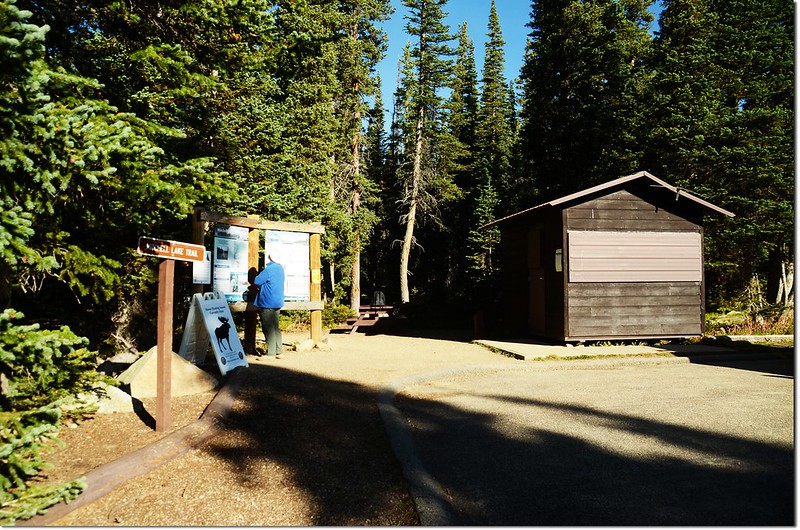
Mitchell Lake Trailhead
09:00 經過橫跨Mitchell Creek一座小橋,距登山口約0.4哩(停車處1.0哩)。
09:11 抵達Mitchell Lake,距登山口約0.9哩(停車處1.5哩),此湖海拔10,699呎(3,261公尺), 湖的西北邊是科羅拉多的一座13ers—Mount Audubon,海拔13,221呎(4,030公尺),此山曾兩度登頂。
Mitchell Lake
09:22 經過Mitchell Lake的進水口(inlet),距登山口約1.1哩(停車處1.7哩)。
過了進水口沒多久便離開Mitchell Lake,之後步道穿出杉林曝露在陽光下,此後步道也有較大幅度的爬升,地形也脫離森林線漸漸進入高山苔原地貌,石堆、少數野花、小瀑一路相隨。=======================
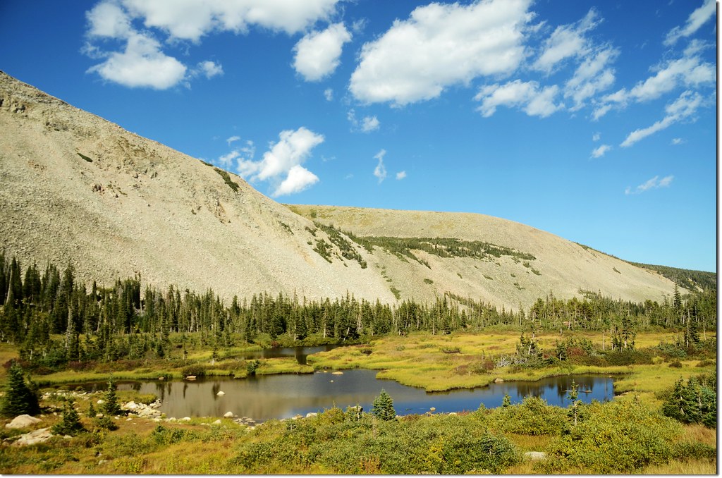
Outlying ponds near Mitchell Lake are good places to look for moose

Looking down to Mitchell Lake from the trail
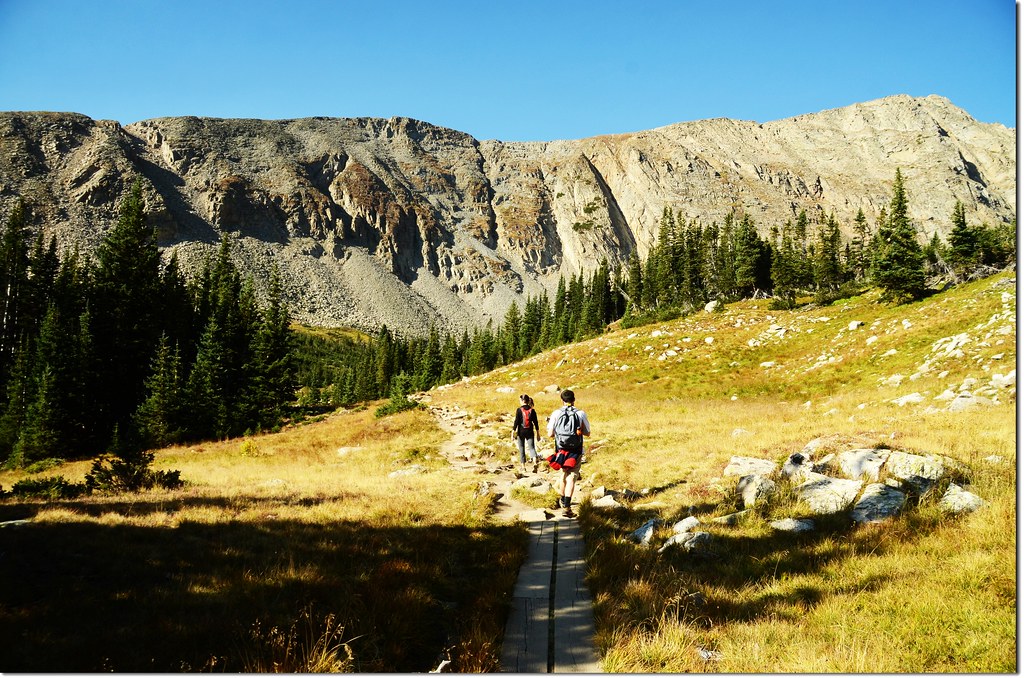
Blue Lake trail
Unnamed pond along the trail
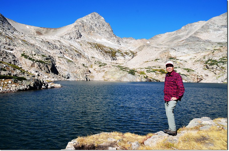
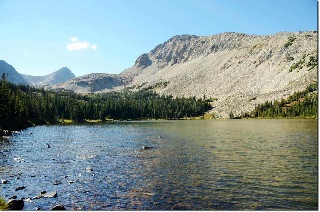
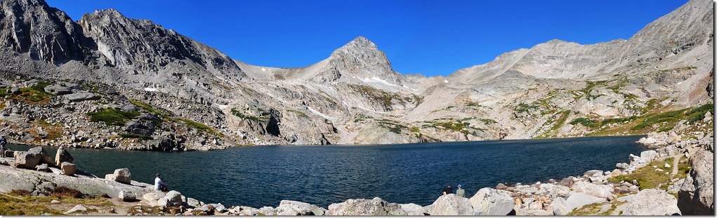
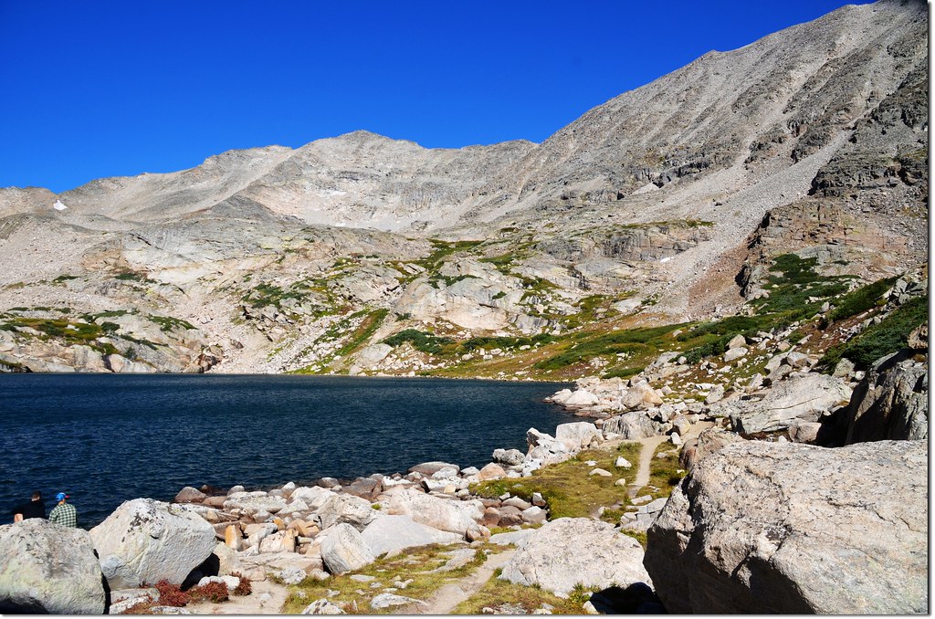
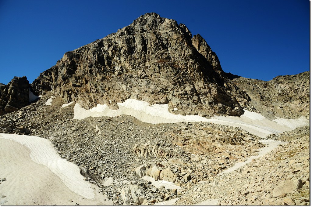
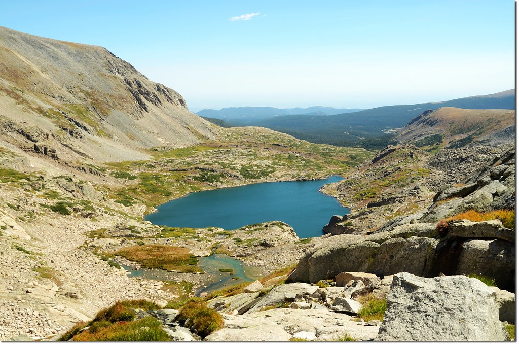
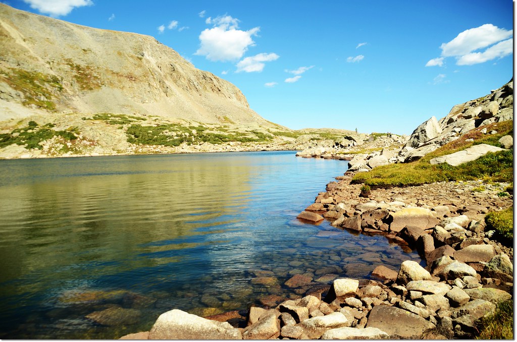
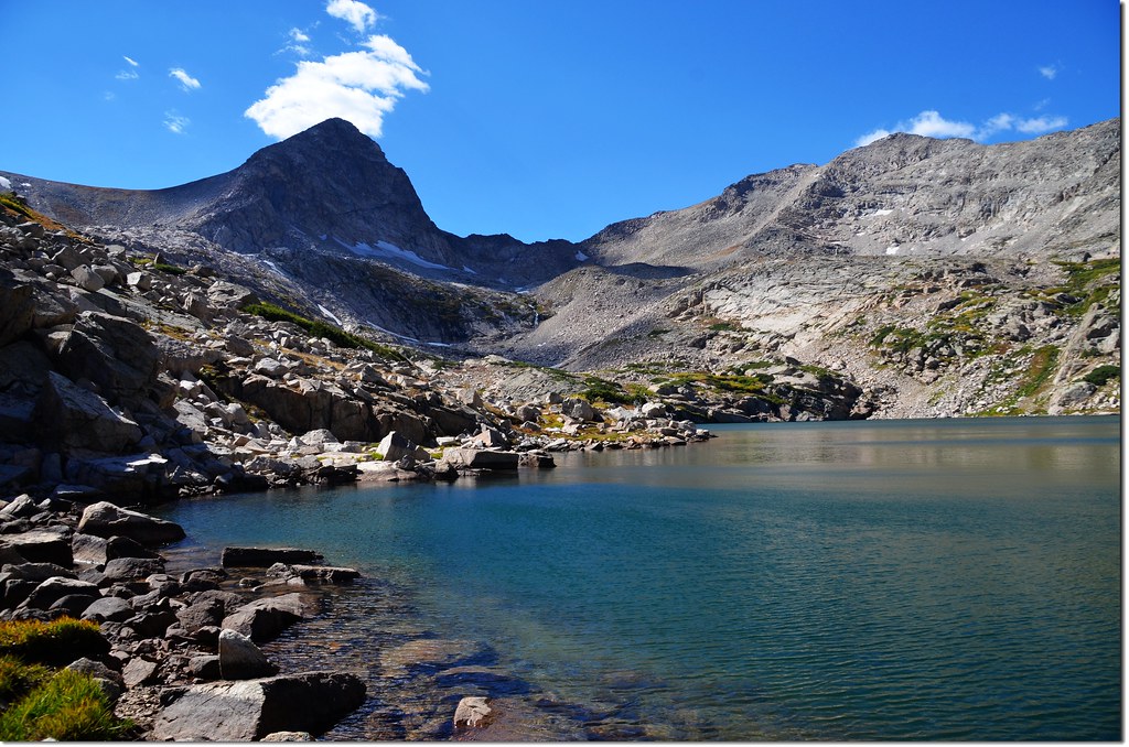
10:10 抵達Blue Lake,海拔11,355呎(3,461公尺) ,距登山口約2.55哩(停車處3.15哩),尖塔狀的Mount Toll(海拔12,979呎/3,956公尺)矗立在湖的西岸,這是待會兒要攀登的山頭;
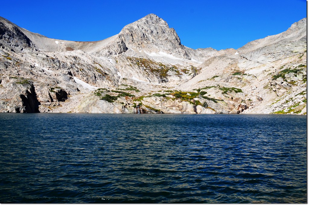
Blue Lake, background is Mount Toll
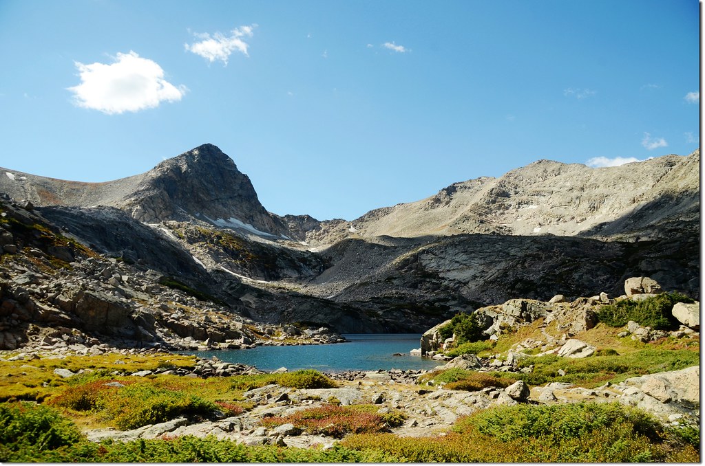
Blue Lake, background is Little Pawnee Peak
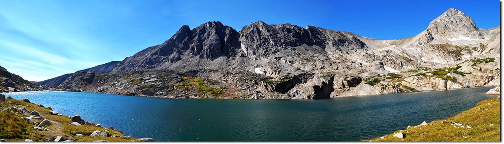
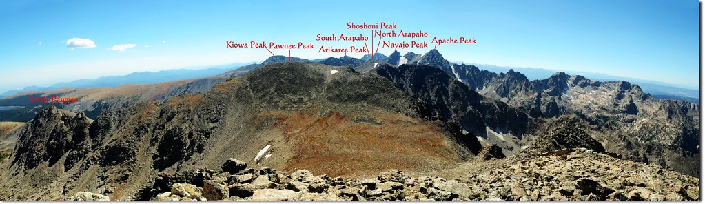
Panorama of Blue Lake,背景為Little Pawnee Peak(海拔12,466呎)
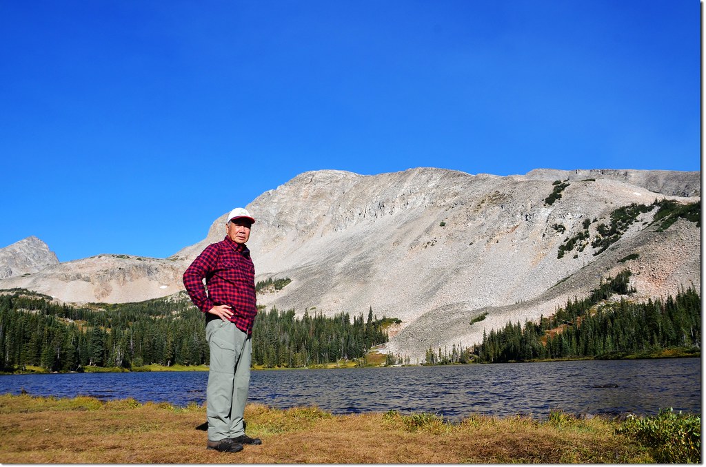
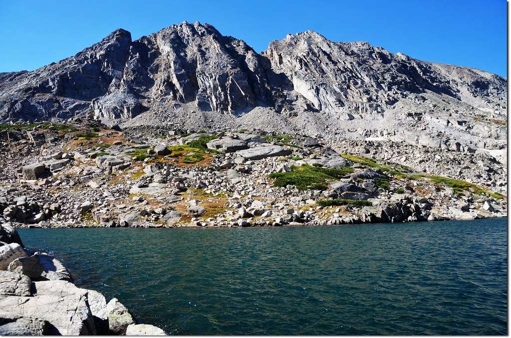
Mount Toll右側不很突出的山頭是海拔13,088 呎(3,989公尺)的Paiute Peak,北岸是海拔13,221呎(4,030公尺)的Mount Audubon,南岸則是海拔12,943 呎(3,945公尺)的Pawnee Peak的尾稜Little Pawnee Peak(海拔12,466呎)。
在湖岸小休,接下來的路程才是挑戰的開始;根據紀錄攀登Mount Toll有兩條路徑,一是經由Blue Lake北岸爬上Upper Blue Lake,然後橫切過Mount Toll下方的谷地再從Mount Toll的南坡下上攀Pawnee Peak與Mount Toll之間的鞍部;另一條路徑是經由Blue Lake南岸直接上切Mount Toll下方的谷地再從Mount Toll的南坡下上攀Pawnee Peak與Mount Toll之間的鞍部。這兩條路徑南岸路程較短,北岸雖然路程較長,但可順遊Upper Blue Lake,且景觀也較美,所以我選擇走北岸路線。
10:30 沿Blue Lake北岸往Upper Blue Lake挺進;
Blue Lake 北岸小徑,背景不突出山頭為 Paiute Peak
行約0.2哩後脫離Blue Lake向上爬升,路徑還算清楚。
11:00 開始在亂石堆中爬升,偶而可發現小石堆,但大部分還是自找路徑上攀。
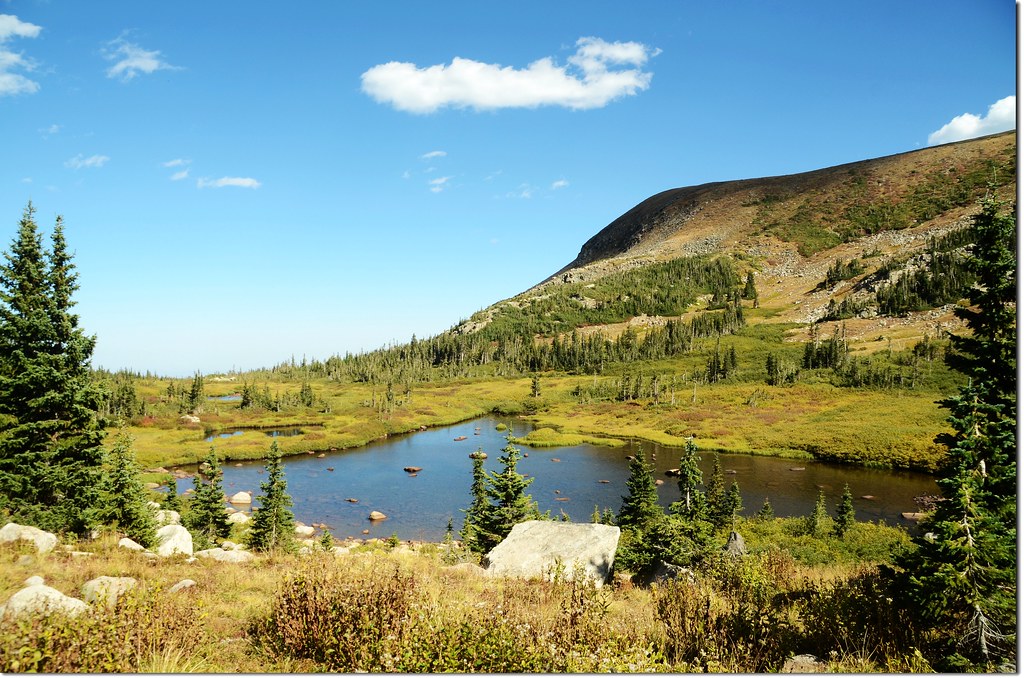
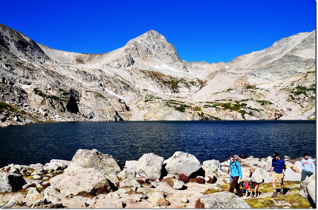
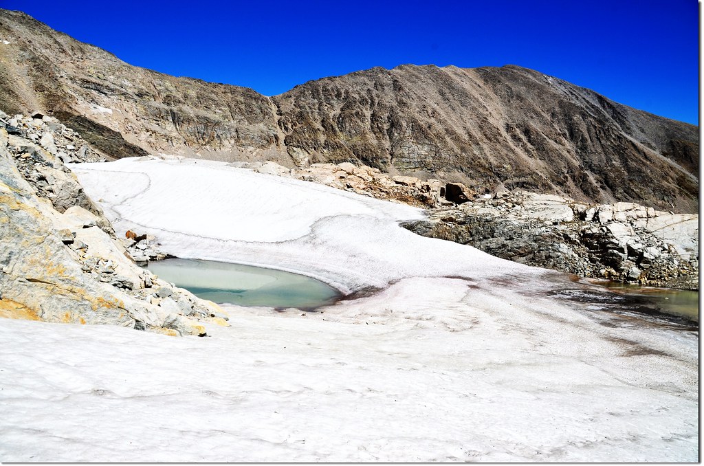
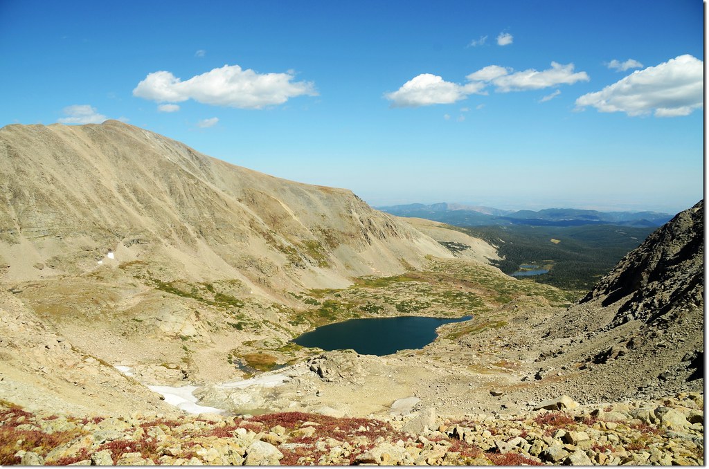
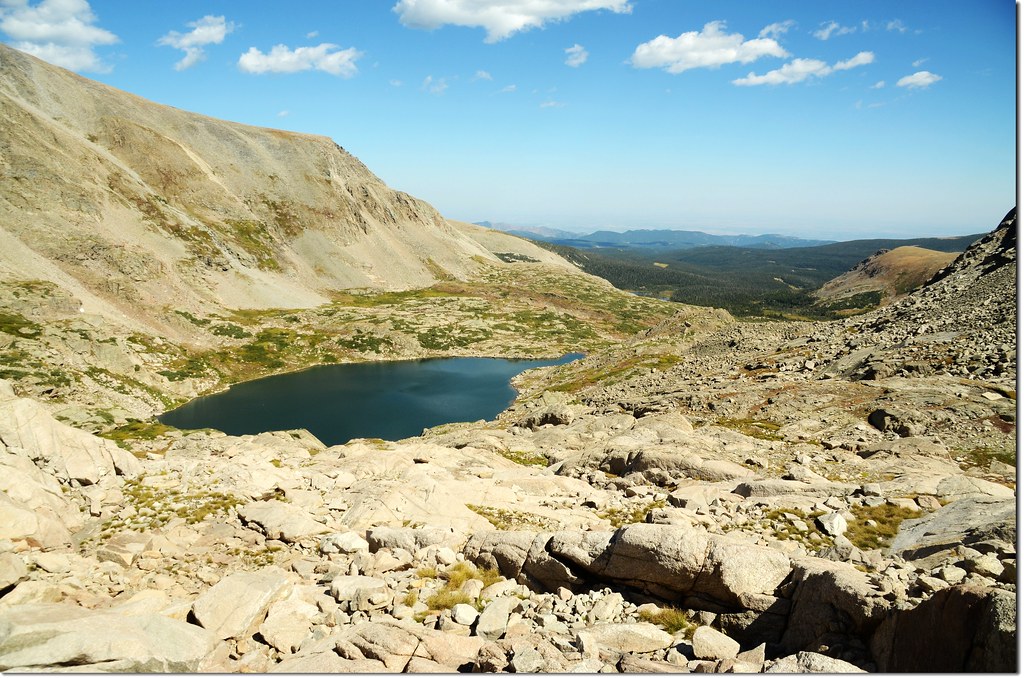
11:20 抵達Upper Blue Lake,海拔11,901呎(3,627公尺),距登山口約 3.35哩(停車處3.95哩);
Upper Blue Lake
Upper Blue Lake是Paiute Peak山下一座小湖泊,堤岸倒是蠻寬廣的,像是一條大長廊,俯瞰Brainard Lake Recreation Area幾個湖泊及青翠的松林,絕美的展望。
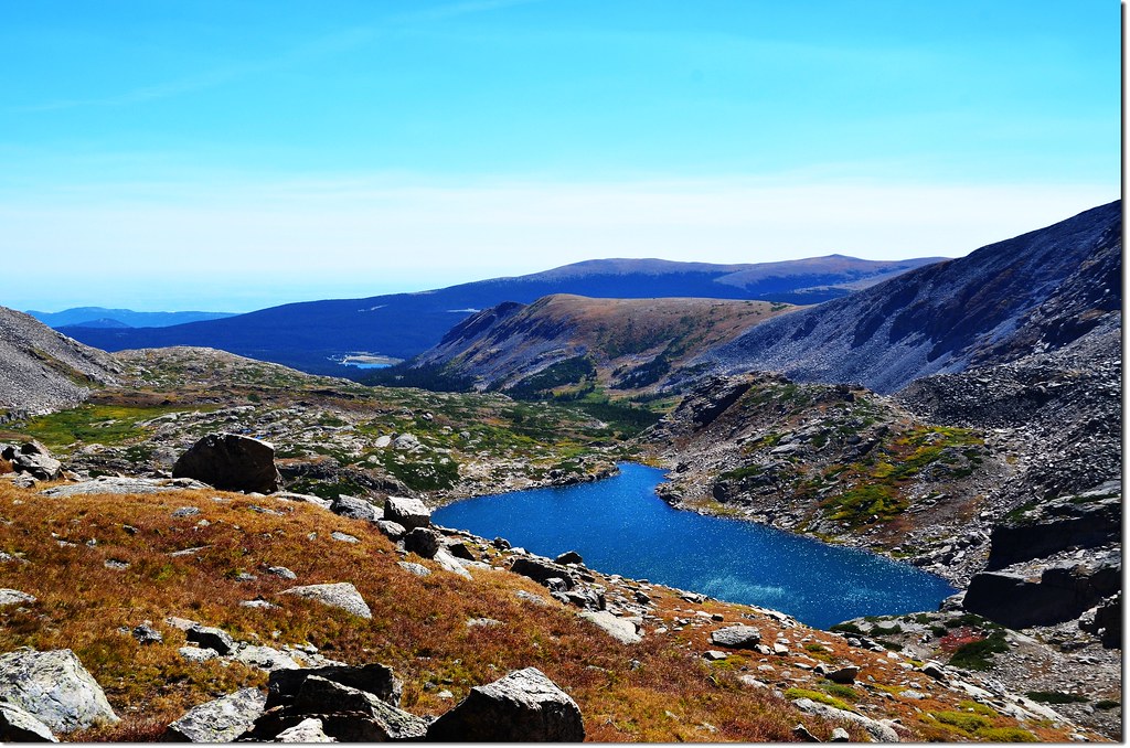
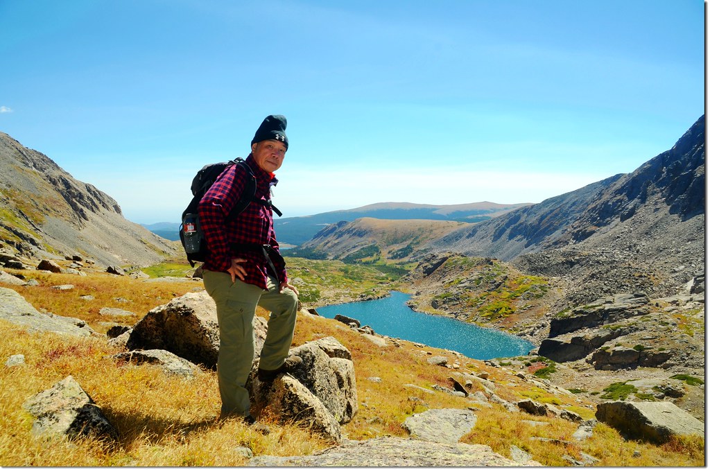
Overlooking down on Blue Lake from Upper Blue Lake
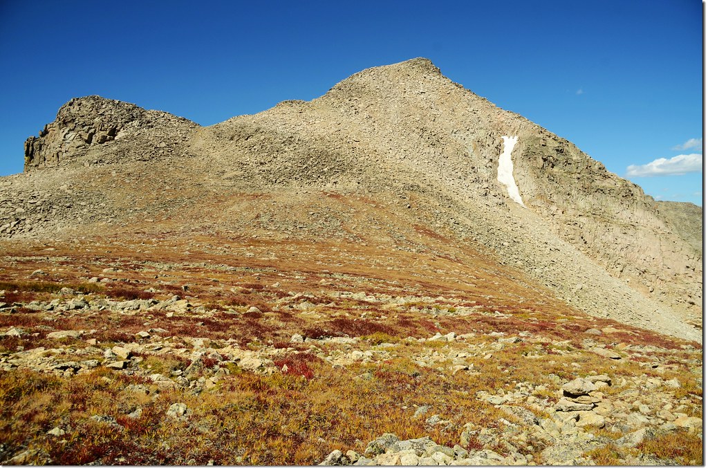
Mount Toll from Upper Blue Lake
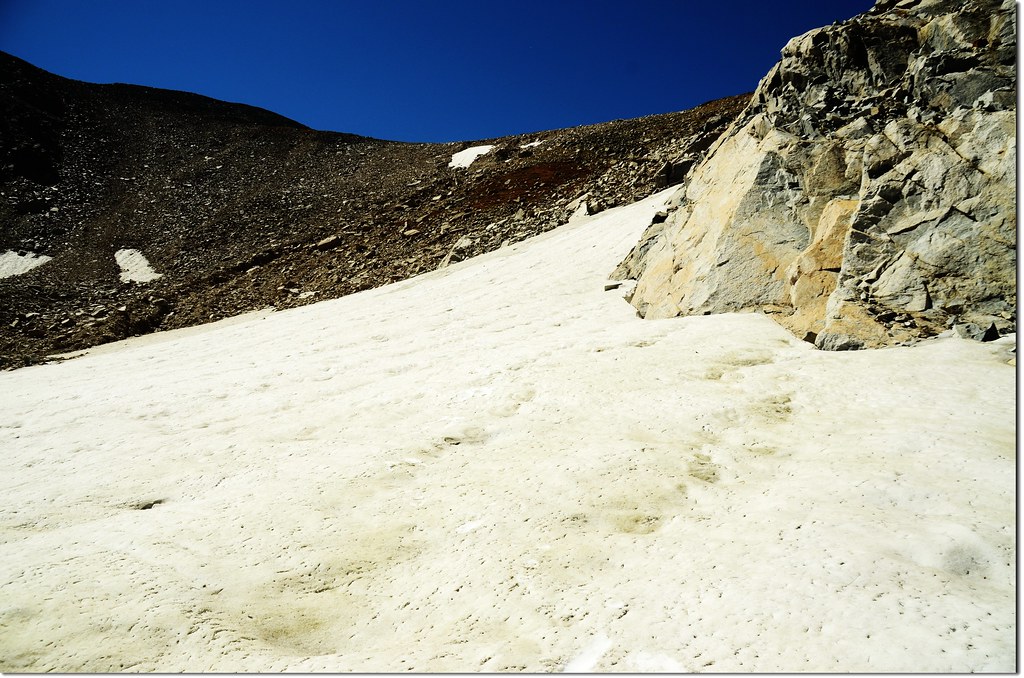
由Upper Blue Lake往西南方越過一座小山頭後開始下切Mount Toll山腳下的河谷,河谷是未融化的雪原。
Rolling snow bowls between Upper Blue Lake and Mt Toll
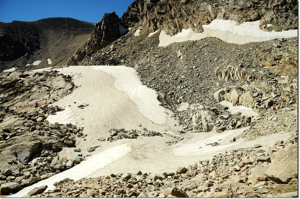
Lengthy snowfields between Upper Blue Lake and the southwest corner of the valley
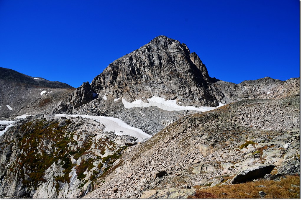
11:50 抵達Mount Toll下方雪原,海拔約12,090呎(3,685公尺),距登山口約 3.95哩(停車處4.55哩);
Mount Toll from Upper valley
Overlooking down on Blue Lake from Upper valley
橫渡雪原後僅接著是接近垂直的亂石坡,目標是上頭Pawnee Peak與Mount Toll之間的鞍部,自找路徑上攀,上攀途中特別小心鬆動的石塊。
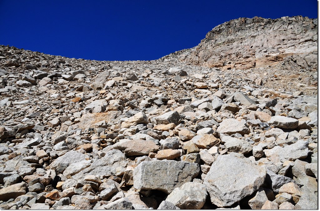
The route scales a steep wall in the southwest corner of the valley to reach the saddle beneath Mt Toll
12:46 短短約0.3哩的陡坡,爬升約500呎,費了將近一小時終於上抵Pawnee Peak與Mount Toll之間的鞍部,海拔約12,540呎(3,822公尺) ,距登山口約 4.25哩(停車處4.85哩);
Westerly views from the expansive saddle beneath Mt Toll's summit
Pawnee-Toll鞍部南望Pawnee Peak
Looking down-valley at Mt Audubon and Blue Lake from the saddle beneath Mt Toll
鞍部到Mount Toll山頂還有0.3哩,爬升約439呎(134公尺);由Mount Toll南面坡往山頂與左側小山頭間鞍部上攀。
Looking upon Mount Toll from the saddle
13:00 登上一處小鞍部,海拔約12,800呎(3,901公尺) ,距登山口約 4.45哩(停車處5.05哩);往後的路徑又是亂石堆,自找路徑直攻山頂。
13:13 登頂了,費了不少力氣終於登頂Mount Toll,距登山口約 4.55哩(停車處5.15哩)。
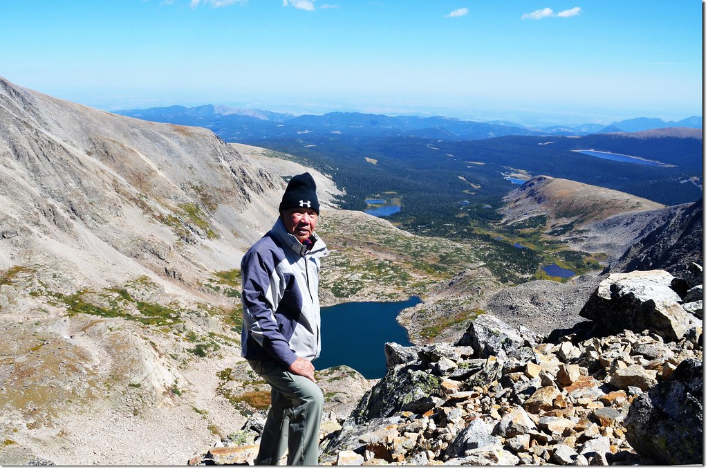
Me on the summit of Mount Toll, overlooking down onto Brainard Lake Recreation Area
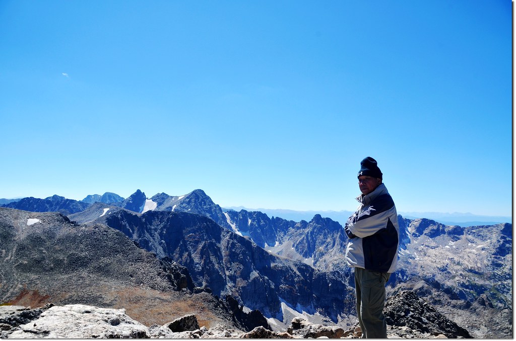
Me on the summit of Mount Toll, background are Indian Peaks
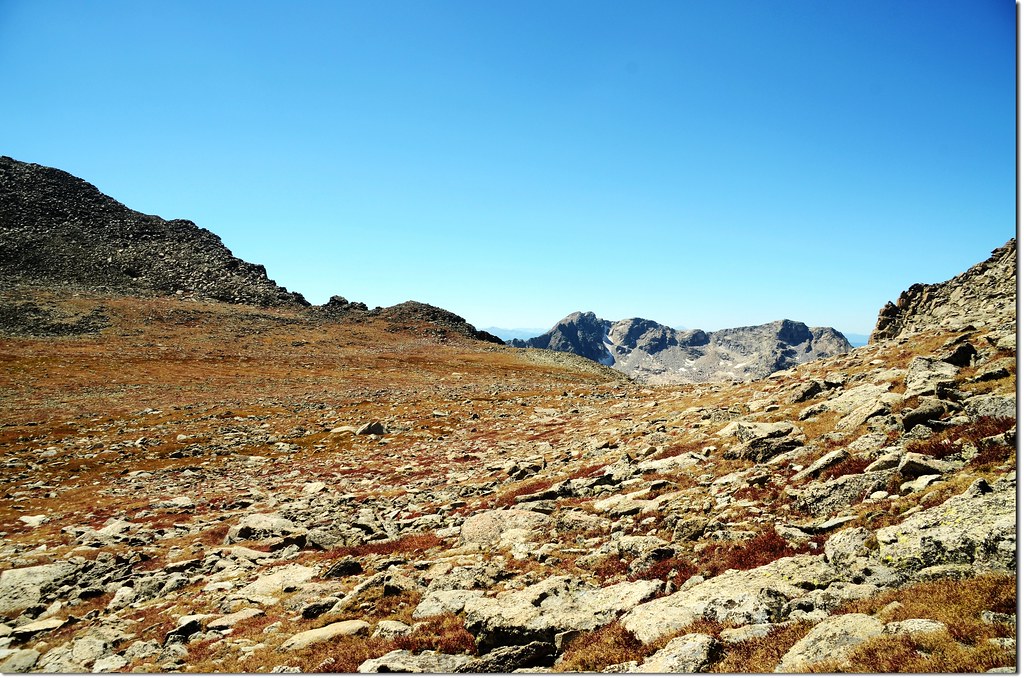
Mount Toll海拔12,979呎(3,956公尺),由於山頭突出有型,展望極佳,站在山頂上往東南眺有Little Pawnee Peak(12,466')、Pawnee Peak(12,943'),向南則可眺望Shoshoni Peak(12,967')、Apache Peak (13,441')和Niwot Ridge等高山;北邊則有 Paiute Peak (13,088'), Mt Audubon (13,223')橫亙在東北方,稜線往北延伸則是落磯山脈大陸分水嶺及更北的Never Summer Range 和 Gore Range。
Paiute Peak (13,088'), Mt Toll's immediate neighbor to the north
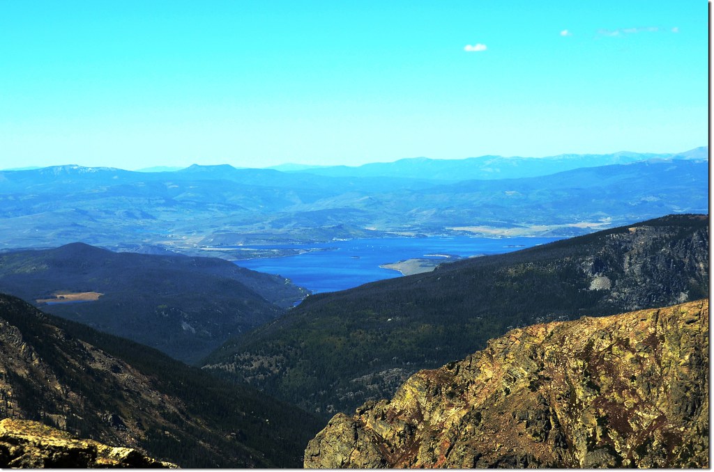
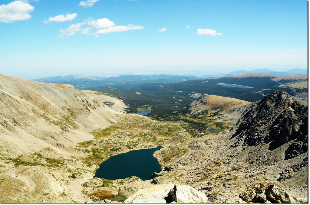
Overlooking down on Lake Granby from Mount Toll
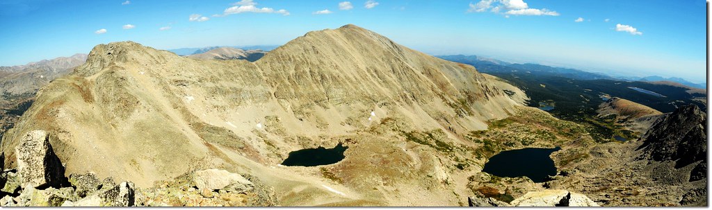
Mount Toll山頂東北展望, Paiute Peak(13,088'-left), Upper Blue Lake, and Mt Audubon(13,223' - right)
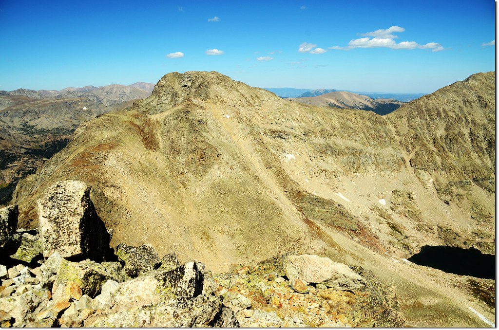
Mount Toll山頂南邊展望
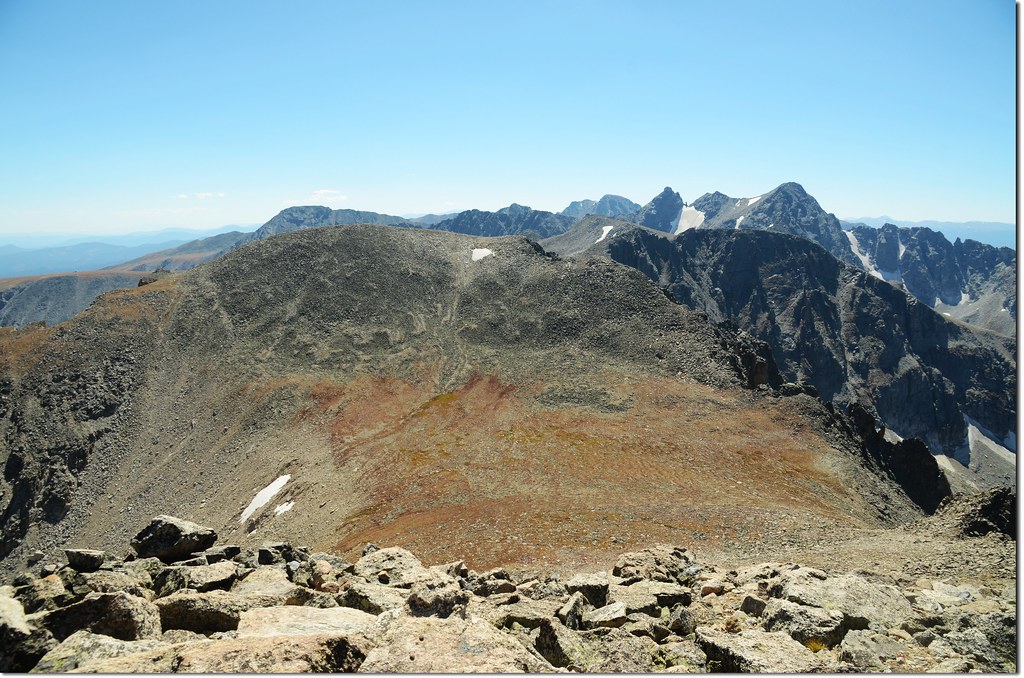
Mountains view from the summit of Mt Toll looking south
Overlooking down on Blue Lake from the summit of Mt Toll
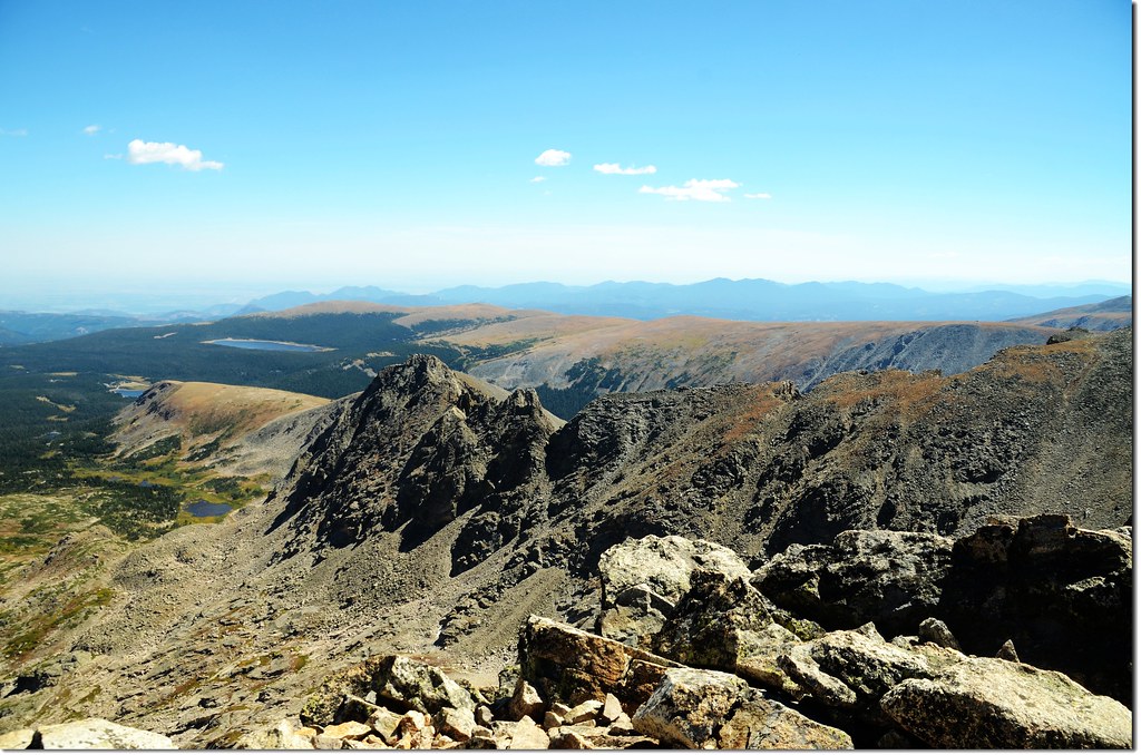
Overlooking down on Little Pawnee Peak from the summit of Mt Toll
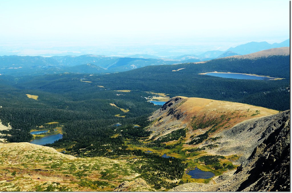
Overlooking down onto Brainard Lake Recreation Area from the summit of Mt Toll
13:22 下山。
13:40 下抵鞍部,本打算爬上Pawnee Peak,然後走Pawnee Pass經Long Lake下山,但一看那陡坡還是算了,已是強弩之末,況且那條路線多年前已走過,還是循原路下山,但回程打算走Blue Lake的南岸下山,反正此山很難找到一條清楚所謂正確的路徑好依循,一切靠正確的判斷。
14:00 下抵Mount Toll下方雪原處,由雪原右緣繞過,取Blue Lake南岸方向下切;
Overlooking down on Blue Lake from Upper valley
此路線路跡仍然不明,但與北岸路線不同之處是此路線較少鬆動之亂石堆,而是巨大的大岩石,行走在大岩石坡面是好走多了,問題是有幾處斷崖,必須仔細尋找小溝縫才能安全下攀。
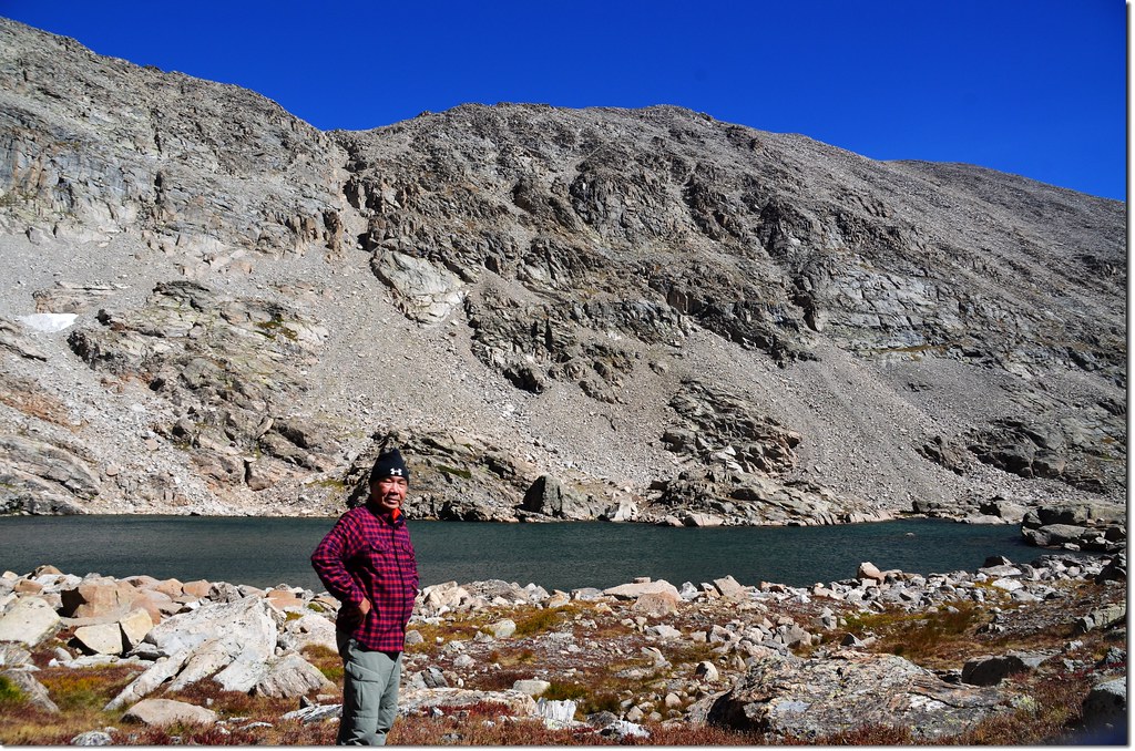
14:30 下抵Blue Lake南岸,繞過南岸後循原路下山。
South shore of Blue Lake
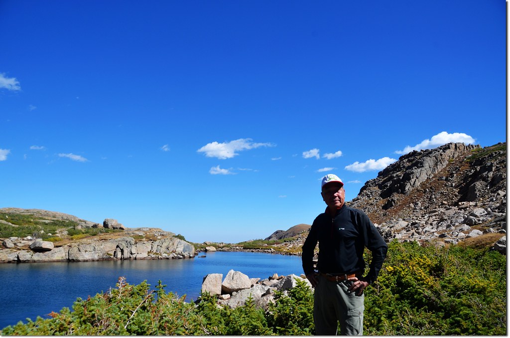
Me on the Blue Lake's south shore
Blue Lake, background is Mount Toll
Blue Lake from it's outlet
16:20 回到Brainard Lake停車處,有點累、但總算安全順利完登Mount Toll,真是不太輕鬆的行程。
沒有留言:
張貼留言