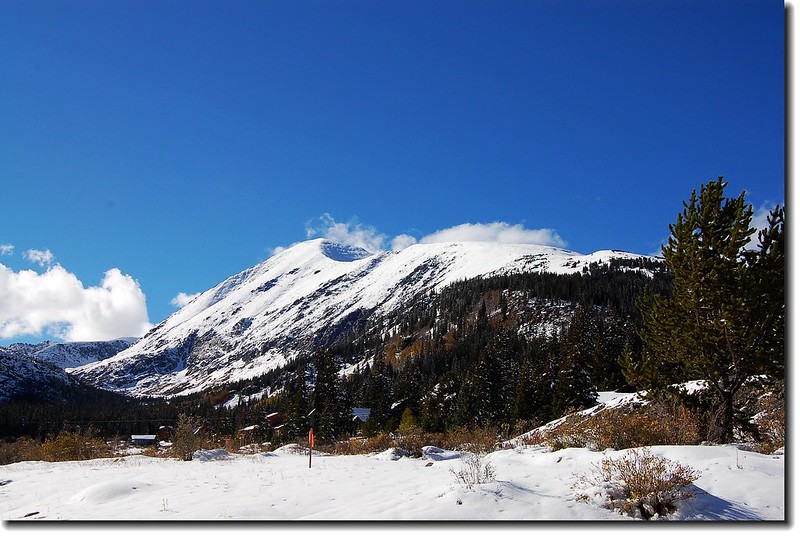
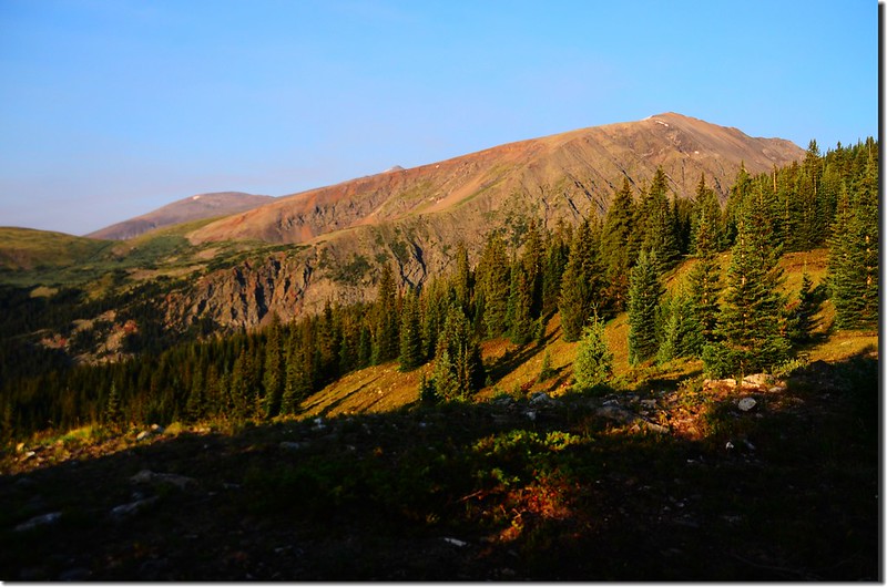
Quandary Peak as seen from Hoosier Pass
Quandary
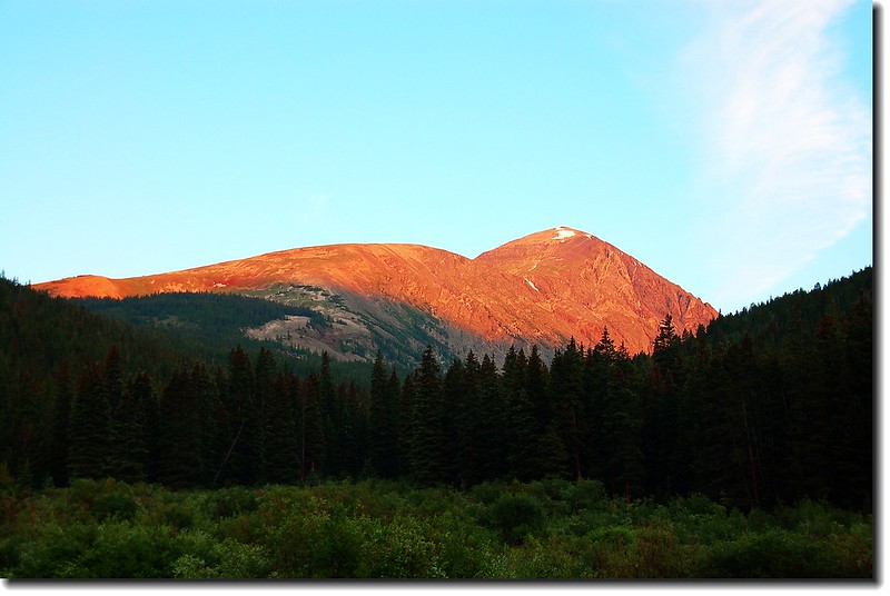
Peak as seen from From Breckenridge 7 miles south on CO- 9
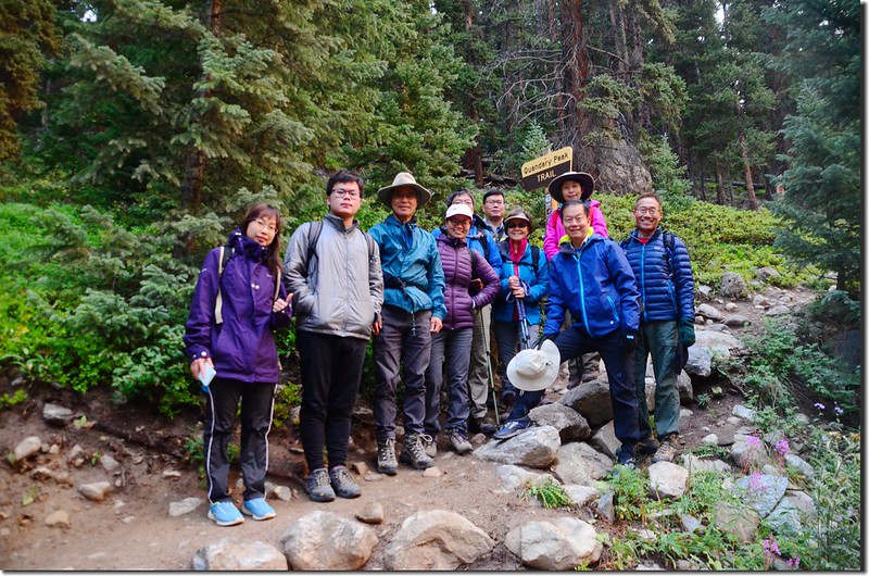
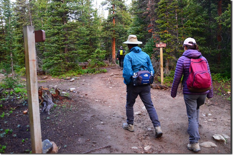
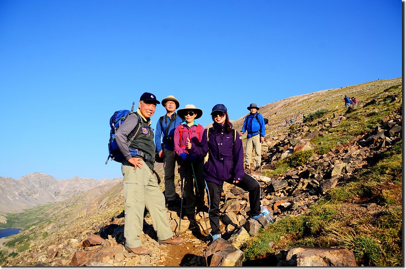
週日(29)隨同丹佛地區華人登山隊前往Breckenridge附近攀登Quandary Peak,該山我在2006年和2010年各去攀登一次,此次是第三度攀登;當天早上04:30相約在Golden集合後成員11人分乘兩部車前往登山口,約在06:00左右抵達登山口。
~~~~~~~~~~~~~~~~~~~~~~~~~~~~~~~~~~~~~~~~~~~~~~~~~~~~~~~~~~~~
山岳簡介:
Quandary Peak海拔14,265呎(4,348公尺),是Tenmile Range(Mosquito Range向北延伸的山脈)最高的一座山,在科羅拉多州14ers中排名第13,位在滑雪勝地Breckenridge西南方約8哩處,它的傳統登山口Quandary Peak East Ridge Trailhead位在Hoosier Pass北方約1哩的CO 9公路旁,若從丹佛出發不管從I-70州際道路到Frisco轉CO-9南下,或走US 285公路到Fairplay北上皆僅90哩左右。此座山若由傳統登山口East Ridge起登,攀登難度是Class 1,所以是一座很容易親近的14ers。
Quandary Peak山名來源:
Quandary Peak(困惑山)是位在McCullough Gulch與Monte Cristo Creek之間的一條稍成西北-東南走向的稜脈,遠觀就像一條巨龍般俯臥在McCullough Gulch的南邊,所以早期此山被稱為“McCullough's Peak”,而此山東南邊不遠處即是Hoosier Pass,所以又被稱為“Hoosier Peak”或“Ute Peak”,而之後來會改稱為Quandary Peak是源自於一群礦工,在19世紀的60年代有一群礦工在此山的斜坡上發現一種無法辨識的礦物樣品,這群礦工對該礦物樣品的確切種類感到十分困惑(Quandary),“Quandary Peak”就此取代了原來的山名;在南方Elk Mountains的另一座14ers高山Conundrum Peak和此山有著相同的命名典故,都是發現了一種矛盾的、不可解決的、或困難的問題而將該山命名為“Conundrum Peak”(難題山),。
~~~~~~~~~~~~~~~~~~~~~~~~~~~~~~~~~~~~~~~~~~~~~~~~~~~~~~~~~~~~
攀登山岳:Quandary Peak(海拔14,265呎/4,348公尺)
登山口:Quandary Peak Trailhead(海拔10,850呎/3,307公尺)
爬升高度:3,450 呎/1,052公尺
登山里程:6.75哩/10.8公里(來回)
登山時間:8小時10分
~~~~~~~~~~~~~~~~~~~~~~~~~~~~~~~~~~~~~~~~~~~~~~~~~~~~~~~~~~~~
步程簡述:
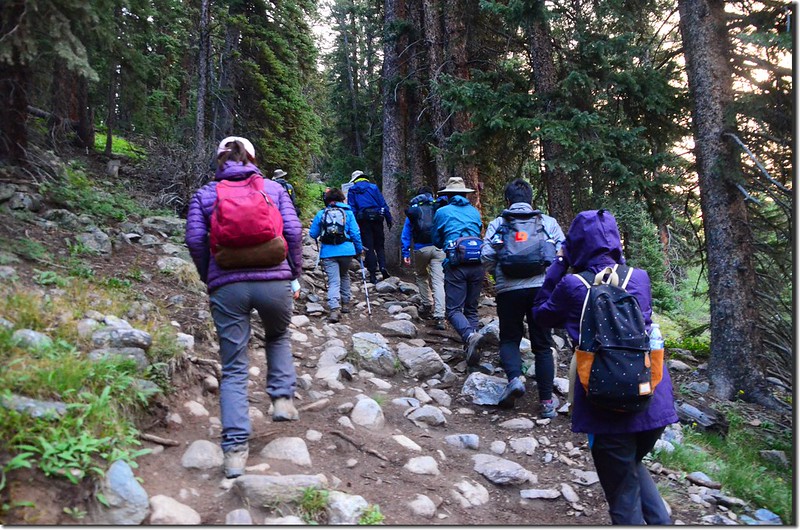
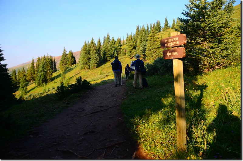
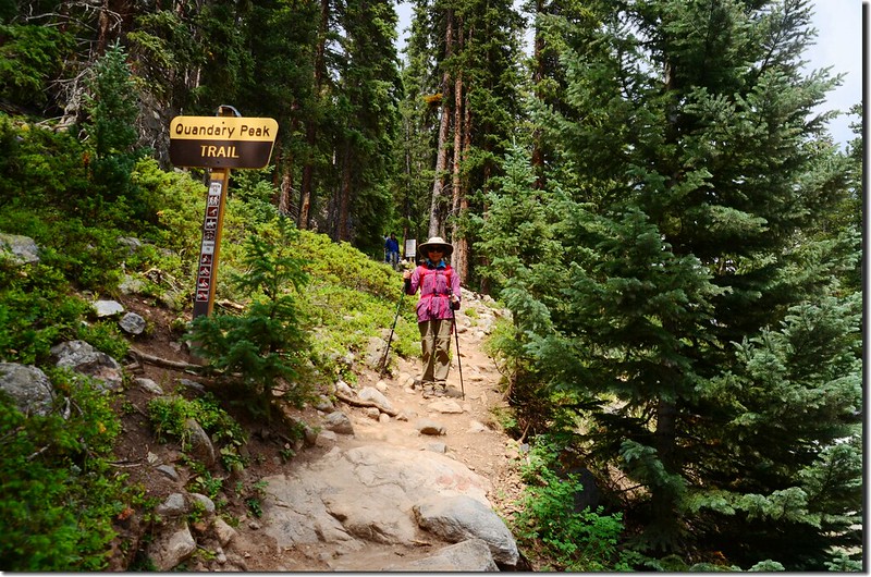
06:15 登山口出發,海拔10,850呎(3,307公尺);
Taken from Quandary Peak Trailhead
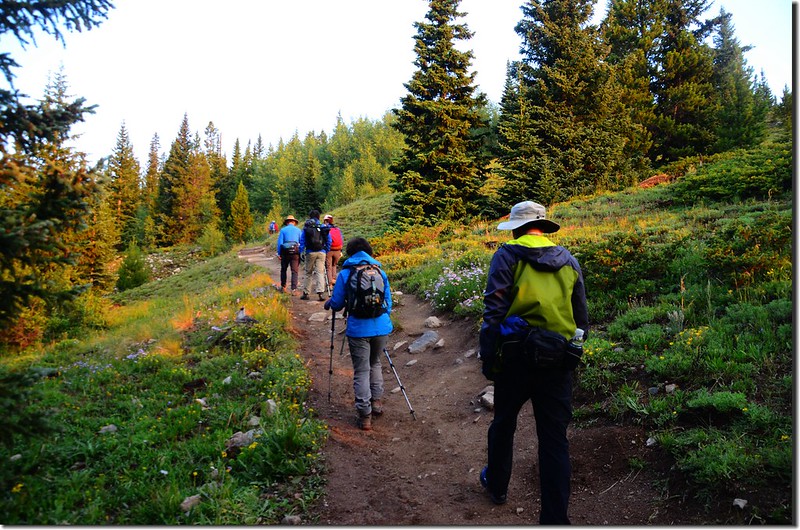
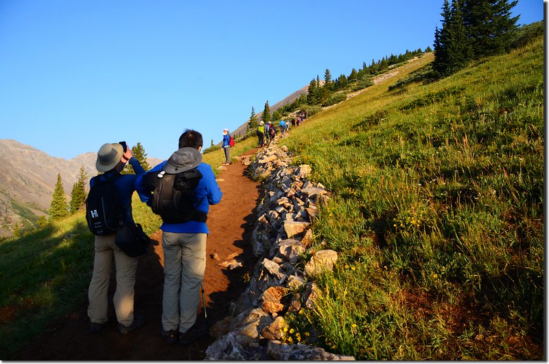
登山步道一開始是在松林中之字形緩升,偶有廢棄的採礦小路,但沿途有明顯路標,應不致走錯路。
Quandary Peak East Ridge Trail
Taken from Quandary Peak Trailhead
登山步道一開始是在松林中之字形緩升,偶有廢棄的採礦小路,但沿途有明顯路標,應不致走錯路。
Quandary Peak East Ridge Trail
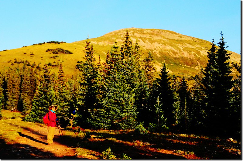
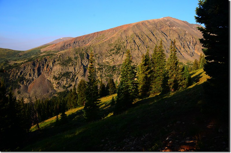
06:44 爬升到一透空處,海拔約11,300呎;透空處可南眺North Star Mountain。
Taken from Quandary Peak East Ridge Trail
Taken from Quandary Peak East Ridge Trail
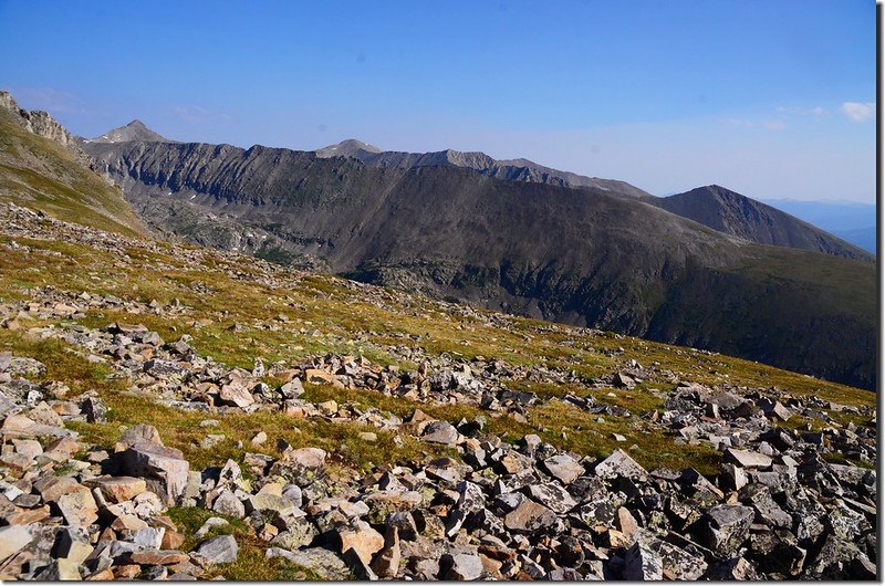
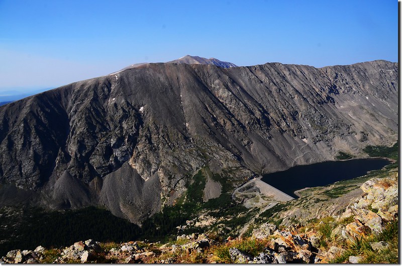
06:56 抵達一處平坦空曠處,已接近森林線;往西眺整座Quandary呈現眼前,此處海拔約11,600呎;
Taken from Quandary Peak East Ridge Trail
Looking southwest at Mount Bross、Lincoln & North Star Mt. from Quandary Peak East Ridge trail near 11,600 ft.
之後寬敞的步道在平坦的稜線上往西南前進,視野奇佳。
Quandary Peak East Ridge Trail
Looking southwest at North Star Mt. from Quandary Peak East Ridge trail
Seen looking SE from East Ridge trail of Quandary, Mt Silverheels is in the distance
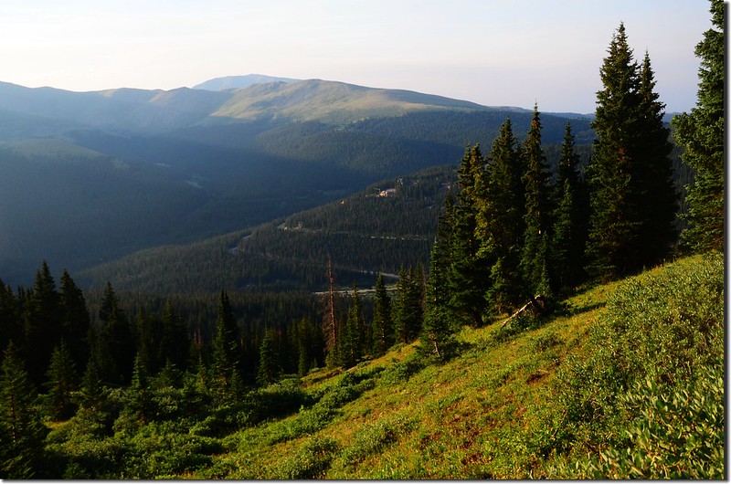
07:13 出森林線,海拔約12,000呎;
On the way up to Quandary Peak
步道在Quandary南坡盤旋,Blue Lakes就在左下方,湖的左側即是North Star Mountain,接下來是坡度稍陡的石階路。
 On the way up to Quandary Peak
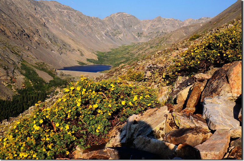
Looking down at Blue Lake from Quandary Peak East Ridge Trail
Taken from Quandary Peak East Ridge Trail
On the way up to Quandary Peak
Looking southwest at North Star Mt. & Blue Lake from Quandary Peak East Ridge Trail
On the way up to Quandary Peak
步道在Quandary南坡盤旋,Blue Lakes就在左下方,湖的左側即是North Star Mountain,接下來是坡度稍陡的石階路。
On the way up to Quandary PeakLooking down at Blue Lake from Quandary Peak East Ridge Trail
Taken from Quandary Peak East Ridge Trail
On the way up to Quandary Peak
Looking southwest at North Star Mt. & Blue Lake from Quandary Peak East Ridge Trail
08:24 步道右上稜線,北眺Grays Peak和Torreys Peak雙峰,此處海拔約12,800呎;之後步道即在稜線上往西爬升。
View to northeast from Quandary Peak East Ridge trail near 12,800 ft
Looking northeast at Grays & Torreys Peak from Quandary Peak East Ridge trail near 13,150 ft
On the way up to Quandary Peak
Looking west at Quandary's summit from Quandary Peak East Ridge trail near 13,150 ft
Looking southeast at Mount Silverheels from Quandary Peak East Ridge Trail near 13,150'
Looking northeast at Bald Mountain from Quandary Peak East Ridge trail near 13,150 ft
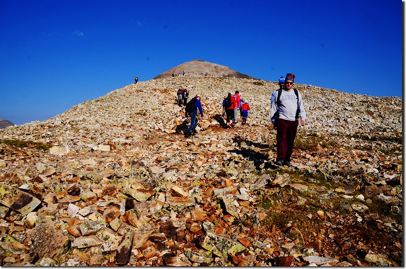
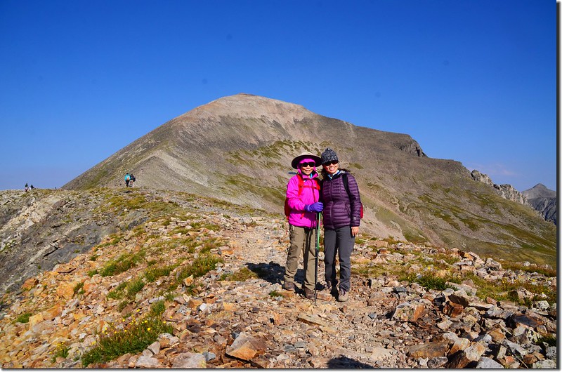
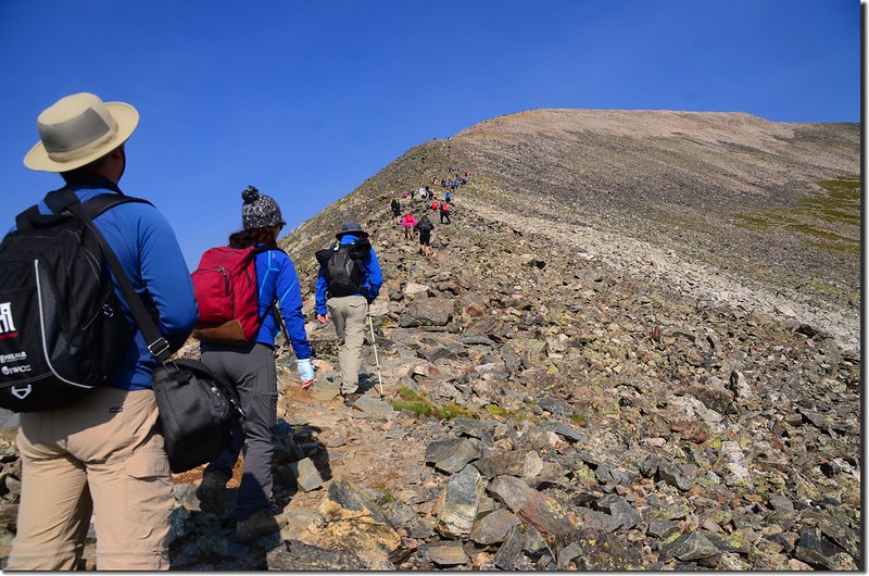
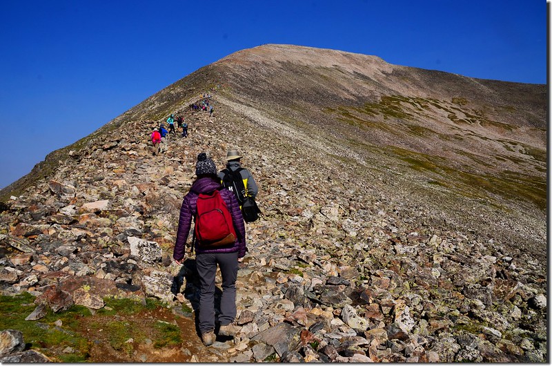
08:40 登上Quandary Peak山頂前一大平坦肩稜13,150’高地,主峰就在正前方約一哩處,此地海拔13,150呎/4,008公尺,距登山口約2.4哩;再走一段平路後主峰前是一段陡坡。
Taken from Quandary Peak East Ridge Trail 13,150'
Looking northwest at Tenmile Range from Quandary Peak East Ridge trail near 13,150 ft
Looking southwest at North Star Mt. & Blue Lake from Quandary Peak East Ridge Trail 13,150'
Taken from Quandary Peak East Ridge Trail 13,150'
Looking northwest at Tenmile Range from Quandary Peak East Ridge trail near 13,150 ft
Looking southwest at North Star Mt. & Blue Lake from Quandary Peak East Ridge Trail 13,150'
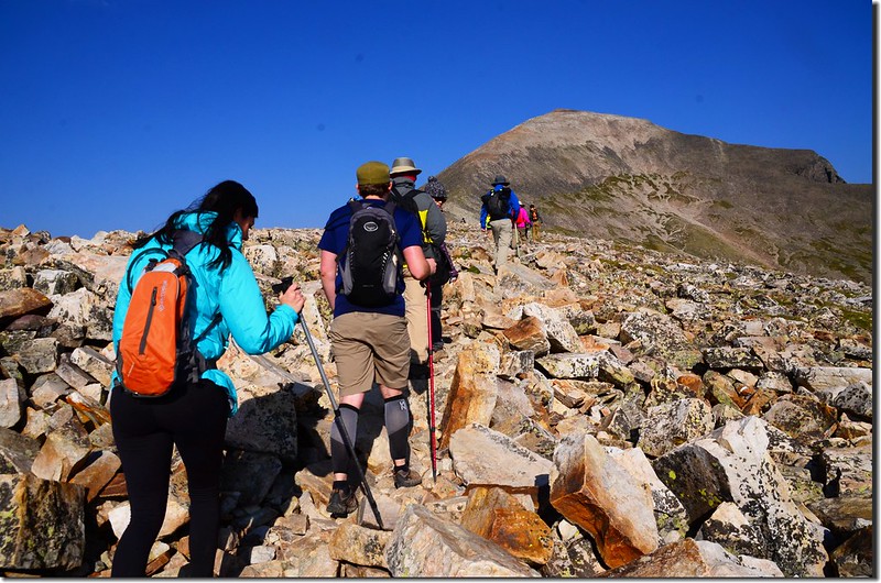
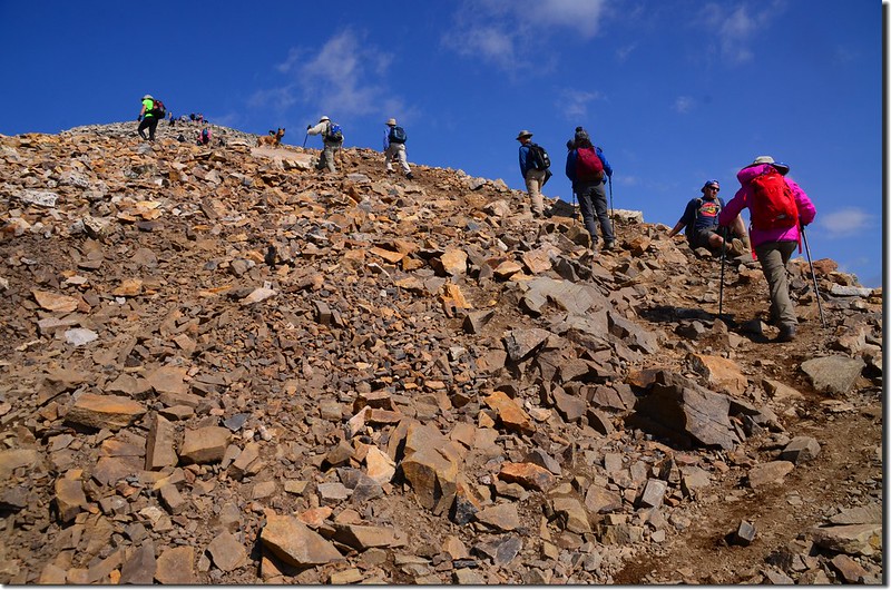
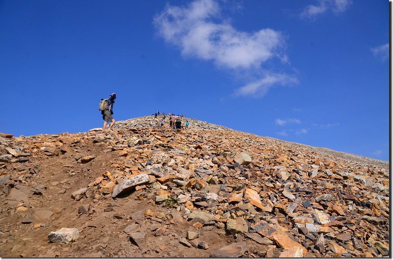
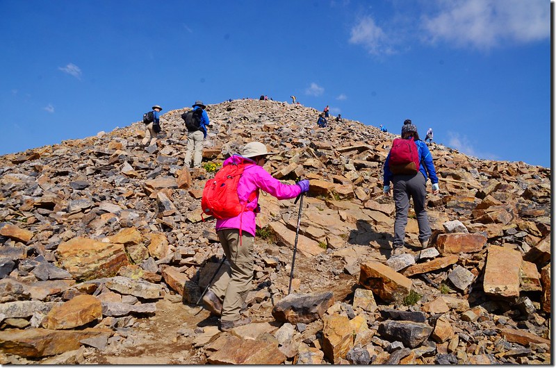
08:52 開始陡升,此處海拔約13,174呎/4,015公尺,距登山口約2.5哩;這最後一段陡坡大約要爬升1,000呎/305公尺,繼續爬升到13,400呎至14,000呎間這一段路線較為分歧,但山頂將至,應不致迷路。
The final 1,000' of upper the Quandary Peak East Ridge
The final 1,000' of upper the Quandary Peak East Ridge
09:16 遇到兩位單車青年,大概只有在美國才會看到這種玩命式的極限運動。
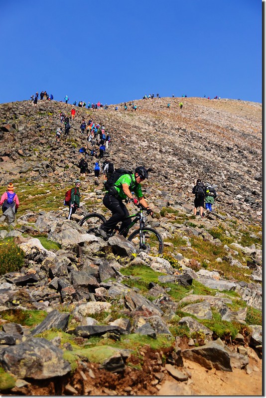
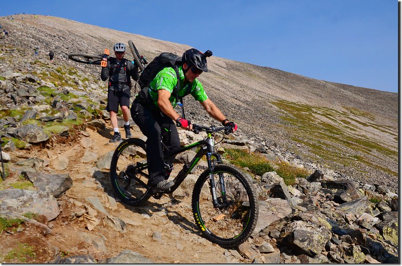

A biker biking down the trail
The final 1,000' of upper the Quandary Peak East Ridge
Taken from the upper portion of Quandary Peak East Ridge
Looking down Quandary's east ridge from the final 1,000' of upper ridge
Looking down at Blue Lake & The Decalibron from upper Quandary Peak East Ridge
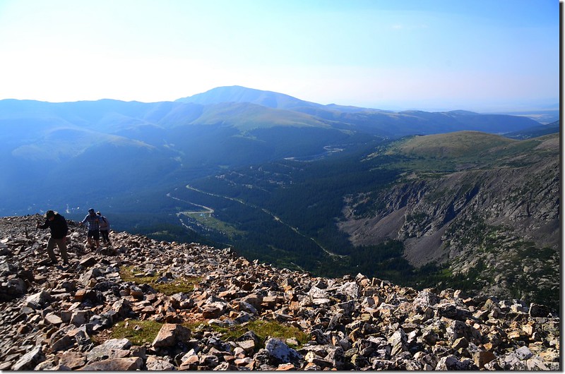
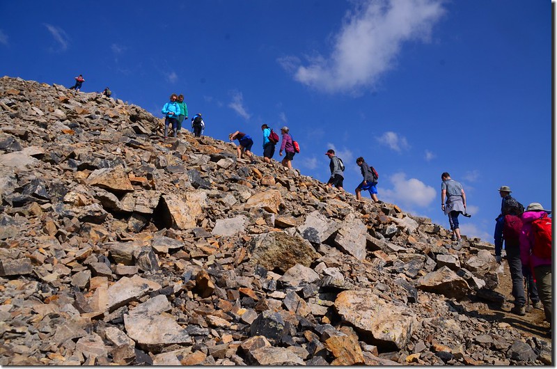
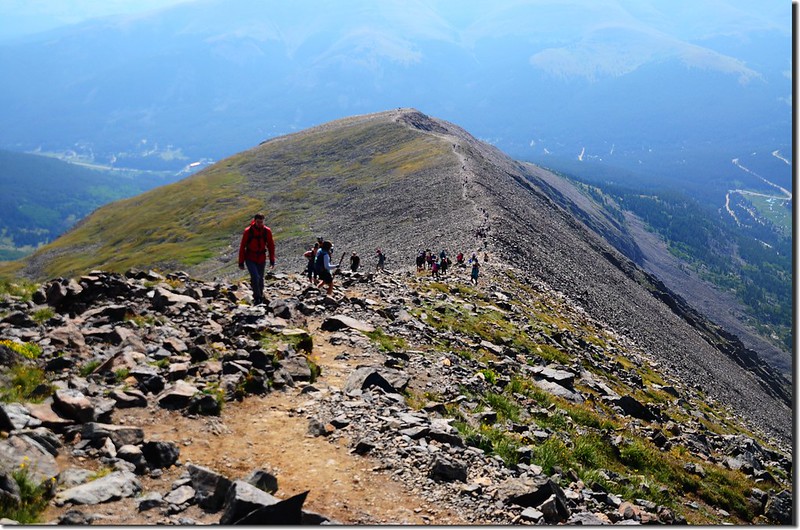
10:33 登上山頂前高地(假山頭),海拔14,210呎/ 4,331公尺,距登山口約3.2哩;山頂在望,接下來的0.15哩路是幾近平路的緩坡,平緩好走。
Taken from Quandary Peak Trail near the summit
A biker biking down the trail
The final 1,000' of upper the Quandary Peak East Ridge
Taken from the upper portion of Quandary Peak East Ridge
Looking down Quandary's east ridge from the final 1,000' of upper ridge
Looking down at Blue Lake & The Decalibron from upper Quandary Peak East Ridge
10:33 登上山頂前高地(假山頭),海拔14,210呎/ 4,331公尺,距登山口約3.2哩;山頂在望,接下來的0.15哩路是幾近平路的緩坡,平緩好走。
Taken from Quandary Peak Trail near the summit
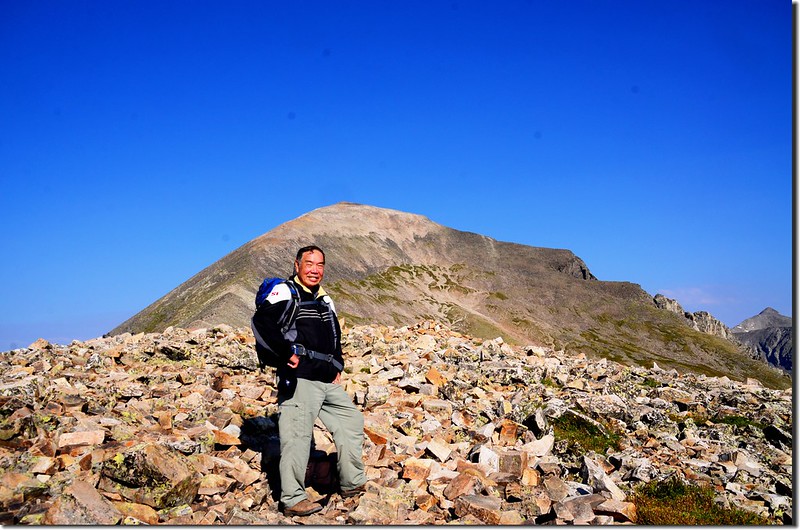
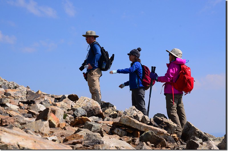
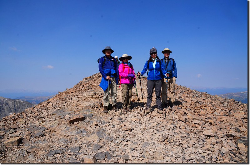
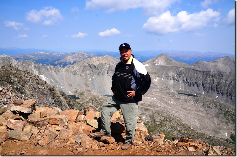
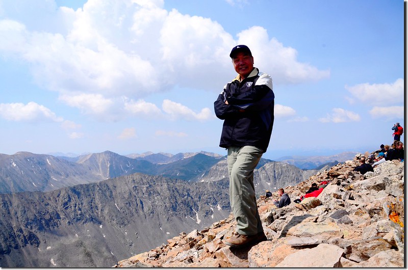
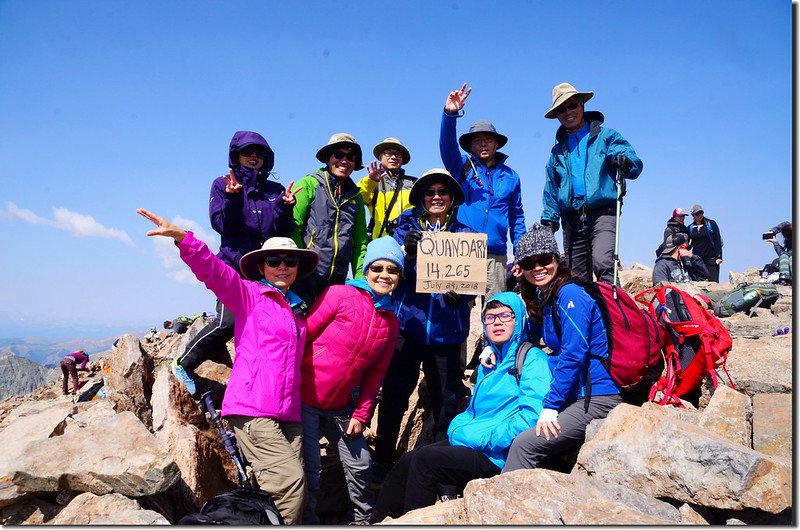
10:35 登頂Quandary Peak,第一批的山友早在半個多小時前就已登頂;Quandary Peak海拔14,265呎(4,348公尺) ,山頂蠻熱鬧的。
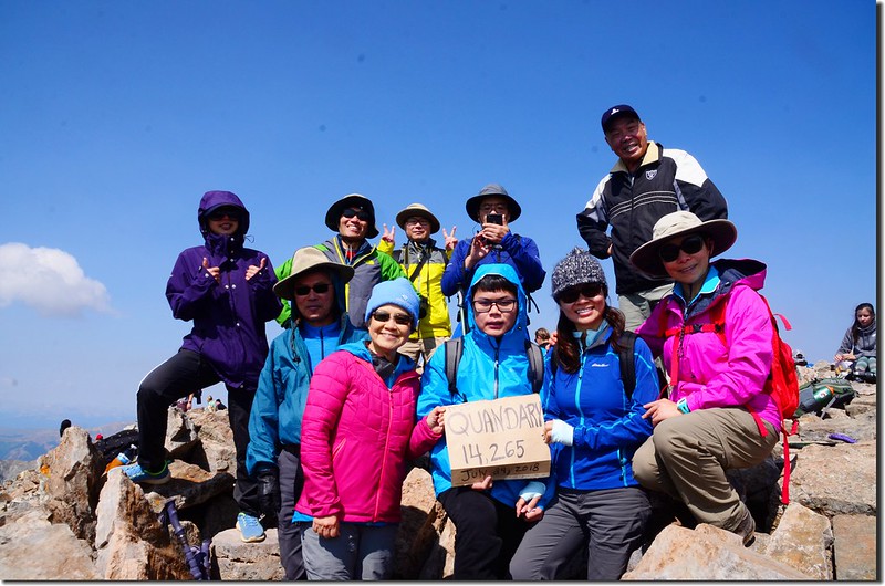
Taken from the summit of Quandary Peak, Colorado
Taken from the summit of Quandary Peak, Colorado
Quandary Peak的山頂是一東西向狹長亂石地形,最高點岩石上崁有兩個US Coast & Geodetic Survey Reference Mark(功用如同台灣的三角點)。
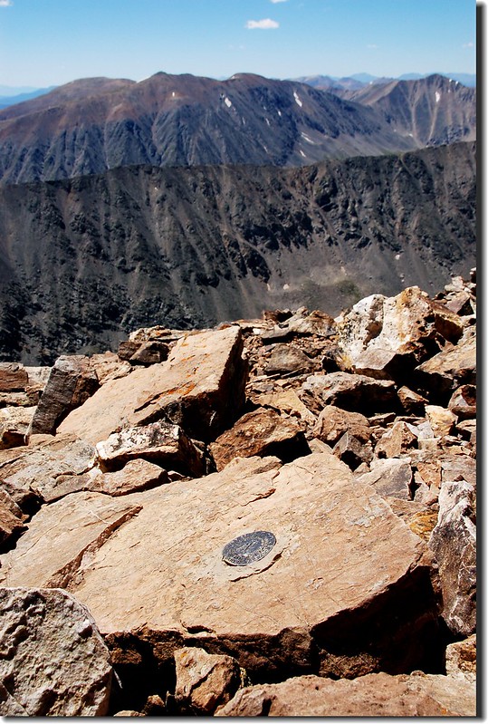
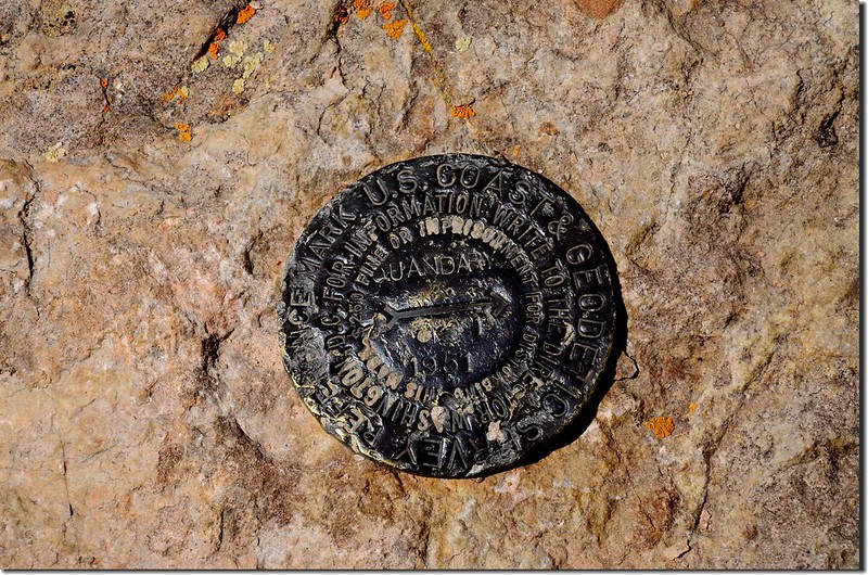
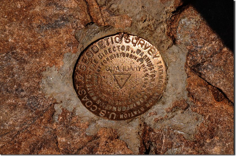
Benchmark on the summit of Quandary Peak
Benchmark on the summit of Quandary Peak
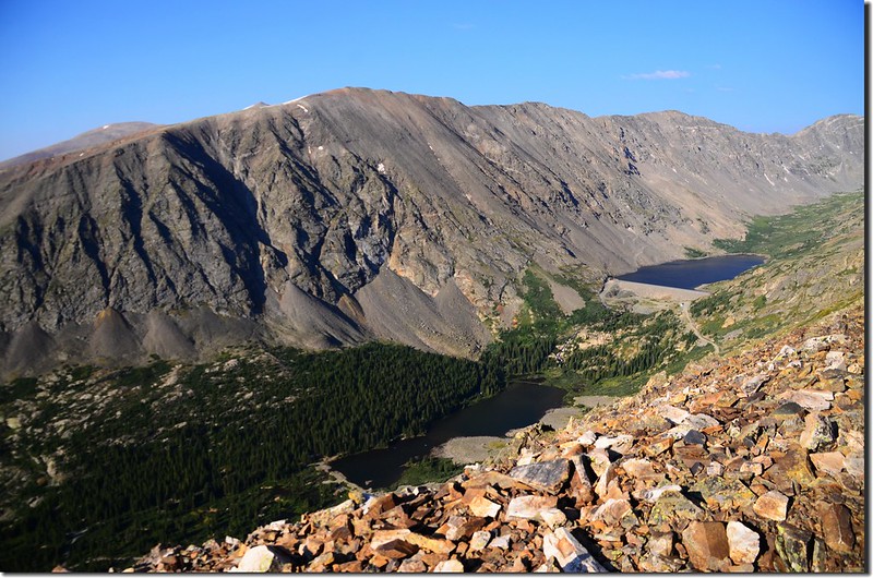
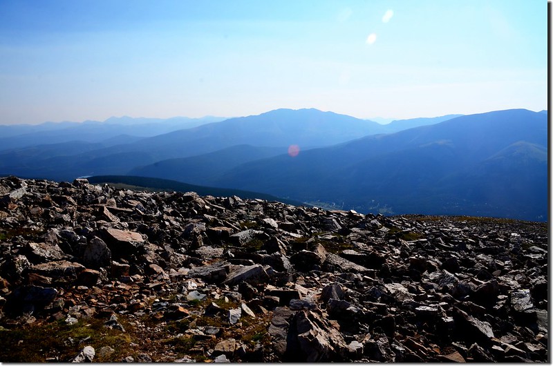
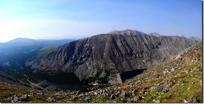
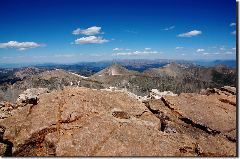
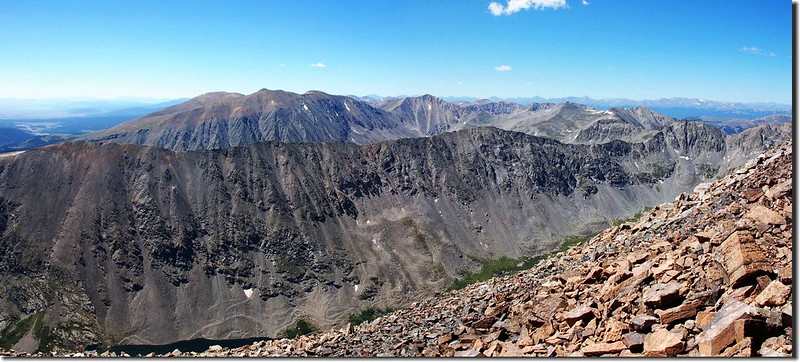
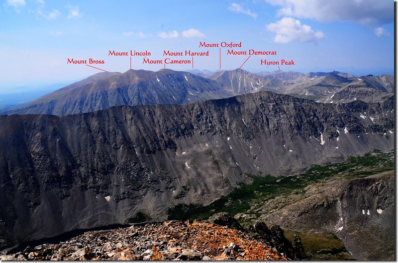
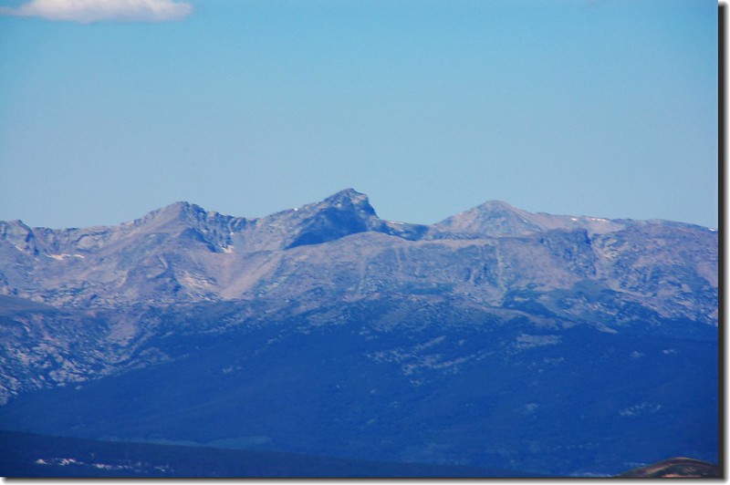
今天山頂展望奇佳,往南俯瞰Blue Lake,其南側則是13ers--North Star Mountain,再往南則是四座14ers-- Mt. Lincoln 、Mt. Cameron、Mt. Bross和Mt. Democrat;
View to southwest from the summit of Quandary Peak
Looking south at The Decalibron from the summit of Quandary Peak
View to southwest from the summit of Quandary Peak
Looking south at The Decalibron from the summit of Quandary Peak
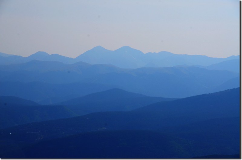
西南邊遠眺Sawatch Range的科州第一、第二高峰Mt. Elbert和Mt. Massive;
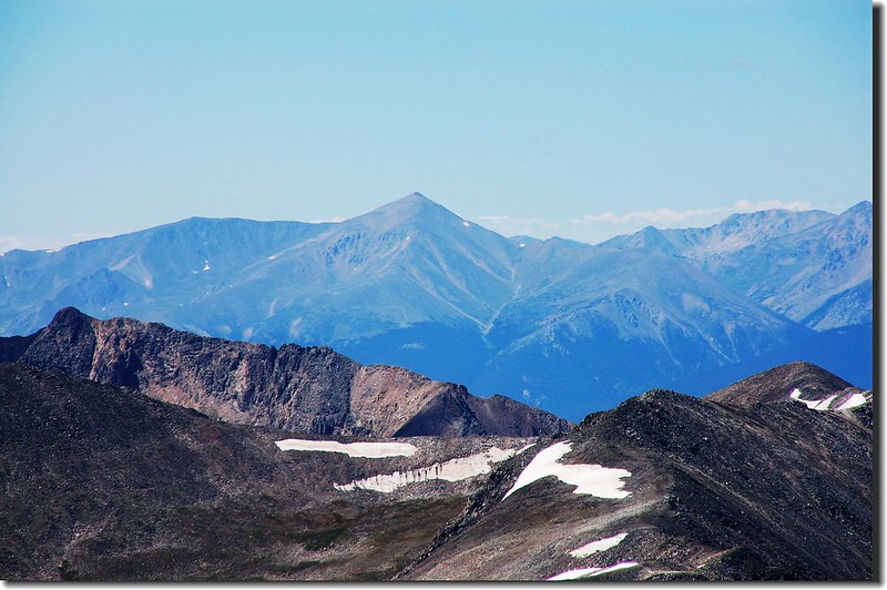
Looking southwest at Mount Elbert from the summit of Quandary Peak
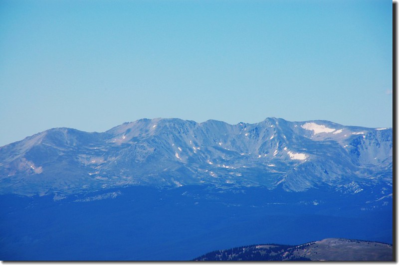
Looking southwest at Mount Massive from the summit of Quandary Peak
其他如La Plata Peak和Mount of the Holly Cross也都清晰可見;
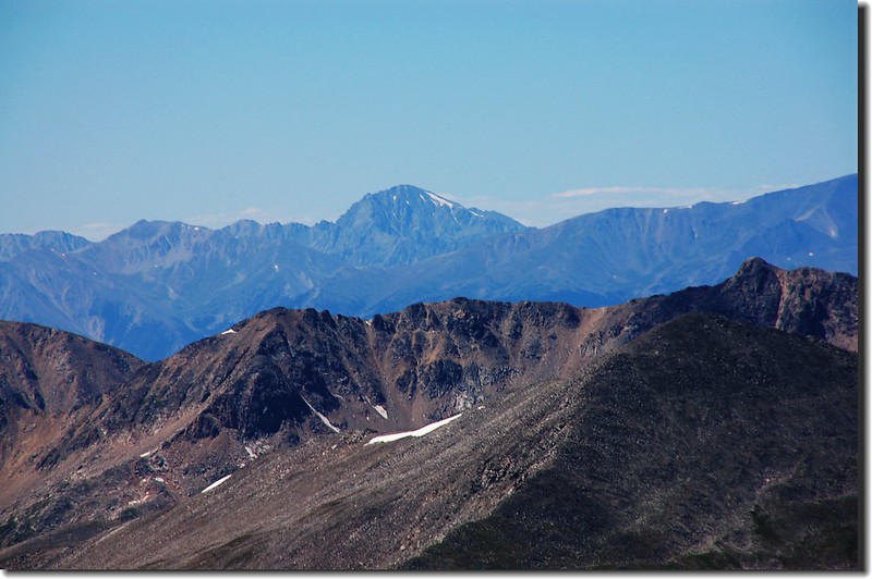
Looking southwest at La Plata Peak from the summit of Quandary Peak
Looking northwest at Mount of the Holy Cross from the summit of Quandary Peak
View to southwest from the summit of Quandary Peak
Looking southwest at Mount Elbert from the summit of Quandary Peak
Looking southwest at Mount Massive from the summit of Quandary Peak
其他如La Plata Peak和Mount of the Holly Cross也都清晰可見;
Looking southwest at La Plata Peak from the summit of Quandary Peak
Looking northwest at Mount of the Holy Cross from the summit of Quandary Peak
View to southwest from the summit of Quandary Peak
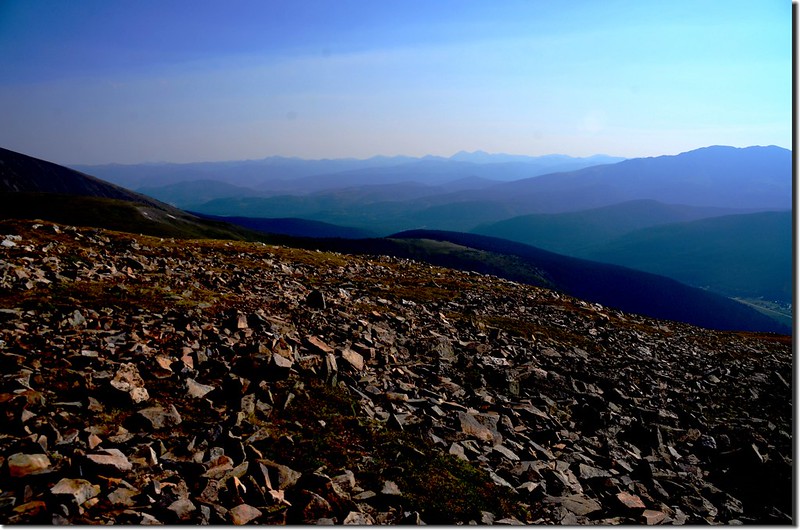
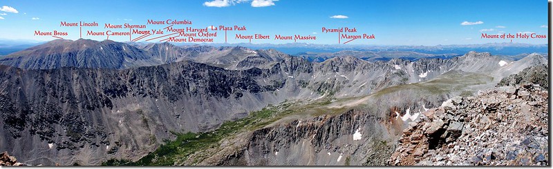
往西北則有Tenmile Range綿延北上,遠方的Grays Peak 和Torrys Peak雙峰更是醒目。
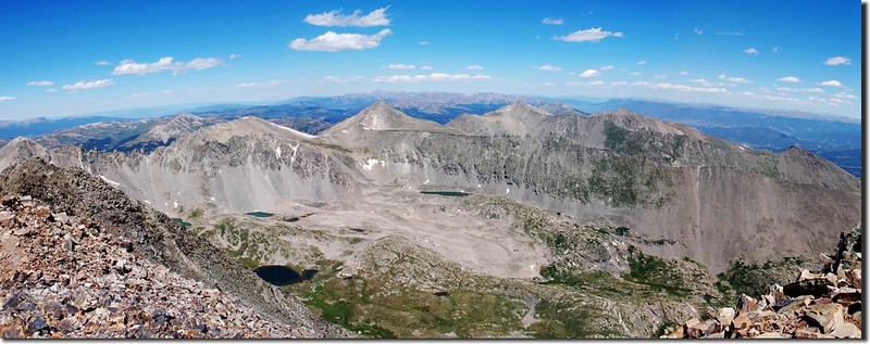
View to northwest from the summit of Quandary Peak

Looking northwest at Tenmile Range from the summit of Quandary Peak
View to northwest from the summit of Quandary Peak
Looking northwest at Tenmile Range from the summit of Quandary Peak
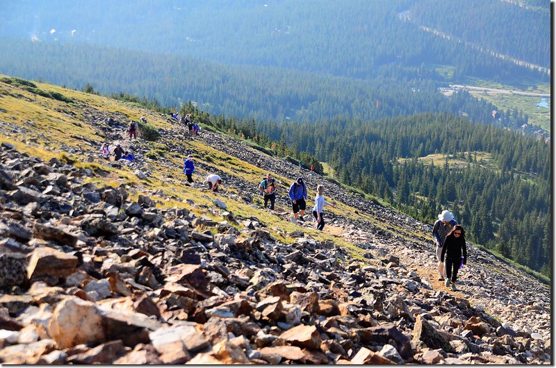
11:10 在山頂休息半個多小時後下山。
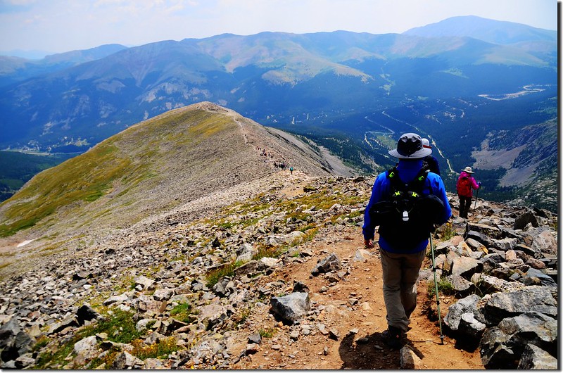
Hikers making their way down from Quandary summit
Hikers making their way down from Quandary summit
14:25 返抵登山口,第一批山友已於半個多小時前先行回家,我們隨後搭阿才的車子回Golden,結束今天的登山行程。
Finally, I did it!
Finally, I did it!