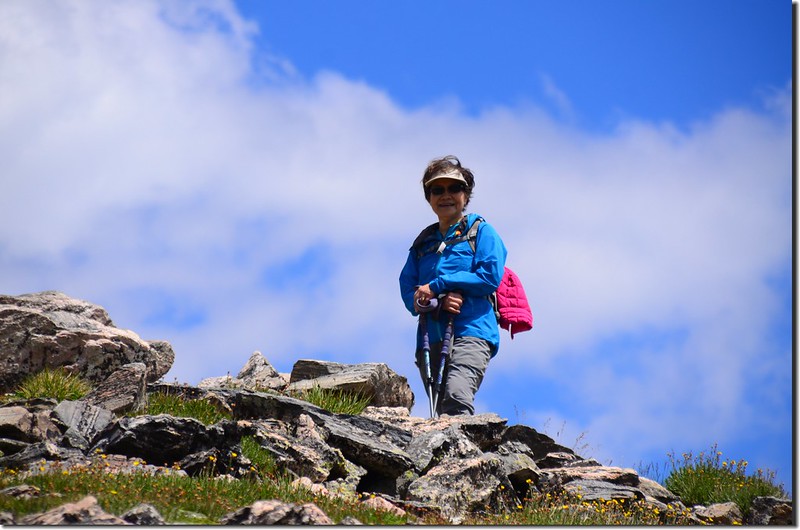
前天(14)和登山隊前往Idaho Springs附近攀登Saint Mary's Glacier上頭的James Peak;James Peak海拔13,294呎(4,052公尺),是科羅拉多州眾多13ers(海拔介於13,000呎~13,999呎間的高山)中排名第352的一座高山,該山我之前曾去攀登過兩次,登山紀錄請瀏覽:
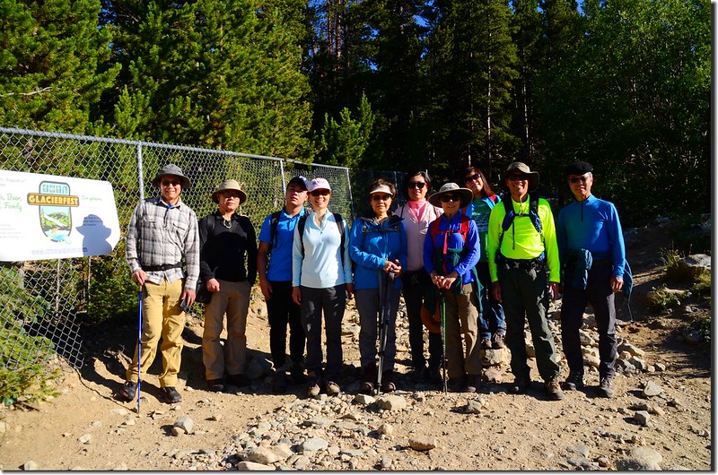
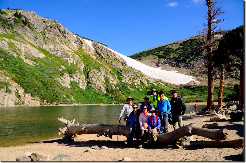
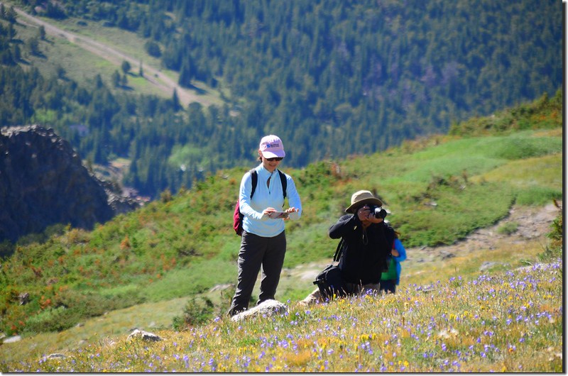
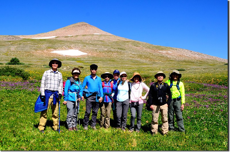
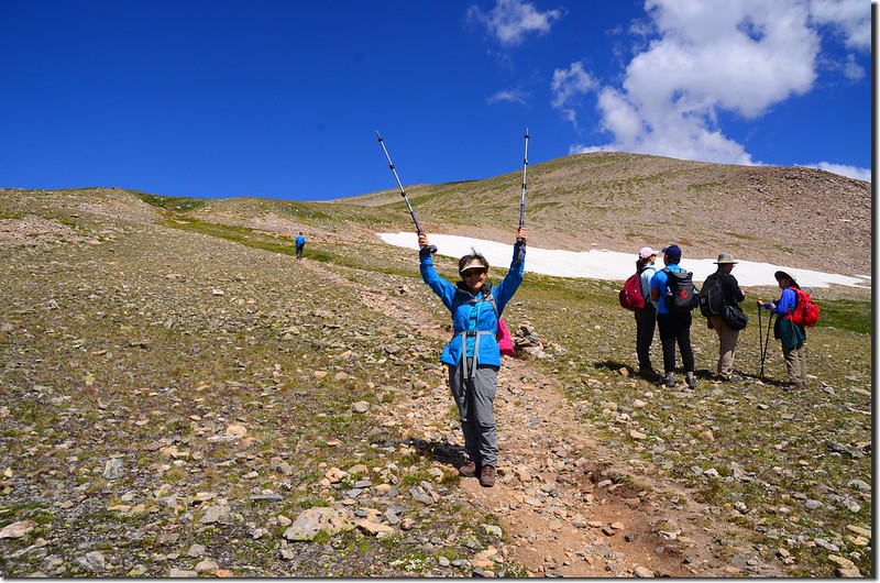
前天早晨07:00我們約在Golden的Jefferson County Courthouse parking lot集合,參加人員有11人,分乘兩部車開往登山口。
~~~~~~~~~~~~~~~~~~~~~~~~~~~~~~~~~~~~~~~~~~~~~~~~~~~~~~~~~~~~~
攀登山岳:James Peak,海拔13,294呎(4,052公尺)
登山口:Saint Mary's Glacier trailhead,海拔10,300呎(3,139公尺)
登山里程:約8.5哩(13.6公里)
總爬升高度:約3,000呎(914公尺)
登山時間:7小時50分
~~~~~~~~~~~~~~~~~~~~~~~~~~~~~~~~~~~~~~~~~~~~~~~~~~~~~~~~~~~~~
行車資訊:
在Golden分配共乘車輛後沿I-70州際公路西行,過Idaho Springs(Exit 240) 不久於Exit 238下高速公路後沿Fall River Road (County Road 275) 北行,中途經過Alice小鎮後抵登山口停車場,I-70至停車場約9哩;該停車場一大一小皆在公路左側,每車停車費5元美金,夏天假日有時車位一位難求,大部分的遊客是為著St. Mary's Glacier和St. Mary's Lake而來,這個景點距登山口僅0.75哩,爬升約400呎(122公尺);我們於08:00左右抵達登山口停車場,整裝後出發。
步程簡述:
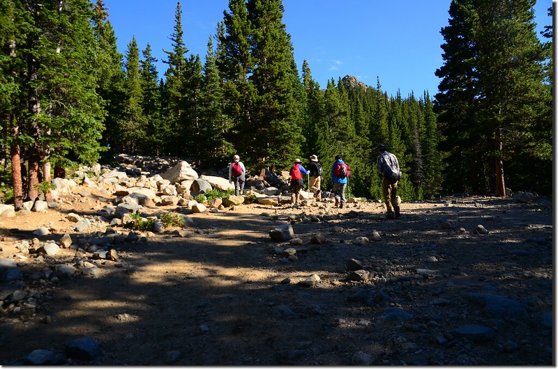
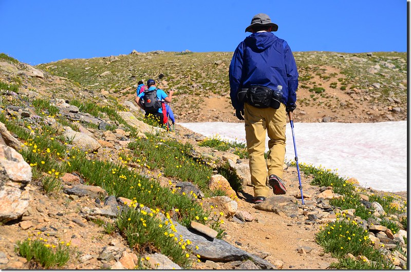
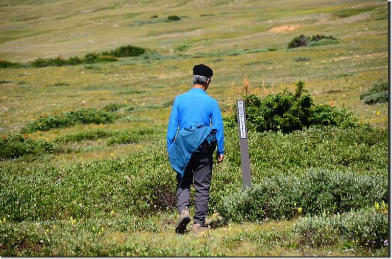
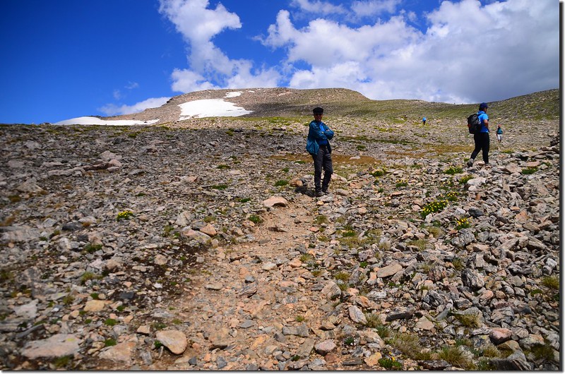
08:10 停車場出發,前行0.1哩抵達登山口(海拔10,300呎),登山口告示牌標示距冰河(Glacier)底部3/4哩;
Saint Mary's Glacier trailhead
左轉往Saint Mary's Glacier的還算寬大、亂石集聚的步道上山,步道雖寬但亂石堆積走來不輕鬆。
James Peak Trail, Colorado
Saint Mary's Glacier trailhead
左轉往Saint Mary's Glacier的還算寬大、亂石集聚的步道上山,步道雖寬但亂石堆積走來不輕鬆。
James Peak Trail, Colorado
08:30 到達冰河(Glacier)底部小湖--Saint Mary's Lake,此處海拔約10,696呎/3,260公尺,距登山口約0.45哩,時間尚早遊客不多。
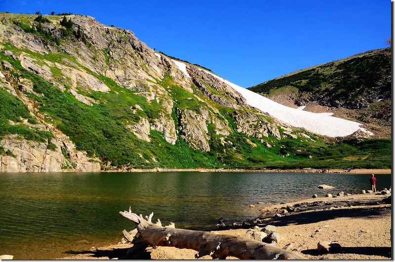
Saint Mary's Lake
Saint Mary's Lake
08:45 由St. Mary's Lake東岸出水口的小鐵橋繞過後,來到北岸的St. Mary's Glacier底部,此處海拔約10,848呎/3,306公尺,距登山口約0.75哩;
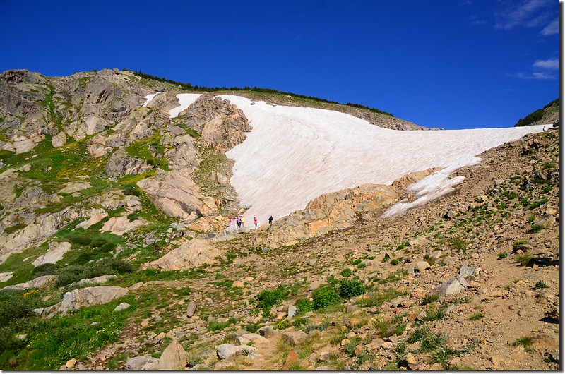
Saint Mary's Glacier
與其說是冰河(Glacier)不如說是雪原(Snowfield)來得恰當,因為他並不是真的冰河,之所以取名冰河可能是為吸引觀光客吧!
Saint Mary's Glacier
與其說是冰河(Glacier)不如說是雪原(Snowfield)來得恰當,因為他並不是真的冰河,之所以取名冰河可能是為吸引觀光客吧!
08:50 循冰河上山;
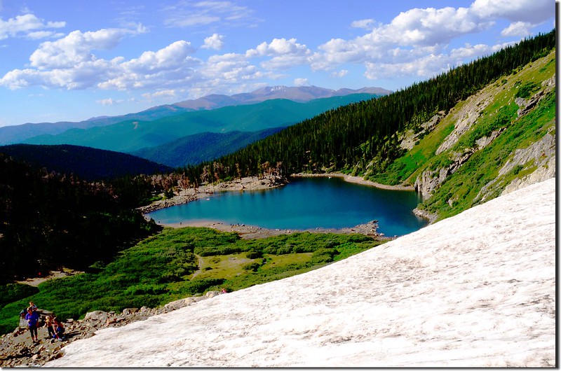
Saint Mary's Lake from Saint Mary's Glacier
早上的冰河因夜晚的低溫冰面蠻堅硬的,但也容易滑倒,我們取左切過冰河,切到冰河左岸後順著岩石坡的小徑上行。
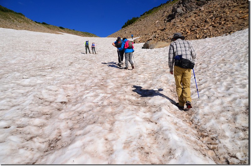
Beginning of the hike up the glacier
Saint Mary's Lake from Saint Mary's Glacier
早上的冰河因夜晚的低溫冰面蠻堅硬的,但也容易滑倒,我們取左切過冰河,切到冰河左岸後順著岩石坡的小徑上行。
Beginning of the hike up the glacier
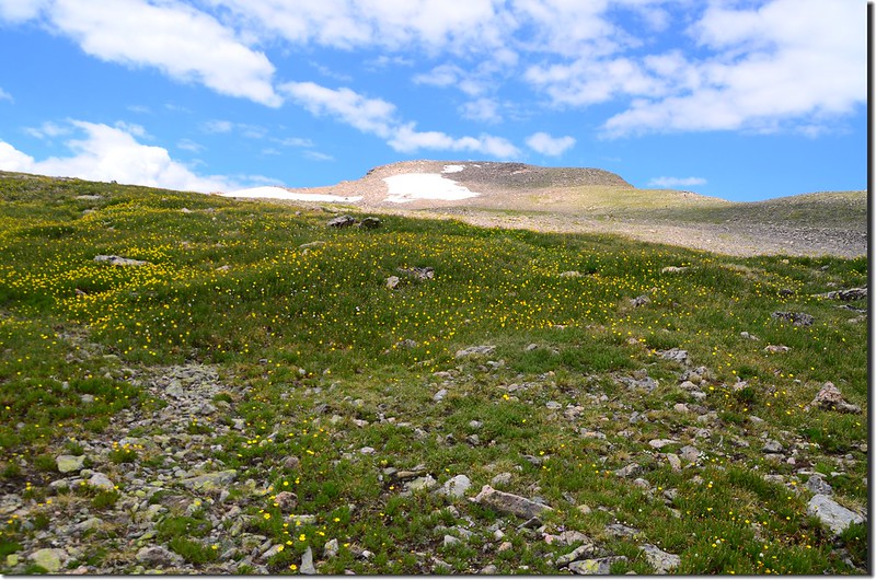
這段小徑上次7月初來時野花盛開,尤其是Alpine Sunflower、Sky Pilot綻放整個山坡,今天則看不到,應該是花期已過,僅看到寥寥幾株已凋謝的Alpine Sunflower。
James Peak Trail, Colorado
James Peak Trail, Colorado
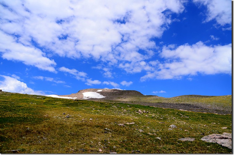
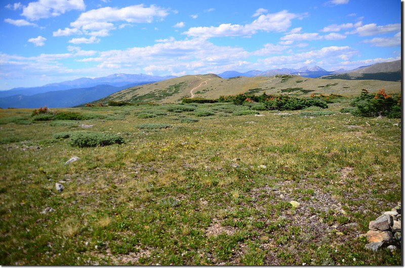
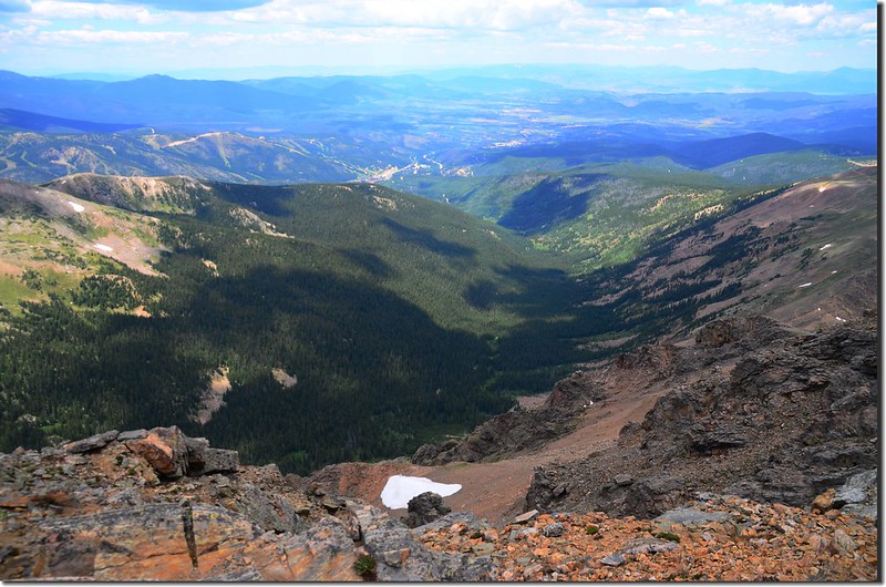
09:35 抵達冰河頂端,此處海拔約11,236 呎/ 3,425 公尺,距登山口約1.1哩;
這條冰河大約有五、六百公尺吧!爬升高度約一百多公尺左右;上到冰河頂端是一望無際的苔原,好壯觀哦!
Taken from the top of St. Mary's Glacier, background is James Peak
The
top of Saint Mary's glacier
Taken from the top of St. Mary's Glacier, background is James Peak
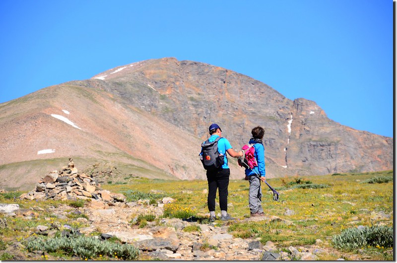
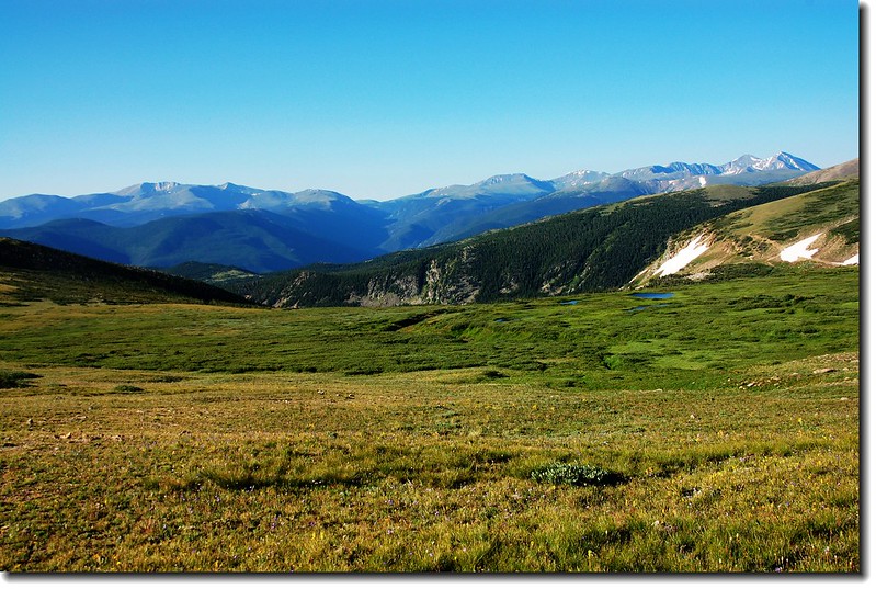
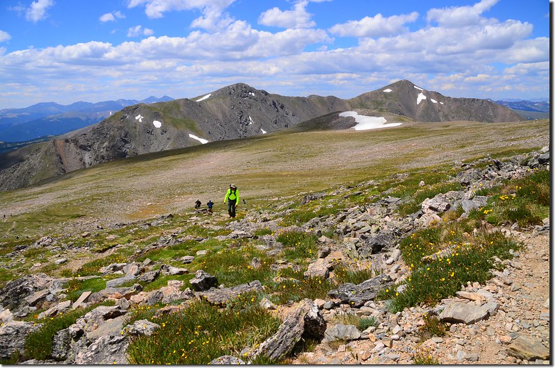
這裡是James Peak的東面山坡,走在苔原上往西一看,兩塊大山頭矗立在遠處;左邊雙駝峰的左側山頭是海拔13,250呎(4,039公尺)的Mount Bancroft,右邊即是今天的目的地James Peak;我們就在這寬廣的苔原上朝James Peak西進。
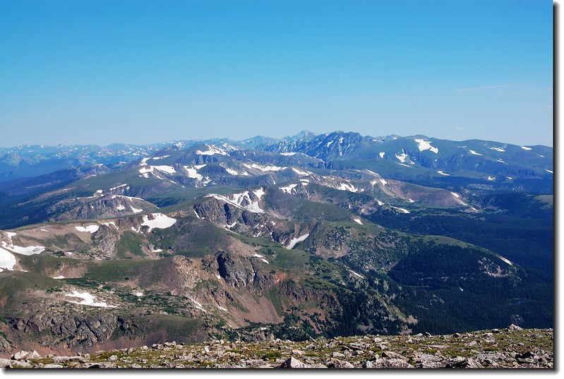
Looking at Mount Evans to Torreys Peak crest line from the Tundra
Looking south at Mount Evans from the Tundra above the glacier
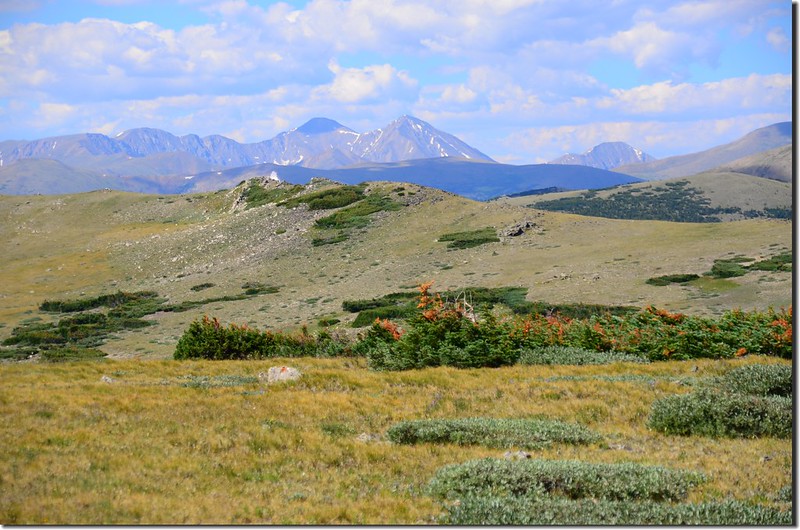
Looking southwest at Grays & Torreys Peak from the Tundra above the glacier
Looking at Mount Evans to Torreys Peak crest line from the Tundra
Looking south at Mount Evans from the Tundra above the glacier
Looking southwest at Grays & Torreys Peak from the Tundra above the glacier
10:05 抵達Kingston Peak Off-Road Trail(這是一條ATV-All-terrain vehicle車道) ,此處海拔約11,641 呎/ 3,548 公尺,距登山口約2.0哩;
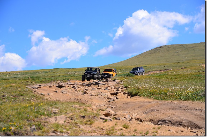
Kingston Peak Off-Road Trail
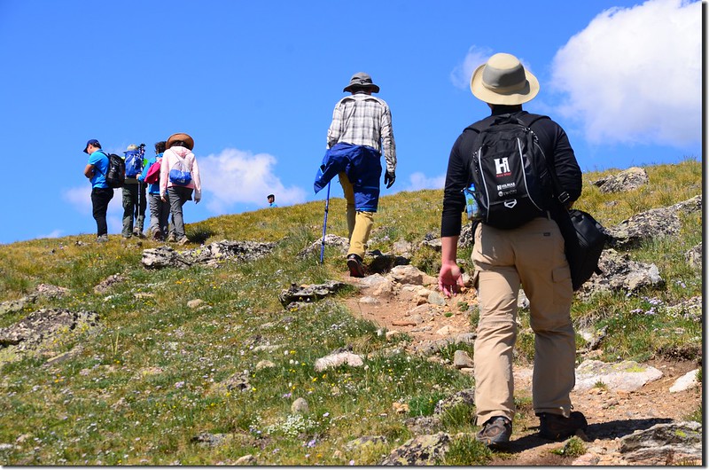
右轉沿ATV車道行一小段路後在一處小路標處左切橫過苔原地帶;
Crossing the wetland at James' east slope
此路段無明顯路徑,但寬闊的苔原上立有幾根路標還蠻容易辨識的;
The wetland at James' east slope
Crossing the wetland at James' east slope
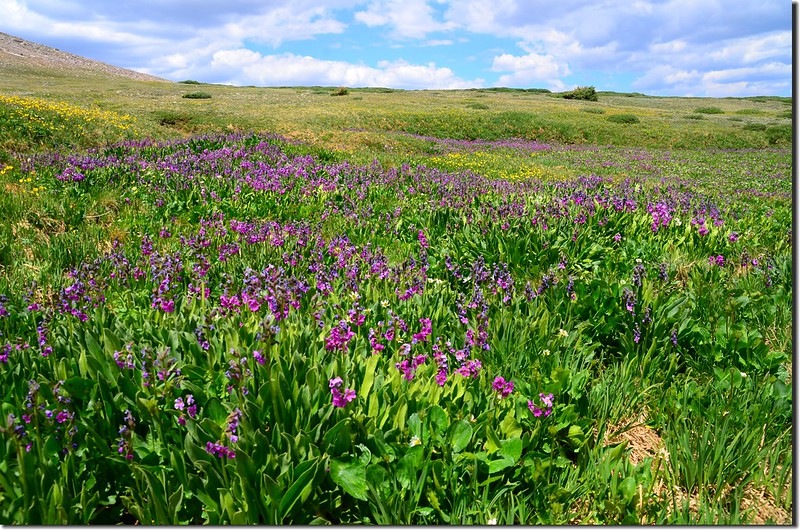
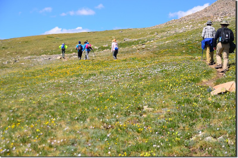
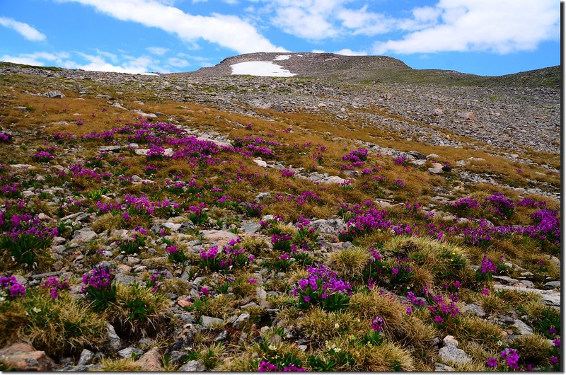
行一小段苔原地形後來到一處沼澤地,沼澤地野花盛開、美不勝收。
0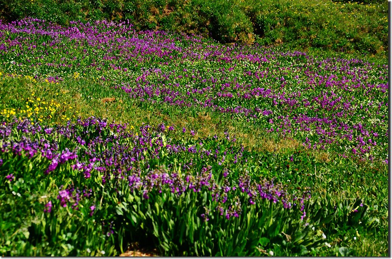
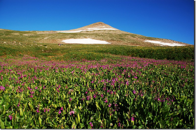
Wildflowers are Blooming along James Peak Trail
Kingston Peak Off-Road Trail
右轉沿ATV車道行一小段路後在一處小路標處左切橫過苔原地帶;
Crossing the wetland at James' east slope
此路段無明顯路徑,但寬闊的苔原上立有幾根路標還蠻容易辨識的;
The wetland at James' east slope
Crossing the wetland at James' east slope
行一小段苔原地形後來到一處沼澤地,沼澤地野花盛開、美不勝收。
0
Wildflowers are Blooming along James Peak Trail
涉過沼澤地後步道轉向往南上坡,坡度變陡,此處海拔約11,818 呎/ 3,602公尺,距登山口約2.5哩;
On the way up to James' summit
Looking at the summit of James Peak from the trail
On the way up to James' summit
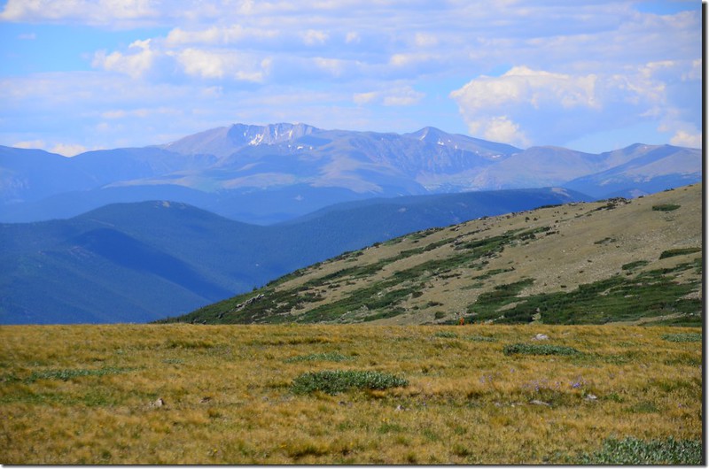
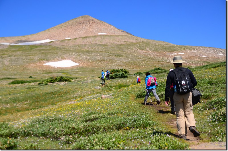
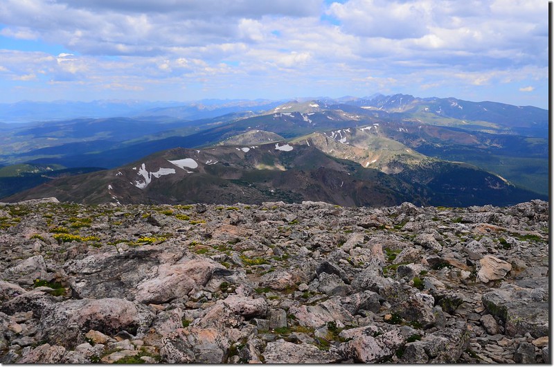
一路在James Peak的東面山坡“之”字形挺進,沿途南眺Mount Evans、Mount Bierstadt、Grays Peak和Torreys Peak等幾座14ers。
Mount Evans to Torreys Peak crest line from James' slope
On the way up to James' summit
Looking at the summit of James Peak from the trail
On the way up to James' summit
一路在James Peak的東面山坡“之”字形挺進,沿途南眺Mount Evans、Mount Bierstadt、Grays Peak和Torreys Peak等幾座14ers。
Mount Evans to Torreys Peak crest line from James' slope
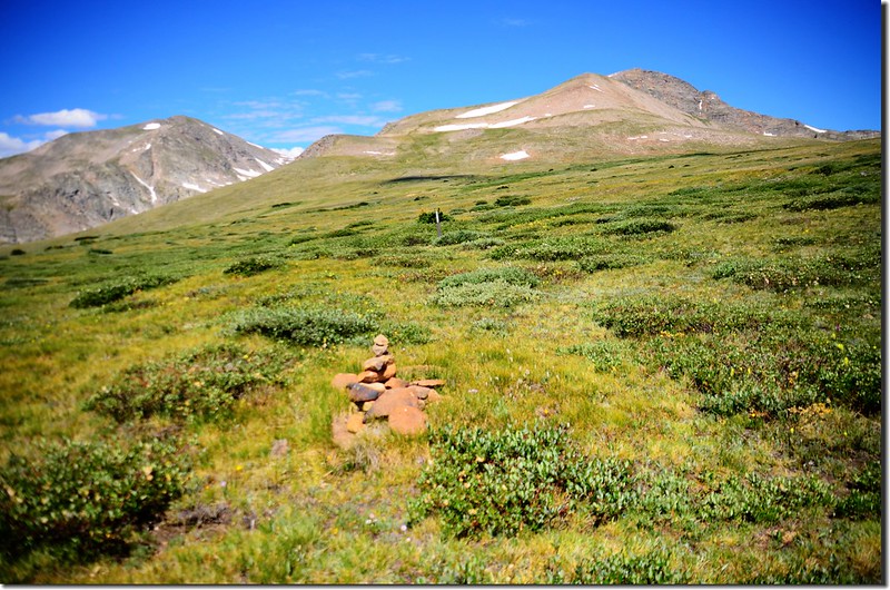
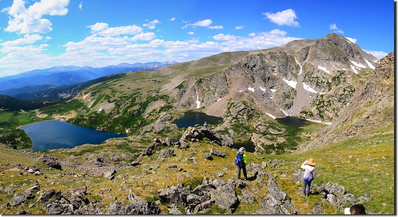
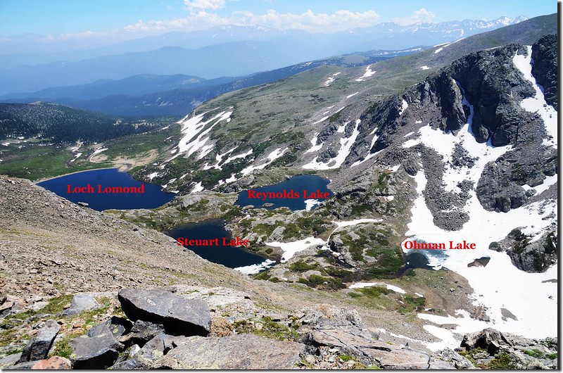
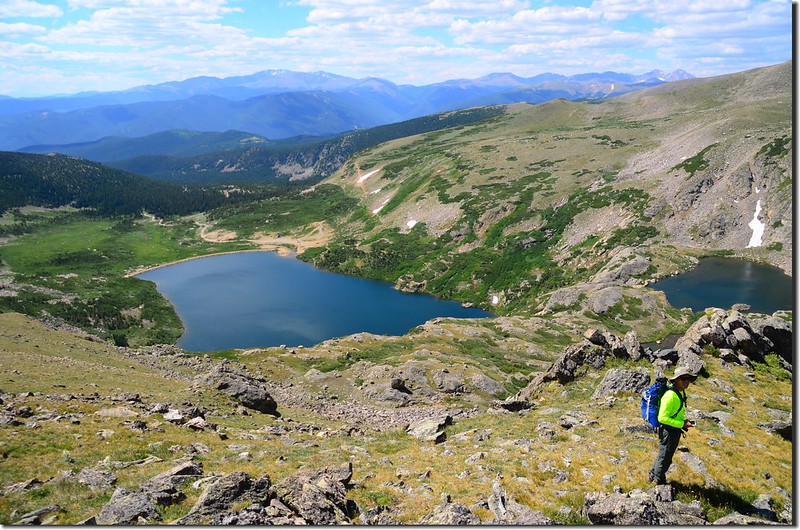
10:45 左側一條小徑來接,岔路口有一堆cairn,此小徑是由Loch Lomond上來的小徑,此處海拔約12,020呎/ 3,664公尺,距登山口約2.8哩;過了岔路口步道偏右往山頂緩坡上升。
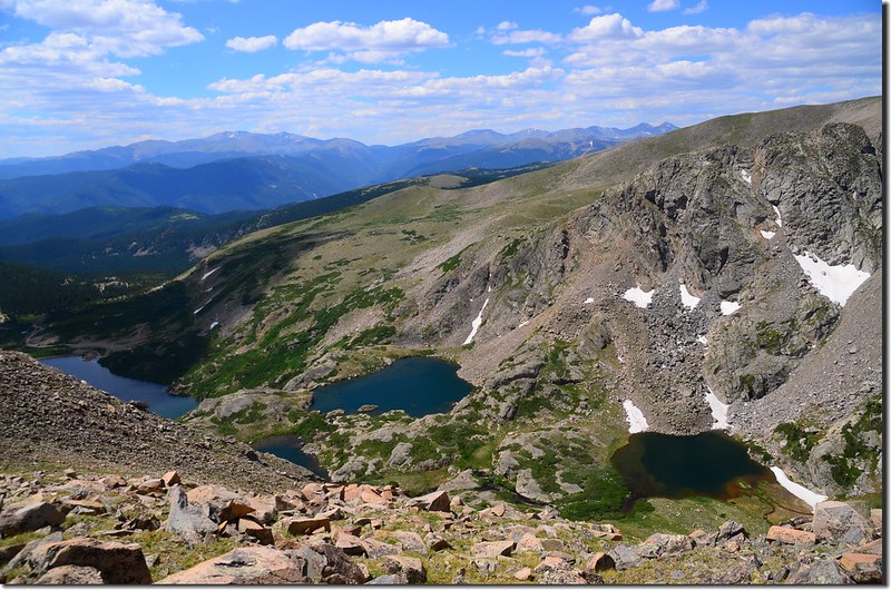
10:48 抵達一峭壁口,左下是Loch Lomond drainage,幾座小湖星盤羅列著,此處海拔約12,195呎/ 3,717公尺,距登山口約3.0哩;
Looking down at the Loch Lomond drainange from James Peak trail
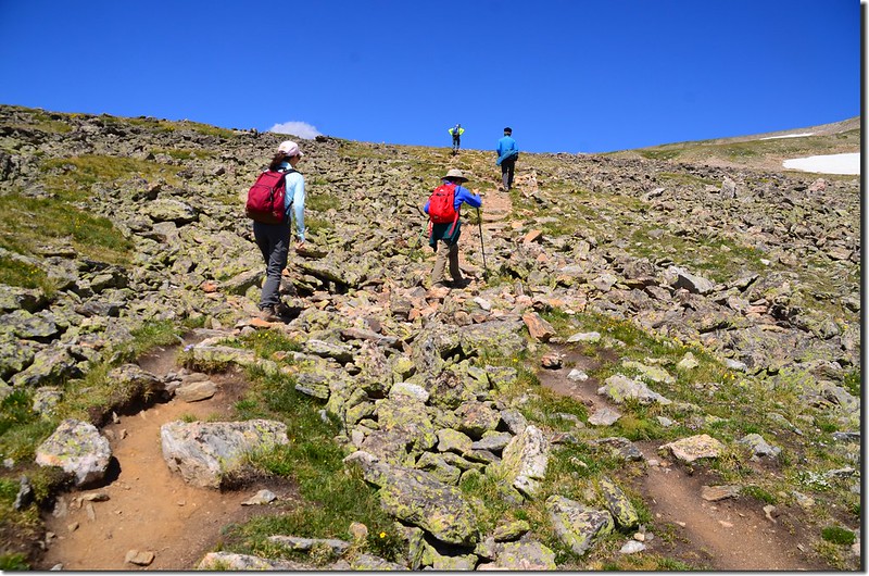
通過峭壁口後步道繼續在岩石坡陡升。
Looking down at the Loch Lomond drainange from James Peak trail
On the way up to James' summit
On the way up to James' summit
Looking down at the Loch Lomond drainange from James Peak trail
通過峭壁口後步道繼續在岩石坡陡升。
Looking down at the Loch Lomond drainange from James Peak trail
On the way up to James' summit
On the way up to James' summit
11:07 陡坡上到一制高點,此處又可俯瞰Loch Lomond drainage幾座高山湖,介於James Peak 和Mount Bancroft間的Ice Lake也清晰可見。
Looking down at the Loch Lomond drainange from James Peak trail
Ice Lake at the foot of Mount Bancroft
Looking down at the Loch Lomond drainange from James Peak trail
Ice Lake at the foot of Mount Bancroft
11:20 登抵James Peak山頭下一苔原鞍部,此處海拔約12,535呎/ 3,821公尺,距登山口約3.4哩;
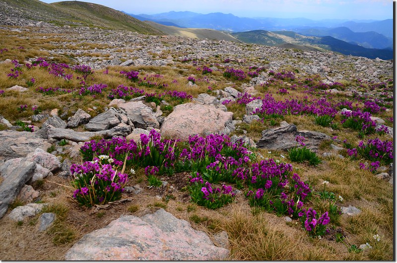
Fairy Primrose
步道轉向西北朝山頂下方腰繞過,然後朝山頂“之”字形爬升。
On the way up to James' summit
Looking south at Parry Peak & Mount Bencroft from below the summit of James Peak
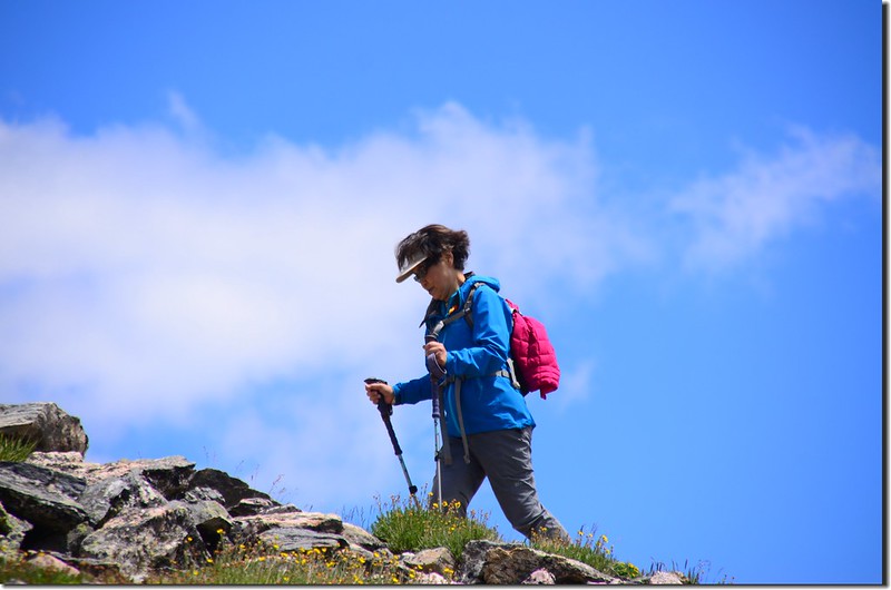
On the way up to James' summit
Fairy Primrose
步道轉向西北朝山頂下方腰繞過,然後朝山頂“之”字形爬升。
On the way up to James' summit
Looking south at Parry Peak & Mount Bencroft from below the summit of James Peak
On the way up to James' summit
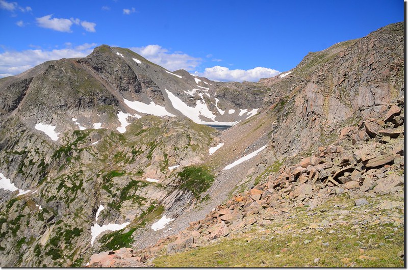
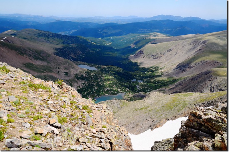
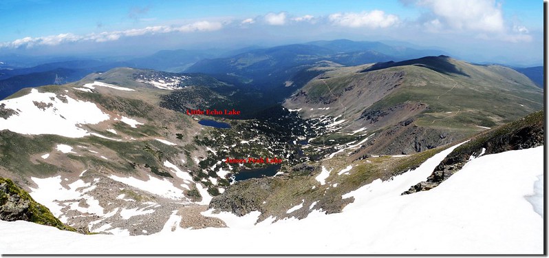
12:00 右側一峽谷,俯瞰右側Mammoth Gulch中的Little Echo Lake和James Peak Lake;
Looking down at Mammoth Gulch from James Peak trail
此處海拔約12,880呎/ 3,926公尺,距登山口約3.8哩,已接近山頂。
Looking down at Mammoth Gulch from James Peak trail
此處海拔約12,880呎/ 3,926公尺,距登山口約3.8哩,已接近山頂。
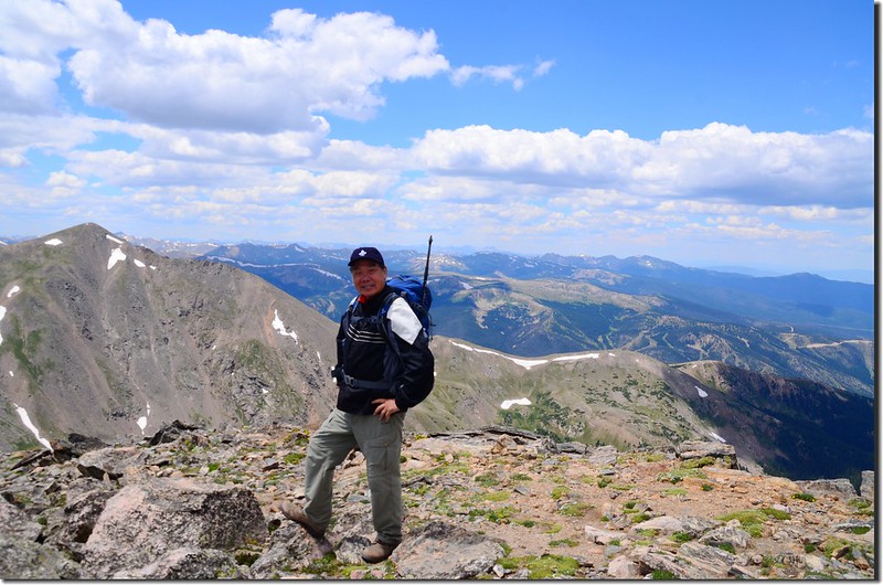
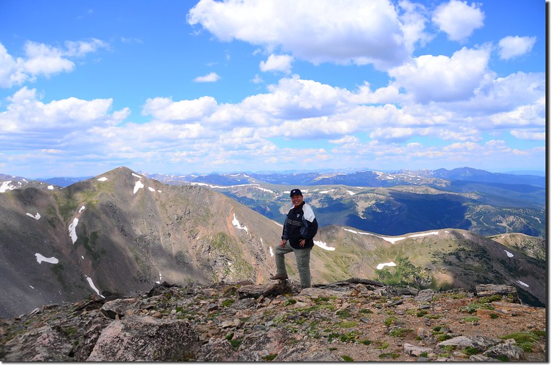
12:15 登頂James Peak,海拔13,294呎(4, 052公尺),這裡地處落磯山脈大陸分水嶺 ,西邊是Winter Park滑雪勝地;
Taken from the summit of James Peak
Looking northwest at Winter Park from James' summit
北望Indian Peaks和落磯山脈連稜;
Looking north at Rockies from James Peak summit
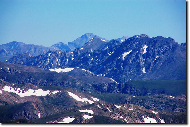
View to North from James' summit, Longs Peak is in the distance
南邊最近的兩個山頭即是同是13ers的Parry Peak和Mt. Bancroft;
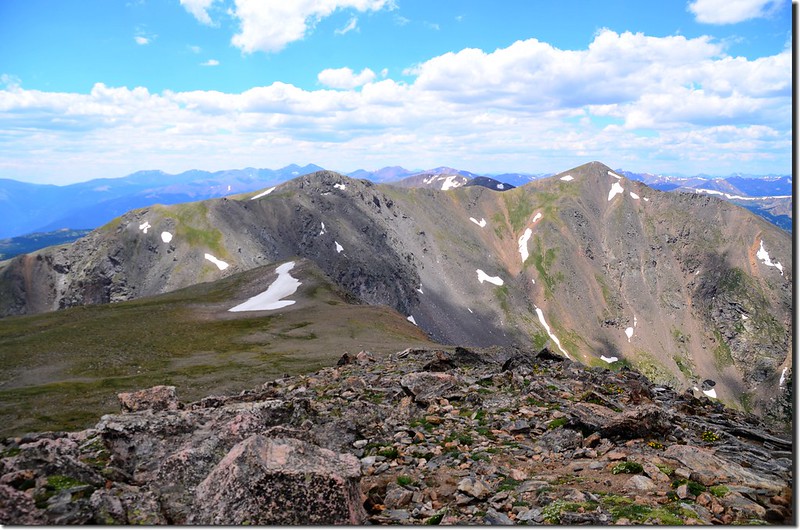
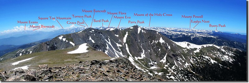
View to South from James' summit
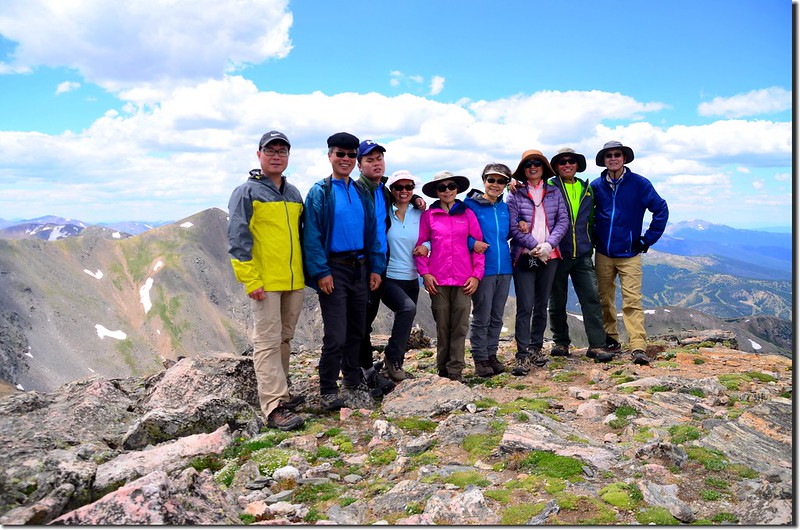
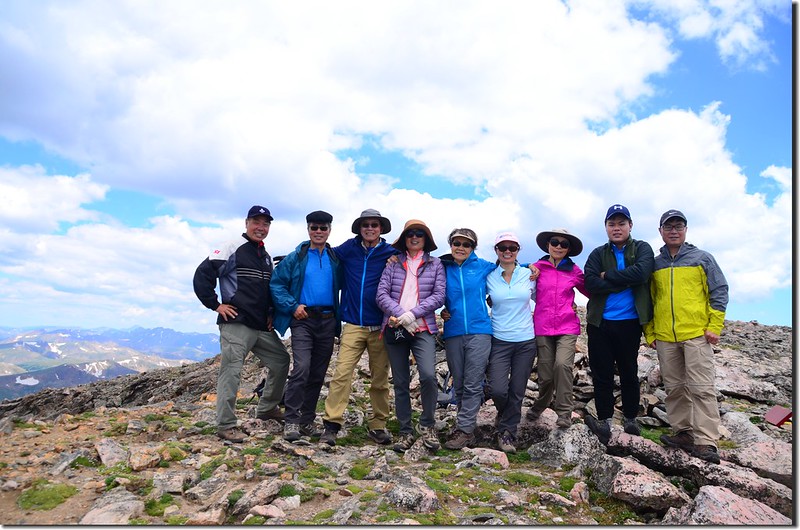
我們在山頂一座石頭圍成的避風處(rock shelter)休息午餐。
Taken from the summit of James Peak
Taken from the summit of James Peak
Looking northwest at Winter Park from James' summit
北望Indian Peaks和落磯山脈連稜;
Looking north at Rockies from James Peak summit
View to North from James' summit, Longs Peak is in the distance
南邊最近的兩個山頭即是同是13ers的Parry Peak和Mt. Bancroft;
View to South from James' summit
我們在山頂一座石頭圍成的避風處(rock shelter)休息午餐。
Taken from the summit of James Peak
12:55 休息40分鐘後循原路下山。
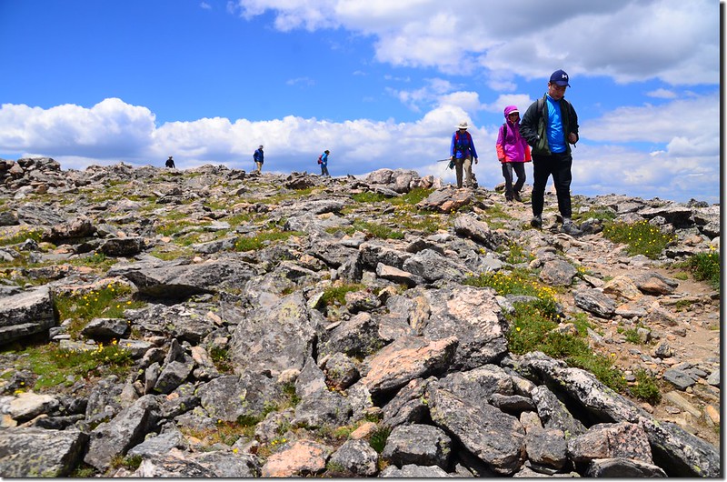
Going down from James Peak

Going down from James Peak
Going down from James Peak
Going down from James Peak
14:00 下抵沼澤地區,拍拍野花後續行下山。
14:40 抵達Saint Mary's Glacier頂端,這次我順著冰河下行,因為冰河經過日曬有點鬆軟比較好走了!
15:15 回到Saint Mary's Lake,等全員到齊後再一起下山。
16:00 回到停車場,稍作整裝後下山。
沒有留言:
張貼留言