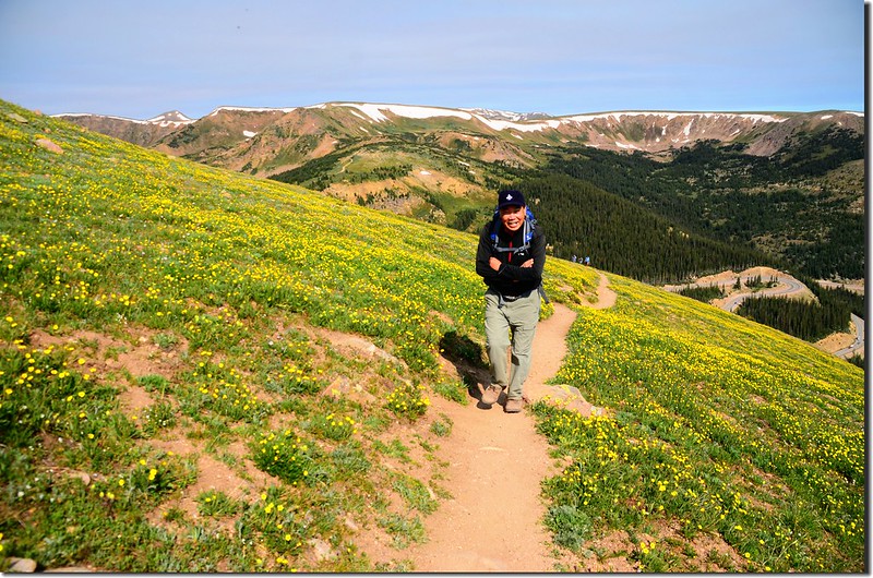
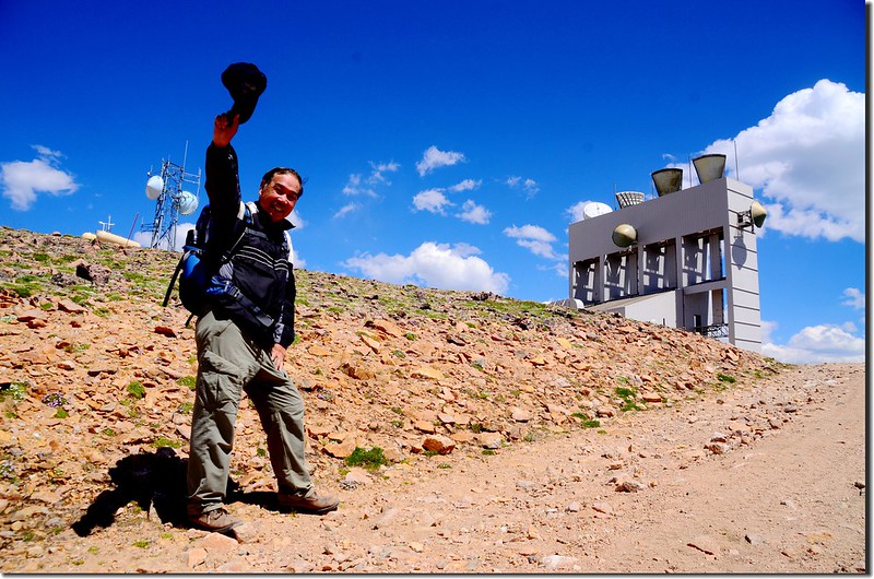
週一和小外孫貝貝前往Berthoud Pass登山口攀登James Peak Wilderness區內的Mount Flora(13,132呎/4,003公尺)、Breckenridge Peak(12,889呎/3,929公尺)和Colorado Mines Peak(12,497呎/3,809公尺)三座大陸分水嶺上的高山,當天天氣晴朗,山上溫度華氏五十幾度,非常舒服的登山行程。
~~~~~~~~~~~~~~~~~~~~~~~~~~~~~~~~~~~~~~~~~~~~~~~~~~~~~~~~~~~~~
攀登山頭:
Mount Flora:海拔13,132呎(4,003公尺)
Breckenridge Peak:海拔12,889呎(3,929公尺)
Colorado Mines Peak:海拔12,497呎(3,809公尺)
登山里程:來回約9.2哩(14.72公里)
總爬升高度:3177呎(968公尺)
登山時間:7小時35分
~~~~~~~~~~~~~~~~~~~~~~~~~~~~~~~~~~~~~~~~~~~~~~~~~~~~~~~~~~~~~
行車資訊:
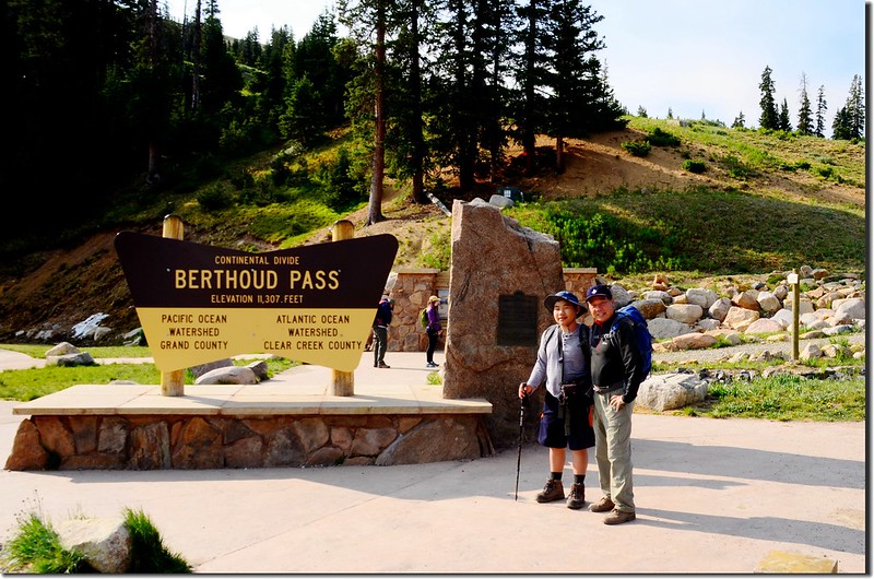
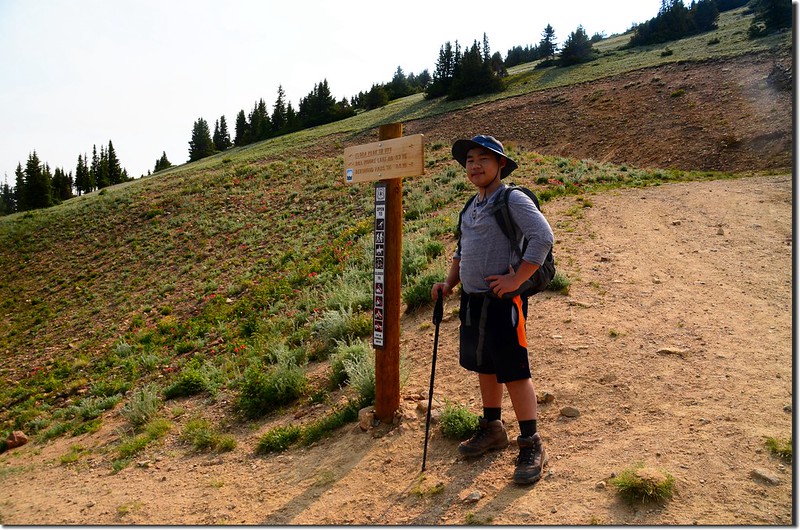
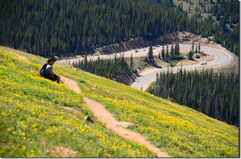
由Thornton開車經I-25轉I-76、I-70西行,行至I-70里程232哩時由Exit-232下交流道,然後右轉沿U.S. 40 西行,行約14.5哩抵達道路最高點大陸分水嶺Berthoud Pass,道路右側有一大型停車場和一座避難和休息用的warming hut,此處為洛磯山脈大陸分水嶺,北邊屬於太平洋水系,南邊屬於大西洋水系,此處也是Berthoud Pass登山口,海拔11,307呎(3,446公尺),將車子停在停車場。
步程簡述:
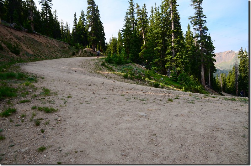
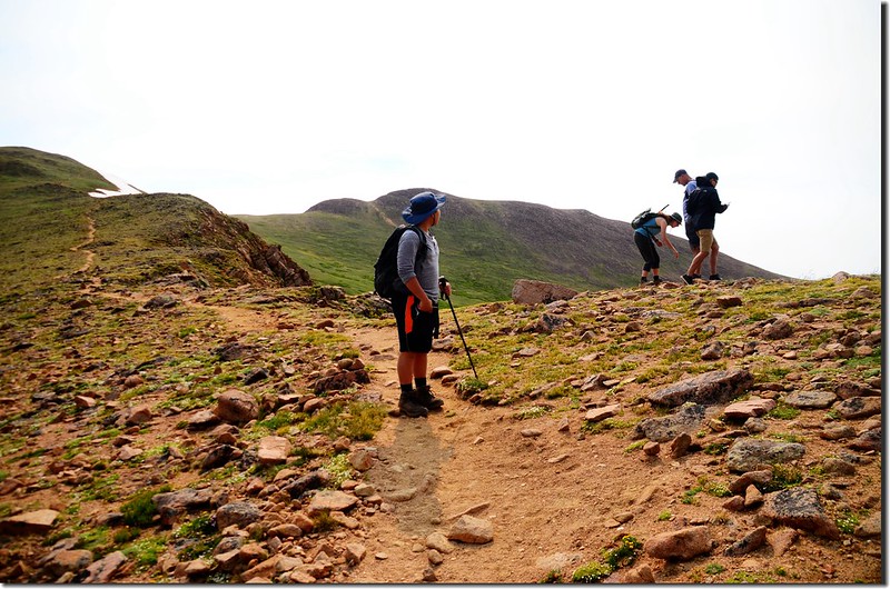
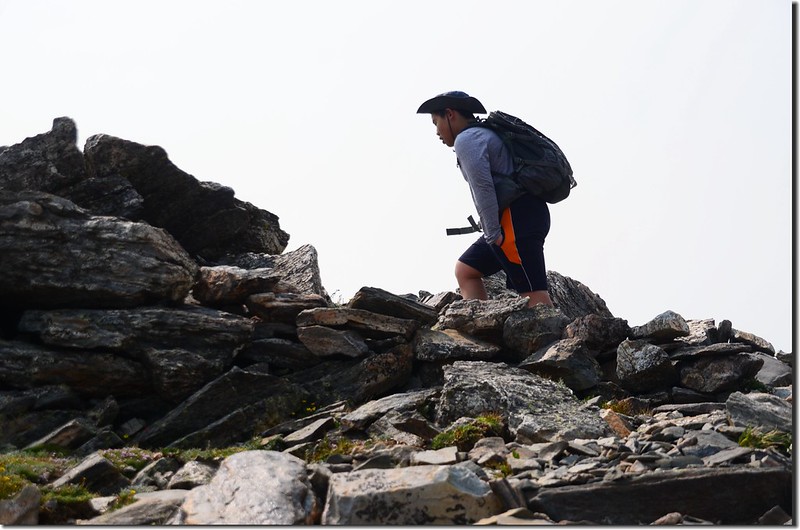
08:30 登山口起登,Mount Flora的登山口是在US 40公路右側(東),也就是停車場這邊;
Berthoud Pass Trailhead
登山口有一條寬大的土石車道,此土石車道可行車通往Colorado Mines Peak的山頂,這條土石車道的前半段也是登Mount Flora的登山步道,在此土石車道的左側另有一條捷徑通往Colorado Mines Peak半山腰接Mount Flora的登山步道,我們先沿可行車的土石車道往上爬,土石車道”之”字形爬升。
Colorado Mines Peak road
Looking west across Berthoud Pass at the ridge leading to Stanley Mountain
Berthoud Pass Trailhead
登山口有一條寬大的土石車道,此土石車道可行車通往Colorado Mines Peak的山頂,這條土石車道的前半段也是登Mount Flora的登山步道,在此土石車道的左側另有一條捷徑通往Colorado Mines Peak半山腰接Mount Flora的登山步道,我們先沿可行車的土石車道往上爬,土石車道”之”字形爬升。
Colorado Mines Peak road
Looking west across Berthoud Pass at the ridge leading to Stanley Mountain
08:57 抵達道路左側一小徑岔路,路牌標示通往Mount Flora,右側土石車道續行通往Colorado Mines Peak山頂,取左小徑往Mount Flora;
Colorado Mines Peak road & Mount Flora Trail junction
此處海拔約11,675呎(3,559公尺),已出了森林線,距登山口約0.85哩。
Colorado Mines Peak road & Mount Flora Trail junction
此處海拔約11,675呎(3,559公尺),已出了森林線,距登山口約0.85哩。
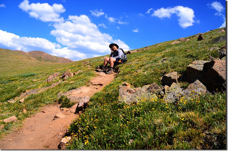
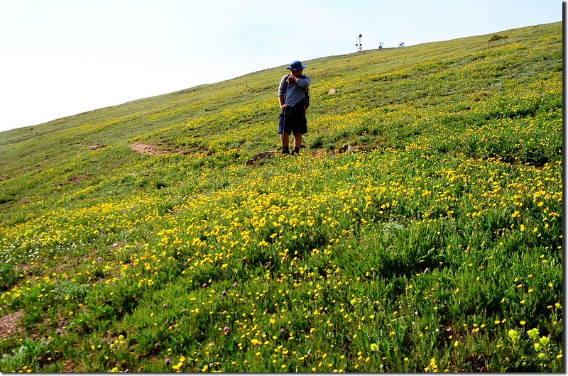
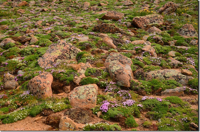
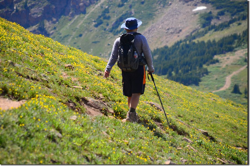
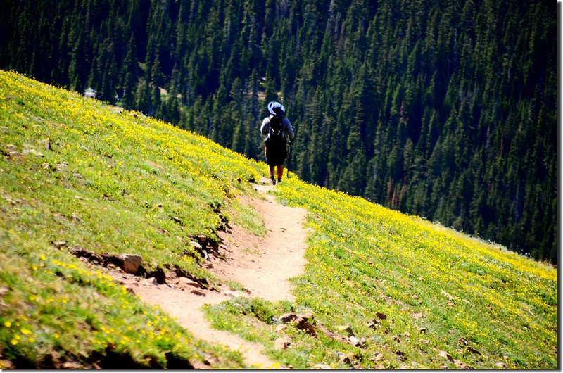
此後小徑在Colorado Mines Peak西面坡山腰朝東北緩升,整面山坡是苔原地貌,長滿苔原短草及花卉,花卉正盛開著;
Wildflowers blooming along the trail
當海拔爬升至約11,800呎後小徑轉到Colorado Mines Peak北面坡朝東緩升,兩旁綻放的野花行走其中有如徜徉在花叢中,真是一種享受!
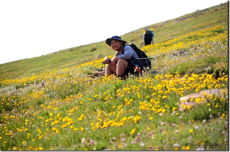
Wildflowers blooming along the trail
Wildflowers blooming along the trail
當海拔爬升至約11,800呎後小徑轉到Colorado Mines Peak北面坡朝東緩升,兩旁綻放的野花行走其中有如徜徉在花叢中,真是一種享受!
Wildflowers blooming along the trail
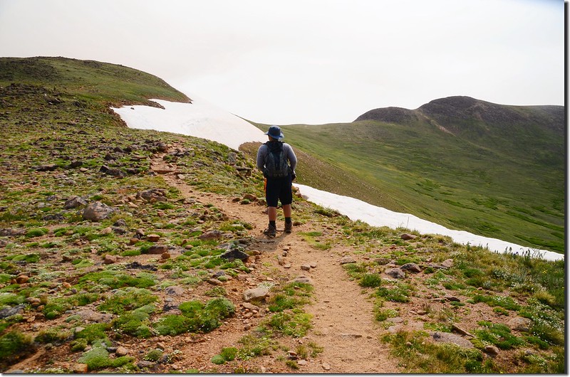
09:47 抵達Colorado Mines Peak和Mount Flora間的鞍部,此處海拔12,157呎(3,705公尺),距登山口約1.6哩(2.56公里)。
Saddle below Colorado Mines Peak
Saddle below Colorado Mines Peak
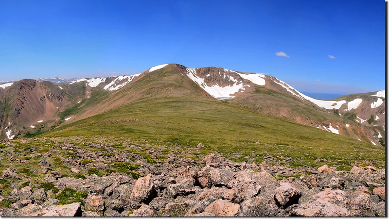
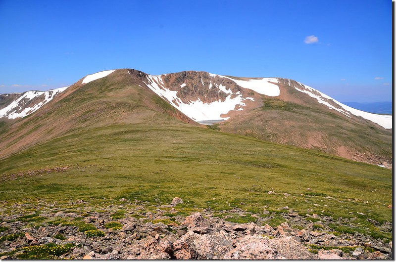
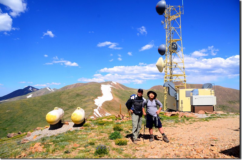
在鞍部上右邊(南)是Colorado Mines Peak,山頂上雷達設施是美國聯邦航空局空中交通管制設施;
Looking southwest at Colorado Mines Peak from Mount Flora Trail
左邊(北)是通往Mount Flora的路線,正前方(東南)向下俯瞰Blue Creek流域,Blue Creek最上游湛藍的小湖是Blue Lake;
Looking down at Blue Lake & Blue Creek drainaga from the saddle below Colorado Mines Peak
Looking down at Blue Lake from the saddle below Colorado Mines Peak
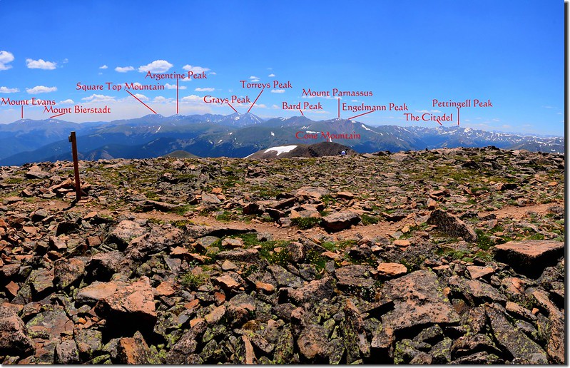
鞍部往南極目遠眺則可將Mount Evans、Mount Bierstadt、Grays Peak和Torreys Peak四座14ers盡收眼底。
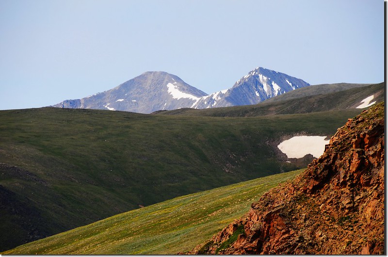
Looking southwest at Grays Peak & Torreys Peak from the saddle below Colorado Mines Peak
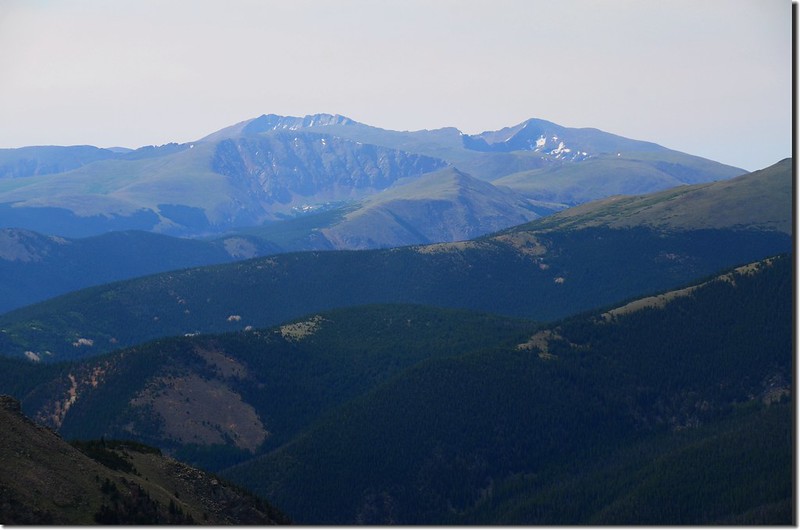
Looking south at Mount Evans & Mount Bierstadt from the saddle below Colorado Mines Peak
Looking southwest at Colorado Mines Peak from Mount Flora Trail
左邊(北)是通往Mount Flora的路線,正前方(東南)向下俯瞰Blue Creek流域,Blue Creek最上游湛藍的小湖是Blue Lake;
Looking down at Blue Lake & Blue Creek drainaga from the saddle below Colorado Mines Peak
Looking down at Blue Lake from the saddle below Colorado Mines Peak
鞍部往南極目遠眺則可將Mount Evans、Mount Bierstadt、Grays Peak和Torreys Peak四座14ers盡收眼底。
Looking southwest at Grays Peak & Torreys Peak from the saddle below Colorado Mines Peak
Looking south at Mount Evans & Mount Bierstadt from the saddle below Colorado Mines Peak
在鞍部小休後取左朝Mount Flora往東北爬升,這一段路有點陡,一路在稜線上爬升。
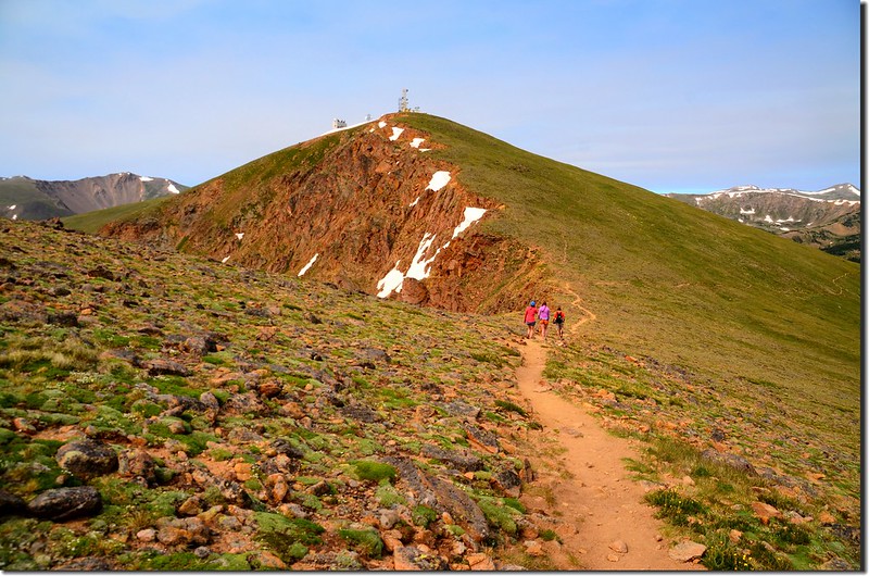
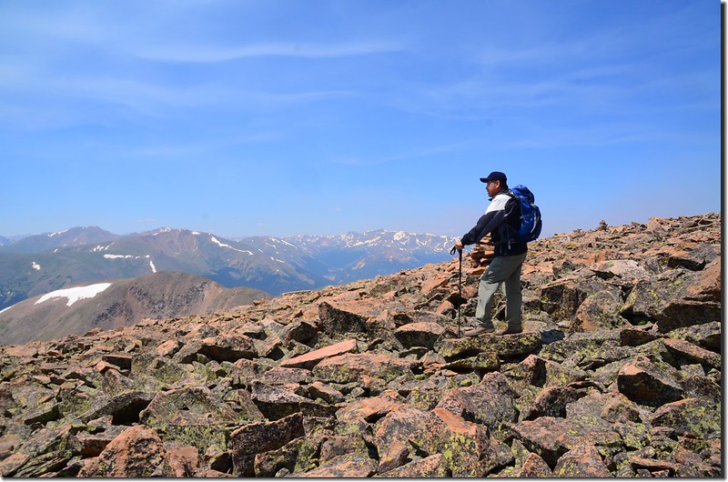
10:35 由Mount Flora前假山頭腰繞而過,海拔約12,723呎(3,878公尺),距登山口約2.35哩;
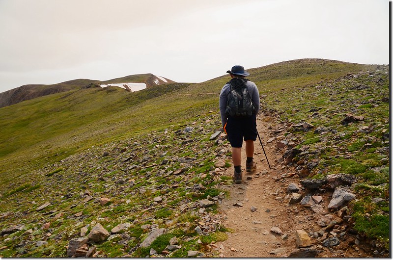
Jacob on the false summit of Mount Flora
過了假山頭後步道坡度趨緩,Mount Flora山頂在望。
On the way up to Mount Flora
Tundra wildflower on the slope of Mount Flora
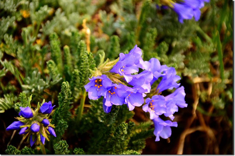
Sky Pilot
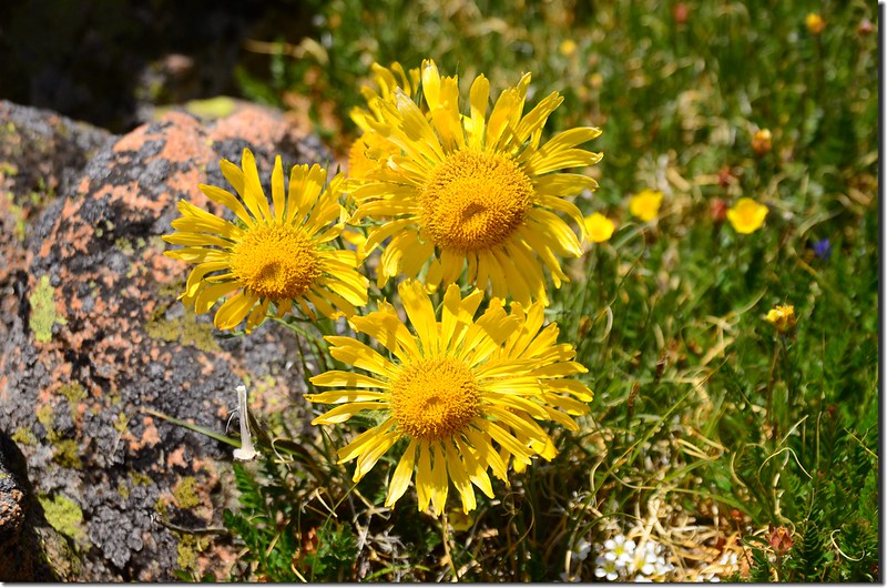
Alpine sunflowers, also known as 'old man of the mountain'
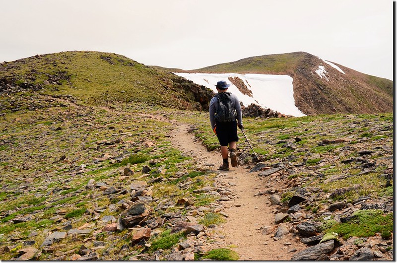
Jacob on his way up to Mount Flora
Jacob on the false summit of Mount Flora
過了假山頭後步道坡度趨緩,Mount Flora山頂在望。
On the way up to Mount Flora
Tundra wildflower on the slope of Mount Flora
Sky Pilot
Alpine sunflowers, also known as 'old man of the mountain'
Jacob on his way up to Mount Flora
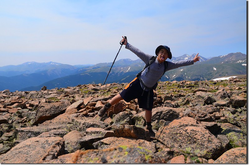
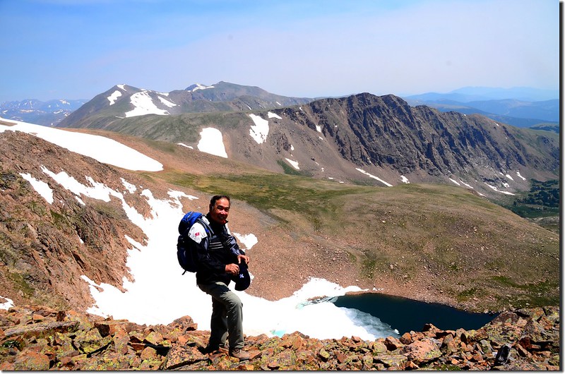
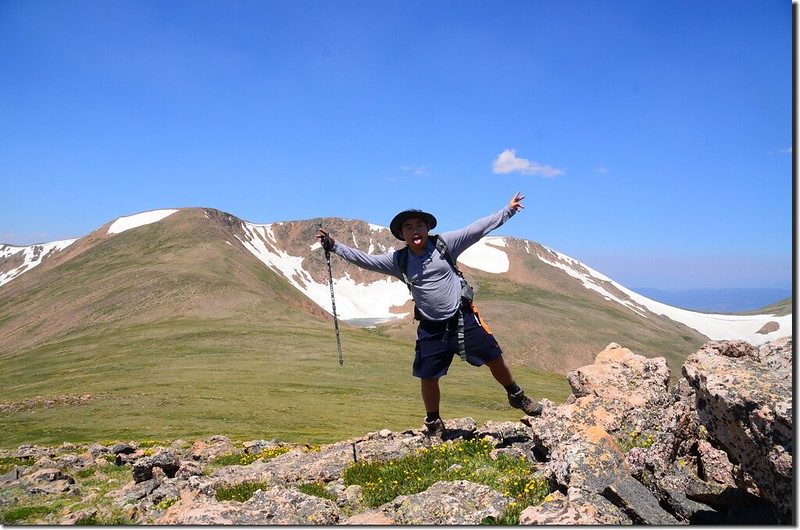
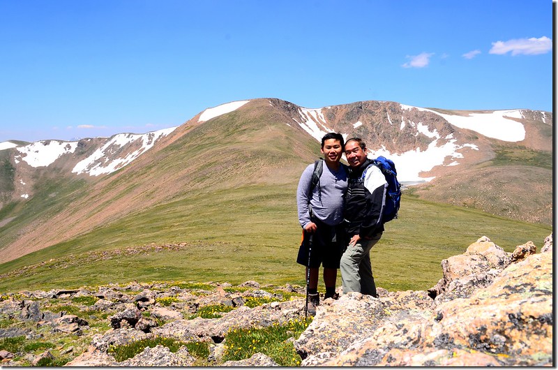
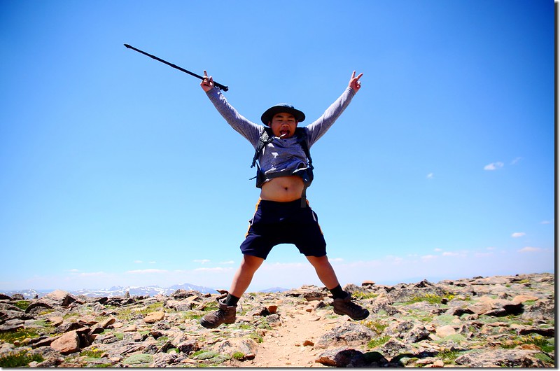
11:12 登頂Mount Flora,Mount Flora海拔13,132呎(4,003公尺),距登山口約3.22哩(5.15公里);
Taken from the summit of Mount Flora
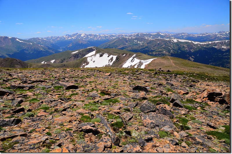
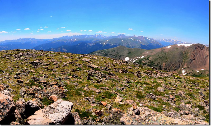
山頂是一片寬平的岩石平台,從山頂往北極眺是一望無際的洛磯山脈;
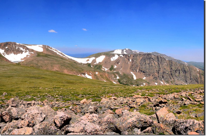
Looking northeast at James Peak Wilderness area from Mount Flora's summit
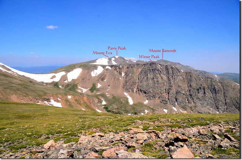
東北方較近的幾個山頭是James Peak Wilderness區內的Mount Eva、Parry Peak、James Peak和Mount Bancroft等四座13ers;
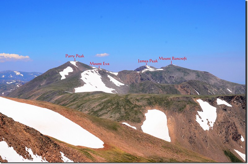
Looking northeast at James Peak Wilderness mountain from Mount Flora
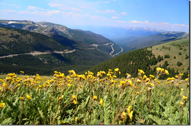
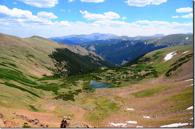
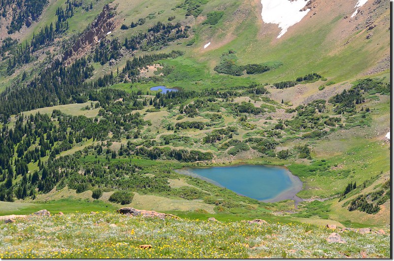
俯瞰東邊的山谷是Mill Creek流域,其源頭的湖泊Ethel Lake約有三分之一的湖面還是處於冰凍狀態,融冰的湖面則是湛藍一片;
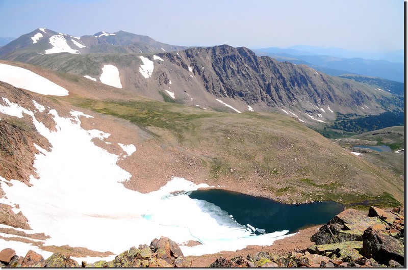
Looking down Ethel Lake from Mount Flora's summit
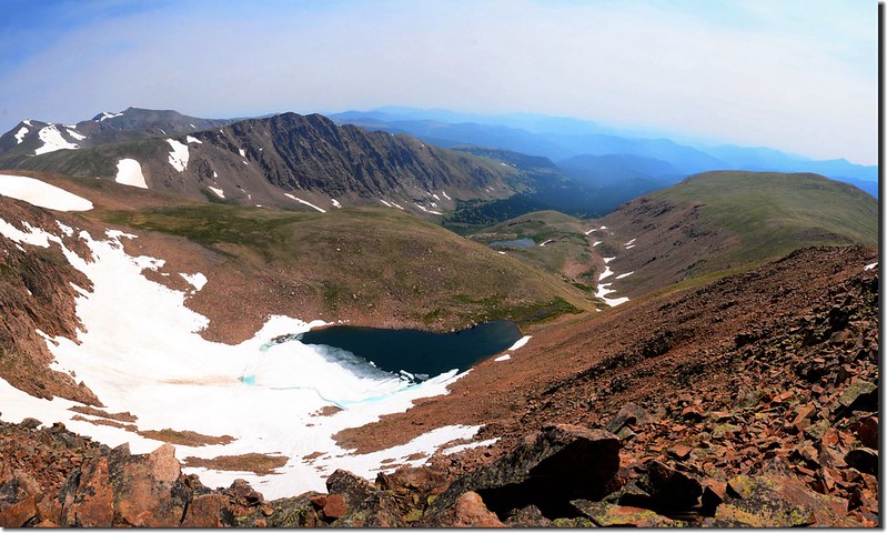
Looking down Ethel Lake & the Mill Creek drainage from Mount Flora's summit
Taken from the summit of Mount Flora
東邊往下延伸的稜線可到Breckenridge Peak,那是等一下我們要去的山頭;南邊遠方則是Mount Evans等四座14ers。
Looking southwest from Mount Flora's summit
Taken from the summit of Mount Flora
山頂是一片寬平的岩石平台,從山頂往北極眺是一望無際的洛磯山脈;
Looking northeast at James Peak Wilderness area from Mount Flora's summit
東北方較近的幾個山頭是James Peak Wilderness區內的Mount Eva、Parry Peak、James Peak和Mount Bancroft等四座13ers;
Looking northeast at James Peak Wilderness mountain from Mount Flora
俯瞰東邊的山谷是Mill Creek流域,其源頭的湖泊Ethel Lake約有三分之一的湖面還是處於冰凍狀態,融冰的湖面則是湛藍一片;
Looking down Ethel Lake from Mount Flora's summit
Looking down Ethel Lake & the Mill Creek drainage from Mount Flora's summit
Taken from the summit of Mount Flora
東邊往下延伸的稜線可到Breckenridge Peak,那是等一下我們要去的山頭;南邊遠方則是Mount Evans等四座14ers。
Looking southwest from Mount Flora's summit
Mount Flora的山頂有一座石頭圍成的避風處(rock shelter),在美國幾乎每座高山山頂都有此種登山客自行堆砌的避風處,今天山頂沒其他登山客,我和貝貝躲在裡面用餐,山頂風蠻大的!

The rock shelter on the summit of Mount Flora
The rock shelter on the summit of Mount Flora
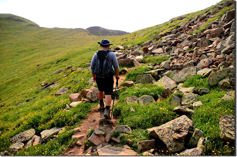
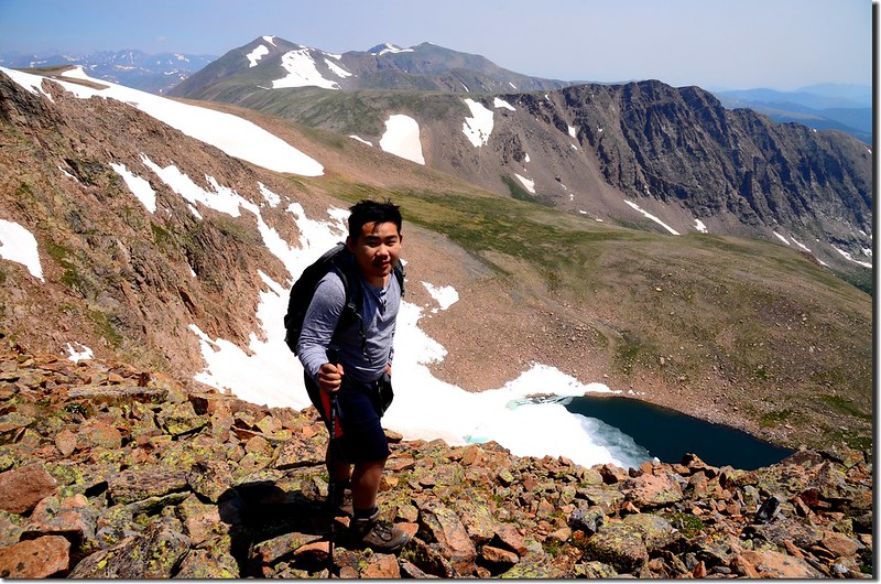
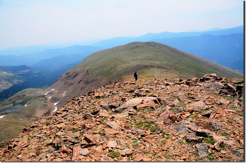
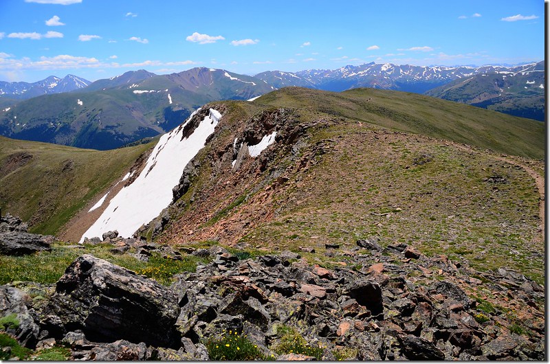
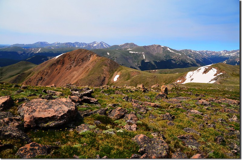
12:00 離開Mount Flora山頂,沿著Mount Flora的東稜下行前往Breckenridge Peak,Breckenridge Peak比Mount Flora矮了243呎(74公尺),所以一開始是一段下坡,還好坡度不是很大,路徑還算好走。
The hike to Breckenridge Peak adds 1.8 miles and 550' of total climbing from Mt Flora
Looking southwest from below Mount Flora's summit
The hike to Breckenridge Peak adds 1.8 miles and 550' of total climbing from Mt Flora
Looking southwest from below Mount Flora's summit
12:18 下到Mount Flora和Breckenridge Peak之間鞍部最低點,海拔12,748呎(3,886公尺),距Mount Flora山頂約0.63哩(1,08公里);自此明顯的路徑稍偏左由Breckenridge Peak的北面坡邀繞過下山,而Breckenridge Peak的山頂是在偏右方高處,沒有明顯的路徑,必須自行循路往高處爬,切勿沿明顯路徑下行。
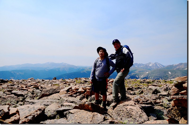
12:45 登上Breckenridge Peak,海拔12,889呎(3,929公尺),距Mount Flora山頂約0.9哩(1,44公里);
Taken from the summit of Breckenridge Peak
Breckenridge Peak山頂也有極佳的展望,在山頂稍作停留後開始往Mount Flora回走。
Looking northwest at Mount Flora from Breckenridge Peak's summit
Looking northeast at Mount Eva et al. from Breckenridge Peak's summit
Looking north at James Peak Wilderness mountain from Breckenridge Peak
Looking south from Breckenridge Peak's summit
View of the Ethel Lake cirque from Breckenridge Peak
13:35 回到Mount Flora小休一下隨即下山,打算再攀登Colorado Mines Peak。
Taken from the summit of Mount Flora
Looking south at Grays Peak et al mountains from the trail below Mount Flora's summit
Taken from the summit of Mount Flora
Looking south at Grays Peak et al mountains from the trail below Mount Flora's summit
14:35 返抵Colorado Mines Peak和Mount Flora間的鞍部,右下是下山路,取右上朝西南往Colorado Mines Peak上山,上山小徑在Colorado Mines Peak北面坡腰繞上山。
14:50 登山小徑行約1,600呎(488公尺)接到Colorado Mines Peak的土石車道,海拔約12,387呎(3,776公尺),取左沿土石車道上山。
Colorado Mines Peak Road near the summit
Colorado Mines Peak Road near the summit
Colorado Mines Peak Road near the summit
Colorado Mines Peak Road near the summit
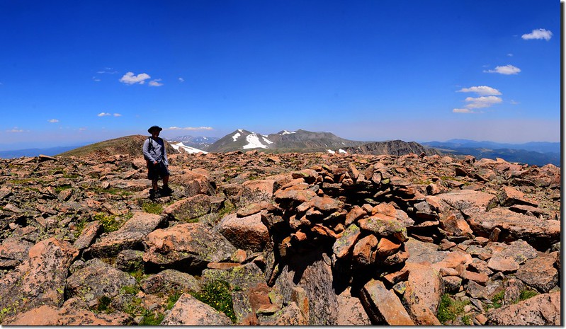
15:00 土石車道行約1,050呎(320公尺)抵達Colorado Mines Peak山頂,山頂有許多美國聯邦航空管制用的雷達設施;
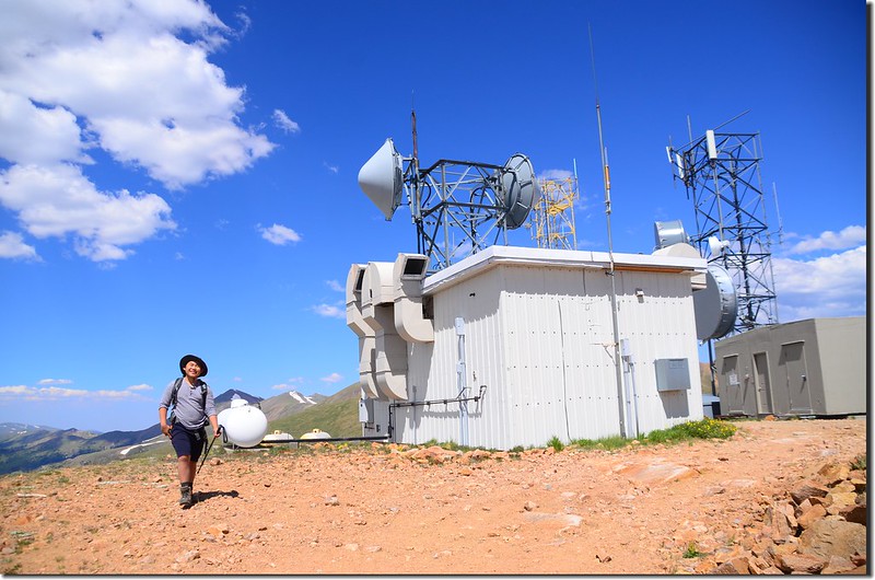
Taken from the summit of Colorado Mines Peak
我們在山頂稍事休息後循原路下山。
Taken from the summit of Colorado Mines Peak
我們在山頂稍事休息後循原路下山。
15:18 下道土石車道和山腰小徑岔路,可取左沿土石車道下山,我們取右循原路下山。
15:30 下到Colorado Mines Peak和Mount Flora間的鞍部取左下山,沿途慢走欣賞野花。
Wildflowers blooming along the trail
Wildflowers blooming along the trail
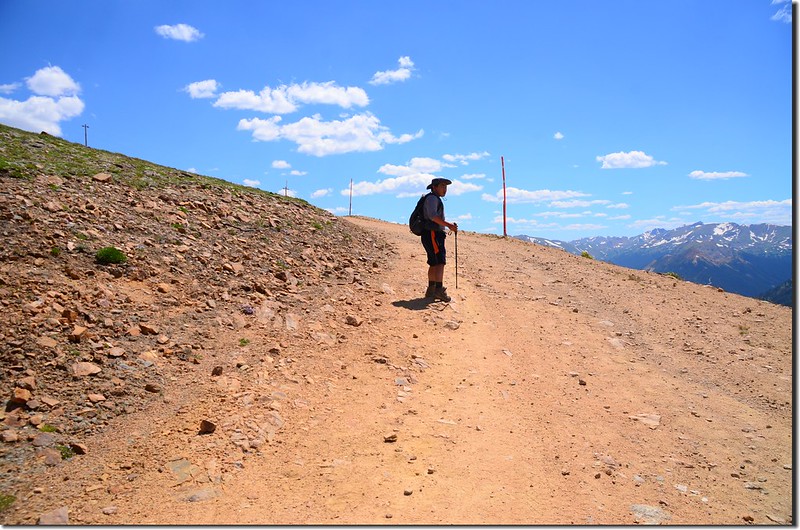
15:55 將抵達土石車道岔路前有一捷徑下山,取右循捷徑下山,海拔約11,675呎(3,559公尺)。
The short cut down to the trailhead
The short cut down to the trailhead
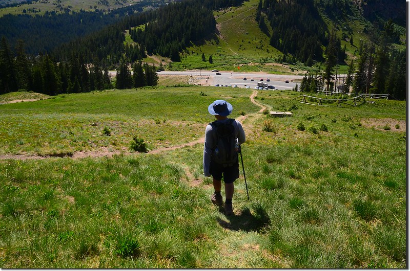
16:05 返抵登山口,今天登山時間約7小時35分,看貝貝像是毫無倦容,這一兩年他體力增加不少,登山時我已落後他好遠;在停車場整裝後開車返家。
沒有留言:
張貼留言