Mills Lake
落磯山國家公園(Rocky Mountain National Park)裡面一些高山湖除了一些較高海拔、幾乎沒有山徑的小湖外,在前幾年大都已攀登過,前一陣子和登山隊要去Guanella Pass攀登一座Shelf Lake時,上網搜尋資料才知道在國家公園內的Glacier Gorge也有一座Shelf Lake,就位在Black Lake Trail快接近Black Lake的右邊山上,在Shelf Lake 之上還有一座Solitude Lake,這兩座高山湖座落在Arrowhead和Thatchtop兩座高山的山腳下,看紀錄登該兩湖的路徑非常陡峭而且沒有明確的登山步道,當時就有想去一探的意念,看氣象預報本週三是個晴朗的好天氣就決定前往。
當天一大早就進入公園,在Bear Lake Road路邊幸運地發現一隻難得一見的駝鹿(moose),車抵Glacier Gorge Trailhead時停車場已無停車位,只好將車開到Bear Lake停車場,由Bear Lake停車場起登僅多出0.2哩的路程,但Bear Lake停車場的車位也是很早就會被停滿的!
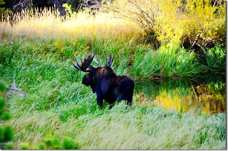
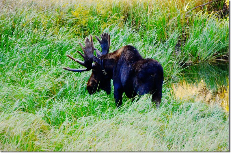
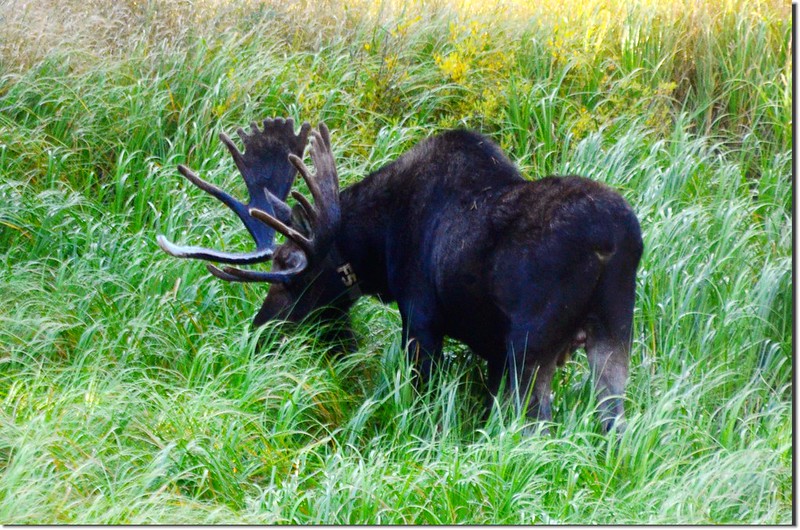
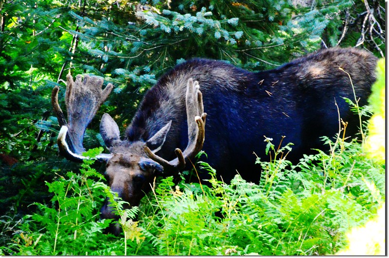
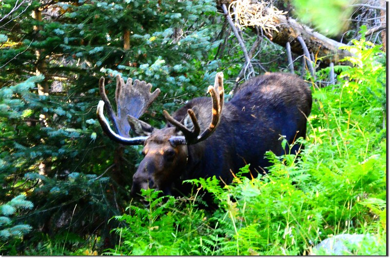
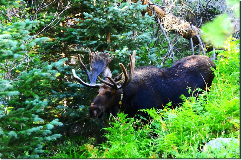
Moose at Bear Lake Road, Rocky Mountain National Park
Moose at Bear Lake Road, Rocky Mountain National Park
~~~~~~~~~~~~~~~~~~~~~~~~~~~~~~~~~~~~~~~~~~~~~~~~~~~~~~~~~~~~~~
攀登湖泊:
Mills Lake:海拔9,940呎/3,030公尺
Jewel Lake:海拔9,955呎/3,034公尺
Shelf Lake:海拔11,200呎/3,414公尺
Solitude Lake:海拔11,430呎/3,484公尺
Black Lake:海拔10,718呎/3,26公尺
登山口:Bear Lake Trailhead(海拔9,475呎/2,888公尺)
登山里程:來回約11.6哩/18.56公里
總爬升高度:2,843呎/867公尺
登山時間:9小時15分
~~~~~~~~~~~~~~~~~~~~~~~~~~~~~~~~~~~~~~~~~~~~~~~~~~~~~~~~~~~~~~
步程簡述:
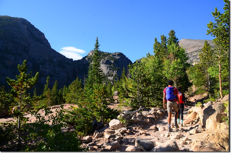
08:10 從Bear Lake登山口出發,左下坡往Glacier Gorge。

Bear Lake Trailhead
Bear Lake Trailhead
08:33 抵達Alberta Falls,海拔9,400呎/2,865公尺,距Bear Lake登山口約0.8哩。
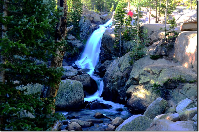
Alberta Falls
Alberta Falls
09:00 抵達Boulder Brook Trail & Mills Lake Trail岔路,海拔9,756呎/2,974公尺,距Bear Lake登山口約1.7哩;取右轉向在Glacier Knobs南面山腰往Mills Lake西南行。
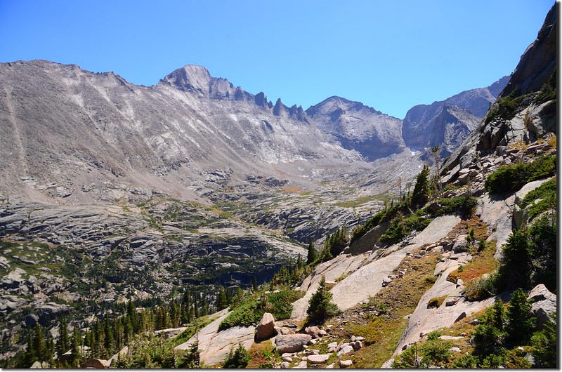
Looking south at Thatchtop from Black Lake Trail
Looking south at Thatchtop from Black Lake Trail
09:12 抵達Mills Lake和Sky Pond等高山湖的岔路,取左岔往Mills Lake;此處海拔9,787呎/2,983公尺,距Bear Lake登山口約2.2哩。
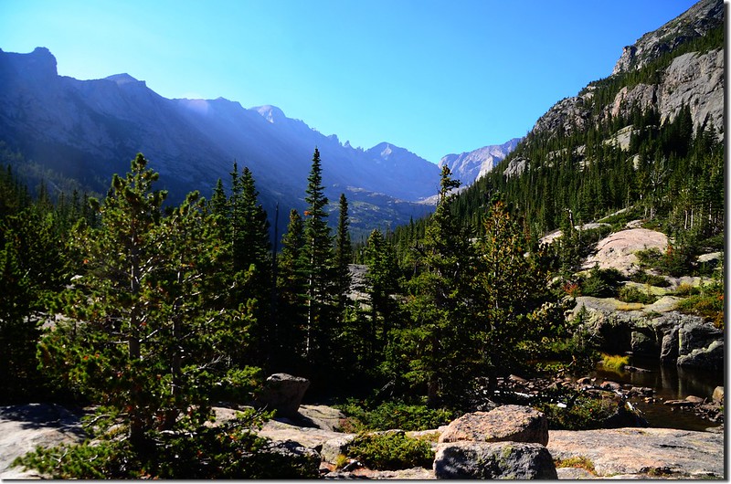
Mills Lake Trail with Pagoda Mtn in center
Mills Lake Trail with Pagoda Mtn in center
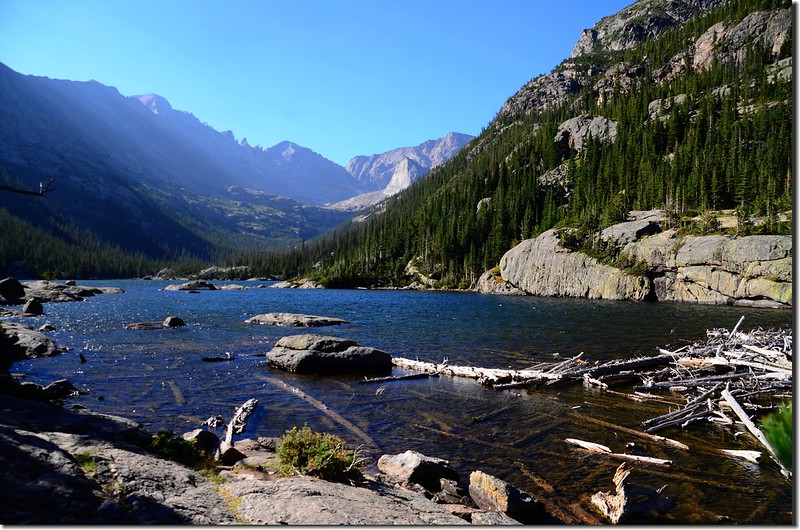
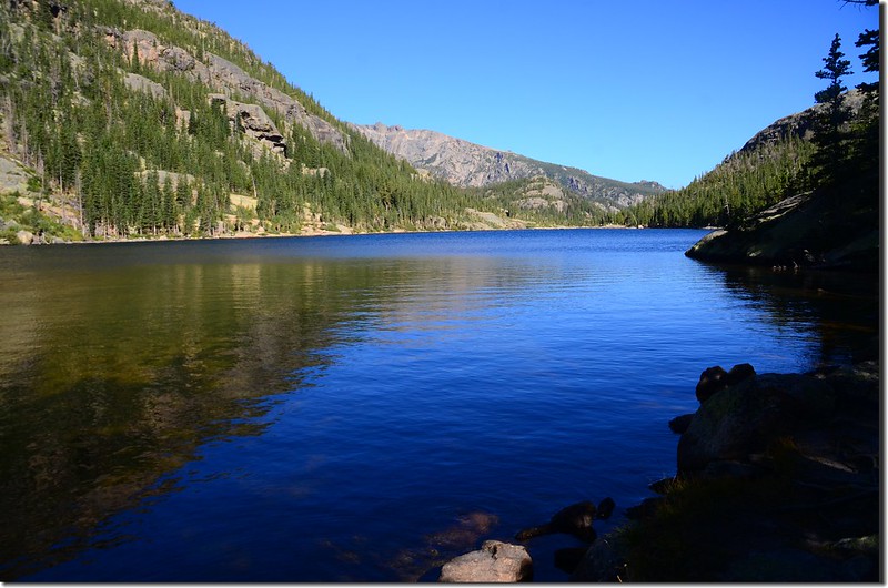
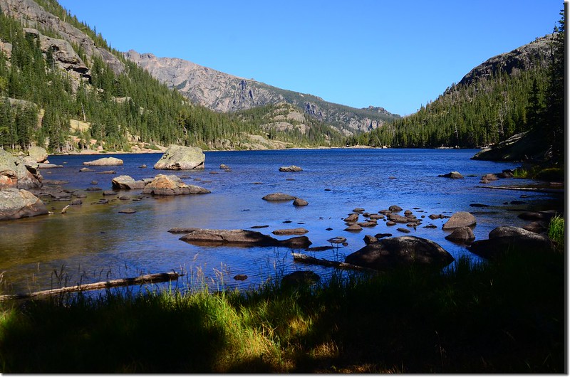
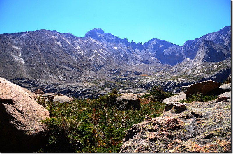
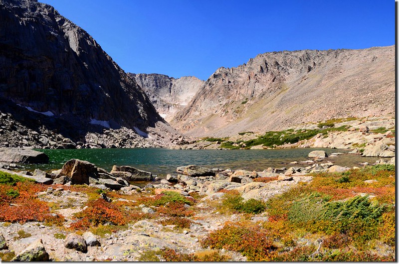
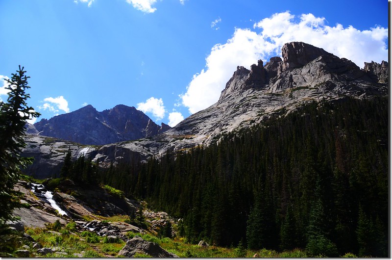
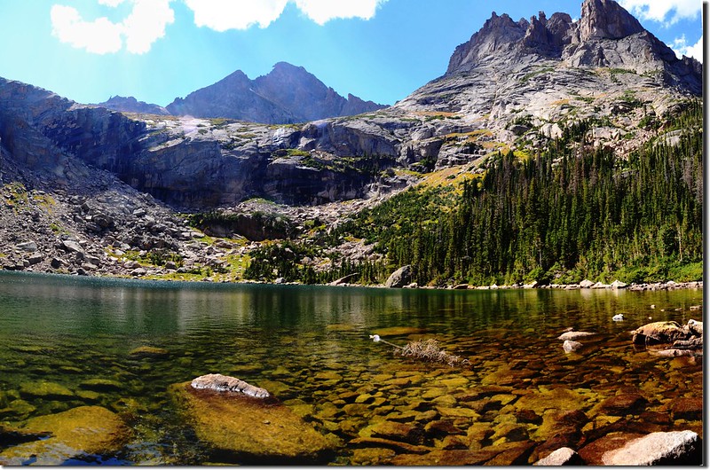
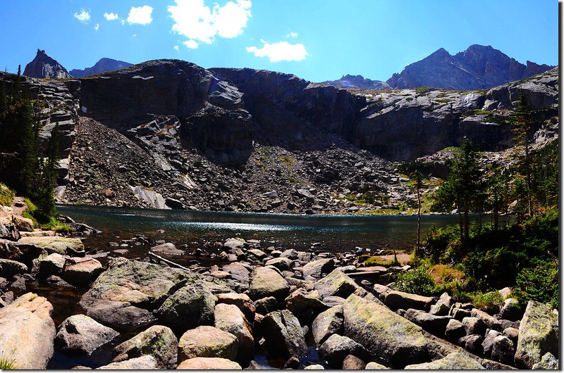
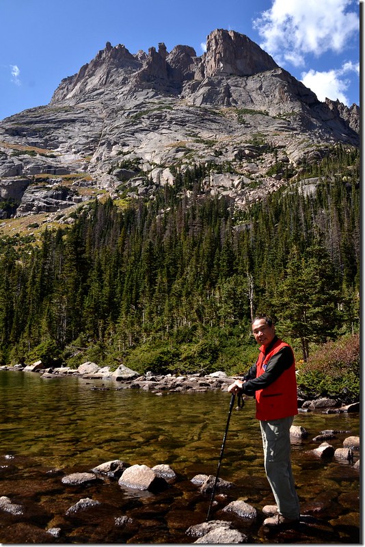
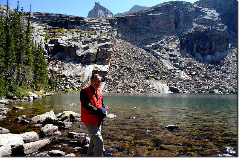
09:30 抵達Mills Lake西北角湖邊,此湖已來過多次,湛藍的湖面散布著星點般岩石橫躺在Longs Peak山腳下,清晨無風益顯得其靜謐;此處海拔9,956呎/3,035公尺,距Bear Lake登山口約2.7哩;
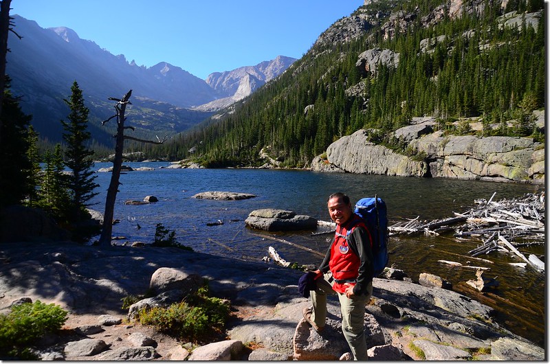
Mills Lake
Mills Lake
拍照後續沿湖岸東南轉向南行。
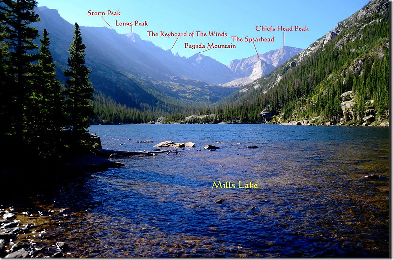
Mills Lake with Longs Peak et al. mountains in the distance

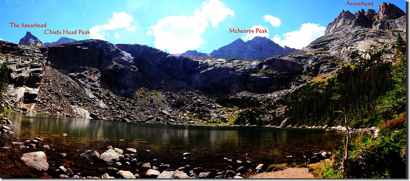
Looking south at Chiefs Head Peak & The Spearhead from Mills Lake
Mills Lake
Mills Lake
拍照後續沿湖岸東南轉向南行。
Mills Lake with Longs Peak et al. mountains in the distance
Looking south at Chiefs Head Peak & The Spearhead from Mills Lake
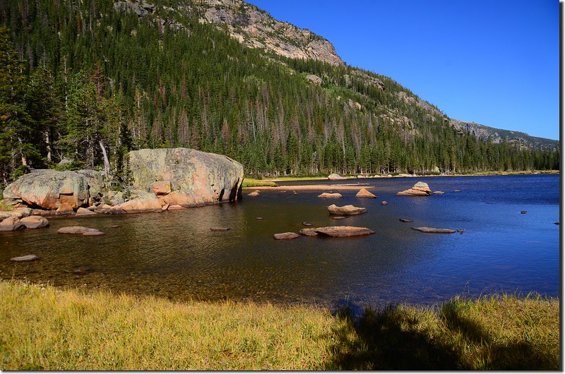
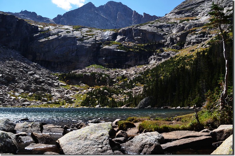
09:52 抵達Jewel Lake,此處海拔9,955呎/3,034公尺,距Bear Lake登山口約3.2哩;經過Jewel Lake後步道續往南行。
Jewel Lake
Jewel Lake
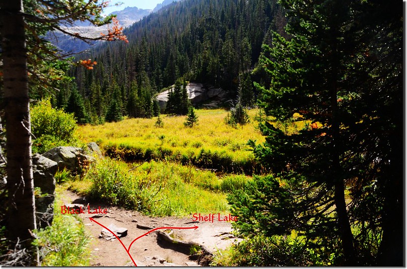
10:00 抵達Glacier Gorge露營地岔路,海拔9,995呎/3,046公尺,距Bear Lake登山口約3.6哩;
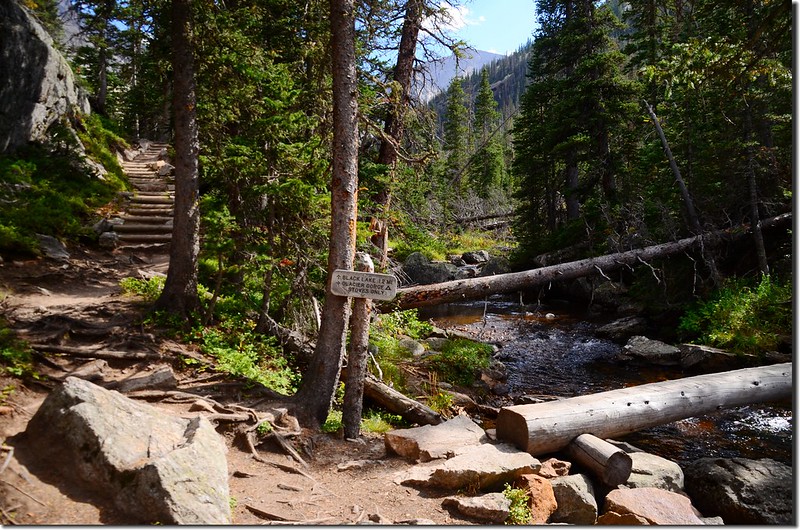
The junction of Black Lake Trail & Glacier Gorge campground
指示牌標示右岔過原木橋往Glacier Gorge露營地,左直行往Black Lake約1.2哩,其實不太正確,實際里程約有1.4哩左右,取左直行。
The junction of Black Lake Trail & Glacier Gorge campground
指示牌標示右岔過原木橋往Glacier Gorge露營地,左直行往Black Lake約1.2哩,其實不太正確,實際里程約有1.4哩左右,取左直行。
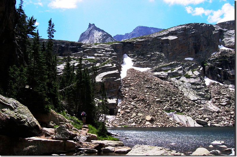
10:22 抵達Shelf Lake岔路,海拔10,240呎/3,121公尺,距Bear Lake登山口約4.2哩。
登Shelf Lake並沒有明確的山徑,所以岔路口沒指標也看不出明顯岔路,找此岔路有一原則,當離開Glacier Gorge露營地岔路後一路在森林中穿行,行約0.6哩後出森林來到一片大草原,Glacier Creek從草原中穿過;
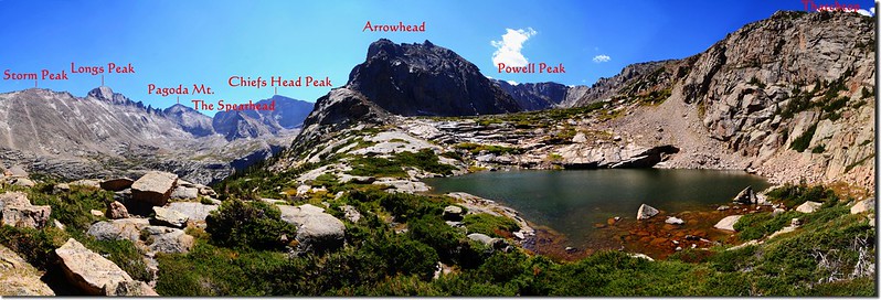
此時往西南看在山谷盡頭是Chiefs Head Peak和山頭尖尖如矛頭的The Spearhead;
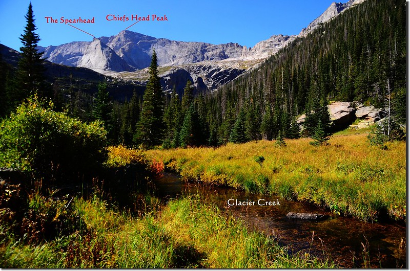
Looking southwest at Chiefs Head Peak & The Spearhead from the Shelf Lake Trail fork
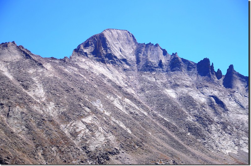
西邊則是Arrowhead和Thatchtop兩座山頭,Shelf Lake和Solitude Lake即位在Arrowhead和Thatchtop中間的山谷平台上;
Looking up at Arrowhead from Black & Shelf Lake Trail fork
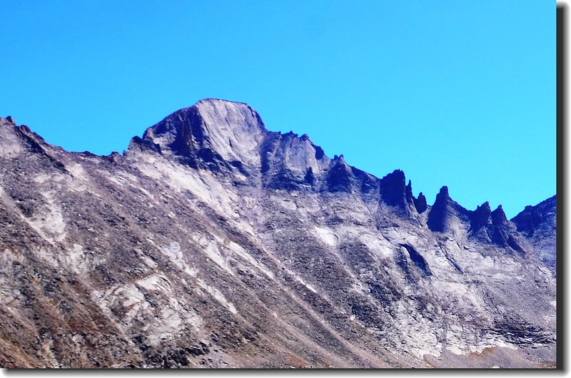
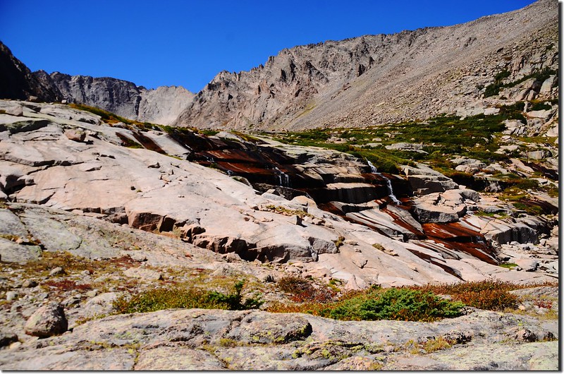
在Arrowhead下方的森林中仔細看可以看到一線瀑布,此瀑布是Shelf Creek所形成,攀登Shelf Lake的山徑即是沿此溪的右岸上攀。
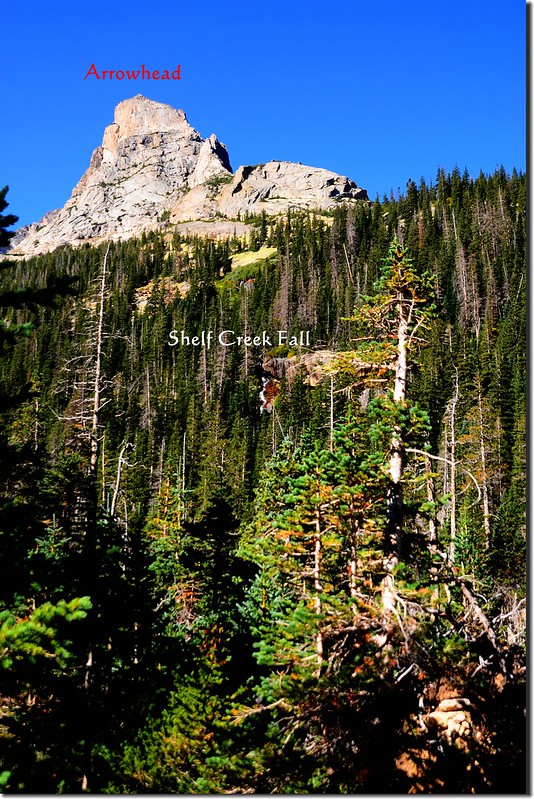
Looking up at Arrowhead & Shelf Creek Falls from Black Lake Trail
此時往西南看在山谷盡頭是Chiefs Head Peak和山頭尖尖如矛頭的The Spearhead;
Looking southwest at Chiefs Head Peak & The Spearhead from the Shelf Lake Trail fork
西邊則是Arrowhead和Thatchtop兩座山頭,Shelf Lake和Solitude Lake即位在Arrowhead和Thatchtop中間的山谷平台上;
Looking up at Arrowhead from Black & Shelf Lake Trail fork
在Arrowhead下方的森林中仔細看可以看到一線瀑布,此瀑布是Shelf Creek所形成,攀登Shelf Lake的山徑即是沿此溪的右岸上攀。
Looking up at Arrowhead & Shelf Creek Falls from Black Lake Trail
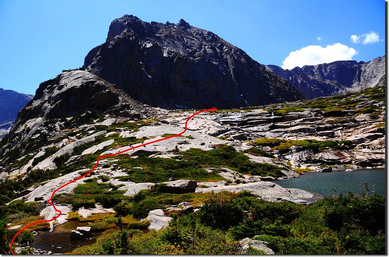
Black Lake步道出森林遇大草原時右轉沿Glacier Creek溪邊下行一、二十公尺後從溪上倒木小心度過Glacier Creek;
Bear right to the unmaintained social trail across glacier creek up to Shelf Lake from this meadow
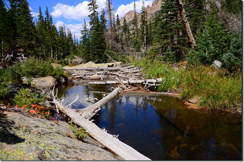
Crosses Glacier Creek on fallen tree bridge
到對岸後仔細尋找可找到不是很明顯的路跡往山上上登,上登途中有時會遇到岔路,研判是登山客各找各的路走出來的,最終都會會合,基本上還是依循較明顯的路跡來走;路徑很陡峭,但還不至於有危險性,走走停停,適度的休息保持體力,利用休息時眺望河谷對岸的Longs Peak有夠雄偉。
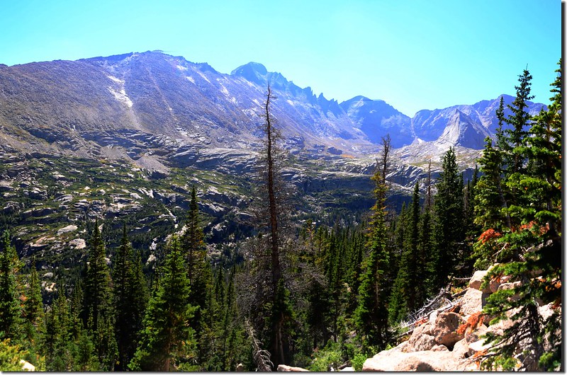
Looking southeast at Longs Peak from the trail up to Shelf Lake
Looking south at The Spearhead from the trail up to Shelf Lake
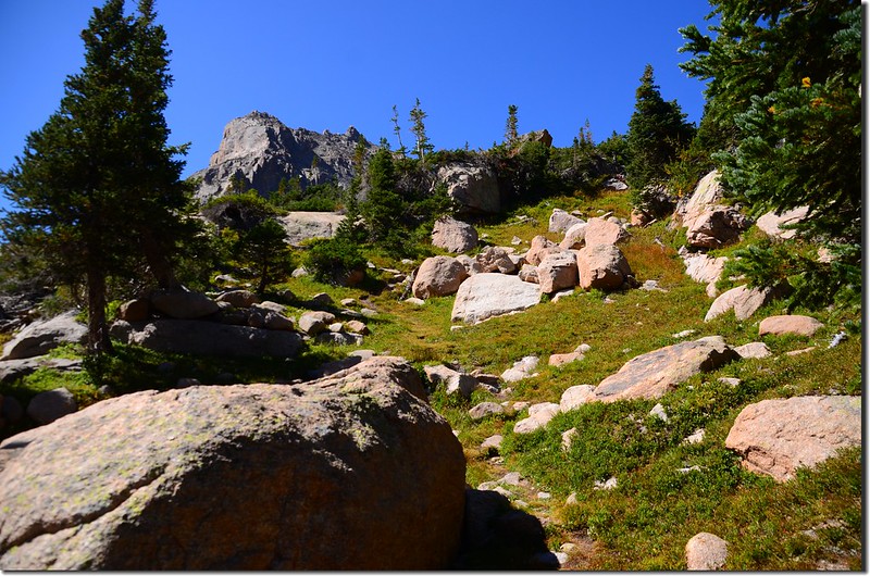
Looking up at Arrowhead from the trail near Shelf Lake
Bear right to the unmaintained social trail across glacier creek up to Shelf Lake from this meadow
Crosses Glacier Creek on fallen tree bridge
到對岸後仔細尋找可找到不是很明顯的路跡往山上上登,上登途中有時會遇到岔路,研判是登山客各找各的路走出來的,最終都會會合,基本上還是依循較明顯的路跡來走;路徑很陡峭,但還不至於有危險性,走走停停,適度的休息保持體力,利用休息時眺望河谷對岸的Longs Peak有夠雄偉。
Looking southeast at Longs Peak from the trail up to Shelf Lake
Looking south at The Spearhead from the trail up to Shelf Lake
Looking up at Arrowhead from the trail near Shelf Lake
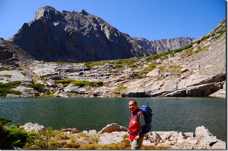
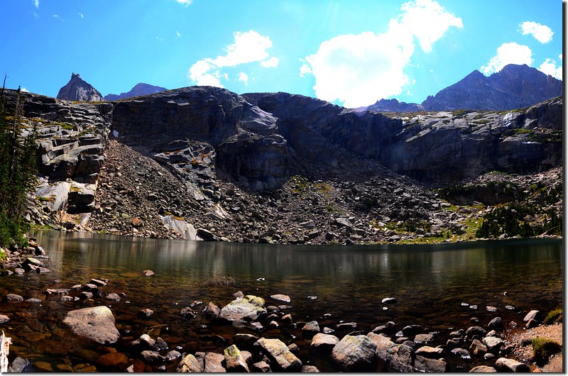
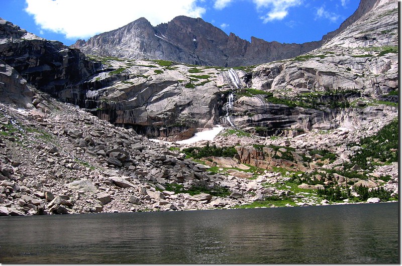
11:28 登上Shelf Lake東岸,海拔11,200呎/3,414公尺,從Black Lake Trail岔路口到此約一公里(0.62哩)計爬升了約1,000呎/305公尺,有夠陡的!
Shelf Lake
Shelf Lake panorama
Shelf Lake
Shelf Lake panorama
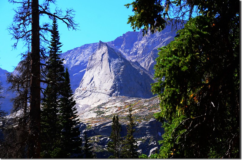
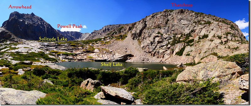
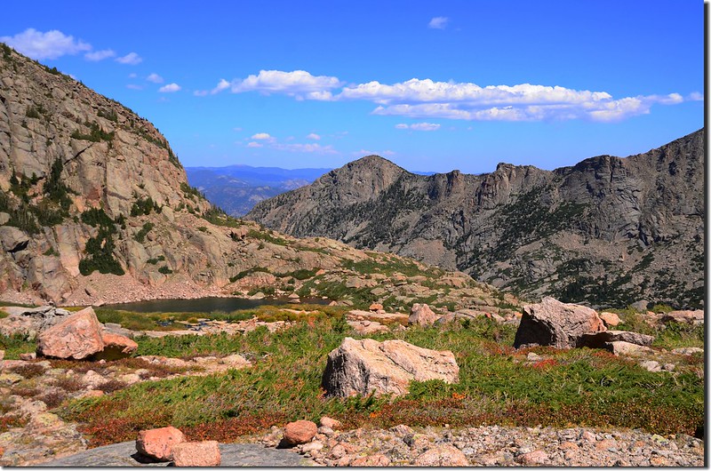
Shelf Lake位在海拔 12,651 呎/ 3,856 公尺的Arrowhead和海拔 12,654 呎/ 3,857公尺的Thatchtop兩座山中間的山谷岩架上,此湖之得名應該源自於湖之所在的地理位置。
Looking southeast at Longs Peak from Shelf Lake
Looking southeast at Longs Peak and the Keyboard of the Winds from Shelf Lake
The falls between Shelf & Solitude Lake
Looking southeast at Longs Peak from Shelf Lake
Looking southeast at Longs Peak and the Keyboard of the Winds from Shelf Lake
The falls between Shelf & Solitude Lake
11:50 在Shelf Lake休息拍照後由Shelf Lake東岸朝南沿著山壁往上頭的Solitude Lake爬升,山壁是緩坡安全好爬。
Looking southwest at the route up to Solitude Lake
Looking down at Shelf Lake from Solitude Lake
Shelf Lake
Looking southwest at the route up to Solitude Lake
Looking down at Shelf Lake from Solitude Lake
Shelf Lake
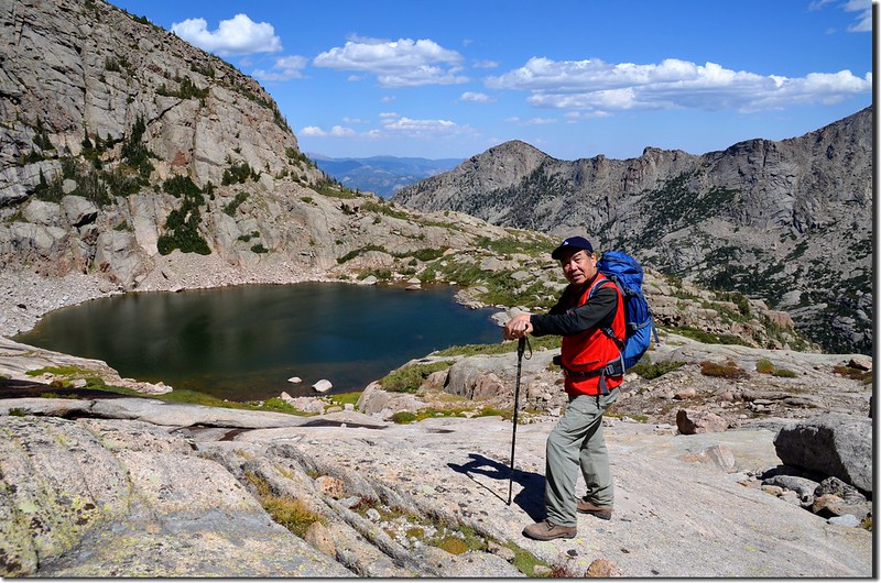
12:04 行約0.22哩/350公尺、爬升230呎/70公尺後上抵Solitude Lake,此湖海拔11,430呎/3,484公尺,正位在Arrowhead(左)和Thatchtop(右)兩山之中的山腳下,我在湖邊休息用餐。
Solitude Lake
Solitude Lake
12:50 下山,沿上山路往Shelf Lake移動。
13:22 回到Shelf Lake東岸後再循上山路下山,由於山徑陡峭下山時宜加小心。
Steep Descent, trail's a bit steep here and about to get steeper
Steep Descent, trail's a bit steep here and about to get steeper
13:54 下抵Glacier Creek草原,再橫跨Glacier Creek上倒木接回Black Lake Trail,此處距Black Lake不遠,大約0.8哩左右,該湖多年前去過兩次,我看時間還早決定再走一趟,隨即沿Black Lake Trail續往南行。
Looking southwest at Arrowhead(R)、Mchenrys Peak(L) from Black Lake Trail
Looking southwest at Arrowhead、Mchenrys Peak from the trail below Black Lake
Looking southwest at Arrowhead(R)、Mchenrys Peak(L) from Black Lake Trail
Looking southwest at Arrowhead、Mchenrys Peak from the trail below Black Lake
14:25 抵達Black Lake,湖水比當年來此湖時少很多,所以看起來沒當年壯觀;在湖邊小休後下山。
Black Lake
Black Lake
17:20 返抵Bear Lake停車場後開車返家。