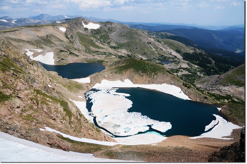
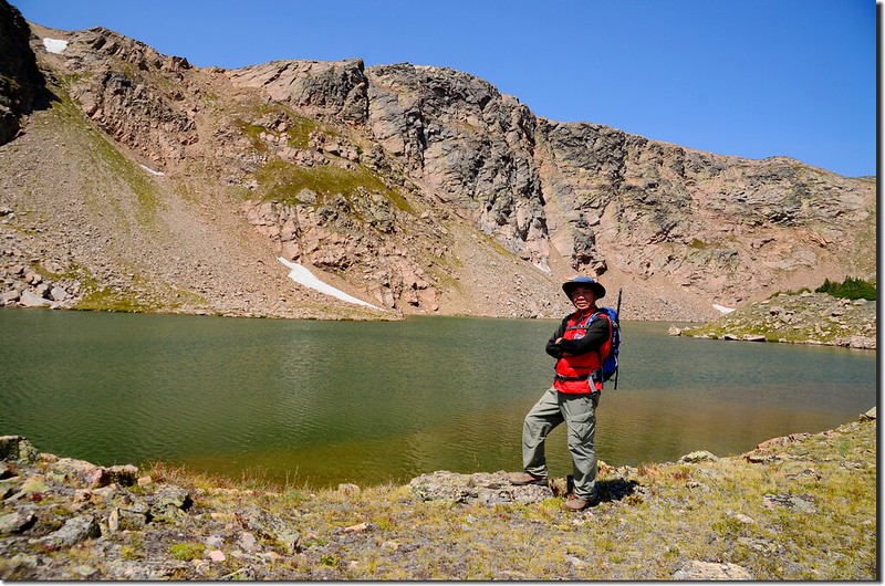
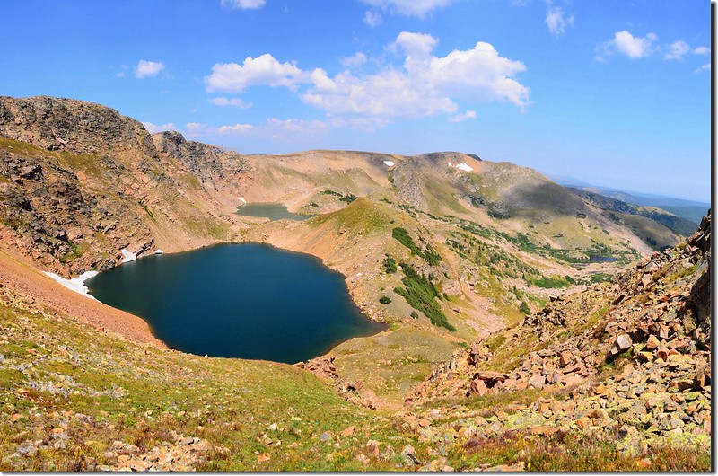
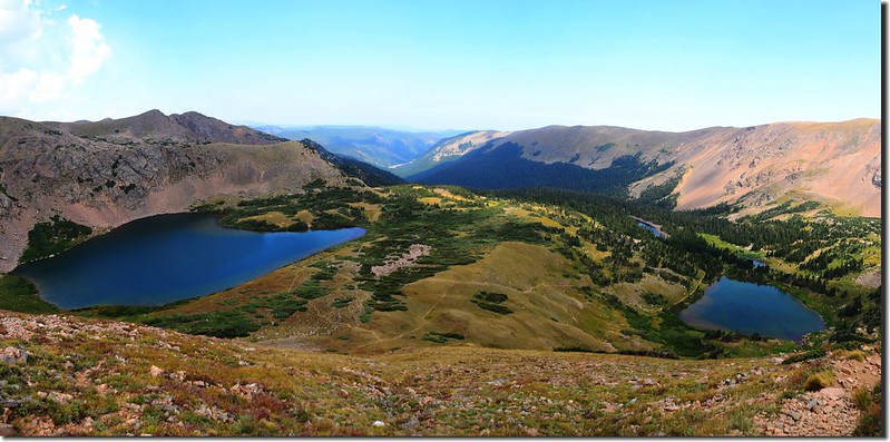
Looking down at South Iceberg Lake from Continental Divide (shot on 2014.08.09)
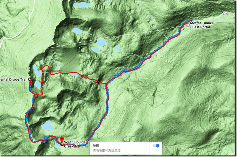
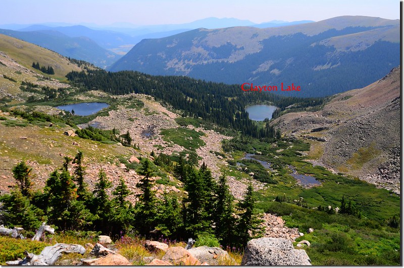
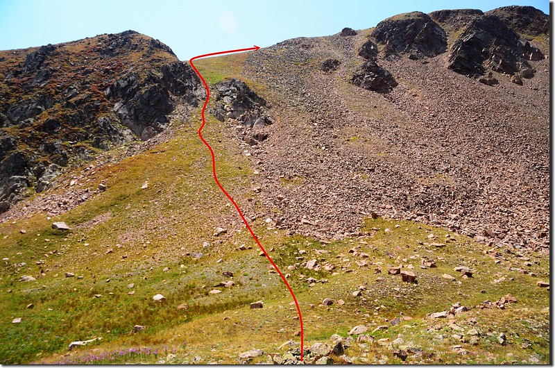
Hiking route of Clayton to Rogers Pass Lake loop
四年前和小外孫貝貝攀登Clayton Lake時知道在Clayton Lake的上方還有兩座高山湖South & North Iceberg Lake,但因該兩座湖沒有明顯路徑加上當天時間來不及所以沒輕易嘗試攀登,一個星期後我改由另一個高山湖Rogers Pass Lake登上大陸分水嶺,然後沿著Continental Divide Trail走到Iceberg Lake西邊的山頂向下俯瞰這兩座高山湖,當時湖面上漂浮著浮冰真是名符其實的Iceberg Lake(冰山湖),後來上網查了一下資料僅找到一篇由Rogers Pass Lake上大陸分水嶺,再經由Continental Divide Trail下Iceberg Lake、Clayton Lake的O形環走紀錄,當時即興起走此路線的計畫。
經過一段時間的醞釀詳細研究地形,發現僅有一段由大陸分水嶺下切到South Iceberg Lake的路況較為危險,這一段路落差約280呎/86公尺,坡度約在40~60%之間,而且大部分是鬆散的石礫岩塊,為了解決此難題我變更攀登路線,決定先由Clayton Lake登上Iceberg Lake,到了Iceberg Lake後再爬這一段陡峭的岩石坡上大陸分水嶺,然後經Heart Lake、Rogers Pass Lake下山,我覺得那段陡坡上坡應該比下坡安全多了,心意已定利用前天不錯的天氣付諸行動。
~~~~~~~~~~~~~~~~~~~~~~~~~~~~~~~~~~~~~~~~~~~~~~~~~~~~~~~~~~~~~~
攀登湖泊:
Clayton Lake:海拔10,945呎/3,336公尺
North Iceberg Lake :海拔11,670呎/3,557公尺
South Iceberg Lake :海拔11,710呎/3,569公尺
Heart Lake:海拔11,347呎/3,459公尺
Rogers Pass Lake:海拔11,090呎/3,380公尺
登山里程:11哩/17.6公里
總爬升高度:4,080呎/1,244公尺
登山時間:8小時40分
~~~~~~~~~~~~~~~~~~~~~~~~~~~~~~~~~~~~~~~~~~~~~~~~~~~~~~~~~~~~~~
行車資訊:
從 Boulder走Boulder Canyon Road(CO 119)西行,16哩後抵Nederland小鎮,接Peak To Peak景觀公路(CO 119, CO 72)南下,行4.8哩抵Rollinsville,右轉E. Portal road (Rollins Pass)西行,約7.5哩後行車終點(Moffat Tunnel)即為登山口,此處是Union Pacific Railroad火車隧道的東入口。
步程簡述:
08:15 登山口East Portal Trailhead出發,海拔約9,220呎/2,810公尺。
08:52 抵達Forest Lakes Trail 和South Boulder Creek Trail、Crater Lakes Trail的岔路,海拔9,555呎/2,912公尺,距登山口1.25哩;取左岔沿South Boulder Creek Trail、Crater Lakes Trail直行。
09:15 抵Crater Lakes Trail岔路,海拔9,930呎/3,027公尺,距登山口1.95哩;取左岔沿South Boulder Creek Trail、Rogers Pass直行。
09:27 抵一座沒有扶手之兩根原木橋,此橋再行約30公尺另有一座有單面扶手之小橋;四年前來登Clayton Lake時岔路是在原木橋和單面扶手橋的中間,今天則已改至兩根原木橋橋頭(未過橋)右轉上山,路徑不是很明顯且有一根倒木擋住,此處海拔10,083呎/3,073公尺,距登山口2.2哩;取右岔上山,直行過橋往Rogers Pass Lake和Heart Lake。
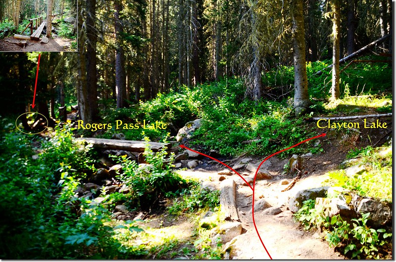
Clayton Lake & Rogers Pass Lake fork
Clayton Lake & Rogers Pass Lake fork
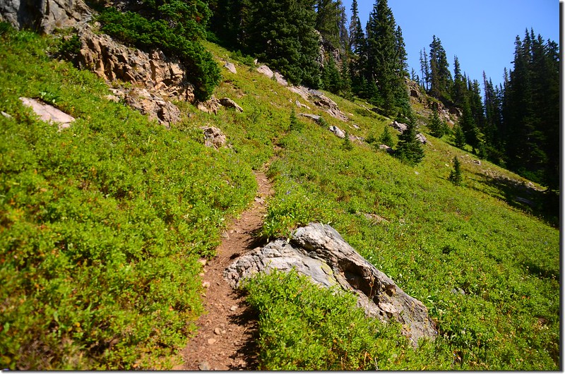
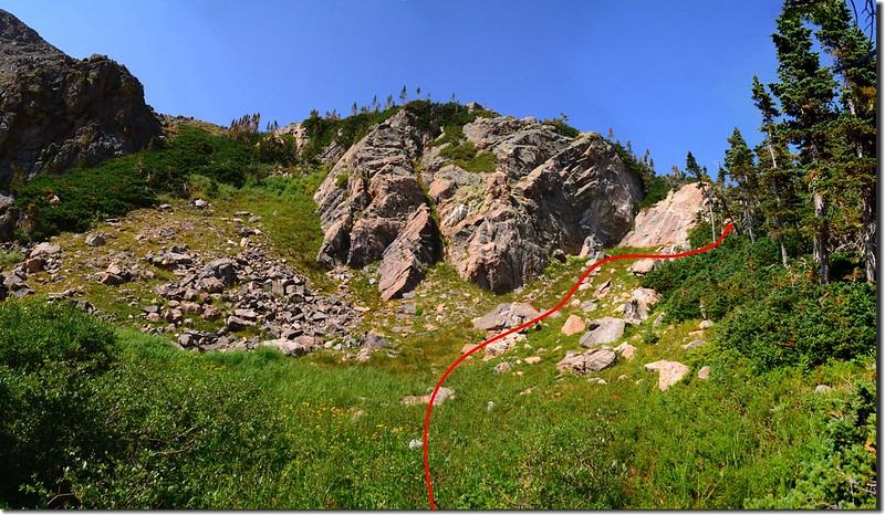
Clayton Lake是一座除了釣客外登山客鮮少登臨的高山湖,主要是難爬,據紀錄在0.8哩的路程要爬升1000呎,其中有段路非常陡峭難爬,也因為登山客鮮少登臨,所以登山步道不是很明顯,必須抓準方位細心辨認,但有一原則掌握住就不易迷路,那就是緊靠South Boulder Creek的支流上攀。
09:34 右邊一片大絕壁,路徑開始沿著小溪右岸疾陡上;
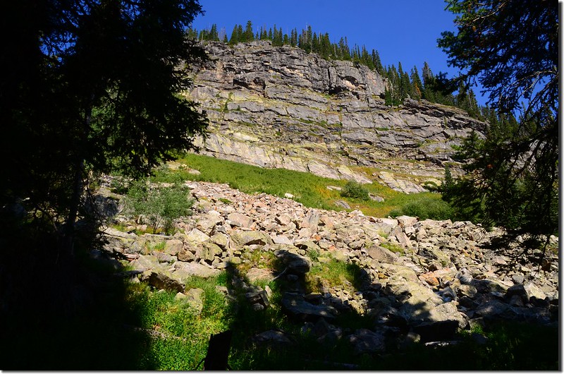
Steep Cliff to the right of the trail
此路段是本行程最難爬路段,既陡峭又易滑動,步步為營小心上攀。
Steep Cliff to the right of the trail
此路段是本行程最難爬路段,既陡峭又易滑動,步步為營小心上攀。
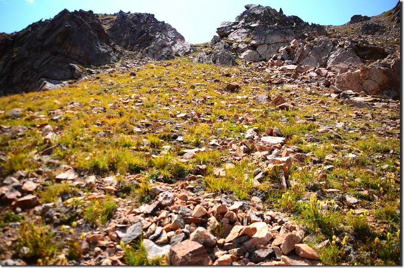
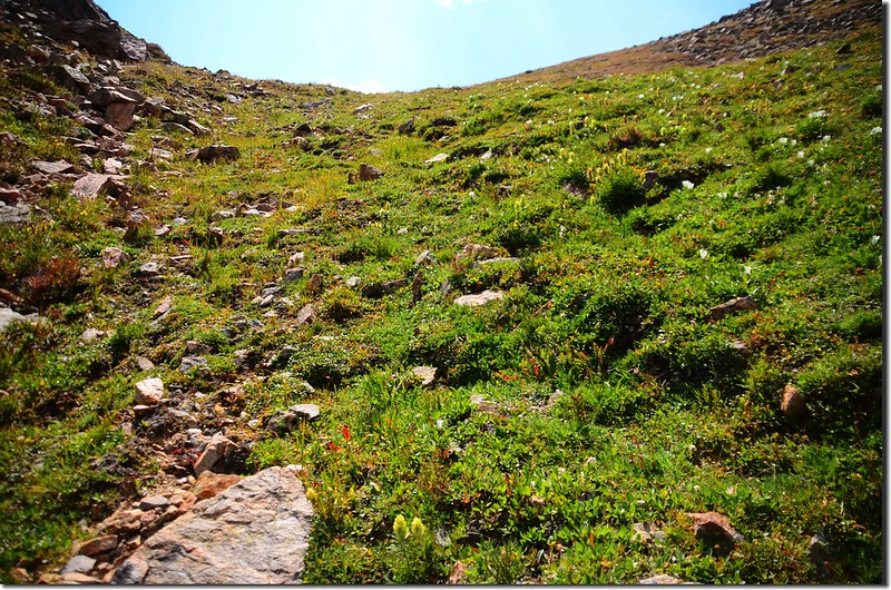
10:00 上抵較緩坡,路左出現一片不小的草原,經過草原沒多久又是一段陡上坡,但比前一段安全多了!
Clayton Lake Trail
Clayton Lake Trail
10:22 上抵稜線,Clayton Lake快到了。
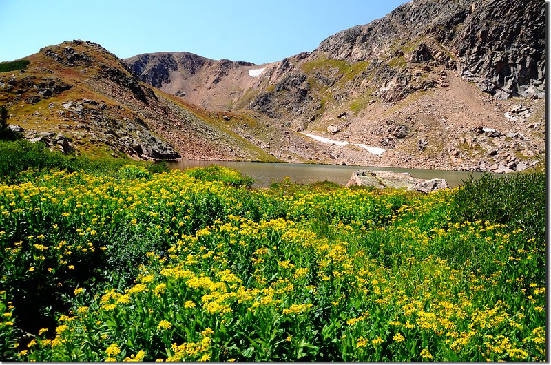
10:26 抵達Clayton Lake上方,Clayton Lake出現在左側樹林後方,先下到出水口,出水口沼澤區一片花海。
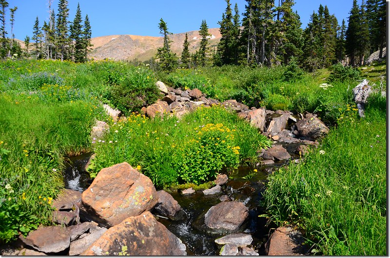
Clayton Lake outlet
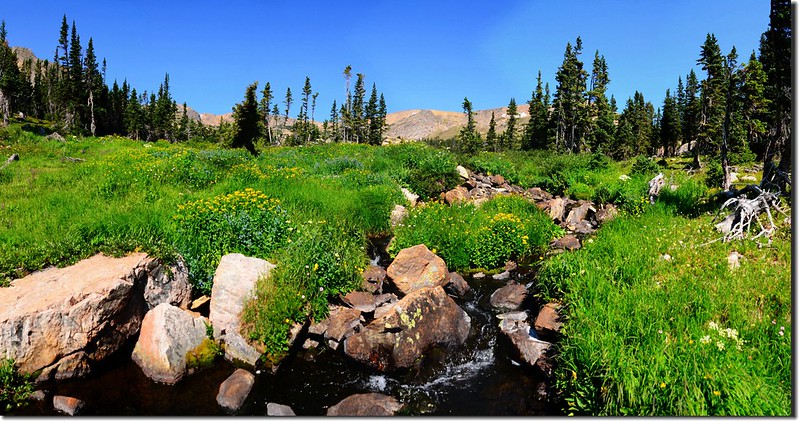
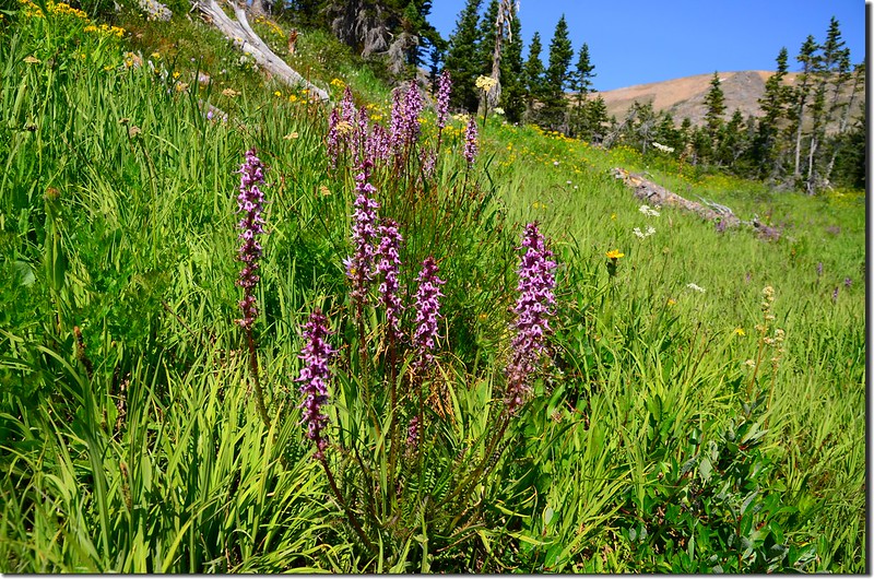
Wildflowers blooming at Clayton Lake outlet
Clayton Lake outlet
Wildflowers blooming at Clayton Lake outlet
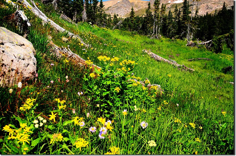
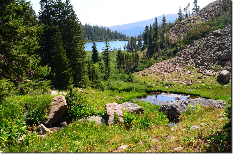
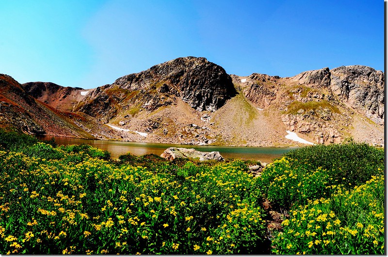
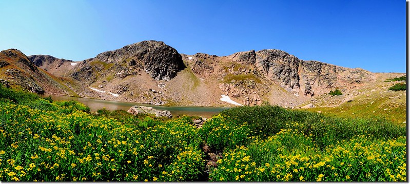
在出水口沼澤區賞完野花後上到Clayton Lake東岸欣賞整個湖景及觀察上登Iceberg Lake的路徑。
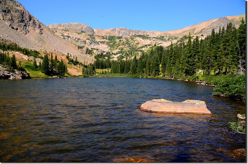
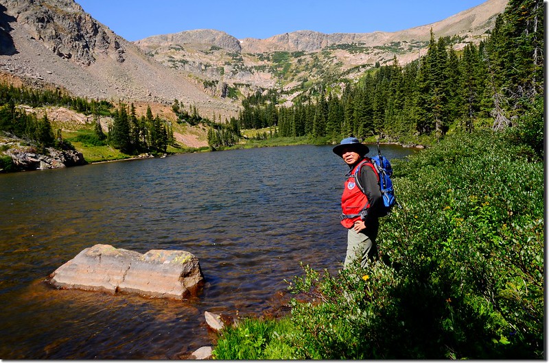
Clayton Lake
Clayton Lake
由Clayton Lake上到Iceberg Lake距離約1.3哩,落差約750呎/229公尺,這段路地圖上找不到明確的一條路徑,出發前詳細看了地圖,心理上虛擬了一條路徑,打算先沿Iceberg Lake出水口的小溪流(也就是Clayton Lake進水口的小溪)朝西上攀,上到半程後在Iceberg Lake和Clayton Lake中途有一處沼澤小潭區取右轉沿較緩坡的岩石坡朝北方爬升,爬升到緩稜後再左轉上到North Iceberg Lake。
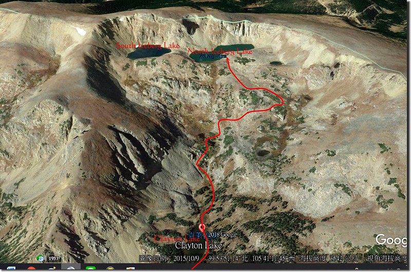
Hiking route from Clayton to Iceberg Lake
Hiking route from Clayton to Iceberg Lake
我在Clayton Lake東岸將虛擬路線再和實際地形詳細觀察後便沿著北岸往西出發。
11:00 抵達Clayton Lake西端進水口,沿著進水口小溪上溯,偶而見到不很明確的小徑,可見此路徑是有登山客在利用的。
Looking down Clayton Lake from it's inlet
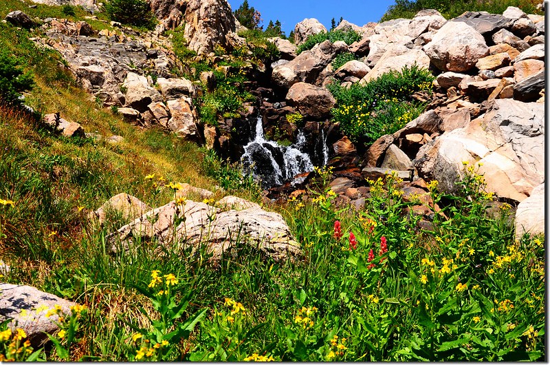
The cascade above Clayton Lake
Looking down Clayton Lake from it's inlet
The cascade above Clayton Lake
11:12 經過一小流瀑後上到一小凹谷地形,凹谷地形正前方有一大塊突出岩壁,取岩壁右側腰繞上攀。
The terrain above Clayton Lake
The terrain above Clayton Lake
11:23 由岩壁右側腰繞到上方穿過矮松林後抵達Iceberg Lake下方一片低窪沼澤小潭區,在此沼澤區取右朝北方岩石坡爬升,爬升到一緩稜後再左轉朝North Iceberg Lake西南爬升。
The wetland below Iceberg Lake
The wetland below Iceberg Lake
View down valley from the trail near North Iceberg Lake
The wetland below Iceberg Lake
The wetland below Iceberg Lake
View down valley from the trail near North Iceberg Lake
11:56 登上North Iceberg Lake東岸,海拔11,670呎/3,557公尺,距登山口約4.1哩;
North Iceberg Lake
View down valley from North Iceberg Lake
沿東岸南行經過野花遍開的出水口後抵達North Iceberg Lake和South Iceberg Lake之間的大山丘下,要登上South Iceberg Lake必須越過此大山丘,我取道山丘東面坡腰繞而過。
Wildflowers are blooming at North Iceberg Lake outlet
Wildflowers are blooming at North Iceberg Lake outlet
North Iceberg Lake
View down valley from North Iceberg Lake
沿東岸南行經過野花遍開的出水口後抵達North Iceberg Lake和South Iceberg Lake之間的大山丘下,要登上South Iceberg Lake必須越過此大山丘,我取道山丘東面坡腰繞而過。
Wildflowers are blooming at North Iceberg Lake outlet
Wildflowers are blooming at North Iceberg Lake outlet
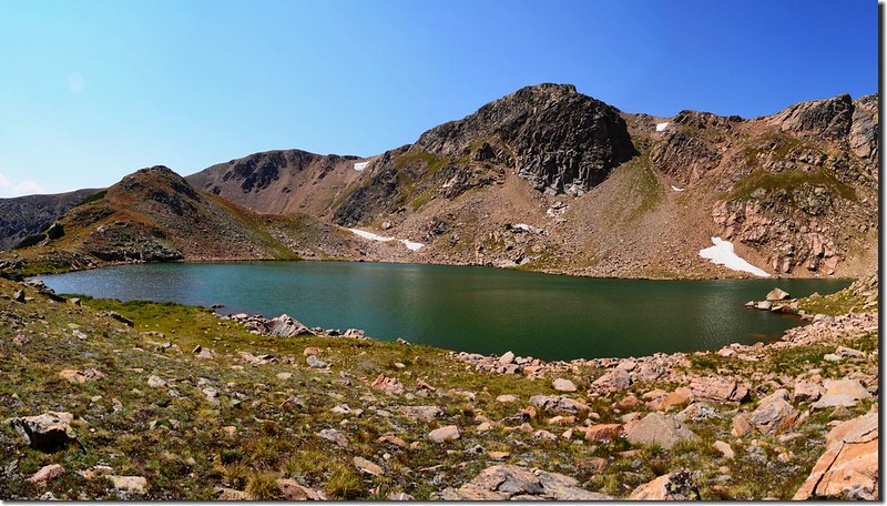
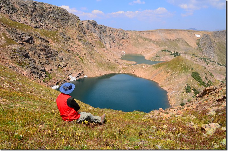
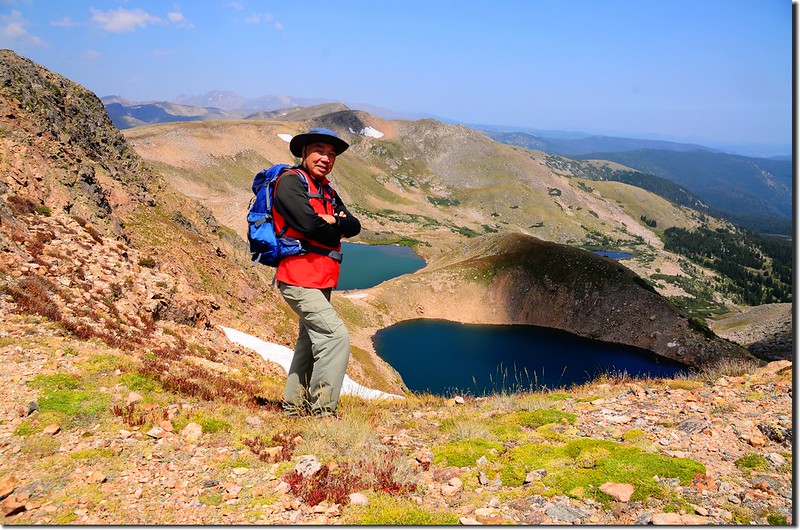
12:24 登上South & North Iceberg Lake間山丘頂,此處俯瞰整個South Iceberg Lake湖上浮冰已完全融化不見,記得四年前同樣時間從大陸分水嶺俯瞰此湖時,大半湖面還漂浮著浮冰,真是名符其實的Iceberg Lake。
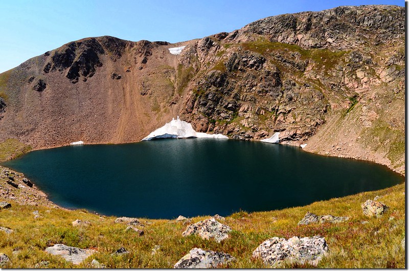
South Iceberg Lake
South Iceberg Lake
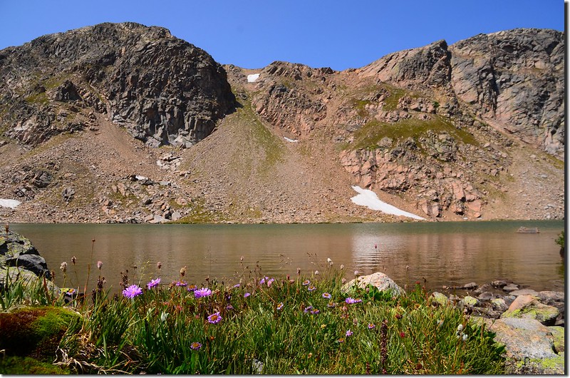
12:50 下到South Iceberg Lake南岸,此處海拔11,710呎/3,569公尺,距登山口約4.55哩。
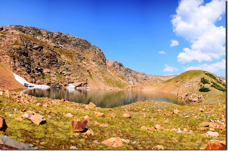
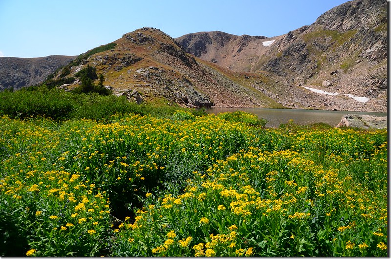
South Iceberg Lake
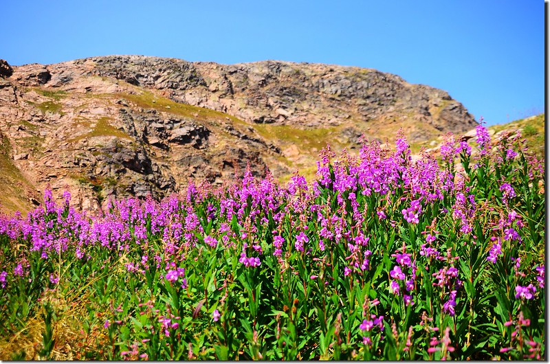
Wildflowers are blooming along the lake
South Iceberg Lake
Wildflowers are blooming along the lake
站在South Iceberg Lake的南岸環視四周,東邊是South Boulder Creek支流的山谷;
View down valley from the south shore of South Iceberg Lake
北邊是South Iceberg Lake,西邊和南邊則是大陸分水嶺高達百餘公尺猙獰陡峭的山壁,觀察地形後發覺只有南邊的山壁有一條小溝槽比較適合攀爬,爬上山壁接到稜線後再右轉循稜西行便可接到大陸分水嶺的Continental Divide Trail;
Looking up at the steep slope from South Iceberg Lake
觀察好地形路線後開始小心翼翼地往上爬!
Looking up at the steep slope from South Iceberg Lake
13:00 小心地爬上陡峭碎岩石坡後緊接著是坡度稍緩的苔原草原坡,坡度仍陡峭,此處海拔11,880呎/3,621公尺,距登山口約4.62哩。
Looking up at the tundra slope from the middle slope
Looking down at South Iceberg Lake from the slope
Looking up at the tundra slope from the middle slope
Looking down at South Iceberg Lake from the slope
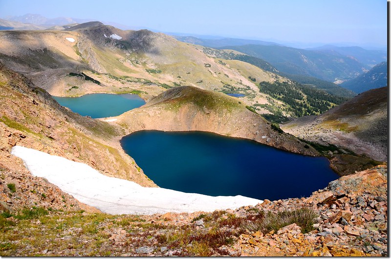
13:13 安全登上South Iceberg Lake南岸山脊頂端,此處海拔11,990呎/3,655公尺,距登山口約4.7哩;
Looking down at South Iceberg Lake from the ridge
隨後右轉沿著山脊稜線朝大陸分水嶺西行。
Looking down at South Iceberg Lake from the ridge
隨後右轉沿著山脊稜線朝大陸分水嶺西行。
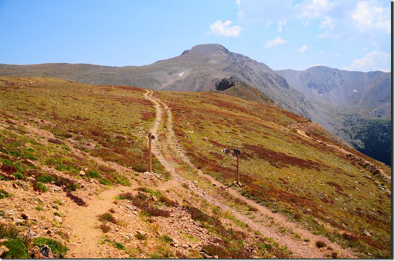
13:25 登上大陸分水嶺一小山頭,海拔12,162呎/3,707公尺,距登山口約4.8哩;然後沿著稜線北行。
Looking down at South Iceberg Lake from the ridge
Looking down at South Iceberg Lake from the ridge
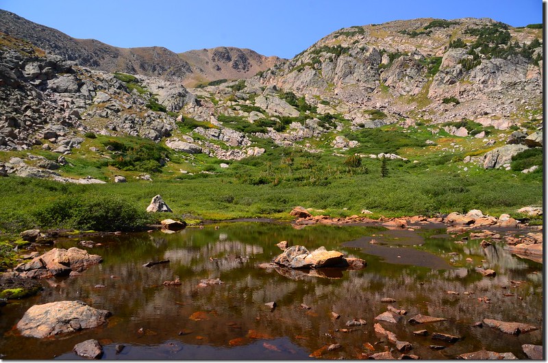
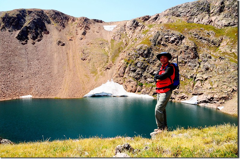
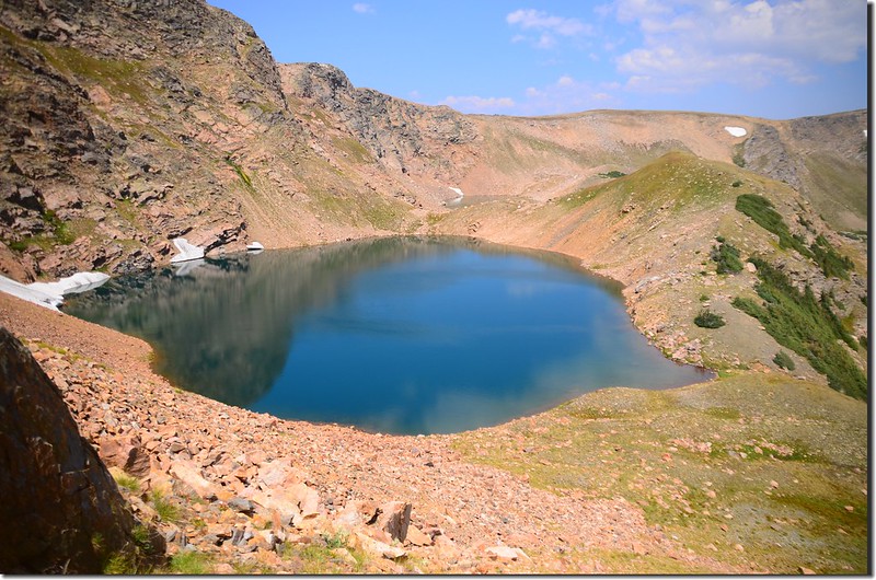
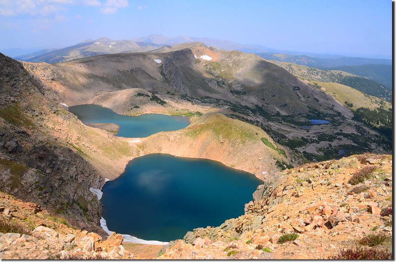
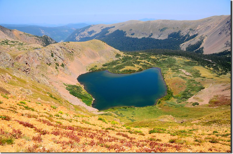
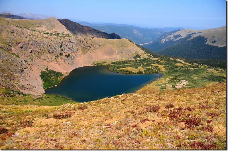
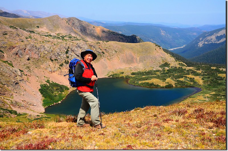
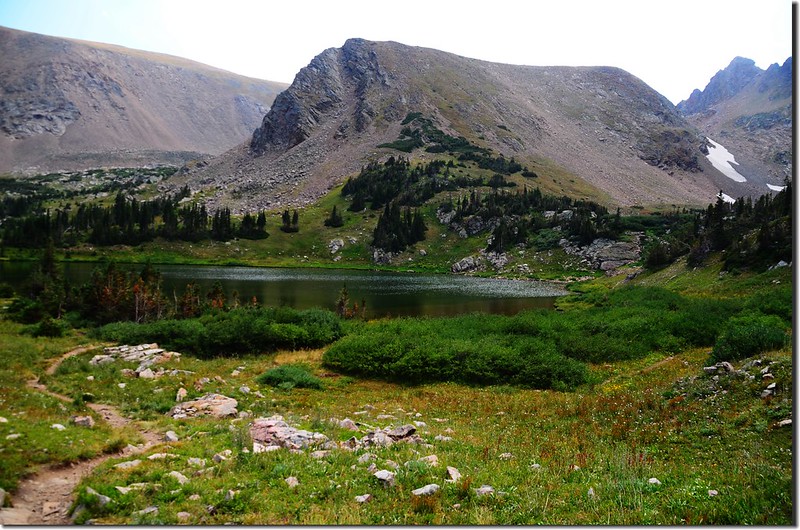
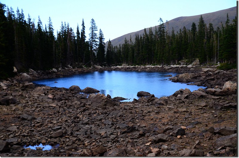
13:30 下抵South Iceberg Lake西邊大陸分水嶺一小鞍部,海拔約12,080呎/3,682公尺,距離登山口約4.92哩;在此清楚俯瞰Iceberg Lakes。
Looking down at Iceberg Lake from Continental Divide
Looking down at Iceberg Lake from Continental Divide
Looking down at South Iceberg Lake from Continental Divide (shot on 2014.08.09)
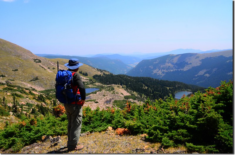
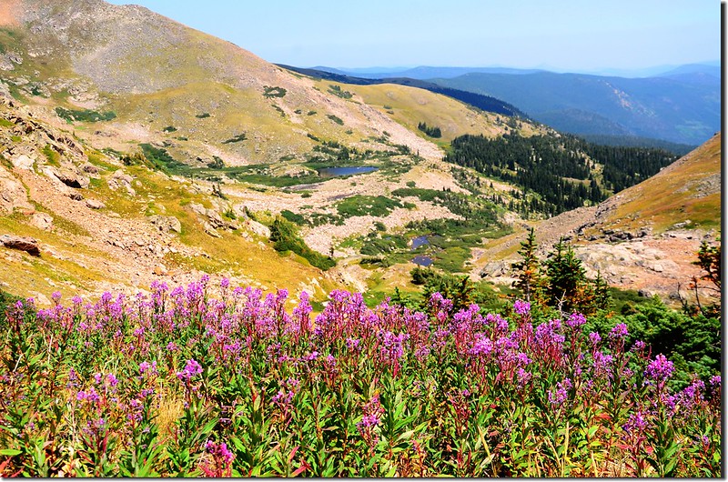
在鞍部欣賞完Iceberg Lake後沿著Continental Divide Trail南行;
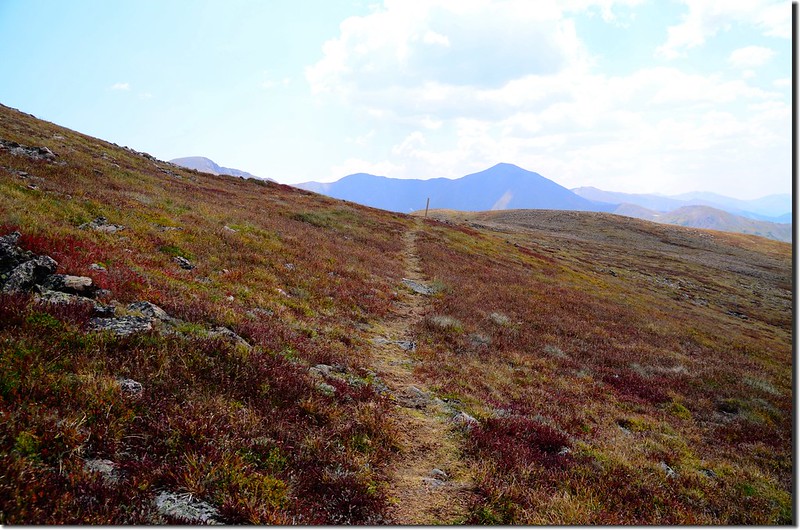
The route turns south on the Continental Divide Trail with great views south of James Peak
此路線在四年前已走過,路徑還算清楚,且沿途約每兩三百呎處便堆有一堆石堆,上插一根木頭為記,整條路徑大致在等高線上的苔原、亂石堆中緩下,除非你刻意要登上路左的無名山頭。
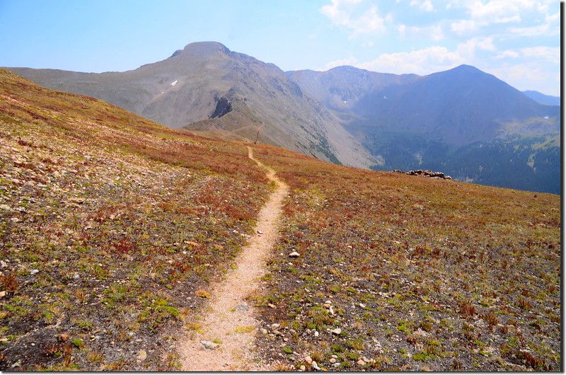
The route turns south on the Continental Divide Trail with great views south of James Peak
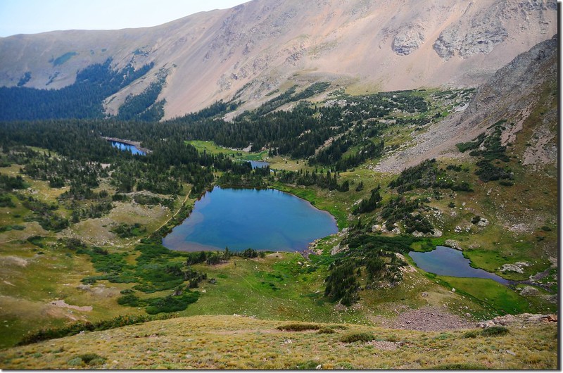
Looking down at Heart Lake from Continental Divide
The route turns south on the Continental Divide Trail with great views south of James Peak
此路線在四年前已走過,路徑還算清楚,且沿途約每兩三百呎處便堆有一堆石堆,上插一根木頭為記,整條路徑大致在等高線上的苔原、亂石堆中緩下,除非你刻意要登上路左的無名山頭。
The route turns south on the Continental Divide Trail with great views south of James Peak
Looking down at Heart Lake from Continental Divide
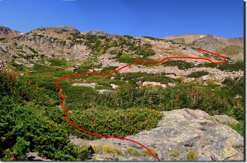
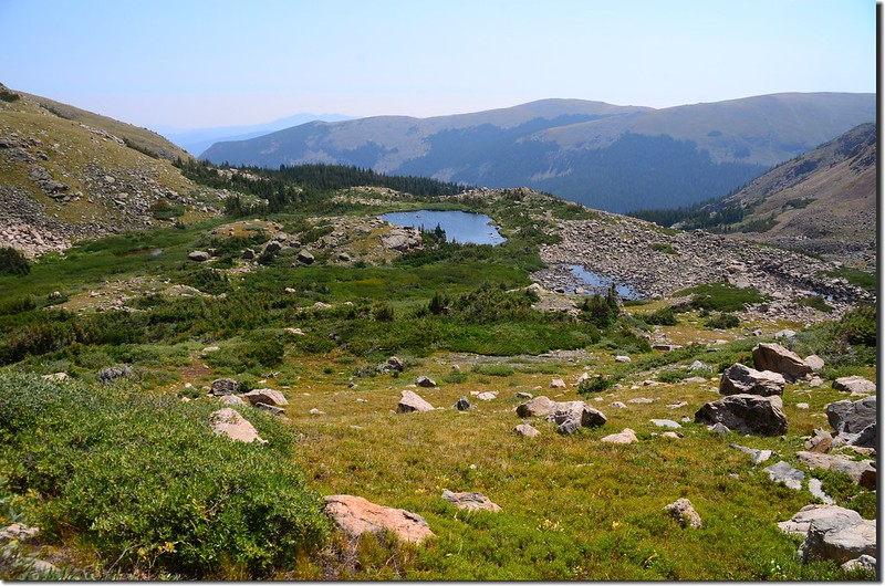
14:02 抵達Corona Trail和Rogers Pass Trail的岔路,此處海拔約11,850呎/3,612公尺,距登山口約6.0哩;
Corona Trail (CDT) - Rogers Pass Trail split
右岔往下行是Corona Trail通往James Peak Trailhead,左岔南行往Rogers Pass Trail和South Boulder Creek Trail,取左行,行約0.15哩後抵達Heart Lake上方稜線,海拔約11,875呎/3,620公尺,此處距登山口約6.15哩,如經由Rogers Pass Lake到登山口則約4.85哩;
Looking down at Heart Lake from Continental Divide
在此取左下沿South Boulder Creek Trail下行。
Looking down at Rogers Pass Lake from Rogers Pass Trail
Looking down at Heart & Rogers Pass Lake from Rogers Pass Trail
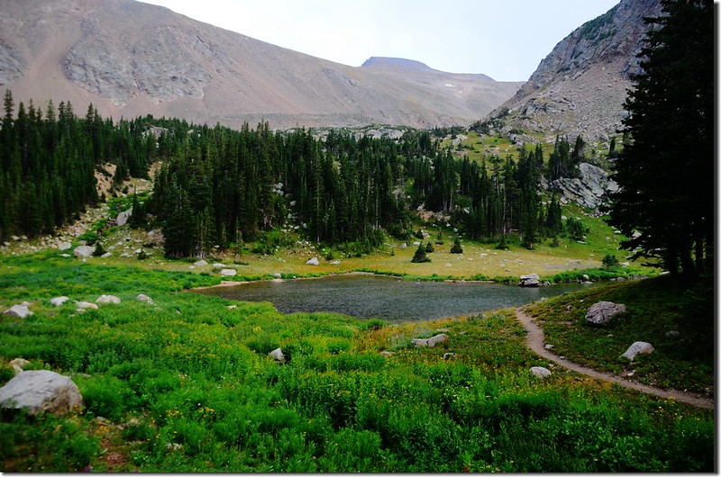
14:30 下抵Heart Lake南岸稜線,海拔約11,347呎/3,459公尺,Heart Lake已去過多次僅在南岸稜線俯瞰,隨即取右下往Rogers Pass Lake下行。
14:40 下抵Rogers Pass Lake,海拔約11,090呎/3,380公尺,拍照後沿步道下山;
Rogers Pass Lake
下行沒多久順道繞到步道右側及左側的兩個小潭逛逛。
Unnamed pond below Rogers Pass Lake
Rogers Pass Lake
下行沒多久順道繞到步道右側及左側的兩個小潭逛逛。
Unnamed pond below Rogers Pass Lake
15:15 路旁發現一隻雄moose,可能還是年輕小夥子所以角尚未長完全,但能近距離與牠接觸已屬難能可貴。
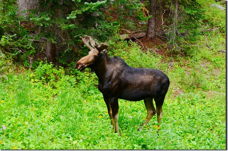
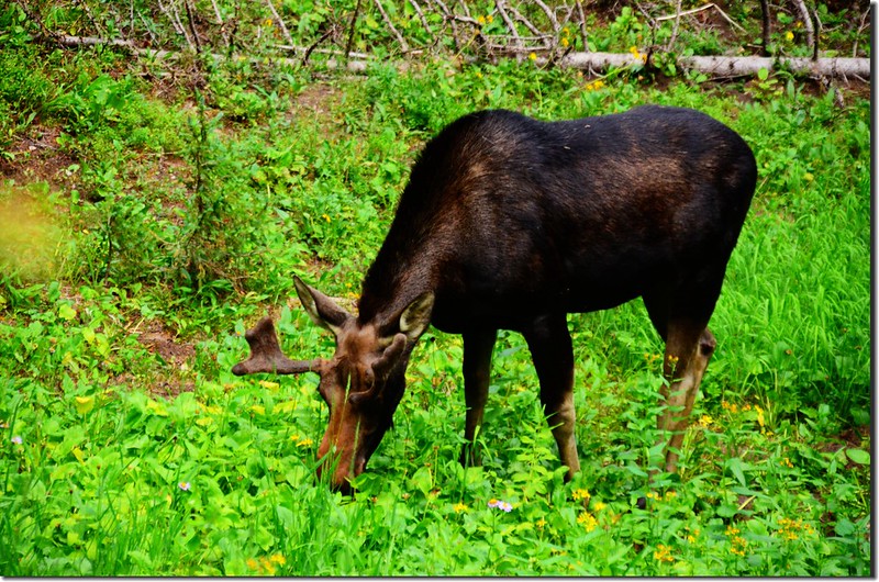
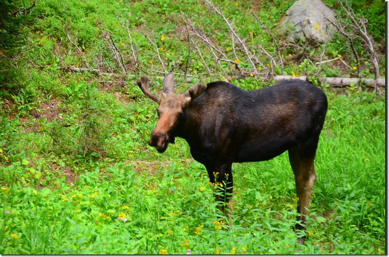
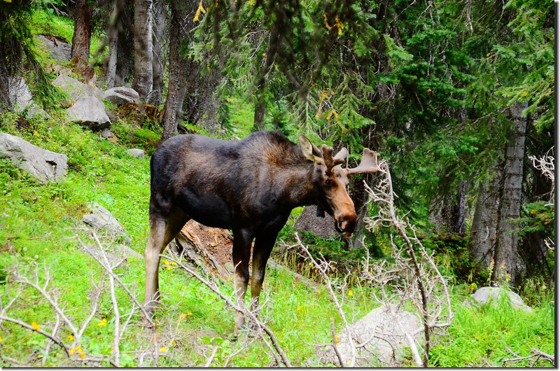
Moose at South Boulder Creek Trail
Moose at South Boulder Creek Trail
15:54 返抵Clayton Lake Trail岔路,取右下山。
16:04 抵達Crater Lakes Trail岔路,取右下山。
16:22 抵達Forest Lakes Trail岔路,仍取右下山。
16:55 返抵登山口,計畫多年的五湖O形環走總算如願完成,興奮異常;整裝後開車返家。
沒有留言:
張貼留言