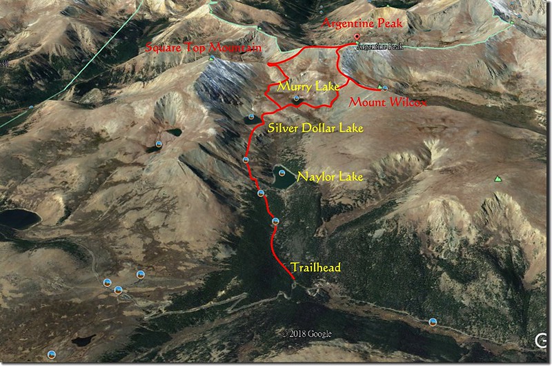
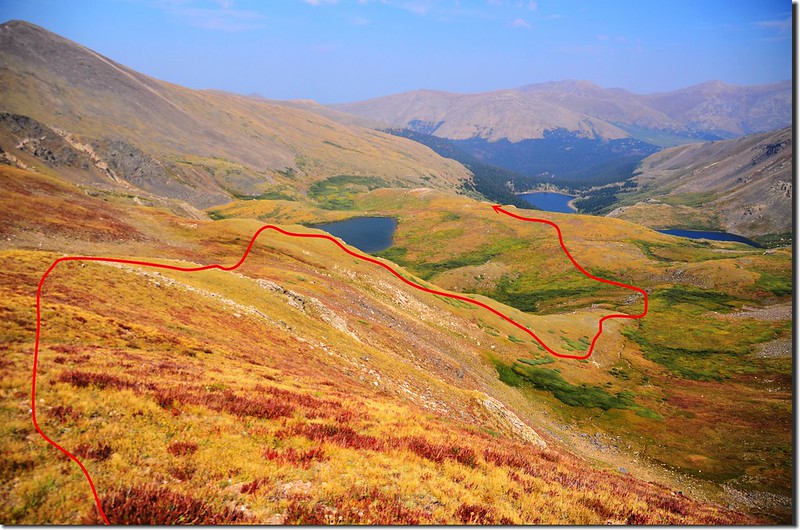
Hiking route
上週六和登山隊前去Guanella Pass附近的Silver Dollar Lake健行,因天氣欠佳,冒雨登上Silver Dollar Lake和Murry Lake後匆忙下山;領隊品菁女士曾詢及由Murry Lake攀登Argentine Peak的可行性,上網查了一下資料發覺是可行的,而且有多數登山客是採取Square Top~Argentine~Wilcox loop的O形環走方式,但中間有一段路是必須經過Naylor Lake的私人領域,那是一種非法行為,我利用本週一大晴天特地前往一探路況。
為了避開侵入Naylor Lake的私人領域我採取由Silver Dollar Lake Trailhead起登,到Murry Lake後先攀登Mount Wilcox,然後沿Wilcox~ Argentine稜線攀登Argentine,之後再沿Argentine南稜下到Argentine~Square Top鞍部,屆時視時間及體力決定進一步行程,要是時間及體力許可下續登Square Top Mountain後原路回到Argentine~Square Top鞍部,然後向東下切回到Murry Lake接上Silver Dollar Lake Trail回到登山口;如果時間或體力不許可則行至Argentine~Square Top鞍部後捨去攀登Square Top Mountain隨即下切回登山口,反正Square Top Mountain在十多年前即已攀登過了!
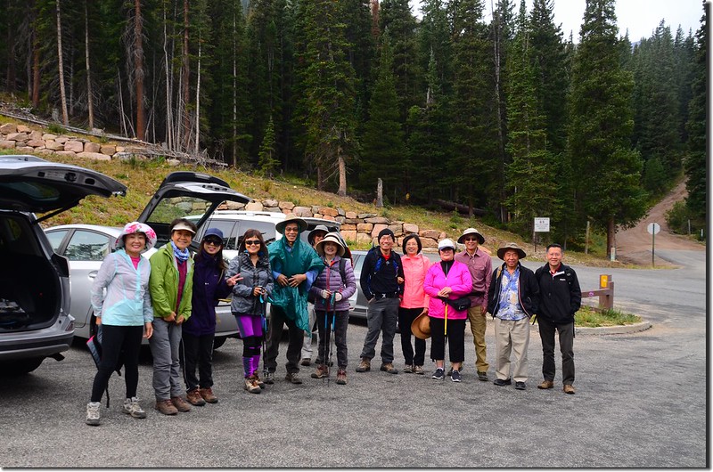
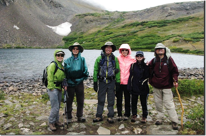
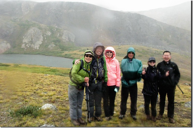
本文圖片有團體照之照片是上週六和登山隊去健行的照片,因路線相同加之當天天候不佳拍照不多,當天行程不再另寫紀錄,特將當天團體照張貼在今天的紀錄中。
~~~~~~~~~~~~~~~~~~~~~~~~~~~~~~~~~~~~~~~~~~~~~~~~~~~~~~~~~~~~~
攀登湖泊及山岳:
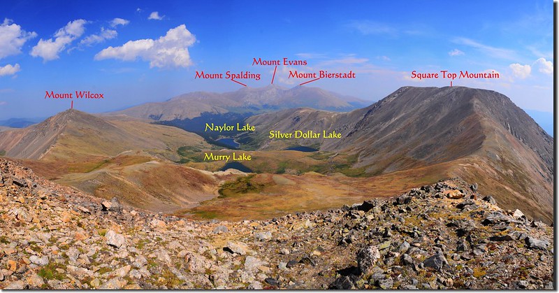
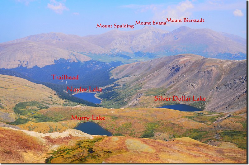
Silver Dollar Lake:海拔 11,950呎/3,642公尺
Murry Lake:海拔12,150呎/3,703公尺
Mount Wilcox:海拔 13,408呎/4,087公尺
Argentine Peak:海拔 13,738 呎/4,187 公尺
總爬升高度:約3,600呎/1,097公尺
登山里程:約10.73哩/17.17公里
~~~~~~~~~~~~~~~~~~~~~~~~~~~~~~~~~~~~~~~~~~~~~~~~~~~~~~~~~~~~~
行車資訊:
從丹佛沿I-70州際公路西行,在Exit 228下交流道進入小鎮Georgetown,然後一路沿“Guanella Pass”南行;9.5哩抵Guanella Pass Campground,再行0.1哩遇右岔Naylor Lake Road,右轉Naylor Lake Road立即抵達Silver Dollar and Murray Lake第一登山口,小車停此,但車位很少(六七部左右),在右轉Naylor Lake Road之前道路左側另有一較大停車場。四傳車輛可沿Naylor Lake Road土石路續行0.7哩抵達第二停車場。
步程簡述:
08:10 第一登山口出發,海拔約10,880呎(3,316公尺);
Silver Dollar Lake 1st Trailhead
Silver Dollar Lake 1st Trailhead (shot on 2018.08.18)
沿著Naylor Lake Road西行,一開始路有點陡,沿路林間幾處營地有人在露營。
Silver Dollar Lake 1st Trailhead
Silver Dollar Lake 1st Trailhead (shot on 2018.08.18)
沿著Naylor Lake Road西行,一開始路有點陡,沿路林間幾處營地有人在露營。
08:30 抵達第二登山口,海拔約11,200呎(3,414公尺),距第一登山口約0.7哩,路旁空地蠻大的,可停不少車子;道路續行通往Naylor Lake,那是一座私人湖泊勿進,Silver Dollar and Murry Lake第二登山口左岔小徑上山。
Silver Dollar Lake 2nd Trailhead
Silver Dollar Lake 2nd Trailhead
小徑先在松林間穿行一陣子後便穿越森林線,一路在Square Top Mountain北坡下爬升,偶而是岩石坡,偶而是高可及腰的willow樹叢,沿途俯瞰右側山坡下的私人湖泊Naylor Lake;
Naylor Lake
此段山徑坡度不大,走來蠻舒服的。
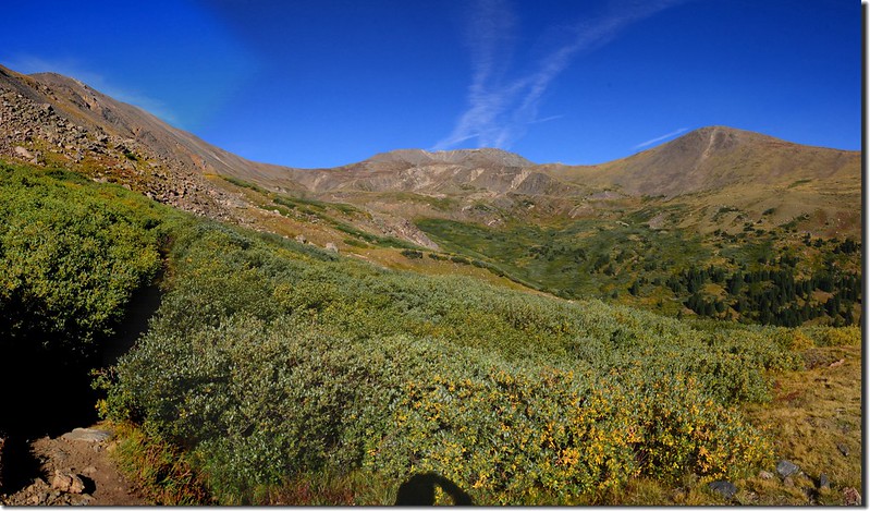
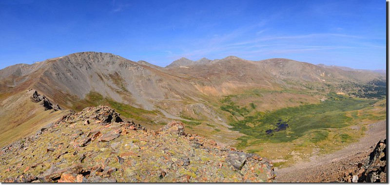
On the trail to Silver Dollar Lake, looking towards Square Top (left) 、Argentine(mid) and Wilcox (right)
Naylor Lake
此段山徑坡度不大,走來蠻舒服的。
On the trail to Silver Dollar Lake, looking towards Square Top (left) 、Argentine(mid) and Wilcox (right)
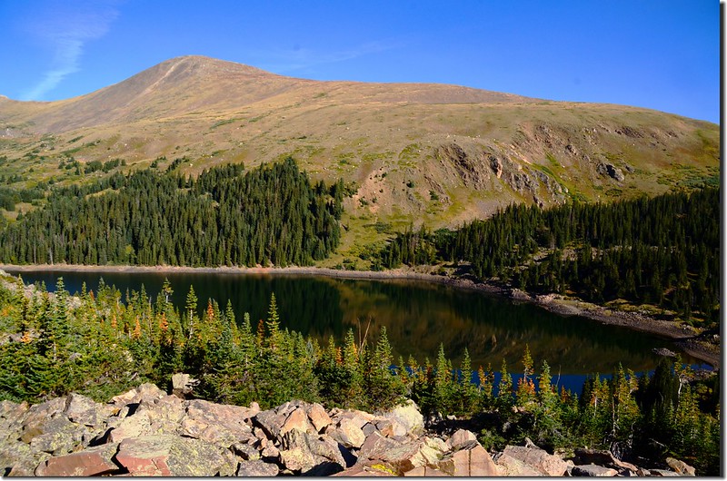
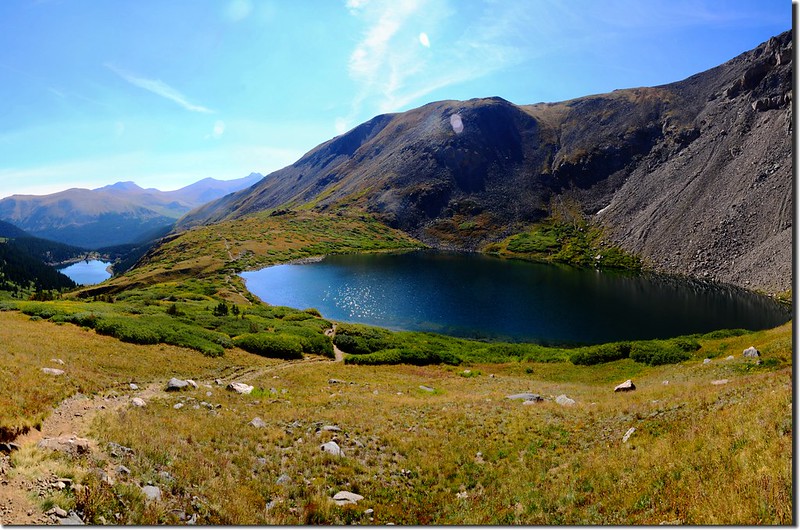
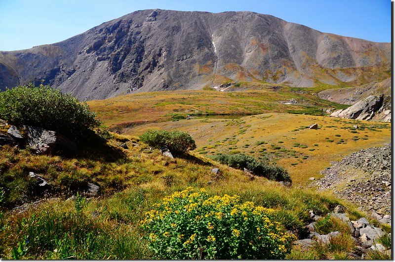
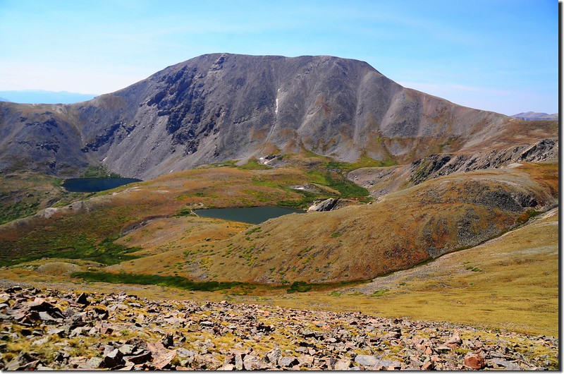
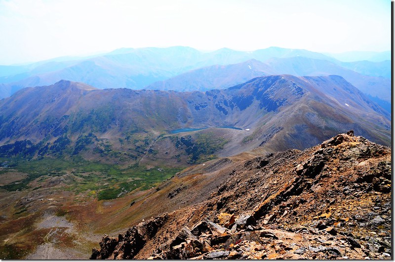
09:30 抵達第一個湖泊Silver Dollar Lake,海拔 11,950呎(3,642公尺),距第一登山口約2.5哩,她安詳的躺臥在海拔13,794呎(4,204公尺)的Square Top Mountain北坡下;
Silver Dollar Lake
Silver Dollar Lake (shot on 2018.08.18)
Silver Dollar Lake
Silver Dollar Lake
Silver Dollar Lake (shot on 2018.08.18)
Silver Dollar Lake
休息拍照後續往Murry Lake,Murry Lake距Silver Dollar Lake約有半哩路,爬升約250呎,從Silver Dollar Lake的北岸沿小徑稍往西北爬升,沒多久即抵達Silver Dollar Lake的北岸稜線,海拔約12,200呎(3,719公尺),Murry Lake就在北邊幾十呎的稜線下。
Looking down on Naylor lake & Silver Dollar Lake on the way up to Murray Lake

Naylor Lake from the trail above Silver Dollar Lake
Looking down on Naylor lake & Silver Dollar Lake on the way up to Murray Lake
Naylor Lake from the trail above Silver Dollar Lake
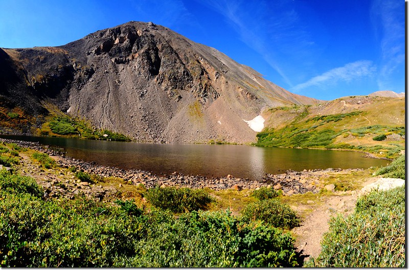
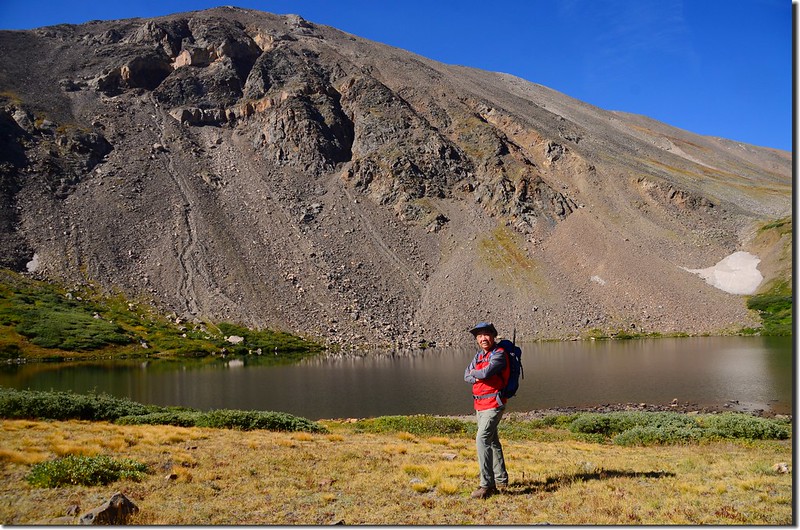
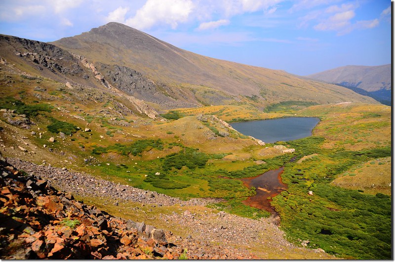
10:05 下抵Murry Lake,海拔12,150呎(3,703公尺),距第一登山口約3.0哩;
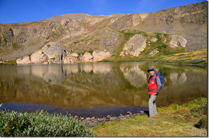
Murry Lake
Murry Lake (shot on 2018.08.18)
此湖比Silver Dollar Lake小了一點;在此觀察一下上Mount Wilcox的路線後取右下行,然後由一條乾溪溝上攀到Mount Wilcox南坡下谷地,由Murry Lake上到Mount Wilcox一路無明顯路跡,全得靠自行研判行進路線。
Mount Wilcox from Murry Lake
Looking south at Square Top Mountain from Wilcox's south slope
Murry Lake
Murry Lake (shot on 2018.08.18)
此湖比Silver Dollar Lake小了一點;在此觀察一下上Mount Wilcox的路線後取右下行,然後由一條乾溪溝上攀到Mount Wilcox南坡下谷地,由Murry Lake上到Mount Wilcox一路無明顯路跡,全得靠自行研判行進路線。
Mount Wilcox from Murry Lake
Looking south at Square Top Mountain from Wilcox's south slope
10:30 上到Mount Wilcox南面山坡下山谷凹地,山谷凹地長滿矮柳樹叢(willows),觀察一下上Mount Wilcox西南稜的路線後先沿柳樹叢左側上行,行約數十公尺再右切穿過柳樹叢。
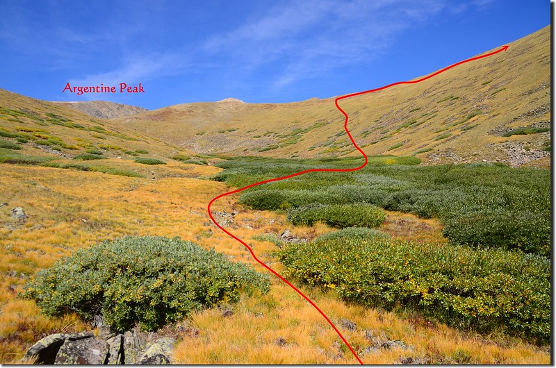
Looking towards Argentine Peak from the vallley
Looking towards Argentine Peak from the vallley
10:35 穿過柳樹叢(willows)到Mount Wilcox山腳下朝Mount Wilcox和Argentine Peak間的鞍部爬升,這段路毫無路跡,全靠登山者自行判斷路線上攀;如果越取左往低鞍上切,到稜線後再右轉沿Mount Wilcox西南稜登頂距離較長,但坡度較緩,如果越取右往稜線上切,到稜線後再右轉沿Mount Wilcox西南稜登頂距離較短,但坡度較陡峭,我則依自己事先規劃的路線往上爬升。
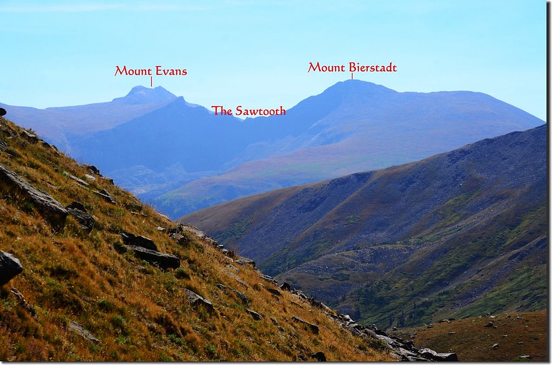
Looking east at Evans、the Sawtooth & Biestadt from Wilcox's south slope
Looking east at Evans、the Sawtooth & Biestadt from Wilcox's south slope
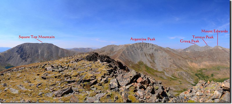
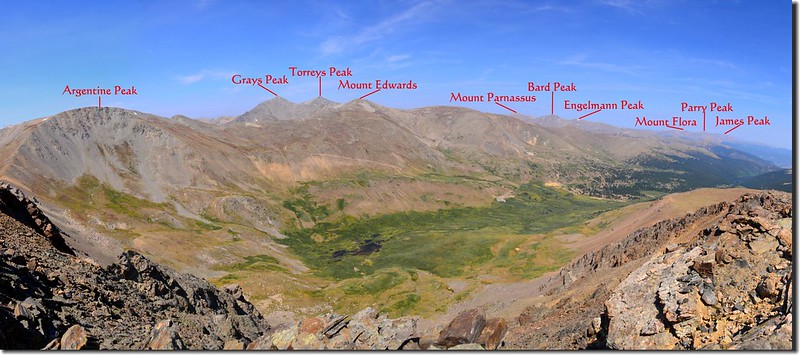
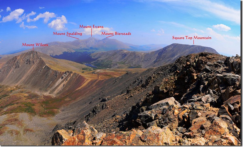
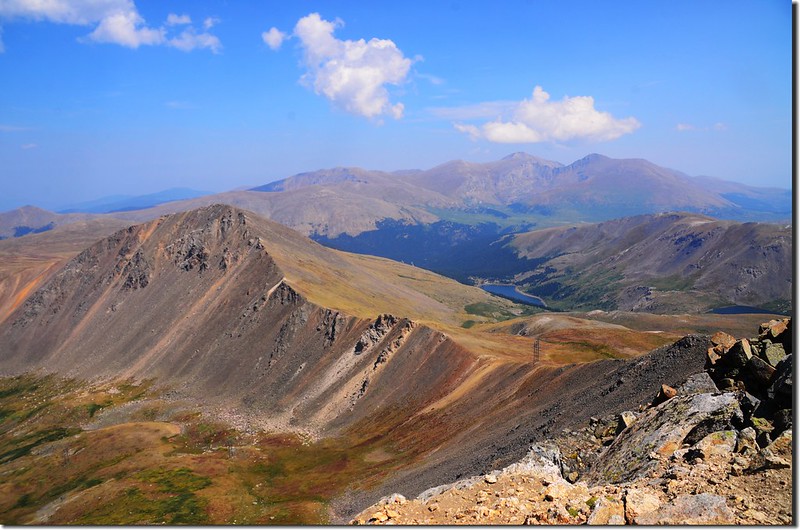
11:15 登上Mount Wilcox西南稜稜線,此處海拔約12,960呎/ 3,950公尺,距登山口約3.78哩/6.05公里;在稜線上東望Mount Evans、Mount Bierstadt兩座14ers,西眺待會兒要去攀登的Argentine Peak和遠方的兩座14ers~Grays & Torreys Peaks;
Facing northeast from Argentine~Wilcox saddle
南望Silver Dollar Lake 上頭的Square Top Mountain;
Looking south at Square Top Mountain from Wilcox's southwest ridge
北邊則是Mount Wilcox西南稜的稜線直通山頂;
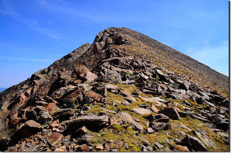
Terrain up to Mount Wilcox
在此右轉沿Mount Wilcox西南稜稜線上攀,路徑不是很清楚,自行循路上行。
From near the summit of Wilcox, Looking back the ridge toward Argentine
Facing northeast from Argentine~Wilcox saddle
南望Silver Dollar Lake 上頭的Square Top Mountain;
Looking south at Square Top Mountain from Wilcox's southwest ridge
北邊則是Mount Wilcox西南稜的稜線直通山頂;
Terrain up to Mount Wilcox
在此右轉沿Mount Wilcox西南稜稜線上攀,路徑不是很清楚,自行循路上行。
From near the summit of Wilcox, Looking back the ridge toward Argentine
11:44 登上Mount Wilcox山頂,海拔13,408呎/ 4,087公尺,距登山口約4.19哩/6.75公里。
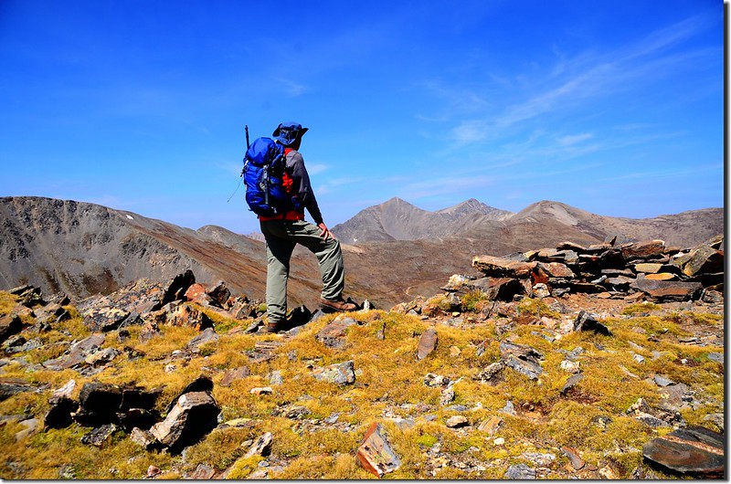
Me on the summit of Mount Wilcox
Me on the summit of Mount Wilcox
Mount Wilcox是全科羅拉多排名第315的高山,也是全科羅拉多州排名第262名的13ers (海拔介於13,000呎~13,999呎之高山總稱),今天天氣良好,山頂有360度的展望,只可惜最近全美各地的森林大火影響空氣品質,視線不是很清晰。
Looking west at Argentine & Grays、Torreys Peaks from Wilcox's summit
A panorama South~West from Wilcox's summit
A panorama East~South from Wilcox's summit
A panorama West~North from Wilcox's summit
Looking east at Evans & Bierstadt from Wilcox's summit
Looking down on the northeast ridge of Mount Wilcox from It's summit
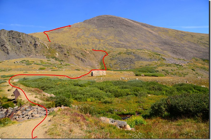
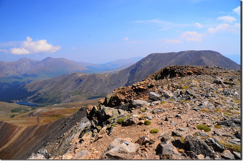
12:00 下山,循原路下山前往Argentine Peak,規劃路線是沿Mount Wilcox西南稜下到Mount Wilcox/Argentine Peak間鞍部後再沿Argentine Peak東南稜上到Argentine Peak山頂。
12:38 下到Mount Wilcox/Argentine Peak間鞍部最低鞍,海拔約12,900呎/3,932 公尺,距登山口約4.77哩/7.68公里。
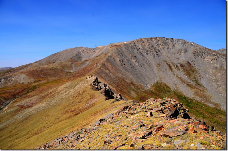
Argentine Peak from the saddle between Argentine & Wilcox

Facing southwest from Argentine~Wilcox saddle
Argentine Peak from the saddle between Argentine & Wilcox
Facing southwest from Argentine~Wilcox saddle
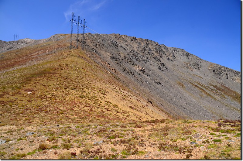
從最低鞍沿Argentine Peak東南稜朝西北方往Argentine Peak山頂爬升,這一段路比較陡峭難爬,中途會由高壓輸電鐵塔下經過,接近Argentine Peak山頂時由於右側稜線陡峭險峻,必須向右腰繞避過陡峭險峻路段。
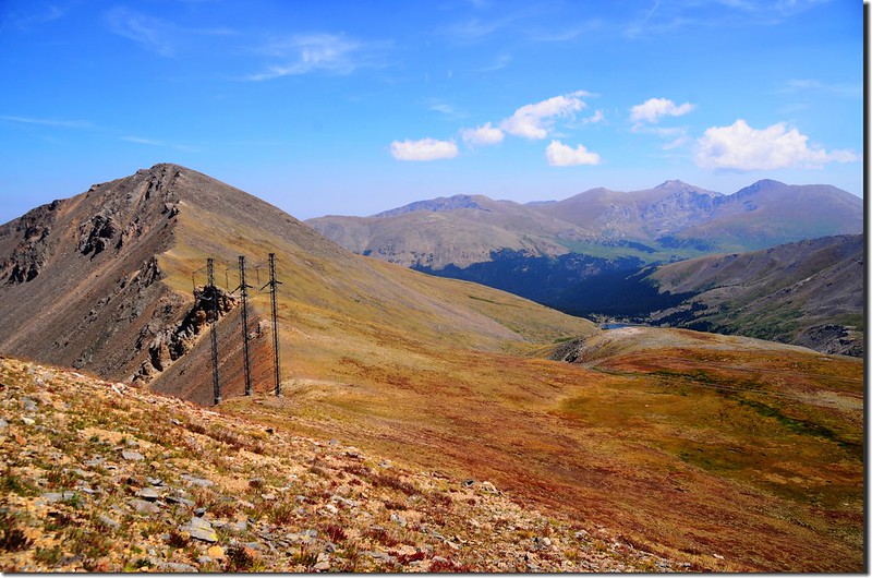
Wilcox from just below the Argentine summit
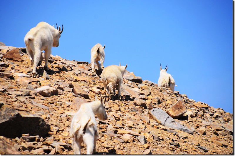
Mountain goats
Wilcox from just below the Argentine summit
Mountain goats
13:40 上抵Argentine Peak山頂東南面寬平的苔原帶,繼續沿西北方朝山頂前進,山頂立有一根大陸分水嶺步道( Continental Divide
National Scenic Trail )的木樁,目標明顯。
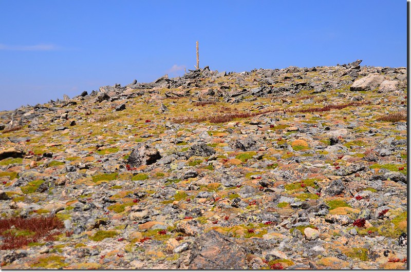
Final push to Argentine
Grays & Torreys Peaks from near Argentine summit
Final push to Argentine
Grays & Torreys Peaks from near Argentine summit
13:45 登上Argentine Peak山頂;Argentine Peak山頂海拔 13,738 呎/4,187 公尺,距登山口約5.7哩/9.12公里;Argentine Peak是全科羅拉多排名第131的高山,也是全科羅拉多州排名第78名的13ers (海拔介於13,000呎~13,999呎之高山總稱),山頂岩石上崁有一枚毀損僅剩一半的水準點(benchmark);
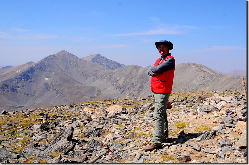
Me on the summit of Argentine Peak
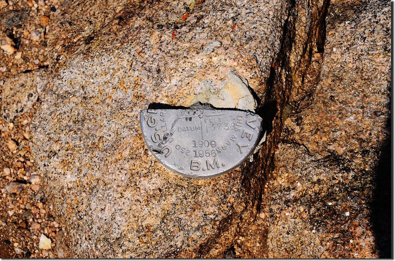
Argentine Peak's Benchmark
Me and Argentine Peak's Benchmark
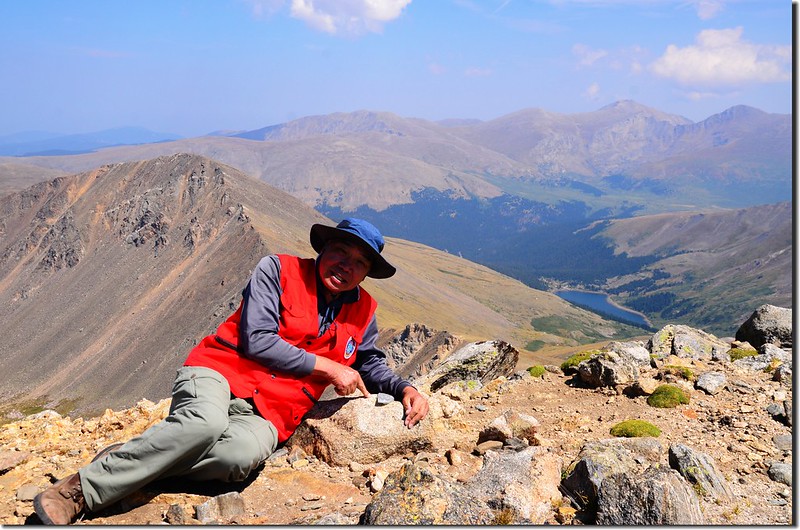
我在山頂用餐、賞景拍照。
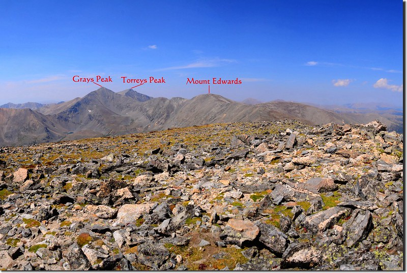
View of Grays、Torreys Peaks and Mt. Edwards from the summit of Argentine Peak
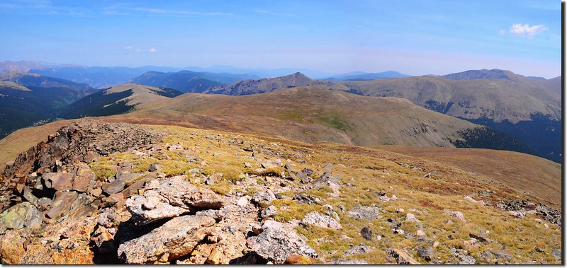
A panorama East~South from Argentine Peak
A panorama looking east from the south ridge of Argentine Peak
Looking southeast at Evans、Bierstadt & Square Top from the summit of Argentine Peak
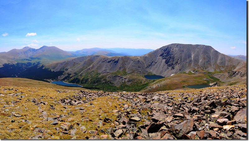
Looking down at the valley from the summit of Argentine Peak
Wilcox from the summit of Argentine, Evans & Bierstadt are in the distance
Me on the summit of Argentine Peak
Argentine Peak's Benchmark
Me and Argentine Peak's Benchmark
我在山頂用餐、賞景拍照。
View of Grays、Torreys Peaks and Mt. Edwards from the summit of Argentine Peak
A panorama East~South from Argentine Peak
A panorama looking east from the south ridge of Argentine Peak
Looking southeast at Evans、Bierstadt & Square Top from the summit of Argentine Peak
Looking down at the valley from the summit of Argentine Peak
Wilcox from the summit of Argentine, Evans & Bierstadt are in the distance
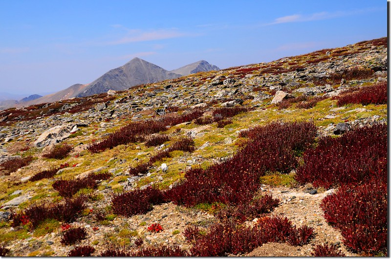
14:30 下山,計畫沿著Argentine Peak的南稜下到Argentine Peak/Square Top Mountain間的鞍部後看情況續上Square Top Mountain或左切下山。
View of Grays、Torreys Peaks from the south ridge of Argentine Peak

The shack below Point 13,550' near the summit of Argentine
View of Grays、Torreys Peaks from the south ridge of Argentine Peak
The shack below Point 13,550' near the summit of Argentine
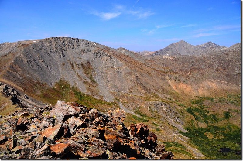
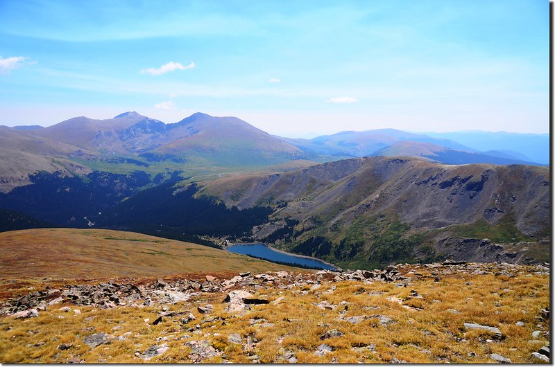
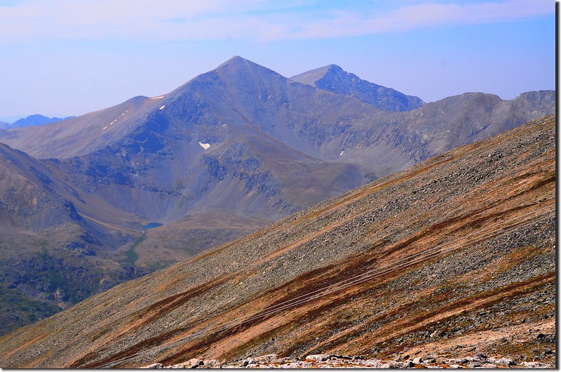
14:50 抵達Argentine Peak南稜13,550呎山頭,在此西南俯瞰前兩週才去攀登的高山湖Shelf Lake及其後面的Decatur Mountain;
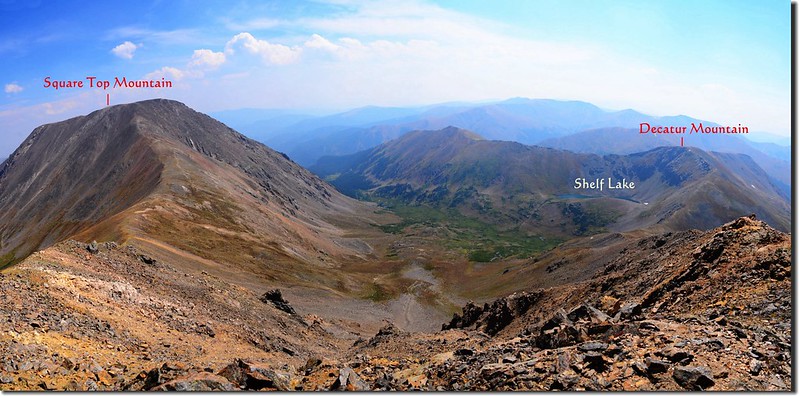
Looking south at Square Top & Decatur Mountain from Point 13,550'
Looking southwest at Decatur Mountain & Shelf Lake from Point 13,550'
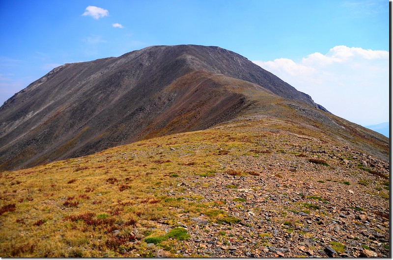
東南方近在眼前的則是海拔4,201公尺的Square Top Mountain;續沿Argentine Peak的南稜往Argentine Peak/Square Top Mountain間的鞍部下行。
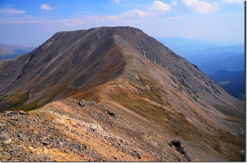
Square Top Mountain from the south ridge of Argentine Peak
Looking south at Square Top & Decatur Mountain from Point 13,550'
Looking southwest at Decatur Mountain & Shelf Lake from Point 13,550'
東南方近在眼前的則是海拔4,201公尺的Square Top Mountain;續沿Argentine Peak的南稜往Argentine Peak/Square Top Mountain間的鞍部下行。
Square Top Mountain from the south ridge of Argentine Peak
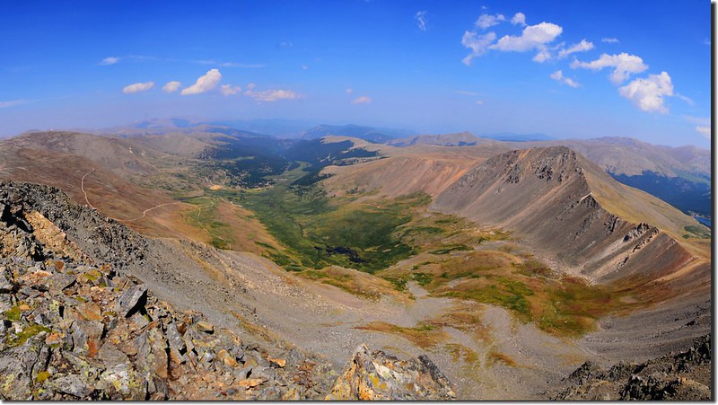
15:10 下抵Argentine Peak/Square Top Mountain間的最低鞍部,海拔 13,990 呎/3,959公尺,距登山口約6.7哩/10.2公里;
Looking towards Square Top Mountain from the saddle between Square Top & Argentine
Looking east towards the valley from the saddle between Square Top & Argentine
此處如要繼續攀登Square Top Mountain還有1.3公里的距離,必須再爬升約250公尺,來回估計還要一、兩個小時,恐怕下山太晚,況且該山我於十多年前即已攀登過,所以捨該山取左下切往Murry Lake移動,打算下抵Murry Lake的南岸稜線後接到Silver Dollar Lake Trail循早上上山的步道下山。
Looking down at the down hill route
Murry Lake from the upper slope
15:49 下抵Murry Lake的南岸稜線後接到Silver Dollar Lake Trail右轉下山;由Argentine Peak/Square Top Mountain間的最低鞍部到此約1.13哩。
17:10 返抵登山口停車場,完成一趟兩座13ers的小O環走,如果早些出門再加上攀登Square Top Mountain來個三山小O環走不是太難的行程!
沒有留言:
張貼留言