
Jasper Lake
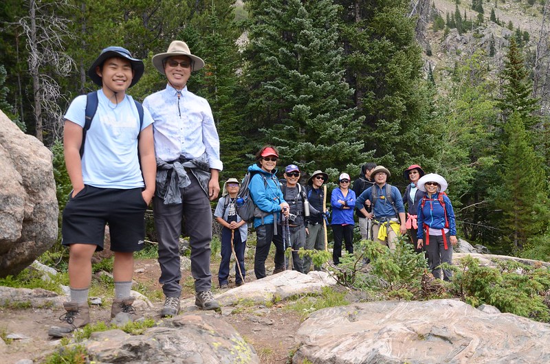
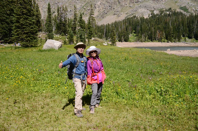
上週六(24)登山隊前往攀登Nederland附近隸屬於Indian Peaks Wilderness範圍內的Jasper Lake,由於該湖的登山口Hessie Trailhead停車不易,我們先開車到Nederland的Park & Ride停車,再搭免費的shuttle bus進到登山口。
-----------------------------------------------------------------------------------------------------
攀登湖泊:Jasper Lake,海拔10,814呎/3,296公尺
登山口:Hessie Trailhead
登山里程:來回約10.3哩/16.48公里
總爬升高度:約1,942呎/592公尺
登山時間:6小時10分鐘
-----------------------------------------------------------------------------------------------------
步程簡述:
09:40 從CR 130 (The Fourth of July Road) shuttle bus停車處出發,海拔8,990呎/2,470公尺;
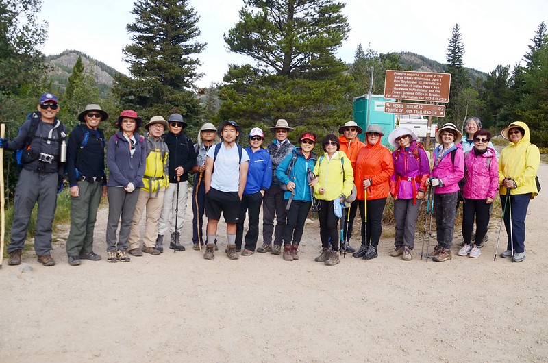
The shuttle bus stop at The Fourth of July Road
取左岔Jeep road朝西北往Hessie Trailhead下行,行數十公尺後遇水路取右側小徑繞行。
The shuttle bus stop at The Fourth of July Road
取左岔Jeep road朝西北往Hessie Trailhead下行,行數十公尺後遇水路取右側小徑繞行。
09:45 避開水路後接回Jeep road往Hessie Townsite續行;

Hessie Townsite
行不久路右幾間老舊木屋遺址。

Hessie Townsite
Hessie Townsite
行不久路右幾間老舊木屋遺址。
Hessie Townsite
09:51 抵Jeep road終點,有一人行木橋橫跨Jasper Creek支流,此處海拔約9,032呎/2,753公尺,距CR 130岔路約0.6哩。

The Footbridge on Trailhead
The Footbridge on Trailhead
09:52 通過木橋不遠即抵達Hessie Trailhead,海拔約9,035呎/2,754公尺,距CR 130岔路約0.65哩;

Hessie Trailhead
過了登山口沿寬敞石子路續行。
Hessie Trailhead
過了登山口沿寬敞石子路續行。
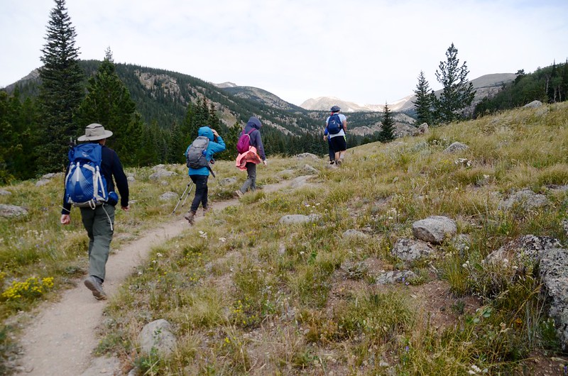
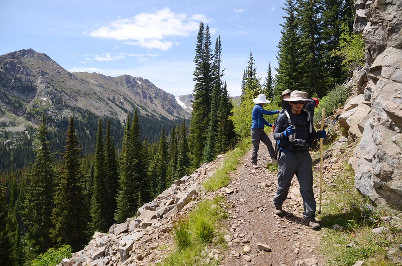
09:58 路左一捷徑直接穿越草原斜坡,我們沿寬敞石子路續行。

Jasper Lake Trail, Colorado

Jasper Lake Trail (picture taken by Tony)

Jasper Lake Trail, Colorado
Jasper Lake Trail, Colorado
Jasper Lake Trail (picture taken by Tony)
Jasper Lake Trail, Colorado
10:10 由Jasper Creek Falls上方經過,海拔約9,337呎/2,846公尺,距CR 130岔路約1.1哩;Jasper Creek Falls就在左下方數十公尺處,下山時再去一遊,沿步道續行。
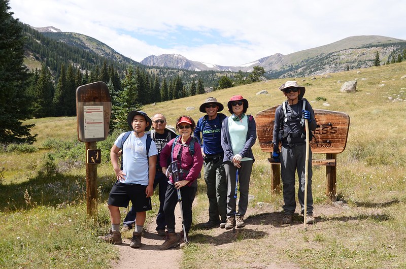
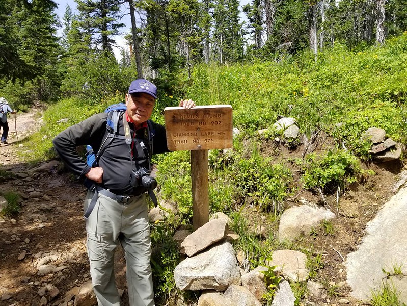
10:18 抵達Devils Thumb Trail & Devils Thumb Bypass Trail 岔路,海拔約9,444呎/2,879公尺,距CR 130岔路約1.5哩;

Lower Thumb Trail & Devils Thumb Bypass Trail junction
Lower Thumb Trail & Devils Thumb Bypass Trail junction
左岔過橫跨Jasper Creek木橋是Devils Thumb Trail,可通往Lost Lake、King Lake和Woodland Lake,右行直上是Devils Thumb Bypass Trail,直通Jasper Lake和Devils Thumb Lake,兩路最後會再相會;取右上,山徑變得狹窄陡峭。

Jasper Lake Trail, Colorado
Jasper Lake Trail, Colorado
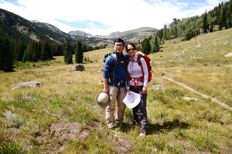
10:35 抵一片大草原,海拔約9,625呎/2,934公尺,距CR 130岔路約1.9哩;
A meadow near Indian Peaks Wilderness boundary sign
此草原如在七月份經過正是野花遍開,非常壯觀,現在已是八月底,大部分的野花花期已過,看不到遍地野花的盛況,西北遠眺積雪的Devils Thumb Bypass。

View west along Devils Thumb trail near the entrance sign to the Indian Peaks Wilderness
A meadow near Indian Peaks Wilderness boundary sign
此草原如在七月份經過正是野花遍開,非常壯觀,現在已是八月底,大部分的野花花期已過,看不到遍地野花的盛況,西北遠眺積雪的Devils Thumb Bypass。
View west along Devils Thumb trail near the entrance sign to the Indian Peaks Wilderness
10:37 進入Indian Peaks Wilderness的範圍,立有一面木製界牌,海拔約9,630呎/2,935公尺,距CR 130岔路約2.0哩;


Indian Peaks Wilderness boundary sign
過界牌後沿草原續往西北行。
Indian Peaks Wilderness boundary sign
過界牌後沿草原續往西北行。
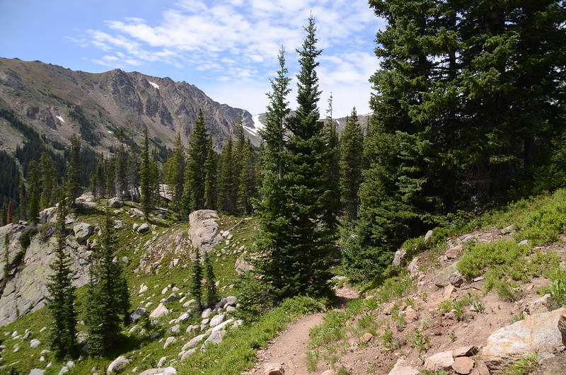
10:45 步道又進入林中緩升穿行,海拔約9,678呎/2,950公尺,距CR 130岔路約2.2哩。
11:02 接到Upper Devils Thumb Trail & Devils Thumb Bypass Trail 岔路,海拔約9,790呎/2,984公尺,距CR 130岔路約2.8哩;
Upper Thumb Trail & Devils Thumb Bypass Trail junction
左岔下行可通往Woodland Lake、King Lake和Lost Lake等步道及回到登山口,取右岔往Jasper Lake上行,此後步道多亂石較為難行。


Jasper Lake Trail, Colorado
Upper Thumb Trail & Devils Thumb Bypass Trail junction
左岔下行可通往Woodland Lake、King Lake和Lost Lake等步道及回到登山口,取右岔往Jasper Lake上行,此後步道多亂石較為難行。
Jasper Lake Trail, Colorado
11:28 抵一處展望點,海拔約10,142呎/3,091公尺,距CR 130岔路約3.5哩;

Jasper Lake Trail (picture taken by Tony)
在展望點往東南俯瞰整個Jasper Creek及Middle Boulder Creek流域山谷。

Jasper Lake Trail, Colorado
Jasper Lake Trail (picture taken by Tony)
在展望點往東南俯瞰整個Jasper Creek及Middle Boulder Creek流域山谷。
Jasper Lake Trail, Colorado
在展望點觀景休息後續行,之後的步道更陡了一些,加上亂石偶有溼地,走起來不似前段輕鬆。

Jasper Lake Trail, Colorado
Jasper Lake Trail, Colorado
12:10 抵達Devils Thumb Trail & Diamond Lake Trail岔路,海拔約10,665呎/3,251公尺,距CR 130岔路約4.4哩;

Devil's Thumb Trail & Diamond Lake Trail junction
右岔往Diamond Lake不取,取左岔直行。

Jasper Lake Trail (picture taken by Tony)
Devil's Thumb Trail & Diamond Lake Trail junction
右岔往Diamond Lake不取,取左岔直行。
Jasper Lake Trail (picture taken by Tony)
12:20 路右有一無名小湖,湖雖小,也蠻漂亮的!

Unnamed pond below Jasper Lake


Jasper Lake Trail (picture taken by Tony)
Unnamed pond below Jasper Lake
Jasper Lake Trail (picture taken by Tony)
12:25 抵達Jasper Lake Trail和Campsite岔路,兩者皆可 抵達,取右岔往Campsite,上一小高點即是Jasper Lake南岸,海拔10,816呎/3,297公尺,距CR 130岔路約5.0哩;


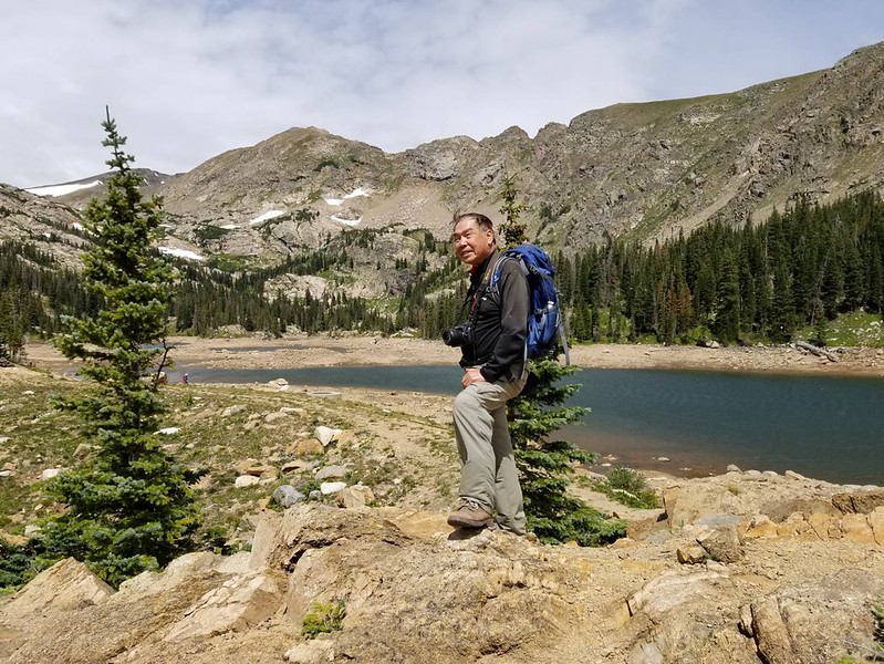


Jasper Lake
Jasper Lake
Jasper Lake本來風光明媚,但由於2013年9月份的大水災導致該湖潰堤,迄今未見修復,加上現在已是枯水期,致使不見昔日風采,我們在湖的西南岸陰涼處用餐。

Jasper Lake before the 2013 flooding


Jasper Lake
Jasper Lake before the 2013 flooding
Jasper Lake
13:10 經Jasper Lake出水口沿Devils Thumb Trail下山。
Jasper Lake Trail, Colorado
Jasper Lake Trail, Colorado
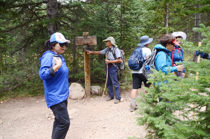
14:14 經過Upper Thumb Trail & Devils Thumb Bypass Trail junction,取左下山。
14:30 返抵大草原Indian Peaks Wilderness界牌處。


Taken from a meadow near Indian Peaks Wilderness boundary sign
Taken from a meadow near Indian Peaks Wilderness boundary sign
14:50 抵達Lower Thumb Trail & Devils Thumb Bypass Trail 岔路,取左岔下山。

Lower Thumb Trail & Devils Thumb Bypass Trail junction
Lower Thumb Trail & Devils Thumb Bypass Trail junction
15:00 抵達Jasper Creek Falls上方,右下切約50公尺抵Jasper Creek Falls處,在此休息約20分鐘後下山。

Jasper Creek Waterfall


Jasper Creek Waterfall
Jasper Creek Waterfall
Jasper Creek Waterfall
15:35 返抵Hessie Trailhead,等候shuttle bus來了後搭shuttle bus回到Nederland開車返家。