
Berthoud Pass
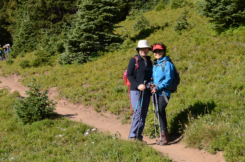
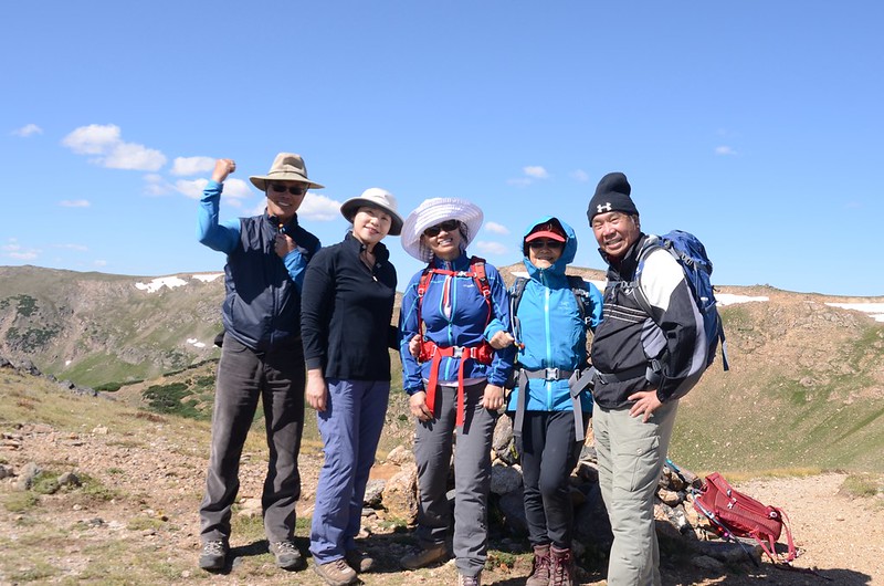
這個禮拜天(18)登山隊前往Berthoud Pass附近攀登Russell Peak,並續沿Continental Divide trail西行,本有意續行到Stanley Mountain,後來因大陸分水嶺上風太大,舉步維艱因而下撤,今天共走了約8公里,總爬升約四百多公尺。
-------------------------------------------------------------------------------------------------------
攀登山頭:Russell Peak,海拔12,300 呎 / 3,749公尺
登山口:Berthoud Pass Trailhead,海拔11,307呎/3,446公尺
折返點:海拔約12,331呎/3,758公尺,距登山口2.5哩
登山里程:約5.0哩/8.0公里
總爬升高度:約1,350呎/411公尺
登山時間:約4小時
-------------------------------------------------------------------------------------------------------
行車資訊:
由Golden開車沿I-70西行,行至I-70里程232哩時由Exit-232下交流道,然後右轉沿U.S. 40 西行,行約14.5哩抵達道路最高點大陸分水嶺 Berthoud Pass,道路右(東)側有一大型停車場和一座避難和休息用的warming hut,此處為洛磯山脈大陸分水嶺 ,北邊屬於太平洋水系,南邊屬於大西洋水系,此處也是Berthoud Pass登山口,海拔11,307呎(3,446公尺),將車子停在停車場。

Berthoud Pass
Looking north at mountains from Berthoud Pass
Berthoud Pass
Looking north at mountains from Berthoud Pass
步程簡述:
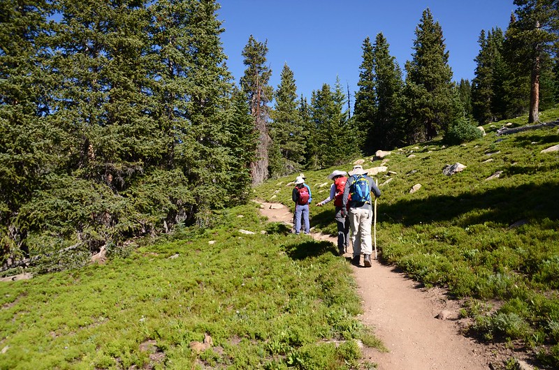
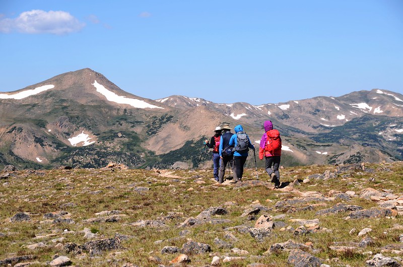
09:05 登山口出發,由Berthoud Pass停車場橫越US 40公路到公路西側沿Continental Divide trail朝西北上行。

Berthoud Pass Trailhead

Continental Divide Trail
Berthoud Pass Trailhead
Continental Divide Trail
09:12 上行約0.1哩後步道右側立有一面Vasquez Peak Wilderness解說牌,海拔約11,391呎/3,472公尺,距登山口約0.1哩;
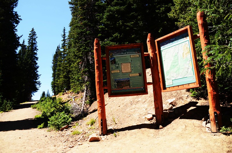
Vasquez Peak Wilderness sign
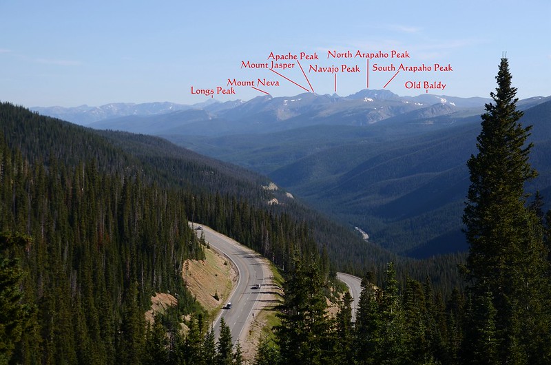
過了解說牌後寬敞的步道沿著西南側山腰在杉林中緩和上升,左邊樹縫空隙南眺Engelmann Peak、Mount Parnassus和Woods Mountain等高山,並清楚望見上週登山隊去登山的Ruby Gulch Trail以及所抵達的位在Mount Parnassus和Woods Mountain稜線下的盆地。

Continental Divide Trail

Looking east at Colorado Mines Peak from Russell Peak Trail


Continental Divide Trail


Continental Divide Trail


Looking south at mountains from Russell Peak Trail
Vasquez Peak Wilderness sign
過了解說牌後寬敞的步道沿著西南側山腰在杉林中緩和上升,左邊樹縫空隙南眺Engelmann Peak、Mount Parnassus和Woods Mountain等高山,並清楚望見上週登山隊去登山的Ruby Gulch Trail以及所抵達的位在Mount Parnassus和Woods Mountain稜線下的盆地。
Continental Divide Trail
Looking east at Colorado Mines Peak from Russell Peak Trail
Continental Divide Trail
Continental Divide Trail
Looking south at mountains from Russell Peak Trail
09:50 出森林線抵達大陸分水嶺東端稜線,海拔約11,914呎/3,631公尺,距登山口約0.9哩;

Taken from Russell Peak trail near 11,900 ft
稜線上一座蠻高的石堆(cairns),過了石堆到空曠處有極佳的展望,東北方是Winter Park及遠方的洛磯山脈。


Taken from Russell Peak trail near 11,900 ft


Continental Divide Trail
Taken from Russell Peak trail near 11,900 ft
稜線上一座蠻高的石堆(cairns),過了石堆到空曠處有極佳的展望,東北方是Winter Park及遠方的洛磯山脈。
Taken from Russell Peak trail near 11,900 ft
Continental Divide Trail
09:58 上到稜線開闊處,Russell Peak矗立在西邊稜線上,沿著Continental Divide trail朝西行。


Continental Divide Trail
Continental Divide Trail
10:12 抵達Russell Peak山腳下,開始”之”字形爬升,海拔約11,940 呎 / 3,639公尺,距登山口約1.3哩。


Up to Russell Peak on the Continental Divide Trail


Alpine Gentian

Looking east at James Peak~Colorado Mines Peak ridge from Continental Divide trail
Up to Russell Peak on the Continental Divide Trail
Alpine Gentian
Looking east at James Peak~Colorado Mines Peak ridge from Continental Divide trail
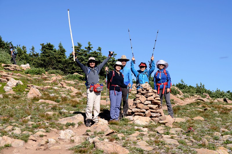
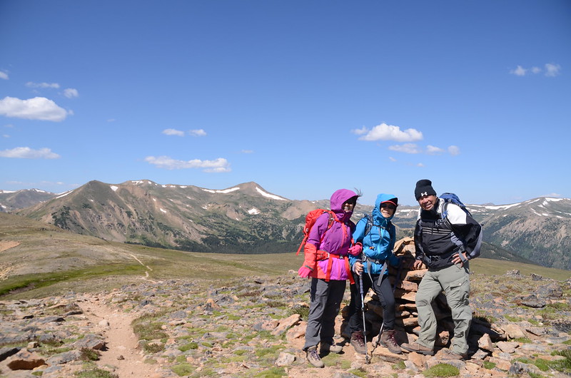
10:30 登頂Russell Peak,海拔約12,300 呎 / 3,749公尺,距登山口約1.6哩;

Taken from the summit of Russell Peak
山頂有360度的展望。


Taken from the summit of Russell Peak

Mountain views from Russell Peak

Overlook from Russell Peak
Taken from the summit of Russell Peak
山頂有360度的展望。
Taken from the summit of Russell Peak
Mountain views from Russell Peak
Overlook from Russell Peak
在Russell Peak山頂小休後續沿Continental Divide trail西行。


Continental Divide Trail
Continental Divide Trail
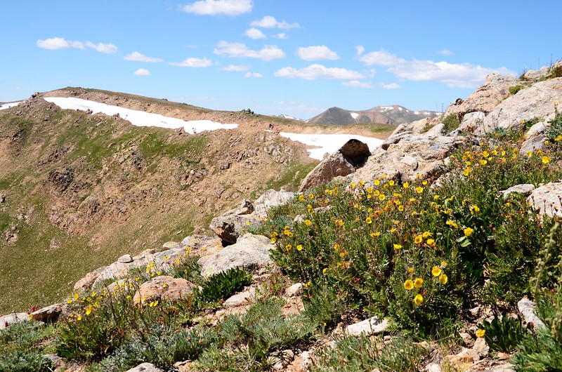
10:52 抵達一高點~Point 12,391 ft.,高點上立有一根Vasquez Peak Wilderness木製界牌,海拔約12,391呎/3,777公尺,距登山口約1.9哩;


Taken from the Point 12,391 ft on the Continental Divide

Taken from the Point 12,391 ft on the Continental Divide
高點南面山坡下有幾個小小潭湊成的小湖群,湛藍的湖水由高往下望異常的美麗。

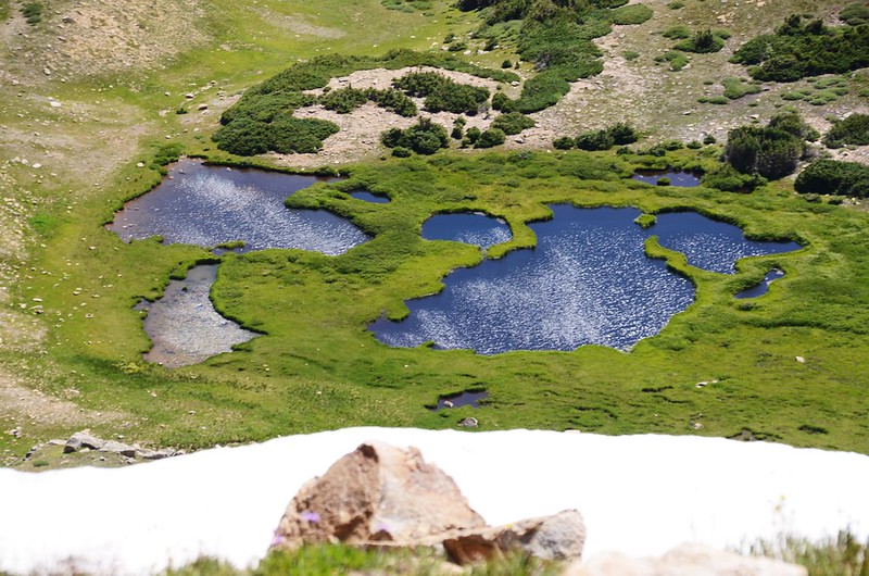
Looking southwest at mountains & unamed pond from Continental Divide Trail
Taken from the Point 12,391 ft on the Continental Divide
Taken from the Point 12,391 ft on the Continental Divide
高點南面山坡下有幾個小小潭湊成的小湖群,湛藍的湖水由高往下望異常的美麗。
Looking southwest at mountains & unamed pond from Continental Divide Trail
過了Point 12,391 ft.後Continental Divide trail就在一圈圓弧白雪的稜線朝西南延伸。

Continental Divide Trail
Continental Divide Trail
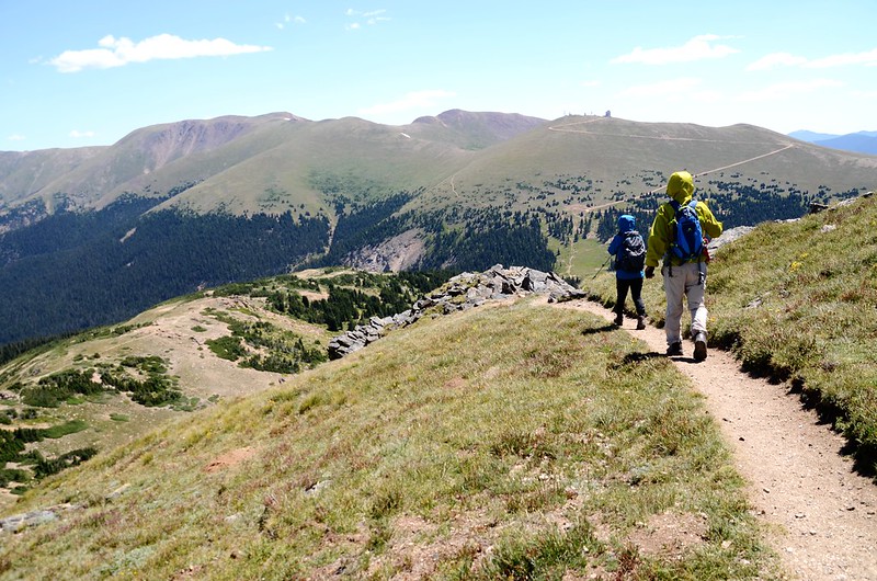
11:00 步道由Point 12,424 ft.西北面山腰腰繞而過。


Continental Divide Trail
Continental Divide Trail
11:13 折返點,海拔約12,331呎/3,758公尺,距登山口2.5哩,此處到Stanley Mountain大約還有一哩左右;


Taken from Continental Divide Trail near 12,331 ft


Taken from Continental Divide Trail near 12,331 ft
由於風大舉步維艱,大夥兒決定不再前行就此折返。


Continental Divide Trail
Taken from Continental Divide Trail near 12,331 ft
Taken from Continental Divide Trail near 12,331 ft
由於風大舉步維艱,大夥兒決定不再前行就此折返。
Continental Divide Trail
11:32 路過Point 12,391 ft.,找一處避風處休息用餐。

Continental Divide Trail
Continental Divide Trail
11:55 續行下山。

Rock ptarmigan
Rock ptarmigan
12:03 由Russell Peak山頂朝東北”之”字形下切。
Continental Divide Trail
Continental Divide Trail
13:00 返抵Berthoud Pass停車場,整裝後共乘返回Golden,結束今天的登山行程。
沒有留言:
張貼留言