
Hiking route
小孫子貝貝一直希望我帶他攀登科羅拉多第14高峰Mount Evans (海拔 14,264 呎 / 4,348 公尺),他強調是”攀登”,因為該山有景觀道路車子可直開山頂停車場,在走個十幾二十分即可登頂,這個他不要,強調要”攀登”;今天恰好有山友邀約攀登該山,就帶貝貝去圓夢!
-------------------------------------------------------------------------------------------------------
山岳簡介:
Mount Evans位在丹佛西方約50哩的地方,隸屬於Front Range,海拔14,264呎/4,348公尺,在科羅拉多州高山14ers中排名第14,該座山有一條全美最高的鋪設柏油道路Mount Evans Scenic Byway 直通到距山頂130呎/40公尺高的地方。
Mount Evans最早的命名是Mount Rosa或 Mount Rosalie,她是由Albert Bierstadt為他後來的妻子Fitz Hugh Ludlow所命名,之所以名為Mount Evans是參考瑞士第一高峰Monte Rosa而來。Bierstadt是19世紀一位風景藝術家(Landscape artist)、落磯山脈勘測隊 (Rocky Mountains Survey Team) 成員,Mount Bierstadt即是以他之名而命名;他在1863年 和他的嚮導 William Newton Byers從Idaho Springs沿著Chicago Creek欲登此山,他們在要登上Summit Lake面對此山時花了幾天的時間在Chicago Lakes畫下此山的山容素描。
1895年科羅拉多州議會正式通過將此山改名為Mount Evans,用以表達對1862~1865年間的第二任科羅拉多州長John Evans的敬意。
到底誰是第一位登上此山者一直有所爭議,一說是Alber Bierstadt,另一說則是一位名為Judge Lunt的男子。
登Mount Evans有許多條路線,包括從Echo Lake路線、 Summit Lake路線、 West Chicago Creek路線、 Guanella Pass路線、 Bear Creek路線、 Deer Creek路線、 Cub Creek 和 Scott Gomer Creek路線,最簡單的路線是開車經由 Highway 5 (Mount Evans Scenic Byway)直上山頂,到距山頂僅剩130呎/40公尺高的停車場啟登,登頂不用10分鐘。
該座山我曾帶家人開車上過無數次,2006年夏天在美期間曾和山友Thomas和George 從另一登山口攻頂。該登山口位在Georgetown北方的Guanella Pass,海拔11,669呎/3,557公尺。我們由該登山口攀登Mount Bierstadt (海拔14,060 呎 /4,285公尺 在14ers中排名第38 )後,經由Sawtooth Ridge再攀登Mount Evans,然後由Sawtooth 和 Mt. Spalding之間的小峽谷下山,這是一條頗有難度的挑戰路線 (Mount Bierstadt to Mount Evans via Sawtooth ridge )。
2011.07.24隨同來自台北旅居丹佛的陳聰胤(Tony)會計師再由Guanella Pass 登山口同登此山,攀登路線是由Guanella Pass起登的West Ridge 路線,由登山口行約半哩多後(未跨越Scott Gomer Creek)取左穿入willows樹叢,然後由Mount Spalding與The Sawtooth之間的山溝(gully)左側的稜線上攀,下山時則由Mount Spalding與The Sawtooth之間的山溝(gully)直切下山,今天我們要走的路線差不多,只是上山時直接由Mount Spalding與The Sawtooth之間的山溝(gully)上切,然後循原路下山。
------------------------------------------------------------------------------------------------------
攀登山岳: Mount Evans (海拔 14, 264 呎 / 4,348 公尺)
登山口:Guanella Pass Trailhead
登山口高度:海拔11,669呎/3,557公尺
距離(來回):約9.25哩(14.8公里)
總爬升高度:約3,100呎/945公尺
攀登等級:Class 2
登山時間:11小時
同行山友:沈宇靈、王如友(Tony)、陳基滿、貝貝(Jacob)
------------------------------------------------------------------------------------------------------
行車資訊:
丹佛沿I-70西行,在Exit 228出口下交流道經Georgetown轉行Guanella Pass南下,續行約11.5哩的山路即達Guanella Pass的最高點前道路左側下方的停車場,此處即為登山口,海拔11,669呎/ 3,557公尺,此段道路一般車輛皆可到達。

Mount Bierstadt Trailhead parking lot
Mount Bierstadt Trailhead parking lot
步程簡述:
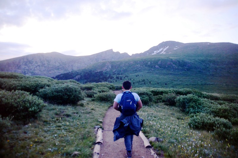
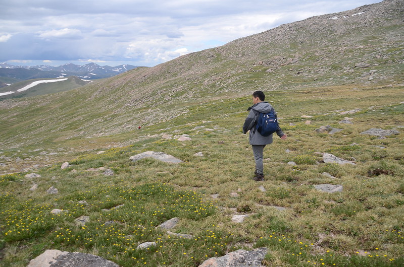
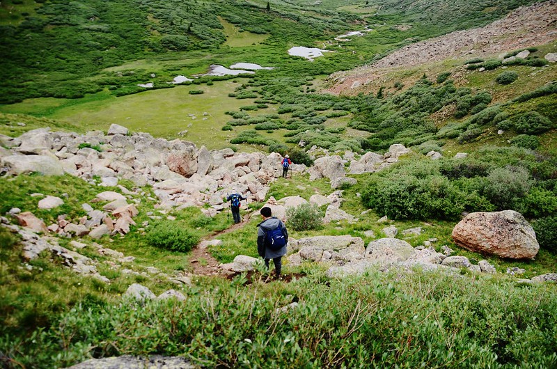
05:30 天微亮,登山口出發,沿著Mount Bierstadt Trail先下坡往沼澤地走;

Mount Bierstadt from Guanella Pass
一開始便是長滿Willows的小樹叢,在較低窪的沼澤地方已鋪有木棧道,登山路徑在沼澤和Willows間穿梭而過,之後更穿越一大片大草原。

The boardwalk have been built on the muddy sections

Unnamed pool beside the trail at 11,510'
Mount Bierstadt from Guanella Pass
一開始便是長滿Willows的小樹叢,在較低窪的沼澤地方已鋪有木棧道,登山路徑在沼澤和Willows間穿梭而過,之後更穿越一大片大草原。
The boardwalk have been built on the muddy sections
Unnamed pool beside the trail at 11,510'
05:48 抵達Scott Gomer Creek ,海拔約11,476呎/3,498公尺,距登山口約0.8哩;

Near 11,500', Crossing the Scott Gomer Creek
由小溪上的墊腳石渡過小溪,過溪後行不久步道左側出現小草原,草原上有蠻清晰的幾條小徑。
Near 11,500', Crossing the Scott Gomer Creek
由小溪上的墊腳石渡過小溪,過溪後行不久步道左側出現小草原,草原上有蠻清晰的幾條小徑。
05:51 取第一條小徑左切脫離Mount Bierstadt Trail往東前進;

The thin trail leave the main trail lead to Mount Evans

Scott Gomer Creek in the dawn
幾條小徑根本很難判斷哪條較正確,因每條小徑行一小段便鑽入Willows叢中,腳下雖有小徑痕跡,但幾乎每一條小徑都是泥濘不堪,我們就在Scott Gomer Creek右岸不遠處的Willows叢中艱難的前進。
Weaving through the Willows
The thin trail leave the main trail lead to Mount Evans
Scott Gomer Creek in the dawn
幾條小徑根本很難判斷哪條較正確,因每條小徑行一小段便鑽入Willows叢中,腳下雖有小徑痕跡,但幾乎每一條小徑都是泥濘不堪,我們就在Scott Gomer Creek右岸不遠處的Willows叢中艱難的前進。
Weaving through the Willows
昨天此地區下了雨,Willows樹叢滿是雨水,專心找路忘了叮嚀大家穿上防水夾克,一路在偶而鑽比人還高的Willows樹叢,偶而踩在沼澤地涉水而過,沒多久衣服全身濕透,加上氣溫又低,約在攝氏5度左右,大夥兒凍得直打哆嗦,Tony事後說他差點失溫,真是慘痛的經驗;

Weaving through the Willows
大約在Willows樹叢及沼澤地穿行約半哩路後接到較明確的路徑,路徑漸往右側山坡杉林邊緣腰繞,此時路徑漸漸脫離泥濘地,但兩旁的Willows仍與人同高且溼答答的,一刻不敢停留,因為一停下來就凍得直發抖,平時極為耐寒的小孫子貝貝也直說好冷!
Weaving through the Willows
大約在Willows樹叢及沼澤地穿行約半哩路後接到較明確的路徑,路徑漸往右側山坡杉林邊緣腰繞,此時路徑漸漸脫離泥濘地,但兩旁的Willows仍與人同高且溼答答的,一刻不敢停留,因為一停下來就凍得直發抖,平時極為耐寒的小孫子貝貝也直說好冷!
07:08在Willows叢中鑽行約一哩多後終於抵達Mount Spalding與The Sawtooth之間的山溝(gully)底部Scott Gomer Creek的西岸,找一處小溪較狹窄處跨過小溪再沿著明顯小徑朝山溝底部前進。

Looking at the gully from near the base of the gully, 11,700 ft
Looking at the gully from near the base of the gully, 11,700 ft
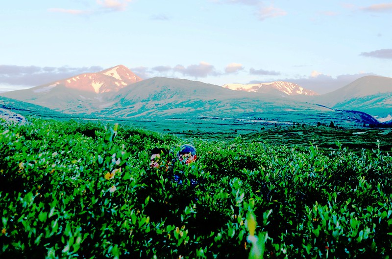
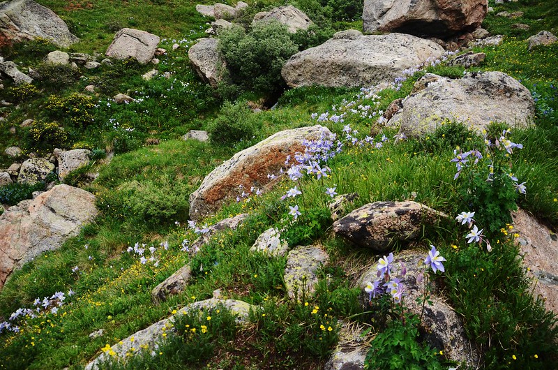
07:15 來到山溝的底部,海拔約11,850呎/3,612公尺,此地距脫離Mount Bierstadt Trail大約1.5哩,距登山口約2.3哩;開始朝著山溝頂端上爬,山溝的前半段多草地及大塊固定的岩石,小徑還算清楚,兩旁是盛開的野花,尤其是藍色的Columbine更是滿山遍野,此處的Columbine是我在丹佛近郊登山見過最大片的Columbine群聚。


Blue columbine flower

Looking down at Scott Gomer Creek & the mountains in the background
Blue columbine flower
Looking down at Scott Gomer Creek & the mountains in the background
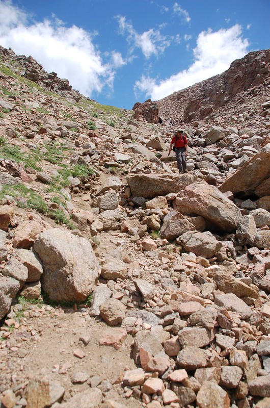
08:00 爬上多草地及大塊固定的岩石區頂端,此處海拔約12,200呎/3,719公尺;

A closer look at the gully
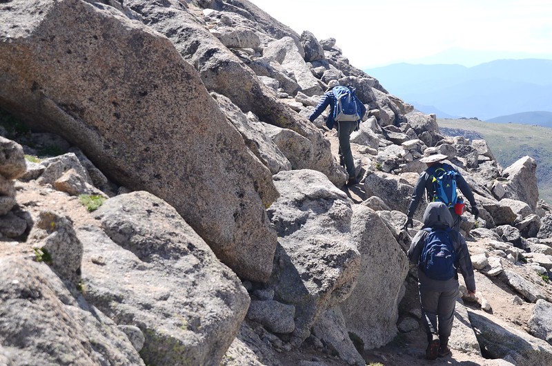
接下來的路段是狹窄的山溝地形,山徑極為陡峭且多鬆散亂石,除了埋頭往上爬外還得隨時注意是否有落石;
A closer look at the gully
貝貝最近體力特佳奮力往上爬,山友宇靈和Tony也漸漸將我甩在後頭,年紀大了爬得真累!


Tundra flowers along the trail up to Mount Evans

Looking down at Scott Gomer Creek, ascending the gully
A closer look at the gully
接下來的路段是狹窄的山溝地形,山徑極為陡峭且多鬆散亂石,除了埋頭往上爬外還得隨時注意是否有落石;
A closer look at the gully
貝貝最近體力特佳奮力往上爬,山友宇靈和Tony也漸漸將我甩在後頭,年紀大了爬得真累!
Tundra flowers along the trail up to Mount Evans
Looking down at Scott Gomer Creek, ascending the gully
此時西邊空中一架救難直升機一直在Mount Bierstadt山頭附近盤旋,不知是在執行搜救任務或其他演練,持續蠻久的,直到我們登頂(大約三小時後)還看到牠的蹤跡。

Mountain rescue helicopter hovering in the air
Mountain rescue helicopter hovering in the air
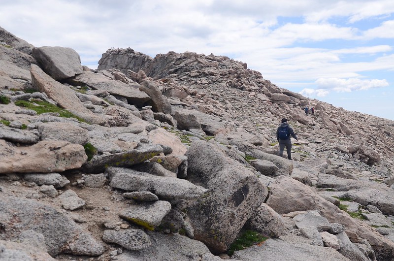
09:03 好不容易爬上陡峭峽谷頂端,海拔約13,300呎/4,054公尺,此段山溝總長約0.8哩,此地距登山口約3.1哩。
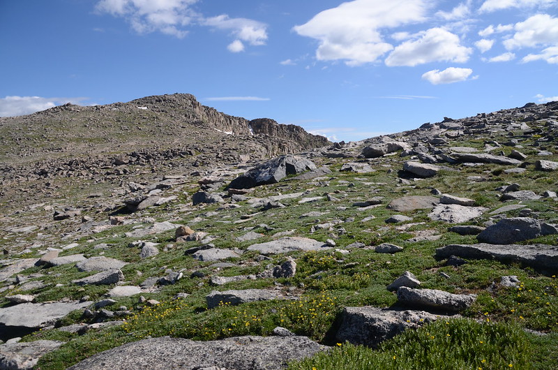
在山溝(gully)上方即是寬廣的大坡面,左右兩側偏高,中間仍是一條凹槽,只是兩側坡面緩和多了;

Taken from the top of the gully
左邊隱約看到的高點是Mount Spalding稜線,右邊高點是The Sawtooth,此時目標抓準右前方朝著東南方向高點繼續向上爬。

Taken from the west slope of Mount Evans after climbing the gully
Taken from the top of the gully
左邊隱約看到的高點是Mount Spalding稜線,右邊高點是The Sawtooth,此時目標抓準右前方朝著東南方向高點繼續向上爬。
Taken from the west slope of Mount Evans after climbing the gully
09:20 正前方稜線上出現一座小駝峰,那是Mount Evans西稜最尾端的高點,我們將從該高點的右側下切腰繞往Mount Evans山頂;


Tundra flowers along the trail up to Mount Evans
此時坡面變得更加平緩,岩石坡上蠻多苔原植物花卉,此處海拔約13,700呎/4,176公尺;

Tundra flowers along the trail up to Mount Evans

Looking back toward the gully


Taken from the west slope of Mount Evans after climbing the gully

False summit of Evans on the West end of Evans' West ridge
右側Mount Bierstadt、Sawtooth Ridge及左側的Mount Spaldingd看得一清二楚。

Looking south at Mount Biestadt & The Sawtooth from the west slope of Mount Evans after climbing the gully

Looking north at Mount Spalding from the west slope of Mount Evans after climbing the gully

Looking south at the Sawtooth ridge from the ridge between The Sawtooth & Mount Evans, near 13,750 ft
Taken from the ridge between The Sawtooth & Mount Evans, near 13,750 ft
Looking down at Summit Lake from Spalding-Evans ridge
Tundra flowers along the trail up to Mount Evans
此時坡面變得更加平緩,岩石坡上蠻多苔原植物花卉,此處海拔約13,700呎/4,176公尺;
Tundra flowers along the trail up to Mount Evans
Looking back toward the gully
Taken from the west slope of Mount Evans after climbing the gully
False summit of Evans on the West end of Evans' West ridge
右側Mount Bierstadt、Sawtooth Ridge及左側的Mount Spaldingd看得一清二楚。
Looking south at Mount Biestadt & The Sawtooth from the west slope of Mount Evans after climbing the gully
Looking north at Mount Spalding from the west slope of Mount Evans after climbing the gully
Looking south at the Sawtooth ridge from the ridge between The Sawtooth & Mount Evans, near 13,750 ft
Taken from the ridge between The Sawtooth & Mount Evans, near 13,750 ft
Looking down at Summit Lake from Spalding-Evans ridge
10:25 由稜線上最高點的一堆cairns右側下切到Mount Evans的西稜假山頭下一小鞍部(海拔約13,900呎/4,237公尺),距登山口約3.7哩;

The final part of the trail travels along the south slope of Mount Evans' west ridge
隨即再右下切到Mount Evans南坡腰繞。

Mountain rescue helicopter hovering in the air

The final part of the trail travels along the south slope of Mount Evans' west ridge
The final part of the trail travels along the south slope of Mount Evans' west ridge
隨即再右下切到Mount Evans南坡腰繞。
Mountain rescue helicopter hovering in the air
The final part of the trail travels along the south slope of Mount Evans' west ridge
Mount Evans南坡腰繞路段並不是很好走,部分路段必須在岩石堆中翻越攀爬,部分路段路跡分歧不明,必須仔細判斷、尋找,才不致迷失方向。

Looking southwest at the Sawtooth Ridge from the west side of Mt Evans
The final part of the trail travels along the south slope of Mount Evans' west ridge
Looking southwest at the Sawtooth Ridge from the west side of Mt Evans
The final part of the trail travels along the south slope of Mount Evans' west ridge
11:24 接到由停車場上來的登山步道,海拔約14,182呎/4,323公尺,距登山口約4.5哩;Mount Evans南坡腰繞路計走了約0.8哩,花了一小時的時間,腰繞路不是很好走;取左沿步道往山頂爬升。

The final part of the trail travels along the south slope of Mount Evans' west ridge

Looking down at summit parking lot from near the summit of Mount Evans
The final part of the trail travels along the south slope of Mount Evans' west ridge
Looking down at summit parking lot from near the summit of Mount Evans
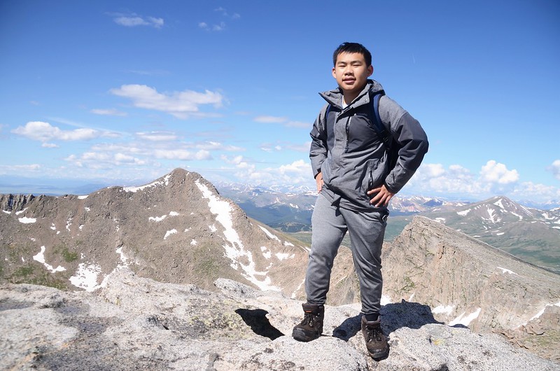
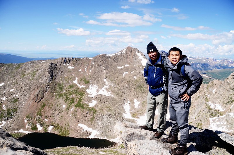
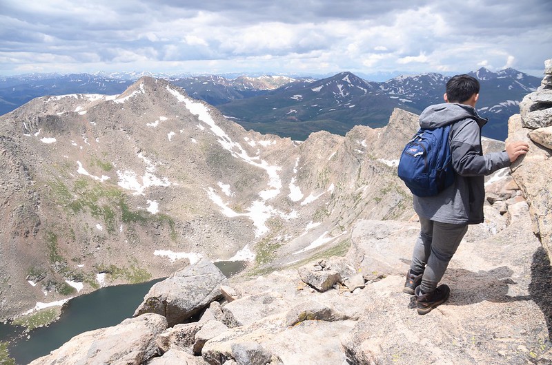
11:30 登頂Mount Evans,海拔14,264呎/4,348公尺;


Benchmake on the summit of Mount Evans


On the summit of Mount Evans
假日加上風和日麗,山頭都是人,好不熱鬧;在此用餐、休息!

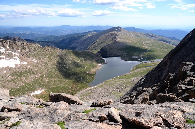
View of Summit Lake from the summit of Evans

Looking northwest at mountains from Mount Evans' summit

Looking southwest at mountains from Mount Evans' summit
12:00 循原路下山。

Alpine Sunflower – Old Man of the Mountain

The final part of the trail travels along the south slope of Mount Evans' west ridge

Taken from the south slope of Mount Evans' west ridge
Alpine Sunflower – Old Man of the Mountain
The final part of the trail travels along the south slope of Mount Evans' west ridge
Taken from the south slope of Mount Evans' west ridge
13:00 繞完腰繞路抵達Mount Evans西稜假山頭下的小鞍部,取左上高點隨即由cairns旁下切循上山路下山。
Descending the gully
Descending the gully
13:37 抵達山溝(gully)頂端,開始小心下切。


Tundra flowers along the trail up to Mount Evans


Descending the gully

Looking down Scott Gomer Creek, descending the gully

Looking down Scott Gomer Creek, descending the gully
Tundra flowers along the trail up to Mount Evans
Descending the gully
Looking down Scott Gomer Creek, descending the gully
Looking down Scott Gomer Creek, descending the gully
15:05 下抵山溝(gully)底端,再走一小段路後跨過Scott Gomer Creek上游進入willows樹叢中沿原路下山;

樹叢雨水經一日曝曬已曬乾,但地面仍泥濘不堪,又與willows樹叢和泥濘沼澤地奮戰一哩多路。
樹叢雨水經一日曝曬已曬乾,但地面仍泥濘不堪,又與willows樹叢和泥濘沼澤地奮戰一哩多路。
16:04 接回Mount Bierstadt Trail取右回停車場。
16:30 返抵停車場,歷經11個小時的苦戰終於下山了,距上次八個小時不到完登足足多了三個多小時,除了年歲漸長體力大不如前外,今天在柳樹(willows)叢中消耗太多體力也是原因之一,回到車上後看貝貝一臉疲憊樣但充滿喜悅的眼神,可以感受到他終於圓夢的成就感!

Guanella Pass Trailhead
Guanella Pass Trailhead
沒有留言:
張貼留言