
Jump!~Mount Sherman
上週六登山隊多位成員前往歐洲旅遊,固定的週六登山停辦,約集幾位山友前往Fairplay近郊攀登一座14ers~ Mount Sherman;當天阿才一部車乘載6人自行前往,我則和女兒、小孫子Jacob開一部小車前往,兩部車約在Fairplay南邊US-285和4 Mile Creek Rd岔路口會合後再開往登山口。
山岳簡介:
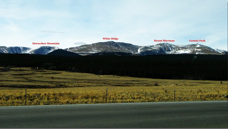
Mount Sherman海拔14,036呎/4,278公尺,是科羅拉多州第46高峰,屬於Mosquito Range;該山大約位在Fairplay 和 Leadville兩市之間,躺臥在另一座14ers Mount Lincoln南邊約8哩處,距其西北的小鎮Leadville約7哩之遙。Mount Sherman 是一座緩坡、沒有陡峭地形、山頂又很寬廣平坦的山岳,加上它的連稜也有幾座高度相近的高山,所以遠看很難分辨出來,也因為它的緩坡易爬,大部分有意征服14ers的登山客都把這座山當作入門山岳。
攀登Mount Sherman 較常走的路線有兩條,各有其特色,通常一般登山客都是從東邊經小鎮Fairplay,走 Fourmile Creek Trailhead,即所謂Southwest Ridge Route,從此登山口起登沿途會經過幾個老礦區,單程約2.7哩/4.32公里,爬升高度約2,100呎/640公尺,攀登等級Class 2;另一條路線是從西邊經小鎮Leadville走Iowa Gulch Trailhead,即所謂West Slopes Route,單程約2.25哩/3.6公里,爬升高度約2,150呎/655公尺,攀登等級Class 2。兩條路線交會於距山頂約一哩處之Mount Sherman南稜,然後沿著維護良好的小徑直達山頂。從Mount Sherman往北走可順登Gemini Peak(13,951呎)和Dyer Mountain(13,855呎),往南則可攀登Mount Sheridan(13,748呎),這幾座山都是蠻有名的13ers。
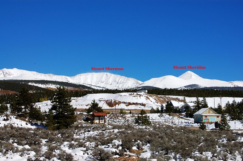
Mt. Sherman as seen from the viewpoint along US-24,south
Mount Sherman from Fairplay
Mt. Sherman as seen from the viewpoint along US-24,south
Mount Sherman from Fairplay
-------------------------------------------------------------------------------------------------------
攀登山岳:Mount Sherman,海拔14,036呎/4,278公尺
登山口:Fourmile Creek Trailhead,海拔11,916呎/3,632公尺
登山里程:來回5.34哩/8.6公里
總爬升高度:2,323呎/708公尺
登山時間:6小時36分
登山人員:Tony、Tina、阿才、姜官祥、王冰、趙薇、Ruth、Jacob、陳基滿
-------------------------------------------------------------------------------------------------------
行車資訊:
由Golden開車經CO-470轉US-285朝西南往Fairplay前進,行約67哩抵小鎮Fairplay,過了小鎮再行約1.3哩後右轉4 Mile Creek Rd西南行,4 Mile Creek Rd行約10.4哩小車不易再前行,此處有一座停車場,將小車停此祖孫三人轉搭阿才的高底盤車續往登山口,再行約1.6哩抵登山口停車場,此處海拔11,916呎/3,632公尺。
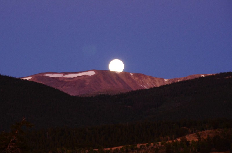
The moon is setting
The moon is setting
步程簡述:
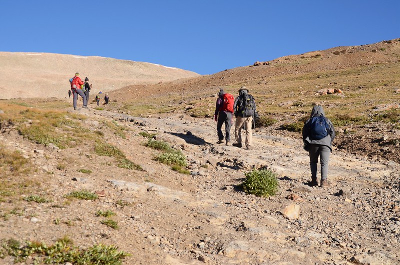
07:30 停車處出發,海拔11,916呎/3,632公尺,矗立在正前方的山頭是13ers~Mount Sheridan。
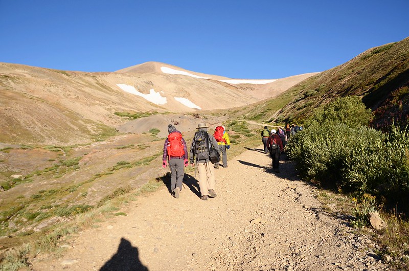
On our way up to Mount Sherman
On our way up to Mount Sherman
07:35 柵欄,由旁邊繞過,海拔12,060呎/3,676公尺,距停車處984呎/300公尺。

Mount Sherman Trailhead
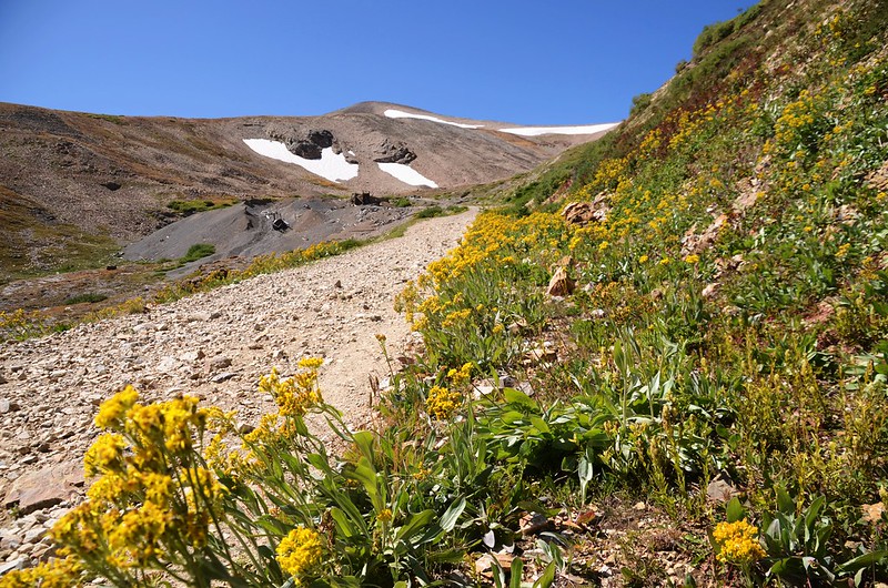
Mount Sherman Trail
Mount Sherman Trailhead
Mount Sherman Trail
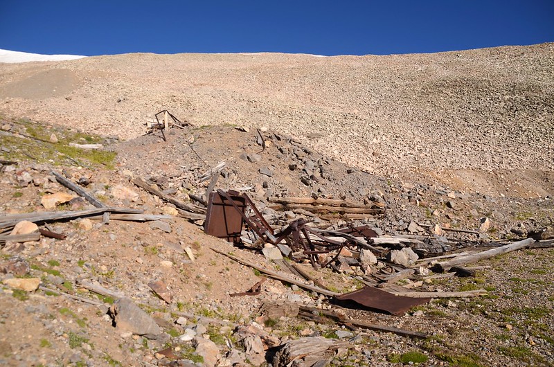
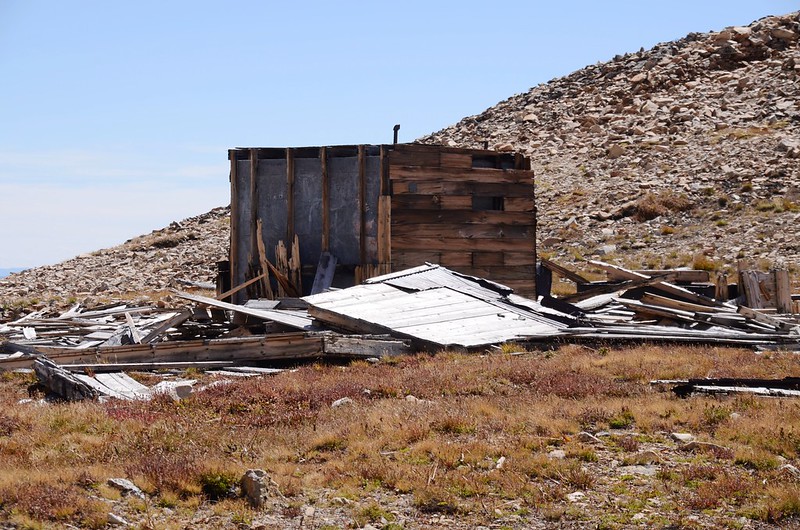
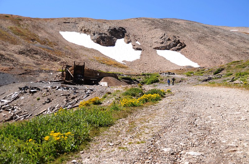
07:50 經過已停止採礦的Dauntless Mine礦區,海拔12,218呎/3,724公尺,距停車處0.44哩/0.7公里。


Dauntless Mine ruins
On our way up to Mount Sherman
Dauntless Mine ruins
On our way up to Mount Sherman
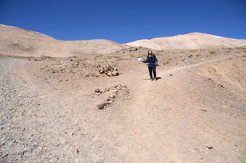
08:04 遇到一岔路,2006年登此山時我們取右岔上山,今天我們取左岔上行;

Hiking route & drive road junction
此處海拔12,477呎/3,803公尺,距登山口約0.69哩/1.1公里,右岔為礦區行車道,左岔為登山步道,右岔行車道比左岔登山步道距離多出300公尺左右。

Mt. Sherman(Taken from just above Dauntless Mine)

On our way up to Mount Sherman
Hiking route & drive road junction
此處海拔12,477呎/3,803公尺,距登山口約0.69哩/1.1公里,右岔為礦區行車道,左岔為登山步道,右岔行車道比左岔登山步道距離多出300公尺左右。
Mt. Sherman(Taken from just above Dauntless Mine)
On our way up to Mount Sherman
08:17 抵一處礦場遺址,遺留少許建物殘骸及機具,海拔12,684呎/3,866公尺,距登山口約0.87哩/1.4公里;
Mining ruins
再行約100公尺又有一處遺址,遺留有疑似蒸汽車頭及纜車電纜等物。

Mining ruins
Mining ruins
再行約100公尺又有一處遺址,遺留有疑似蒸汽車頭及纜車電纜等物。
Mining ruins
08:25 陡峭難行的亂石坡,海拔12,726呎/3,879公尺,距登山口約1.0哩/1.6公里。
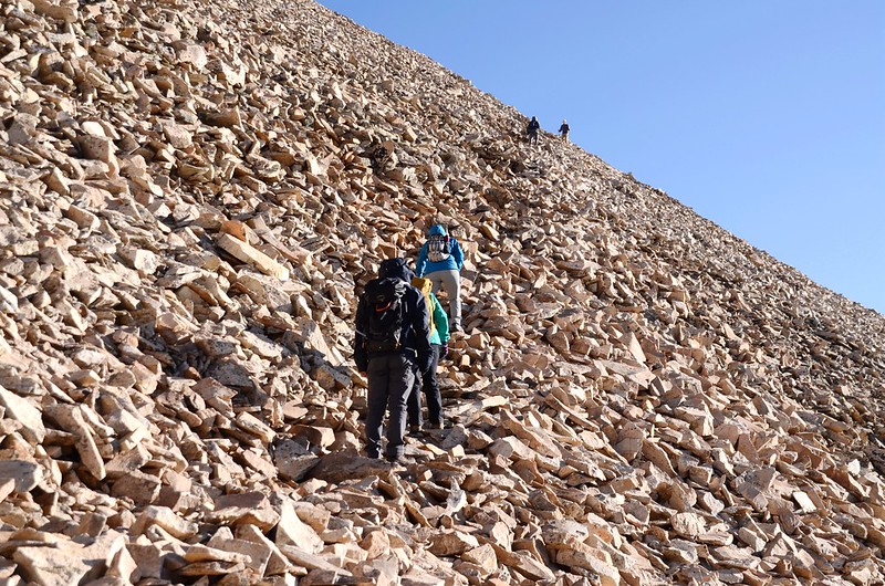

Rocky slope
On our way up to Mount Sherman
Rocky slope
On our way up to Mount Sherman
08:39 上抵亂石坡頂端,右側下方是Hilltop Mine 遺址,此處海拔12,933呎/3,942公尺,距登山口約1.18哩/1.9公里;

Hilltop Mine ruins
過了Hilltop Mine 遺址下一小坡。
Hilltop Mine ruins
過了Hilltop Mine 遺址下一小坡。
08:45 下抵一處低鞍遇岔路,此岔路即是08:04岔路來接,右岔為寬敞車道下山,取左岔上山;此處海拔12,904呎/3,933公尺,距登山口約1.24哩/2.0公里。
此後目標朝向上方的Mount Sheridan 和 Mount Sherman之間的鞍部沿著亂石坡小徑盤旋上升。
Looking north at the southwest ridge of Mount Sherman from below the saddle
Looking north at the southwest ridge of Mount Sherman from below the saddle
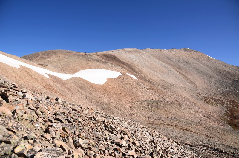
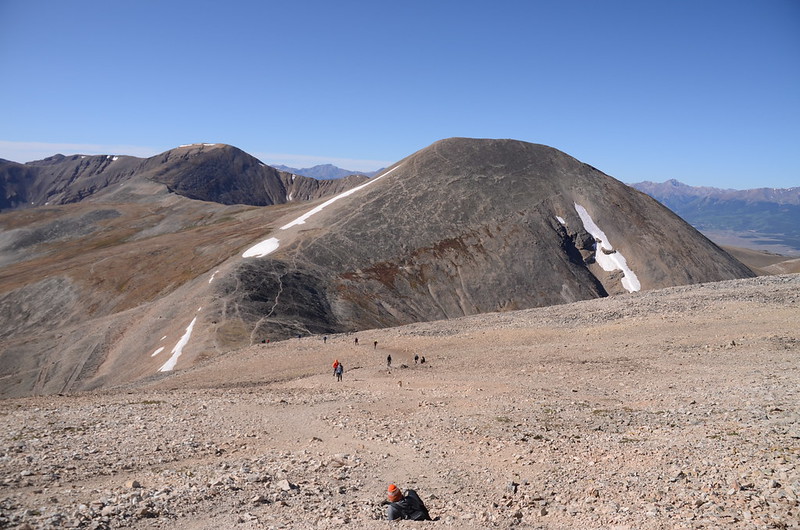
09:08 抵達Mount Sheridan 和 Mount Sherman之間的鞍部,海拔約13,127呎/4,001公尺,距登山口約1.49哩/2.4公里;

Taken from The saddle between Mt. Sheridan and Mt. Sherman
Looking north at Sherman's southwest ridge from the saddle
Looking west at Mount Sheridan from the saddle
鞍部左側是Mount Sheridan,右側是Mount Sherman,在鞍部小休後取右朝北沿著Mount Sherman的西南稜往Mount Sherman爬升。

On our way up to Mount Sherman
Taken from The saddle between Mt. Sheridan and Mt. Sherman
Looking north at Sherman's southwest ridge from the saddle
Looking west at Mount Sheridan from the saddle
鞍部左側是Mount Sheridan,右側是Mount Sherman,在鞍部小休後取右朝北沿著Mount Sherman的西南稜往Mount Sherman爬升。
On our way up to Mount Sherman
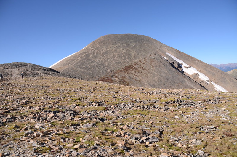
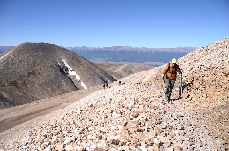
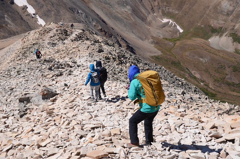
Mount Sherman的西南稜前段還算好走,路徑也蠻清楚的,只是強烈的西風吹得有點受不了;
The southwest ridge of Mount Sherman
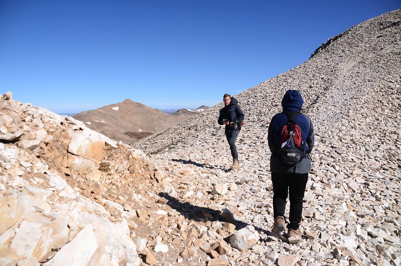
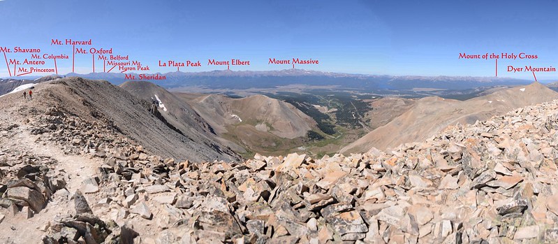
稜線上西望科羅拉多第一高峰Mount Elbert和第二高峰Mount Massive,隨著高度的爬升其他幾座14ers如La Plata Peak、Missouri Mountain、Mount Belford、Mount Oxford、Mount Harvard等都在西南方一一浮現,此時Tony和小孫子Jacob已一馬當先往山頂爬升。
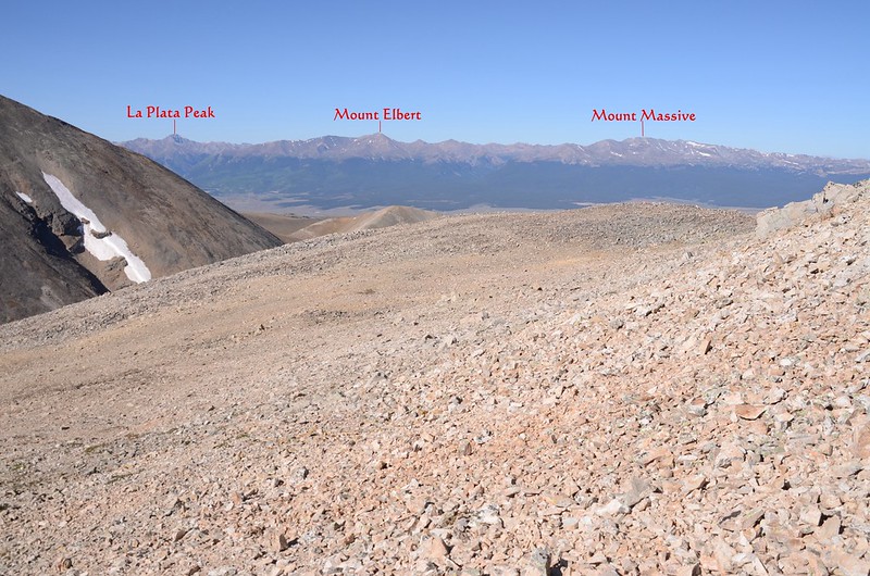
Looking west at La Plata Peak、Mount Elbert & Massive from the southwest ridge of Mount Sherman
Looking southwest at mountains from the southwest ridge of Mount Sherman
The southwest ridge of Mount Sherman
The southwest ridge of Mount Sherman
稜線上西望科羅拉多第一高峰Mount Elbert和第二高峰Mount Massive,隨著高度的爬升其他幾座14ers如La Plata Peak、Missouri Mountain、Mount Belford、Mount Oxford、Mount Harvard等都在西南方一一浮現,此時Tony和小孫子Jacob已一馬當先往山頂爬升。
Looking west at La Plata Peak、Mount Elbert & Massive from the southwest ridge of Mount Sherman
Looking southwest at mountains from the southwest ridge of Mount Sherman
The southwest ridge of Mount Sherman
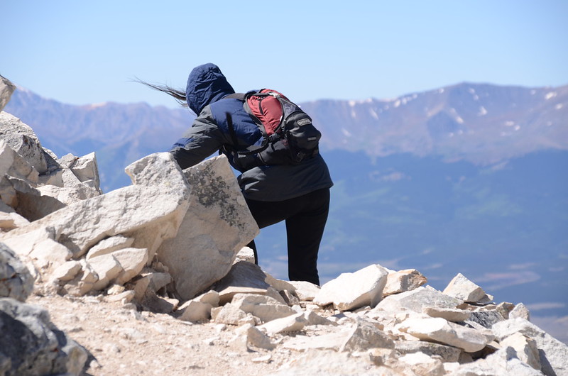
10:05 抵達一處缺口小鞍部,風超強的,站都站不穩,海拔約13,704呎/4,177公尺,距登山口約2.0哩/3.2公里;

A small notch near 13,704 ft
手拉著女兒的手奮力衝過風口續往山頂爬升。
Looking down at Fourmile Creek Trail from the trail up t0 Mount Sherman
A small notch near 13,704 ft
手拉著女兒的手奮力衝過風口續往山頂爬升。
Looking down at Fourmile Creek Trail from the trail up t0 Mount Sherman
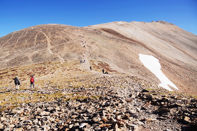
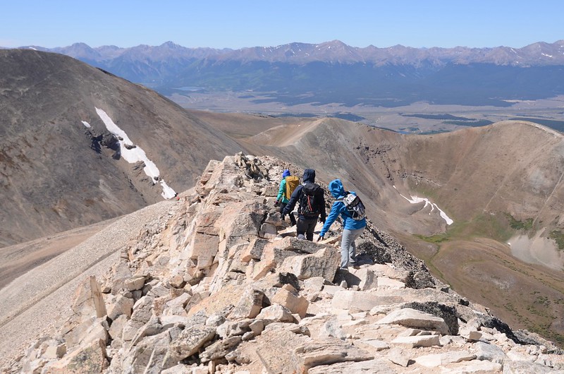
過了風口後步道轉為在暴露感十足的瘦稜上爬升,崎嶇崢嶸的瘦稜本就不好走,加上強烈的西風狂吹,如稍不小心就有被吹倒甚至跌落斷崖的危險,走來真又吃力又驚險!

Narrow ridge near the summit
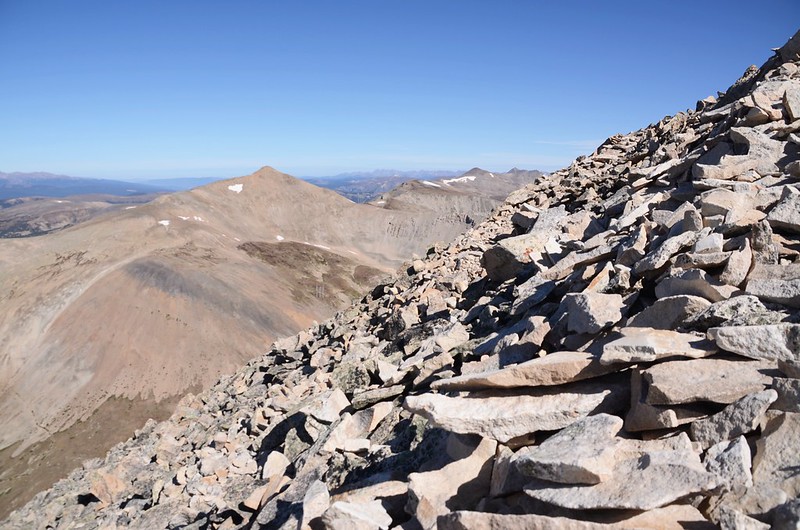
Looking northwest at Mountains from Mount Sherman's southwest ridge near 13,820 ft
Looking southt at Mountains from Mount Sherman's southwest ridge near 13,820 ft

Looking southwest at mountains from the southwest ridge of Mount Sherman near 13,904 ft
Narrow ridge near the summit
Looking northwest at Mountains from Mount Sherman's southwest ridge near 13,820 ft
Looking southt at Mountains from Mount Sherman's southwest ridge near 13,820 ft
Looking southwest at mountains from the southwest ridge of Mount Sherman near 13,904 ft
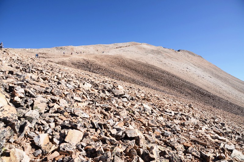
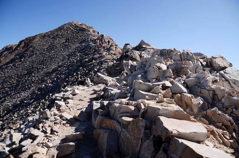
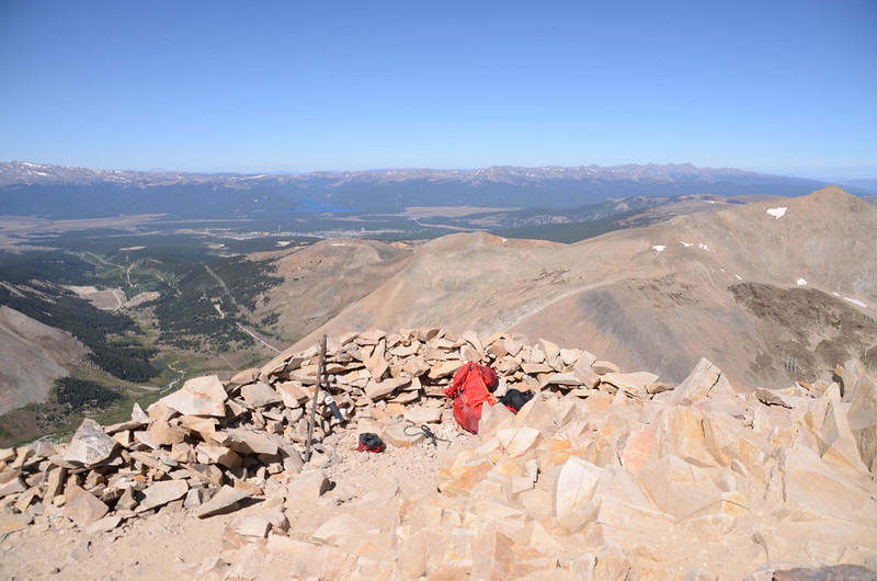
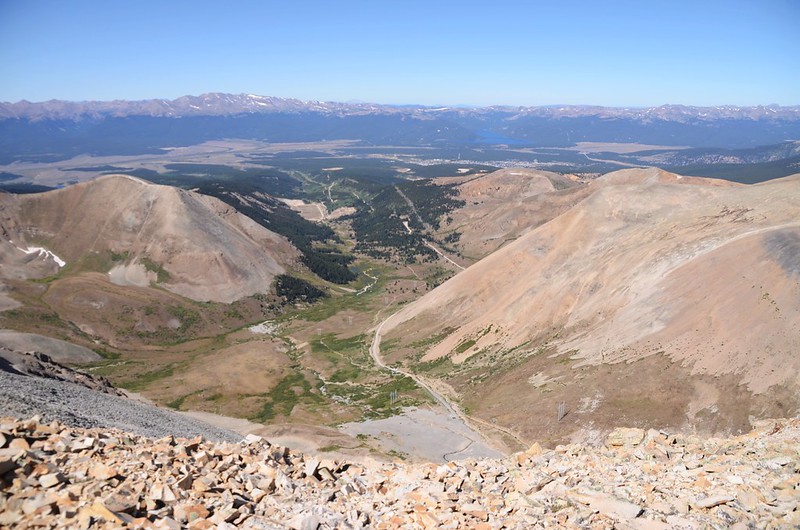
10:48 登上山頂平台南端,海拔13,940呎/4,249公尺,距登山口約2.37哩/3.8公里;

The south end of the long summit ridge

Taken at Mount Sherman summit ridge
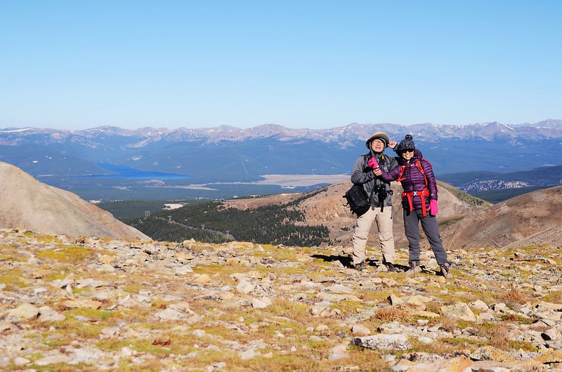
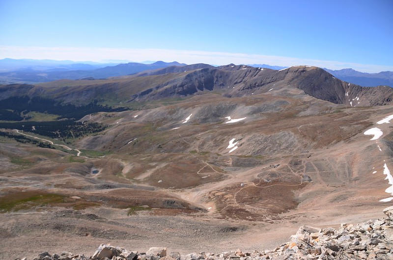
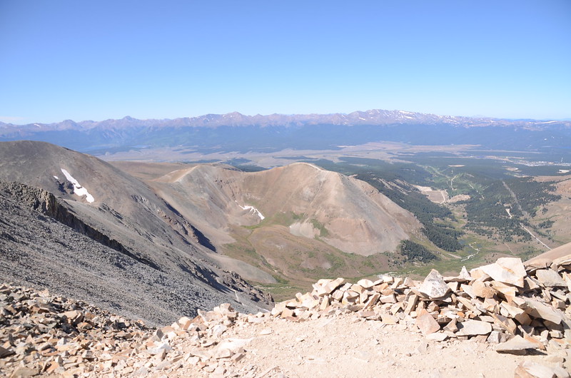
Sherman的山頂就像好幾個足球場般寬敞平坦,展望一級棒,Tenmile Range、Mosquito Range、Sawatch Range、和Front Range的14ers不下十來座在此盡收眼底,真正山頂在北端,續往北前進。
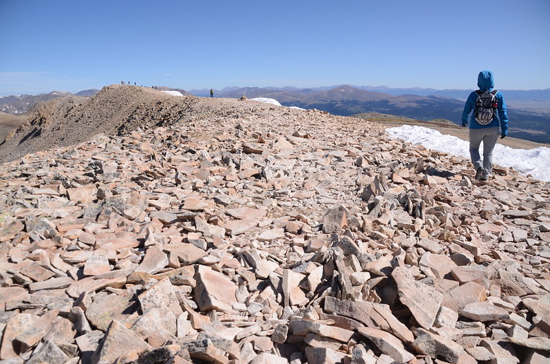
The south end of the long summit ridge
The south end of the long summit ridge
Taken at Mount Sherman summit ridge
Sherman的山頂就像好幾個足球場般寬敞平坦,展望一級棒,Tenmile Range、Mosquito Range、Sawatch Range、和Front Range的14ers不下十來座在此盡收眼底,真正山頂在北端,續往北前進。
The south end of the long summit ridge
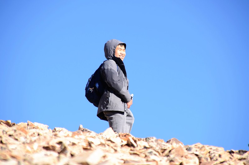
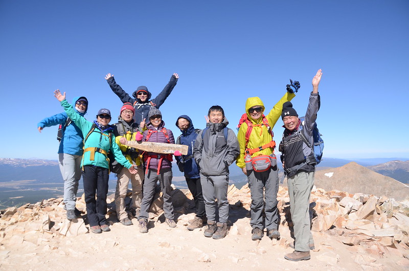
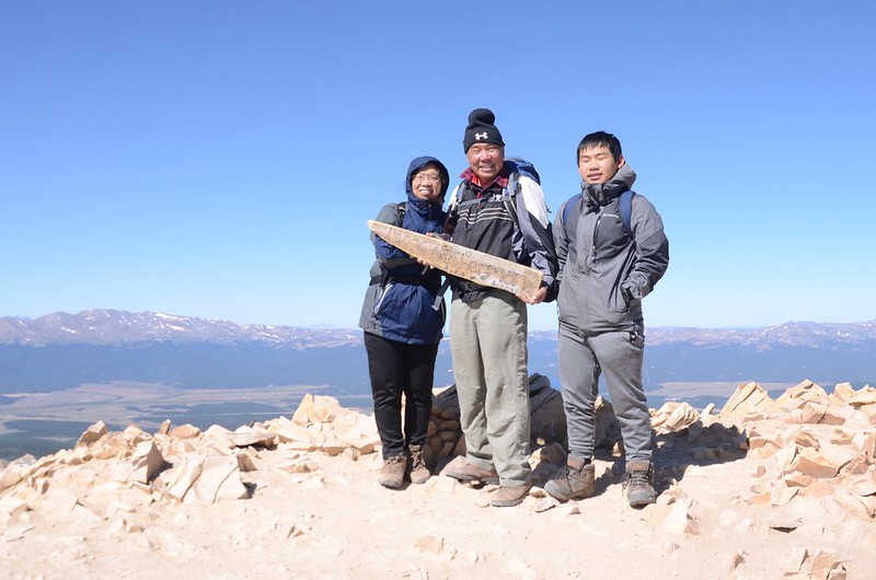
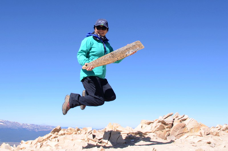
11:00 登頂Mount Sherman,海拔14,036呎/4,278公尺,我的GPS實測為14,016呎/4,272公尺,距登山口約2.55哩/4.1公里,先頭部隊Tony和小孫子Jacob早在45分鐘前就已登頂,並在山頭睡了一覺。


Taken at the summit of Mount Sherman
Looking southwest at mountains from Mount Sherman's summit
Looking southwest at mountains from Mount Sherman's summit
Taken at the summit of Mount Sherman
Looking southwest at mountains from Mount Sherman's summit
Looking southwest at mountains from Mount Sherman's summit
此山在2006年我便帶女兒及當時年僅七歲的大孫子Matthew來登此山,一晃就是13年,今天是二度登頂,同樣是帶著女兒及孫子,只是大孫子換為小孫子Jacob;我們在山頂休息用餐、賞景拍照。


Jump!~Mount Sherman
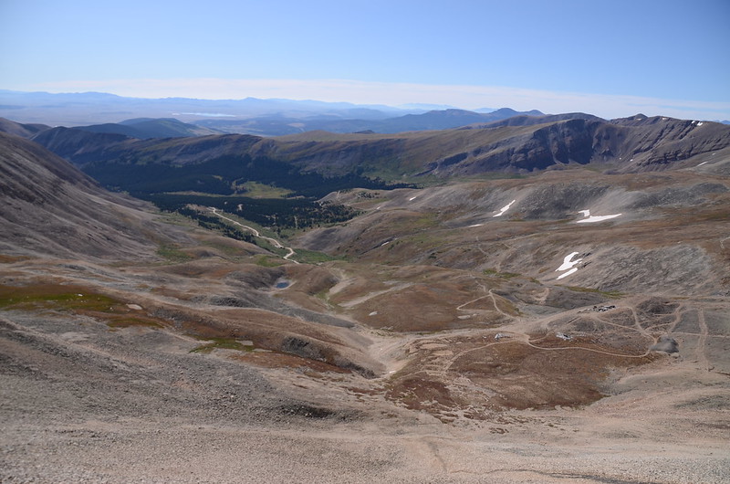
Looking down at Iowa Gulch from the summit of Mount Sherman
Jump!~Mount Sherman
Looking down at Iowa Gulch from the summit of Mount Sherman
Looking west at mountains from Mount Sherman's summit

Looking northwest at Mount of the Holy Cross from Mount Sherman's summit
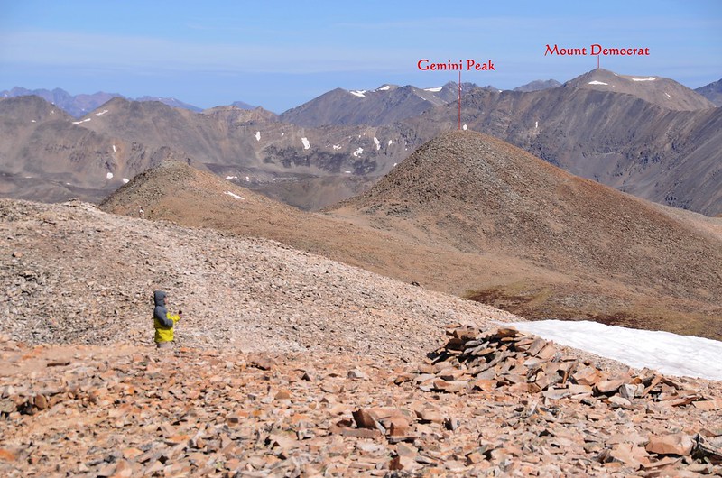
Looking north at mountains from Mount Sherman's summit

Looking north at mountains from Mount Sherman's summit
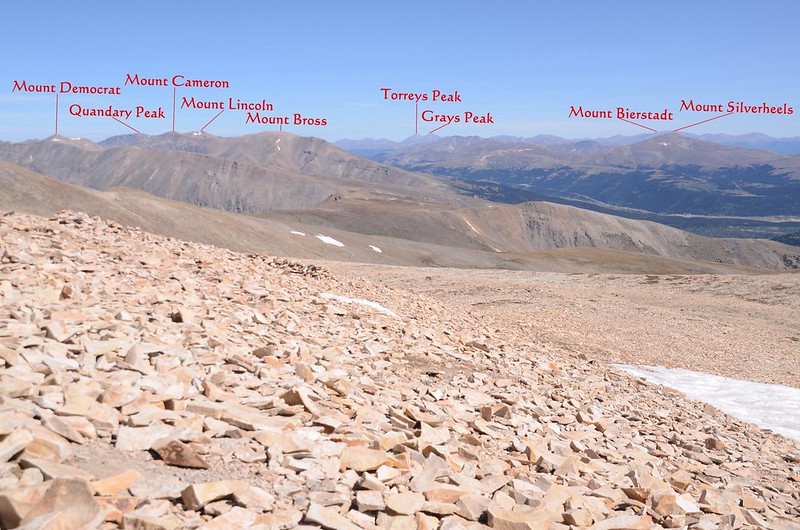
Looking northeast at mountains from Mount Sherman's summit
Looking northwest at Mount of the Holy Cross from Mount Sherman's summit
Looking north at mountains from Mount Sherman's summit
Looking north at mountains from Mount Sherman's summit
Looking northeast at mountains from Mount Sherman's summit
11:45 下山,Tony和Jacob還要攀登Mount Sheridan所以先行,我們循原路下山。

The summit ridge of Mount Sherman
On our way down from Mount Sherman
The summit ridge of Mount Sherman
On our way down from Mount Sherman
下山時風勢還是很強,還是走得戰戰兢兢的。

On our way down from Mount Sherman, narrow ridge near the summit
On our way down from Mount Sherman, narrow ridge near the summit
12:36 下抵Mount Sheridan 和 Mount Sherman之間的鞍部,眼看Tony和Jacob已登上Mount Sheridan的半山腰,我們取左直接下山。
On our way down from Mount Sherman
On our way down from Mount Sherman
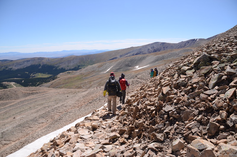
13:00 下抵Hilltop Mine 遺址下岔路,取左岔沿寬敞車道下山。

Hilltop Mine ruins
Hilltop Mine ruins
13:29 接回主道,取左下山。
Hiking route & drive road junction
Dauntless Mine ruins
Senecio atratus (Blacktip Senecio) -- Asteraceae
Hiking route & drive road junction
Dauntless Mine ruins
Senecio atratus (Blacktip Senecio) -- Asteraceae
14:00 返抵停車處,在停車處等候Tony和Jacob約半小時,人員到齊後搭阿才的車回到小車停車處取車返家,結束今天登山行程。
沒有留言:
張貼留言