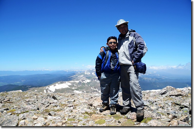
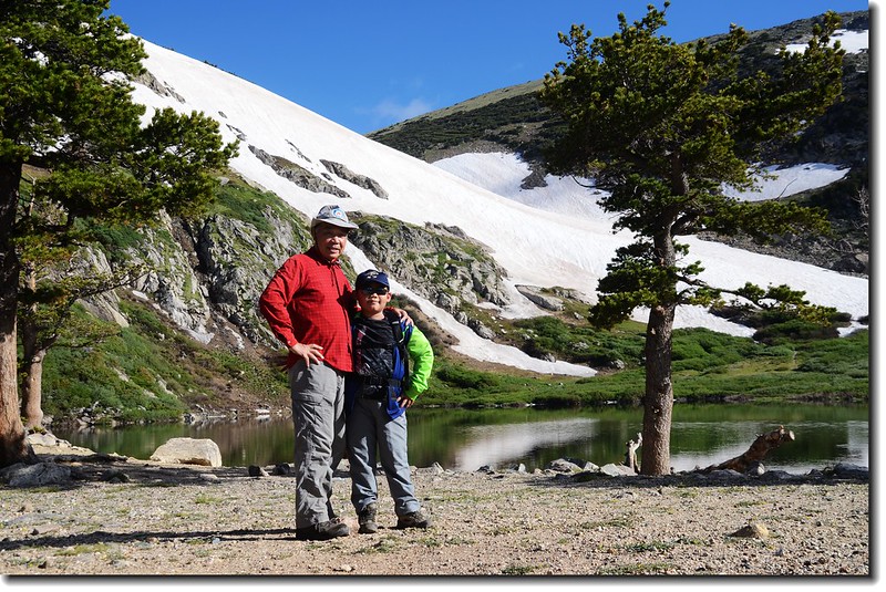
Jacob & me on the James' summit
豆豆和同學到佛羅里達 (Florida) 州的Disney World去玩,今天就帶著貝貝去爬山;前不久帶他到St. Marys Lake時曾告訴他在冰河(St. Marys Clacier)之上有一座13ers(海拔在13,000~13,999呎的高山)James Peak,自此之後一談到爬山他就說要爬James Peak,本來我還猶豫他是否能順利登頂;該山我在三年前曾跟住在Golden的山友Tony隨同CMC登過一次,其距離及難度對貝貝現在的身材來說我是有點擔心的,但拗不過他的要求只好答應了,事先跟他講好~~不一定登頂,爬到累了就下撤!
-------------------------------------------------------------------------------------------------------------------------------------------
攀登山岳:James Peak
山岳高度:海拔13,294呎(4, 052公尺)
登山口:Saint Mary's Glacier trailhead
登山口高度:10,300呎(3, 139公尺)
登山里程:約8.5哩(13.68公里)
爬升高度:約3,000呎(914公尺)
登山時間:9小時
---------------------------------------------------------------------------------------------------
清晨五點四十分左右祖孫兩人從家中出發,到附近的King Soopers買了午餐後沿I-25南下轉I-76接I-70西行,到Idaho Springs下去麥當勞用過早餐後,於I-70的Exit 238下高速公路後沿Fall River Road (County Road 275) 北行,中途經過Alice小鎮後抵登山口停車場,I-70至停車場約9哩;該停車場一大一小皆在公路左側,每車停車費5元美金,夏天假日有時車位一位難求,大部分的遊客是為著St. Mary's Glacier和St. Mary's Lake而來,這個景點距登山口僅0.75哩,爬升約400呎(122公尺)。
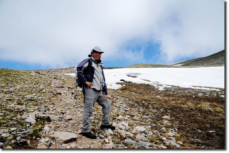
我們抵達停車場時約七點半左右,僅一部車比我們早到,時 間尚早且非假日吧!整裝後出發。
--------------------------------------------------------------------------------------------------------
步程簡述:
07:55 登山口出發(海拔10,300呎);
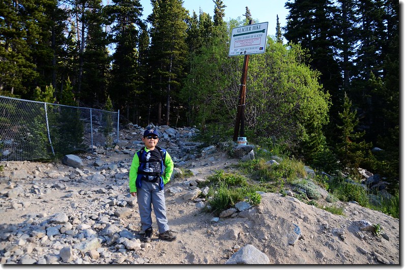
St. Mary's Glacier trailhead
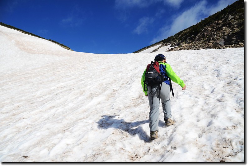
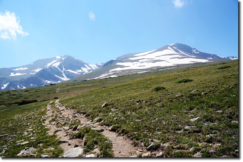
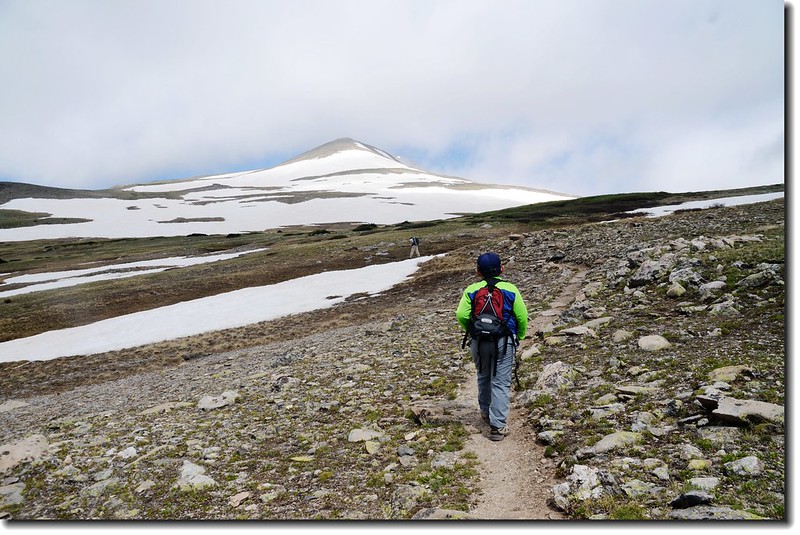
一路沿亂石集聚的還算寬大步道上山,貝貝邊走邊說今天好像比較累~~我暗想著:攻頂可能有難度!
08:18到達冰河(Glacier)底部小湖--St. Mary's Lake (海拔10,696 呎 / 3,260 公尺),該湖上週才來過。
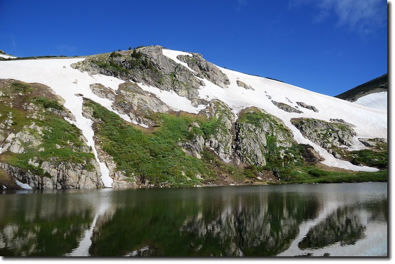
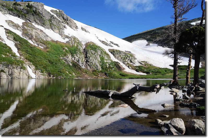
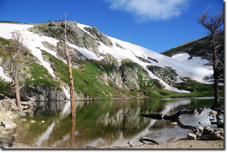
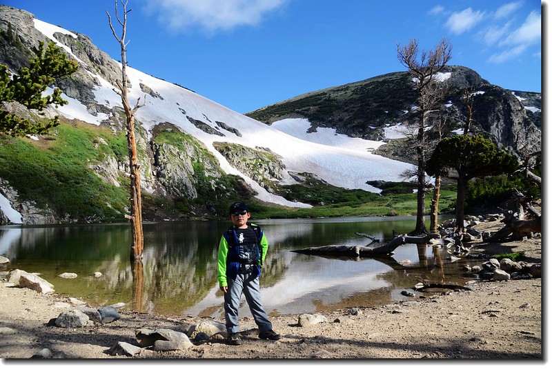
St. Marys Lake
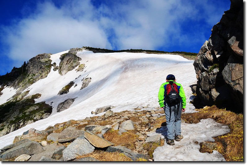
和貝貝拍完照後由St. Mary's Lake東岸出水口的小鐵橋繞過,來到北岸的St. Mary's Glacier底部;此Glacier嚴格來說不能說是冰河(Glacier),它僅是一處長年積雪不化的雪原(Snowfield)而已,之所以取名Glacier可能是為吸引觀光客吧!
Jacob at the base of St Mary's Glacier
-------------------------------------------------------------------------------------------------------
St. Mary's Glacier (聖瑪莉冰河)
冰河高度:底部海拔10,696 呎 / 3,260 公尺
頂端海拔11,200 呎 / 3,414 公尺
落差 約500呎 / 152公尺
冰河長度:約0.5哩 / 800公尺
-------------------------------------------------------------------------------------------------------
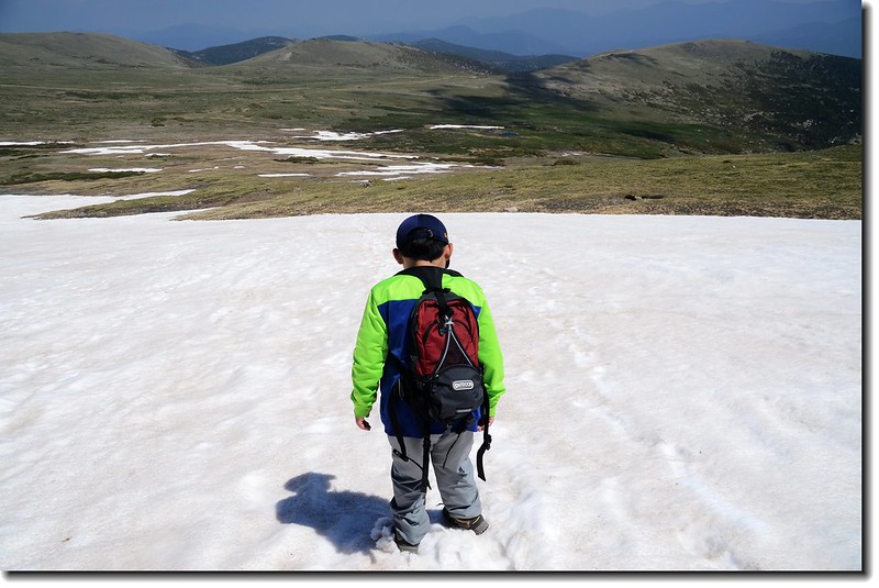
08:40 循冰河上山,早上的冰河因夜晚的低溫冰面蠻堅硬的,但也容易滑倒,小心行走、步步為營。
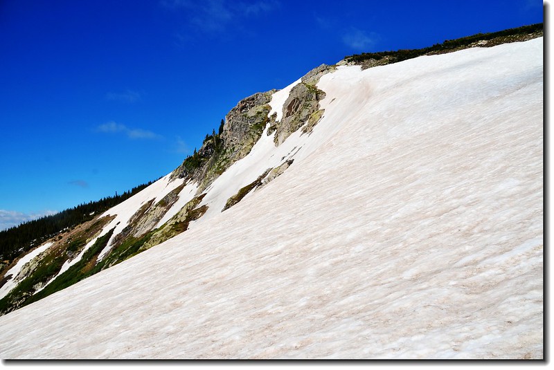
St. Mary's Glacier
St. Marys Lake from the Glacier
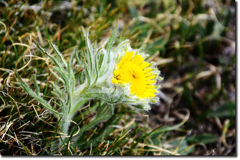
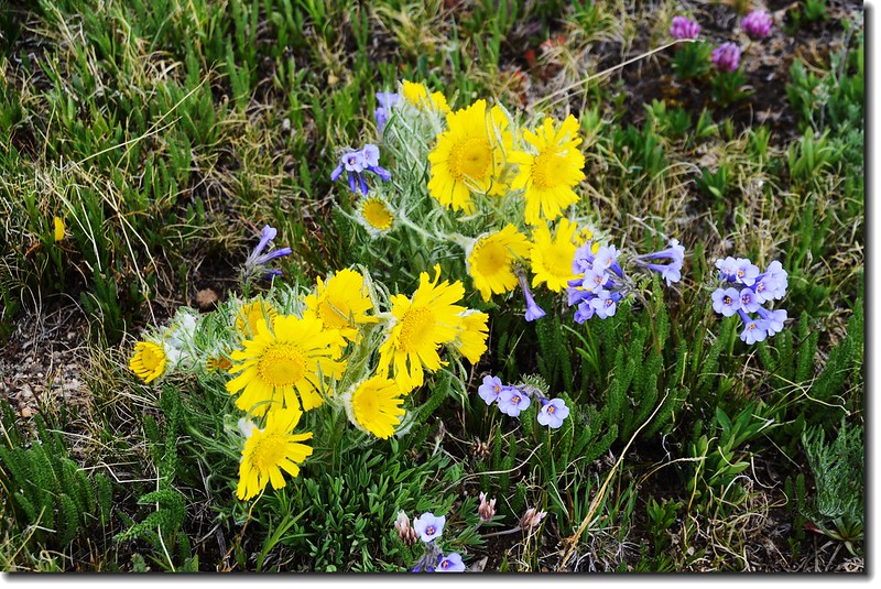
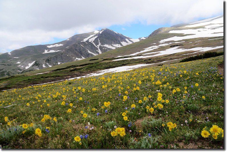
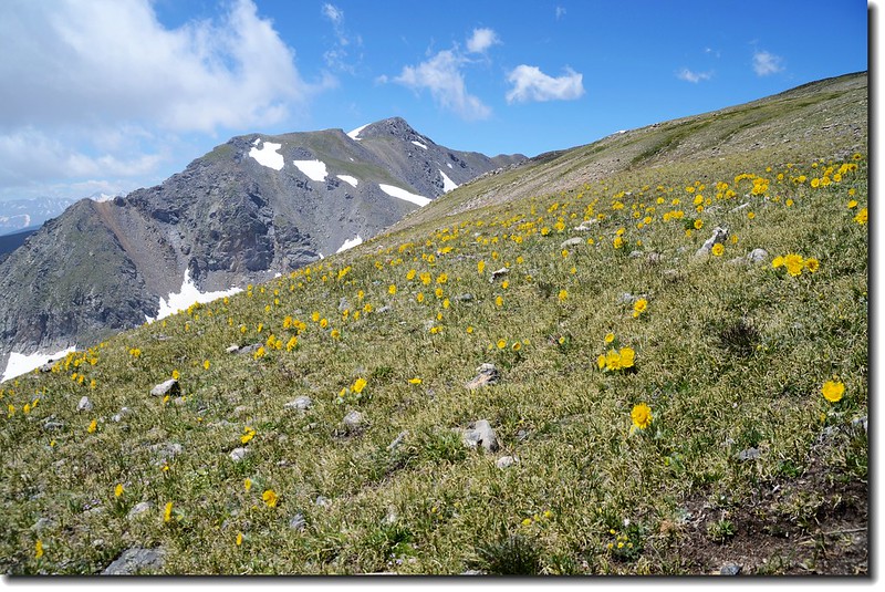
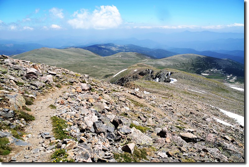
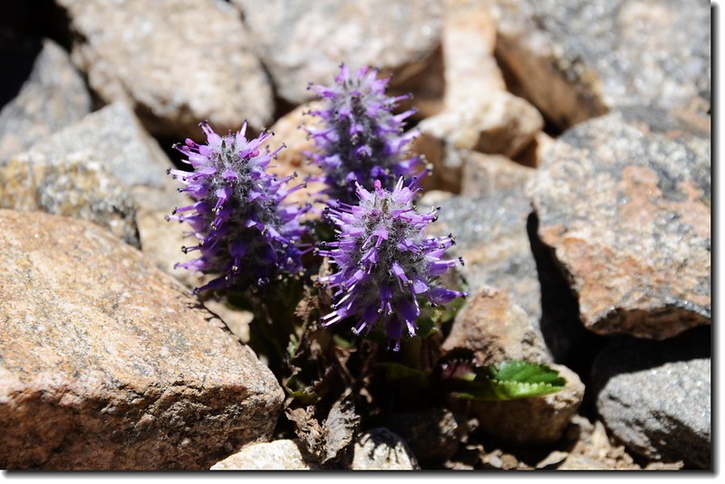
09:15 切到Glacier左邊山坡,離開冰河改走左邊山坡小路,山坡上Alpine sunflower、Sky pilot flower等野花盛開。
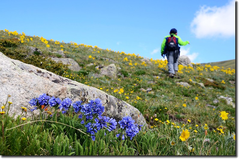
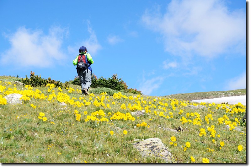
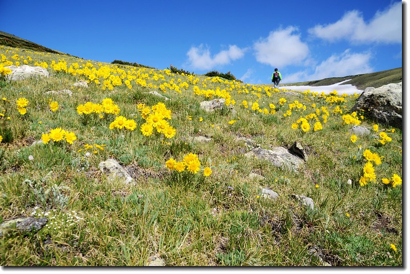
Wildflowers along the trail
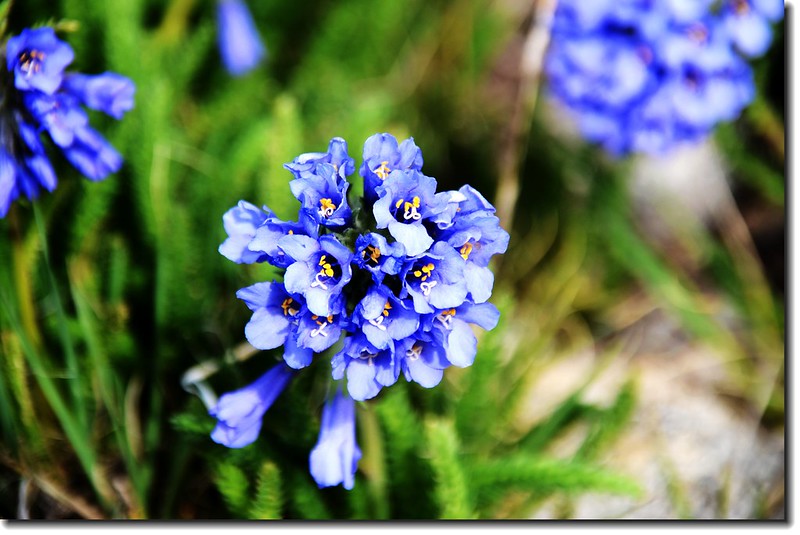
Alpine Polit flower
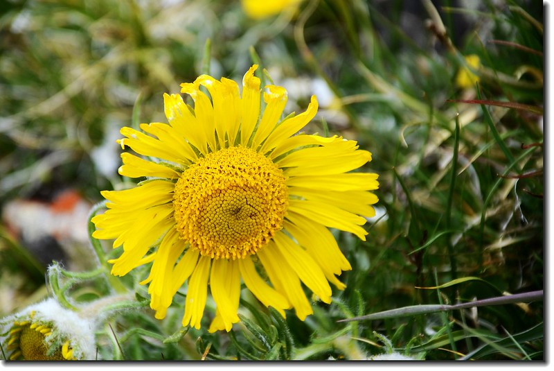
Alpine sunflower
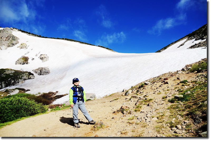
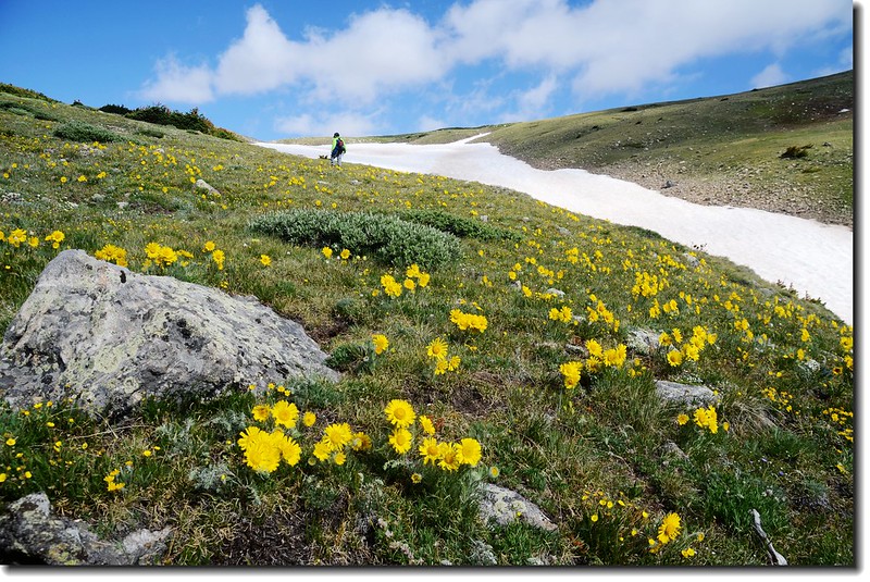
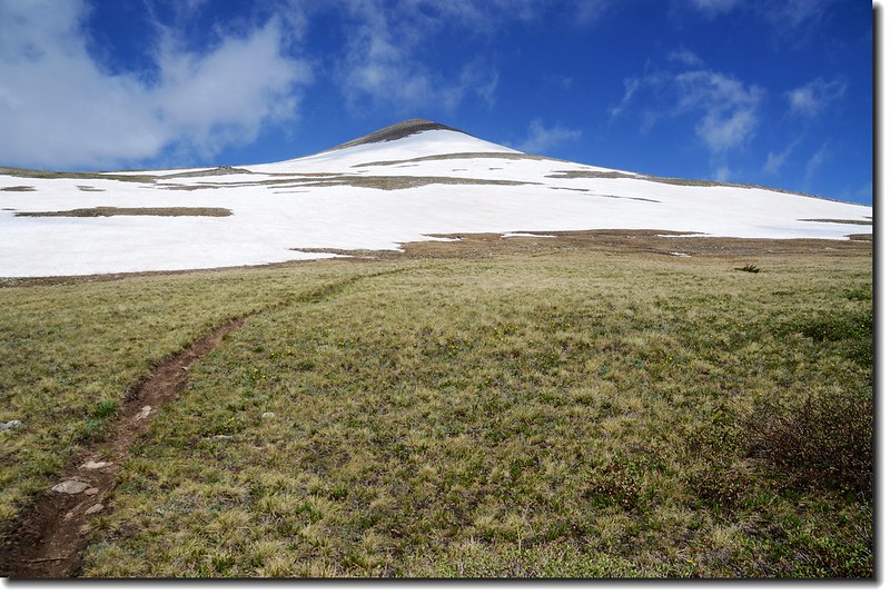
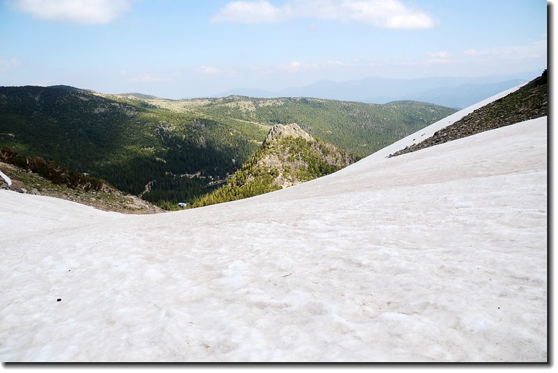
09:35 抵達冰河頂端(11,200 呎/ 3,414 公尺),這條冰河大約有七、八百公尺長,爬升高度約150公尺左右,上到冰河頂端是一望無際的苔原。
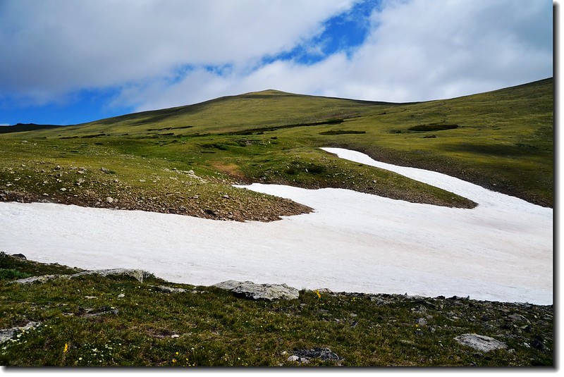
The top of St. Mary's Glacier
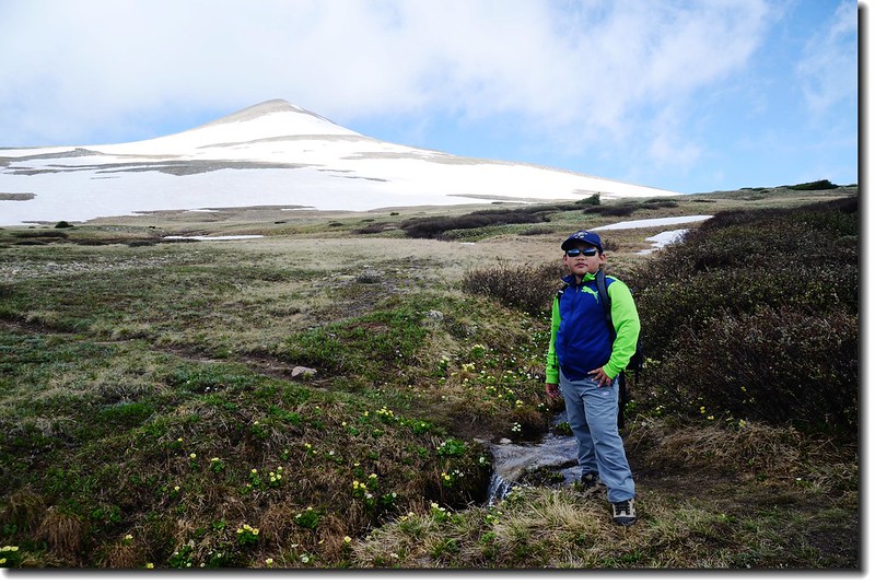
Jacob is resting on his way to James Peak
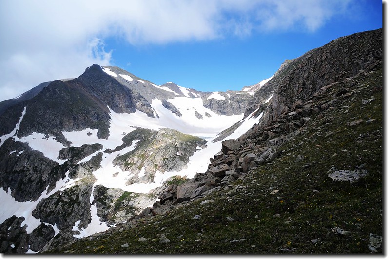
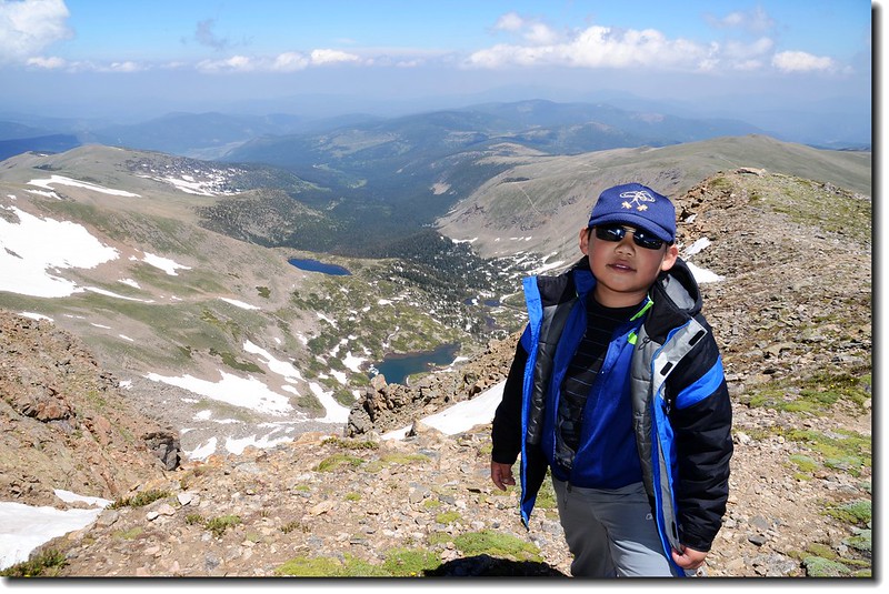
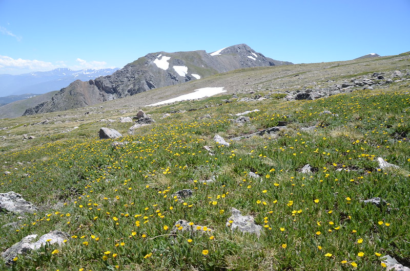
這裡是James Peak的東面山坡,走在苔原上往西一看,兩塊大山頭矗立在遠處;左邊雙駝峰似的是另兩座13 ers--Parry Peak(13,391 ft.)和Mt. Bancroft(13,250 ft.),右邊即是今天的目的地James Peak,可惜今天James Peak的山頭上被一層雲霧罩住,僅能看到其前方的假山頭;我們就在這寬廣的苔原上朝James Peak西進。
At the top of St. Mary's Glacier, background is James Peak
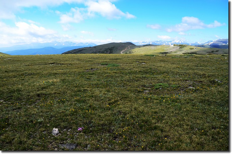
Looking at Mount Evans to Torreys Peak crest line from the Tundra

James Peak and Mount Bancroft from theTundra
10:10 來到一條ATV(All-terrain vehicle)車道,此處距登山口約2哩,近半程;穿過ATV(All-terrain vehicle)車道後不久來到一處沼澤地,在此遇到一位超越我們的登山客,他說他來剛從墨西哥上來,到今天已開了一萬一千多英哩的車,出來主要是爬山,他還要一路開回加拿大。
The wetland below James false summit
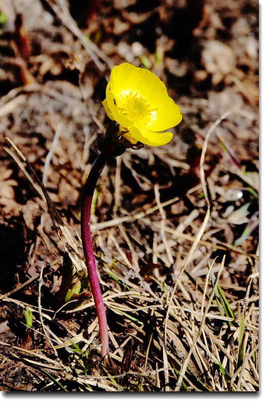
Alpine Avens
Wildflowers along the trail
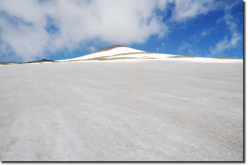
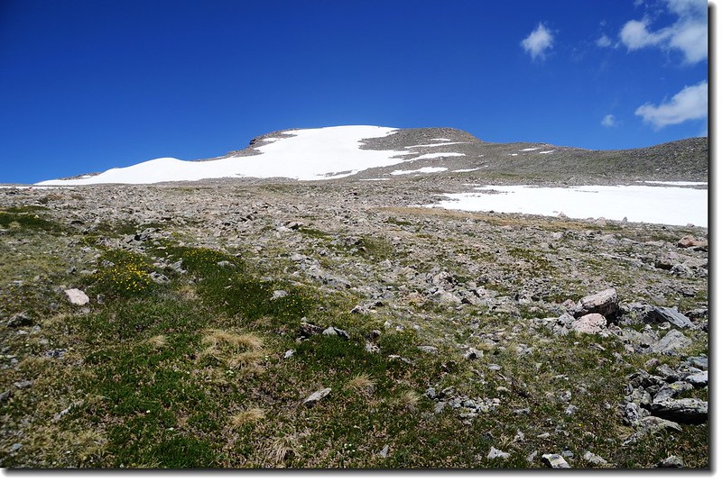
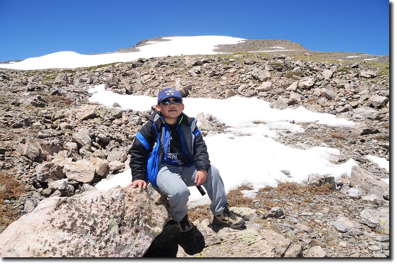
10:30 涉過沼澤地後步道面對的是一大片雪原(海拔約12, 000呎 / 3,658公尺),原登山步道全被雪原蓋住無跡可尋,只好憑三年前的記憶抓準方向切過雪原,約有百來公尺寬吧!
Hike to James' false summit
James Peak false summit from east slope
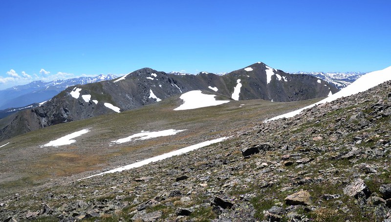
11:00 接回登山步道,然後一路在James Peak的東面山坡“之”字形挺進,沿途南眺Mount Evans、Mount Bierstadt、Grays Peak和Torreys Peak等幾座14ers。
“Grandpa is trying to be a superhero but failed ! ” ~~Jacob said.
Jacob is resting on his way to James Peak
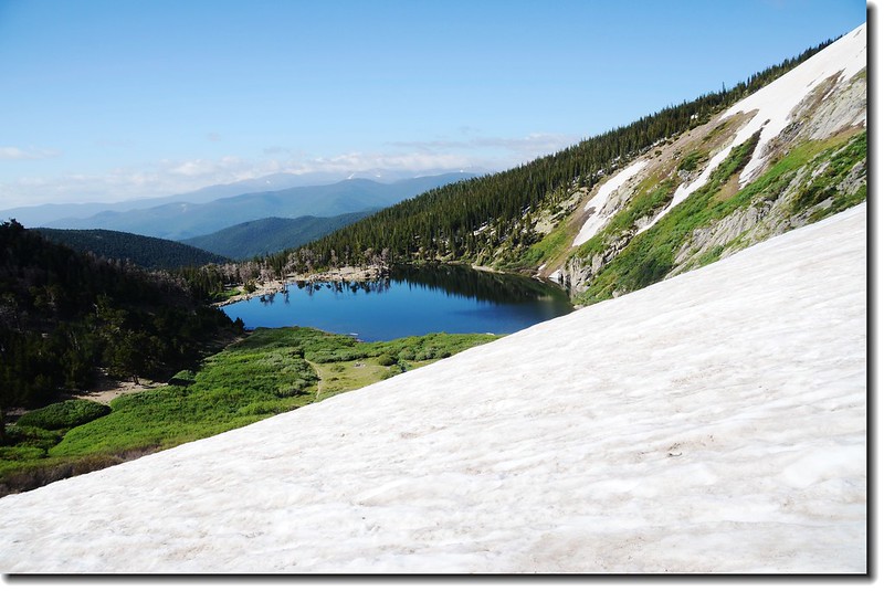
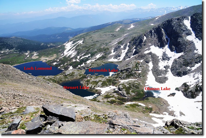
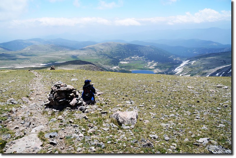
11:20 抵達一峭壁口,左下是Loch Lomond drainage,幾座小湖星盤羅列著,介於James Peak 和Mount Bancroft間的Ice Lake則尚在冰凍中,此處距登山口約3哩。
View down the Loch Lomond drainange from the trail
Ice Lake
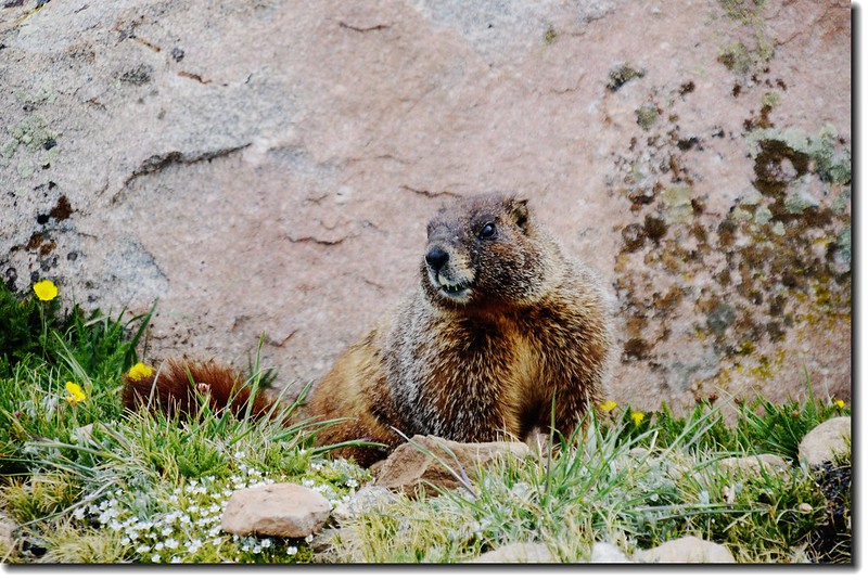
Marmot
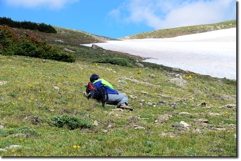
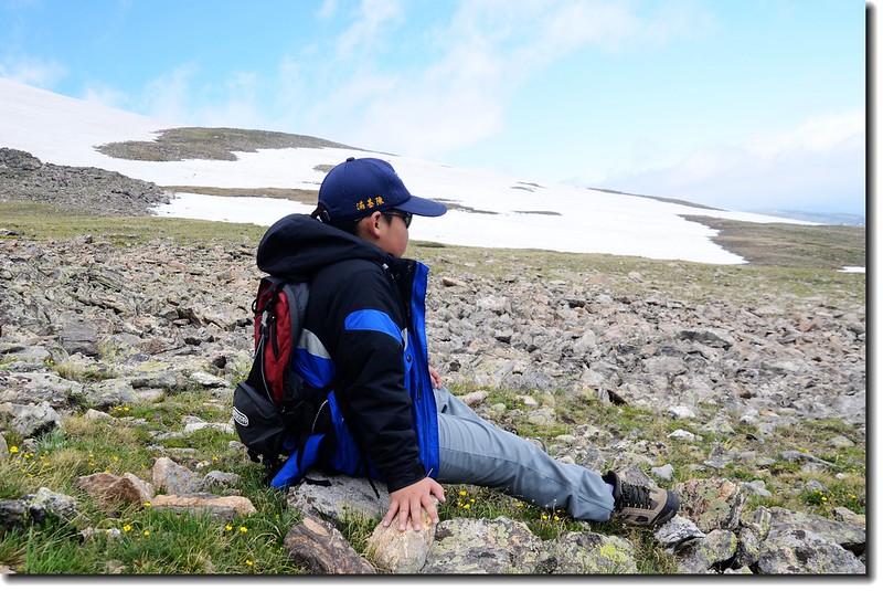
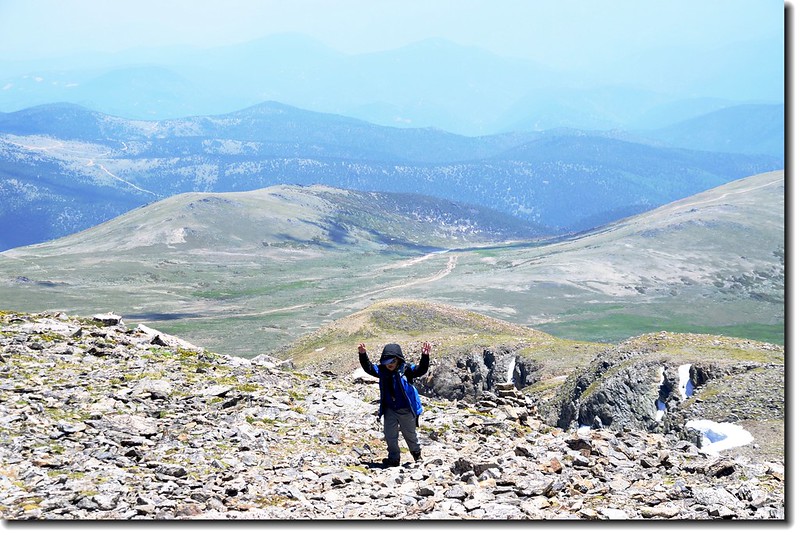
走到此貝貝已顯疲態,望著前頭陡峭的山徑他面有難色,勸他下撤他又不肯,咬牙硬撐,每走幾步路就坐下休息,他此次是真得累,休息完繼續走路時還要我幫著拉他一把才能站起來;據舊經驗估計此處距登頂約需一個多小時,雖然累一點,登頂應該沒問題。
Parry Peak、Mt. Bancroft as seen from James' slope
Jacob is resting on his way to James Peak
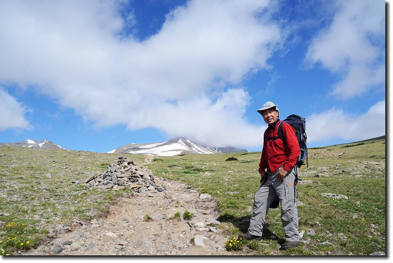
12:18 登抵James Peak山頭下一苔原鞍部,距登山口約3.5哩;
Looking at James Peak's summit from below
Jacob is resting on his way to James Peak
步道轉向西北朝山頂下方腰繞過,又穿過一大片雪原後朝山頂“之”字形爬升。
12:50 右側一峽谷,俯瞰Mammoth Gulch中的Little Echo Lake和James Peak Lake;
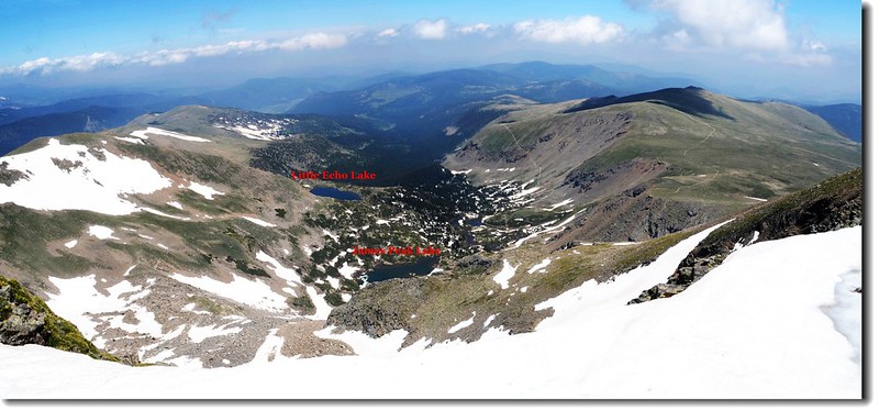
Overlooking to Mammoth Gulch from James Peak trail
Overlooking to Mammoth Gulch from James Peak trail
此處距登山口約3.8哩,快要登頂了,但貝貝的體力似乎也硬撐到極限,他有氣無力得跟我說:“阿公,快要到summit了,你知道我在想什麼嗎?”問他想甚麼,他說:“我在想待會兒我要怎麼下山!”可憐的小貝貝~~
Parry Peak、Mt. Bancroft as seen from James' slope near the summit
13:15 登頂James Peak,海拔13,294呎(4, 052公尺),這裡地處落磯山脈大陸分水嶺,西邊是Winter Park滑雪勝地,北望Indian Peaks和落磯山脈連稜,南邊最近的兩個山頭即是同是13ers的Parry Peak和Mt. Bancroft。
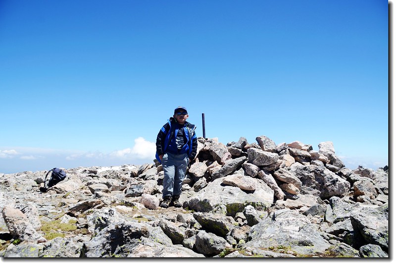
Finally, I did it !
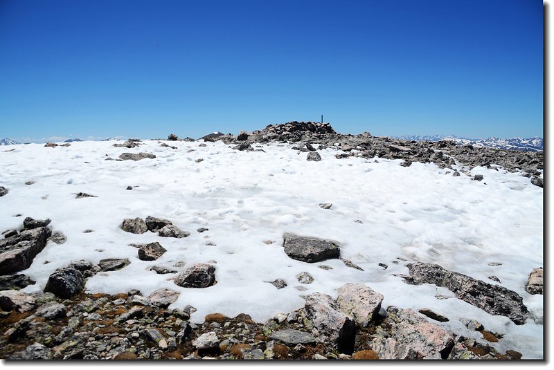
The summit of James Peak
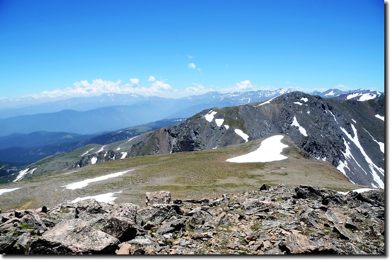
Looking at Mount Evans to Torreys Peak crest line from James Peak's summit
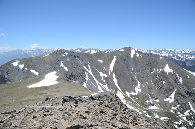
Parry Peak、Mt. Bancroft from James' summit
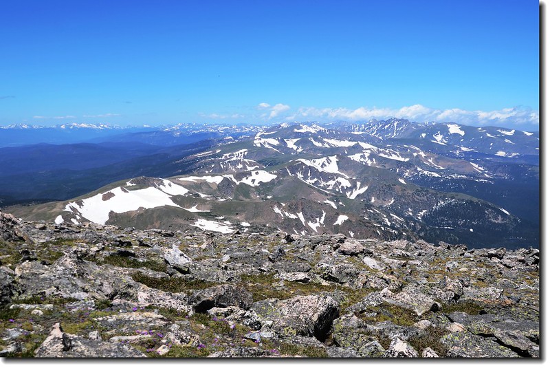
View to North(落磯山脈) from James' summit
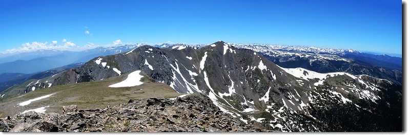
View to South from James' summit
貝貝餓得找處避風的shelter窩下來就狼吞虎嚥起來,瞧他那付疲憊的模樣真令人既心疼又不捨。
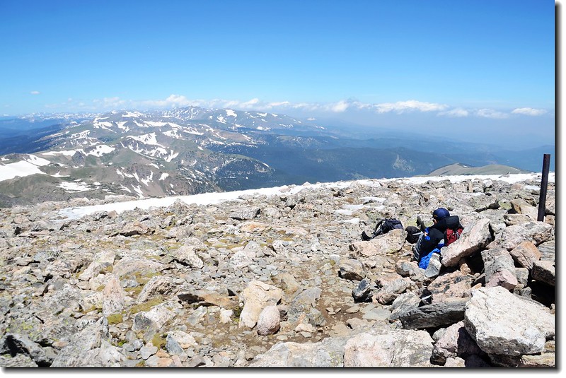
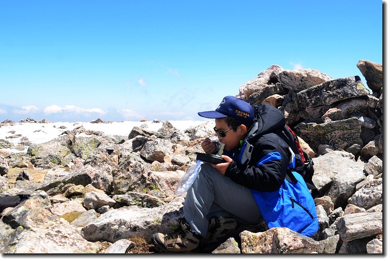
累斃了,也餓壞了!看他窩在避風處狼吞虎嚥,實在心不忍~~
Jacob on James Peak's summit
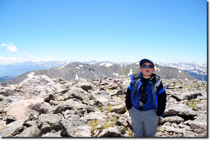
Jacob on James Peak's summit (背景是Parry Peak & Mt. Bancroft)
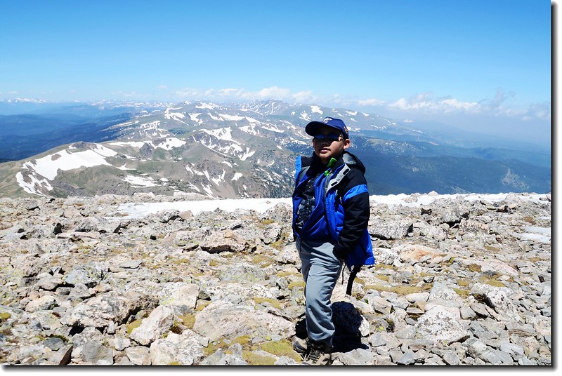
Jacob on James Peak's summit (背景是落磯山脈)
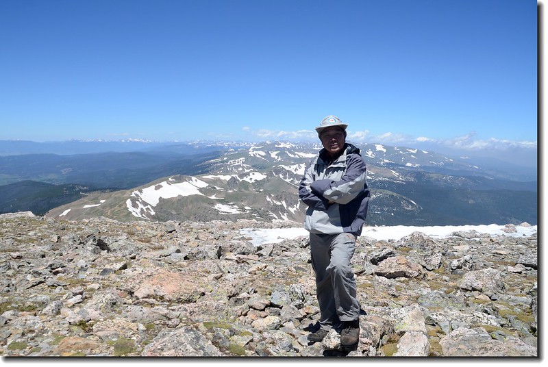
Me on the summit of James Peak(背景為落磯山脈)
13:40 時間有點拖延所以不敢在山上待太久,下山。
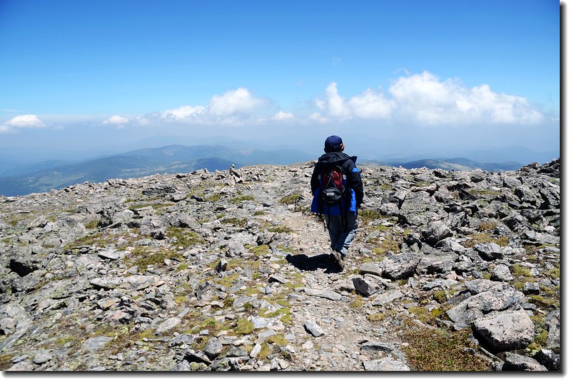
下山囉~~
俯瞰下山路
Alpine kittentails
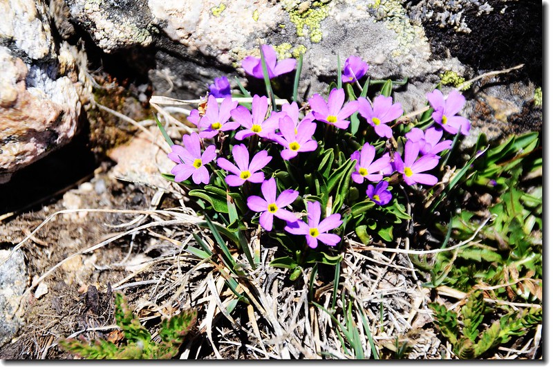
Alpine primrose
Parry Peak、Mt. Bancroft as seen from James' slope
14:42 抵大片雪原處,從雪原上切過。
Jacob is passing the snowfield
15:48 抵達冰河頂端,沿右側山坡小徑行一段路後再切下冰河下行。
17:00 回到停車場,整裝後下山,貝貝完成了一件不太容易的登山行程。
沒有留言:
張貼留言