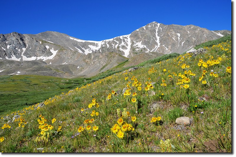
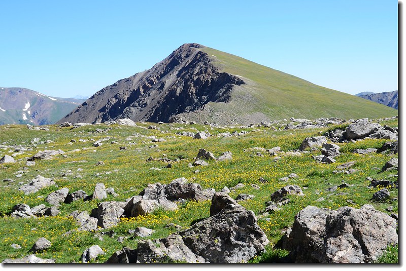
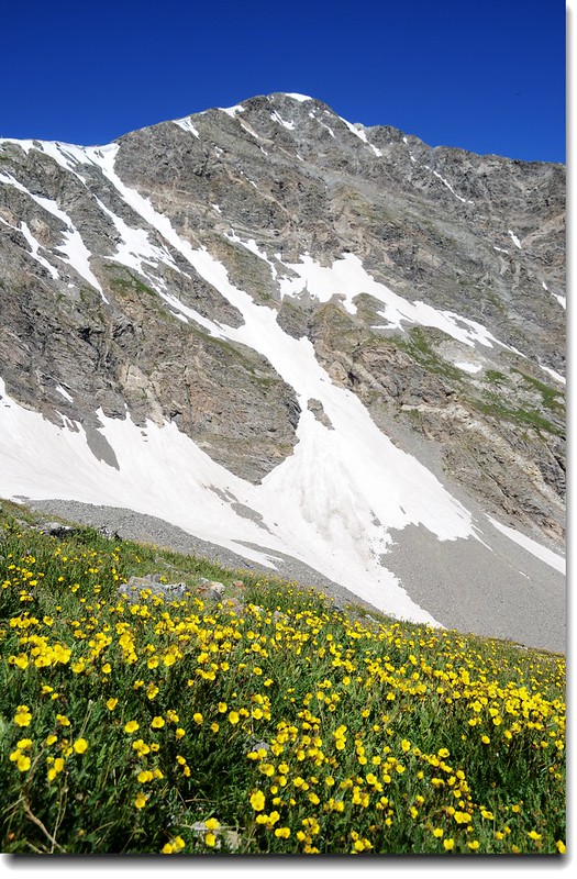
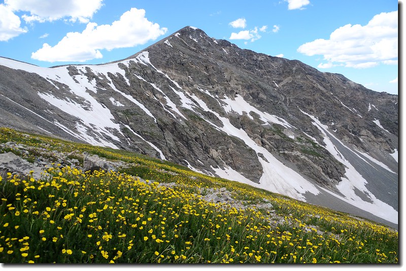
Alpine Sunflower with Grays(left) & Torreys(right) Peak in the distance
Grays Peak(14,270呎/4,350公尺)是科羅拉多州高度排第九的高山,介於Clear Creek County和Summit County兩郡間的高點,它也是Front Range和美國大陸洛磯山脈分水嶺(Continental Divide)的最高峰,她與位在北邊不到一哩的Torreys Peak(14,267呎/4,349公尺)同列科羅拉多的14ers高山。
首登Grays Peak和Torreys Peak的是一位植物學家Charles C. Parry,他以他兩位很有名的同事、也是植物學者Asa Gray和John Torrey之名分別為這兩座山命名,而Asa Gray和John Torrey真正看到此兩峰卻是在11年後的1872年。
該山我已攀登過三次,此趟特地帶小外孫貝貝來攀爬,這是他的第四座14ers。
---------------------------------------------------------------------------------------------------------
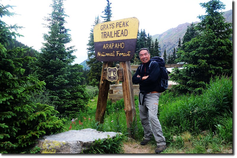
攀登山岳:Grays Peak(海拔14,270呎/4,350公尺)
登山口:Grays Peak Trailhead(海拔11,280呎/3,438公尺)
登山路徑:East Slopes Route
爬升高度:約3,000呎/914公尺
登山里程:來回約8哩/12.8公里
登山時間:含午餐休息計9小時25分
---------------------------------------------------------------------------------------------------------
行車指南:
從丹佛出發取道I-70州際道路往西行約50哩,由Bakerville exit (#221)出交流道,再沿Stevens Gulch Road南行約3哩可抵登山口Stevens Gulch Trailhead,但這三哩的小路是粗糙的石子路,最好是性能良好的四傳車否則勿開進去,此趟前往路況較四年前來攀登時要來得差,幾處深洞、亂石差點不敢開進去。
步程簡述:
07:25 登山口出發,海拔11,280呎/3,438公尺;
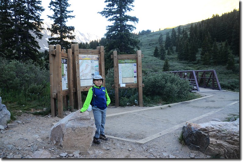
Grays Peak Trailhead
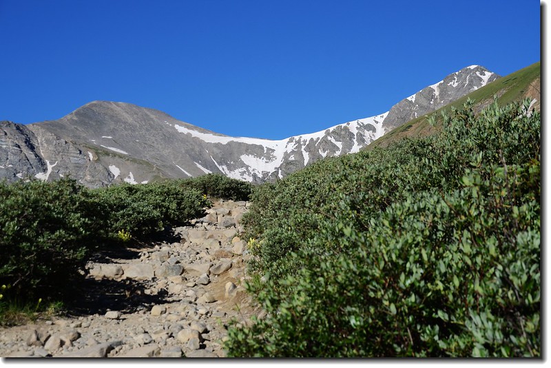
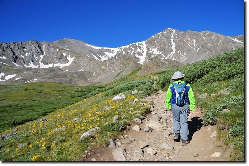
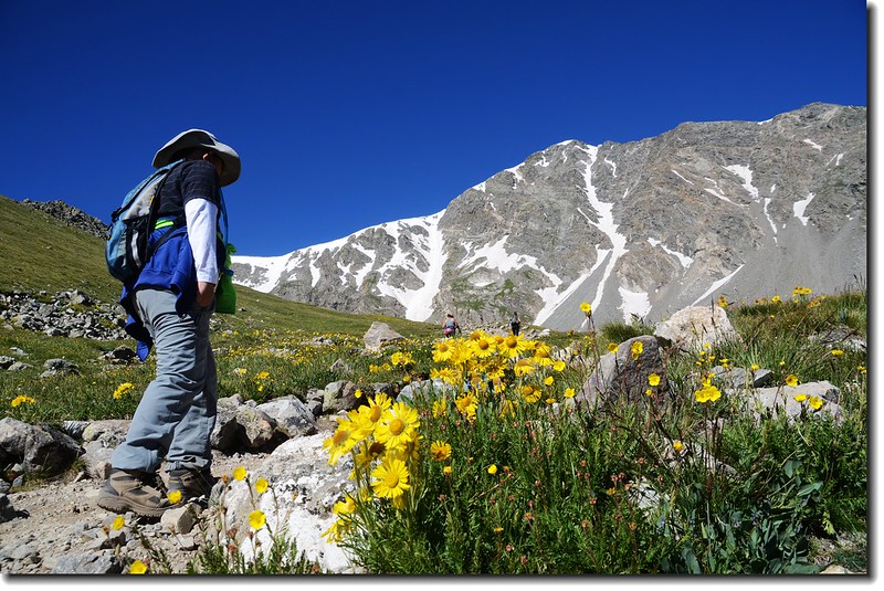
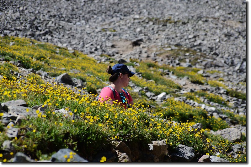
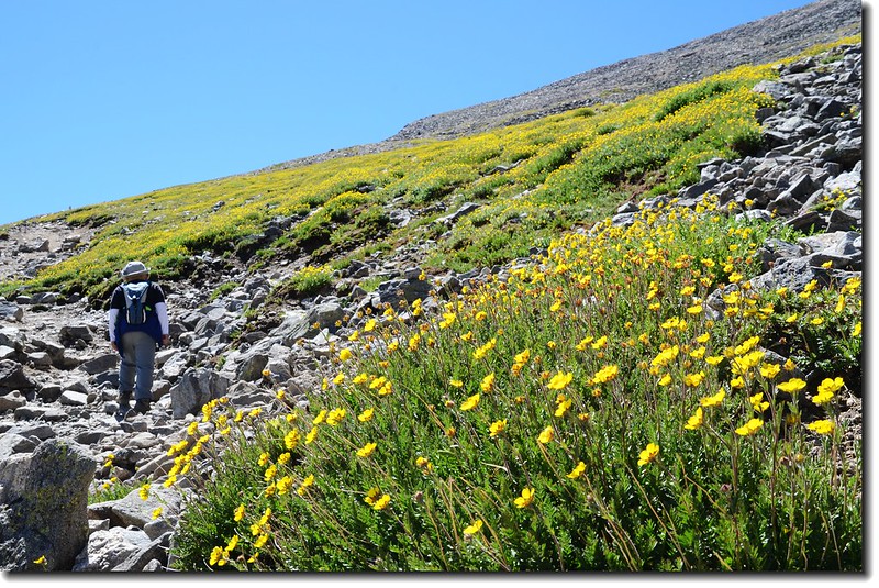
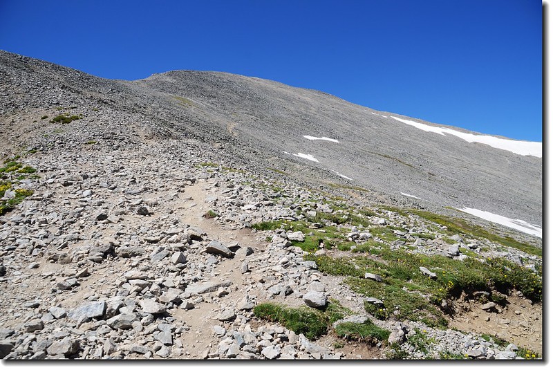
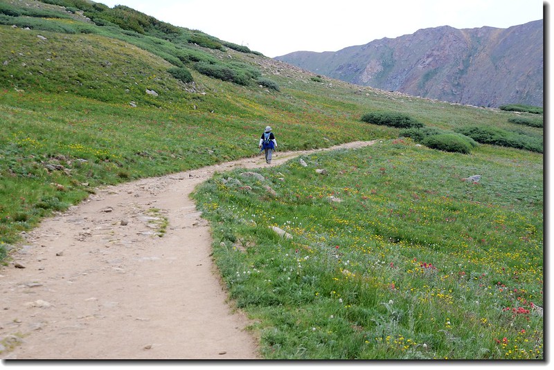
渡過橫跨Stevens Gulch Creek的鐵橋後便是野花遍開的高級步道,貝貝今天精神不錯,希望能順利登頂。
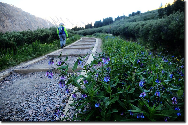
The Grays Peak trail is in great condition and easy to follow
Kelso Mt. (13164 ft, 4012 m) as viewed from the Grays Peak Trail
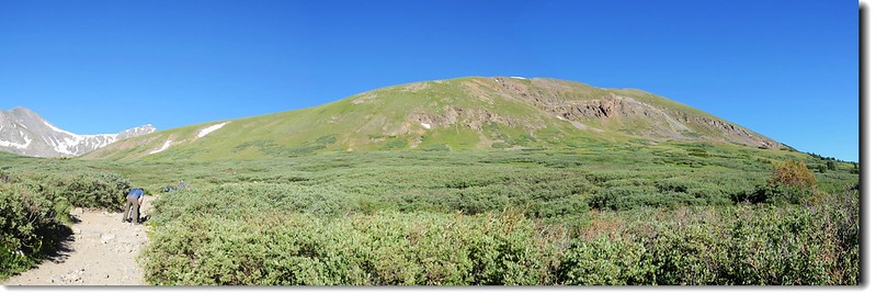
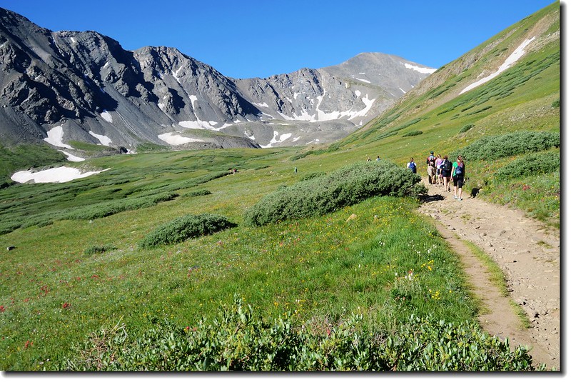
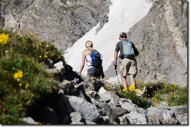
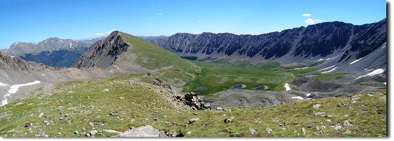
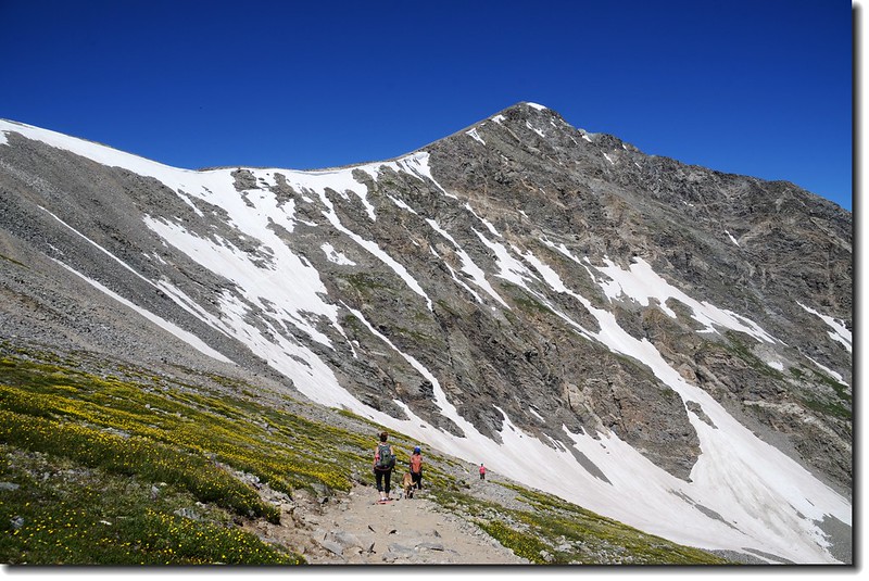
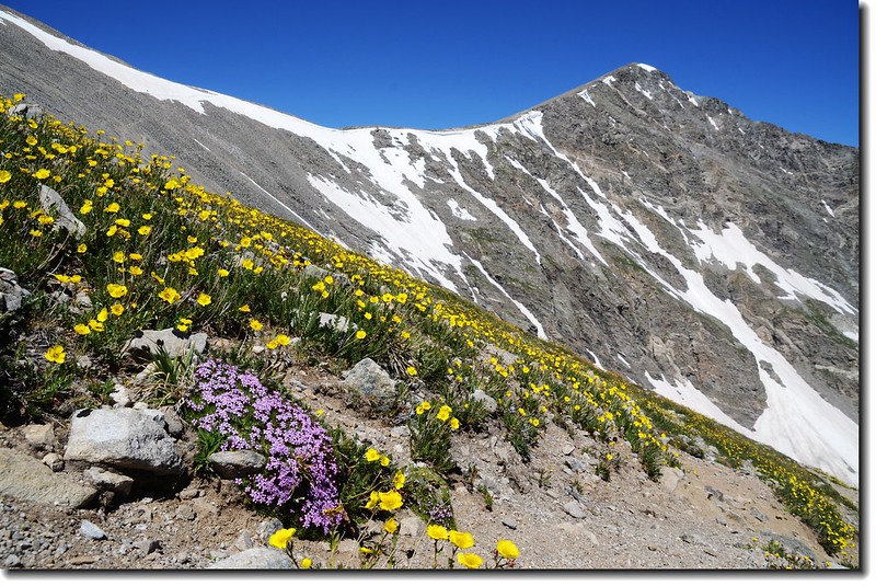
07:50 Grays Peak和Torreys Peak兩座14ers的山形出現在西邊。
Grays (laft) and Torreys seen from 11,700' along the trail
Hikers are on their way to Grey's Peak
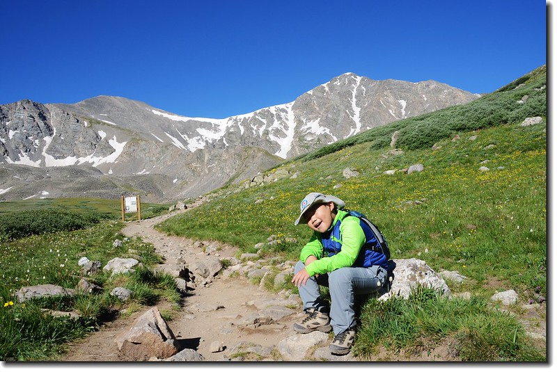
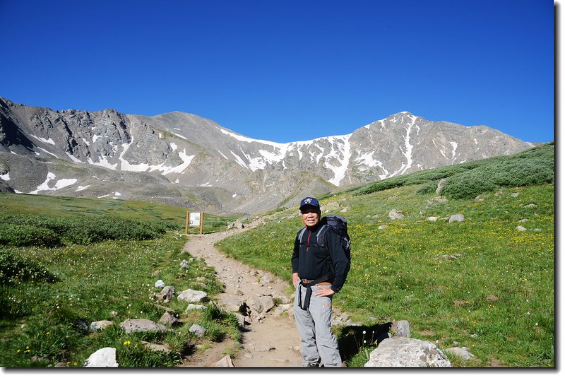
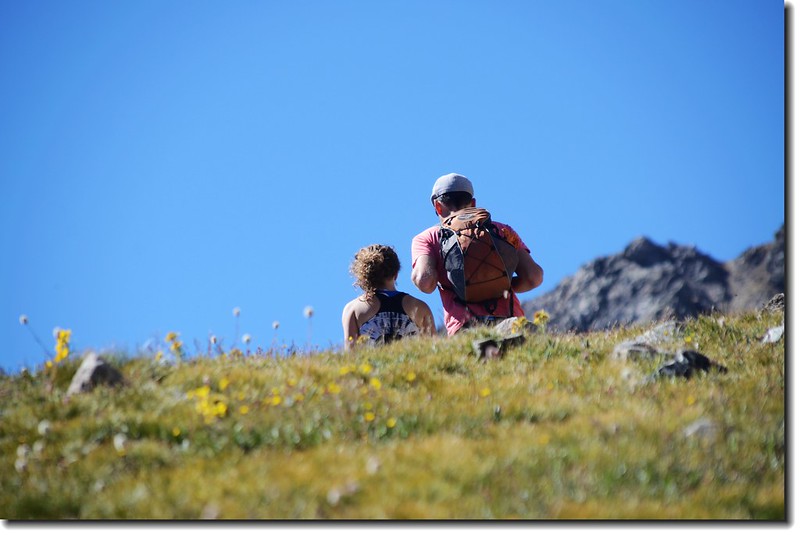
08:47 抵登山資訊牌(information sign),此地海拔11,900呎/3,627公尺,距登山口約1.5哩;
Jacob is taking a break at the base of Grays Peak
Me at the trail from 1.5 miles into the hike
天氣預報今天是個大晴天,來往登山客絡繹不絕。在登山資訊牌處能清楚的西眺Grays Peak和Torreys Peak兩座14ers;過了登山資訊牌後登山步道有點上坡,而且轉為狹窄的小徑。
Jacob is on his way to Grays Peak
09:08 抵Stevens Gulch Creek,由小溪上墊腳石跨過。
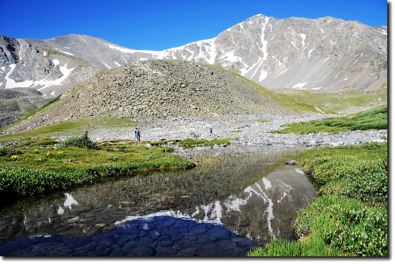
Grays & Torreys Peak from Stevens Gulch Creek
Hikers on their way to Grays Peak
09:24 抵傳統步道和Torreys Peak - Kelso Ridge路線分岔,此地海拔12,100呎/3,688公尺,距登山口約1.75哩;
Hikers on the Torreys Peak - Kelso Ridge
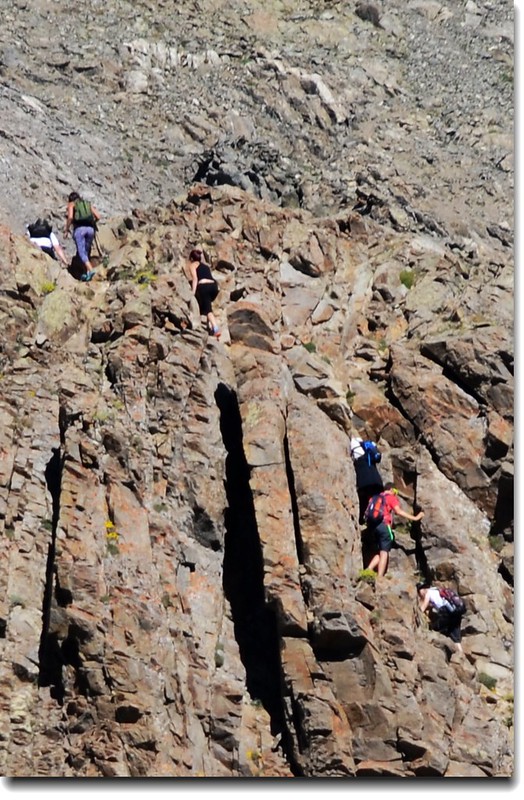
Hikers on the Torreys Peak - Kelso Ridge
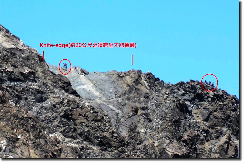
Hikers on the Torreys Peak - Kelso Ridge (knife edge)
Jacob is on his way to Grays Peak
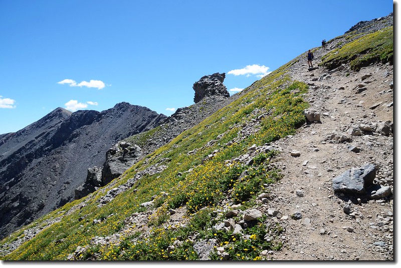
右往Kelso Ridge攻Torreys,取直上Grays Peak;登山口至此處為止貝貝表現不錯,進度跟我前幾次攀登時沒落後太多。
Kelso Mountain from Grays Peak's slope
Hikers on their way to Grays Peak
Hikers on their way to Grays Peak
Near 12,800', looking back down on the route, with Kelso Mountain in full view
Kelso Mountain & Stephens Gulch from Grays Peak's slope
Looking down at Stephens Gulch from Grays' slope
Hiker is taking a break at the Grays Peak trail
Looking back at the trail that we came from
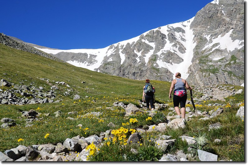
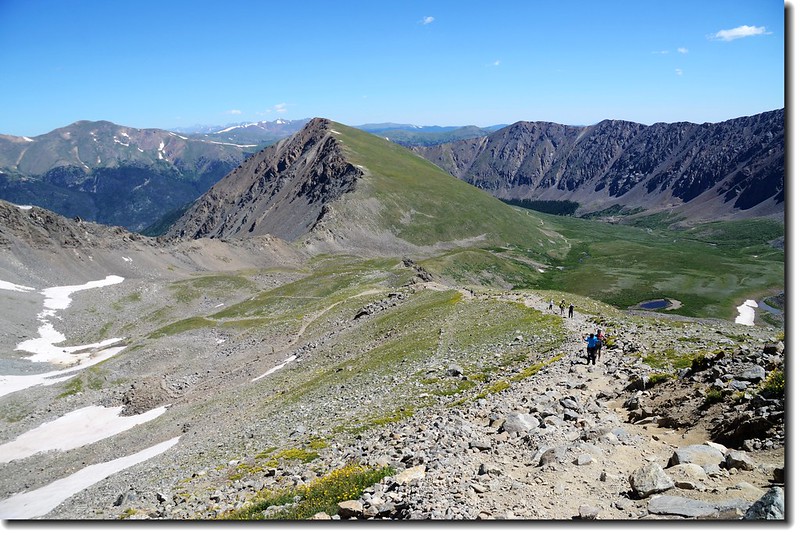
11:09 登抵Grays Peak 和Torreys Peak岔路,此地海拔13,200呎/4,023公尺;
Grays & Torreys Peak trail junction
右往Grays-Torreys saddle,取此線上saddle後可登Torreys Peak和Grays Peak,左往Grays Peak,一般登山客大多走此線,取左上;登山步道越來越陡峭,貝貝體力也受到極大考驗,隨著高度的爬升,休息的間隔也越來越緊密。
Torreys Peak from Grays' slope
Jacob is on his way to Grays Peak
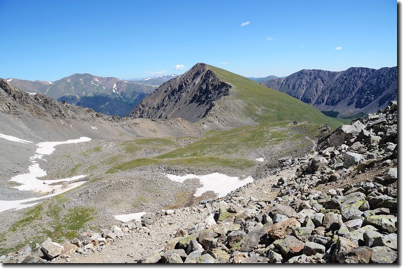
11:30走了四小時,來到路左下一塊巨岩;
An interesting finger of rock beside the route of ascending (13,400 ft.)
Jacob at the trail above the rock tower
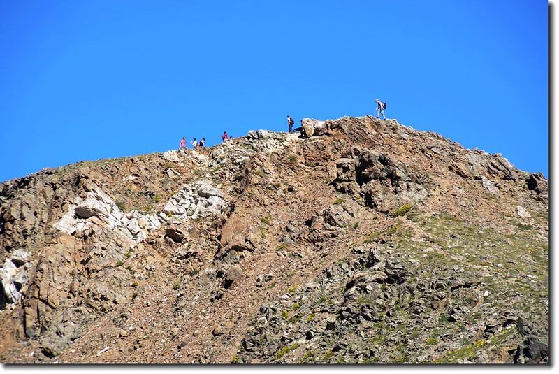
這裡海拔13,400呎(4,084公尺),回首來時路下面是Stevens Gulch,登山步道依稀可見,遠處黑影森林處是登山口;距山頂還要爬升兩百多公尺,但卻是無止境的“之”字路,我們再爬了近兩小時才登頂!
Looking up the remnant trail from rock tower
Torreys Peak from Grays' slope
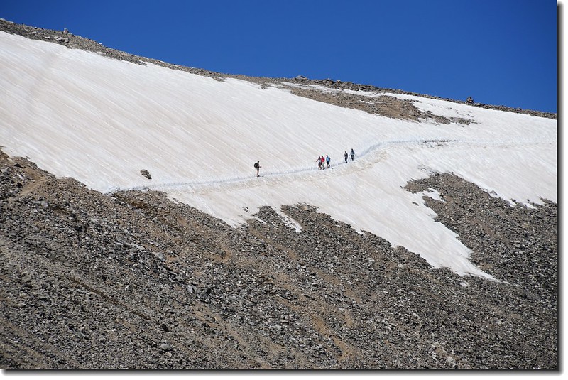
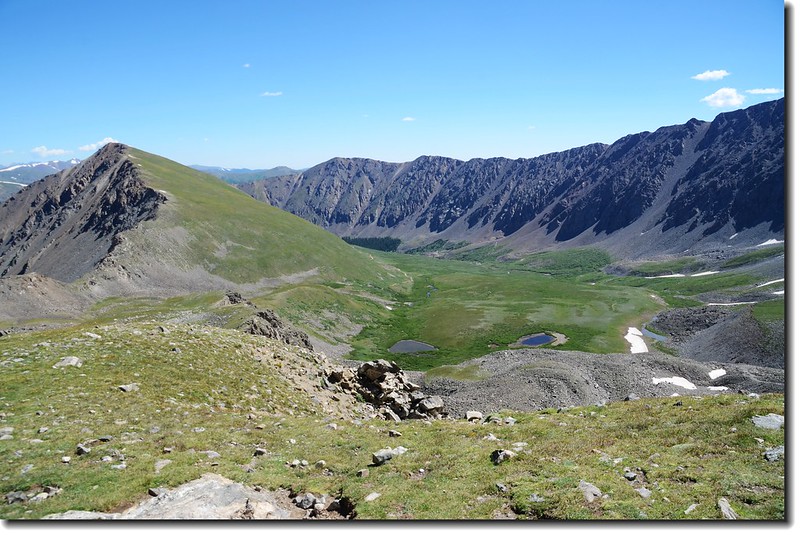
仰望Grays-Torreys間鞍部下雪原及登山客
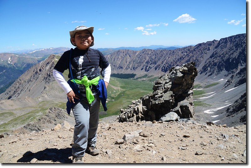
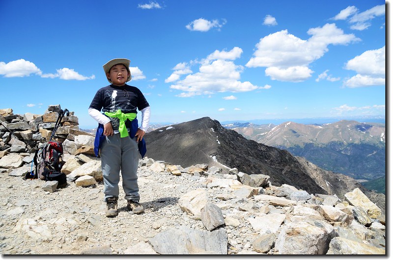
13:15 登頂Grays Peak,這是我第四度登上此座科羅拉多排名第九的14ers,也是貝貝的第四座14ers。
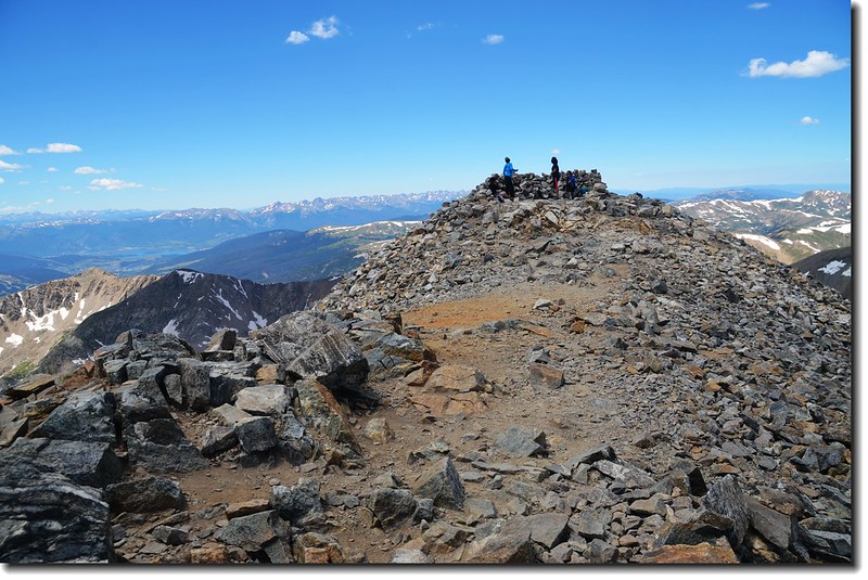
The summit of Grays Peak
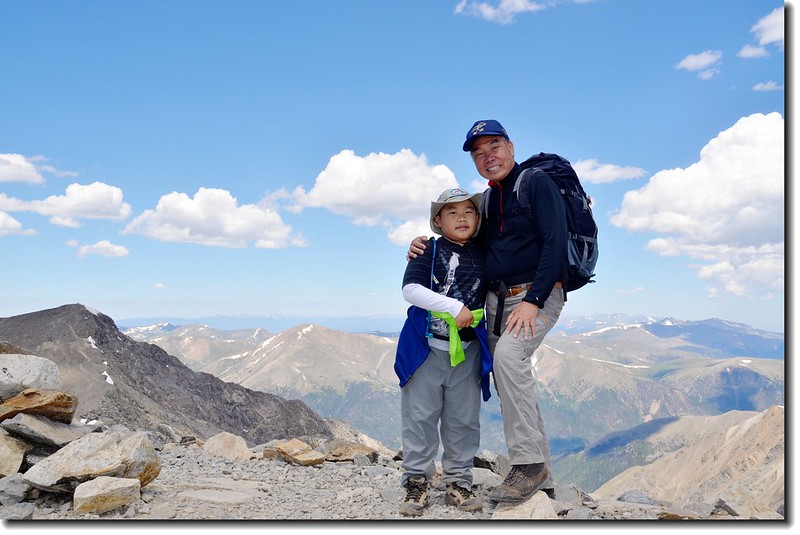
Jacob & me on the summit of Grays Peak
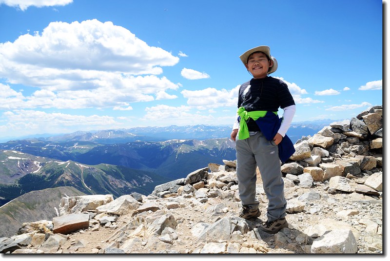
Jacob on the summit of Grays Peak's summit (background is Torreys Peak)
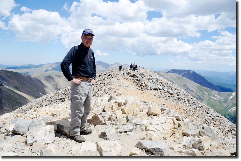
Me on the summit of Grays Peak
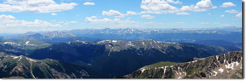
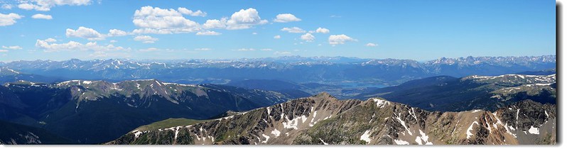
今天天氣很好,山頂展望奇佳,肉眼即可辨識出Mount Evans、Mount Bierstadt、等近十座14ers;
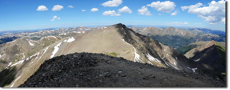
View to the North from Grays Peak's summit, Torreys Peak in the front
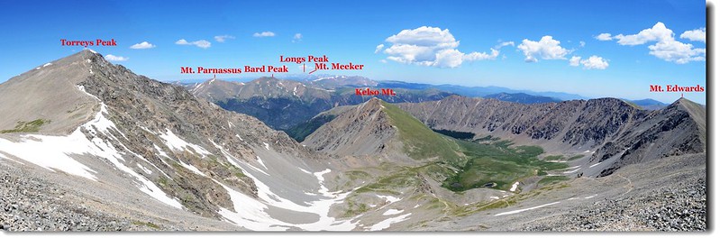
Looking north from the summit of Grays( Longs Peak & Indian Peaks in the distance) 1
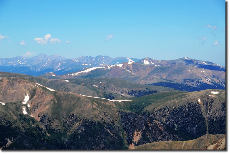
Looking west from the summit of Grays Peak,Mt.of the Holy Cross is in the distance center
View to West from Grays peak, Dillon Reservoir can be seen in the distance
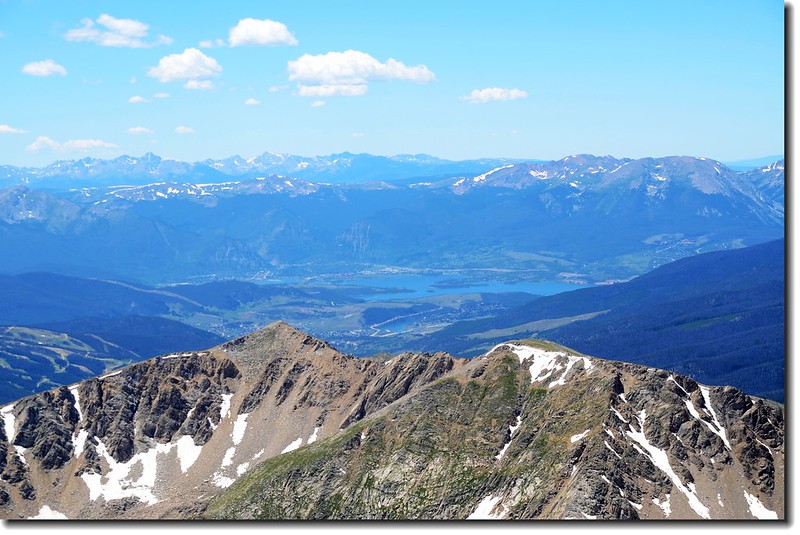
View to West from Grays peak, Dillon Reservoir can be seen in the distance
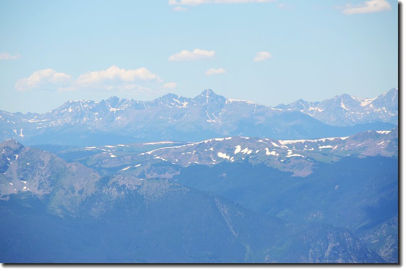
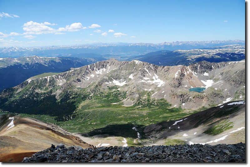
View to the Southwest from Grays Peak's summit
View to the Southwest & West from Grays Peak's summit
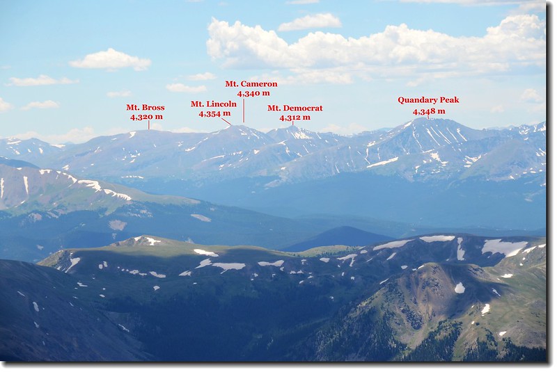
Looking SW to Mosquito Ranges from Grays peak
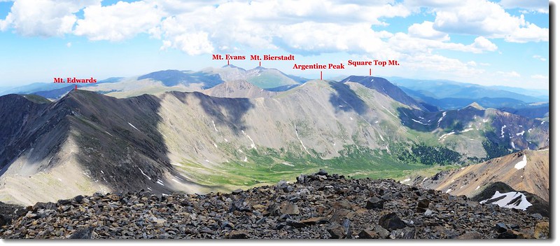
View to the Southeast from Grays Peak's summit
Looking down at Stephens Gulch from Grays Peak's summit
五、六隻Mountain Goat在山頂附近徘徊,幾隻是緊偎母羊、稚氣未脫的小羊,幾隻是徐娘半老、風韻猶存的母羊,更有幾隻是半解羅衫、半散雲鬢的少女,這些北美野山羊有點畏懼登山客,只要登山客稍加靠近便跑開,不似Mount Evans山上的Mountain Goat一點也不畏生。
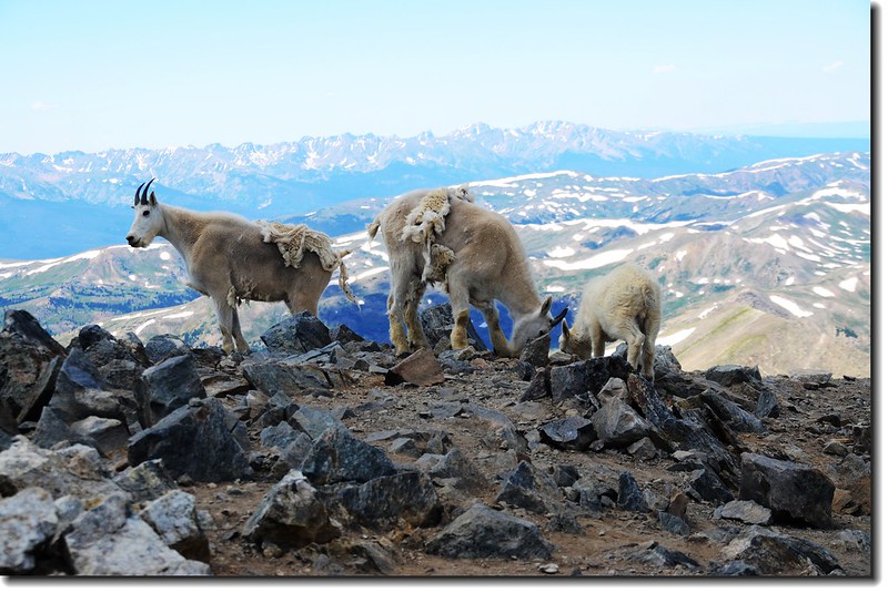
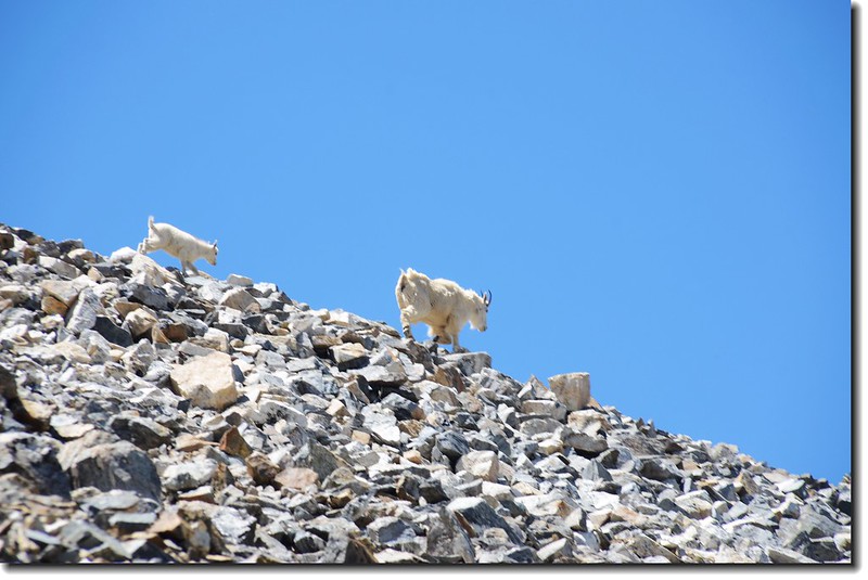
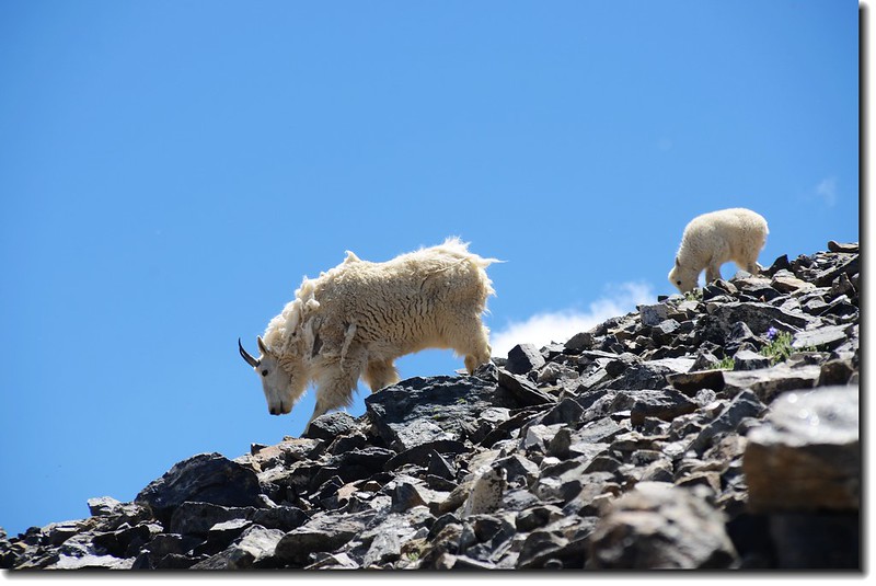
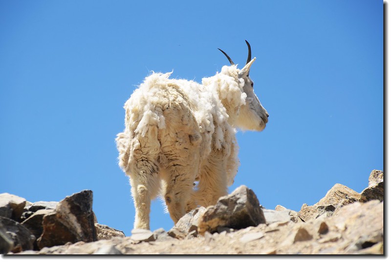
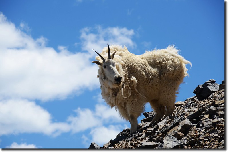
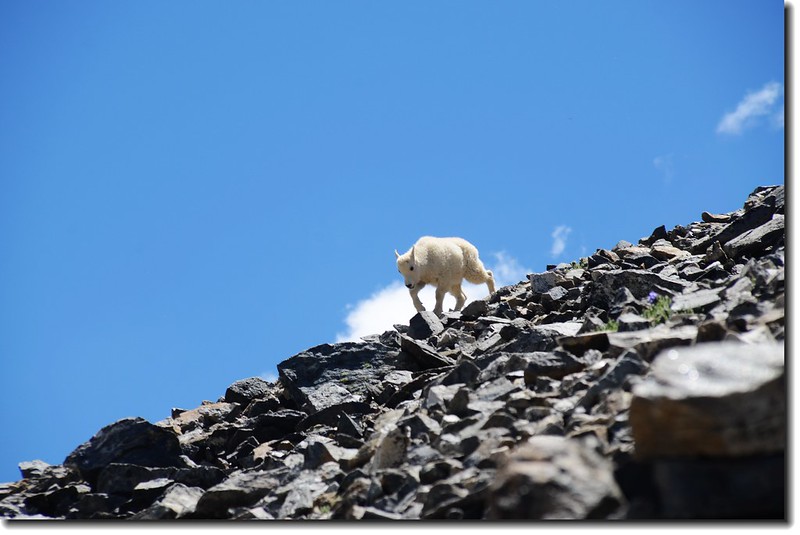
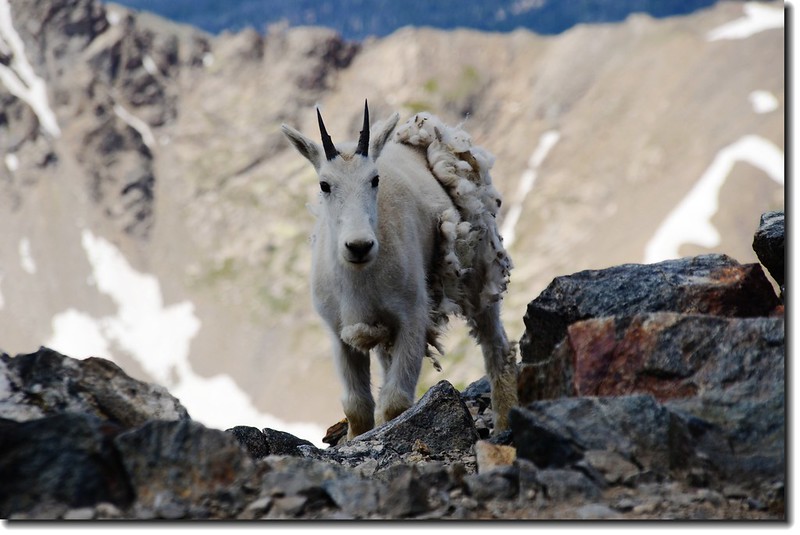
拍甚麼拍,人家衣服都還沒換好就搶著拍!
14:00 下山,循原路下山。
14:23 山頂下約一百多公尺處遇到一位老翁正拄著手杖吃力的往上爬,看年紀應有八十上下(老外年齡看不準~);望著他的背影,稍有感觸~~
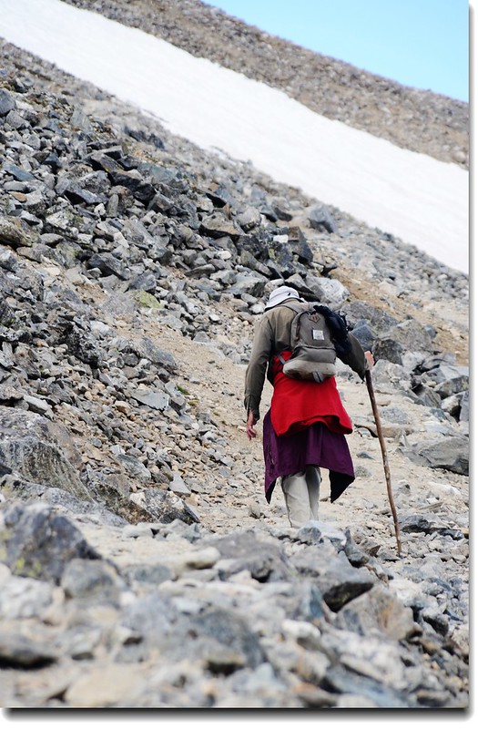
An old hiker on his way to Grays Peak
Torreys Peak from Grays' slope
15:56 下抵登山資訊牌(information sign)處,貝貝下山速度還算快的。
Jacob on his way down mountain
16:50 返抵登山口,貝貝是有點累了,此趟上山費時5小時50分,比我四年前獨登此山時來回的時間還多出25分鐘;下山則僅花2小時50分。
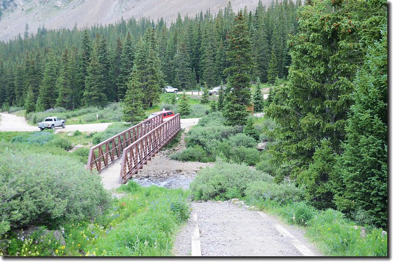
This bridge crossing the creek in Stevens Gulch
返抵登山口
相關連結:
Grays Peak和Torreys Peak攀登記(攀登日期:2006.09.04)
三度攀登Grays Peak(2010.08.11)
攀登科州14ers--Torreys Peak(山岳篇)-2011.07.19
+++++++++++++++++++++++++++++++++++++++++++++++++++++++++++++++++++++++++++++++++++++
行車路線圖:
點此看放大圖
+++++++++++++++++++++++++++++++++++++++++++++++++++++++++++++++++++++++++++++++++++++
沒有留言:
張貼留言