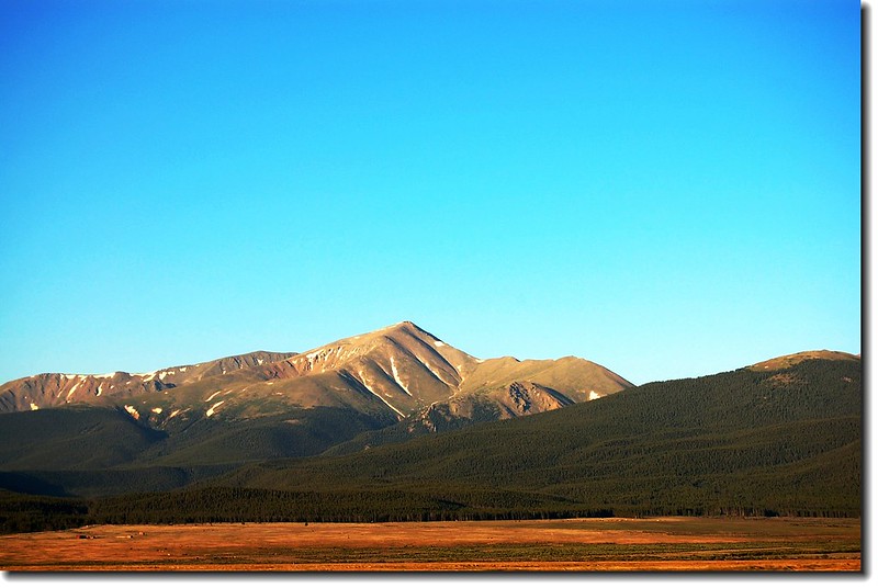
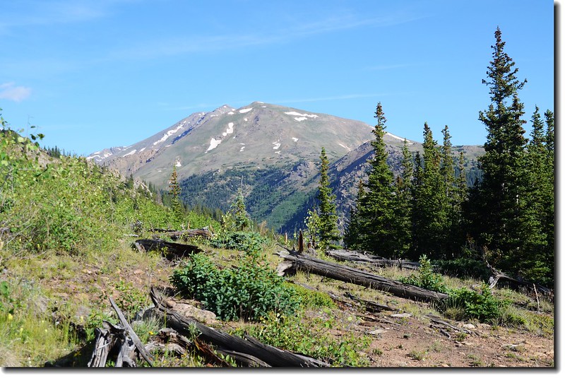
Mt. Elbert(14,433 ft.)from Halfmoon Road
去年帶豆豆攀登難度頗高的Longs Peak之後(三度登頂Longs Peak--豆豆(Matthew)的第12座14ers),他一直 想爬爬科羅拉多的最高峰Mount Elbert,前幾天剛好有空,天氣也不錯,祖孫倆就一同去攀爬此山,這是我第三度登臨,巧的是與八年前我首登此山的日期同樣是七月十四日。
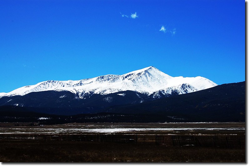
冬天的Mt. Elbert(2006.09.24攝)
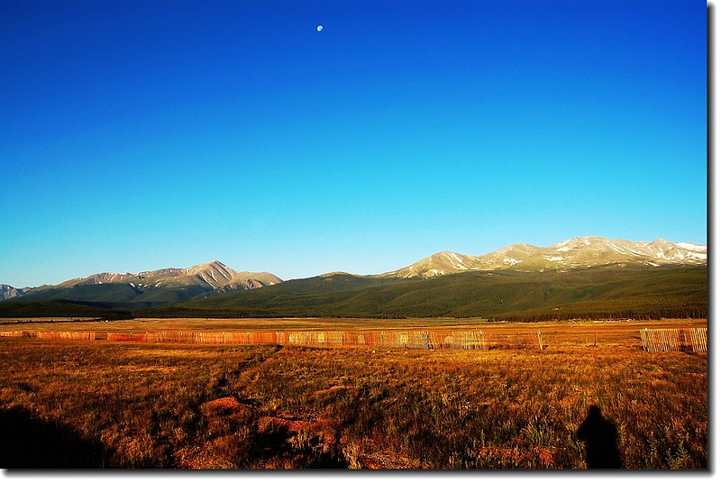
Mt Elbert(L) & Mt. Massive(R)
---------------------------------------------------------------------------------------------------------
山岳簡介:
Mount Elbert位在丹佛西南方約110哩左右,距離其東北方高海拔(10,152呎 / 3,094 公尺)舊銀礦小城Leadville僅11哩遠,座落在洛磯山脈的Sawatch Range範圍內。此山是以1873年的科羅拉多地方長官Samuel Hitt Elbert之名命名(科羅拉多州於1876年才建州),而該山首登紀錄是在1874年由任職在Haydon Survey的Henry W. Stuckle寫下,從此以後每年引來大批的登山客登臨山頭。Mount Elbert被此地登山界喻為“gentle giant”(溫和的巨人),因為此山雖然是科羅拉多州的第一高峰,但他的山況和台灣最高峰的玉山有點雷同,名為最高峰,由於路況沒有太大危險性,在此地攀登等級被列為最簡單的Class 1 (Colorado Fourteeners (上)---14ers 與攀登等級),所以登頂並不難,幾乎可以說只要有基本的體力及沒有不良的高山反應就能登頂。
Mt. Elbert 海拔14,433呎/4,399公尺 (2002年重測為14,440呎,但大多數的登山資料及登山界仍沿用14,433呎的舊記錄) ,是科羅拉多州第一高峰,也是美國本土(Alaska除外)第二高峰(第一高峰是位在加州的 Mount Whitney ,海拔 14,497 ft / 4,419 m);在Mount Elbert北邊五哩處另有一座科羅拉多的第二高峰Mount Massive (14,421呎/4,396公尺),兩座科州的第一和第二高峰和許多座南邊的14ers形成Leadville西南一條美麗壯觀的空中走廊,也是Leadville的一座天然屏障。
在1970年代,一群熱愛Mount Massive的登山客一直認為Mount Massive才值得稱上科羅拉多第一高峰,但是在其南邊的Mount Elbert硬是比它高了12呎(3.7公尺),所以發起了一個運動,就是在山頂上堆砌石塊,試圖使其高度超越Mount Elbert;此舉引起Mount Elbert迷採取反制行動,就是登上Mount Massive時順手摧毀山上的石堆,最後才使Mount Massive迷放棄其企圖,Mount Elbert終究保住科州第一高峰的名號。
-----------------------------------------------------------------------------------------------------
交通資訊:
由丹佛沿I-70州際公路西行,約70哩後在Exit 195出口接CO-91公路往Leadville南行,行約22.6哩後匯入US-24繼續南行,不久經過小城Leadville,出了城再行約3哩後於一大左彎處右轉CO-300公路西行,0.8哩後左轉County Road 11 (Halfmoon Road),1.3哩後右轉續沿Halfmoon Road西南行,5.1哩後抵達道路左邊之Mt. Elbert Trailhead,登山口有停車場,但登山旺季若太晚到達往往一位難求。
-----------------------------------------------------------------------------------------------------
攀登山岳:Mount Elbert
登山口:North Elbert Trailhead
山岳海拔:14,433呎/4,399公尺
登山口海拔:10,040呎/3,060公尺
爬升高度:4,700呎/1,433公尺
登山里程:來回約9哩(14.4公里)
登山時間:含休息午餐共7小時45分
------------------------------------------------------------------------------------------------------
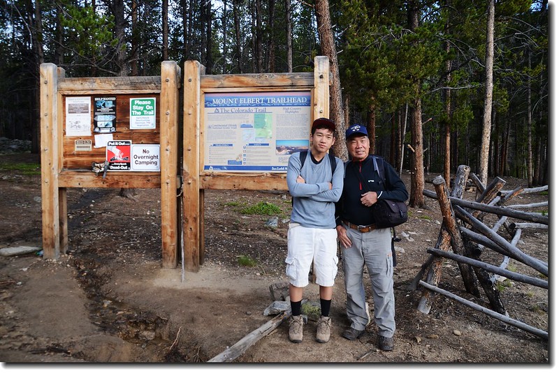
當天我們於清晨四點十分從家中出發,抵達登山口時已是六點四十分左右,整裝後於六點五十五分從登山口起登。
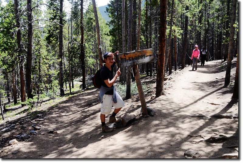
06:55 登山口起登,今天走的是Mount Elbert傳統路線的North Mt. Elbert Trail,登山口海拔10,040呎/3,060公尺。
North Mt. Elbert Trailhead
07:00 遇橫向Colorado Trail,取左行幾步路,渡過一小溪流後步道在松林間“之”字迂迴上山。
07:23 行到一開闊越嶺處,海拔約10,600呎/3,231公尺,步道轉右緩下坡繼續在松林間前進。
07:30 抵達Colorado Trail & Mount Elbert Trail junction,此地海拔約10,560呎/3,219公尺,距登山口約一哩路;
At 10,560', stay right at the Colorado Trail (left) and Mt. Elbert trail junction
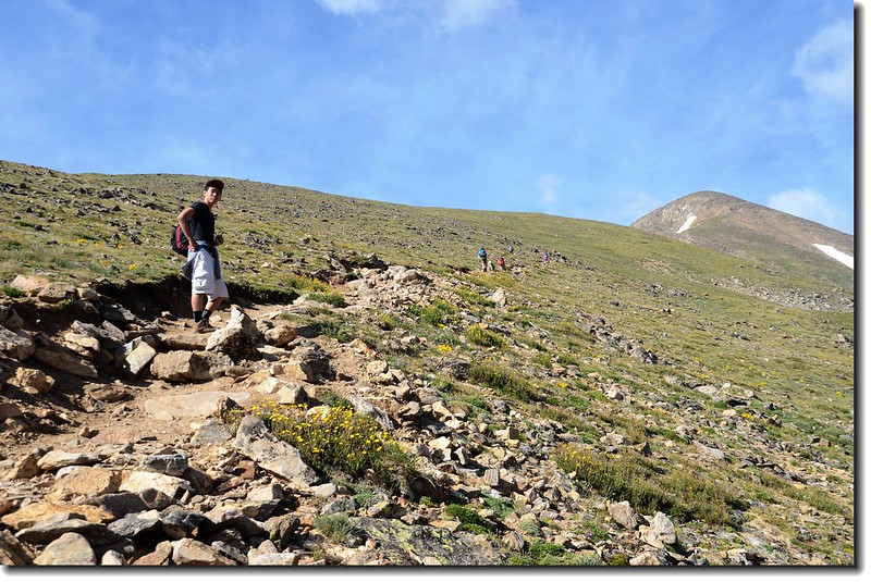
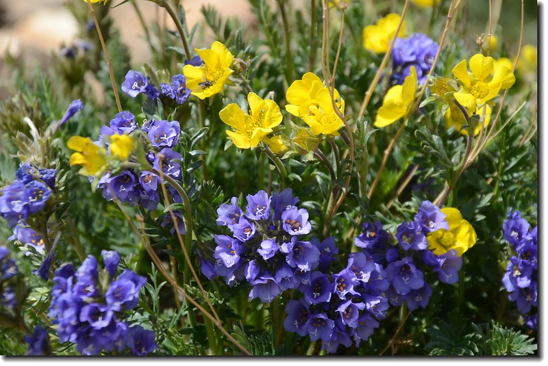
左下Colorado Trail不取,取右直行上山;剛開始步道極為寬大筆直且平緩,路旁Red Columbine及Heart leaved Arnica野花盛開,行不久步道轉為較為狹窄、陡峭在松林間迂迴爬升,我和豆豆開始聽到彼此的喘息聲。
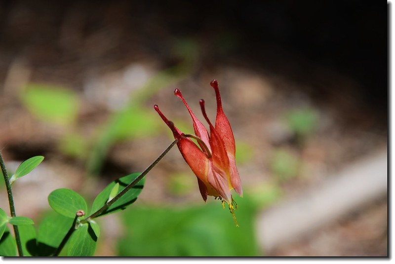
Red columbine
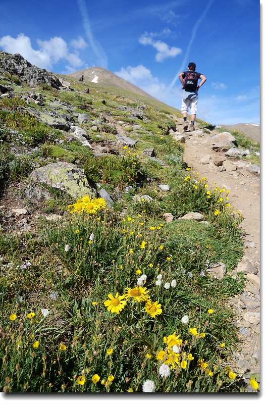
08:15 抵一開闊地,豆豆有點餓,在此小休;此地海拔約11,600呎/3,536公尺,距登山口約2.3哩,空地上野花盛開。
Before tree line, pass through this clearing at 11,600'
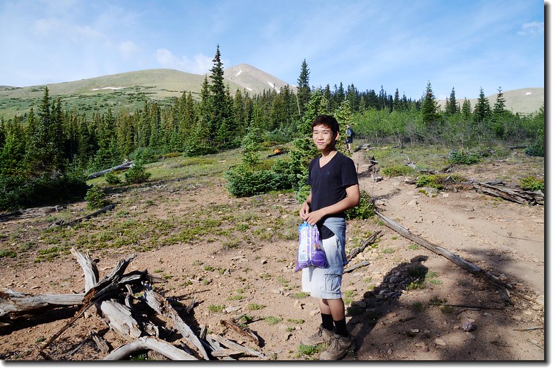
Matthew at the clearing before tree line
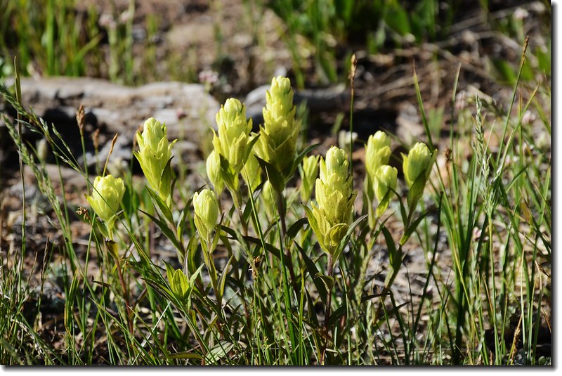
Yellow Indian Paintbrush
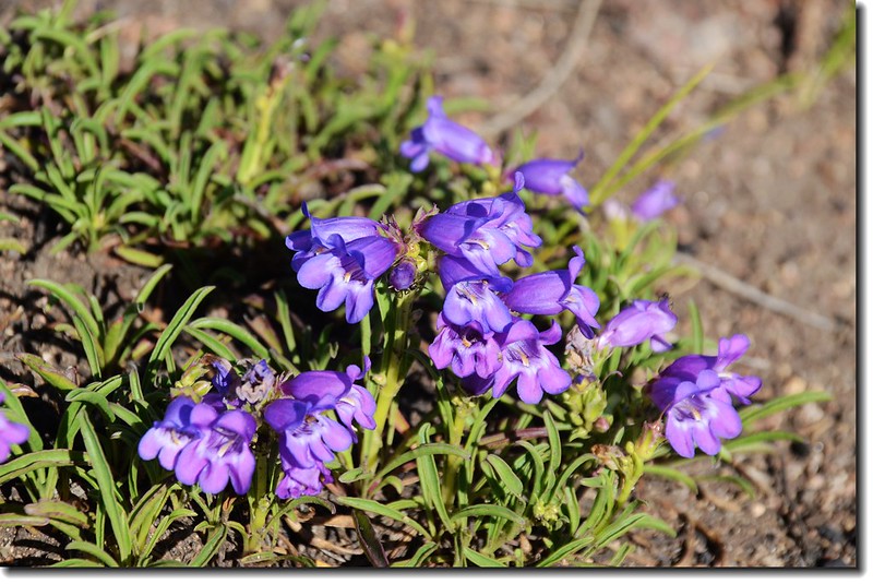
Mojave Beardtongue, Western Desert Penstemon
Mt. Massive from the clearing before tree line
08:33 續行,又穿入松林上行。
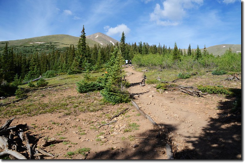
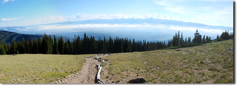
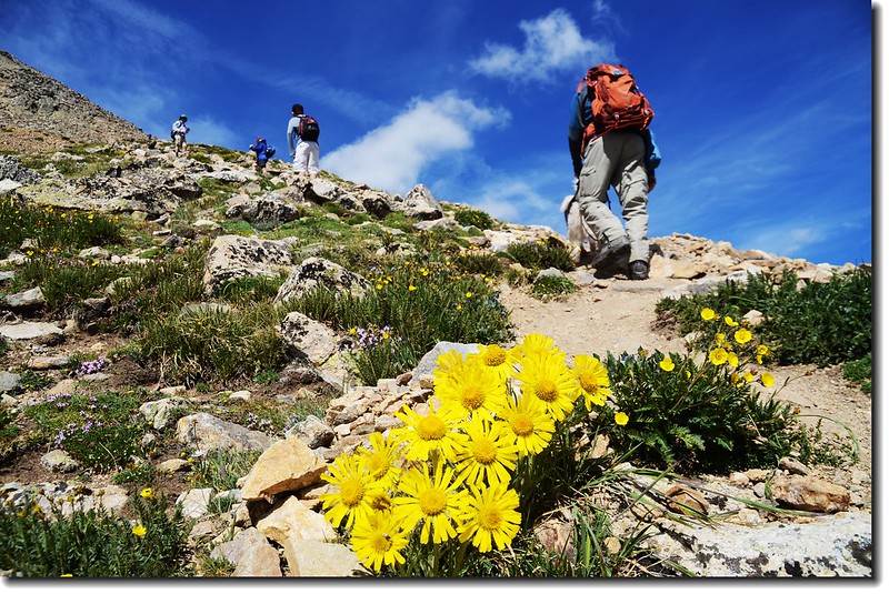
08:44 出森林線,此地海拔約11,900呎/3,627公尺,距登山口約2.6哩;
Tree line
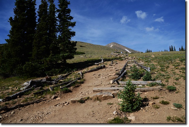
Leave the trees at 12,000' and hike up an easy slope below the ridge
Looking down east from the Mt. Elbert Trail
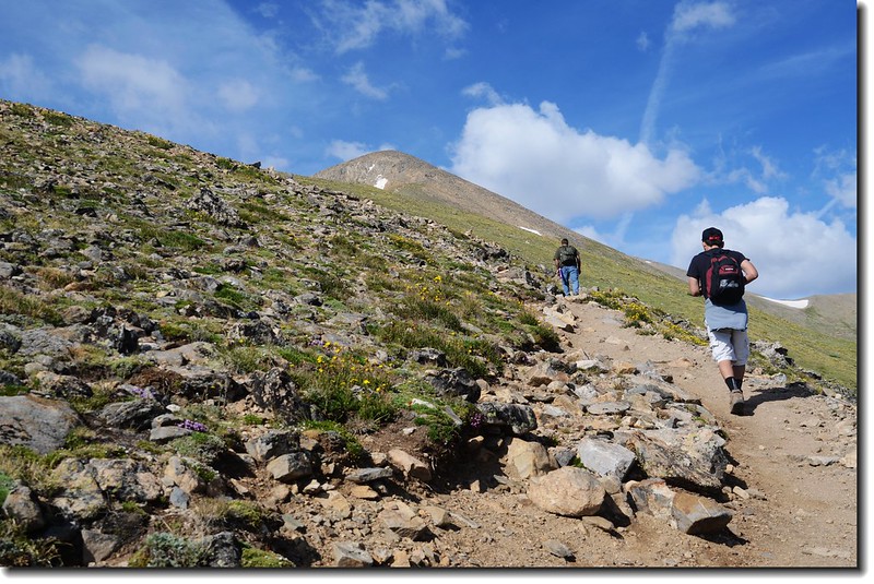
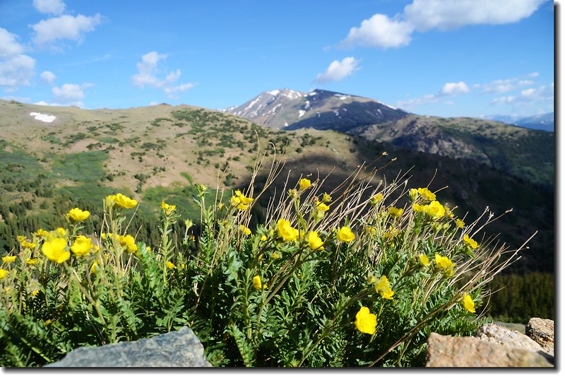
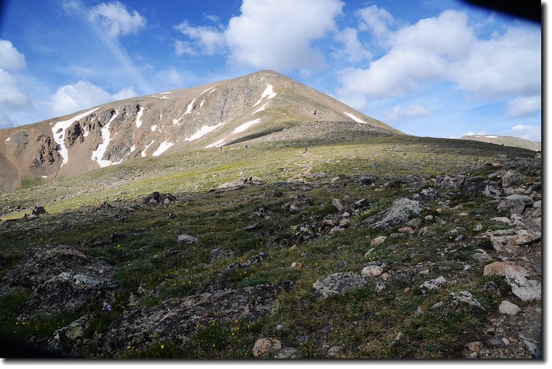
Mount Elbert第一個假山頭矗立在遠方,往後的山徑即要在這看似緩坡其實陡峭的東北稜往上盤升。
Going up Mt. Elbert
Mt. Elbert false summit from tree line
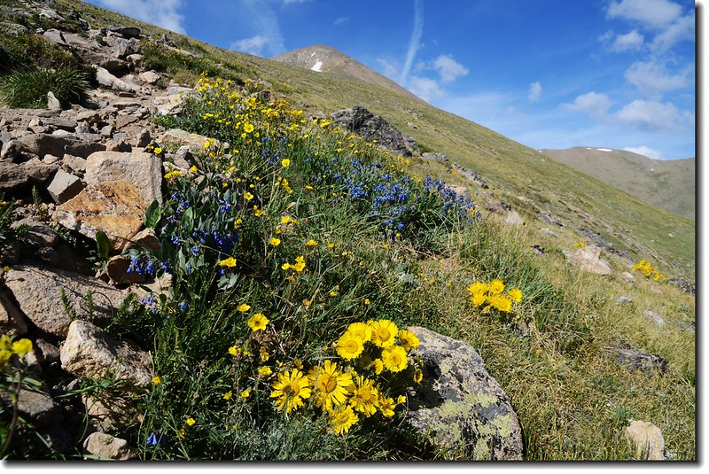
Wildflowers along the trail
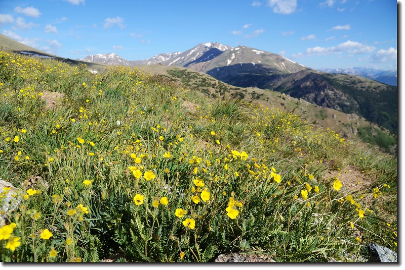
Mt. Massive from Mt. Elbert trail
Mt. Massive from Mt. Elbert trail
Mt. Elbert trail
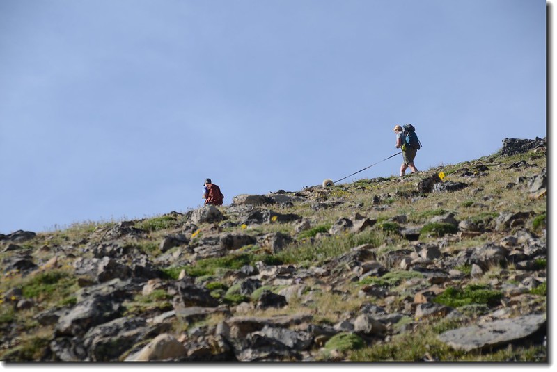
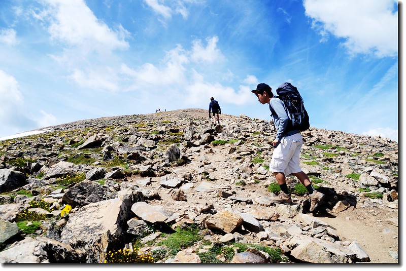
Hikers on their way up the summit
Matthew on his way up Mt. Elbert
Matthew on his way up Mt. Elbert
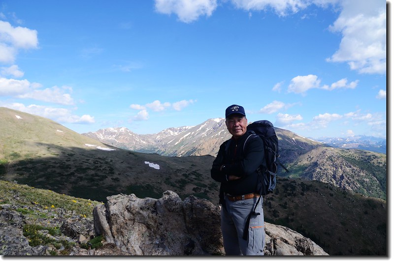
Me on my way up Mt. Elbert, background is Mt. Massive

Looking back at the trail that we came from
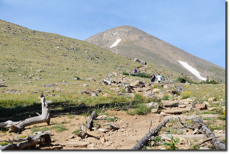
09:30 登上Mount Elbert東北稜稜點,海拔約12,700呎/3,871公尺;
At 12,700' on the Northeast Ridge
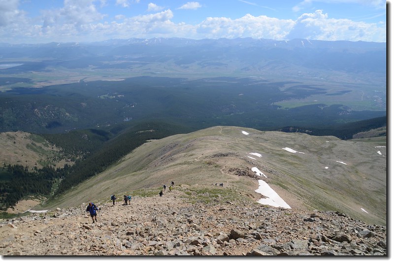
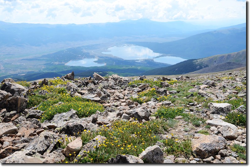
左側下方圓形凹谷有一高山湖,那是Box Creek的源頭,高山湖越稜處山下的Twin Lakes依稀可見;通往山頂的路徑清晰可辨,但此處看不到真正的山頂。
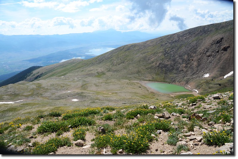
The head of Box Creek
休息5分鐘後繼續上路,從這裡到海拔13,900呎的假山頭爬升約1,200呎,是此山最陡峭較為艱困的一段路程,先平緩的走一段路後山徑開始在石堆間爬升,當爬升到海拔約13,700呎路徑轉右腰繞直抵13,900呎假山頭;從海拔13,450呎到13,900呎是此山最艱困的路段,既陡峭、小碎石鬆軟難爬,下山時可要小心。
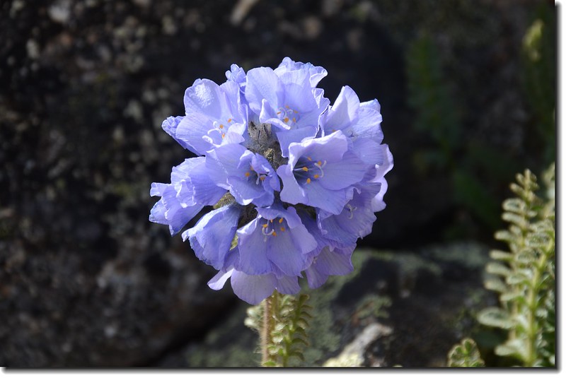
Sky pilot flower
Sky pilot & Alpine avens
Mt. Elbert trail
Looking back at the trail that we came from
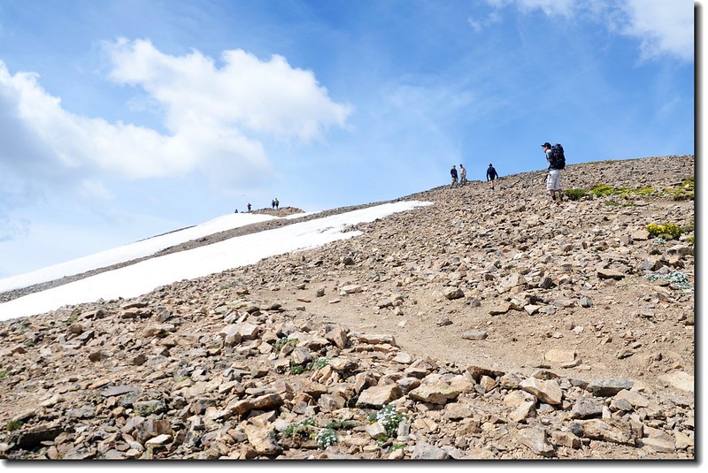
10:40 登上第一個假山頭空曠處,此地海拔約13,900呎/4,237公尺,還有533呎/162公尺的高度要爬升,但在此處還是看不到真正的山頂,剩下的路要比剛才那一段陡坡易走多了!
Matthew at the 13,900' point

Me at the 13,900' point, background is Mt. Massive
Looking down at Twin Lakes from Mt. Elbert trail
At 13,900', near the flat spot on the ridge, 550' of easy hiking remains
休息5分鐘後繼續上路,豆豆肚子餓了,我們交換背包後讓他先走,交代他登頂後找處shelter避風用餐,我隨後趕到。
Matthew on his way up Mt. Elbert
11:20 登抵山頂下一處平緩處,此地海拔約14,300呎/4,359公尺,山頂在望,再幾步路即可登頂,豆豆已不見蹤影,應已登頂。
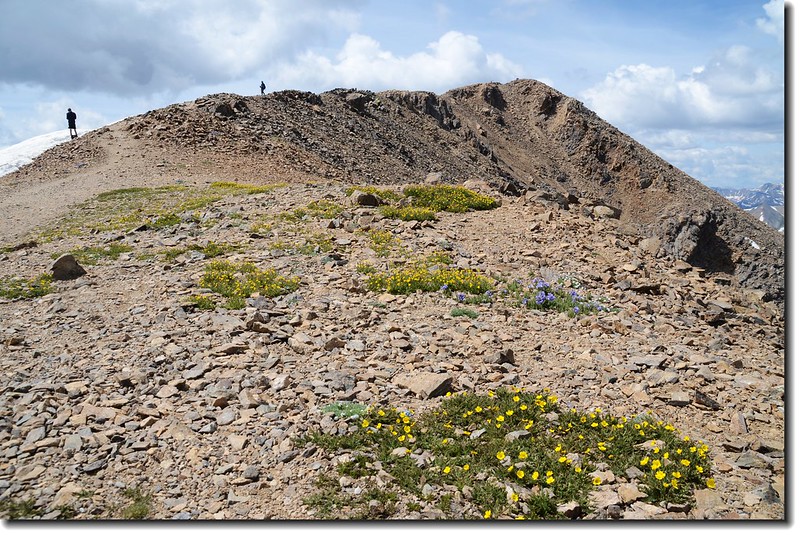
A flat area near 14,300' where the summit ridge comes into view
Just below the summit with La Plata Peak in the distance
Looking down at Twin Lakes from Mt. Elbert trail
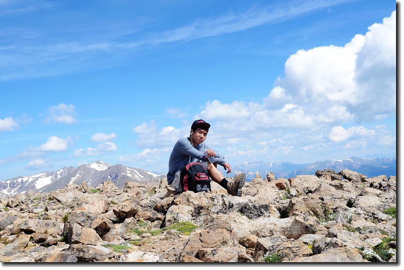
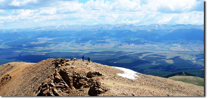
11:30 第三處登頂Mount Elbert,山頂不少登山客,豆豆已在一處shelter用餐,看來是餓壞了!
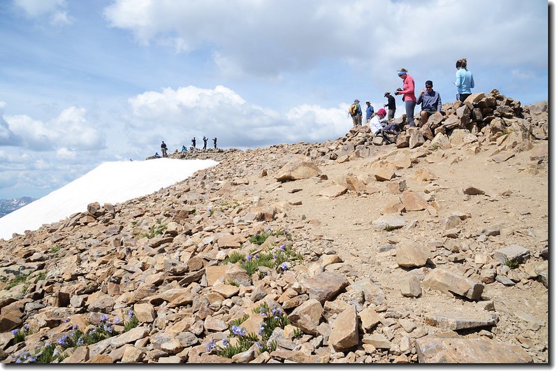
Summit of Mt. Elbert
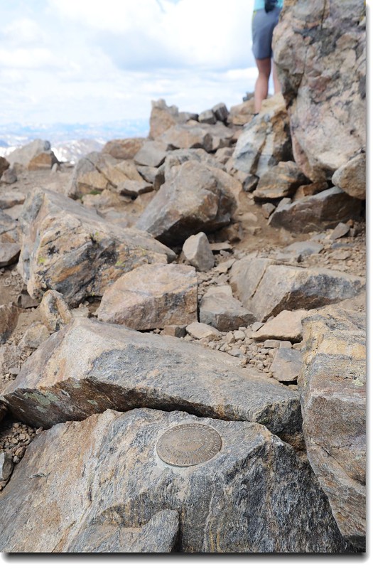
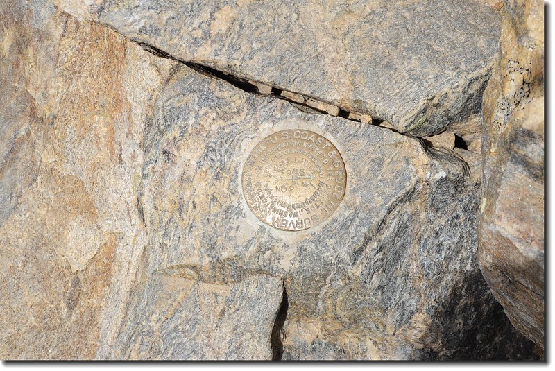
Mount Elbert summit mark (Benchmark)
用完餐後拍拍登頂照,並向豆豆介紹360°環景著名山頭後下山,氣象預報午後兩點有30%的降雨機率。
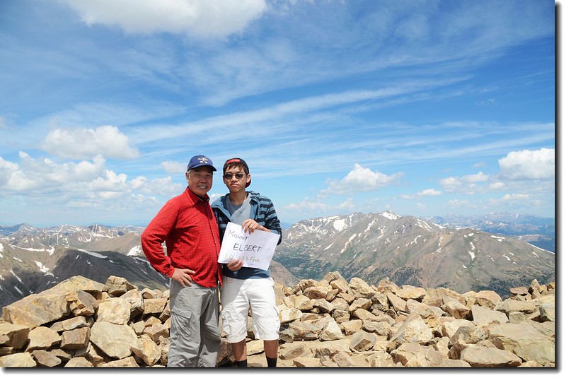
Matthew & me on the summit of Mt. Elbert
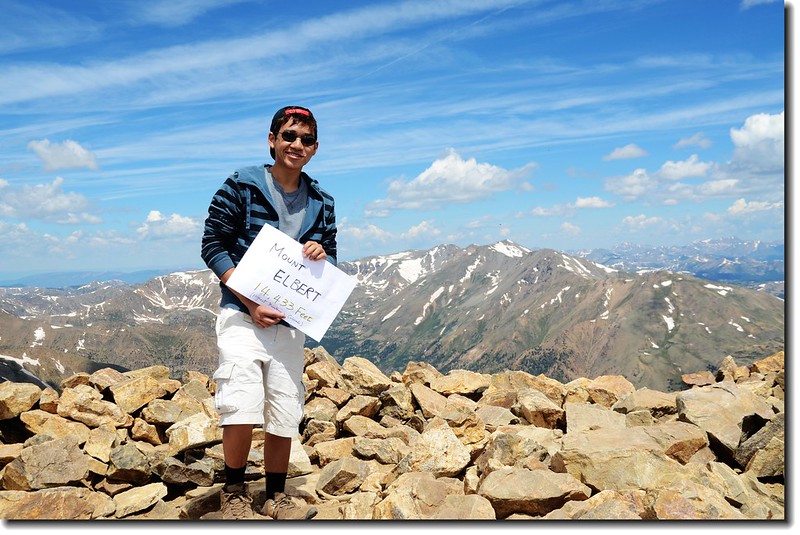
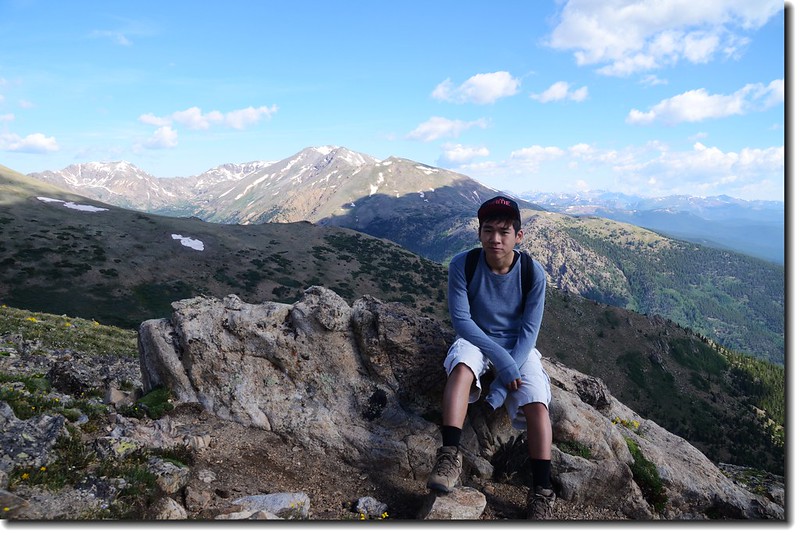
Matthew on the summit of Mt. Elbert, This is Matthew's 13th fourteener
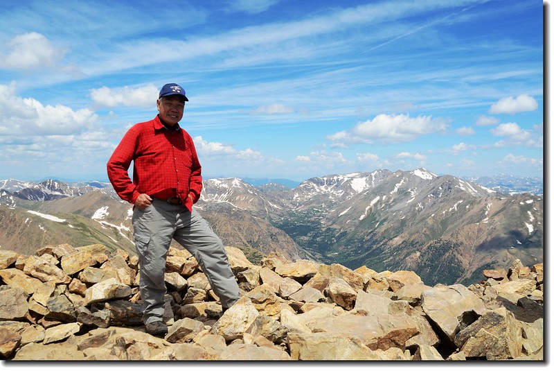
Me on the summit of Mt. Elbert, background is Mt. Massive
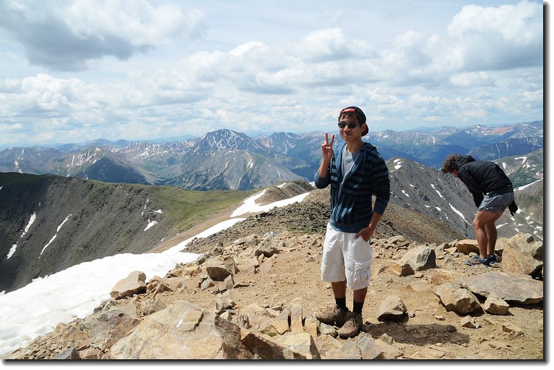
Matthew on the summit of Mt. Elbert, background is La Plata Peak
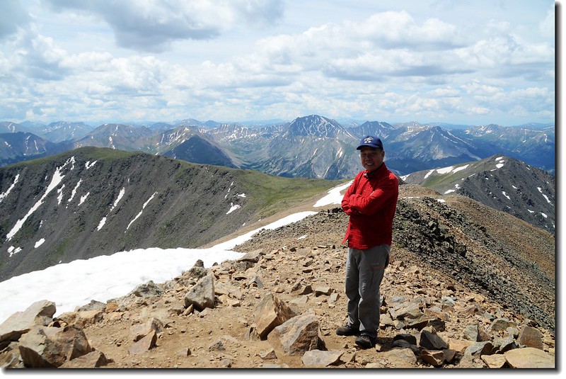
Me on the summit of Mt. Elbert, background is La Plata Peak
La Plata Peak from Mount Elbert
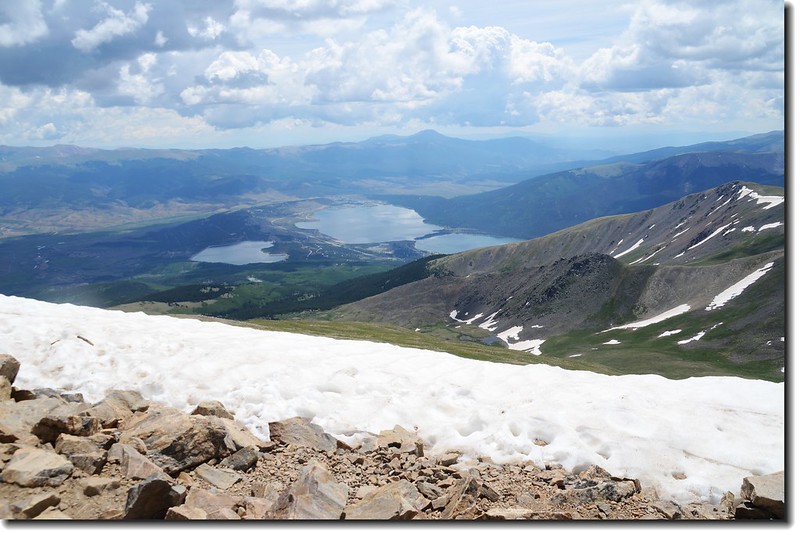
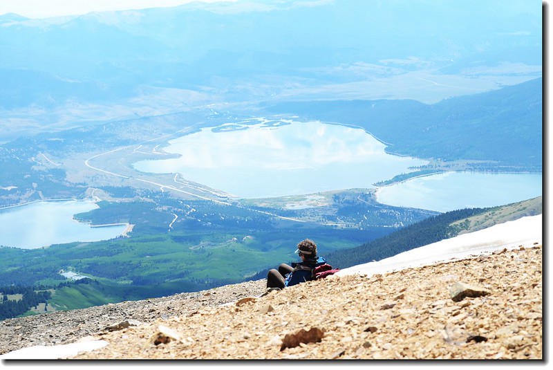
Looking down at Twin Lakes from Mt. Elbert
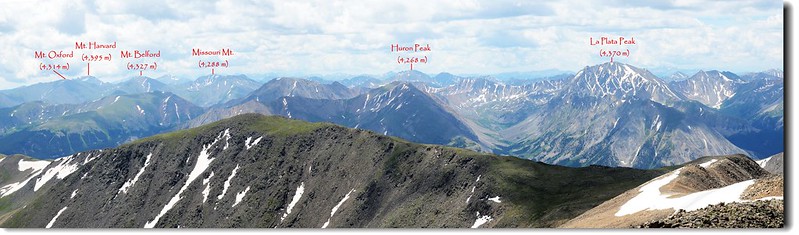
On the summit, looking northwest to Mt. Oklahoma (L) & Mt. Massive
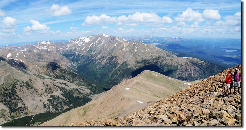
On the summit, looking northwest to Mt. Oklahoma (L) & Mt. Massive
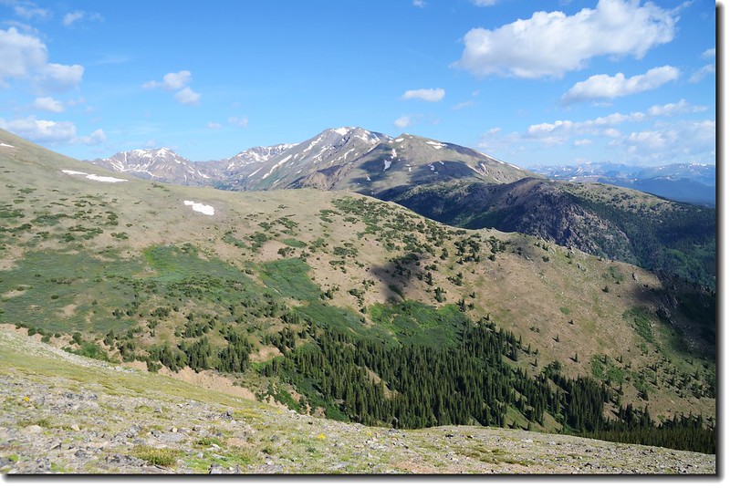
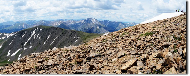
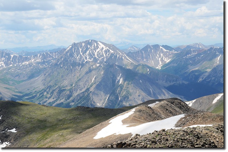
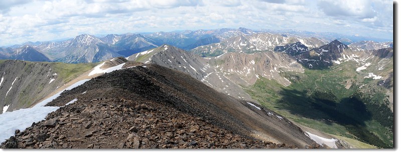
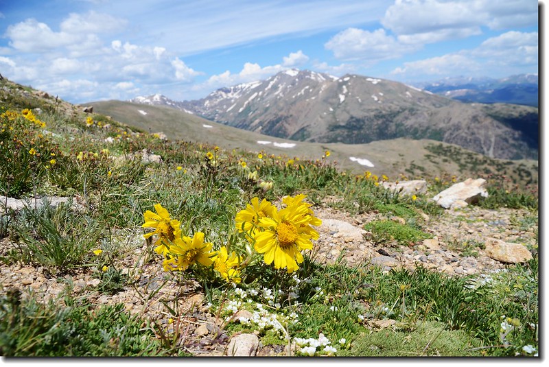
View to Elk Range from Mt. Elbert
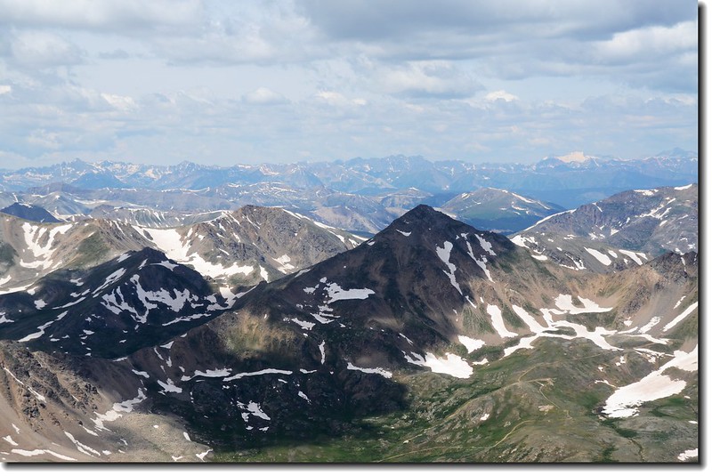
Mountain view from the southern part of Mount Elbert
Mountain view from the southern part of Mount Elbert
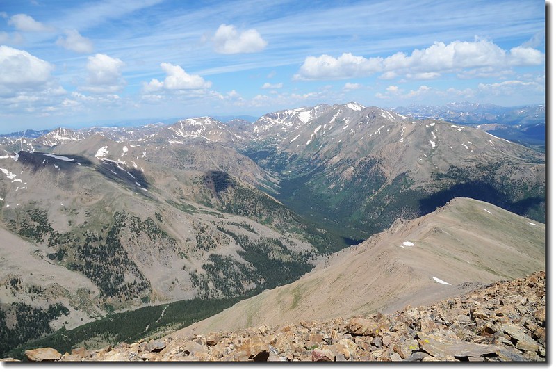
Mountain view from the northeast part of Mount Elbert
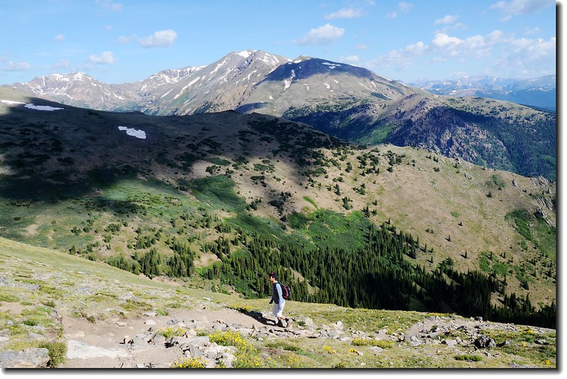
12:05 下山。
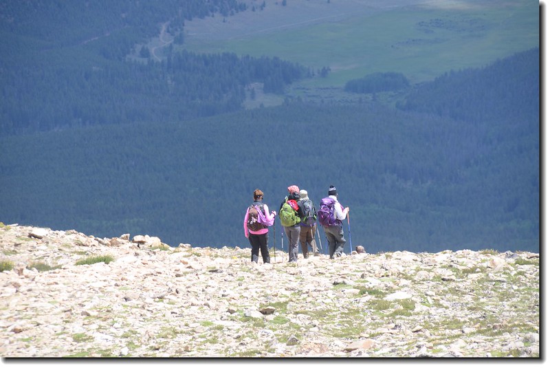
Hiker on their way down summit
Alpine sunflower

Looking down at Leadville from the trail
13:25 經過森林線入松林。
14:40 返抵登山口,豆豆終於完成他的心願,順利完登科州第一高峰,而我也順利的三度登頂此山,前兩次大約八小時完成,而這趟我和豆豆用了七小時四十五分鐘完成,比預期狀況還好;在登山口稍作整裝後開車返家,豆豆一路睡到家門,可累了阿公了!
+++++++++++++++++++++++++++++++++++++++++++++++++++++++++++++++++++++++++++++++++
行車路線圖
點此看放大圖
沒有留言:
張貼留言