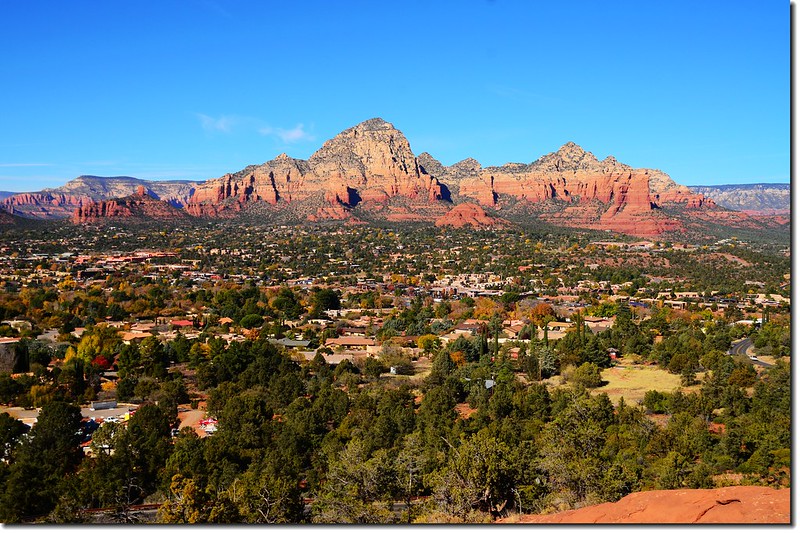
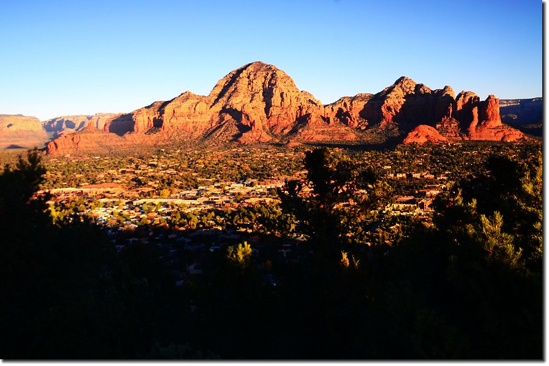
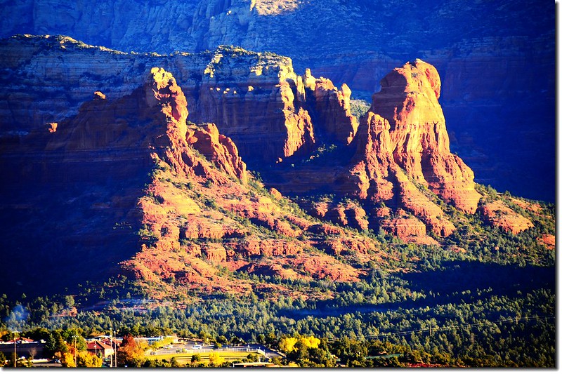
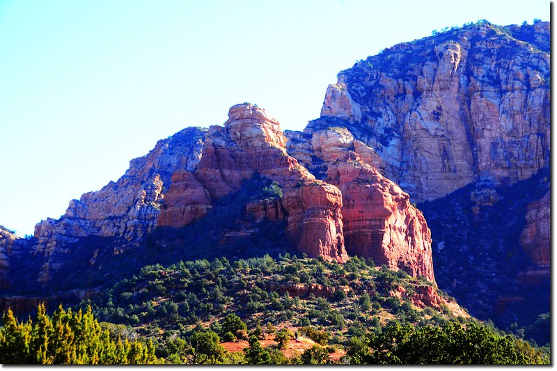
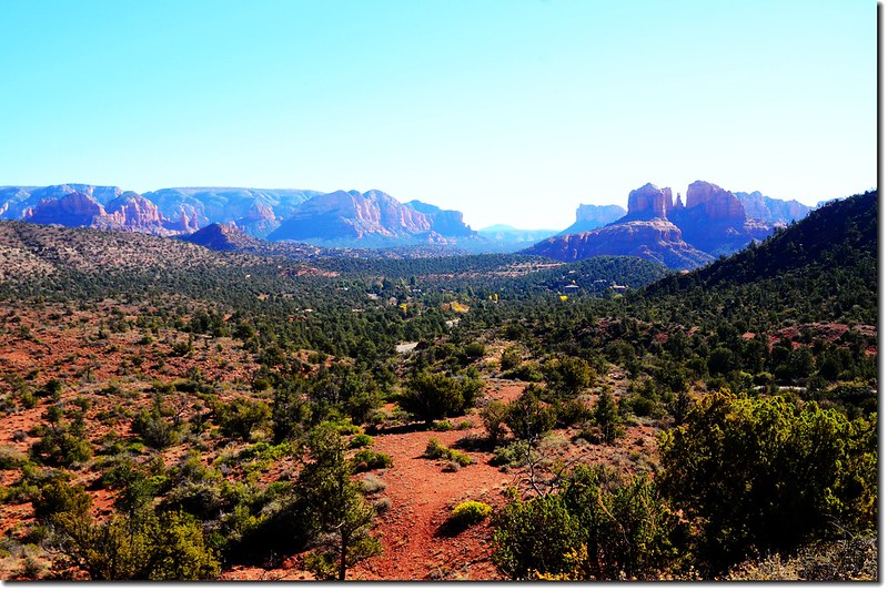
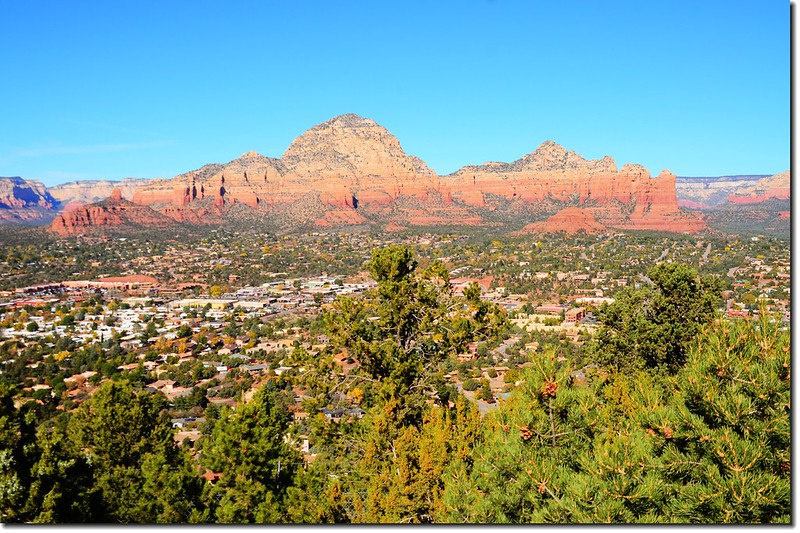
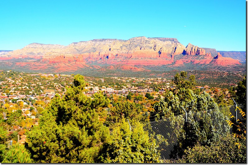
Overlooking Thunder Mountain & Sedona downtown from the Airport Mesa lower scenic overlook
Sedona是位在美國亞利桑那(Arizona)州中北部Verde Valley北邊一個小城,橫跨在Coconino和Yavapai兩郡之間,鄰近大峽谷,海拔4,326呎(1,319公尺),人口10,031人(2010年人口普查)。
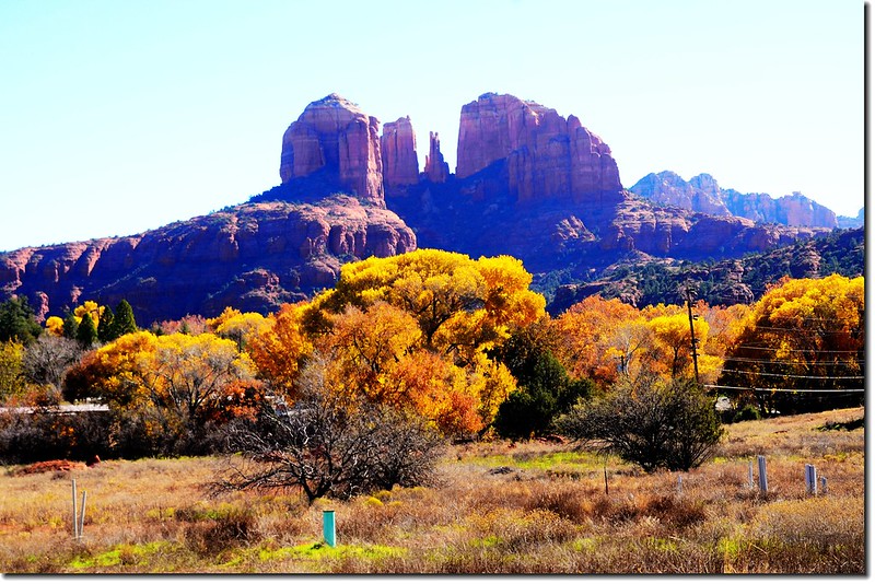
Sedona的主要觀光魅力是大量的紅砂岩岩層,城市以眾多紅色巨岩林立名聞遐邇,有“紅岩國度”(Red Rock Country)之稱,整個城市在綠樹紅岩相輝映之下,異常美麗,它曾被評為全美最美麗的城市,因此又有一說~~“上帝創造大峽谷,但祂住在聖多娜(God created the Grand Canyon, but he lives in Sedona)”;當旭日東昇或夕陽西沉時,陽光照射在這些岩層上呈現出豔麗的紅、橙等色彩,非常迷人。Sedona的紅石群中以Cathedral Rock、Coffee Pot Rock、Chimney Rock、Bell Rock、Courthouse Butte等最為突出有名。
Sedona除了以其紅砂岩岩層名聞遐邇外,還是靈修聖地,早期印安人視此地為具有神奇靈氣的聖地,傳說Sedona幾處地方磁場特強、充滿靈氣,尤以Bell Rock、Airport Mesa、Cathedral Rock和Boynton Canyon四個地區磁場最強,是靈修的好地方。
----------------------------------------------------------------------------------------------------------
我們的一日遊路線:
(一) 清晨和女兒開車上Airport Road最高點的Upper scenic overlook看日出,Airport Road有兩個點是看日出和日落的方,一處是由市中心主要道路89A轉Airport Road南下上山,行約0.5哩(800公尺)的小山丘Lower Scenic Overlook(Airport Vortex),一處是繼續上行約0.6哩到最高點的Upper scenic overlook;此兩點日出因東邊被Munds Mountain山稜擋住,僅能看晨曦映照在西邊紅色岩層上的絢爛山巒,夕陽應該是極佳展望點。
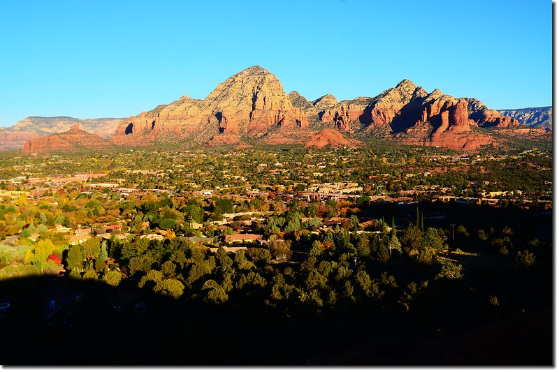
Upper Scenic Overlook
Upper Scenic Overlook位在Airpost Road上,正是Airpost Mesa頂部Sky Ranch Lodge的東北端,鄰近Sedona機場,有一處極大的停車場,是眾多遊客來此觀賞日出及日落的地方。
View of Sedona from the Airport Mesa upper scenic overlook
View of Sedona from the Airport Mesa upper scenic overlook
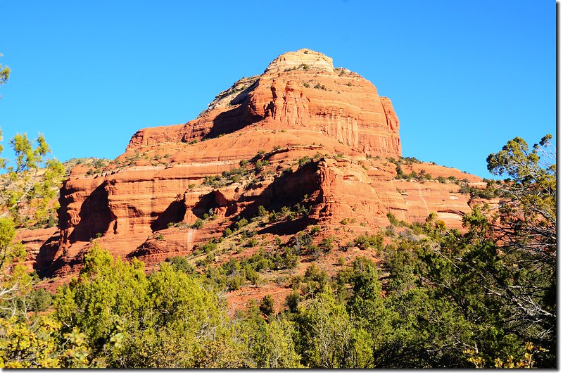
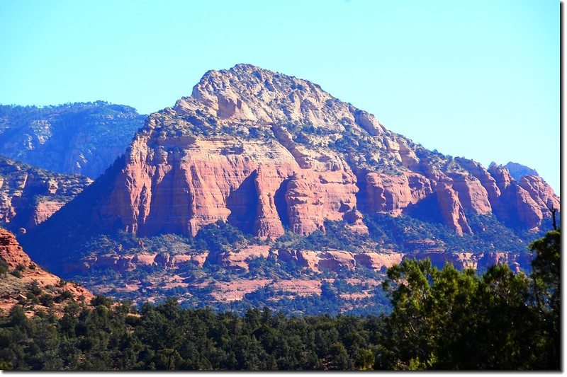
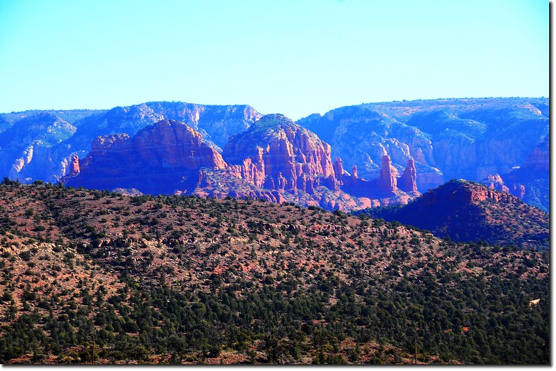
The Thunder Mountain(L) & the Coffeepot Rock(R) from the Airport Mesa upper scenic overlook
View of Sedona from the Airport Mesa upper scenic overlook
The Coffeepot Rock(R) from the Airport Mesa upper scenic overlook
The Cockscomb Rock from the Airport Mesa upper scenic overlook
The Wilson Mountain from the Airport Mesa upper scenic overlook
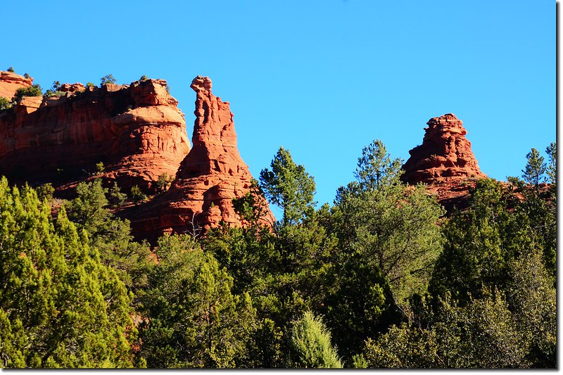
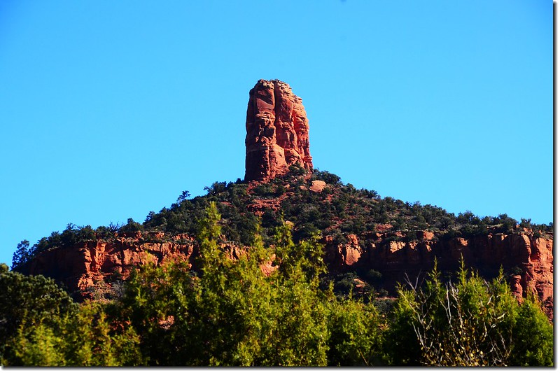
The Morning Glory Spire from the Airport Mesa upper scenic overlook
Lower Scenic Overlook(Airport Mesa Vortex)
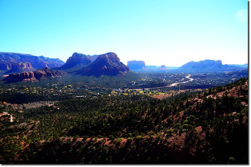
Lower Scenic Overlook是位在Airport Road路邊的一個小山丘,從市中心主要道路89A轉Airport Road南下上山,行約0.5哩(800公尺)即抵達Airport Mesa Vortex,路左有一個小小的停車場,此處距山頂的Upper Scenic Overlook還有0.6哩(約一公里);從停車場沿有點陡的步道行約200公尺即抵達山頂平台"Overlook Point",此處被視為是磁場最強的地方,有不少人在此靜坐冥想,所以當你登此平台時切勿大聲喧嘩。我也許沒慧根,並沒感受到特別的能量或氣場,但此觀景點展望比上頭的Upper Scenic Overlook有過之而無不及,是鳥瞰Sedona的最佳地點;站在觀景點平台上俯瞰被高聳的紅色岩層包圍的Sedona全景,美麗極了。
View of Sedona from the Airport Mesa lower scenic overlook
The Morning Glory Spire from the Airport Mesa lower scenic overlook
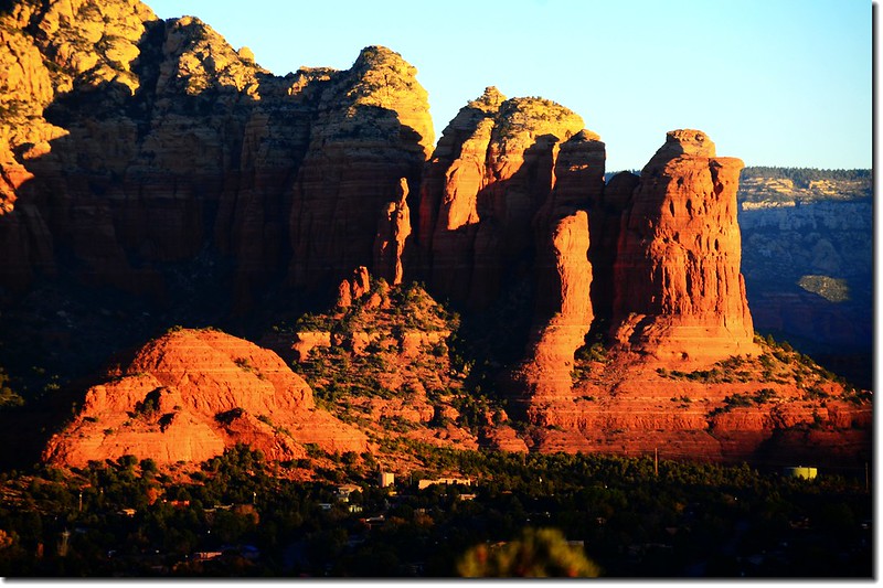
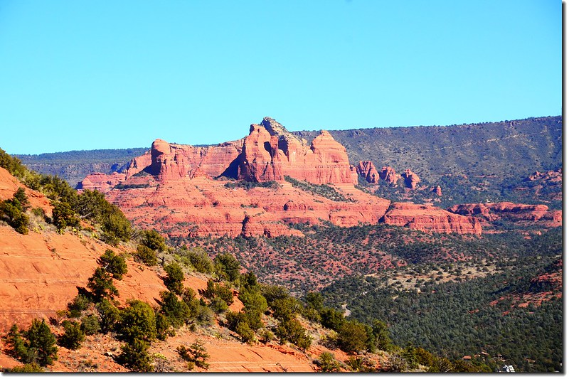
Close up view of the Chimney Rock from the Airport Mesa lower scenic overlook
(二) 看完日出後回到旅館退房後到舉世唯一的綠色M招牌的麥當勞用早餐;
綠色M商標的麥當勞
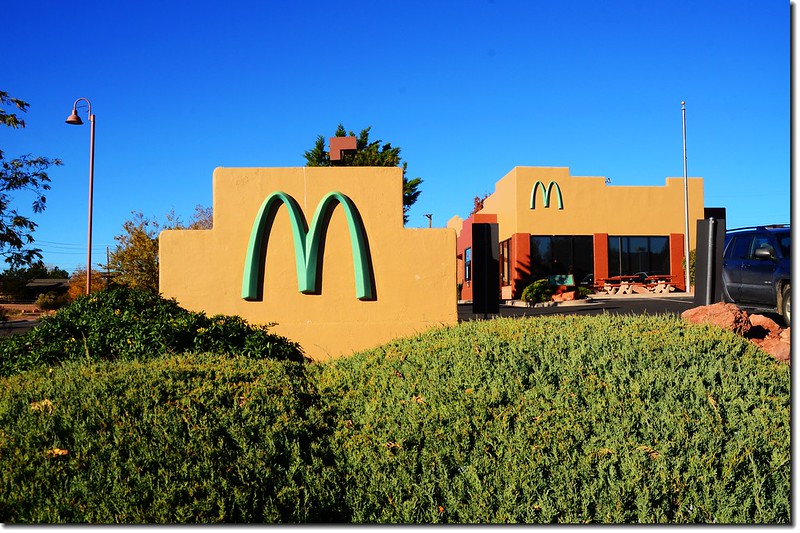
McDonalds at Sedona, AZ
紅底黃字的麥當勞M商標是大家所熟悉的,但在Sedona街上的這家麥當勞卻是與眾不同的硬將M改為淺綠色,聽說全世界還是僅此一家呢,到底是什麼意思?
原來是因為Sedona為了保持城市景觀與周遭大自然環境的協調性,當地對於建築物有特殊的法律規定,建築物結構體及附屬建物不能有過於鮮豔的顏色而與自然環境不協調,所以當年麥當勞在此設點時,為尊重當地建築法規而捨原來的黃色M字商標而改成較為柔和的淺綠色了,同時為了更融入當地的沙漠景觀,麥當勞更刻意的選用橘色、紅色的材料來作為建築物本身的建材,可說是用心良苦。
但我發現此招牌兩面的顏色不同,一面是綠色,一面是藍色,如果不是因為褪色的關係,台灣人看到了又會有許多的聯想!
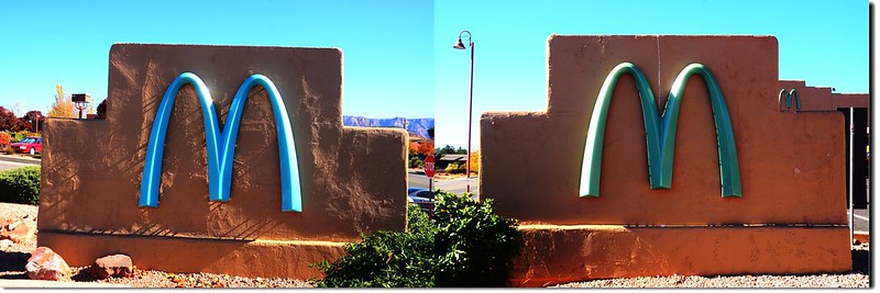
McDonalds' sign, Sedona
這就是此店世界唯一的藍綠(顏色)招牌,此招牌朝東一面是藍色,朝西一面是綠色,不知代表著藍綠永遠是一體,還是永遠背道而馳~~
用完早餐然後西行到Dry Creek Road右轉,行約4.7哩抵達Boynton Canyon Trailhead和Fay Canyon Trailhead遠觀紅岩巨石,本來打算去走Devils Bridge Trail,但從Long Canyon Road到登山口的路況實在太差了,怕中途輪胎被尖銳的石頭扎破,車行一段路後放棄折返。
The Red Rock is taken from the Boynton Canyon Trailhead

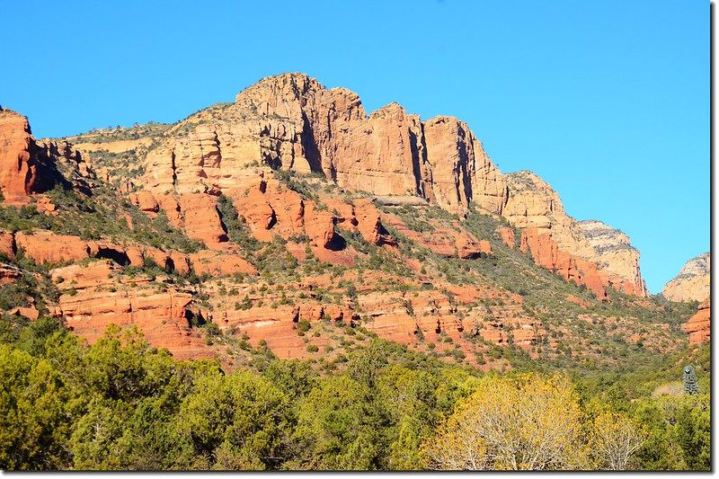
The Red Rocks are taken from the Boynton Pass Road
The Red Rocks are taken from the Fay Canyon Trailhead
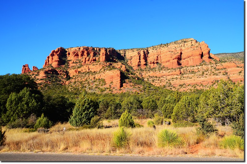
Bear Mountain from Dry Creek Road
The Red Rocks are taken from Dry Creek Road
The Cockscomb rock from Dry Creek Road
The Chimney Rock is taken from Dry Creek Road
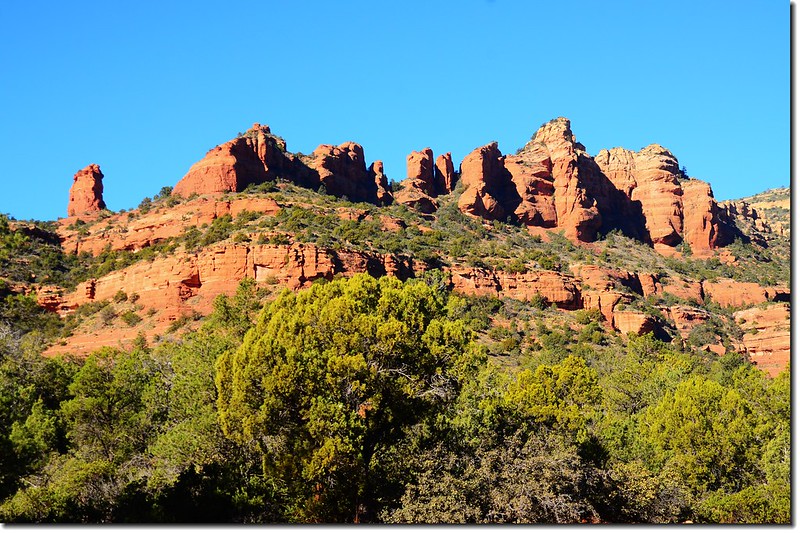
(三) 由Dry Creek Road回到街上89A道路右轉西行,在Upper Red Rock Loop Road左轉南下,這是一條環行道路,沿途有幾個點都可眺望矗立在綠野平疇上的Red Rock;
Red Rocks formation from the Red Rock Loop Road
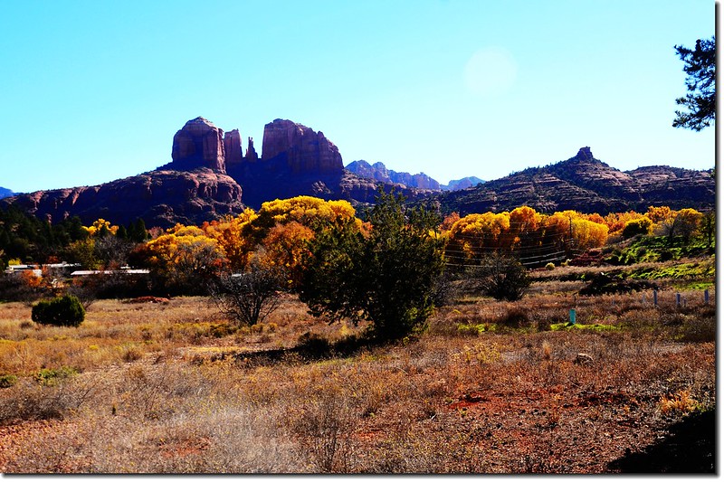
The Cathedral Rock from the Red Rock Loop Road
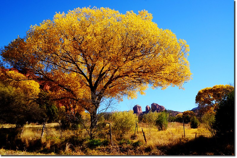
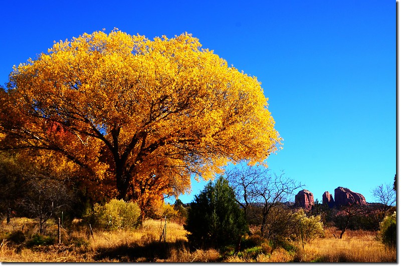
Cottonwood & Cathedral Rock
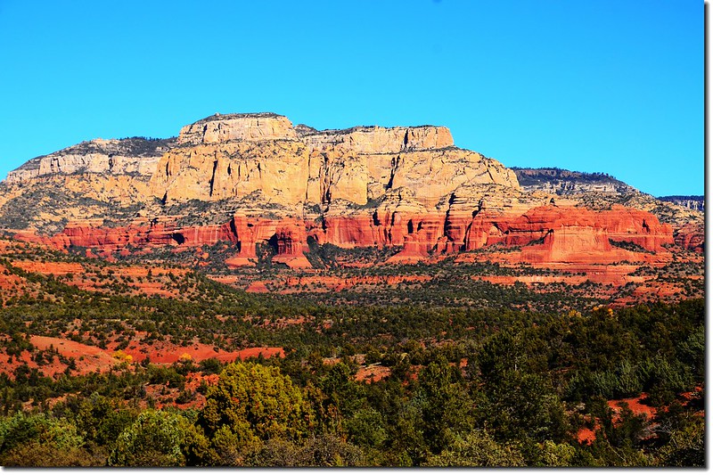
中途我們繞進去Red Rock State Park,Ranger說該公園僅能將車停放停車場,遊園一律採步行,是一座徒步登山健行的公園,限於時間我們沒下去登山。
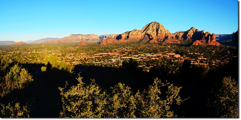
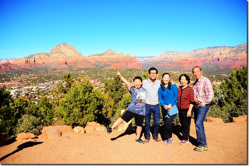
(四) 由Upper Red Rock Loop Road經Lower Red Rock Loop Road繞一圈接回市區89A道路東行,在市區用中餐後再帶孩子們到Airport Road早上看日出的兩個點俯瞰Sedona全貌。
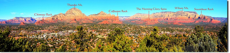
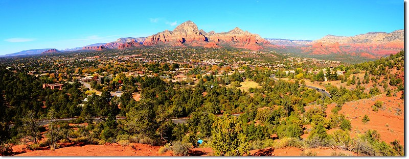
A Panorama from the Airpost Mesa upper scenic overlook
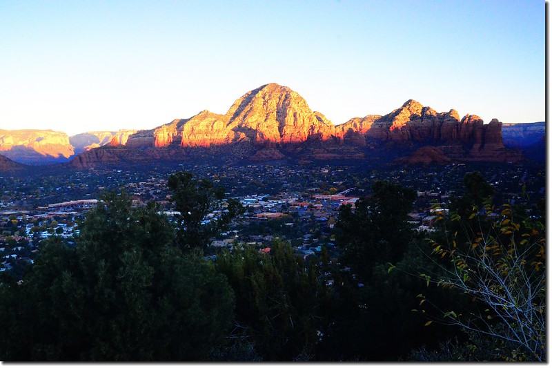
Thunder Mountain from the Airport Mesa upper scenic overlook
Taken from the Airport Mesa upper scenic overlook
View of Sedona from the Airport Mesa upper scenic overlook
The Cockscomb Rock from the Airport Mesa upper scenic overlook
Wilson Mountain from the Airport Mesa upper scenic overlook
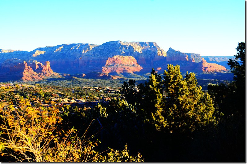
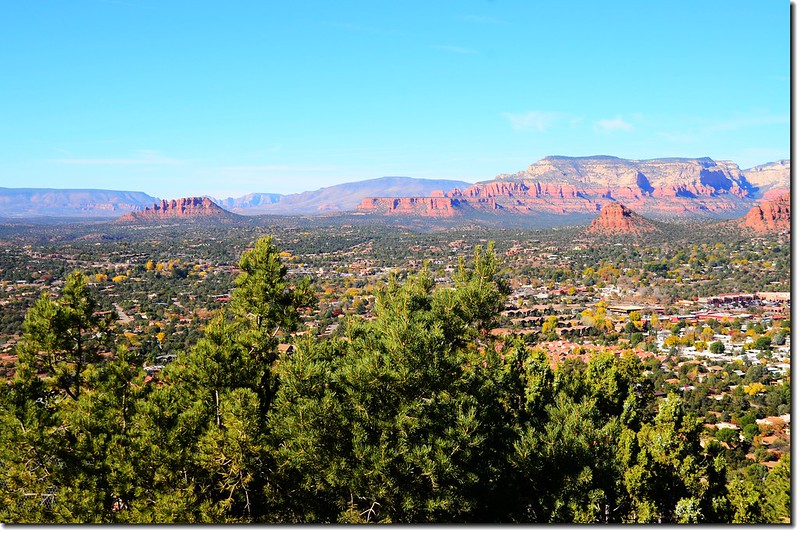
Overlooking west from the Airport Mesa lower scenic overlook
Overlooking east from the Airport Mesa lower scenic overlook
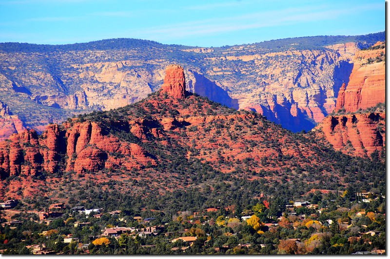
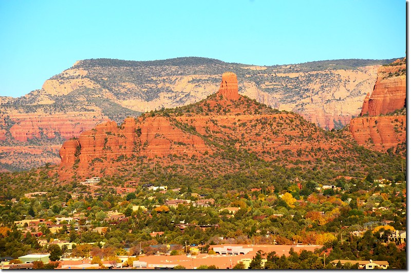
Close up view of the Chimney Rock from the Airport Mesa lower scenic overlook
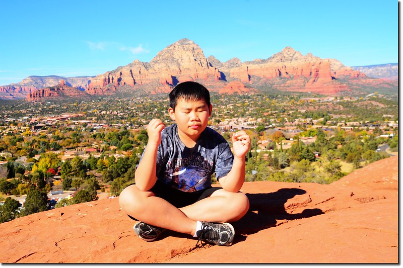
Meditation!!
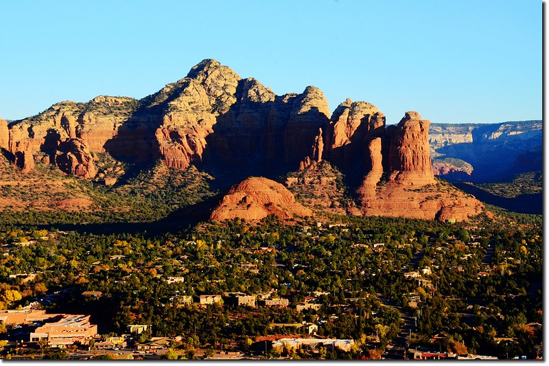
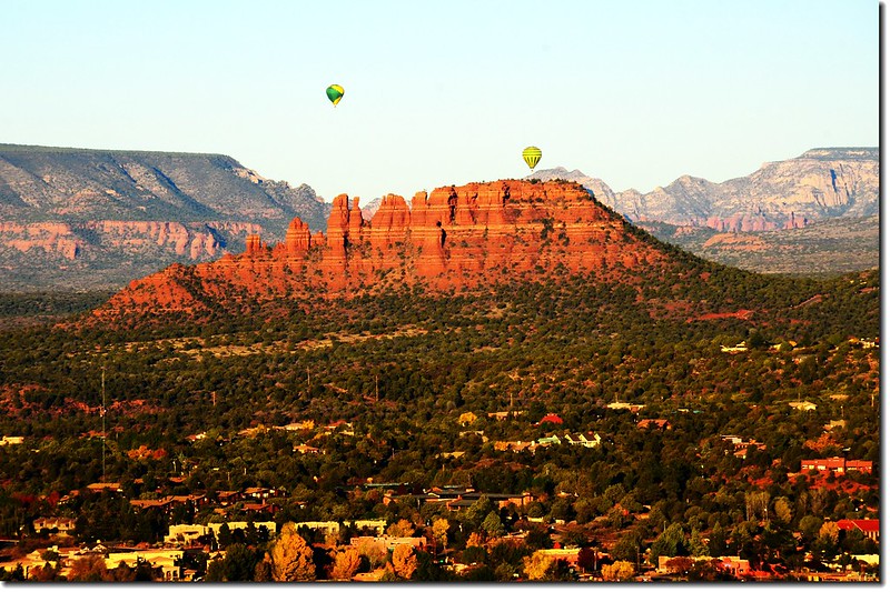
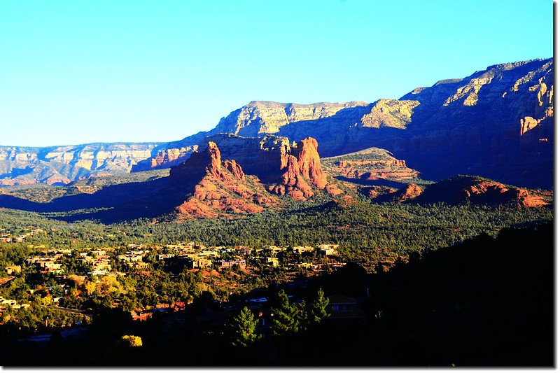
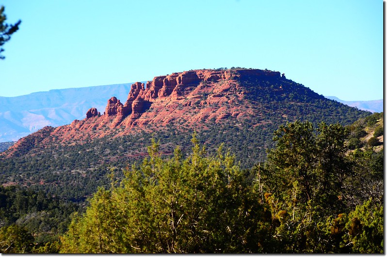
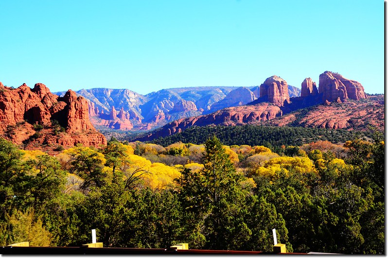
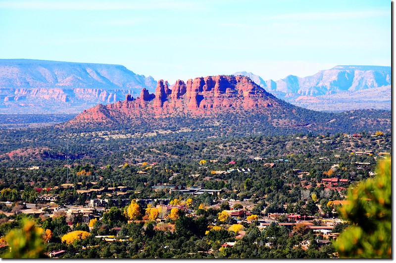
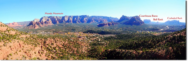
Overlooking southeast onto Cathedral Rock、Bell Rock & Courthouse Butte from the Airport Mesa lower scenic overlook
Red Rocks formation from the Airport Mesa lower scenic overlook
----------------------------------------------------------------------------------------------------------
繼續瀏覽:亞利桑那州Sedona(聖多娜)小城一日遊(2015.11.23)--(下)
----------------------------------------------------------------------------------------------------------
沒有留言:
張貼留言