Chihuahua Lake, Colorado
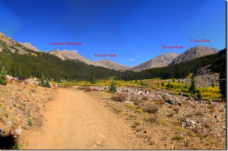
Chihuahua Lake位於科羅拉多滑雪勝地Keystone附近,整個湖依偎在海拔13,427呎/4,093公尺的Grizzly Peak山腳下,登此湖的步道並不好走,前段的吉普車道砂石鬆軟容易滑倒,路面都是大小不一的岩石,夏天多處路面低窪積水必須設法繞道通過;吉普車道過後的登山步道有些路段陡峭,尤其是最後一段攀登湖泊的路段必須在岩石坡中陡登,但當你登上此湖後出現在你眼前的是一片湛藍的湖水,東邊則是兩座14ers~Grays Peak和Torreys Peak馬鞍型的矗立著,非常壯觀!
登山隊安排在9日登此步道,但當天因幾位山友下午有事無法太晚下山,所以一開始就無登完全程的計畫,我詢問領隊下山時間後心想應可走完全程,在徵求領隊同意後便獨自脫隊前行,在半趕路的速度下終於在預定時間內登完此湖!
~~~~~~~~~~~~~~~~~~ ~~~~~~~~~~~~~~~~~~~~~~~~~~~~~~~~~~~~~~~~~~~
攀登湖泊:Chihuahua Lake (海拔12,175呎/3,711公尺)
登山口:Chihuahua Gulch Trailhead(海拔10,471呎/3,192公尺)
登山里程:來回約7.2哩/11.52公里
總爬升高度:約1,880呎/573公尺
登山時間:3小時35分
~~~~~~~~~~~~~~~~~~~~~~~~~~~~~~~~~~~~~~~~~~~~~~~~~~~~~~~~~~~~~
行車資訊:
由Golden走I-70州際公路西行,行約43哩抵Exit 216 (US-6 W 出口) 下交流道,朝Loveland Pass前進,行約13 哩後於E Keystone Rd向左轉,行344 呎隨即於Gondola Rd向左轉,再行0.3 哩後於Montezuma Rd向右轉;Montezuma Rd東行約4.4 哩於Peru Creek Road (Co Rd 260)向左轉,Peru Creek Road為一條坑坑洞洞的土石路,但小心行駛仍可行駛小型車,行約2.2哩抵達Chihuahua Gulch Trailhead (Forest Service Road 263)停車。
步程簡述:
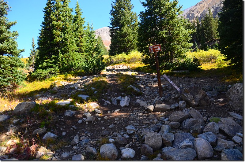
09:50 登山口出發,海拔10,471呎/3,192公尺,沿著粗糙的吉普車道朝西北方緩坡上登;
Chihuahua Lake Trailhead
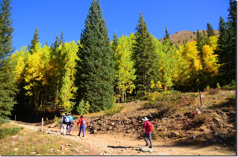
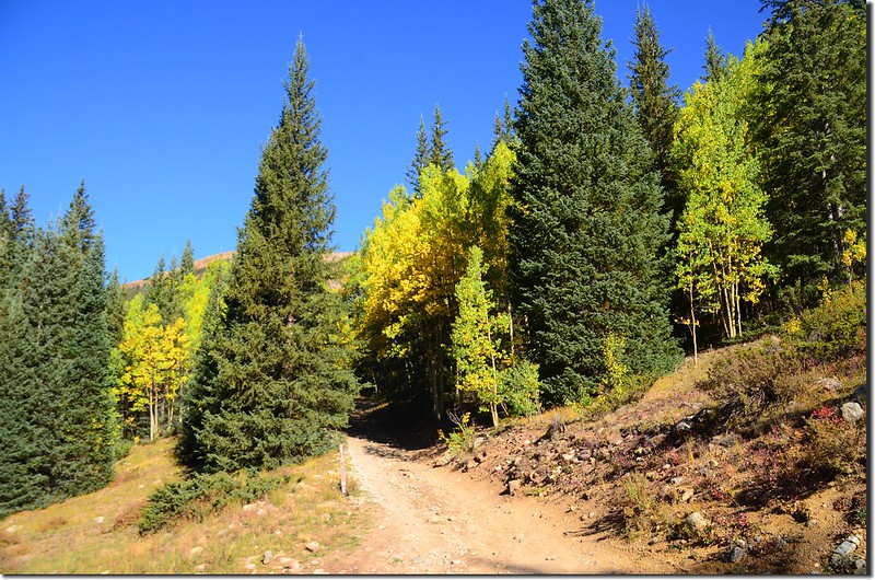
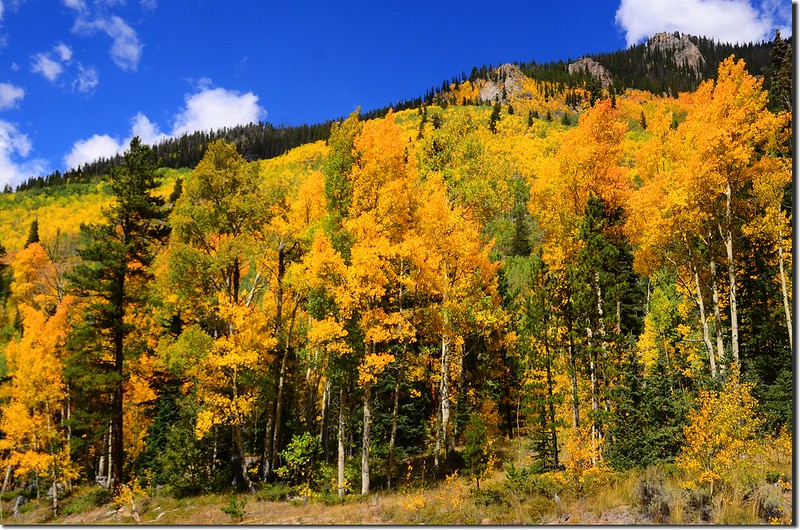
Aspen trees in autumn, Chihuahua Gulch Trail
登山口及沿途的白楊木(aspen)葉子已轉黃,這個月是科州瘋白楊的月份。
Aspen trees in autumn, Chihuahua Gulch Trail
Chihuahua Lake Trailhead
Aspen trees in autumn, Chihuahua Gulch Trail
登山口及沿途的白楊木(aspen)葉子已轉黃,這個月是科州瘋白楊的月份。
Aspen trees in autumn, Chihuahua Gulch Trail
10:04 抵達左側一大片岩石區,步道由岩石區右側繼續上行,海拔10,605呎/3,232公尺,距登山口約0.3哩;
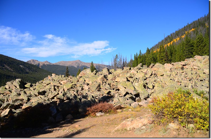
Passing a large boulder field
岩石坡右側北行約0.3哩抵岩石坡高處車道左轉下坡,海拔約10,880呎/3,316公尺。
Passing a large boulder field
Passing a large boulder field
岩石坡右側北行約0.3哩抵岩石坡高處車道左轉下坡,海拔約10,880呎/3,316公尺。
Passing a large boulder field
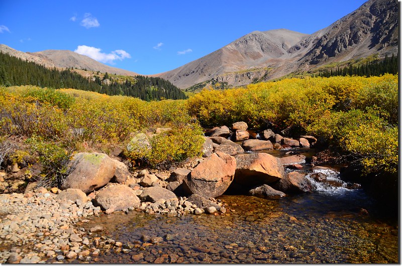
10:16 吉普車道下到一條小溪,在一根半截倒木和石頭上渡過小溪,海拔10,850呎/3,307公尺,距登山口約0.7哩;
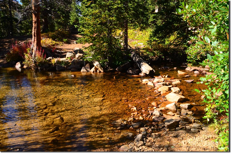
First stream crossing
越過小溪後車道右轉上坡。
First stream crossing
越過小溪後車道右轉上坡。
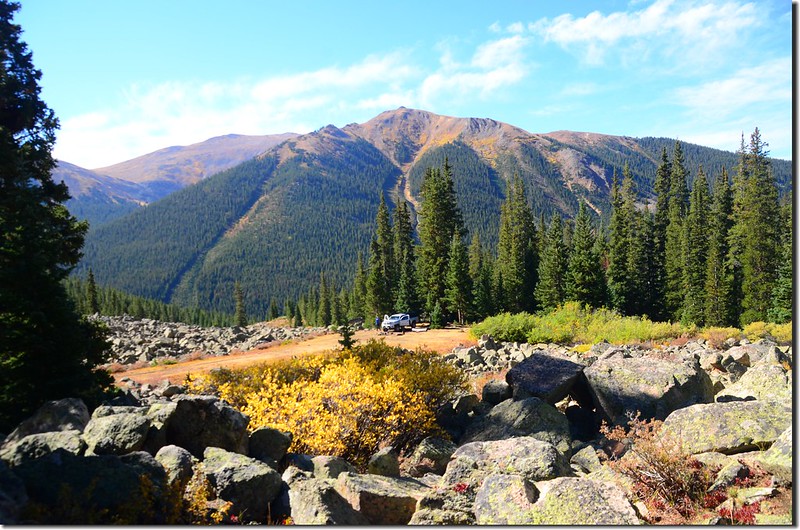
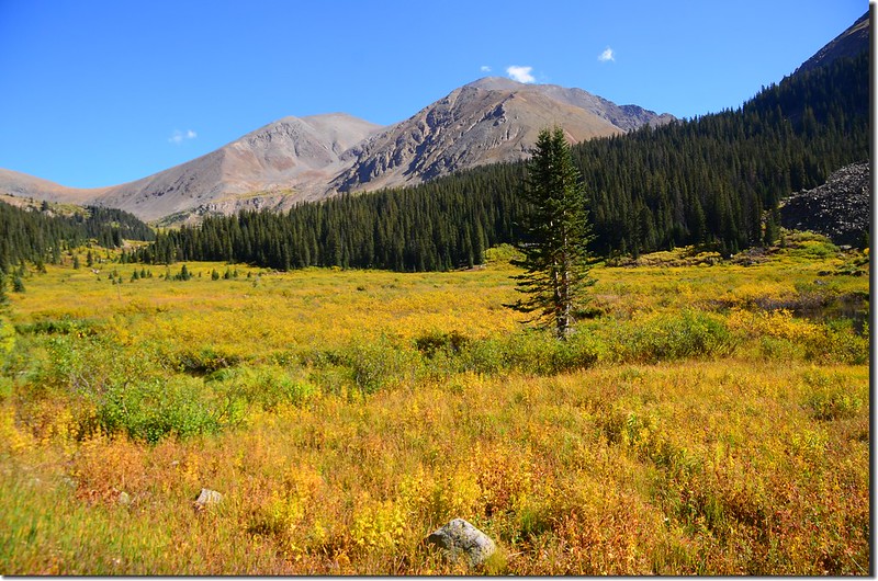
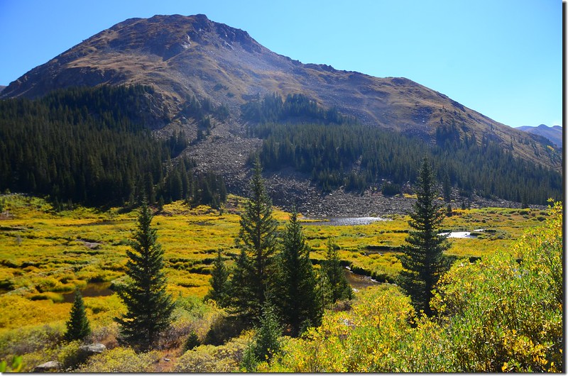
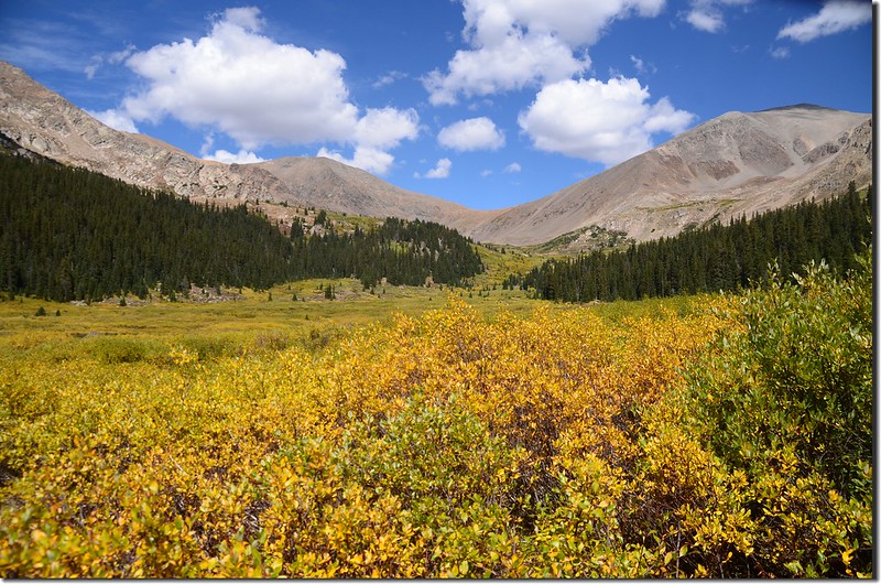
10:20 經一小段陡坡後抵一平緩地形,左側又是一片岩石區,北望山谷頂端幾座高山;此處海拔10,925呎/3,330公尺,距登山口約0.8哩;
Looking north at mountains from Chihuahua Gulch Trail near 10,925 ft
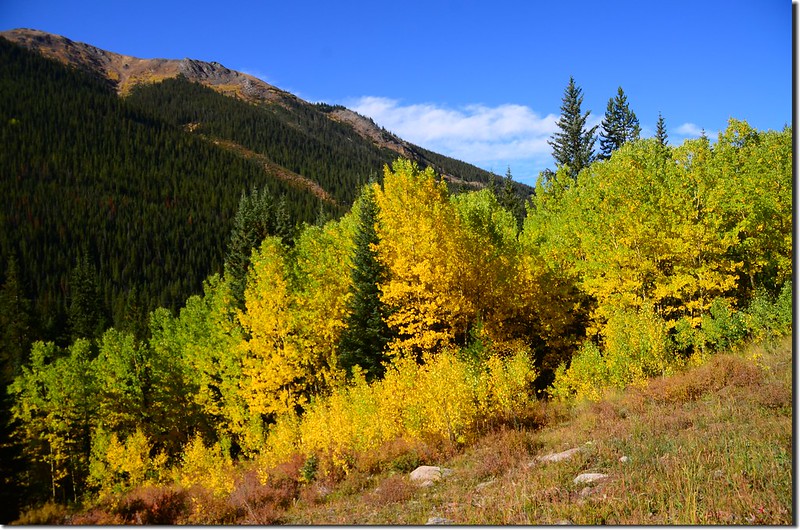
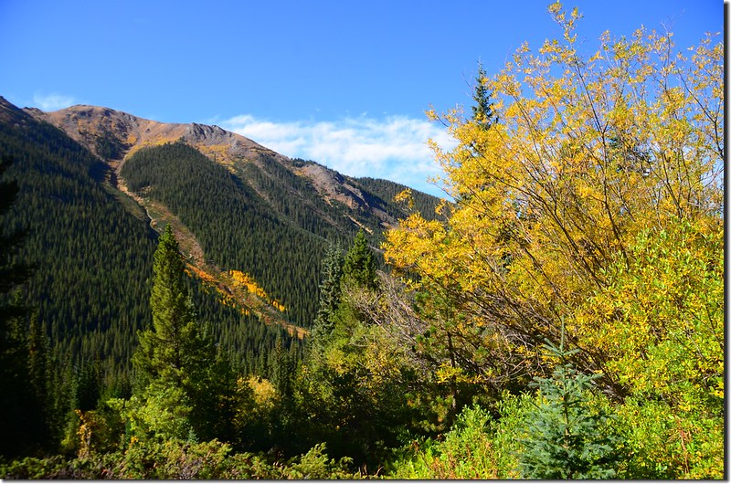
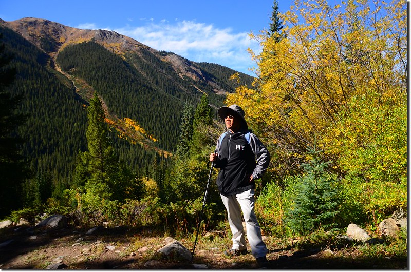
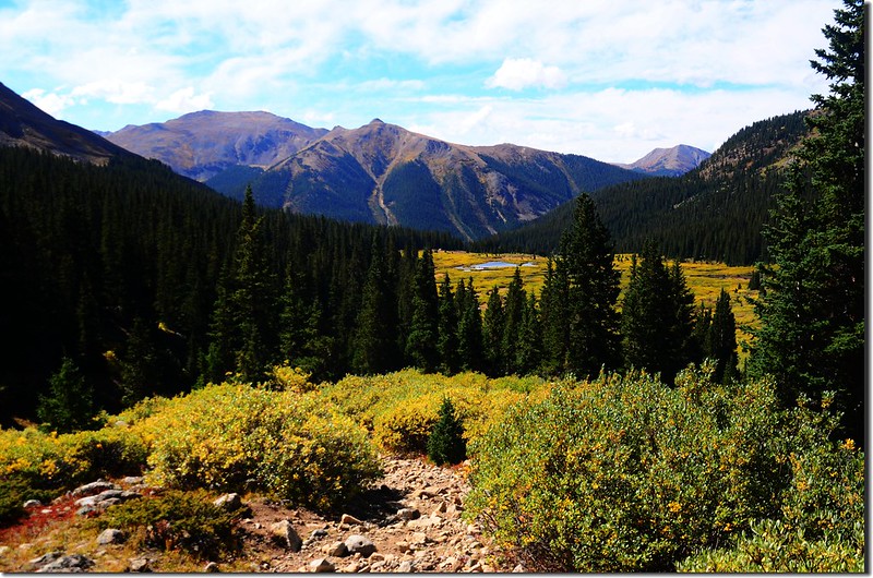
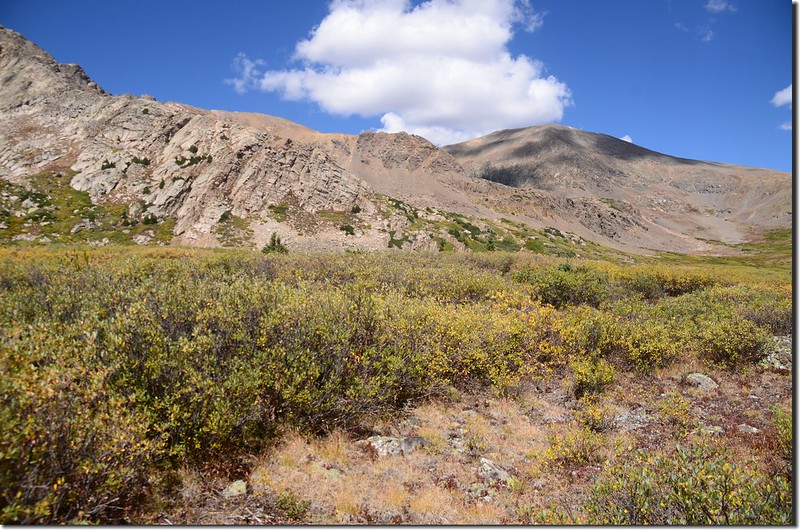
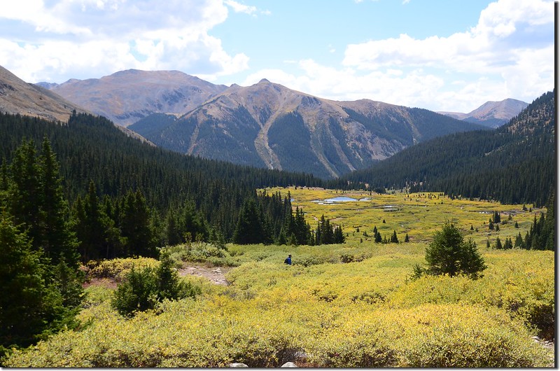
此後吉普車道即在Chihuahua Gulch西側北行,右側俯瞰美麗的山谷及背後高山,山谷中葉子已轉黃的willow灌木叢中幾處小塘益顯迷你美麗!
Looking northeast at Torreys (L) & Grays (R) Peaks from Chihuahua Lake Trail
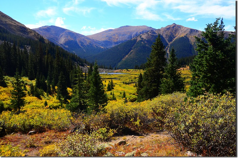
Looking back down the valley and beaver ponds below
Looking north at mountains from Chihuahua Gulch Trail near 10,925 ft
此後吉普車道即在Chihuahua Gulch西側北行,右側俯瞰美麗的山谷及背後高山,山谷中葉子已轉黃的willow灌木叢中幾處小塘益顯迷你美麗!
Looking northeast at Torreys (L) & Grays (R) Peaks from Chihuahua Lake Trail
Looking back down the valley and beaver ponds below
10:36 第二次渡過小溪,海拔11,069呎/3,374公尺,距登山口約1.4哩;渡溪後車道繼續北行。
Looking north up to the valley top from the trail second stream crossing
Looking north up to the valley top from the trail second stream crossing
10:46 抵達Willow 灌木叢區,車道部分路段低窪積水,必須從Willow 灌木叢中繞道通過;此處海拔約11,160呎/3,402公尺,距登山口約1.7哩。
10:52 抵達Chihuahua Lake第二登山口,吉普車道右轉續往Ruby Gulch,Chihuahua Lake 登山步道在左側小徑北行;
Chihuahua Lake #2 Trailhead
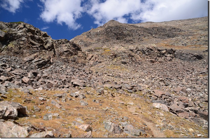
此處海拔約11,209呎/3,417公尺,距登山口約2.0哩,登山步道狹小、陡峭、路面都是大小石塊不太好走。
Looking down the valley from the trail near 10,984 ft
Looking back down the valley and beaver ponds below from the trail near 11,300 ft.
Chihuahua Lake #2 Trailhead
此處海拔約11,209呎/3,417公尺,距登山口約2.0哩,登山步道狹小、陡峭、路面都是大小石塊不太好走。
Looking down the valley from the trail near 10,984 ft
Looking back down the valley and beaver ponds below from the trail near 11,300 ft.
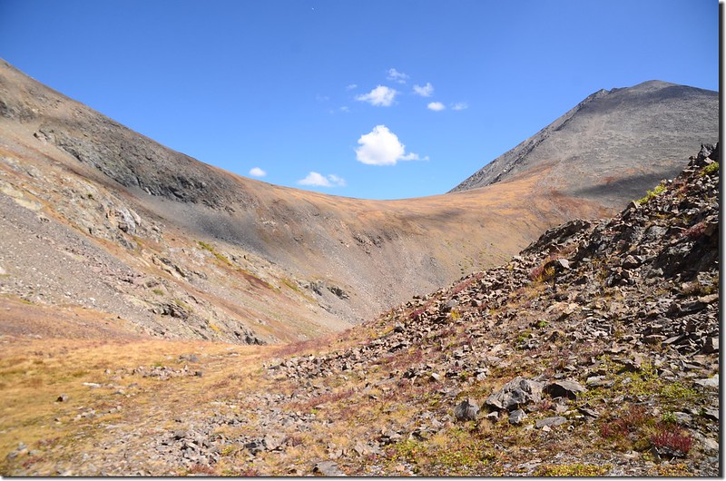
11:09 抵達步道陡坡頂端來到一片群山下的台地,登山步道平緩的往北前行;此處海拔約11,586呎/3,531公尺,距登山口約2.4哩。
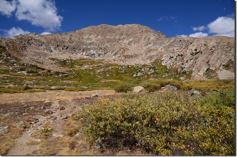
A flat platform terrain near 11,586 ft.
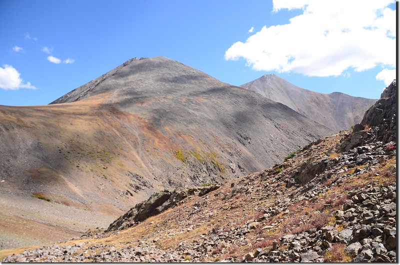
Looking north at Grizzlk Peak from Chihuahua Gulch Trail near 11,680 ft.
Looking north at Grizzlk Peak from Chihuahua Gulch Trail near 11,680 ft.
A flat platform terrain near 11,586 ft.
Looking north at Grizzlk Peak from Chihuahua Gulch Trail near 11,680 ft.
Looking north at Grizzlk Peak from Chihuahua Gulch Trail near 11,680 ft.
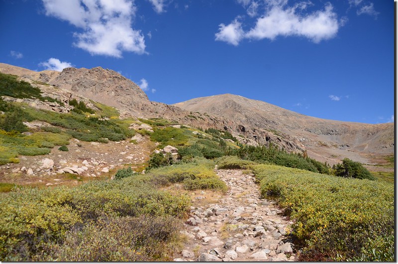
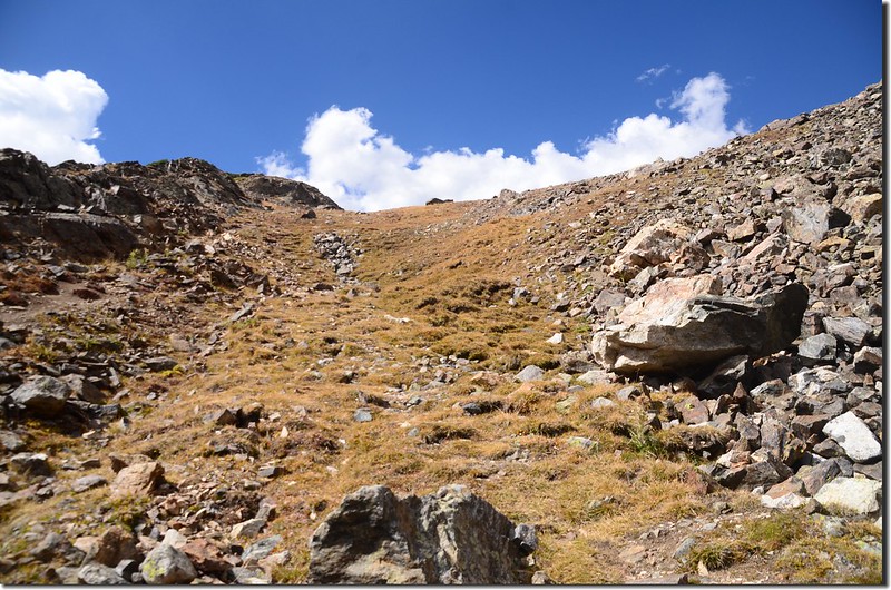
11:32 抵達Chihuahua Lake最後陡攀路段,小徑是在岩石坡間陡升,不太好走;此處海拔約11,982呎/3,612公尺,距登山口約3.4哩。
On the final pitch before the lake
On the final pitch before the lake
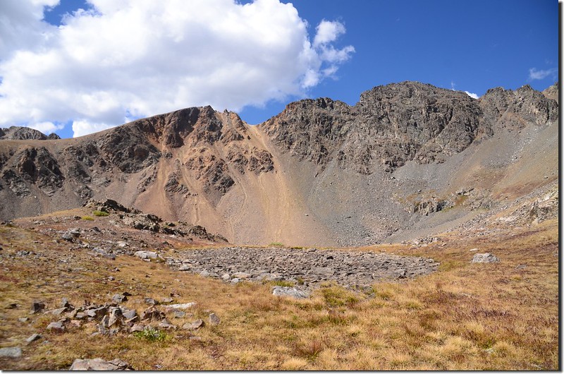
11:50 登上一平台,平台上有一乾涸的小潭,Chihuahua Lake位在小潭的西南方,此處海拔約12,239呎/3,730公尺,距登山口約3.5哩;
A dried pond near Chihuahua Lake
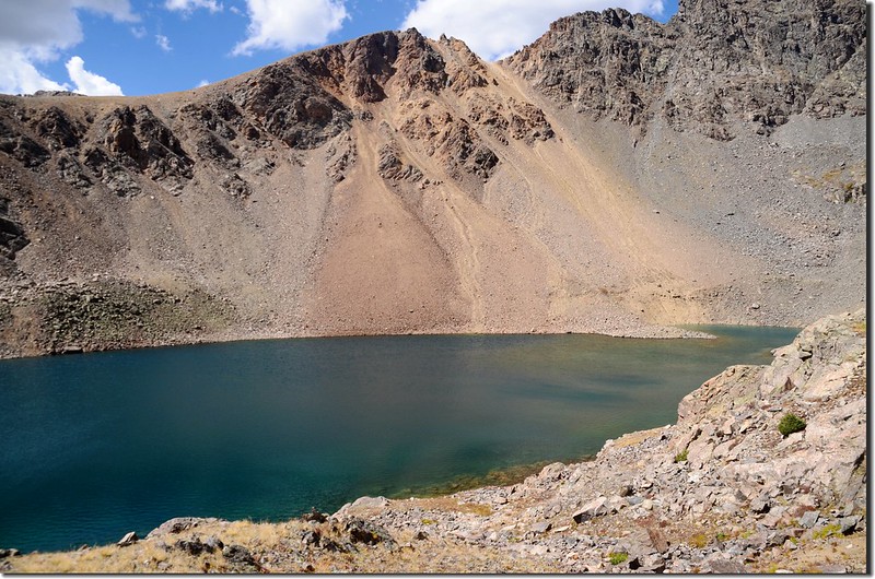
此處東北望Grizzly Peak 和Torres Peak間那圓弧似的鞍部優美極了,東望則是馬鞍似的兩座14ers~Grays Peak和Torreys Peak;
Looking northeast at saddle between Grizzly and Torres Peaks from Chihuahua Lake
Looking east at Torres (L) & Grays Peaks from Chihuahua Lake
小徑轉向西南行約150公尺即抵達Chihuahua Lake東北岸邊高點。
A dried pond near Chihuahua Lake
此處東北望Grizzly Peak 和Torres Peak間那圓弧似的鞍部優美極了,東望則是馬鞍似的兩座14ers~Grays Peak和Torreys Peak;
Looking northeast at saddle between Grizzly and Torres Peaks from Chihuahua Lake
Looking east at Torres (L) & Grays Peaks from Chihuahua Lake
小徑轉向西南行約150公尺即抵達Chihuahua Lake東北岸邊高點。
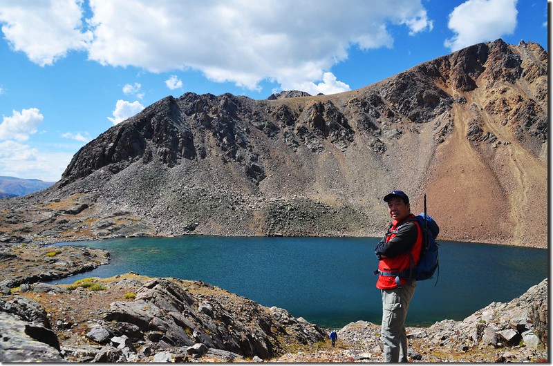
11:51 抵達Chihuahua Lake,海拔12,175呎/3,711公尺,距登山口約3.6哩,湖水深邃湛藍,北岸及西南岸則是山勢崢嶸的岩壁,東南岸則是開闊的出水口。
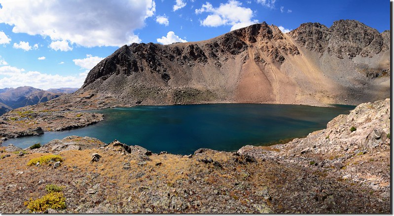
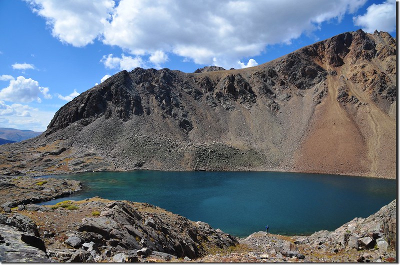
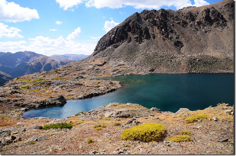
Chihuahua Lake
Chihuahua Lake
因怕來不及準時回到登山口所以沒下到出水口欣賞出水口下方景致,拍完照後匆忙下山。
Looking back down the valley and beaver ponds below from the trail near 11,300 ft.
Looking back down the valley and beaver ponds below from the trail near 11,300 ft.
12:40 返抵Chihuahua Lake第二登山口接吉普車道右轉下行。
Chihuahua Lake #2 Trailhead
Looking back at Grizzlk (L) & Torreys (R) Peaks from Chihuahua Gulch Trail near 11,100 ft.
Chihuahua Lake #2 Trailhead
Looking back at Grizzlk (L) & Torreys (R) Peaks from Chihuahua Gulch Trail near 11,100 ft.
12:54 返抵第二次渡過小溪處,海拔11,069呎/3,374公尺,距登山口約1.4哩。
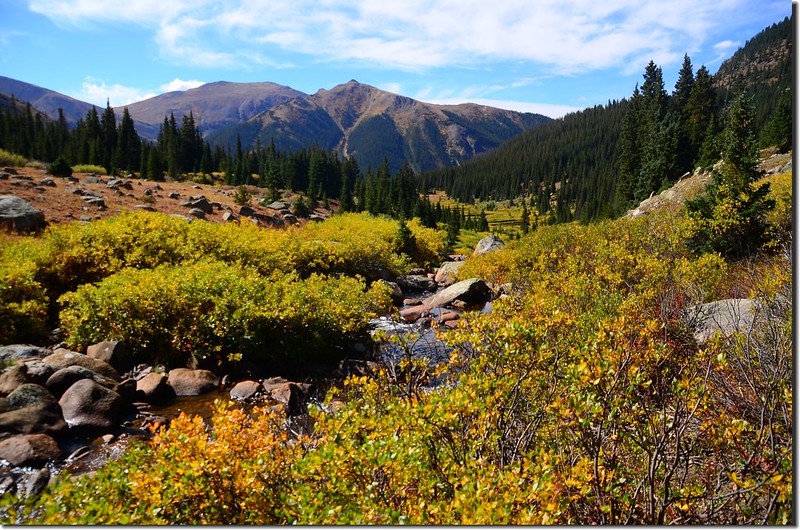
Looking south at the valley lower from the trail second stream crossing
Looking south at the valley lower from the trail second stream crossing
14:25 返抵登山口,其他山友已在停車處等候,隨即搭乘Judy便車返回Golden結束一天的登山行程。
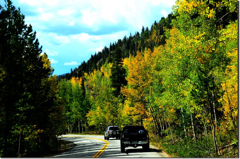
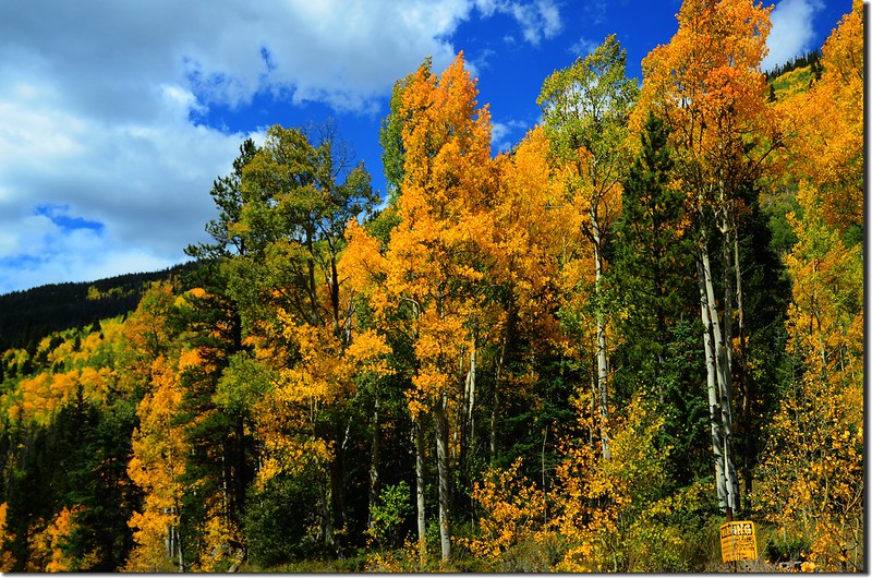
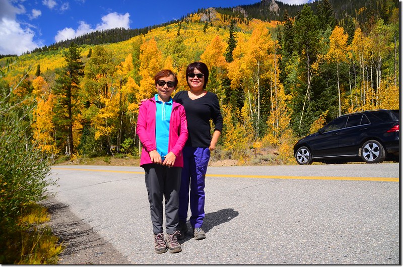
Aspen trees in autumn, Montezuma Rd, Keystone
Aspen trees in autumn, Montezuma Rd, Keystone
沒有留言:
張貼留言