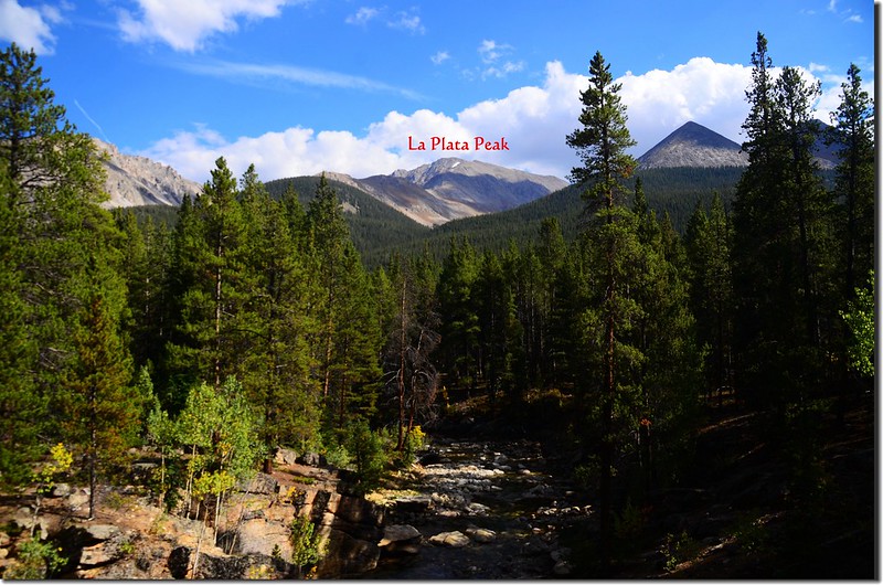
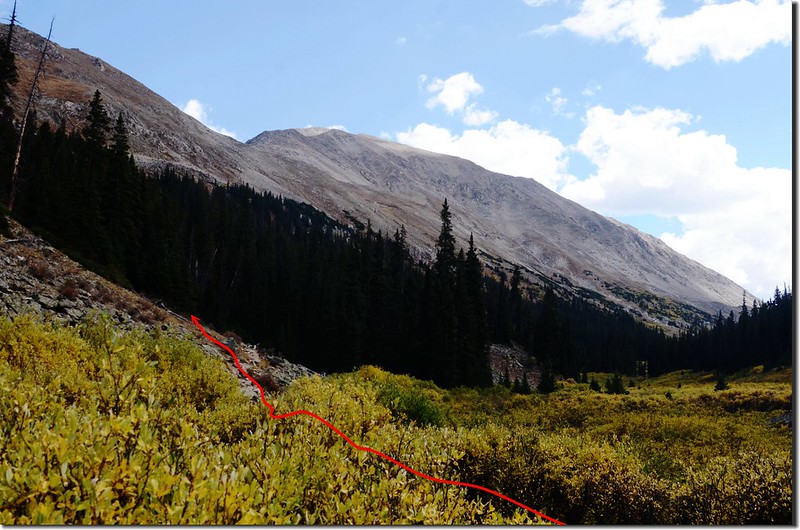
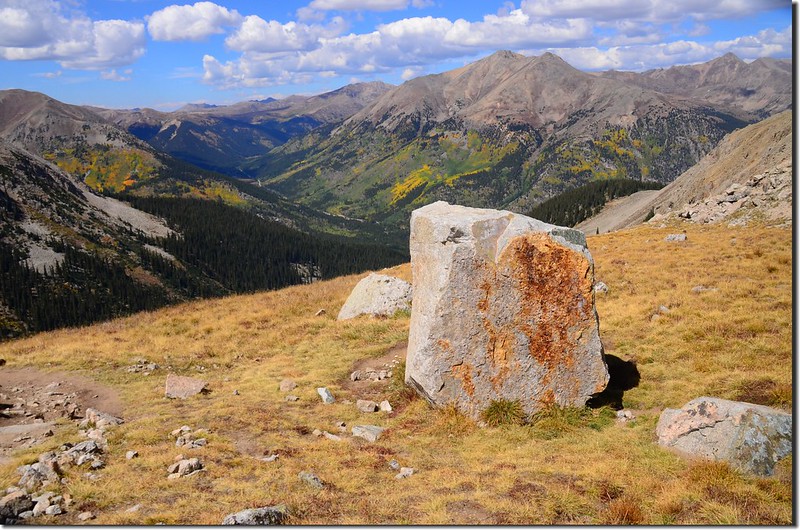
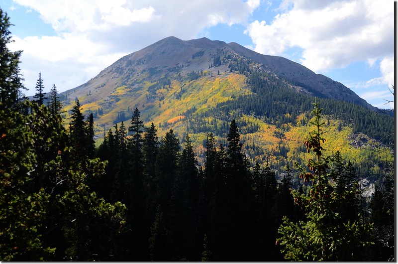
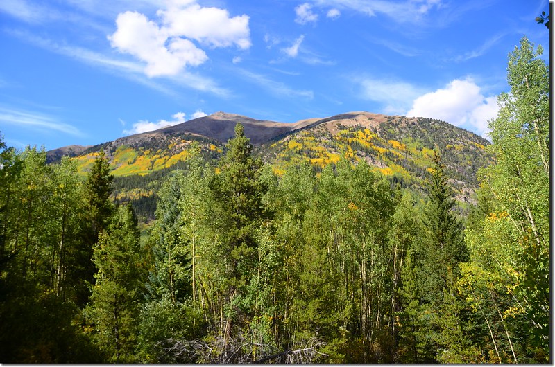
Looking south at La Plata Peak from the trailhead
山岳簡介:
La Plata Peak海拔14,336呎(4,370公尺),科羅拉多排名第5高的高山,座落在Sawatch Range;此座山的特點是他那崎嶇粗獷的北面斜坡,和它那長達2哩的東北稜經典技術攀岩路線Ellingwood Ridge (為紀念Albert Ellingwood而命名,他是一位洛磯山脈技術攀岩的先驅,也是第一位征服這個山脊的人)。紀錄上首次登頂此山的是The Hayden Survey Team,此探測隊於1873年7月26日首次登頂,同時將此山命名為La Plata。La Plata一辭在西班牙語的意思是「銀」,因為在此區域當年蘊藏很豐富的銀礦而得名。附近的Winfield和Hamilton是20世紀初重要的採礦小鎮,如今已成廢墟鬼城(Ghost town)。
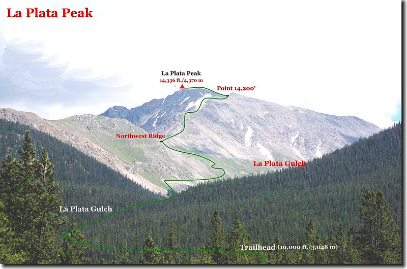
La Plata Peak高聳矗立在Twin Lakes和Independence Pass之間,四面都是陡峭的坡面,只有兩條較寬廣緩坡的山脊通向山頂。一條是Southwest Ridge,登山口在West Winfield Trailhead;另一條是今日一般登山客攻頂的標準傳統路線Northwest Ridge,登山口是La Plata Peak Trailhead,就在CO 82公路旁(距東邊的Balltown 14.5哩,距西邊的Independence Pass 8.8哩)。
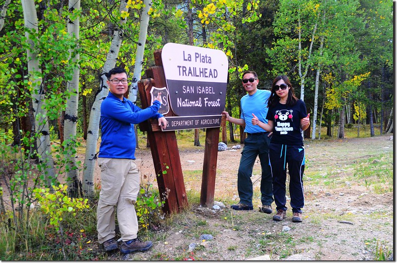
此座山我在2007.07.21和山友Goerge、Thomas完成首登,上週六在山友宇靈兄的邀約下二度前往攀登,同行者還有阿才、佳欣兩位山友,當天我於凌晨02:20從女兒家出發,03:00在Golden的Jefferson County Building parking lot會合後共乘宇靈兄的車子出發。
~~~~~~~~~~~~~~~~~~~~~~~~~~~~~~~~~~~~~~~~~~~~~~~~~~~~~~~~~~~~
攀登山岳:La Plata Peak (海拔14,336呎/4,370公尺)
登山口:La Plata Trailhead (海拔10,150呎/3,094公尺)
登山里程:9.8哩/15.68公里
總爬升高度:4,367呎/1,331公尺
登山時間:10小時50分
~~~~~~~~~~~~~~~~~~~~~~~~~~~~~~~~~~~~~~~~~~~~~~~~~~~~~~~~~~~~
行車資訊:
開車由Golden取道I-70州際道路西行,行約65哩在Exit 195下交流道改走CO-91南下,22.1哩後經過小鎮Leadville匯入US 24續往南行,US 24南行約16.2哩後右轉CO-82西行,途中經過Twin Lakes,CO-82計行約14.5哩後於05:00左右抵達道路左側La Plata Trailhead,登山口有一處不算大的土石地面停車場。
La Plata Peak hiking route
La Plata Peak hiking route
步程簡述:
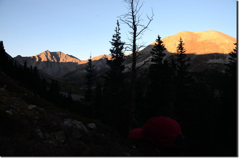
05:10 天未亮,我們戴頭燈從登山口出發;
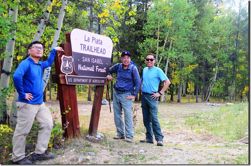
La Plata Trailhead (回程拍攝)
沿停車場東端可行車的土石道路82C (South Fork Lake Creek road)南下,隨即從South Fork Lake Creek的橋上經過後沿車道續行。
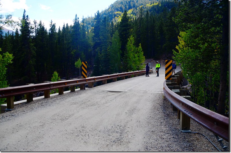
The bridge over a scenic gorge in the South Fork Lake Creek
La Plata Trailhead (回程拍攝)
沿停車場東端可行車的土石道路82C (South Fork Lake Creek road)南下,隨即從South Fork Lake Creek的橋上經過後沿車道續行。
The bridge over a scenic gorge in the South Fork Lake Creek
05:17 脫離82C (South Fork Lake Creek road)取左入林,此處為La Plata Peak Northwest Ridge登山路線的登山口,海拔10,150呎/3,094公尺,距登山口約0.25哩;
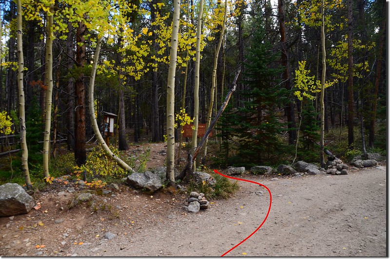
After 0.25 mile, turn left onto the La Plata trail
進入林間是羊腸小徑,天黑不是看得很清楚,偶而要詳細辨識一下正確路徑再前進。
After 0.25 mile, turn left onto the La Plata trail
進入林間是羊腸小徑,天黑不是看得很清楚,偶而要詳細辨識一下正確路徑再前進。
05: 23 經過一座小橋,天黑看不見橋下狀況,記得上次來時橋下是黃濁的South Fork Lake Creek,水勢澎湃,從陡峭的峽谷中穿過,有點「小」峽谷的架勢;此處海拔10,120呎/3,085公尺,距登山口約0.4哩;
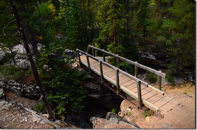
Cross the Souh Fork of Lake Creek using this great bridge
步道在過橋後上一段小坡隨即朝東在松林間緩下坡東行。
Cross the Souh Fork of Lake Creek using this great bridge
步道在過橋後上一段小坡隨即朝東在松林間緩下坡東行。
05:36 來到La Plata Gulch小溪,經幾根倒木跨越小溪,此處海拔10,146呎/3,093公尺,距登山口約1.0哩;
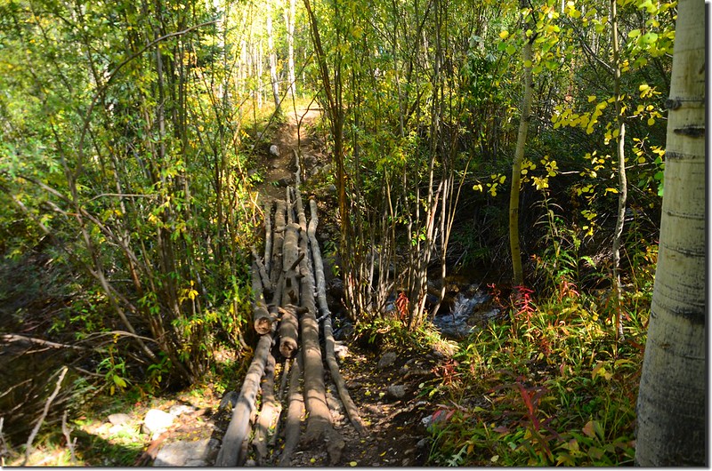
Cross creek on makeshift bridge
過溪後隨即轉向南,一路沿La Plata Gulch上行,路右潺潺流水聲一路相伴。此段路大約在海拔10,400呎到10,700呎之間,整個步道大部份是圓木或石塊築成的石階,坡度有點陡,速度稍微加快便氣喘如牛。
Cross creek on makeshift bridge
過溪後隨即轉向南,一路沿La Plata Gulch上行,路右潺潺流水聲一路相伴。此段路大約在海拔10,400呎到10,700呎之間,整個步道大部份是圓木或石塊築成的石階,坡度有點陡,速度稍微加快便氣喘如牛。
06:23 出森林,海拔11,000呎/3,353公尺,距登山口約1.9哩;路徑轉為平坦,仍在La Plata Gulch中前行。
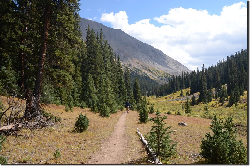
Near 11,000 ft. in La Plata Gulch
Near 11,000 ft. in La Plata Gulch
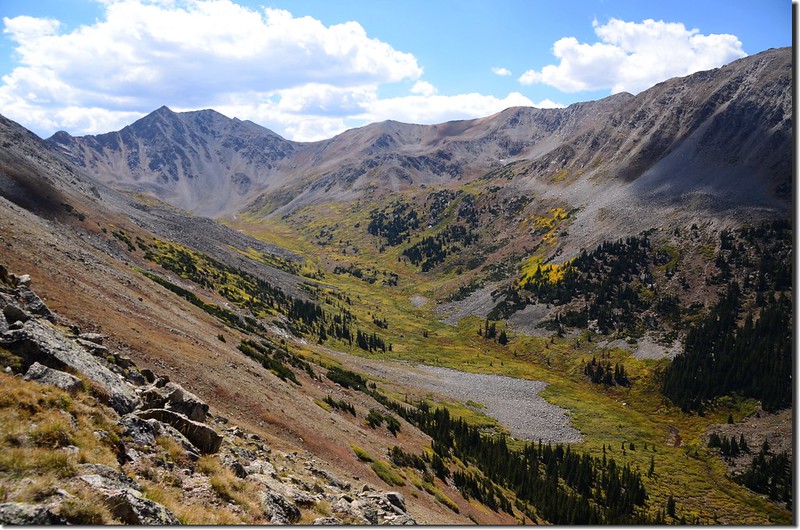
06:32 步道往左切上一處岩石坡離開La Plata Gulch,此時海拔13,743 呎的Sayres Benchmark出現在山谷遠方盡頭,此地海拔11,065呎/3,373公尺,距登山口約2.3哩;
The trail begins to climb left, away from the gulch near 11,370 ft
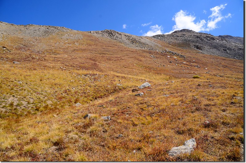
步道在碎石坡中沿山坡緩升,偶而穿過稀疏的松林,離峽谷越來越高。
Sayres BM from La Plata trail near 11,200 ft.
The trail begins to climb left, away from the gulch near 11,370 ft
步道在碎石坡中沿山坡緩升,偶而穿過稀疏的松林,離峽谷越來越高。
Sayres BM from La Plata trail near 11,200 ft.
06:55 來到一凹谷地形,步道90度左轉;往上一看是數不清的“之”字形坡道,此地海拔約11,462呎/3,494公尺,距登山口約2.6哩。
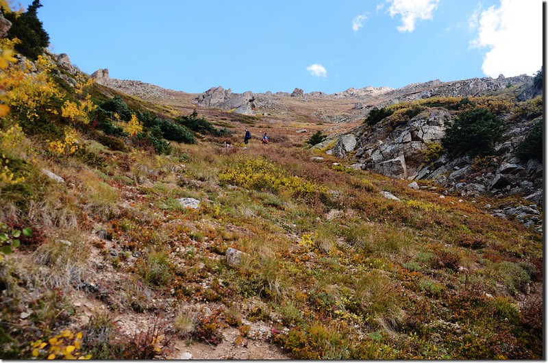
Near 11,450 ft. , switchback up a steep gully to reach 11,900 ft.
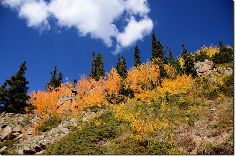
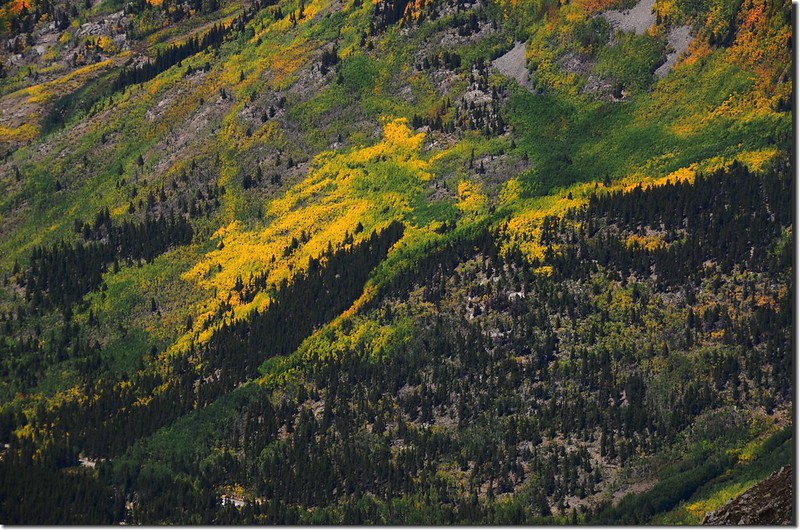
Aspen leaves have already turned golden yellow along the trail
Looking southwest at Sayres BM from La Plata trail near 11,700 ft.
Near 11,450 ft. , switchback up a steep gully to reach 11,900 ft.
Aspen leaves have already turned golden yellow along the trail
Looking southwest at Sayres BM from La Plata trail near 11,700 ft.
07:16 上到“之”字形坡道頂點,步道轉直,朝南沿山腰緩升,此處海拔約11,880呎/3,597公尺,距登山口約2.8哩;
Near 11,800 ft. , the switchbacks cease and the trail traverses south along the slope
朝南緩升的側坡小徑路面細石鬆散易滑,右側是直洩谷底的土、岩石坡,下山時要特別小心。
Near 11,800 ft. , the switchbacks cease and the trail traverses south along the slope
朝南緩升的側坡小徑路面細石鬆散易滑,右側是直洩谷底的土、岩石坡,下山時要特別小心。
07:48 上到一處稍平坦地形,一塊大約6x6呎的巨石在路徑左側,此地海拔約12,421呎/3,786公尺,距登山口約3.4哩。
A 6x6 ft. rock at the trail near 12,420 ft.
The top of switchback section of the trail
A 6x6 ft. rock at the trail near 12,420 ft.
The top of switchback section of the trail
登山小徑在巨石處右轉再行一小段路後步道旋即轉左,朝Northwest Ridge陡上,海拔約12,480呎/3,804公尺。
At 12,400 ft., cross a flat area before climbing up to the northwest ridge
At 12,400 ft., cross a flat area before climbing up to the northwest ridge
08:14 在岩石坡間經一段陡攀後抵Northwest Ridge稜線,海拔約12,742呎/3,884公尺,距登山口約3.6哩;
The trail reaches the northwest ridge at 3.6 miles (12,740 ft.
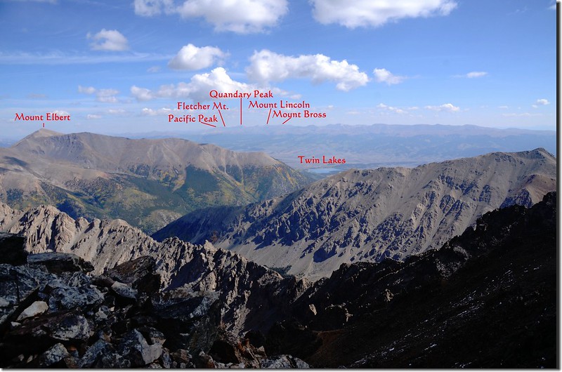
此處展望佳,東側下方是La Plata Basin,後面山勢崢嶸的稜線即是登La Plata Peak的攀岩路線Ellingwood Ridge,北望科羅拉多的最高峰(Mount Elbert)與次高峰(Mount Massive)已在群峰中冒出山頭。
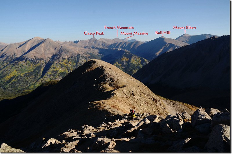
At the northwest ridge looking north at Mount Elbert & Mt. Massive
The trail reaches the northwest ridge at 3.6 miles (12,740 ft.
此處展望佳,東側下方是La Plata Basin,後面山勢崢嶸的稜線即是登La Plata Peak的攀岩路線Ellingwood Ridge,北望科羅拉多的最高峰(Mount Elbert)與次高峰(Mount Massive)已在群峰中冒出山頭。
At the northwest ridge looking north at Mount Elbert & Mt. Massive
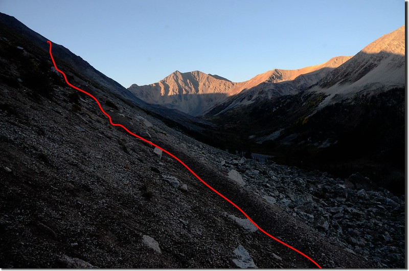
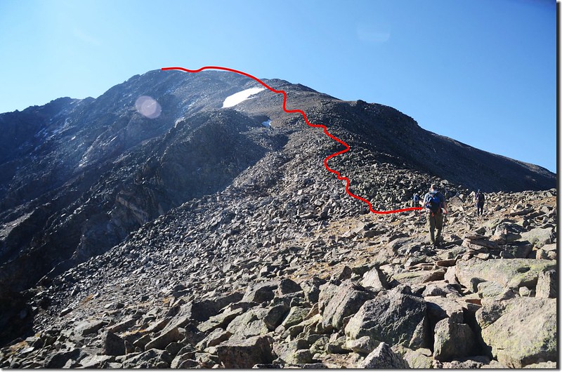
此地距山頂還有1.25哩左右,但卻是此行較為艱難的一段路程,稍事休息後順稜線爬升,在正前方有險惡高點無法直攻,步道從右(西)側坡繞過,時而在亂石堆中穿梭攀爬,挺累人的!
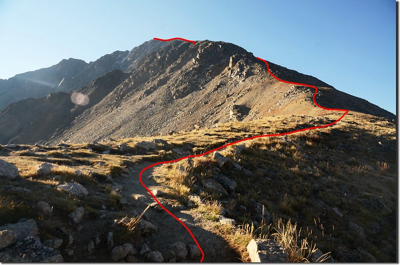
At 12,800 ft. on the ridge, the summit is visible but some of the route above 13,40 ft. is hidden behind the buttress(center)
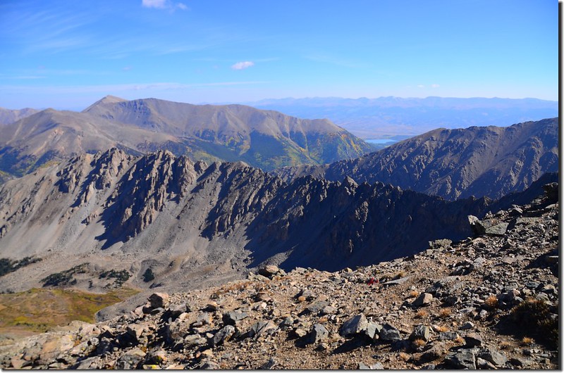
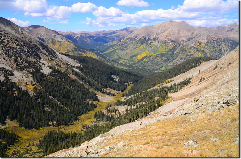
Looking down at Indipendance Pass from La Plata Trail near 13,200 ft.
At 12,800 ft. on the ridge, the summit is visible but some of the route above 13,40 ft. is hidden behind the buttress(center)
Looking down at Indipendance Pass from La Plata Trail near 13,200 ft.
09:00 繞過險惡高點後上抵險惡高點上方有苔原草皮的小肩稜,海拔13,300呎/4,054公尺,距登山口約4.0哩;
A small grassy saddle at the trail near 13,300 ft.
The rocky section of La Plata Trail near 13,400 ft.
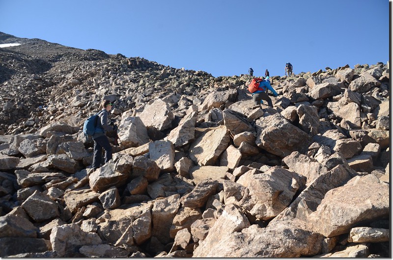
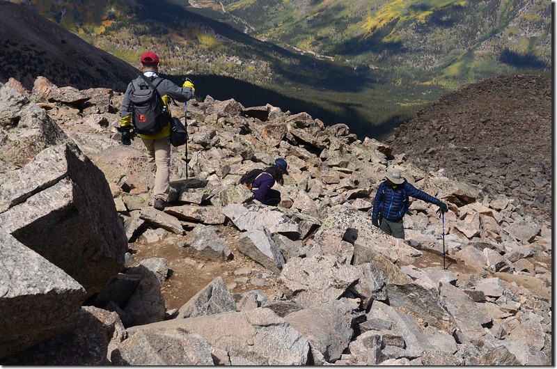
此後步道即沿著稜線上攀,但路徑很分歧,必須靠登山者自行研判要攀爬的路線。
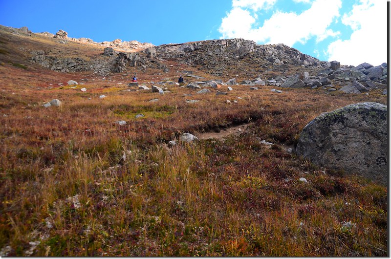
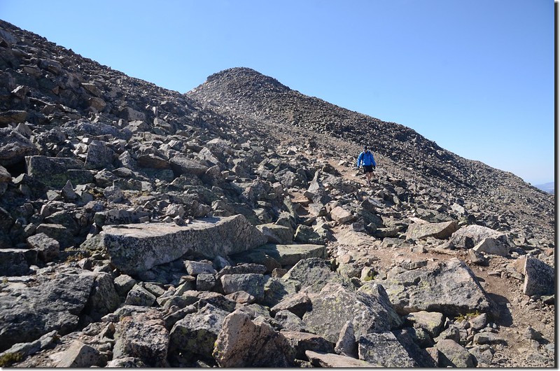
Viewing the remaining route from 13,500 ft.
Looking north at The Collegiate Peaks Wilderness from La Plata trail near 4.3 mile (13,700 ft.)
A small grassy saddle at the trail near 13,300 ft.
The rocky section of La Plata Trail near 13,400 ft.
此後步道即沿著稜線上攀,但路徑很分歧,必須靠登山者自行研判要攀爬的路線。
Viewing the remaining route from 13,500 ft.
Looking north at The Collegiate Peaks Wilderness from La Plata trail near 4.3 mile (13,700 ft.)
09:49 從一處雪原旁經過,海拔約14,000呎/4,287公尺。
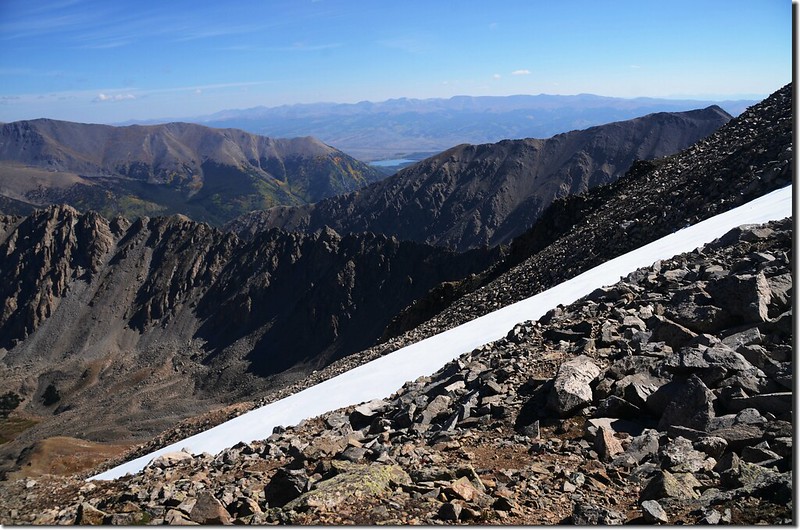
The trail is by the snowfield
Looking north at Mount Elbert & Twin Lakes from the trail near 14,000 ft.
The trail is by the snowfield
Looking north at Mount Elbert & Twin Lakes from the trail near 14,000 ft.
10:35 登上La Plata西側坡一小鞍部,海拔約14,250呎/4,343公尺,距登山口約4.8哩;
Turn left at this point near 14,250 ft.
Looking west at Elk Range from the trail near 14,250 ft.
鞍部西南不遠處有一座小山頭,鞍部往西南另有一條登山步道是La Plata Peak的另一條登山路線Southwest Ridge Trail,下山時在此要特別注意,不要走錯了!步道轉左朝山頂直上。
Turn left at this point near 14,250 ft.
Looking west at Elk Range from the trail near 14,250 ft.
鞍部西南不遠處有一座小山頭,鞍部往西南另有一條登山步道是La Plata Peak的另一條登山路線Southwest Ridge Trail,下山時在此要特別注意,不要走錯了!步道轉左朝山頂直上。
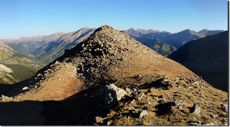
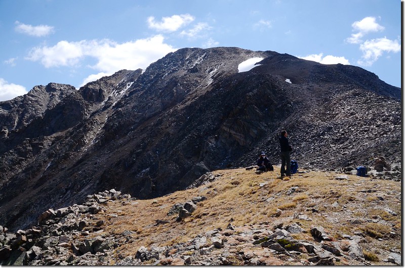
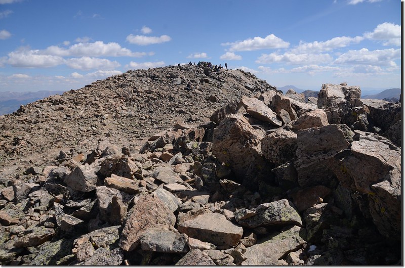
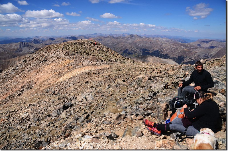
10:44 抵La Plata假山頭,峰頂在不遠處。
Looking the summit of La Plata Peak from false summit
Looking the summit of La Plata Peak from false summit
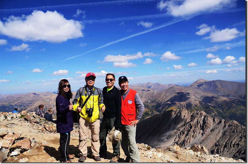
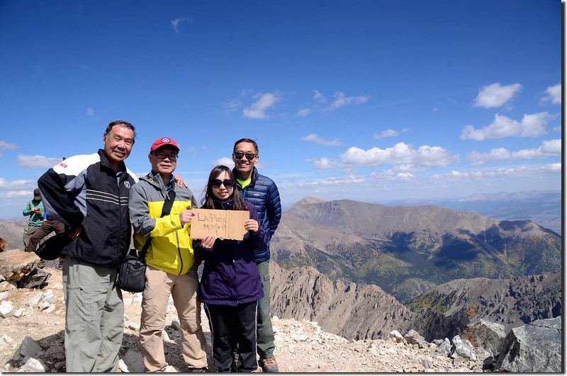
10:50 登頂科州第五高峰La Plata Peak,海拔14,336呎/4,370公尺,登山口到山頂單程約4.9哩。
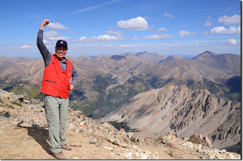
Me on the summit of La Plata Peak
We are on the summit of La Plata Peak
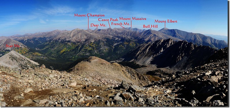
山頂展望佳,在此用餐、照相。
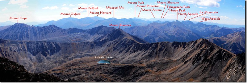
Looking southeast at The Collegiate Peaks from La Plata's summit
Looking northeast from the summit of La Plata Peak
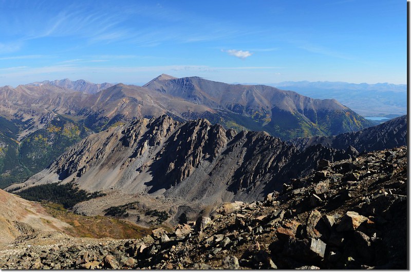
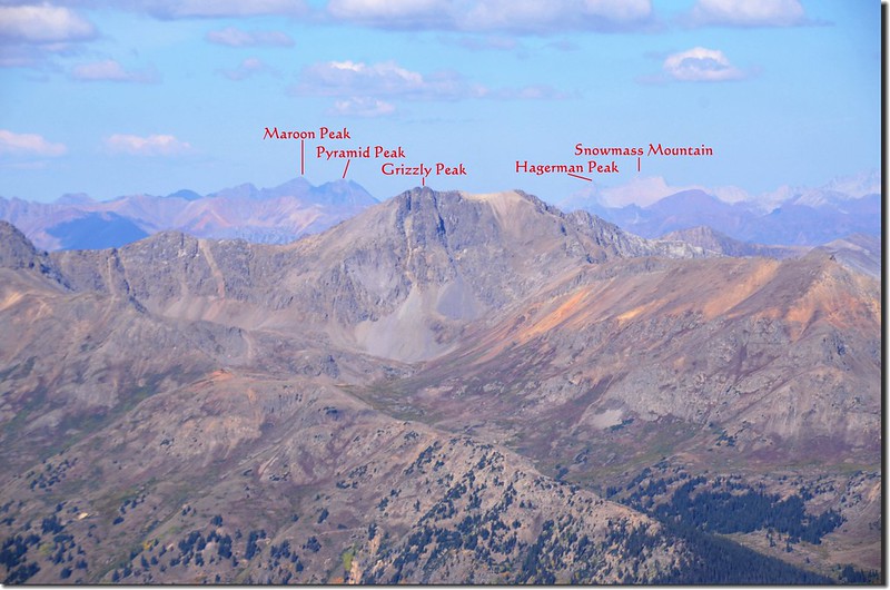
On top, looking over Ellingwood Ridge to Mount Elbert & Massive(center, in the distance)
Looking southwest from the summit
Me on the summit of La Plata Peak
We are on the summit of La Plata Peak
山頂展望佳,在此用餐、照相。
Looking southeast at The Collegiate Peaks from La Plata's summit
Looking northeast from the summit of La Plata Peak
On top, looking over Ellingwood Ridge to Mount Elbert & Massive(center, in the distance)
Looking southwest from the summit
11:50 循原路下山。
12:05 下抵La Plata西側坡小鞍部,海拔約14,250呎/4,343公尺,鞍部左下往西南是La Plata Peak的另一條Southwest Ridge登山路線,我們走Northwest Ridge路線取右下。
Going down from La Plata Peak
Going down from La Plata Peak
12:40 下抵險惡高點上方苔原草皮的小肩稜,海拔13,300呎/4,054公尺,小休後取左避開險惡高點在岩石坡間腰繞下切。
13:22 抵達Northwest Ridge稜線下切處,海拔約12,742呎/3,884公尺,取左下切脫離Northwest Ridge稜線。
Aspen leaves have already turned golden yellow along the trail
Aspen leaves have already turned golden yellow along the trail
13:42 下抵6x6呎的巨石處,海拔12,421呎/3,786公尺,步道左彎下一段小坡後右彎朝西北下行,此段下坡路砂石異常鬆散易滑,小心移動腳步,速度不會比上山快多少。
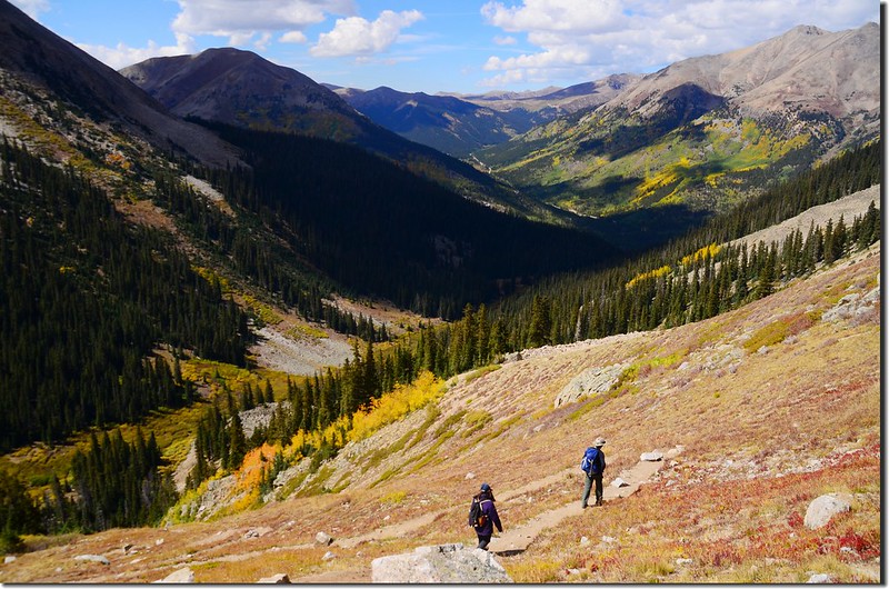
Looking down at La Plata Gulch & Independence Pass from the trail
Looking down at La Plata Gulch from the trail
Looking down at La Plata Gulch & Independence Pass from the trail
Looking down at La Plata Gulch from the trail
14:00 抵達“之”字形坡道頂端,沿“之”字形坡道迂迴下行,砂石易滑還是小心行走。
14:38 步道返抵La Plata Gulch,朝西北續行下山。
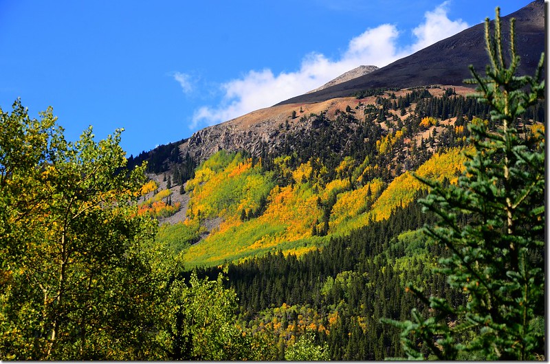
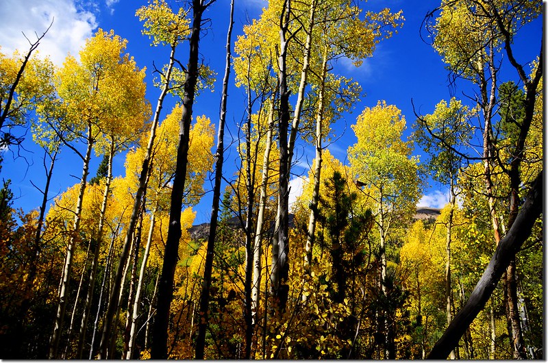
Aspen leaves have already turned golden yellow along the trail
Aspen leaves have already turned golden yellow along the trail
16:00 返抵登山口停車場,順利完成二度登頂La Plata Peak,整裝後共乘宇靈兄的車子返回Golden,美好的一趟登山行程!
La Plata Trailhead
La Plata Trailhead
沒有留言:
張貼留言