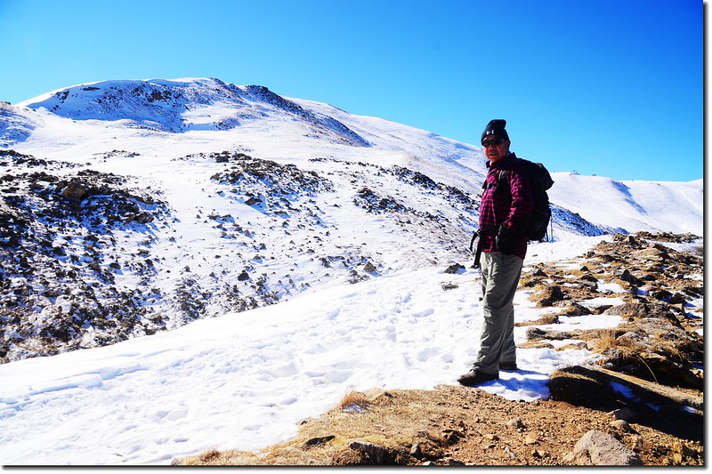
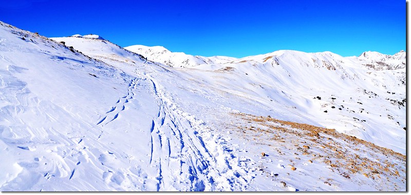
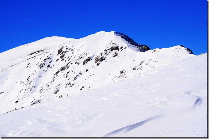
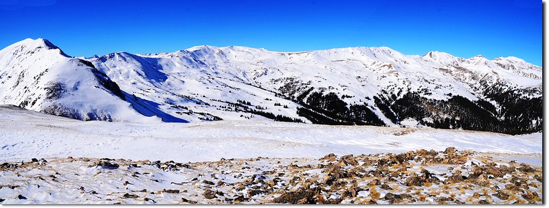
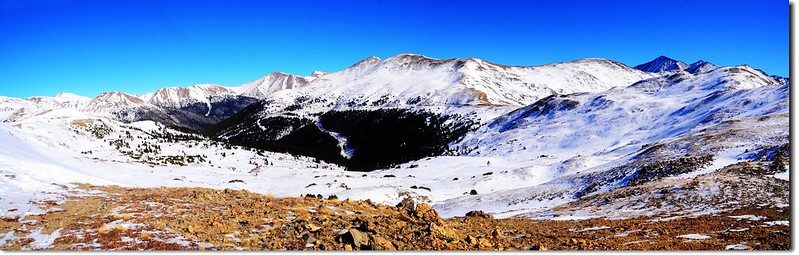
On the way up the ridge
登山路線:Loveland Pass West Ridge
登山口:Loveland Pass summit,海拔11,990呎(3,655公尺)
最高點:12,479’ Point,海拔12,479呎(3,804公尺)
登山里程:來回約3.6哩(5.76公里)
總爬升高度:約600呎(183公尺)
登山時間:3小時
---------------------------------------------------------------------------------------------------------
Mountain Pass意指一條路通過山脈的最低點(通常是兩山之間的鞍部),此點也正是這條路在附近地區的最高點,我們通稱它為關隘、山口。美國高山地區,尤其是落磯山脈有很多這種Pass,而通常這種Pass風景都很美,也都有不錯的登山口(Trailhead),是觀光客、登山客趨之若鶩的景點。
科羅拉多U.S.6號公路由丹佛西行有很大一部分是和70號州際公路(I-70)共用的,在現今70號州際公路216哩到205哩(Dillon,Silverthorne)這一段還沒興建艾森豪隧道(Eisenhower Tunnel)以前,是從Exit216開始循蜿蜒的山路上山,越過落磯山脈分水嶺(Continental Divide),也就是Loveland Pass,然後再陡下進入Arapahoe Basin,經過Keystone接回70號公路(全長20哩)。這一段路的東端是Loveland Ski Area,西邊則是Arapahoe Basin,都是離丹佛不遠的滑雪勝地,由於道路彎曲陡峭,在在冬季下雪的季節是特別危險的。自從1970年代Eisenhower Tunnel建好後,除了Trucks以外的車輛都可直接由70號公路穿越隧道,避開此路段。Loveland Pass為紀念William A.H. Loveland(19世紀末Colorado Central Railroad的總裁)而命名。
Loveland Pass海拔11990呎/3655公尺,目前除了大型貨卡車通行外,就數觀光客和登山客最多,因為車行在這條路線上不僅可近距離親近滑雪場,更可在最高點的分水嶺上飽覽群山之美。如果時間充裕,在公路最高點停車後更可順著維護完善的Hiking trail往東、西方向往上爬到稜線,是一處適合一般遊客的登山健行路線。
日前獨自前往Loveland Pass走走西邊的Loveland Pass West Ridge,因為積雪蠻厚的,上了稜線後走到12,479高地便折返下山。
---------------------------------------------------------------------------------------------------------
行車資訊:
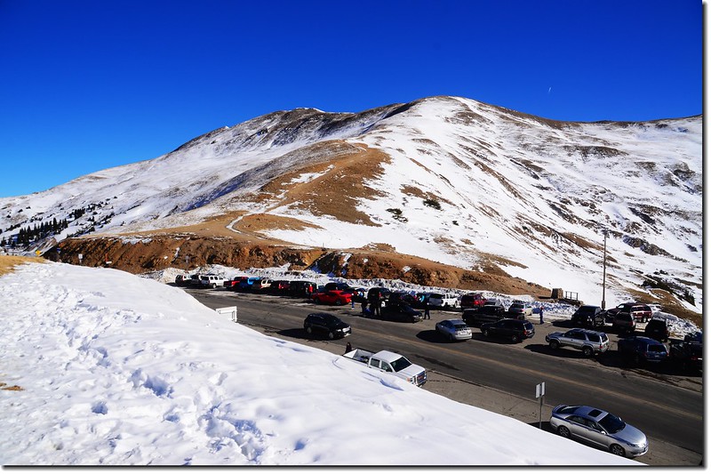
由丹佛沿I-70州際公路西行,在Exit 216出口下交流道,然後行駛US-6 W上山,行約4.4哩抵達Loveland Pass山頂,道路左側(東)有一停車場,海拔11,990呎(3,655公尺)。
步程簡述:
10:30 登山口出發;
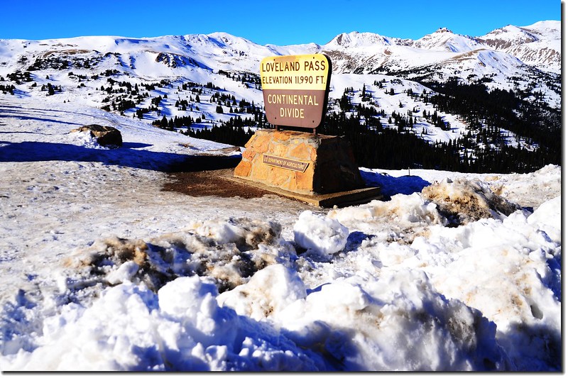
The summit of Loveland Pass
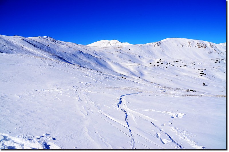
今天要走西側稜線,登山口在道路西側,有一木階梯上山,積雪很滑,小心上行;步道先朝西南方向爬升,當爬升到稜線後步道才轉向西北循稜線而行。
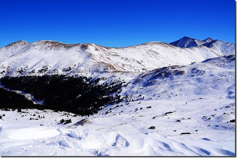
Looking east from the Loveland Pass West
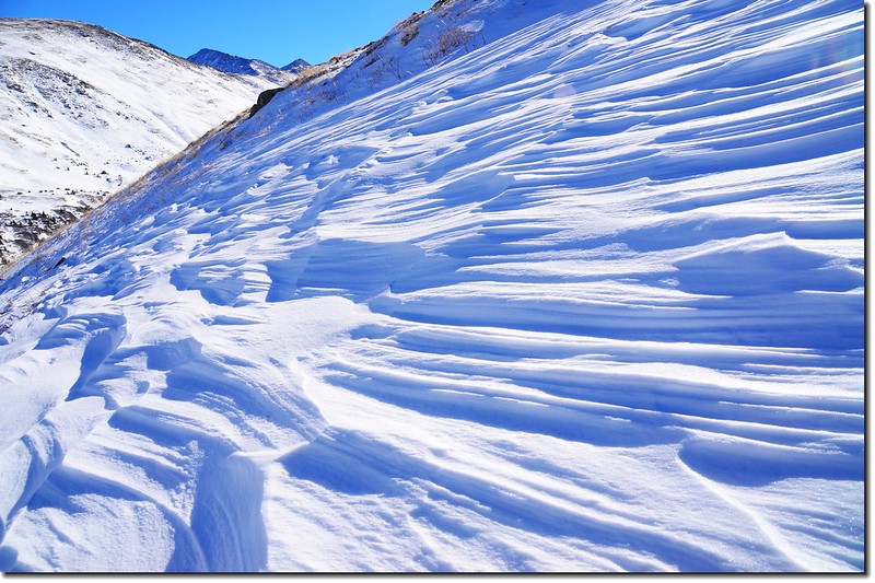
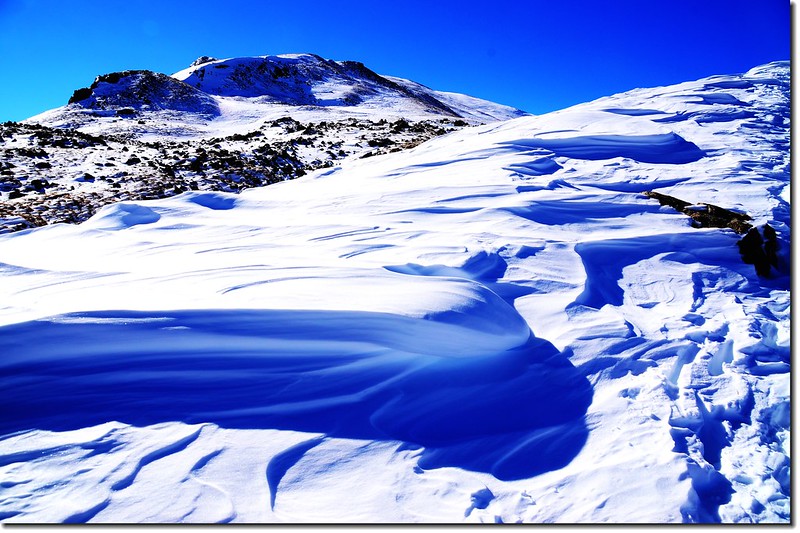
Snow dimples at Loveland West Ridge
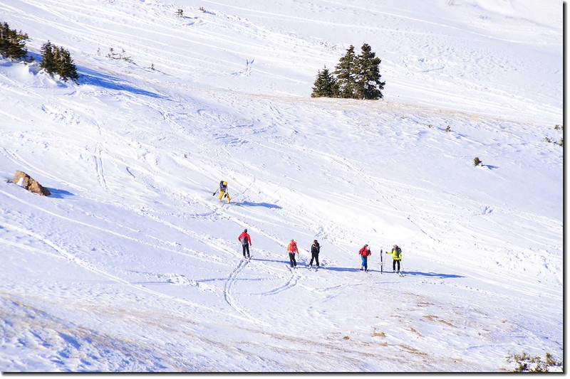
今天是假日,又是暖和的豔陽天,遊客、滑雪客蠻多的,來這裡滑雪的都是喜愛利用大自然山坡來滑雪的,冒險、刺激又免費,許多滑雪高手都喜歡這一套。
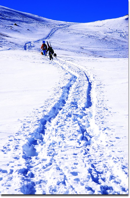
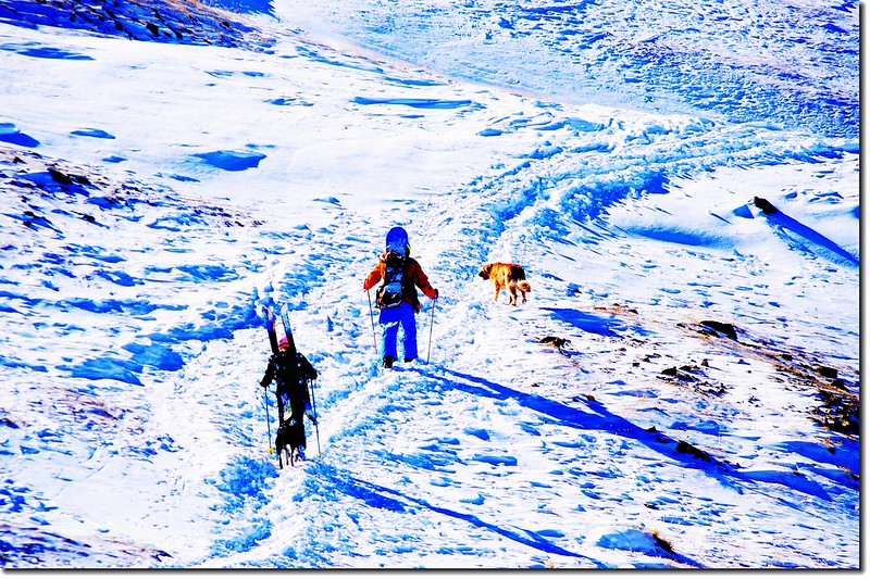
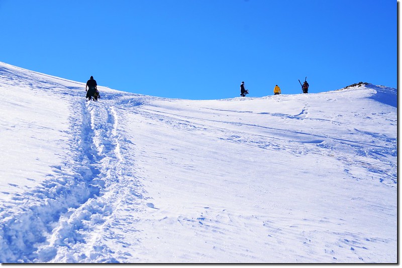
Skiers on their way up the Ridge
Snow view from Loveland Pass West Trail
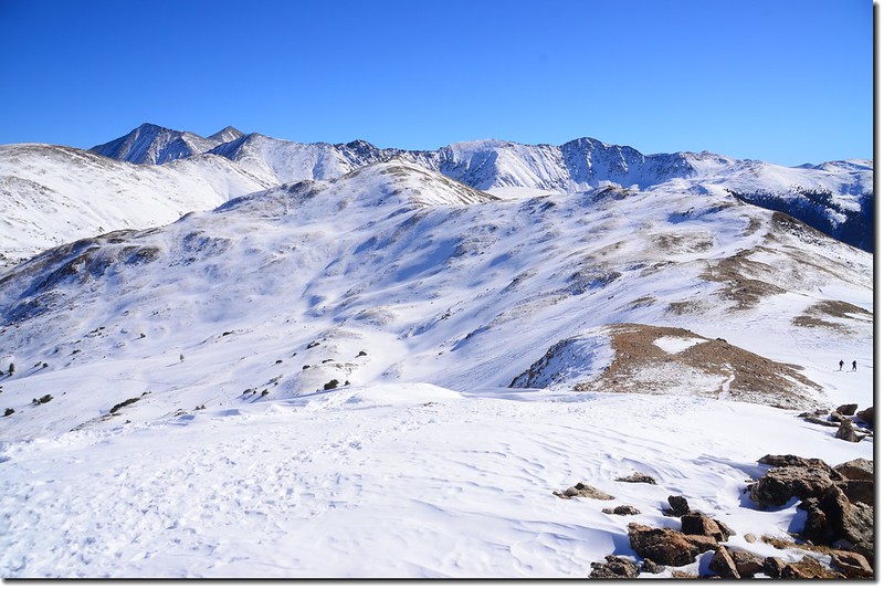
10:50 上到半山腰間一處高點,海拔約12,150呎(3,703公尺),此處已有極佳展望。
Loveland Pass West Ridge Trail
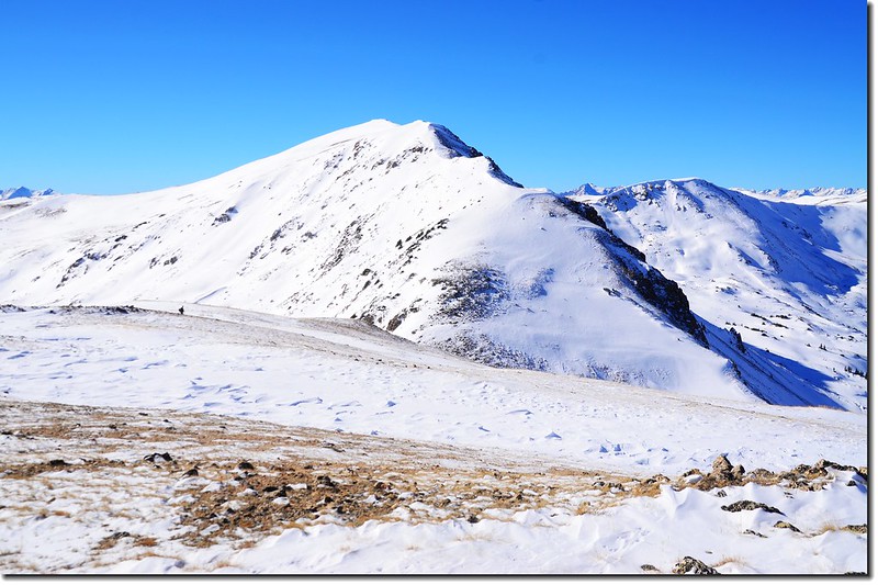
Loveland Pass West
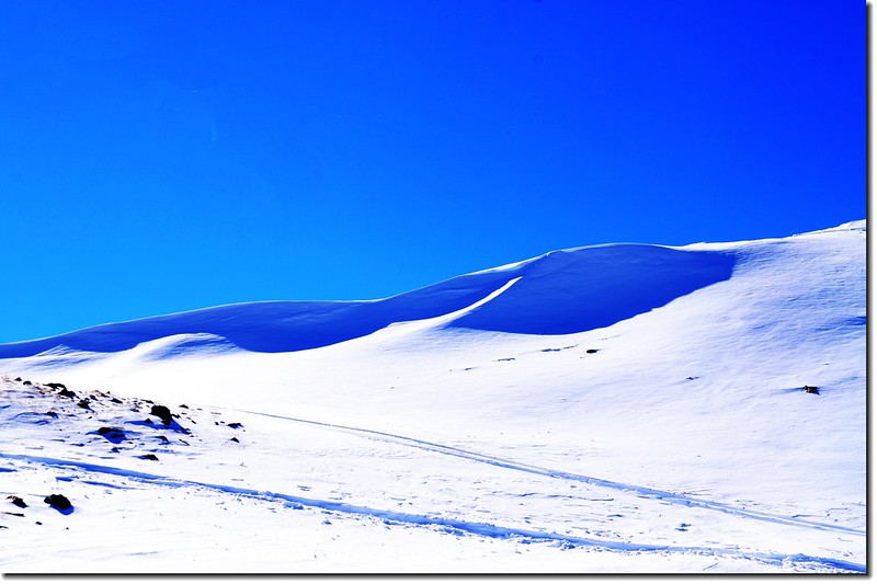
Snow dimples at Loveland West Ridge
Skiers on the Ridge
11:13 登上稜線,海拔約12,360呎(3,767公尺),距登山口約一(0.5)哩左右。
On the ridge
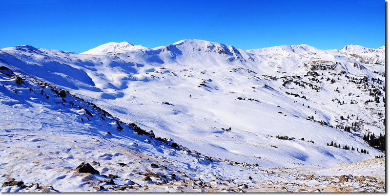
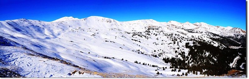
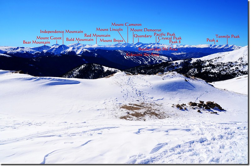
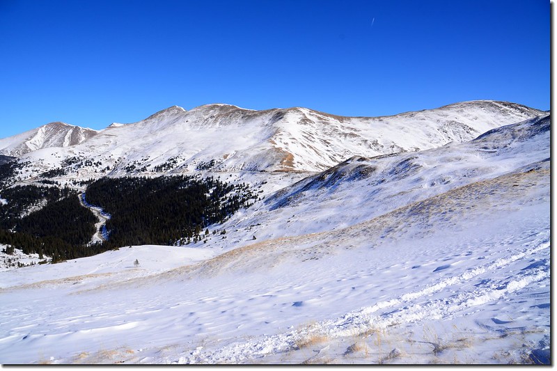
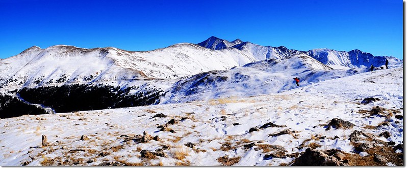
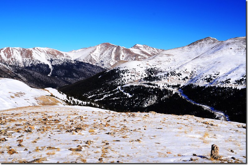
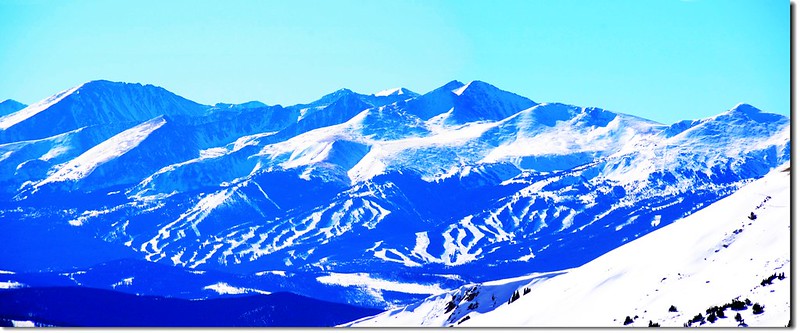
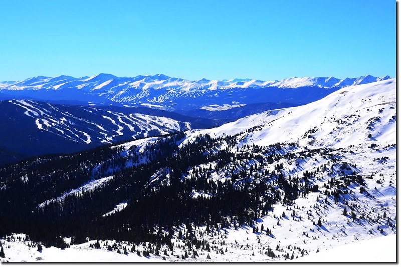
稜線上往西南遠眺可看到Arapahoe Basin、Keystone和Breckenridge三處滑雪場,更遠的Breckenridge滑雪場後面則是Tenmile山脈和Mosquito山脈的幾座14ers高山;
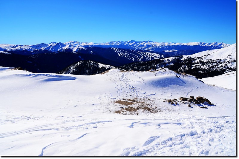
Overlooking southwest onto Tenmile & Mosquito Range from Loveland Pass West
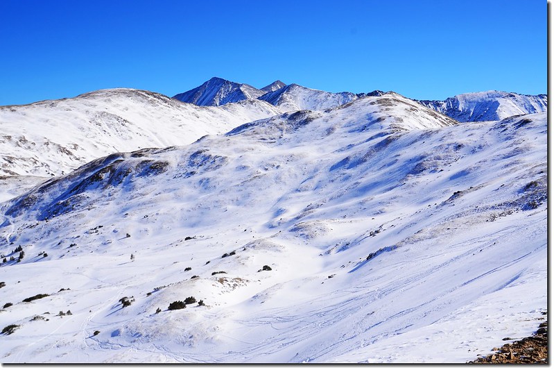
北邊是一路往北延伸的大陸分水嶺,整個山脈覆蓋一層厚厚的白雪;
Loveland Pass West Ridge Trail (稜線北望)
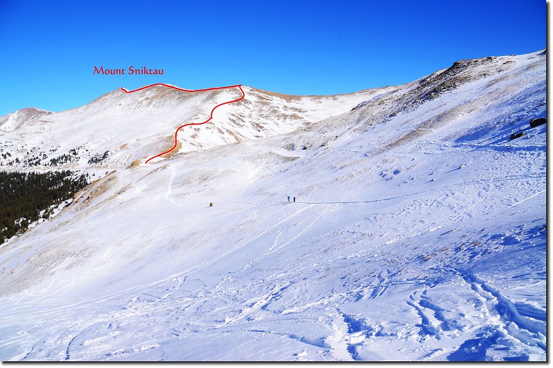
東邊則是Loveland Pass 東側的稜線,三個禮拜前攀登的Mount Sniktau及其登山路線看得一清二楚。
Looking back onto the trail from the ridge
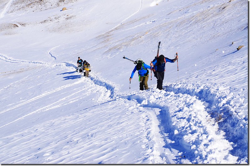
Skiers on their way up the Ridge
在稜線上小休後右轉往東北循著稜線續行,先腰繞過12,414’高地(3,784公尺)下到一鞍部後開始往12,479’高地爬升,這一路都在深達膝蓋的雪地上行走,並不輕鬆,但美景當前也就忘了辛勞。
腰繞12,414'高地
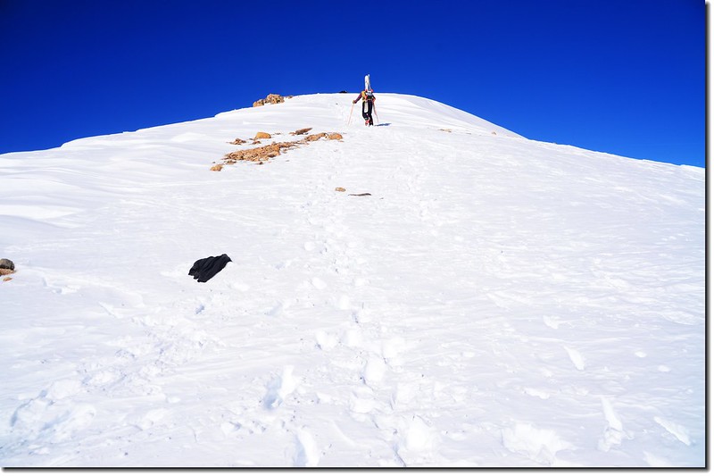
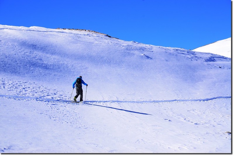
Skier on his way up the 12,479' Point
Overlooking east onto Loveland Pass East Ridge from West Ridge
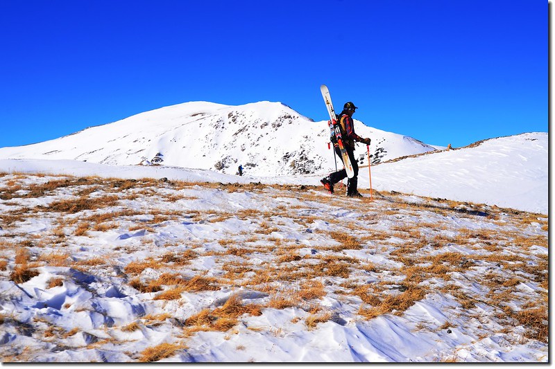
Skiers on their way up the Ridge
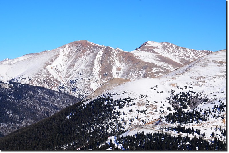
Overlooking southeast onto Grays & Torreys Peak from Loveland Pass West Ridge
Peak 12752 from the south slope of 12,479 Point
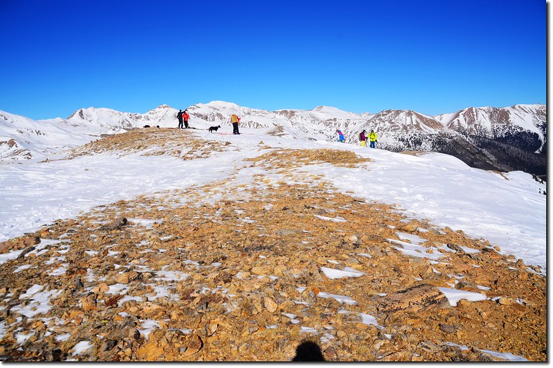
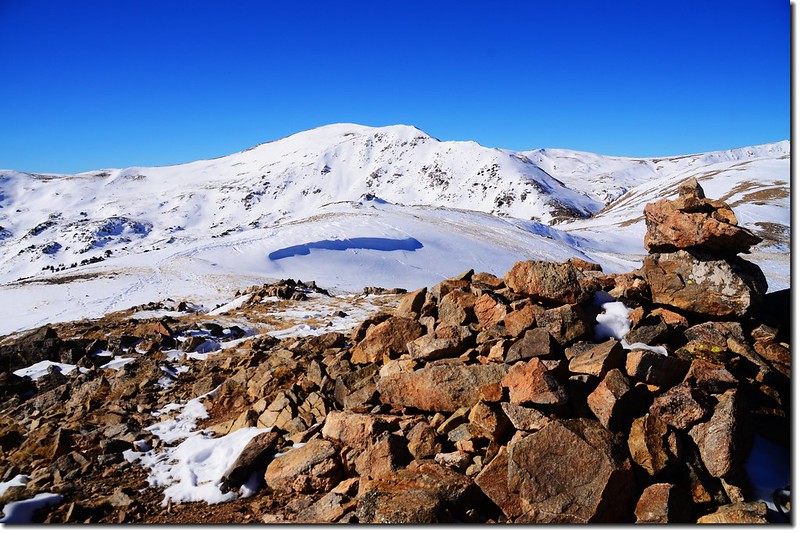
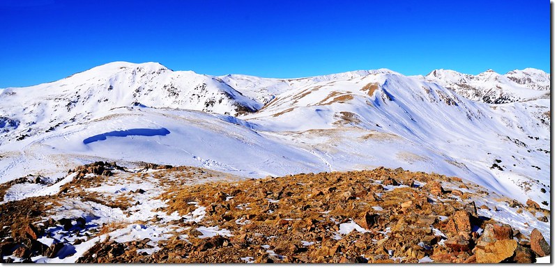
12:05 抵達12,479’高地,海拔12,479呎(3,804公尺),距登山口約1.8哩(2.88公里)。
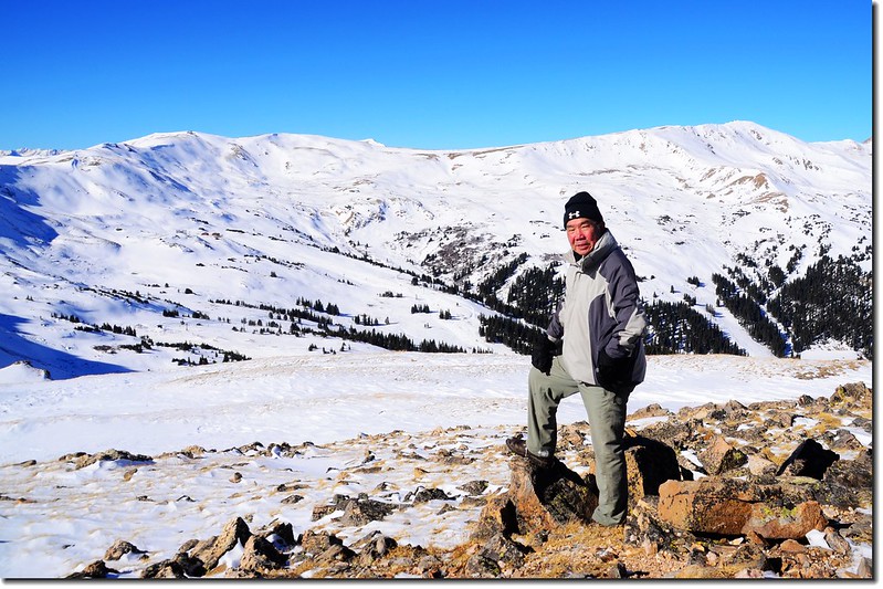
12,479’高地是一處寬闊的平台,展望極佳,春夏之季野花遍地,是一般遊客喜歡到此一遊的地點;
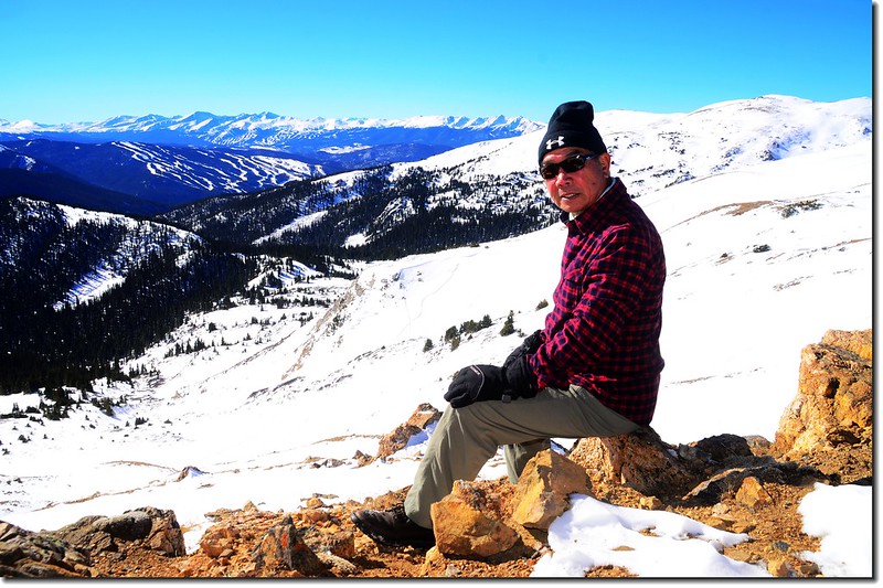
12,479' Point
On the 12,479' Point
高地的西北山谷就是Loveland Basin滑雪場,遠處望去已有不少人迫不及待的來此滑雪,雖然滑雪場的雪況還不甚佳;
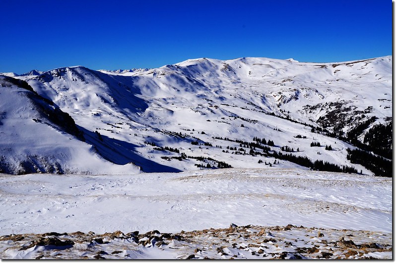
Looking down onto Loveland Ski Area from the 12,479' Point
Overlooking northwest onto Continental Divide from 12,479' Point
Peak 12752 from the 12,479 Point
東邊及東南邊是Loveland Pass 東側的稜線;

Overlooking east onto Loveland Pass East Ridge from 12,479' Point
左邊山頭是海拔4,034公尺的Mount Sniktau,右端則是海拔4,093公尺的Grizzly Peak和海拔4,025公尺的 Lenawee Mountain,而在Grizzly Peak後方則是兩座14ers~Grays Peak和Torreys Peak。
東北方向可清楚遠眺這一個多月來前去攀登的五座四千多公尺的山頭;

Looking northeast from the 12,479 Point at Loveland Pass West
Looking northeast from the 12,479 Point at Loveland Pass West
Bard Peak(R)& Mount Parnassus(L) from 12,479' Point
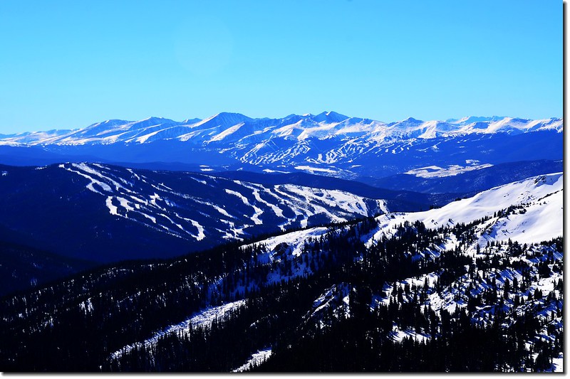
目光轉到西南邊極目遠眺則是Tenmile山脈和Mosquito山脈的幾座14ers高山;

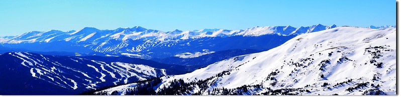
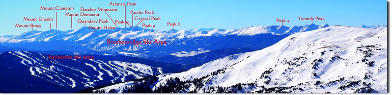
Overlooking southwest onto Tenmile & Mosquito Range from 12,479' Point
From the 12,479' Point, I am looking back onto the trail that came from
12:30 循原路下山,下到鞍部後不再腰繞12,414’高地,而是循稜線攀登12,414’高地。
12:50 登上12,414’高地,海拔12,414呎(3,784公尺);
12,414' Point
展望和12,479’高地差異不大,稍作停留後再沿稜線下山。
Looking northwest from 12,414' Point
Overlooking east onto Loveland Pass East Ridge from 12,414' Point

Overlooking southwest onto Tenmile & Mosquito Range from 12,414' Point
13:03 返抵12,360’稜線,左轉下山。
13:30 返抵登山口。
沒有留言:
張貼留言