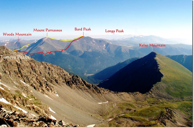
Overlooding Bard, Parnassus route from Grays Peak summit
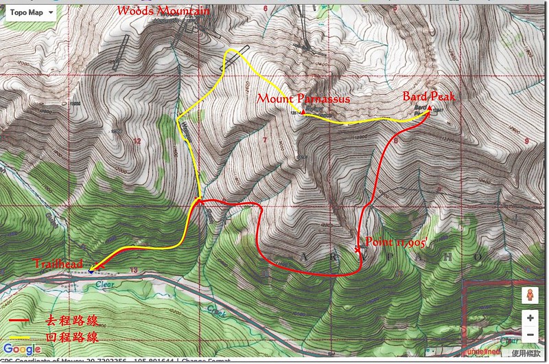
Hiking route
繼上週六爬完Woods Mountain和Mount Parnassus後,今天計畫前往攀登Mount Parnassus東邊的Bard Peak,趁雪季來臨前完成附近的13ers,計畫登上Bard Peak後視體力狀況再登一次Mount Parnassus,完成一次雙峰“O”形大環走。
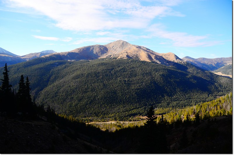
登此山較近的路線是從I-70州際公路Exit 221出口下Bakerville,再沿Mount Parnassus和Bard Peak之間的小峽谷直接上攀,較為陡峭但路程較短,但在森林線以下是一大片松林,我沒帶GPS在身邊不打算冒險,還是走較遠,但較明確的路線,所以選擇從Herman Gulch Trailhead起登。
---------------------------------------------------------------------------------------------------------
行車資訊:
由丹佛沿I-70州際公路西行,然後在Exit 218出口下交流道,隨即右後轉彎行駛一條兩三百呎的石子路即抵達Herman Gulch Trailhead,登山口有一處蠻大的停車場,登山口就在停車場的北邊中間位置,此登山口是Herman Gulch Trail和Watrous Gulch Trail共用登山口。
攀登山岳:
Bard Peak:海拔13,641呎 / 4,158 公尺
Mount Parnassus:海拔13,574呎 / 4,137 公尺
登山口:Herman Gulch Trailhead(海拔10,300呎 / 3,139公尺)
登山里程:9.8哩/15.68公里
總爬升高度:約4,400呎/1,341公尺
登山時間:8小時30分
---------------------------------------------------------------------------------------------------------
步程簡述:
08:00 登山口出發,上週六才爬過Mount Parnassus,前天也來爬過Herman Lake和Pettingell Peak,路況很熟;行約400呎(122公尺)遇左上岔路往Herman Lake不取,取右Watrous Gulch Trail續東行。
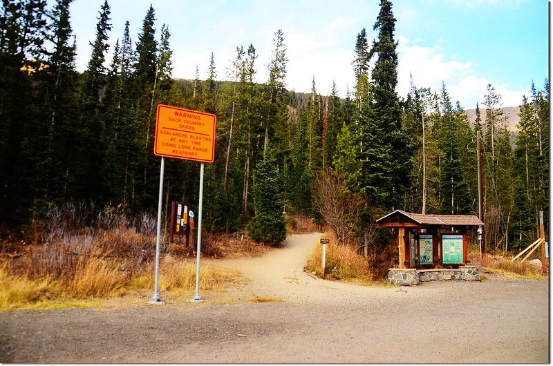
Herman Gulch Trailhead
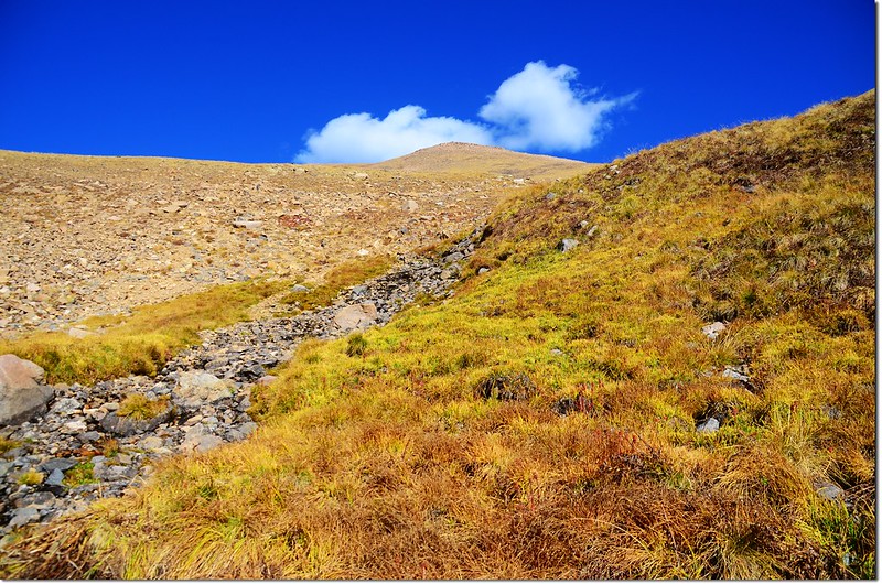
08:50 過Watrous Gulch Creek遇岔路,右往東續行為Bard Creek Trail (#83),左往北行是Watrous Gulch Trail(#95),取右沿Bard Creek Trail續往東行,此地海拔約11,160呎(3,402公尺),距登山口約1.5哩(2.4公里);此後步道即在Mount Parnassus南稜下的西面坡朝東腰繞。
08:54 遇一小溪,潺潺流水是山上融雪的雪水,跨過小溪後隨即穿過一小片白楊木林(Aspen)。
09:03 再跨過一乾溪谷後步道轉向南繼續腰繞緩上。
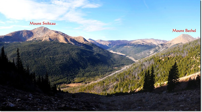
Mount Sniktau from Bard Creek Trail
Looking southwest from the Bard Creek Trail
Looking west onto Herman Gulch from the Bard Creek Trail, Pettingell Peak in the right
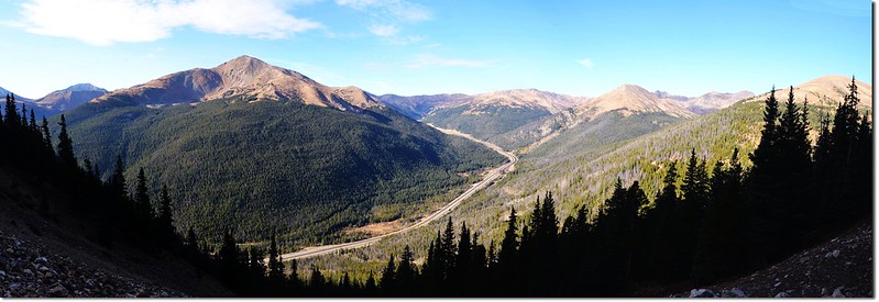
Looking down onto I-70 HWY from Bard Creek Trail
09:36 繞到Mount Parnassus南邊一小支稜(西南稜)稜點,步道旁有一小石堆,海拔約11,400呎,(3,475公尺),步道再轉為東行;
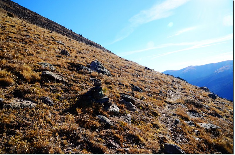
Cairn on the southwest ridge of Parnassus
行不久山坡出現一些造型不錯的枯木及松樹,這些松樹很像Bristlecone pines,但不敢確定。
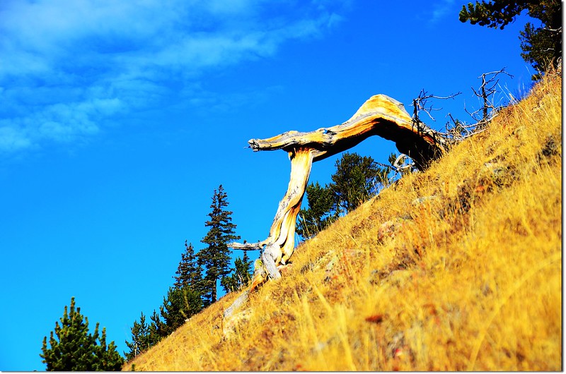
Dry tree on the slopes
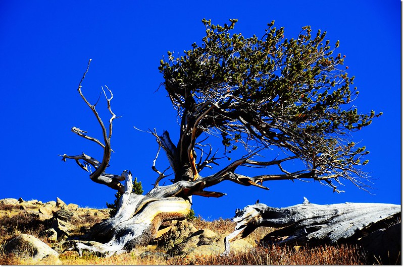
Dry tree & Bristlecone pines
09:50 又到一小支稜(南稜)稜點,步道旁亦有一小石堆,步道續在山腰腰繞。
Cairn on the south ridge of Parnassus
Looking southwest from the Bard Creek Trail
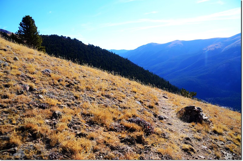
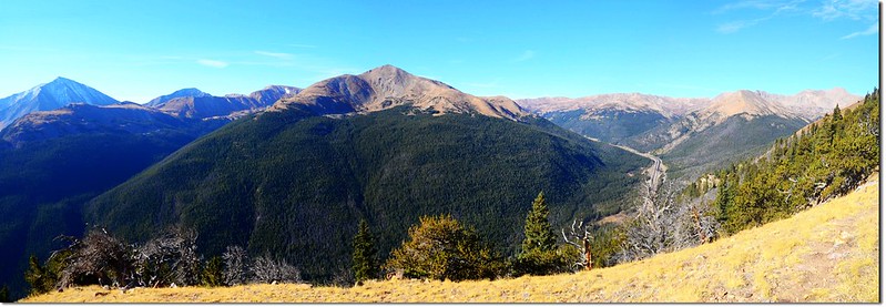
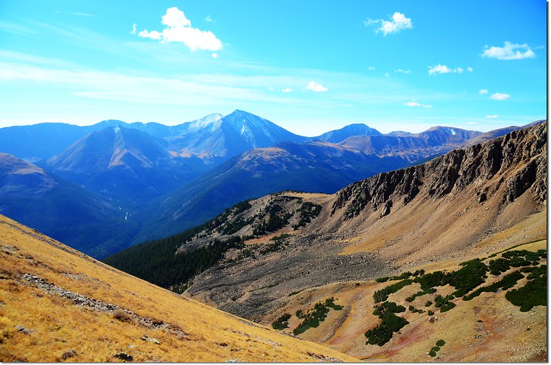
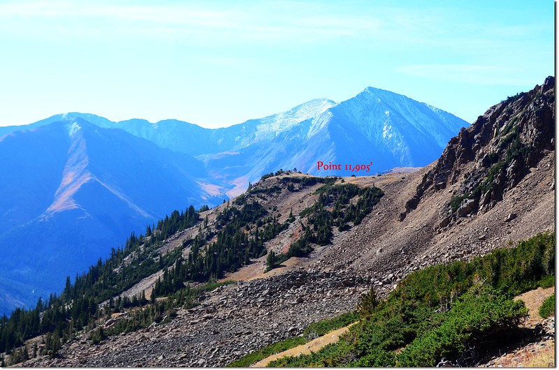
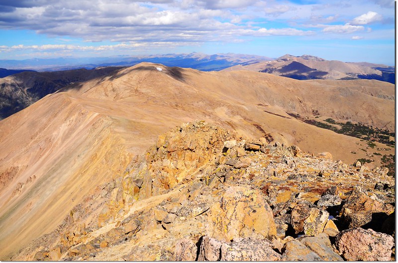
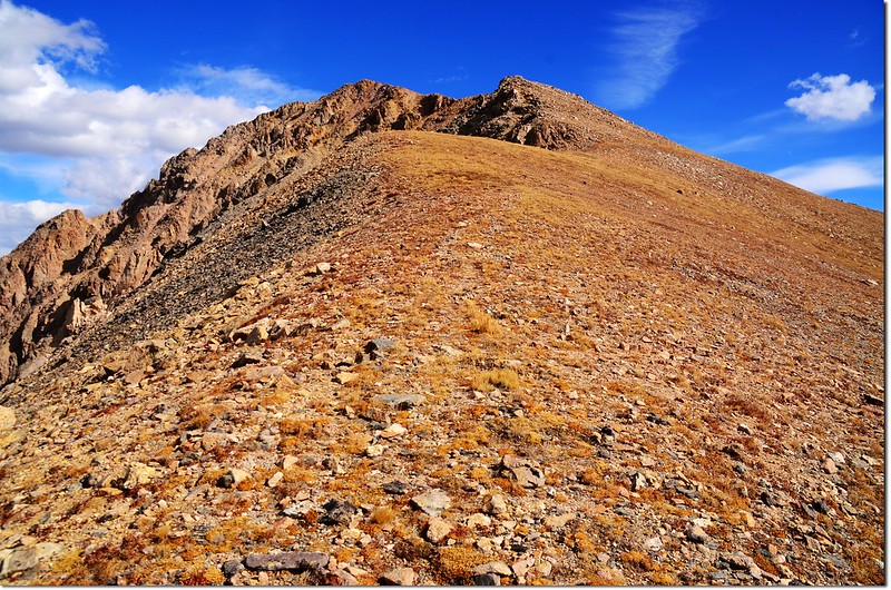
10:11 抵達11,905'高地(Point 11,905),此處是Mount Parnassus東南稜稜尾一處高地平台,海拔11,905呎,距登山口約3哩。

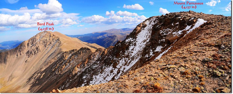
Mount Parnassus & Bard Peak from Point 11,905'
順此稜線左上是登Mount Parnassus的路線,右前方隱約可見Bard Peak的假山頭,中間隔著一條小峽谷;Bard Creek Trail (#83)往右下續行,我勘查地形後決定取直下切到峽谷,再直攻山頂,中間一段岩石裸岩坡應該可以克服。
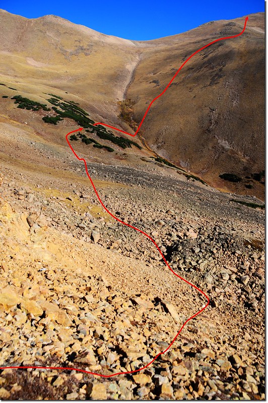

The route I up to Bard Peak
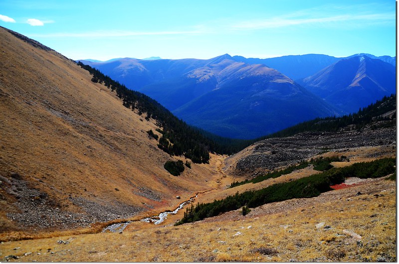
10:30 下降到11,700呎(3,566公尺)左右,這是一大片巨岩亂石堆低處,左上方有一小片矮松樹叢擋路,計畫由樹叢穿過。
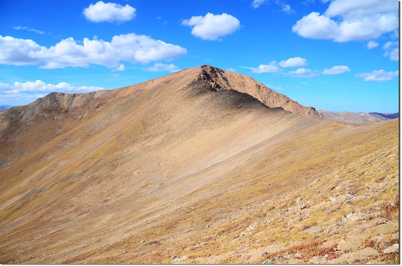
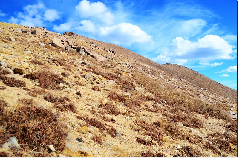
10:45 穿過樹叢後行一小段斜坡到小峽谷,跨過Bard Peak與Mount Parnassus間的小峽谷,開始在Bard Peak西南坡朝山頂攀升,此處距Bard Peak山頂約一哩多,海拔約11,800呎(3,597公尺),預計要陡升1,840呎(561公尺)左右,很難形容的陡。
The southwest slopes of Bard Peak
Looking down onto the gulch between Bard & Parnassus
Looking up onto the gulch between Bard & Parnassus
Looking south onto Grays & Torreys Peak from the slopes of Bard Peak
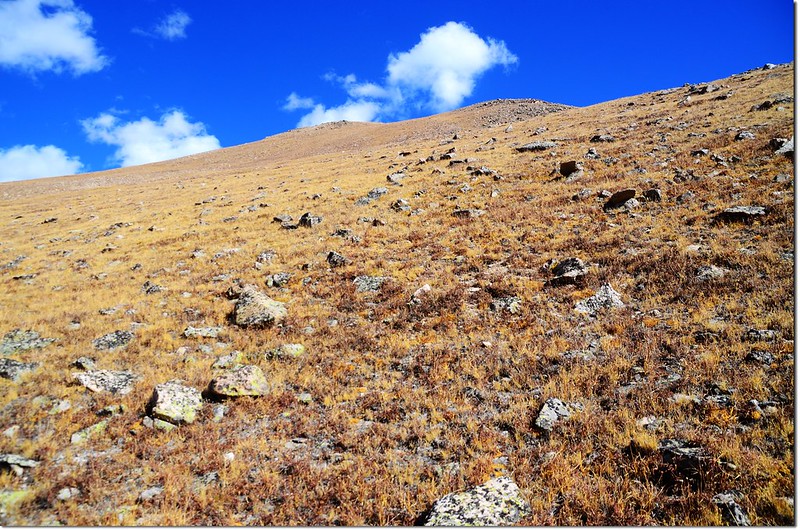
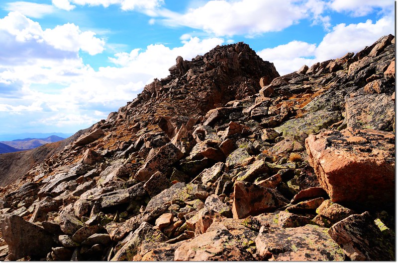
Bard Peak西南坡面都是苔原地帶的短草坡,間夾雜一些小亂石坡,坡度應有六、七十度吧!每爬個四、五十步就小歇一下,也不知休息了幾百次,悶著頭往上爬!
Looking back onto Point 11,905' from Bard's slpopes, Grays & Torreys Peak in the distance
Looking west onto Parnassus' summit from the slopes of Bard Peak
Looking up onto Bards' summit from It's southwest slopes
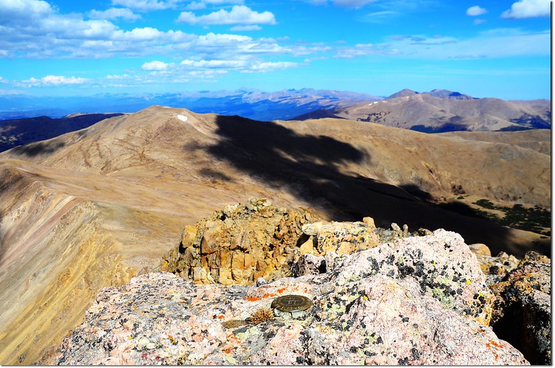
12:44 花了兩個小時好不容易登頂Bard Peak,Bard Peak海拔13,641呎(4,158 公尺),山頂有兩個水準點(Benchmark)銅標,但很奇怪的是都沒標示山名和海拔,其他山頭的Benchmark都會標示山名和海拔,該不會是拿錯了新品嵌上去的吧~~
Benchmark on the summit of Bard Peak
Benchmark on the summit of Bard Peak, the Rockies in the distance
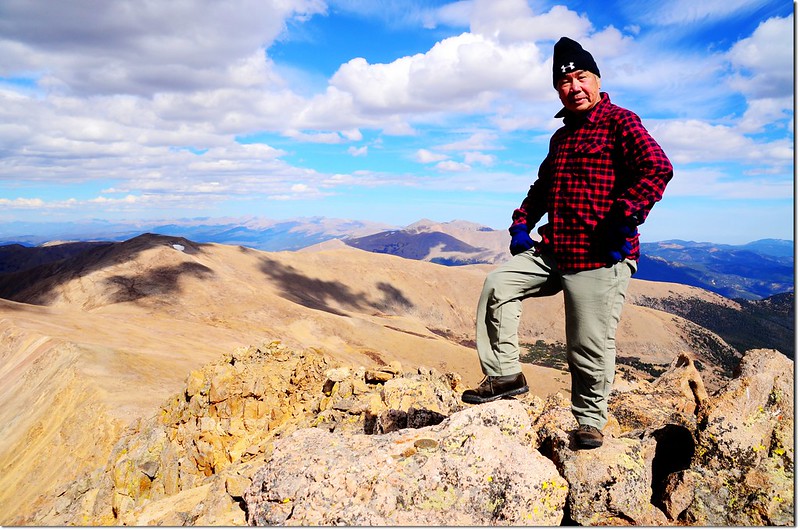
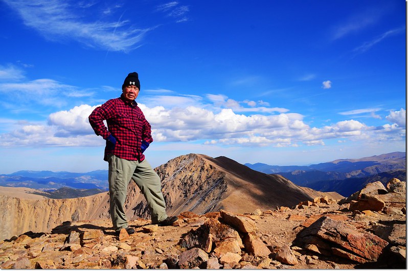
Me on the summit of Bard, in the background is the Rockies
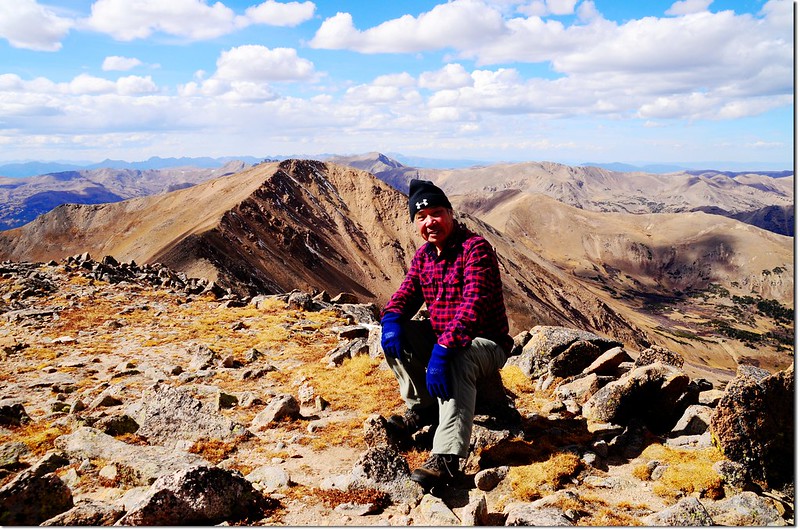
Me on the summit of Bard, the closest peak is Mount Parnassus
天氣好,展望也佳;
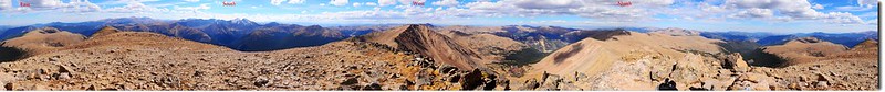
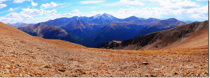
A 360° Panorama from the summit of Bard Peak
東邊望過去就是丹佛市區,丹佛市中心僅有的幾棟商業大樓隱約可見;
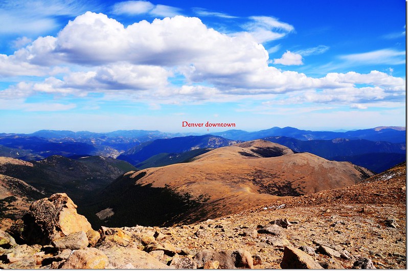
Looking east from Bard's summit, Denver downtown in the distance
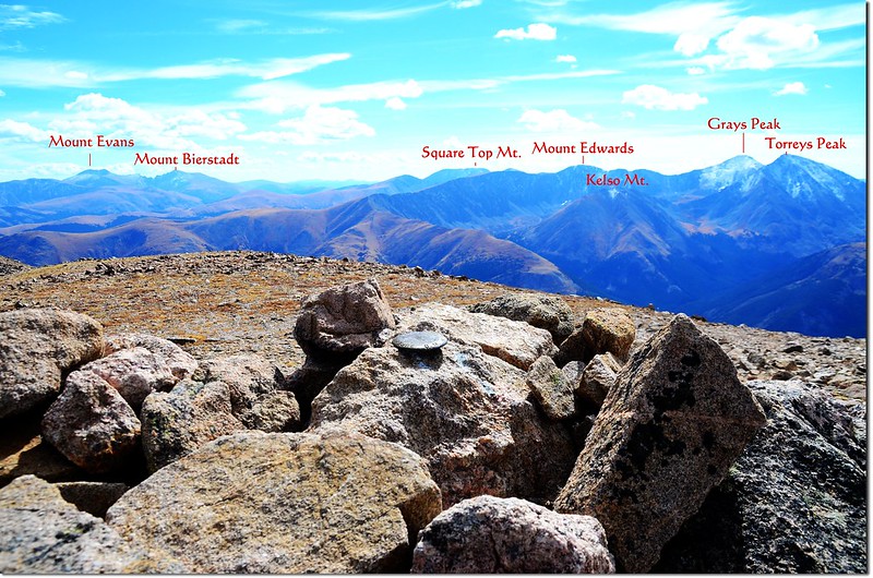
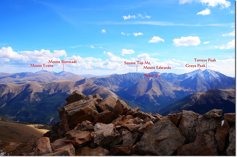
Mount Evans和Mount Bierstadt兩座14ers位在東南邊;
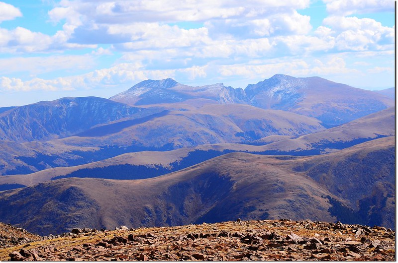
Mount Evans(L) & Bierstadt(R) from the summit of Bard Peak
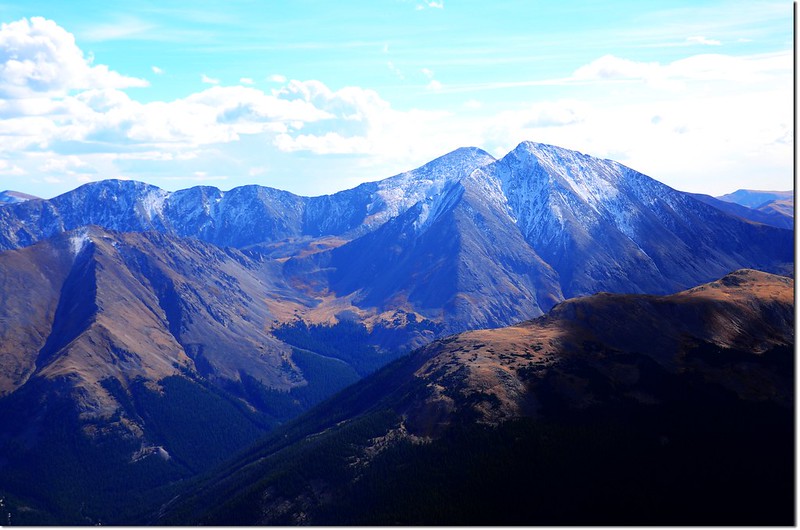
正南方則有Grays和Torrets兩座14ers;
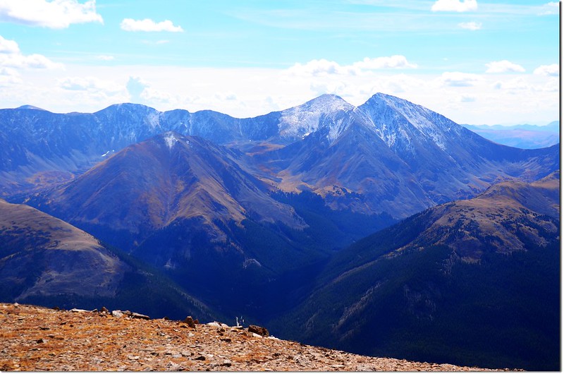
Grays(L) & Torreys Peak(R) from the summit of Bard Peak
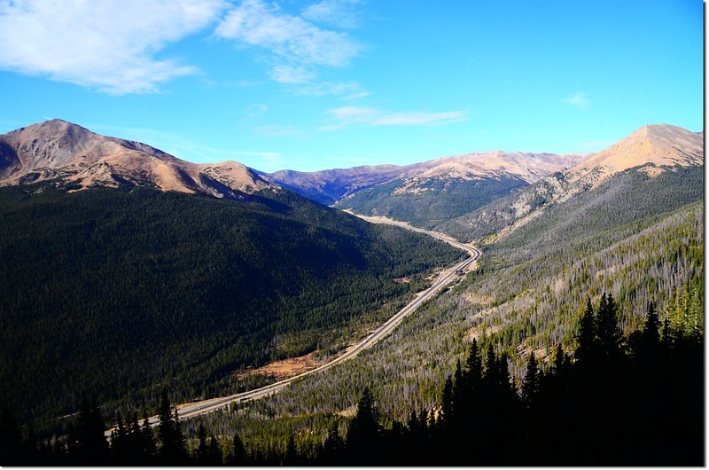
西南邊俯瞰I-70州際公路艾森豪隧道(Eisenhower -Johnson Memorial Tunnels)及Loveland Pass;
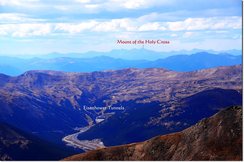
Looking down onto I-70 HWY from Bard's summit, Mount of the Holy Cross in the distance
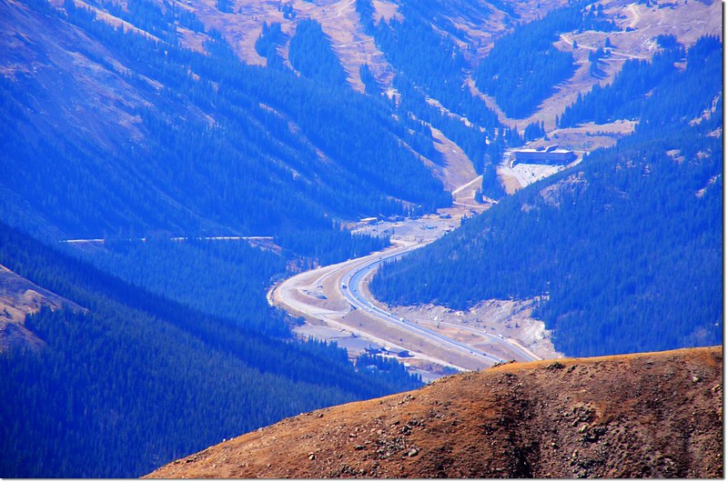
Looking down onto I-70 HWY & Eisenhower Tunnels
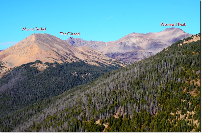
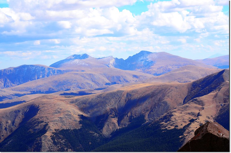
西邊是緊鄰的Mount Parnassus及剛登過的Woods Mountain和Pettingell Peak,遠處則是Gore range;
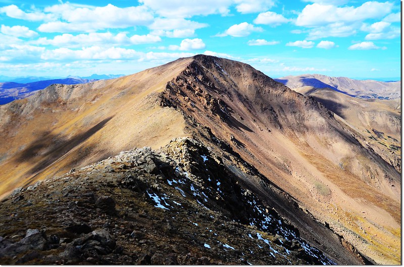
Looking west onto Mount Parnassus from Bard Peak, the ridge connecting Parnassus & Bard
目光拉到北邊,長長的山脊就是落磯山脈大陸分水嶺,另一座14ers~Longs Peak矗立在遠方。
Looking north from Bard's summit, the Rockies in the distance
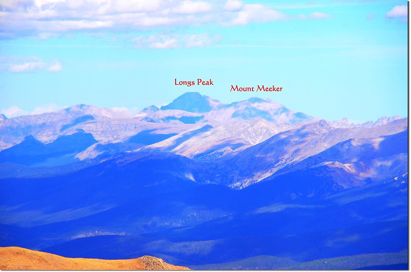
Longs Peak as seen from the summit of Bard Peak
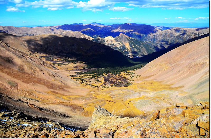
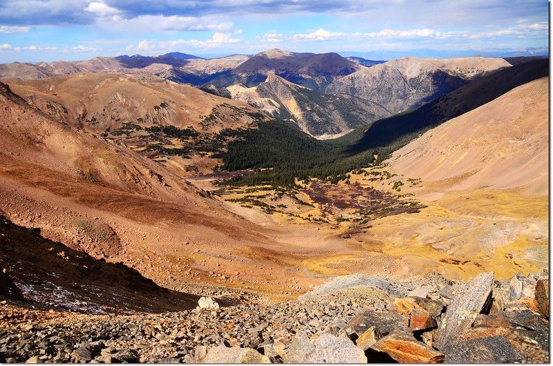
Looking down Ruby Creek Basin from the summit of Bard Peak
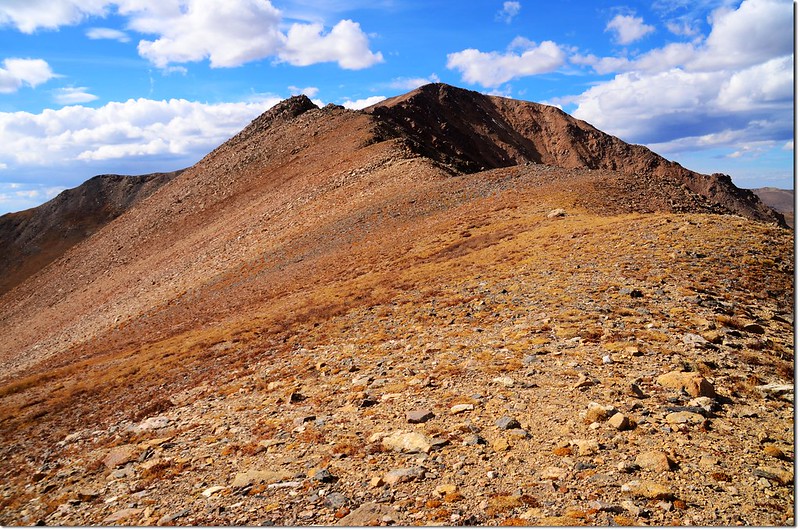
13:26 下山前往Mount Parnassus;Mount Parnassus在Bard Peak西邊直線距離約一哩左右,比此山僅低67呎(21公尺),但中間隔著一個落差604呎(184公尺)的低鞍,看紀錄走起來也不輕鬆。
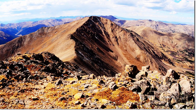
Looking west onto Mount Parnassus from Bard Peak, the ridge connecting Parnassus & Bard
沿著稜線往鞍部移動,行沒多久遇一年輕登山客從鞍部上來,聊了一下子知道他是連登Woods Mountain和Mount Parnassus後續登Bard Peak,我告訴他上禮拜我才連登Woods Mountain和Mount Parnassus,今天打算再登上Mount Parnassus,但又怕太累,他竟然說“You can do it!”並給我來個give me five鼓勵,互相祝福後分道而行。
13:42 下抵Bard Peak和Mount Parnassus間最低鞍,海拔13,037呎(3,974公尺),開始爬坡;
Bard's summit from saddle between Parnassus & Bard
Parnassus' summit from saddle between Parnassus & Bard
Ruby Creek Basin from the saddle between Parnassus & Bard
Looking south onto Grays & Torreys from the saddle between Parnassus & Bard
從最低鞍到Mount Parnassus山頂距離約一公里不到,落差537呎(164公尺),中間除了一處蠻大的巨岩小山頭較難爬外,其他路況還好。
13:58 抵巨岩小山頭,海拔約13,210呎(4,026公尺),攀登等級大約是2等;
Class II options between Parnassus and Bard
在一大片巨岩間小心攀越,不到十分鐘便越過巨岩小山頭,然後一路直攀Mount Parnassus山頂。
14:35 距上週六後再度登上Mount Parnassus,海拔13,574呎(4,137 公尺);
Bard~Parnassus ridge from Parnassus' summit
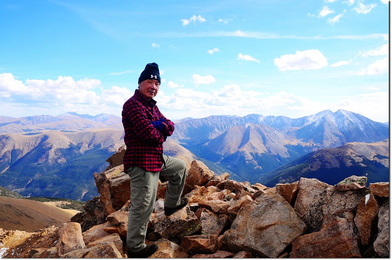
Me on the summit of Parnassus, in the background is Bard Peak
Me on the summit of Parnassus, Evans, Bierstadt, Grays & Torreys in the distance
Looking southeast from Parnassus' summit, Evans, Bierstadt, Grays & Torreys in the distance
Mount Evans & Bierstadt as seen from Parnassus' summit
Grays & Torreys Peak as seen from Parnassus' summit
西邊及西南邊烏雲密佈,且有下雨的跡象,不敢久留,拍完照後下山。
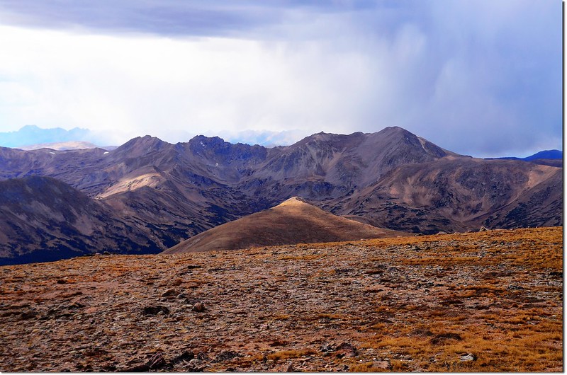
A thunderstorm is coming on a faraway mountain
14:44 沿著Mount Parnassus西坡朝著與Woods Mountain之間的鞍部下切,然後再左下切接Watrous Gulch Trail。
15:42 接Watrous Gulch Trail左轉下山。
15:54 接Bard Creek Trail (#83)岔路,右轉沿Watrous Gulch Trail返登山口。
16:30 返抵登山口,順利完成Bard Peak~ Mount Parnassus雙峰“O”形大環走,感覺良好;開車返家途中路況意外順暢,也許是週六道路沒施工,只花一個多小時便返抵Thornton女兒家。
沒有留言:
張貼留言