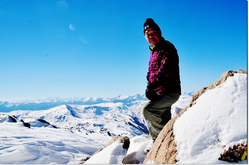
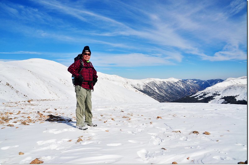
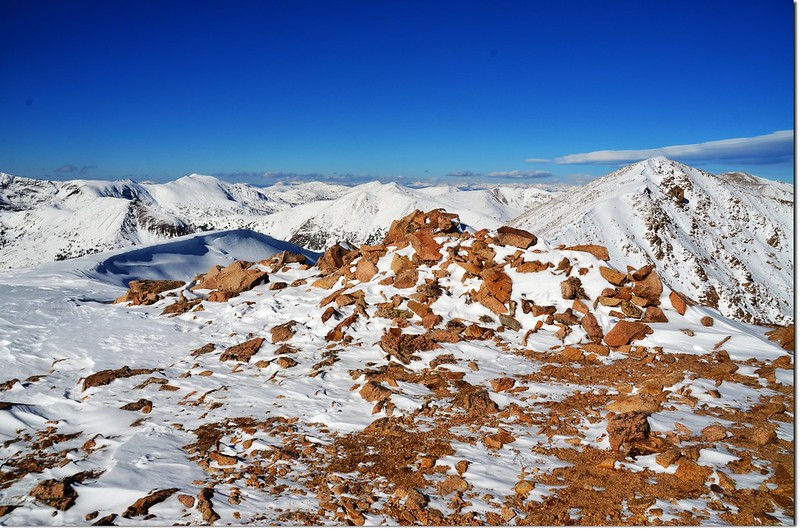
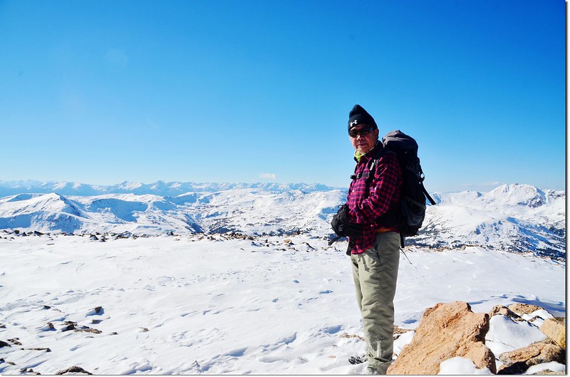
Me on the summit of Mount Sniktau
爬完這座,高山已難爬,積雪太厚了~~
從登山口開始一路在雪地裡攀爬,雪深一度達腰際,大部份達腳踝、小腿,很累~~還好這裡的雪是乾雪,天氣又超好!
攀登山岳:Mount Sniktau(海拔13,234 呎/4,034 公尺)
登山口:Loveland Pass(海拔11,990呎/3,655公尺)
總爬升高度:1,800呎/549公尺
登山里程:3.7 哩/5.92公里
登山時間:4小時
-----------------------------------------------------------------------------------------------------
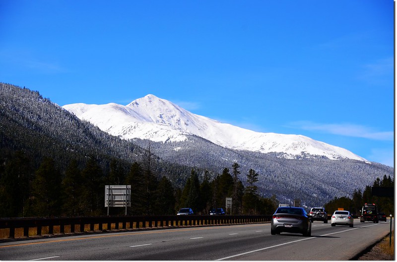
Mount Sniktau from I-70 HWY
一週來的連日陰雨綿綿,難得今天的大好晴天,本來計畫到Loveland Pass攀登海拔4,093公尺的Grizzly Peak,但因繞道Boulder去拍一些艷日下的楓葉耽誤了不少時間,抵達登山口已經十二點多,決定改爬路程較短的Mount Sniktau;Mount Sniktau是位在Loveland Pass山頂東側北邊的一座山頭,海拔13,234 呎/4,034 公尺,在科羅拉多眾多高山中排名第448名,因為此山沒有困難的地形,路程短,爬升也不高,所以在融雪之後的季節算是一座適合郊遊健行的大眾化路線,蠻受一般遊客的喜愛。
該山在八年前曾帶豆豆去爬過,當年他年僅八歲,爬到13,152峰時距山頂僅剩0.45哩,但因積雪未化而撤退,今天打算攻頂,只要積雪不要太深!
行車資訊:
由丹佛沿I-70州際公路西行,在Exit 216出口下交流道,然後行駛US-6 W上山,行約4.4哩抵達Loveland Pass山頂停車場,此為登山口,海拔11,990呎(3,655公尺)。
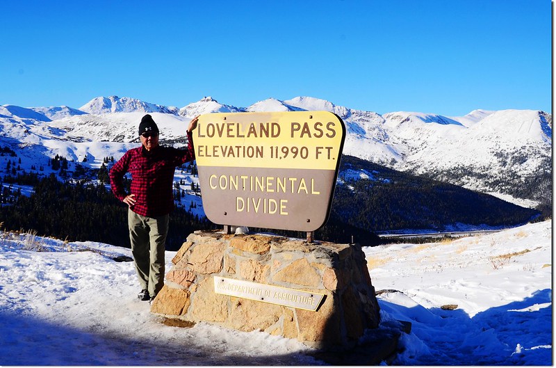
Loveland Pass' summit

登山路線
步程簡述:
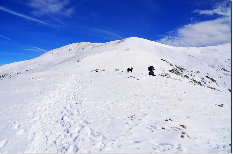
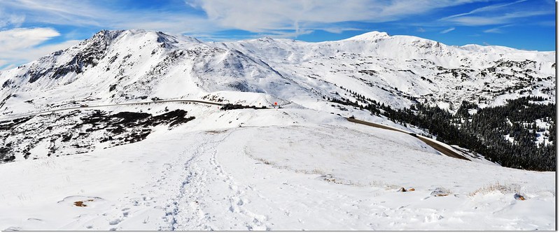
12:20 由公路東側登山口(Loveland Pass)出發上山,積雪蠻多蠻厚的,小心行走。
Up the mountain through the footsteps
Looking up onto Sniktau-Grizzly ridge from Loveland Pass above
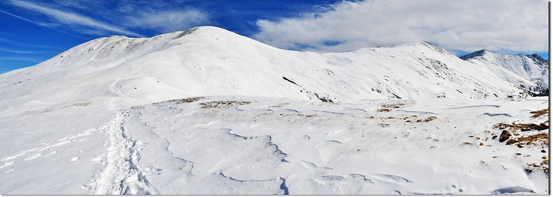
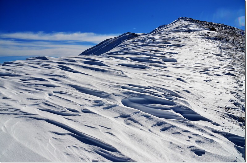
從登山口到山頂陵線約一哩路,爬升約930呎(283公尺),也算有點坡度,加上沿路積雪蠻厚的,爬起來有點吃力,四週白茫茫的,若不帶墨鏡眼睛很容易受傷害。
A part of the Continental Divide from above Loveland Pass
Overlooking south onto Arapahoe Basin Ski Area from Loveland Pass above
Overlooking southwest from Loveland Pass above, Quandary, Lincoln et al. 14ers are in the distance
Looking down onto Loveland Pass from Point 12,915' below
Overlooking down the Loveland Pass from Mount Sniktau ridge
13:20 抵稜線Point 12,915’,海拔12,915呎(3,937公尺),距登山口約一哩(1.6公里);
The 12,915' Point
Me on the 12,915' Point, in the background is the 13,152' Point
往右(南)循稜線走前往攀登Grizzly Peak,路程較遠,本來今天規畫攀登該山,但因先去Boulder拍楓葉耽誤不少時間,決定爬備案的路程較短的Mount Sniktau;
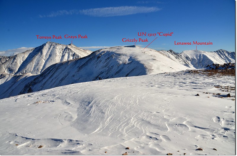
Looking southeast onto Grays, Torreys, Grizzly & Cupit from the 12,915' Point
取左稜線北上。
Looking north onto 13,152' Point & Sniktau from the 12,915' Point
從12,915呎高地先下坡到12,800呎(3,901公尺)左右開始緩坡往13,152呎高地爬升,積雪越來越厚,深達小腿肚,一路踩著之前登山客留下的足跡前進。
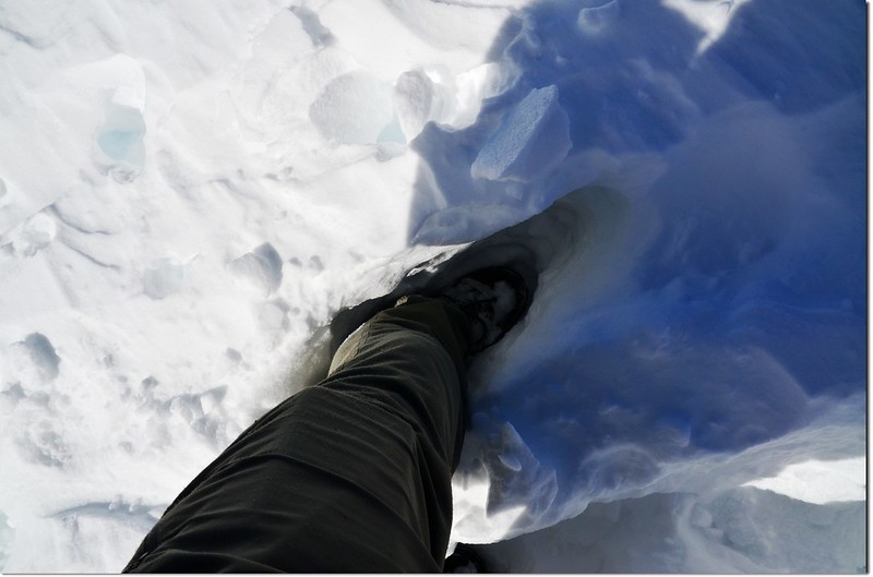
The snow is so deep that it reaches up to my leg
Looking back at the 12,915' Point on the way to 13,152' Point
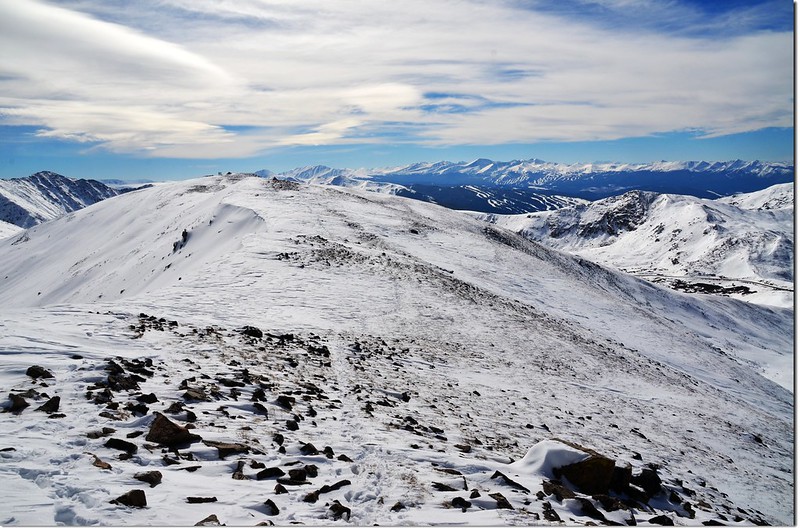
13:50 登抵13,152呎高地(Point 13,152’),海拔13,152呎(4,009公尺),距登山口約1.4哩(2.24公里);循之前登山客的足跡由西側腰繞而過。
Point 13,152'
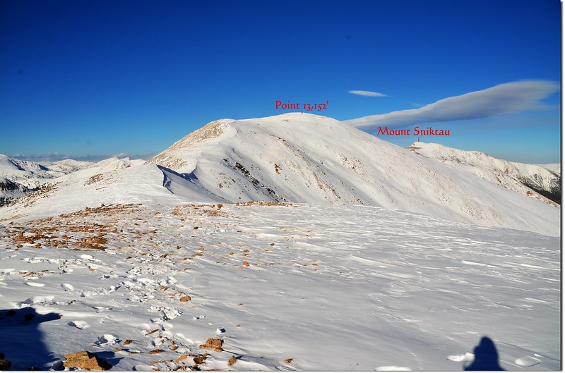
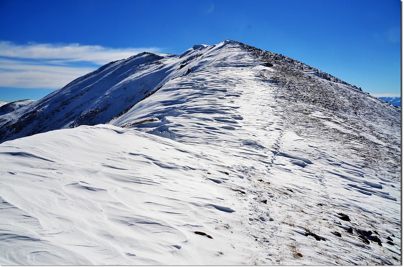
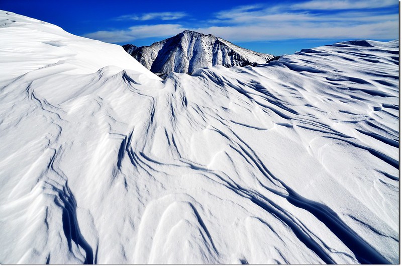
腰繞過13,152呎高地後便可見到Mount Sniktau的山頭矗立在北方偏東的不遠處,但中間隔著一處落差約150呎的低鞍,必須先下到低鞍處再爬升約240呎左右才能登頂。
Overlooking northeast onto Sniktau's summit from the 13,152 Point
Mount Sniktau's summit as seen from point 13,152'
積雪越來越厚,根據經驗美國的高山山頂幾乎是亂石堆,沒積雪還好,有明顯的路跡可依循,積雪後完全看不出路跡,所以雪下的地形可能暗藏危機,增加不少危險性,還好一路留有之前登山客的足跡,一路依循足跡前進還不至太困難。
14:00 下抵13,152呎高地與Mount Sniktau山頂之間的最低鞍,海拔約13,000呎(3,962公尺),距登山口約1.6哩(2.56公里);
Looking back at the 13,152' Point from the saddle between Sniktau & 13,152' Point (鞍部回望13,152高地)
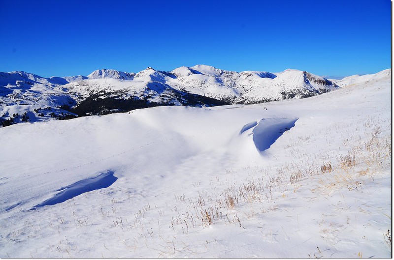
Snow dimples with Point 13,152' behind it
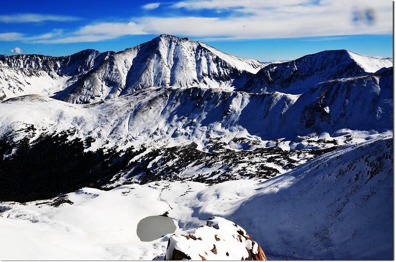
Snow dimples with Torreys Peak behind it(凸出山頭是距此三哩多、海拔4,349公尺的Torreys Peak)
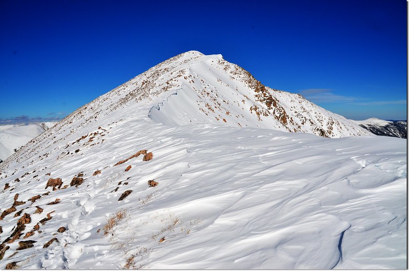
The final push to the summit of Sniktau from the saddle at 13,002' on the Southwest Ridge (鞍部北望Sniktau山頂)
接下來要爬升約近三百呎(91公尺)。
Mount Sniktau東面坡是從稜線即垂直下切的懸崖峭壁,西面坡雖然也很陡,但陡坡面與稜線之間尚有一段蠻安全的斜坡,由於積雪很厚,無法判斷積雪底下的地形,所以登山客都將行進路線盡量往下移,遠離稜線以策安全,我很想上到稜線看看稜線下的風光,但最終還是不敢越雷池一步,深怕一步踩空掉到懸崖下去,還是乖乖的跟著足跡前進。
Looking southeast onto Torreys, Grizzly, Cupit & 13,152 Point from Sniktau's summit down below
Looking southwest from the summit of Mount Sniktau down below
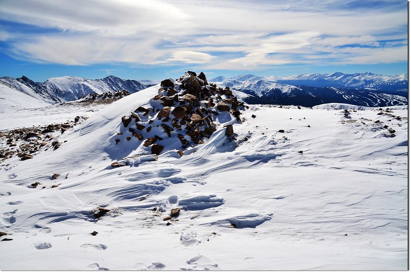
14:20 終於登上Mount Sniktau山頂,積雪已將山頂上兩座石頭堆砌的避風角覆蓋住,可想而知積雪有多厚,剛才一度下陷到腰際,所以在雪地裡走路還真需步步小心呢!
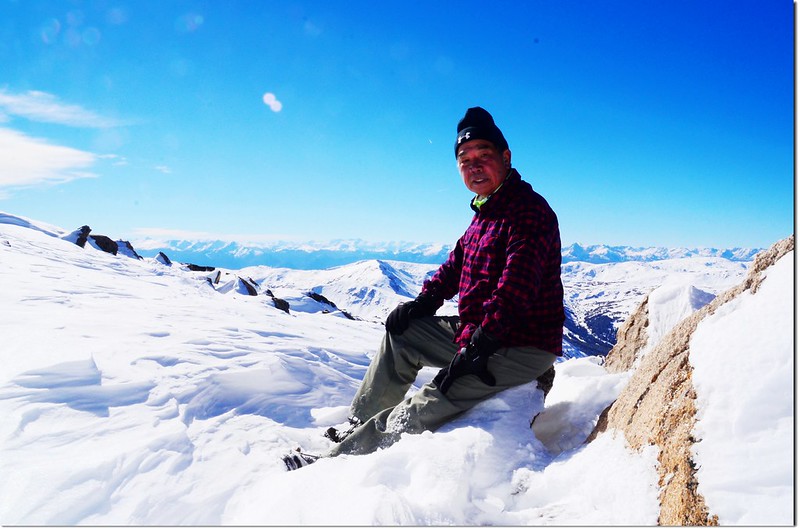
Me on the summit of Mount Sniktau
Mount Sniktau標高13,234 呎(4,034 公尺),登山口到此約1.85哩(2.96公里);今天是一個禮拜以來難得的好天氣,萬里無雲,陽光普照,山頂風勢也不大,溫度應有四十幾度(華氏)以上,遠眺四週的白茫茫的山景甚為壯觀!
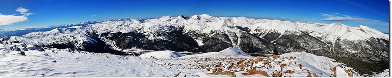
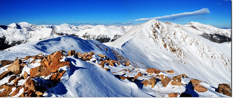
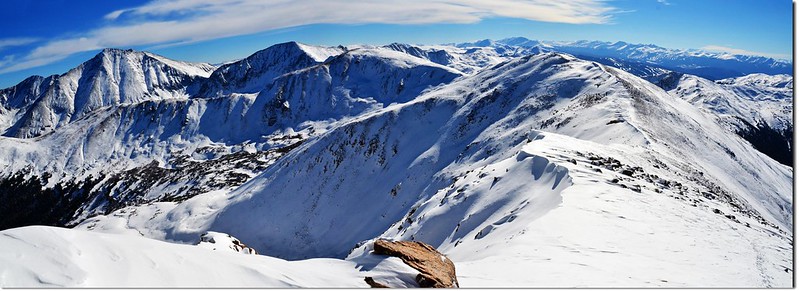
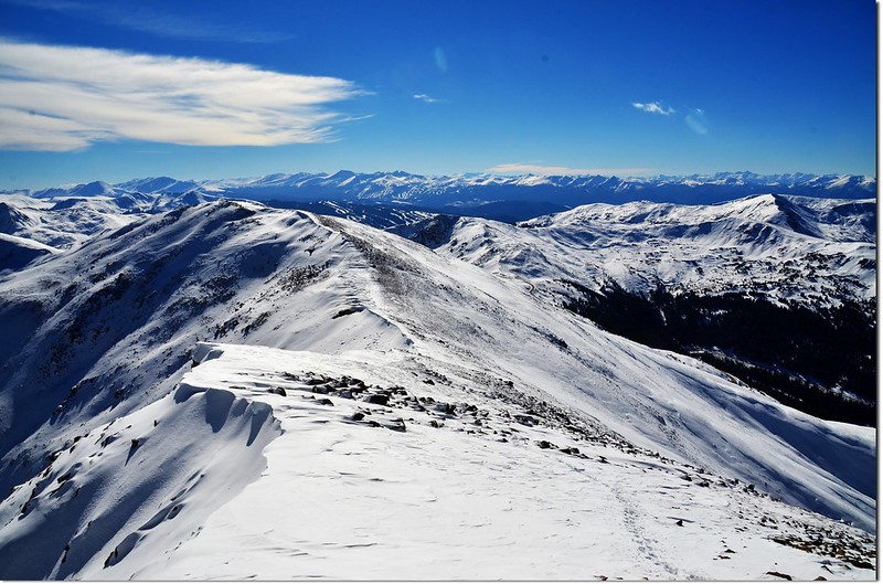
A 180° Panorama from the summit of Mount Sniktau(southwest to northeast)
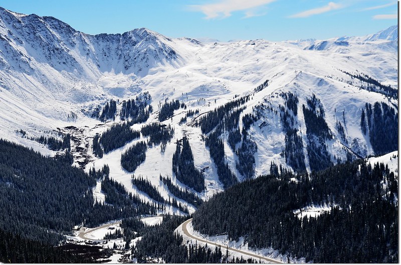
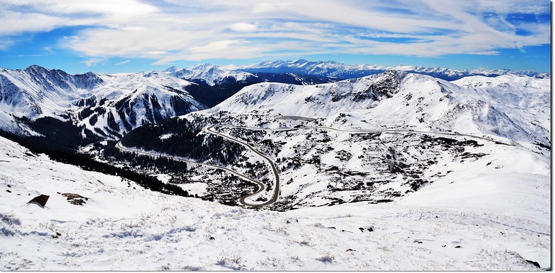
東邊俯瞰I-70州際公路;每每從I-70州際公路經過總是仰望這座山型不錯的高山,今天總算能站在這山頂上俯瞰那常走的I-70州際公路了。
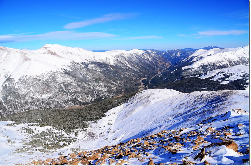
After seeing Mt. Sniktau countless times from Interstate 70, I could finally look down at the upper Clear Creek valley and Interstate 70 from the summit.
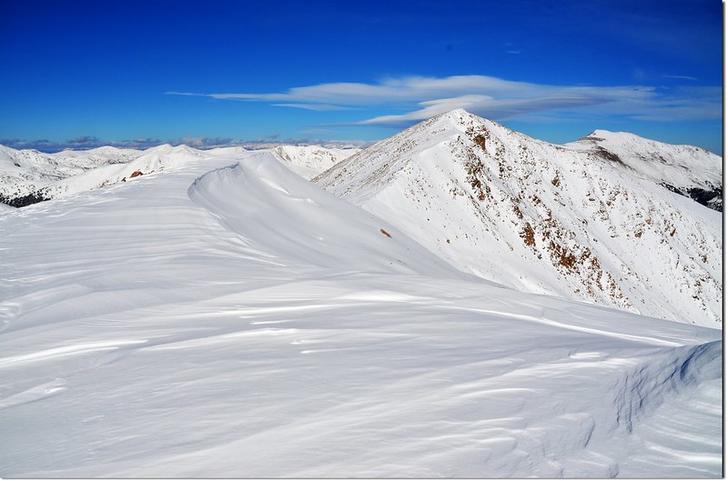
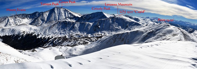
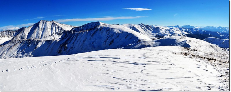
東南邊遠眺Mount Evans, Grays & Torreys Peaks等三座14ers,南邊則是另一座本來今天要攀登的13ers~Grizzly Peak以及整個稜線。
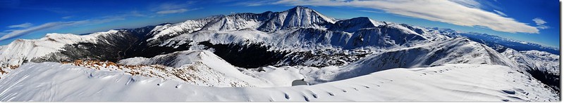
Looking northeast to south from the summit of Mount Sniktau
Looking southeast from the summit of Mount Sniktau
Grays, Torreys, & Grizzly Peaks as seen from the summit of Mount Sniktau
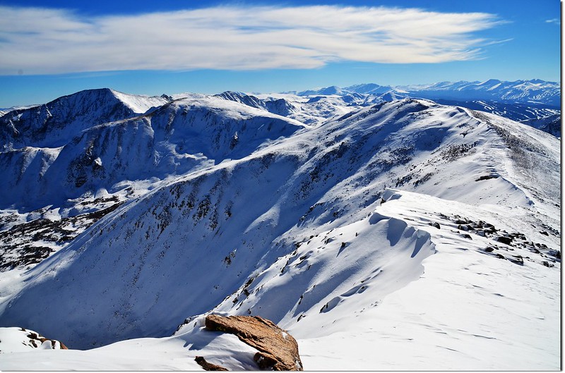
The ridge that connects Sniktau & Grizzly from the summit of Mount Sniktau
Point 13,152' as seen from the summit of Mount Sniktau
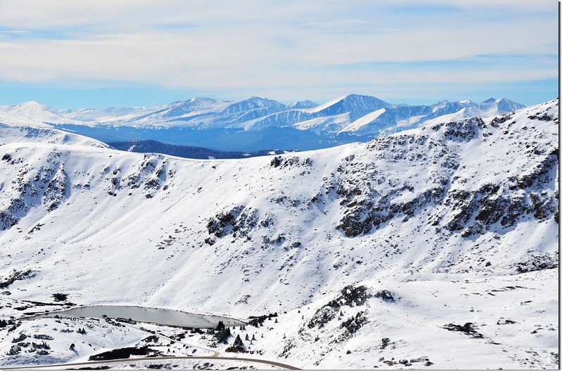
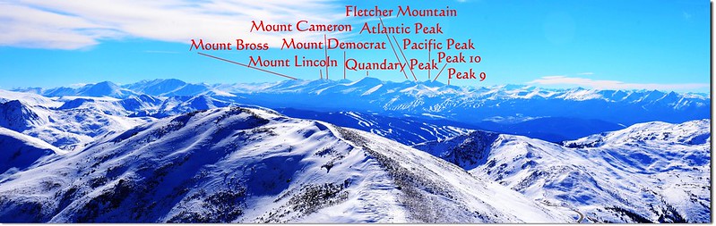
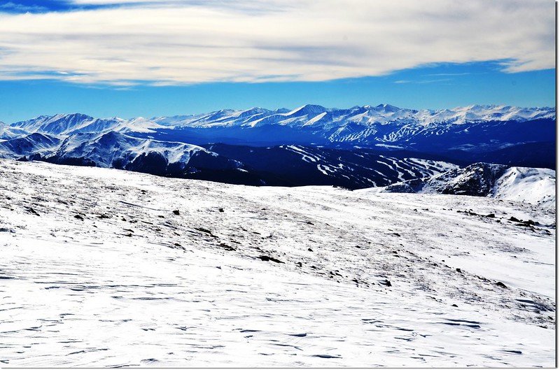
西南邊一直到西邊近處可俯瞰Loveland Pass, I-70州際公路及艾森豪隧道(Eisenhower Tunnels),遠處則可遠眺Quandary Peak和Mount Lincoln等好幾座14ers。
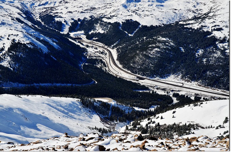
Overlooking down onto Eisenhower Tunnels from the summit of Mount Sniktau
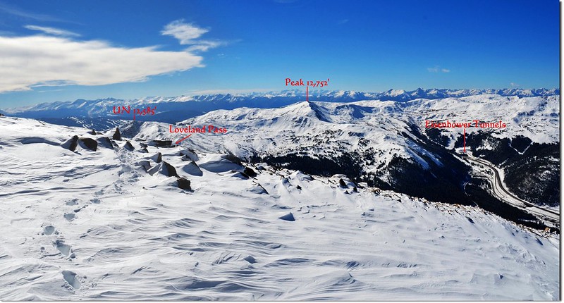
Looking southwest from the summit of Mount Sniktau
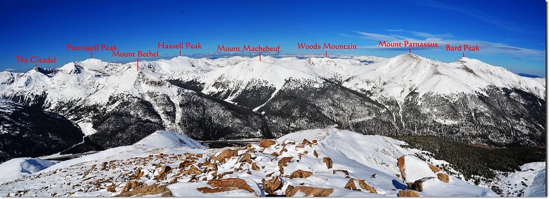
北邊則是綿延千里的落磯山脈大陸分水嶺數不清的高山,尤其是這兩個禮拜攀登的四座山頭Pettingell, Woods, Parnassus和Bard就在眼前,還好早一步攀登,現在去就難了,沒雪地登山配備~~
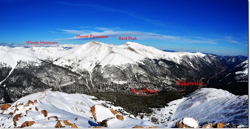
Looking northeast onto Woods, Parnassus & Bard Peak from the summit of Mount Sniktau
Looking north from the summit of Mount Sniktau

Mount Parnassus(L) & Bard Peak(R) as seen from the summit of Mount Sniktau
14:43 賞完景後循原路下山。
15:03 下底最低鞍,往13,152’高地上攀。
15:15 登上13,152呎高地,此次不腰繞直攻山頂賞景。
Me on the Point 13,152'
Overlooking southwest from the 13,152' Point, Quandary, Lincoln et al. 14ers are in the distance
Looking southeast onto Grays, Torreys & Grizzly Peak from the 13,152' Point
15:25 從13,152高地下撤,先下一小段蠻陡又有點難走的亂石坡後續沿雪地往12,915高地移動。
15:45 返抵12,915呎高地,取右沿原路下山。
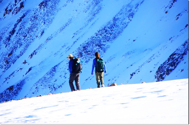
Hikers on their way down the mountain
16:20 返抵登山口,來回共四個小時,若沒積雪此山應可在三個半小時內完成。
沒有留言:
張貼留言