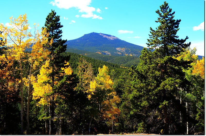
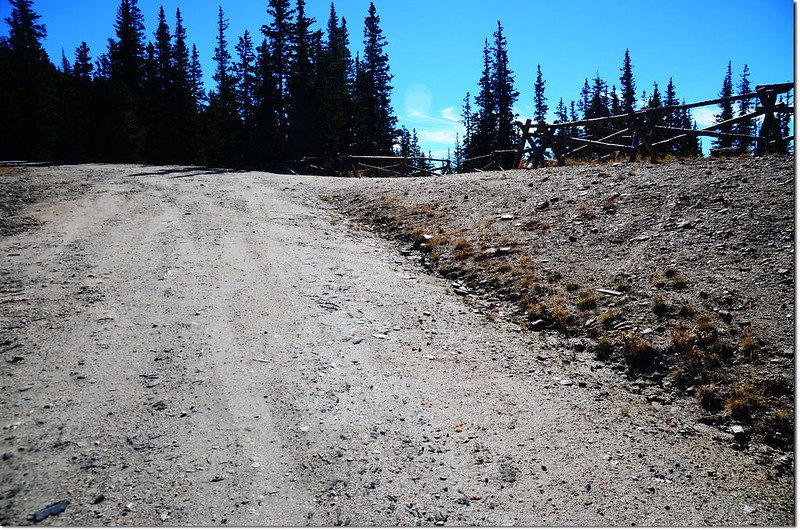
Squaw Mountain from Squaw Pass Road
週四(8)本來計畫上Mount Evans拍拍Summit Lake和Mount Evans的雪景,但上網一查才知道在這個禮拜一該道路已季節性封閉,只好臨時改變計畫,到附近爬一座小山Squaw Mountain,從山頂遙望Mount Evans過過乾癮~~
-----------------------------------------------------------------------------------------------------
攀登山頭:Squaw Mountain(海拔11,486呎 / 3,501公尺)
登山口:Squaw Mountain Trailhead(海拔10,634呎 / 3,241公尺)
總爬升高度:約1,200呎(366公尺)
登山里程:來回約4.75哩(7.6公里)
登山時間:2小時45分
-----------------------------------------------------------------------------------------------------
行車資訊:
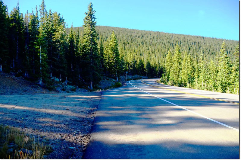
從Denver沿I-70州際公路西行,抵Exit 252時下交流道再沿CO-74 (Evergreen Parkway)南行,約3.4哩後右轉Squaw Pass Road,沿著Squaw Pass Road西行約12哩即抵達Squaw Mountain的登山口,登山口在左側(南),是一條不小的石子路,約在Squaw Pass Road里程牌19 miles左右;登山口沒明顯標示,只有一個高塔圖案下寫Squaw的木牌及一根“Shooting Regulations”的告示牌。

Squaw Mountain from Squaw Pass Road
Squaw Mountain Trailhead
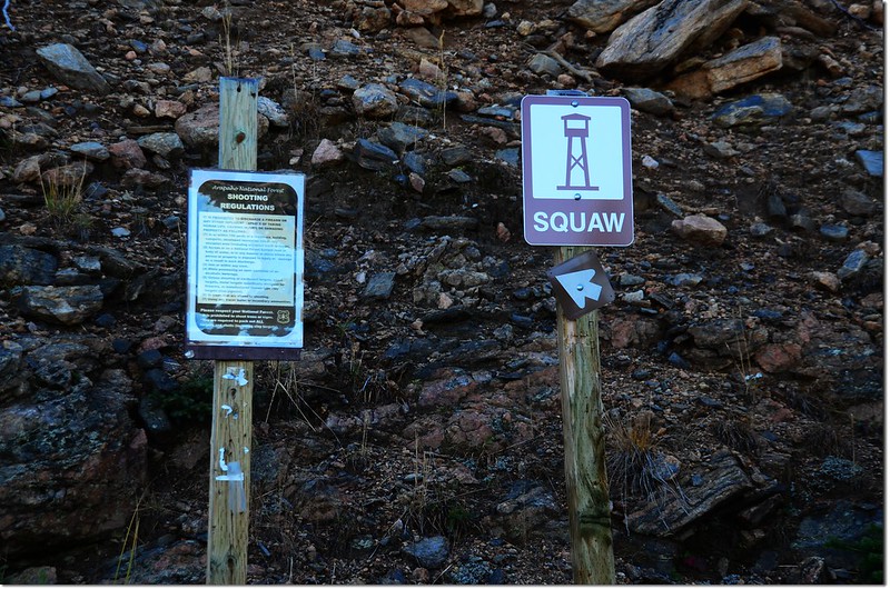
The sign on the trailhead
步程簡述:
10:00 登山口出發,沿Forest Service 192.1石子路上行,該石子路四傳車可一路直達山頂,但約0.5哩後的鞍部上去不遠即有柵門擋路,一般車輛不准通行;一般小車可開到鞍部停車,我們選擇走路上山。
Squaw Mountain Road
10:11 抵達岔路口,距登山口約0.4哩;左下岔路是 Forest Service 252.1D石子路,右上是Old Squaw Pass Road,取直沿Squaw Mountain Road(Forest Service 192.1)續行;沿途槍聲不斷,別怕,這區域是合法的射擊區域,登山口有一個“Shooting Regulations”的告示牌,我沒仔細看其內容。
10:19 抵達稜線鞍部,一般車輛可開到此停車,距登山口約0.6哩;
The saddle between Squaw Mountain & Papoose Mountain
右邊(西)往Papoose Mountain,左邊(東)往Squaw Mountain,取左彎沿石子路續上行。
10:22 抵達柵門管制處,距登山口約0.7哩;非公務或租瞭望台住宿之旅客車輛無法進入,繞過柵門續行,此後約有一哩半的步道是幾處的“之”字彎道,步道坡度不大,行來輕鬆。
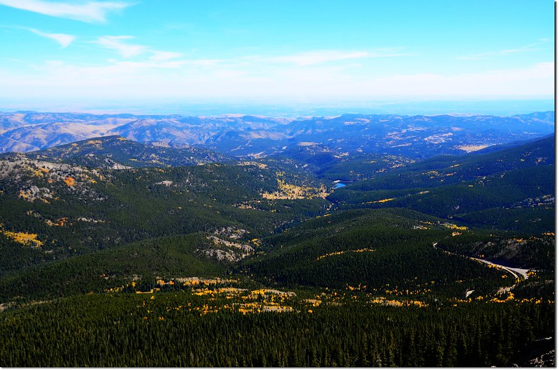
Mount Evans from Squaw Mountain Road
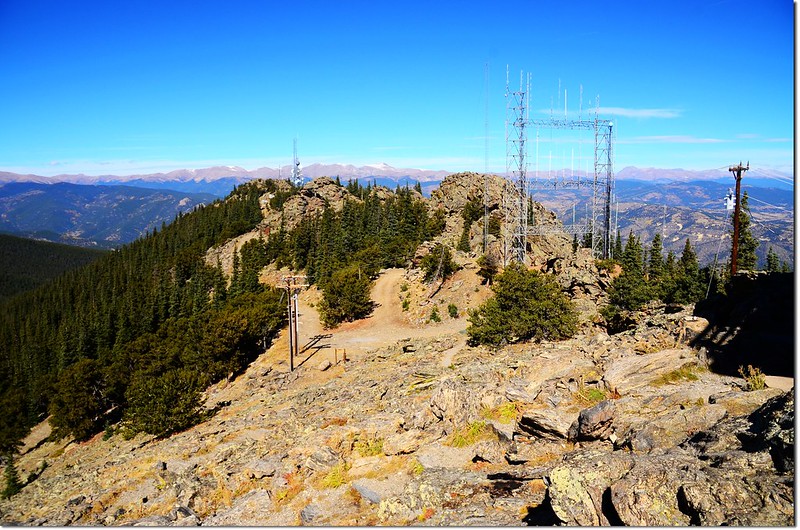
10:49 岔路,左直行往山頂稜線西北邊第一座通訊發射塔,取右彎往森林防火瞭望台(Fire lookout tower)。
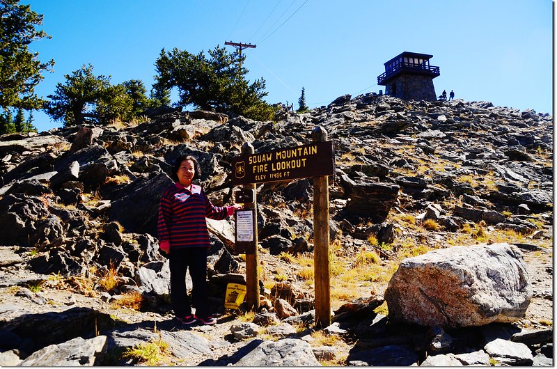
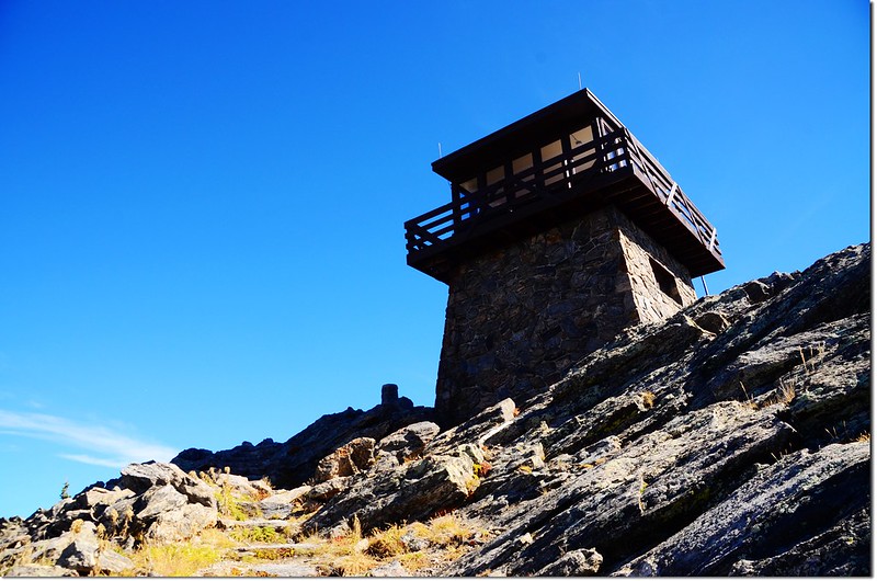
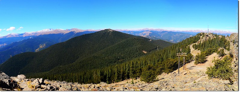
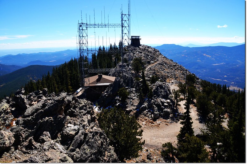
Squaw Mountain山頂是一條西北-東南走向長達半哩的稜線山脊,在這山脊上有三個獨立的山頭,在最東南邊最高的的山頭上有一座建於1940年的石砌二層建築森林防火瞭望台,另外兩個較低的山頭沒有建築物,但小心攀爬仍可攀登到最高點;在這山脊上也建有幾處通訊發射塔,遠處望來有點像是高雄中寮山的縮小版。
10:52 抵瞭望台下方,立有一座“Squaw Mountain Fire Lookout Elev. 11,486 ft.”的木製標示牌,此為行車終點,由標示牌左側沿石階路上山。
Overlooking up on lookout tower from near the summit
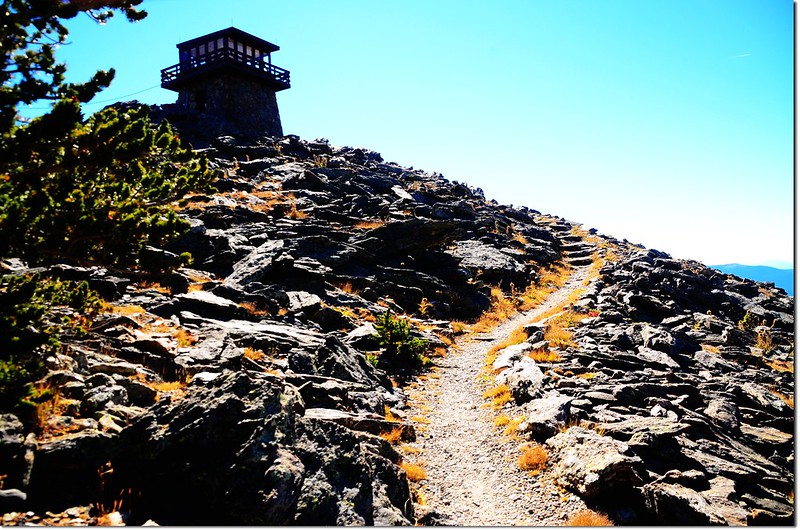
Overlooking up on lookout tower from near the summit
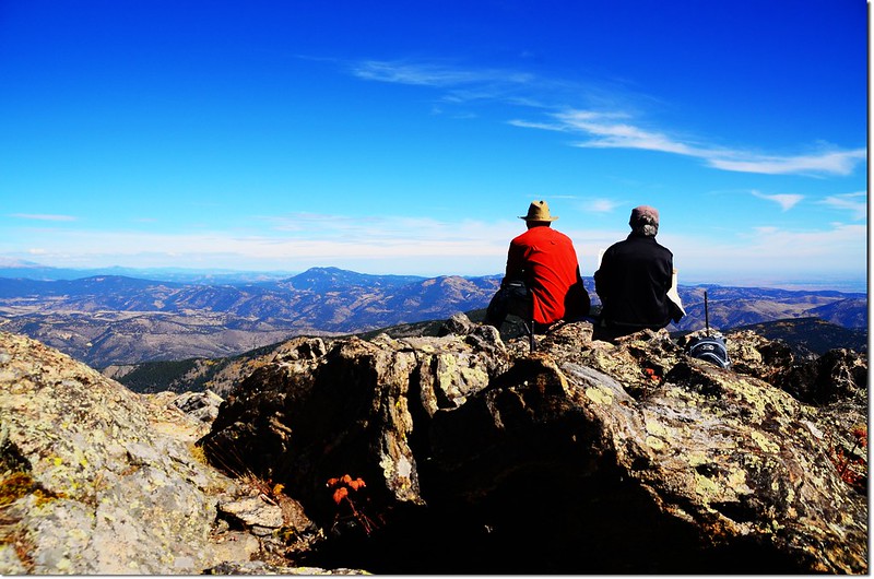
10:55 登頂Squaw Mountain東南方最高山頭防火瞭望台;

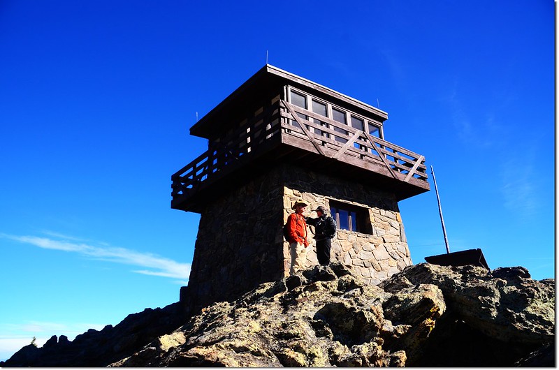
Squaw Mountain Fire Lookout Tower
The summit of Squaw Mountain
該瞭望台可出租住宿,內部廚房、客廳、臥室一應俱全,還有供電,唯一不便是無水,租住此處須自備飲用、盥洗水。
瞭望台一樓唯一的門及室外上二樓的樓梯皆上鎖,無法參觀;瞭望台的南邊及東南邊各有一座室外廁所及野餐桌;
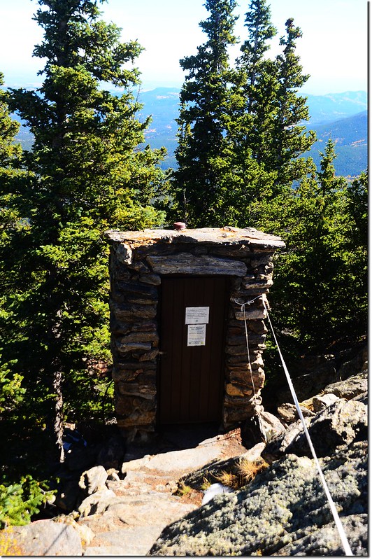
An old outhouse just below the summit tower(室外老廁所)
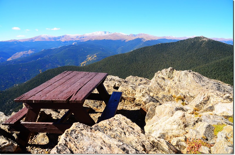
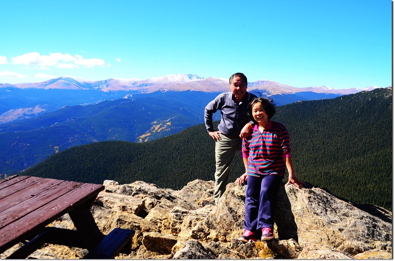
The picnic table on the summit
Squaw Mountain山頂有360度的極佳展望,東邊俯瞰東部大平原(Eastern Plains);
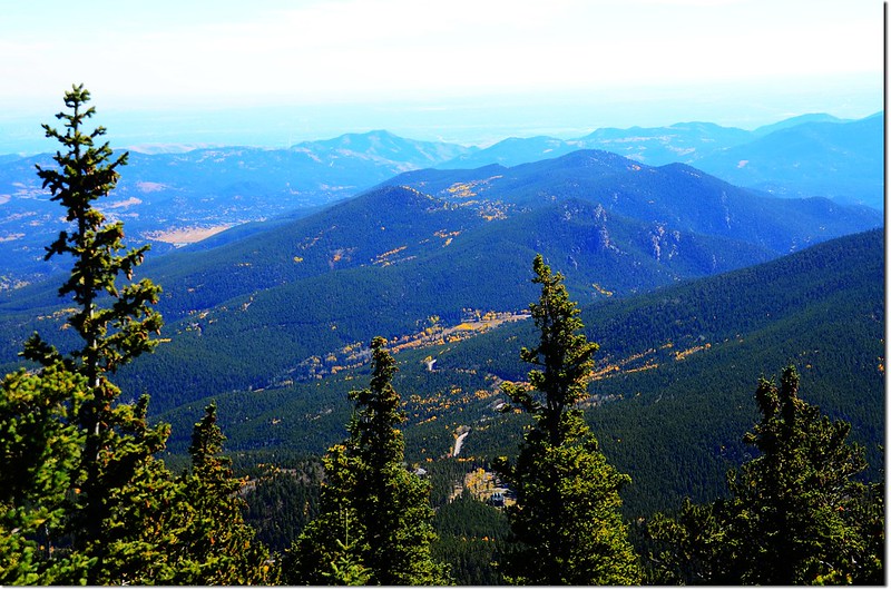
Overlooking down on Squaw Pass from the summit of Squaw Mountain
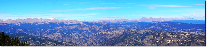
南邊最遠可遠眺海拔14,115呎(4,302公尺)的Pikes Peak;
View to south from the summit of Squaw Mountain
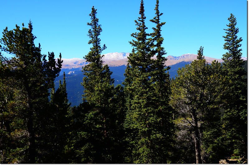
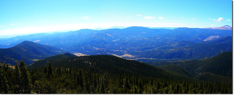
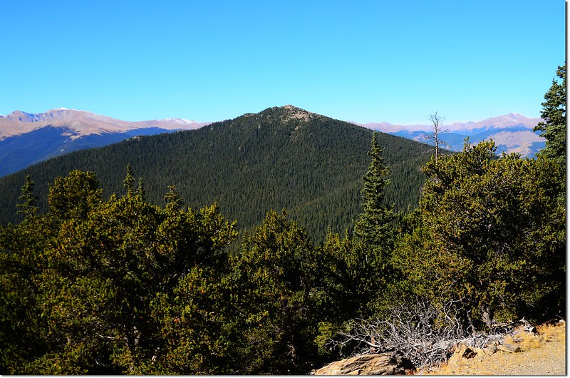
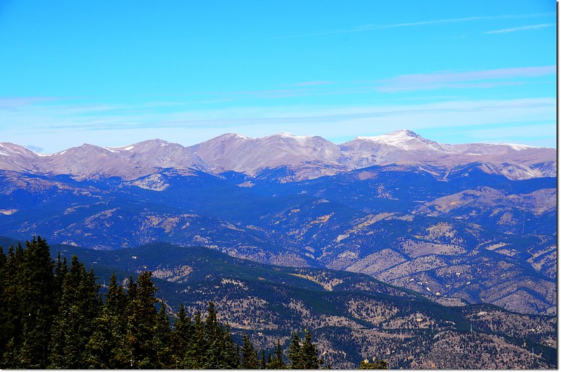
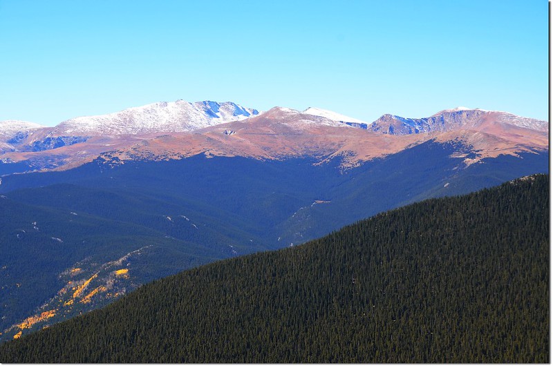
西邊則有Mount Evans和James Peak Wilderness的幾座高山;
View west & north into Indian Peaks & Rockies from the summit of Squaw Mountain

Mount Evans Area & Chief Mountain from Squaw Mountain
View west into Mount Evans & James Peak Wilderness from the summit of Squaw Mountain
Chief Mountain from Squaw Mountain
Squaw Mountain's communication tower studded summit with the peaks of James Peak Wilderness in the background
北邊則可極眺Indian Peaks Wilderness和落磯山脈幾座高山。
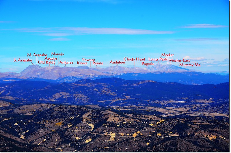
View north into Indian Peaks & Rockies from the summit of Squaw Mountain
在瞭望台外休息、瀏覽風景後下山,續往西北邊不遠的第二(中間)高點;第二高點整個也是一座岩石山頭,但此沿石山頭無路可上,只好自行找路攀岩而上,有一點難度。
11:26 登上Squaw Mountain中間的山頭,此山頭沒有通訊高塔的阻隔,更能清楚看到北方的Indian Peaks和落磯山脈幾座高山。
The middle summit of Squaw Mountain
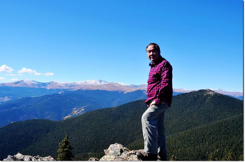
Me on the middle summit of Squaw Mountain, Mount Evans Area are in the background

Longs Peak from the summit of Squaw Mountain
James Peak Wilderness from Squaw Mountain
Mount Evans Area from Squaw Mountain
Overlooking down on Squaw Pass from the summit of Squaw Mountain
View to southeast from the middle summit
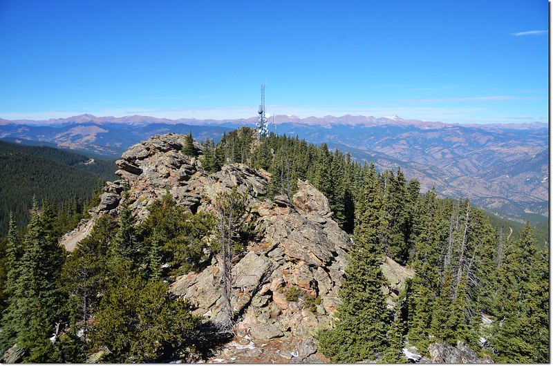
View to northwest from the middle summit
從中間高點下來後和太座又上瞭望台休息一陣子後再下山,下山我們僅花50分鐘,此山來回含山頂休息僅用去2小時45分鐘,輕鬆的一座小山頭 。
沒有留言:
張貼留言