Athabasca Falls
Tangle Creek Falls
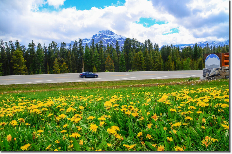
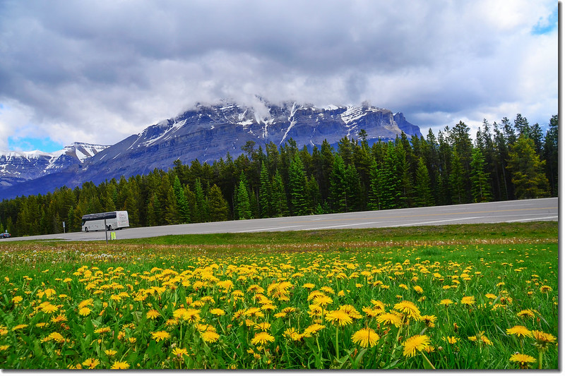
今天的行程是由Jasper開車沿前天開過的93冰原公路南下到今晚的住宿地~~露易絲湖村莊(Lake Louise Village),沿途遊覽前天路過沒時間進去參觀的阿薩巴斯卡瀑布(Athabasca Falls)、森瓦普塔瀑布(Sunwapta Falls)等瀑布,下午抵達露易絲湖村莊(Lake Louise Village)的住宿旅館~~ HI-Lake Louise Alpine Centre,該旅館是一間連鎖青年旅館,位處Lake Louise Village,距露易絲湖僅四公里,開車約8分鐘,露易絲湖畔的路易斯湖城堡酒店(Chateau Lake Louise)住不起,Lake Louise Village附近的旅館是不錯的選擇。
----------------------------------------------------------------------------------------------------------
10:20 由Jasper出發,沿著93冰原公路南下,93冰原公路東南行約30公里右岔路(93A公路)往阿薩巴斯卡瀑布(Athabasca Falls),右轉行約450公尺即抵達阿薩巴斯卡瀑布(Athabasca Falls)停車場。
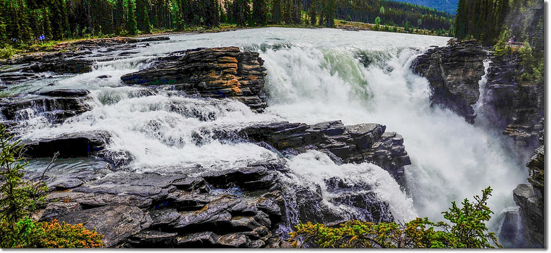
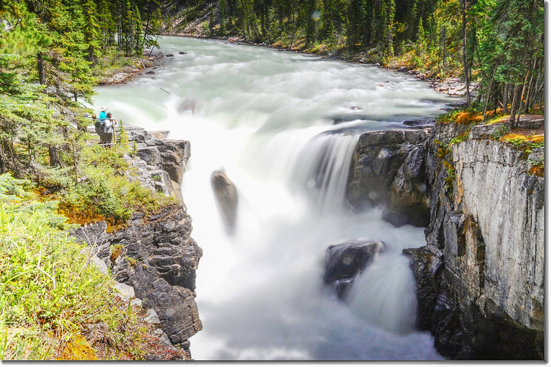
11:00 抵達阿薩巴斯卡瀑布(Athabasca Falls)停車場,阿薩巴斯卡瀑布(Athabasca Falls)週邊有完整步道系統讓遊客從不同角度觀看阿薩巴斯卡瀑布(Athabasca Falls),感受其磅礡的氣勢。

Athabasca Falls with Mount Kerkeslin as a Backdrop (Jasper National Park)
Athabasca Falls from different viewpoint


Athabasca Falls
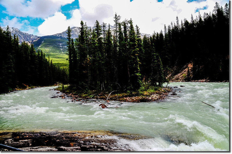
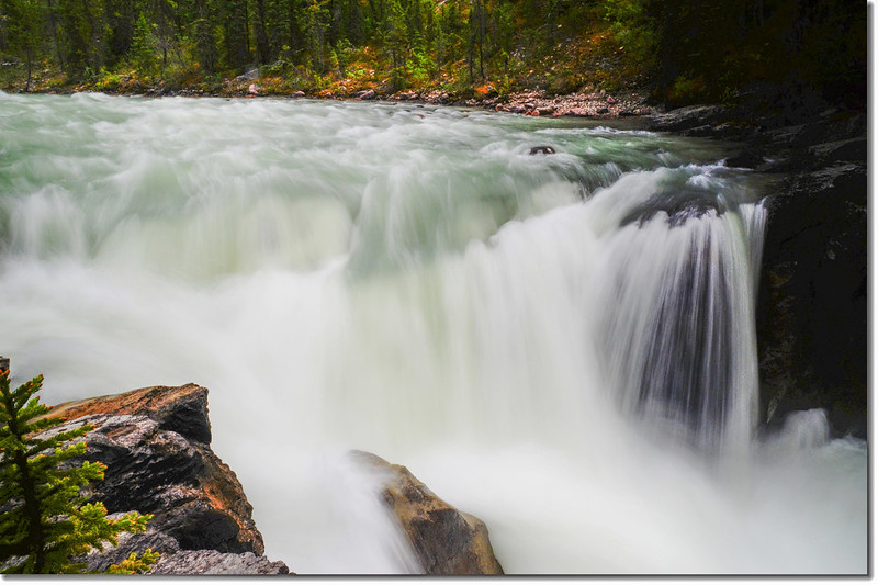
阿薩巴斯卡瀑布(Athabasca Falls)是賈斯伯國家公園(Jasper National Park)裡阿薩巴斯卡河(Athabasca River)的一個著名瀑布,而阿薩巴斯卡河(Athabasca River)的河水則來自阿薩巴斯卡冰川(Athabasca Glacier);阿薩巴斯卡河多年來沖刷著這些堅硬的石頭才造就現在大家眼中的阿薩巴斯卡瀑布 (Athabasca Falls)。


Athabasca Falls with Mount Kerkeslin as a Backdrop (Jasper National Park)
阿薩巴斯卡瀑布(Athabasca Falls)高度雖然只有20多公尺,但它的水流湍急,水量超大,水聲滔天,極具震撼力,它流經的峽谷被水流長年沖刷,形成垂直懸崖的形狀特別有特色。


Athabasca Falls
12:20 在阿薩巴斯卡瀑布(Athabasca Falls)停留了一個多小時才離開瀑布續往南行。
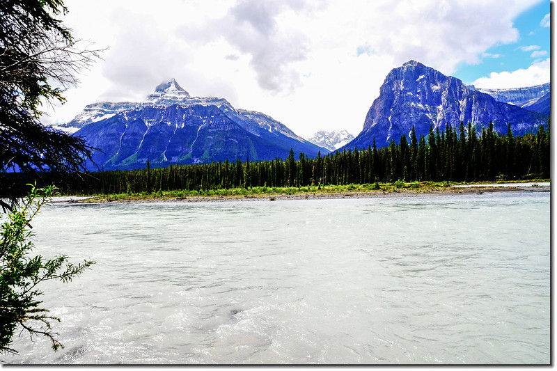
12:34 從阿薩巴斯卡瀑布(Athabasca Falls)出來接93冰原公路南行約10公里路右有一處野餐區,我們進去野餐,並隔著阿薩巴斯卡河(Athabasca River)遙看對面的高山雪景。

The Athabasca River and a Mountain View (Jasper National Park)

Mount Christie from picnic area along Icefield Parkway


The Athabasca River and a Mountain View (Jasper National Park)

Mount Xerxes from picnic area along Icefield Parkway
Mount Fryatt from picnic area along Icefield Parkway
13:00 離開野餐區續往東南行。
13:10 離開野餐區冰原公路東南行約13.3公里遇右岔往森瓦普塔瀑布(Sunwapta Falls),右轉再行500公尺即抵達森瓦普塔瀑布(Sunwapta Falls)停車場。
森瓦普塔瀑布(Sunwapta Falls)是一個在森瓦普塔河(Sunwapta River)上的瀑布,其落差約18.5公尺,夏天瀑布的流量會因上游冰川融雪所帶來的水而上升。
Sunwapta River Falls, Jasper National Park, Alberta, Canada


 Sunwapta Falls
 13:35 離開森瓦普塔瀑布(Sunwapta Falls),車子續往東南行,行約39.4公里來到史德菲爾德冰川(Stutfield Glacier) 觀景點,該觀景點在道路右側,空地上置有望遠鏡、長座椅。
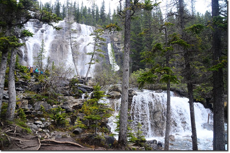
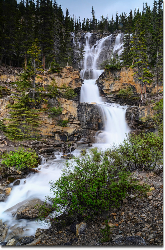
14:24 由史德菲爾德冰川(Stutfield Glacier) 觀景點續東南行1.6公里路左有一處頗大的流瀑,即是坦格瀑布(Tangle Creek Falls)。
Tangle Creek Falls
坦格瀑布(Tangle Creek Falls)的水勢不是一舉傾瀉,而是順著地表層層落下,遊客就是喜愛欣賞這種層疊向下滑落的水流;

Tangle Creek Falls
如果有興趣還可由冰原大道(Icefield Parkway)往上爬到上層瀑布底下感受那磅礡的氣勢,但山徑陡峭,岩石濕滑,攀爬宜特加小心。


Upper Tangle Creek Falls
14:50 離開坦格瀑布(Tangle Creek Falls)車子續往東南行。
14:57 經過阿撒巴斯卡冰川(Athabasca Glacier),天氣不好加上前天已參觀過沒多做停留。
15:49 經過The Crossing Gas Station and Store,小休後續行。
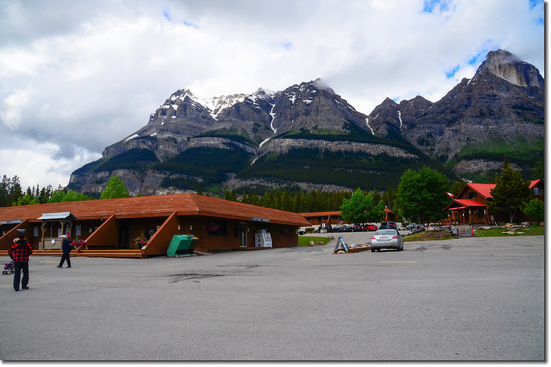
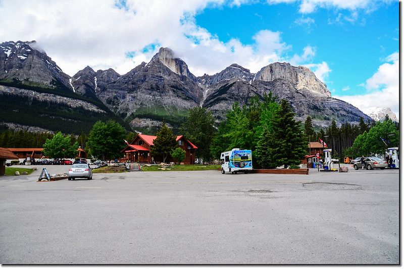
The Crossing Gas Station and Store
Mountains view from The Crossing Gas Station and Store facing south
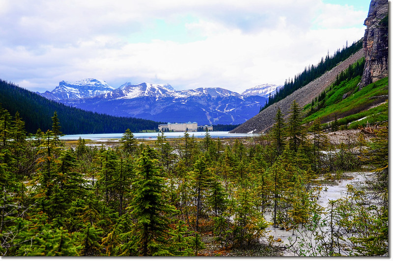
16:50 抵達今晚的住宿地HI-Lake Louise Alpine Centre (Canadian Alpine Centre International Hostel),此處是Lake Louise Village,距露易絲湖(Lake Louise)僅約4公里,幾分鐘的車程。


HI-Lake Louise Alpine Centre (Canadian Alpine Centre International Hostel)
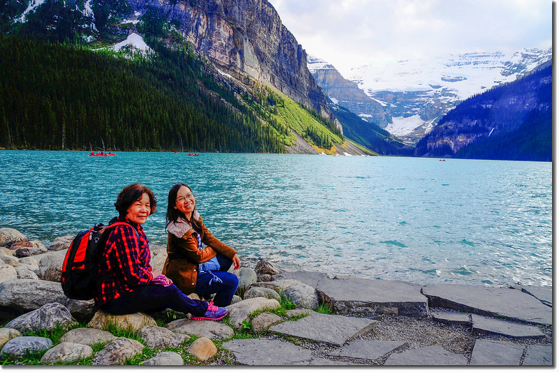
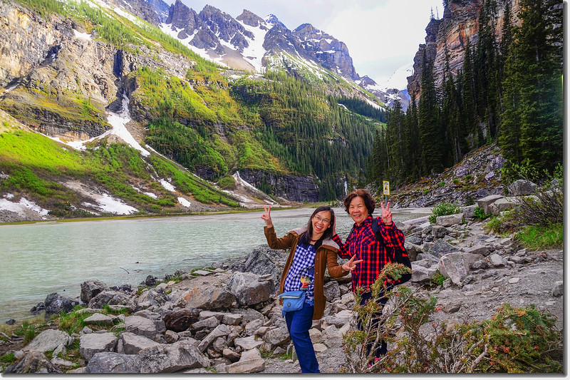
安頓好房間後趁女婿和兩個外孫準備晚餐之際,我和太座、女兒又進去露易絲湖(Lake Louise)走走。
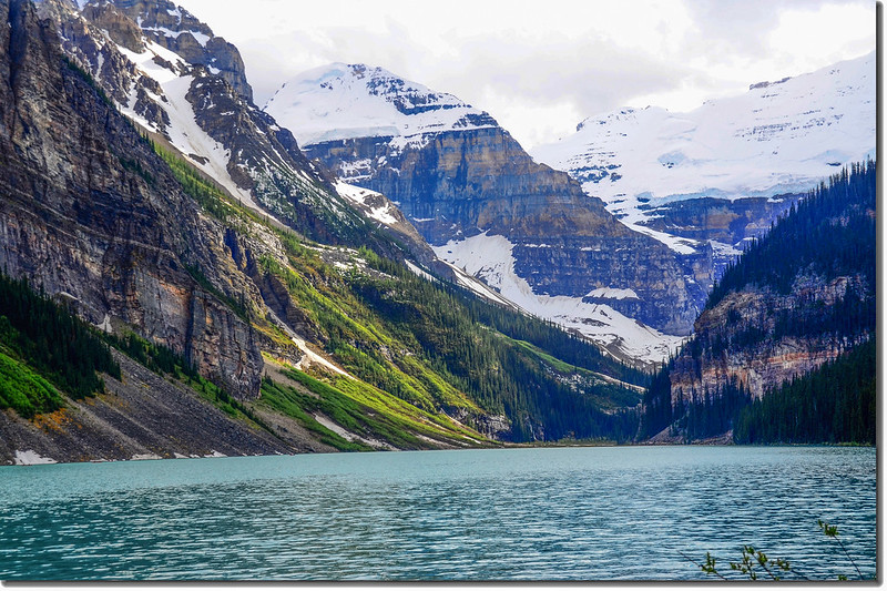
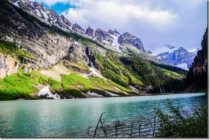
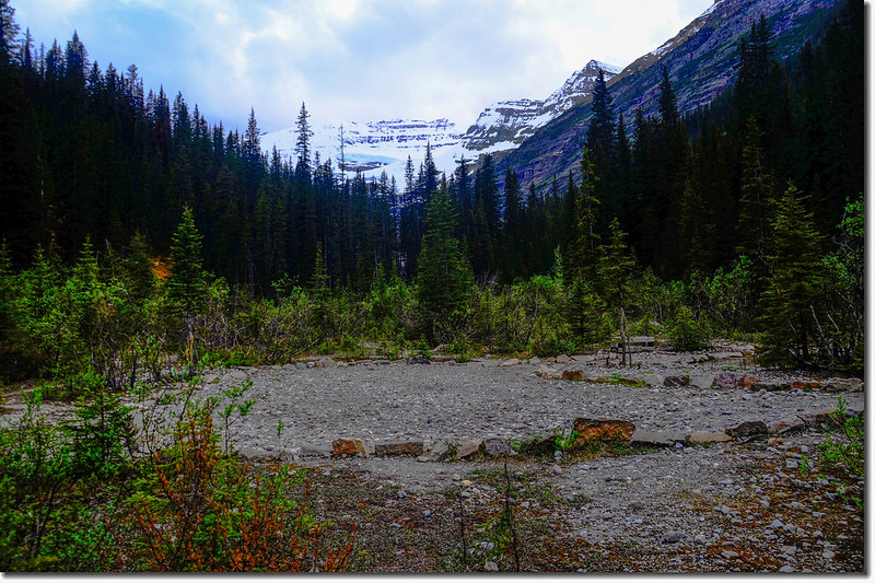
18:05 抵露易絲湖(Lake Louise),今天我們走了Lake Louise Shoreline Trail,該湖岸步道單程2公里,步道沿著Lake Louise西北岸而行,平緩無爬升,來回約一個多小時;我抵達Lake Louise Shoreline Trail終點時又向內推進約500公尺再折返。

Lake Louise

Lake Louise Shoreline Trail
Lake Louise
End of the Lake Louise Shoreline Trail
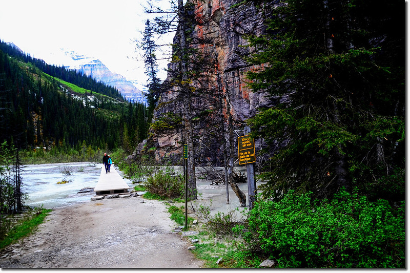
The trail at the end of Lake Louise
Looking toward Northeast from the end of Lake Louise

Frozen Falls Behind Lake Louise
View of Victoria Glacier from the end of Lake Louise
19:44 回到Lake Louise Shoreline Trailhead,計走了約5公里,花了一個半小時,回到停車場後開車回住宿旅館。
★ 今日行車約250公里(約160 哩)
行車路線:
→點此看放大圖
沒有留言:
張貼留言